Archive for the ‘Regions’ Category

National Trails Day at Redbox, Angeles National Forest

Thursday, May 31st, 2012

Saturday June 2, 2012 – Saturday June 2, 2012

Angeles Crest Highway at Mt. Wilson Road.

View MapMap and Directions | Register

Description:

Join CORBA, the Mount Wilson Bicycling Association, the National Forest Foundation and the Boy Scouts of America on National Trails Day, June 2nd. We’ll be working on the Gabrielino trail between redbox and switzers, and/or the Strawberry Peak trail. REI is sponsoring the event by providing lunch.

You must wear long pants and long sleeves, with sturdy shoes. Bring gardening gloves if you have them, but if not gloves will be supplied. Hard hats will also be supplied, but you’re welcome to bring your own. No shorts, t-shirts, flip flops or sandals please. Bring a water bottle or hydration pack, trail snacks and sunscreen.


Register

Recommended Wilderness Proposals in our National Forests

Thursday, May 31st, 2012

In response to a lawsuit, the four Southern California Forests are proposing amendments to their 2006 plans. They are proposing new Backcountry Non Motorized Recreation zones as well as new Recommended Wilderness designations. Several mountain bikers attended the informational workshop at the Angeles National Forest Headquarters on May 30, along with concerned forest users, and many from groups like the Sierra Club, The Wilderness Society and others.

In the Angeles National Forest there is a recommended Salt Canyon, Fish Creek roadless areas were combined to create a 40,000 acre Recommended Fish Creek Wilderness in an area that was Backcountry Non-Motorized. It is now Forest Service policy that a Recommended Wilderness designation will be managed as if it were wilderness and the area will be closed to bikes.

Concerns have been raised about the status of several significant nearby trails that bicyclists ride. We’re happy to report that the Golden Eagle Trail and the Warm Springs/Elderberry Forebay/Fish Canyon fire road Loop are unaffected by this proposal. Wilderness boundaries have been drawn with “cherry stems,” areas of non-wilderness along the existing fire road corridors. the same has been done for the Burnt Peak fire road.

We do have concerns about the Fish Canyon Trail (1GW05) and the Burnt Peak Trail (1GW02). These run generally north-south right in the middle of what would be the new Wilderness. We heard from several people that these trails may be overgrown and quite deteriorated. We need to know if riders have ridden them and are currently riding them. Despite their current condition, if they go into Wilderness, bikes will be excluded and the trails will likely never be restored due to Wilderness Trail maintenance issues. We might lose a significant future opportunity for a ride in a wild landscape. If you have information about these trails, let Steve Messer (steve@corbamtb.com) and Jim Hasenauer (imbajim@aol.com) know.

There are also many changes including Recommended Wilderness Proposals in the Cleveland National Forest, the Los Padres National Forest, and the San Bernadino National Forest. Unfortunately for those who visit all four forests, only the Angeles National Forest proposed management plan revisions were available for review at last night’s event.  If you are concerned about changes in other forests, it will be necessary to meetings. Mountain bike advocates are monitoring the meetings and will soon have talking points for your comments. The deadline for comments is June 11, 2012.

Information about the Forest Manamagement Plan revision process is at http://www.fs.fed.us/nepa/nepa_project_exp.php?project=35130

CORBA”s first comment is that the online data supplied is not of sufficient detail or quality to make informed decisions about any new proposed changes in the management plans for the forests. Without real data that we can zoom in on (digitally) and use with the mapping and GIS tools with which we’re familiar, it is impossible to see what areas and trails may be affected in the detail needed to make informed comments. We’d like to see KML or Shapefiles that can be used with the most popular mapping tools for this, and any future NEPA or CEQA documents.

Though we don’t know the current state or conditions of the Fish Canyon and Burnt Peak singletracks, we would like to see the boundaries adjusted to allow continued bicycle access to these trails. We’ll formulate our final comments after we gather more information on these and other affected trails.  Deadline for comments in June 11.

The current designation: Backcountry non-motorized:

The proposed Recommended Wilderness (in dark green):


Remaining meetings are scheduled as follows:


• May 31,2012, 4:00PM to 7:00PM, Santa Maria Red Cross, 3030 Skyway Drive, Santa Maria, CA 93455 (Hosted by Los Padres National Forest)
• May 31, 2012, 4:00PM to 7:00PM, Santa Clara Mojave Rivers Ranger District Office, 33708 Crown Valley Road, Acton, CA 93510
• May 31,2012,4:00 PM to 7:00PM, San Bernardino National Forest Headquarters, 602 S. Tippecanoe Ave., San Bernardino, CA 92408.
• May 31, 2012,4:00 PM to 7:00PM, Palomar RangerDistrictOffice, 1634 Black Canyon Road, Ramona, CA 92065 ·
• June 1, 2012, 1:00PM to 4 PM, Frazier Park Library, 3732 Park Drive, Frazier Park, CA 93225 (Hosted by Los Padres National Forest)
• June 5, 2012, 4:00PM to 7:00PM, Descanso Ranger District office, 3348 AlpineB!vd, Alpine, CA 91901
• June 5, 2012,4:00 PM to 7:00PM, Trabuco Ranger District office, 1147 E. 6th Street, Corona, CA 92879


CORBA Kids Spring Rides: Next Ride June 2

Wednesday, May 30th, 2012

The CORBA Kids Club had a busy spring with a ride to the MASH site (MCSP) in March, Cheesboro Canyon in April, and the Grasslands Trail (MCSP) in May.

Started by 3 families who met at the 2011 Take a Kid Mountain Biking event, the CORBA Kids Club offers families with children free monthly organized rides in and around the Santa Monica mountains on kid-friendly terrain.

Click here to see photos from our April and May rides.  Our next ride is Sullivan Canyon, (Brentwood side) June 2, from 9 a.m. to noon, and we hope you will join us.  Email kidsclub@corbatmtb.com for more information.

Angeles National Forest Open and Closed Trails – May 2012

Friday, May 25th, 2012

As we approach three years since the Station Fire began, the Forest Service has revised the closure order which has been in place to allow the forest to recover, and to protect the safety of forest visitors. This is an updated list from our May 2011 list of open and closed trails.

The two questions we have been asked more than any other recently: “which trails are closed in the Angeles National Forest?  and “which trails are open in the Angeles National Forest?”

According to the Forest Service map of the station fire closure area at http://maps.fs.fed.us/stationfire/ the list below shows the status, effective May 25 2012, of some of the more popular trails that were affected by the Station Fire. Keep in mind that even though these trails are in the newly opened areas of the forest, the individual trails may be signed closed.  Please respect any trail closure signs and stay off those trails for your own safety and the recovery of the forest.

Many of the trails will not be in good shape, so be prepared for surprises like downed trees, slides, washouts, ruts, and other hazards. Many trails have been drastically changed from before the Station Fire. Many fire roads have not yet been graded and may be much narrower and in very poor condition with ruts and washouts. All the usual caveats about trail safety apply so use the trails safely and responsibly, and be especially careful the first time you travel on one of the newly opened trails.

Opened Trails (As of May 25, 2012) 

  • Brown Mountain (to the saddle)
  • El Prieto
  • Gabrielino (JPL to Paul Little)
  • Gabrielino (Switzers to Redbox to Chantry)
  • Bear Canyon Trail
  • Sam Merrill Trail
  • Castle Canyon Trail
  • Sunset Ridge Trail
  • Mt. Lowe West Trail
  • Idlehour Trail
  • Kenyon Devore Trail
  • Rim Trail
  • Sturtevant Trail
  • Santa Clara Divide Truck Trail (Dillon Divide to Mt. Gleason to Three Points – non-motorized only)
  • Chilao Loop/Mt. Hillyer
  • Silver Mocassin
  • Valley forge
  • Mueller Tunnel
  • Mt. Disappointment
  • San Gabriel Peak
  • Earl Canyon
  • Haines Canyon
  • Rim of the Valley
  • Hoyt
  • Stone Canyon
  • Trail Canyon
  • Condor Peak
  • Fall Creek Canyon
  • Mt Lukens Fire Road
  • Grizzly Flat Fire Road
  • Doc Larsen
  • Rattlesnake Trail
  • Everything east of Chilao

Keep in mind that even though these trails are in the opened area, the individual trails may be signed closed (And those signs mustl be respected). Many of the trails will not be in good shape, so be prepared for surprises like downed trees, massive ruts or slides, washouts, and other hazards.

Closed Trails (Until Further Notice)

  • Strawberry Peak
  • Tom Sloan
  • Dawn Mine
  • Millard Falls
  • Upper Brown Mountain (Saddle to the Summit/Ken Burton)
  • Ken Burton
  • Gabrielino from Switzers to Paul Little
  • Crescenta View
  • Alder Creek
  • Colby Canyon
  • Josephine
  • Vetter Mountain

In addition to the above a separate closure remains in effect for the Williamson Rock area  (Closure Map is available).

50% of Station Fire Closure to Re-open

Thursday, May 24th, 2012

Angeles National Forest supervisor Tom Contreras and District Ranger Mike McIntyre, on Wednesday announced that they were hoping to get approval from the regional director to open approximately 50% of the Station Fire closure area. It only requires a review and a signature, and we hope to have that on Thursday [May 24], in time for the Memorial Day weekend.

Last year the closure order was revised a few days before the memorial day weekend.

The area slated for opening includes everything west of Fall Creek fire road (3N27), which descends from Mount Gleason Road to Big Tujunga Canyon.  Trails in the newly opened area include Stone Canyon, Condor Peak, Trail Canyon and Mendenhall Ridge. Some work has been done on Stone Canyon, Condor Peak trail, and Trail Canyon trail, though their readiness for bicycling is unknown. If these or other trails are not in safe enough condition for public use, the trails will be signed as closed, even though the area is technically open.

Condor Peak was once slated for a wilderness designation, and as a show of protest, CORBA and IMBA led a mass group ride up Condor Peak to demonstrate its viability as a backcountry multi-use trail including bicycles. It’s a steep and challenging trail, and we’ll be very happy to see it opened again.

The announcement was made at a Sierra Club event at Eaton Canyon Nature Center on Wednesday evening, March 23, 2012.  Forest Service staff reported on the station fire recovery efforts. Nathan Sill, staff biologist for the forest reported pre- and post-fire population counts of several endangered species including the Arroyo Toad, Arroyo Chubb, Mountain Yellow-legged frog, Spotted Owl and others. Most of the species covered have shown significant population increases since the fire and are recovering well.

Steve Bear, forester for the Angeles National Forest reported on the controversial re-forestation efforts and the plans for the next five years.

This post will updated when the closure revision is officially announced.

Update: Maps have been released showing the closure:


2012-05-24-station-fire-closure-order

In My Backyard (IMBY)

Saturday, May 12th, 2012

By Mark Langton

Please slow down on Rosewood Trail

You might not know that in addition to being President of CORBA, I am also the chair of the Conejo Open Space Trails Advisory Committee (COSTAC), a Thousand Oaks city-appointed committee to the Conejo Open Space  Conservation Agency (COSCA).  So while I ride all over the Santa Monica mountains and beyond, COSCA is IMBY.

At our most recent COSTAC meeting, a member of the public brought to our attention that several local residents who use the Santa Rosa Trail off Lynn Road on a frequent basis have been seeing increased speed and discourteous behavior by mountain bikers coming downhill on the trail. The Santa Rosa Trail just so happens to be the closest trail to my house and I literally ride it at least once a week, if not more. So this is really IMBY!

One of the more disturbing reports was that riders are not slowing down while passing hikers and other mountain bikers. All I can say is, please slow down on Rosewood Trail and the Los Robles Trail as well (aka Switchbacks or Space Mountain).

Rangers will be increasing their presence on these routes and reminding people to slow down when approaching corners and around other users. While they are not usually prone to writing citations, they do have the authority to do so. Please respect COSCA’s shared use policies and ride respectfully around other users on these and all shared use trails. Thanks!


SoCal High School Cycling League Announces Dates for 2012 Summer Outreach Tour

Thursday, May 10th, 2012

Learn how to form a high school club

For the third year the SoCal High School Cycling League is taking its show on the road and providing a series of informational events to people interested in seeing a high school mountain bike club form at their local high school.

“Many people have heard of the League and want to start or be involved with a high school club but they just don’t know where to begin,” said SoCal League Director Matt Gunnell. “These events are designed to give people a brief overview of the League to allow them to confidently head down the path toward participation as a team founder, coach, or student-athlete. Learning how to get the ball rolling before school is out for summer will allow folks to get a head start on forming clubs for the spring 2013 season.”

There is no charge to attend and no RSVP is needed. Events are targeted at prospective club founders, prospective coaches, teachers, school administrators, parents, riders, and supporters. All stops are held at local bike shops that support the SoCal League and the clubs in the League!

A downloadable and printable PDF tour flyer is available HERE and the dates/locations are as follows:

May 26 (Saturday) at Trek Superstore 10AM-6PM
Grand opening event benefits the SoCal League. Special guests, rides, and a great auction!
1617 Capalina Road
San Marcos, CA 92069
(760) 599-9735

May 29 (Tuesday) at Casino Bicycles 7PM
43906 East Florida Ave (Hwy 74)
Hemet, CA 92544
(951) 927-7796

May 30 (Wednesday) at Rock n’ Road Cyclery 7PM
6282 Irvine Boulevard
Irvine, CA 92620
(949) 733-2453

May 31 (Thursday) at Cynergy Cycles 7PM
2300 Santa Monica Boulevard
Santa Monica, CA 90404
(310) 857-1500

June 5 (Tuesday) at Main Street Cycles 7PM
311 East Main Street
Santa Maria, CA 93454
(805) 922-5577

June 6 (Wednesday) at Pasadena Cyclery 7PM
1670 East Walnut Street
Pasadena, CA 91106
(626) 584-6391

About the SoCal High School Cycling League
The SoCal High School Cycling League was organized to provide a well-defined race season for youth racers and to promote the formation of teams at public and private high schools. With the cooperation of local race promoters and our sponsors, the League organizes a first class series of races designed for high school aged riders and is easiest way for youth to get involved in the challenging and exciting world of competitive cycling. The SoCal League was kick-started with a generous grant from the founding SoCal sponsor, Easton Foundations, and is also generously supported by founding national sponsor, Specialized Bicycle Components, as well as Jeep, SRAM, Trek Bicycles, Clif Bar and Co., Primal Wear, QBP, Cynergy Cycles, El Monte RV, Dr. John Gunnell Oncology, Kaiser Federal Bank, Kayo Clothing, Rock N’ Road Cyclery, Turner Bikes, CamelBak, GU Sports, Kinetic, Maxxis, adidas Eyewear, Cyclingnews.com, Dirt Rag, Feedback Sports, Fort Lewis College, Fox Racing Shox, Mountain Bike Action, Ritchey Designs, Sidi, and WTB. For more information on the League, visit www.socaldirt.org or contact Matt Gunnell at matt@socaldirt.org, Tel. (818) 415-1133.

Skills Clinic Photos for May 5, 2012

Saturday, May 5th, 2012

It was another beautiful day to be riding in Malibu Creek State Park! Eighteen riders came out to enjoy the fabulous weather today and participate in this month’s basic skills clinic. About eight were Mountain Bike Unit recruits. You can see them in the May Skills Clinic Photo Gallery.

Urgent Rancho Palos Verdes City Council Mtg May 15

Wednesday, May 2nd, 2012

On May 15th at 7:00 pm, the Rancho Palos Verdes City Council will review and approve the final trails plan for the Palos Verdes Nature Preserve. This is mountain bikers’ last chance to ask for changes.

CORBA Palos Verdes has proposed allowing bike access on more trails.
For information go to: www.mtbpv.org or email info@mtbpv.org

We need your support. Attend the meeting even if you don’t want to speak. Write the Rancho Palos Verdes City Council, CC@rpv.com. Please make the letters positive.

When:
May 15th 7:00 PM

Where:
Fred Hesse Community Center
29301 Hawthorne Boulevard
Rancho Palos Verdes, CA 90275

Report on and photos of 2012 Santa Monica Mountains Trail Days

Tuesday, May 1st, 2012

Over the weekend of April 28-29, about 200 volunteers had a great time chatting, chowing on a fabulous barbecue meal, taking in the scenery, winning wonderful prizes, and if they liked, camping overnight in the Danielson Multiuse Area in Pt Mugu State Park. The reason for the revelry was the 31st annual Santa Monica Mountains Trail Days where outdoor enthusiasts of all varieties got together to repair trails for everyone to enjoy.

Saturday

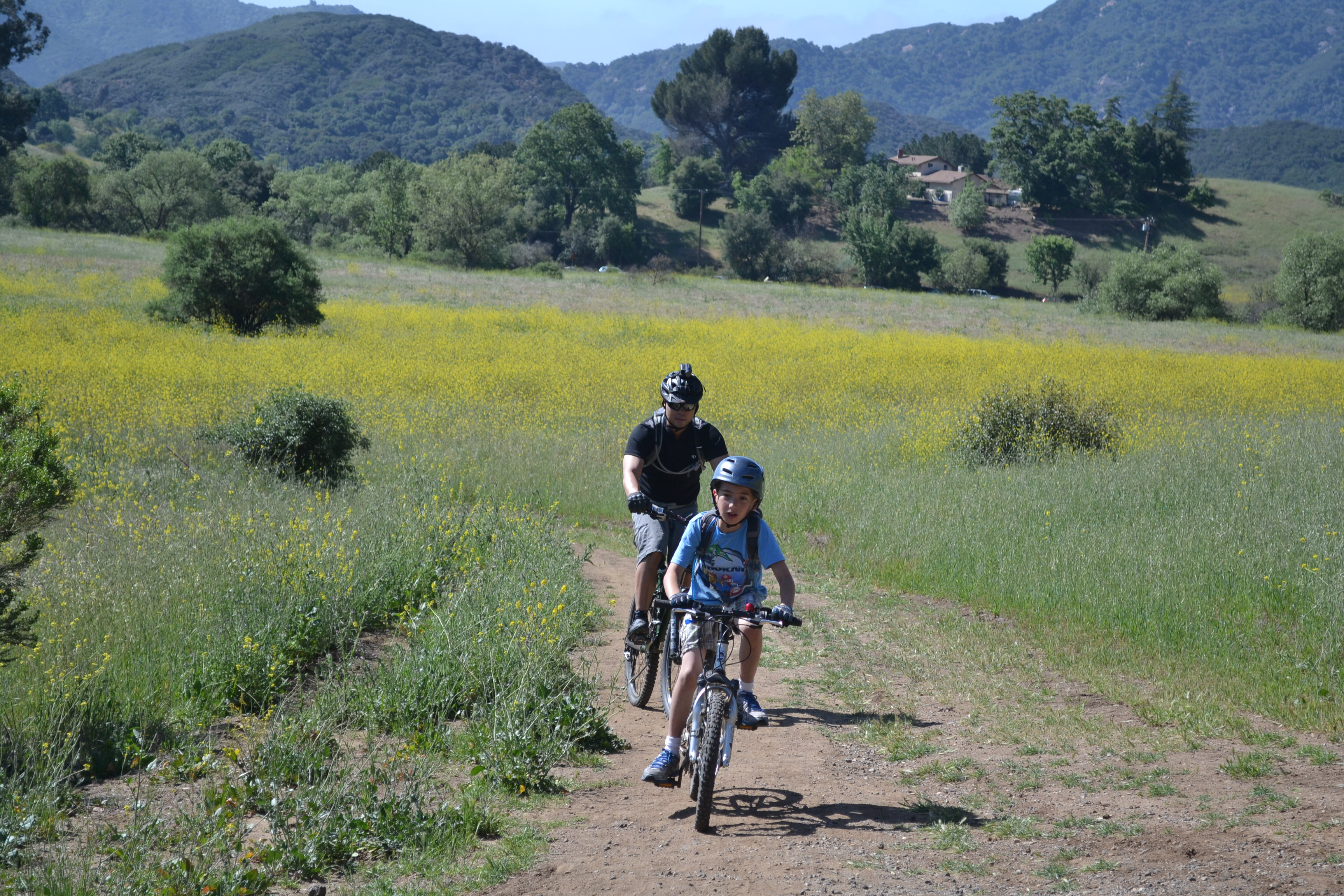
When we arrived on Saturday morning, the staging area at Danielson Multuse Area was bescattered with a couple dozen brightly colored tents of people who had arrived Friday evening and camped overnight. The CORBA volunteers grabbed some tools and shuttled to the top of Hell Hill to work on Guadalasca Trail. Our job would be to clear the brush that was overgrowing the trail.

The 34 mountain bike volunteers, including a half dozen members of the Channel Islands High School Interscholastic SoCal Cycling League, split into three groups, led by crew leaders Hans Keifer, Steve Messer and Steve Clark. We were to hike down the trail, cutting back the overgrowth as we went. Helping us were two State Parks staff who were ahead on the trail. They had chain saws to cut back the largest branches. Keifer and Messer followed with their crews, armed with loppers and small saws, to remove brush and branches of an intermediate size. Bringing up the rear was Clark, wielding a power hedge-trimmer, and two brave assistants, who cut down the smaller brush and swept it off the trail. This included a huge section of poison oak that was flourishing on the top part of the trail, above the first switchback. On the way down, this last group cut back poison oak that the other groups had left. Near the bottom, on the old ranch road section, the power hedge trimmer was also used to cut back thistle near the trail. We wanted to cut it out before it developed seeds for next year’s crop of prickles.

Guadalasca is now in much better shape. It is clear of overgrowth over most of it’s length, and the risk of contacting poison oak is much reduced.

While the CORBA crews were working on Guadalasca, other crews were working on Blue Canyon Trail and Old Boney Trail. Both these trails are in the State Wilderness Area and are closed to mountain biking.

The crews finished about 2:00 pm and headed back to the staging area for some R & R before the barbecue dinner, consisting of salad, tri-tip, chicken, vegi burgers, baked beans, garlic toast and hot dogs, with cake for dessert. The grills were manned by State Parks maintenance workers who had volunteered to help out. Dinner was augmented by snacks and amber/red/white beverages that adults brought for themselves.

While dinner was being prepared, tables were laid out with dozens of items that were to be awarded to volunteers during the prize giveaway. They were there for people to oggle and figure out which they would pick for themselves when their ticket was drawn. Tickets were given out to people in line for dinner. The giveaway itself was held after dinner. Everyone won a prize, but of course the people whose tickets were chosen first had a larger selection to pick from. Among the prizes were two $350 RST M29 Air 29″ forks. New this year were grand prize drawings, in addition to the regular prizes, for a North Face down sleeping bag, a North Face 2-person tent and a mountain bike helmet.

All the pictures of Saturday’s activities are available for viewing in the Saturday photo gallery.

Sunday

Most people headed home Saturday evening after the prize drawing, but a few stayed on for another night of camping. A few of those left on Sunday morning, but many stayed for another morning of trailwork, and were joined by a few who drove in for the day.

Trenched trail with bushes blocking the view around bends

The CORBA crew consisted of four mountain bikers, three Americorps volunteers and three State Parks employees. We headed over to Sin Nombre Trail in two groups. The State Parks staff, along with their power hedge trimmer, started at the top and worked their way down. They were accompanied by two bikers who worked with loppers. The remaining five started at the bottom and worked their way up.

The bottom group worked on the tread and brush in two areas. The trail in the first area was deeply trenched and had large bushes growing next to the trail on the inside of bends. We built two rolling dips to prevent rainwater from running straight down the trail, thus keeping the trenches from getting deeper (they’re already deep enough that you can easily hit your pedals on the side of the trail as you climb up). We also partly filled in the trench so it’s not so deep now. We would have filled it in completely if we’d had time.

Cutting back the bushes on the inside turnsThe large bushes growing right next to the trail on the inside of bends present two problems. First, they obscure the view around the bend so you can’t see people coming the other direction. The trail is moderately sloped here, so people riding downhill can’t see others coming towards them, and don’t have much time to react to avoid a collision. Similarly, people coming up the hill can’t see if a rider is coming down towards them. Second, the bushes are so close to the trail that there’s no room to lean into the turn without running your torso into the bush. Riders need to slow down so much that they’re not leaning, or else ride off the outside of the trail, thus widening it over time. We fixed these problems by cutting the bushes back about three feet from the center of the trail, giving much improved visibility around the curve.

The oak tree on the left used to grow to the edge of the trail, blocking the view of this turn at the bottom of a small hill.

The second area was at an S-turn at the bottom of a small hill. An oak tree at the bottom of this hill obscures the view of the turn, resulting in some mountain bikers missing the first turn and running up a small bank, then being in a poor line for the second turn and possibly falling or running off the trail and down a grassy bank.

The top group and bottom group happened to meet at this point, so the top group worked on trimming back the tree to improve visibility while the bottom group widened the trail by about 18″ to make the turns a little more gentle.

While we were working on Sin Nombre, a second, slightly larger group had headed back up the Blue Canyon Trail to work there.

We got back to the staging area about 1:00 pm for a quick lunch before the second prize giveaway. In addition to the regular prizes, the grand prizes were another 2-person tent from North Face and a $100 gift certificate for Westlake Cyclery.

All the pictures of Sunday’s activities are available for viewing in the Sunday photo gallery.

The 2012 Santa Monica Mountains Trail Days were organized by the Santa Monica Mountains Trails Council in conjunction with California State Parks. Other groups who helped out were CORBA, the Sierra Club, Crenshaw Eco Club, California Native Plant Society, SMM Natural History Assn., Malibu Creek Docents, Temescal Canyon Assn., Ray Miller 50/50 Run and the National Park Service. A special Thank-You goes to Barb Thomas who was the coordinator of this event for the SMM Trails Council.

If you missed the fun and excitement this year, this is an annual event so you should plan to come out next year for the 2013 edition!