Archive for the ‘Santa Susana Mountains’ Category

San Gabriels Protection bill Passes House

Saturday, February 22nd, 2020

Last week four bills affecting California passed the House. H.R.3820, the “San Gabriel Mountains Foothills and Rivers Protection Act”, and H.R.1708, the “Rim of the Valley Corridor Preservation Act,” were rolled into a land protection bill with four other bills including H.R. 2250. the Northwest California Wilderness, Recreation, and Working Forests Act, and the H.R.2199 Central Coast Heritage Protection Act–both of which have earned the support of local mountain biking organizations. Local mountain bike clubs and IMBA have been key players in the development of these bills. The combined bill, H.R. 2546, Protecting America’s Wilderness Act, passed the House on February 12, with 6 house republicans voting in favor.

San Gabriel Mountains, Foothills and Rivers Protection Act

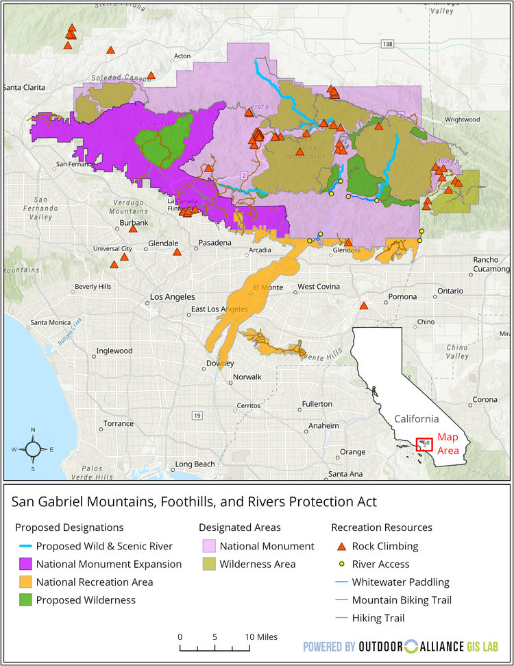
San Gabriel Mountains Foothills and Rivers Protection Act

San Gabriel Mountains Foothills and Rivers Protection Act Reference Map

Wilderness Expansion

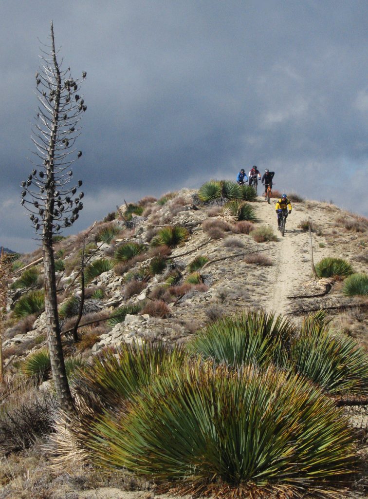
Mountain Bikers descend from Condor Peak

Protest Riders descend from Condor Peak, December 2007

H.R.3820, introduced by Judy Chu (CA-27), expands the boundaries of existing federally-designated wilderness areas within the Angeles National Forest. The bill also creates two new Wilderness areas, the Yerba Buena Wilderness and Condor Peak Wilderness.

Condor peak has long been a target for wilderness protection by environmental groups. It is also one of the last long-distance, high-elevation singletrack trails providing access to a mountain summit that remains open to bikes. It was included in a bill by Barbara Boxer, as a new wilderness area. Jim Hasenauer, then working with IMBA, led a protest ride on the trail showing that it was a high-value trail to mountain bikers on December 1, 2007. It was withdrawn from the Omnibus Public Land Management Act of 2009, but has never been forgotten by environmentalists.

CORBA worked locally with The Wilderness Society, Sierra Club and CalWild on the language and boundaries of the current bill for more than two years. Concurrently, IMBA worked at the national level and in Washington DC, to ensure that the proposed Wilderness areas would have no impact to existing trails open to mountain bikes.

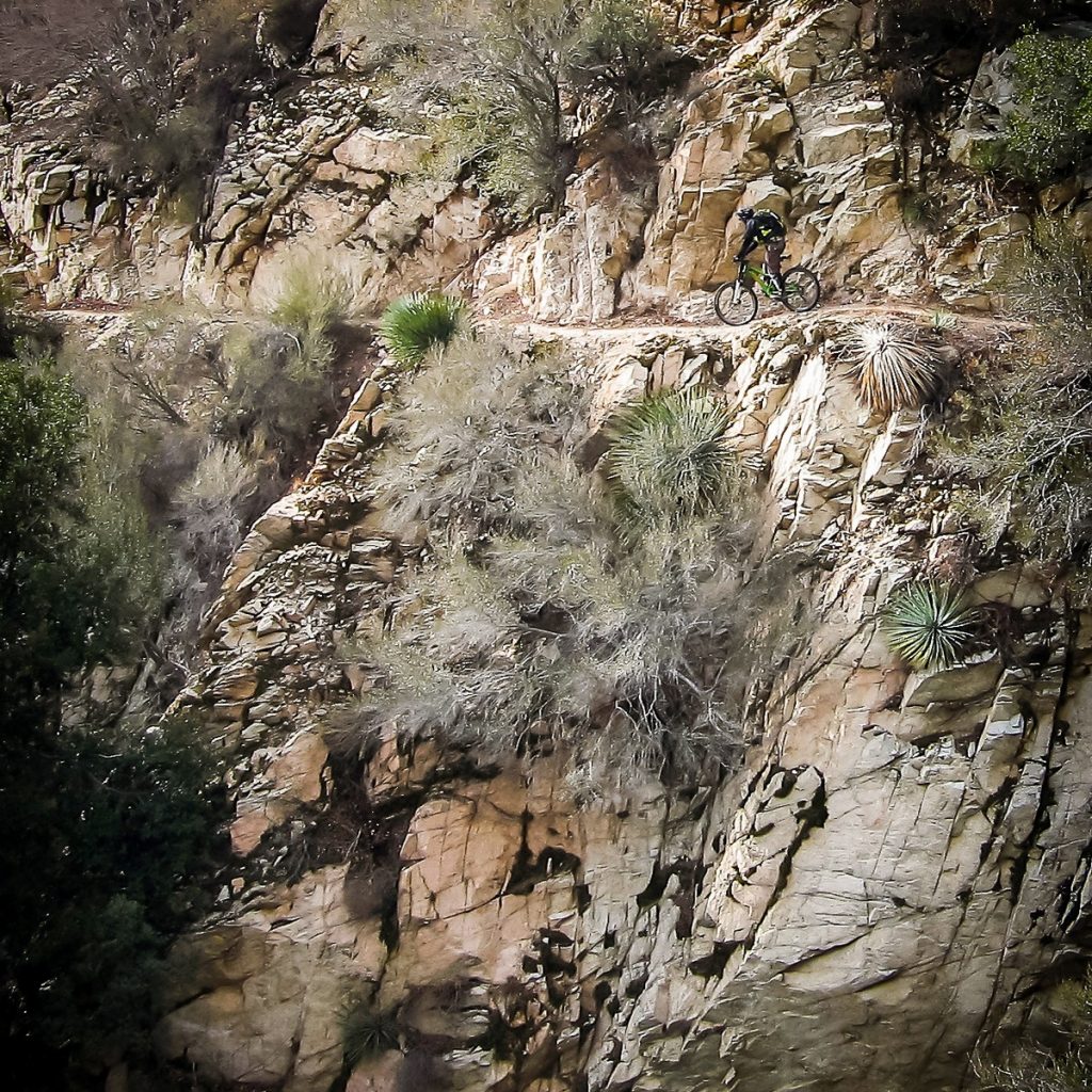
Condor Peak trail is a steep, exposed and challenging backcountry trail.

For mountain bikers, Condor Peak trail was not up for negotiation. While we support protecting the character of the area, we wanted to ensure not only that bicycles could continue to access it, but also that mechanized maintenance (using chainsaws or other powered tools) would continue to be allowed. We’ve seen many trails that have been closed to bikes by Wilderness designations slowly deteriorate as volunteer groups cannot keep up with the existing trail maintenance backlog, and the Angeles National Forest has no trail crew of its own.

The solution we reached was to propose two Wilderness Areas on each side of the trail. The resulting legislation passed last week in the House creates the Yerba Buena and Condor Peak Wilderness areas, separated by a 100′ buffer through which the Condor Peak trail passes. Trail Canyon trail, the only other trail within the proposed Wilderness boundary, is cherry-stemmed out of the Wilderness allowing bicycle access to Trail Canyon falls and the nearby campground. A portion of the upper Trail Canyon trail, which has not been passable by bicycle in decades, will fall within the new wilderness boundary.

CORBA chose not to oppose this latest bill as it had no impact to mountain bike access. However, we could not support it fully, as it does nothing to enhance our mission of improving and increasing trail access for mountain bikes. We remain neutral on the bill, but if it passes, we will remain fully engaged in its implementation to further keep the interests of mountain bikers represented. 

There are two amendments being sought by CORBA and IMBA. Due to what appears to be a mapping error, three switchbacks along the Mt. Waterman trail dip a few dozen feet into the Wilderness area.  Though the Forest Service manages it as a non-wilderness trail, an amendment to the bill, by inserting “fifty feet south of the Mt. Waterman Trail” into the legal description of the wilderness area boundary, would correct that. 

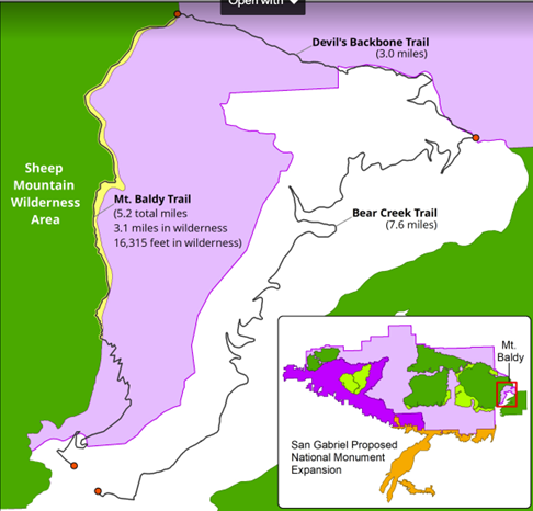
Proposed Boundary Adjustment

Proposed Boundary Adjustment

The other amendment we are seeking is more challenging. The eastern Boundary of the Sheep Mountain wilderness passes directly over the summit of Mt San Antonio (AKA Mt. Baldy).  It is the only one of three peaks in Southern California over 10,000′ and above treeline to which bicycles have access (via the Devil’s Backbone trail). Wilderness advocates wanted to expand the Wilderness boundary eastward, entirely enveloping the Bear Creek trail in Wilderness.  The trail follows the Wilderness boundary, lying just inside the boundary by 25 yards. The trail would completes an incredibly challenging, high-elevation, backcountry loop. We are seeking an amendment to move the boundary 75′ west of the trail, removing it from wilderness, and opening the loop to bicycles. The boundary remains unchanged in the current legislation. 

These two amendments would remove approximately 75 acres of existing wilderness in a bill that adds over 31,000 acres of new Wilderness. These will be difficult asks for some, but we feel the ride loop this boundary adjustment would create a truly unique experience that is attainable nowhere else.

National Monument Expansion

The bill also expands the boundary of the San Gabriel Mountains National Monument, which was declared in October 2014. The boundary expansion makes sense geographically, as one of the biggest challenges in developing the current Monument management plan (as a Forest Management Plan Amendment) was the allocation of district-specific resources.

The Forest Service felt growing pains as they transitioned from three districts to one district and a National Monument (which is managed as a district). The Monument designation left out the most historically significant and most visited section of the Angeles National Forest, which includes the front country trails south and west of Mt. Wilson, and Mt. Lukens, and areas south of Big Tujunga. There was confusion among Forest Service staff when a vehicle, for example, was assigned to the district, but was stationed physically much closer to the Monument. It has taken years, but those challenges have been largely sorted out.

This time around, the bill requires the development of a management plan within three years (the plan amendment for the SGMNM took almost four years to complete). The current Monument designation had no impact to trail access for mountain bikes, and has brought in some additional funding and additional attention to our local mountains. In fact, IMBA and CORBA worked closely with the White House in 2014 to ensure that mountain biking was specifically mentioned in the monument proclamation ensuring its future acceptance. As a result, visitorship has steadily increased since the 2014 designation.

San Gabriel National Recreation Area

The third section of Chu’s bill will create a new National Park Service unit in the San Gabriel Valley. The San Gabriel National Recreation Area would become a new unit of the National Park service. It would comprise land along the foothills of the San Gabriel Mountains and corridors along the San Gabriel, Rio Hondo, and other rivers and open spaces in the San Gabriel Valley.

The proposed NRA would not change any land ownership, nor restrict any current land owner from managing their land (and their trails) as they are already doing. It allows willing landowners or land managers within the NRA boundary to partner with the NPS to improve recreation, habitat connectivity, water quality, wildlife corridors and public access. It doesn’t change any existing trails, and has the potential to bring additional federal resources to local projects.

With all these aspects of the bill, our biggest concern is that the agencies managing lands the bills protect are not adequately funded at a level necessary to do their job effectively. Creating additional financial obligations by the Forest Service and National Park Service, when current budgets are falling short, will bring its own set of challenges.

H.R.3820 has a companion bill in the Senate, S.1109, introduced by Senator Kamala Harris. We will continue to work towards those amendments in the Senate version of the bill, which will face a tougher challenge under the current administration. If the bills fail this year, we expect them to be reintroduced in future sessions of congress.

A fact sheet from Judy Chu’s office can be found at https://chu.house.gov

Rim of the Valley Corridor Protection Act

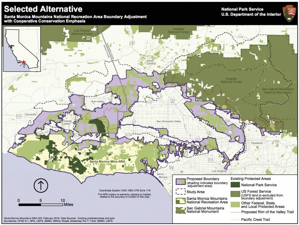
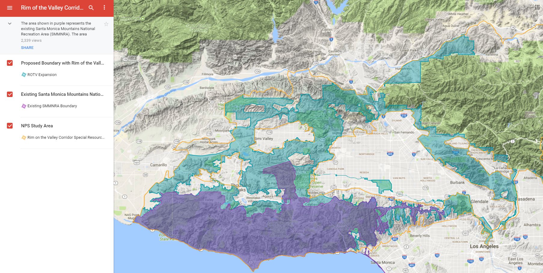
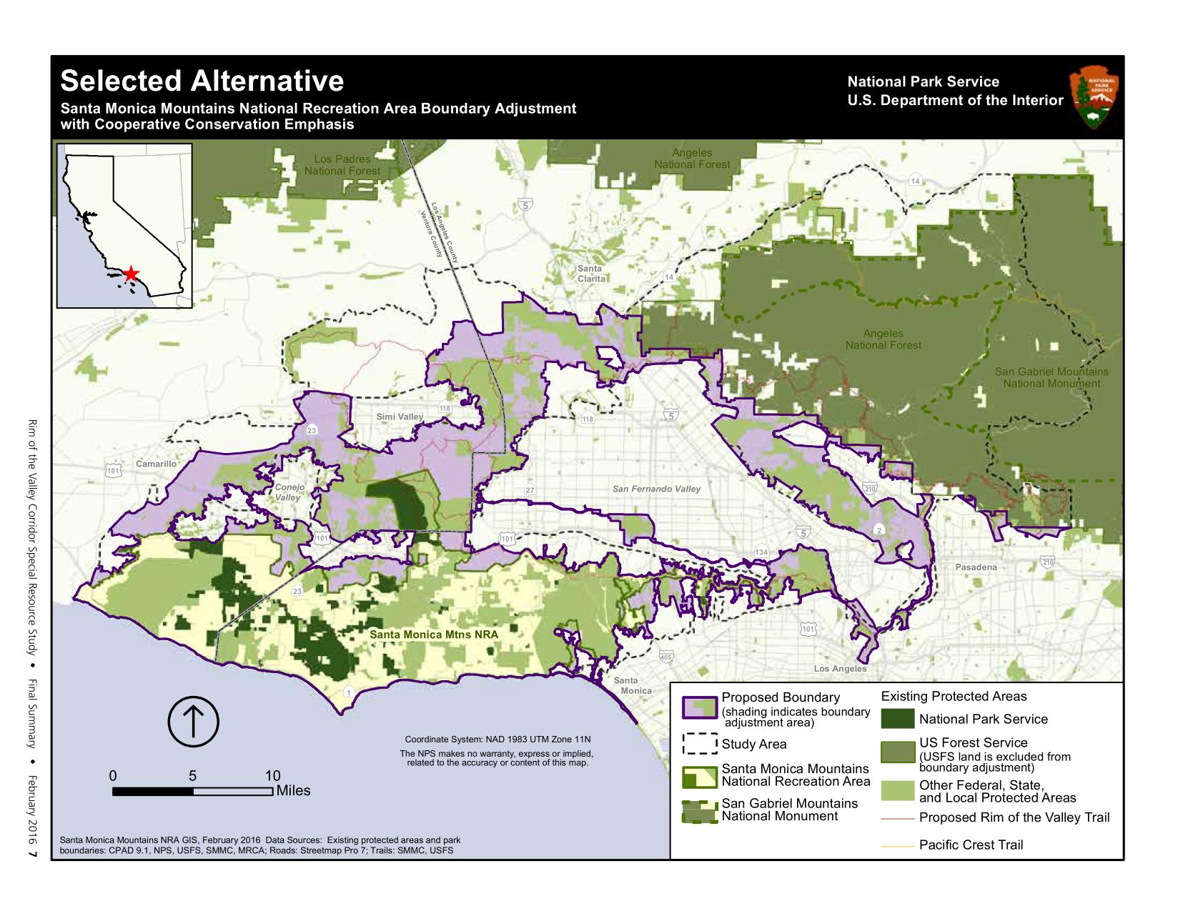
H.R.1708 was introduced by Congressman Adam Schiff, after several years where similar legislation failed to make it out of committee. The Rim of the Valley Corridor Preservation Act will expand the boundary of the Santa Monica Mountains National recreation area. The expanded boundary will include the mountains surrounding the Santa Clarita, San Fernando, Simi, La Crescenta and Conejo valleys. These include the Santa Susana Mountains, the Simi Hills, the Verdugo Mountains, and other adjacent lands and river corridors as shown below.

Rim of the Valley Corridor Map

The act does not change the current management of any land or trails within the expanded boundary. What it will do is allow willing landowners or land managers to partner with the NPS on projects that may enhance recreational access, improve habitat and wildlife connectivity, or provide capital improvements. It does not take land away from any existing landowners, nor does it force existing land managers to partner with the National Park service in any way. It has no downsides for mountain biking, and has the potential to improve trail access.

CORBA’s original mission statement and our operational boundary was defined as “the Rim of the Valley Corridor.” This bill is therefore very much at the heart of CORBA’s mission.

The bill was the outcome of a six-year feasibility study, authorized by an act of Congress in 2008. The study began in 2010, with CORBA engaged throughout the six-year process, attending public meetings, providing expert testimony and public comments, and encouraging public discourse and engagement in the process.

The study sought to determine if the area possess nationally significant natural or cultural resources; whether it is it a suitable and unique addition to the National Park System; whether it is feasible to add it to the Park System; and does it require direct NPS management, instead of stewardship from other groups or a public-private combination? The answer to the first three questions was Yes. Since the study concluded in 2016, legislation has been introduced twice without success. Last week the bill passed the House. In December, the Senate Committee on Energy and Natural Resources passed the Rim of the Valley Corridor Preservation Act, moving it one step closer to the Senate floor.

We are fortunate in Southern California to have one of the most mountain bike friendly NPS units in the country, the Santa Monica Mountains NRA. Currently all National Park service managed singletrack trails in the Santa Monica Mountains are open to bicycles. In fact, the only trails closed to us are closed by the Boney Mountain State Wilderness, and California State Parks. We expect the NPS to continue supporting a multi-use trail policy in the expanded NRA. In fact, all of the land managers within the expanded boundary, with the exception of the City of Los Angeles, are multi-use friendly.

Lands within the Angeles National Forest are specifically excluded from the expanded NRA. The Forest Service and the National Park Service already have an arrangement in which they are able to share resources for the benefit of our public lands under the Service First authority, which was made permanent in 2012.

For these reasons we are supportive of the expanded boundary of the Santa Monica Mountains NRA in the current legislation. However, to our knowledge there is no additional budget allocated to the expanded NRA, nor to the new San Gabriel NRA in Chu’s bill. For these reasons we have been reluctant to throw our full support behind the bills as they can be considered unfunded (or underfunded) mandates. If these bills pass, we will advocate for increased funding, and will remain engaged with land managers in the development of their management plans, and to identify opportunities for creating or improving multi-use trails and mountain bike access.

The Rim of the Valley trail was originally envisioned by Marge Feinberg in the 1960s as a trail that encircles the San Fernando Valley, connecting communities with their local mountains. The trail itself is being piecemealed together as opportunities present themselves. The vision of a trail led to a broader vision to protect the mountains surrounding our valleys, and ultimately to H.R.1708. It has been a forty-year effort to protect the mountains that define our valleys.

A fact sheet on the bill can be found at https://schiff.house.gov

Backbone Trail Bridge Repair Fund

Tuesday, February 4th, 2020

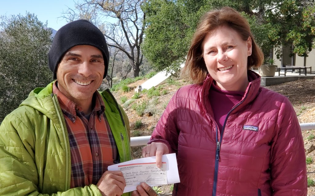
With generous support from REI, CORBA has put $10,000 towards the National Park Service recovery efforts to rebuild bridges on the Backbone Trail that were burned in the Woolsey Fire.

In the wake of the Woolsey Fire, three bridges along the Backbone National Recreation trail were destroyed. It was some time before the National Park Service was able to assess the remaining abutments and determine when it would begin to replace the bridges. There have been many higher priority recovery efforts underway.  Knowing people were eager to get back on the trails, the Backbone trail was reopened with temporary stream crossings where the bridges once spanned. These are meant as temporary measures until the bridges are rebuilt and opened.

Steve Messer and Charlotte Parry, of SAMO Fund

Steve Messer and Charlotte Parry, of SAMO Fund

REI allowed CORBA to coordinate our fundraising with the Santa Monica Mountains Fund. The SAMO Fund also received a grant from REI.  REI’s Vote with your Purchase campaign added to that fund to benefit all trail users in recovering the Backbone trail to pre-fire conditions.

Combined, those funds from REI, CORBA and the Santa Monica Mountains Fund are being used to leverage additional revenue streams to meet the bridge replacement costs. The National Park Service is hoping to have the remaining funding in place, and the bridges under construction this year. While the grant was funded last summer, it has taken time for the NPS to get to this stage.

The remaining grant funding has supported volunteer work days, trailwork tool repair and replacement for the benefit of trails. We also thank the Santa Monica Mountains Trails Council, and the Conejo Open Space foundation, with whom CORBA volunteers have partnered on a number of projects in the fire-ravaged Santa Monica Mountains and Conejo Valleys over the past year.

We appreciate the ongoing support from REI and thank them for efforts.


Santa Susana Mountains Trail Master Plan, Phase 2, Released

Monday, December 10th, 2018

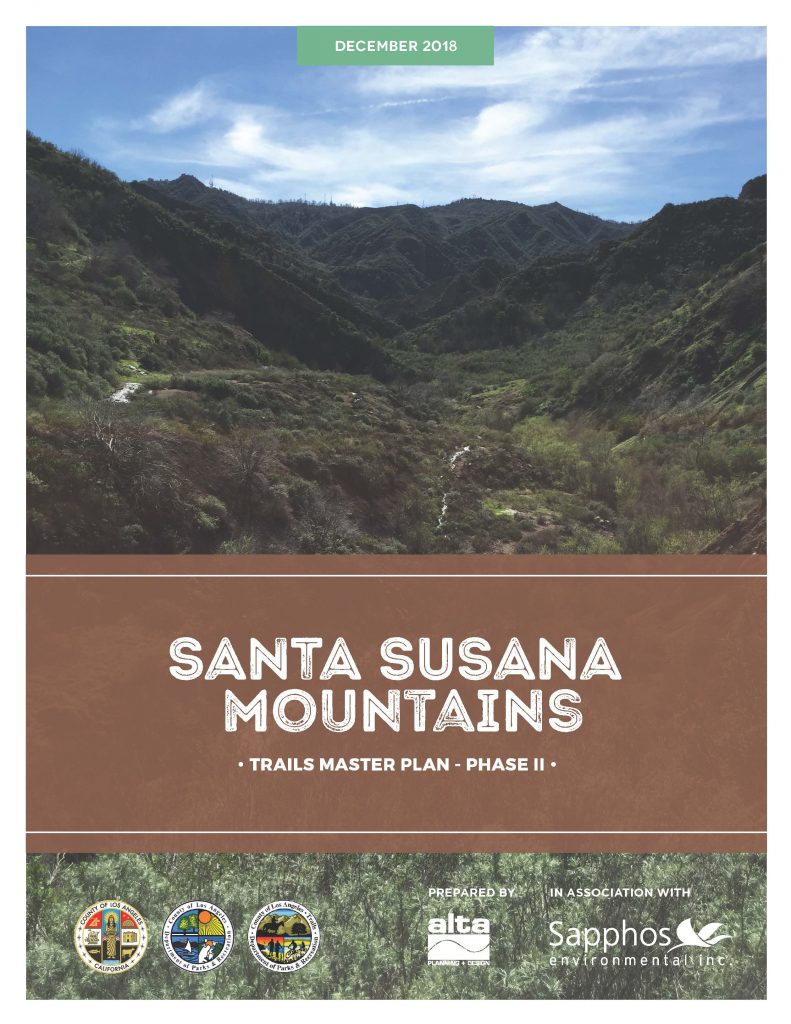
Los Angeles County recently released the final Santa Susana Mountains Trail Master Plan, Phase 2.  CORBA and our friends a the Santa Clarita Valley Trail Users, as well as many local mountain bikers, hikers and equestrians, all gave input on the plan at a series of public meetings in 2016. The plan covers areas east of the I5 in Santa Clarita, including Towsley Canyon and other open spaces, some yet to be developed.

This is the third such trail master plan completed by the County in recent years. Previously, CORBA and SCVTU gave significant input on both the Castaic Area Trail Master Plan and the Santa Susana Mountains Trail Master Plan, Phase 1 and were happy to support both. We’re equally excited about the new plan. 

The plan reflects the comments the County heard from the public, what is feasible (or may be) under current zoning and land ownership, and what makes sense for current growth projections. The final plan has now been released. https://trails.lacounty.gov/Documents  It includes many elements about which we are particularly excited, including two potential bike skills park locations.  

CORBA’s SCVTU committee has submitted a letter of support for the plan, as has the CORBA Board of Directors. The L.A. County Board of Supervisors will vote to adopt this trail master plan as a component of the County General Plan on December 11, 2018. 

While we’re really encouraged by the plans, we realize that this is an aspirational document. It will be many years before being fully realized, if ever. The plan, if completed, would provide great connectivity, much improved recreational access to public lands. But realistically, it will take public support, partnerships and funding opportunities to see any of the plan complete.

CORBA, and our SCVTU Committee are ready and willing to help move elements of the trail master plan forward, such as the Bike Skills Park. 

The County will be moving forward with future trail master plans, which we’ll be sure to announce and advocate for more mountain biking opportunities and more trails for everyone. 

The Plan can be found among the County’s Trail Documents at https://trails.lacounty.gov/Files/Documents/137/SSMTMP-PII%20Final%20Trails%20Master%20Plan_December2018_web.pdf

Santa Clarita Valley Trail Users Letter of Support

CORBA Letter of support

______________________________________________________________________________

Update 12/11/2019, 11 a.m. The County Board of Supervisors today adopted the plan. 

Santa Susana Mountains Trails Master Plan Draft Released

Thursday, November 2nd, 2017

The Draft Santa Susana Mountains Trails Master Plan and Initial Study/Proposed Mitigated Negative Declaration are available for public review beginning today (November 2, 2017) at http://www. santasusanatrailsplan.org/

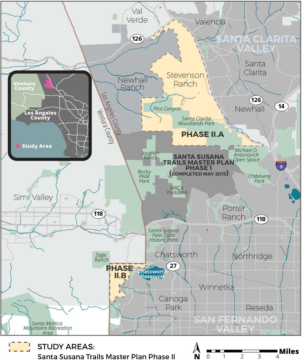
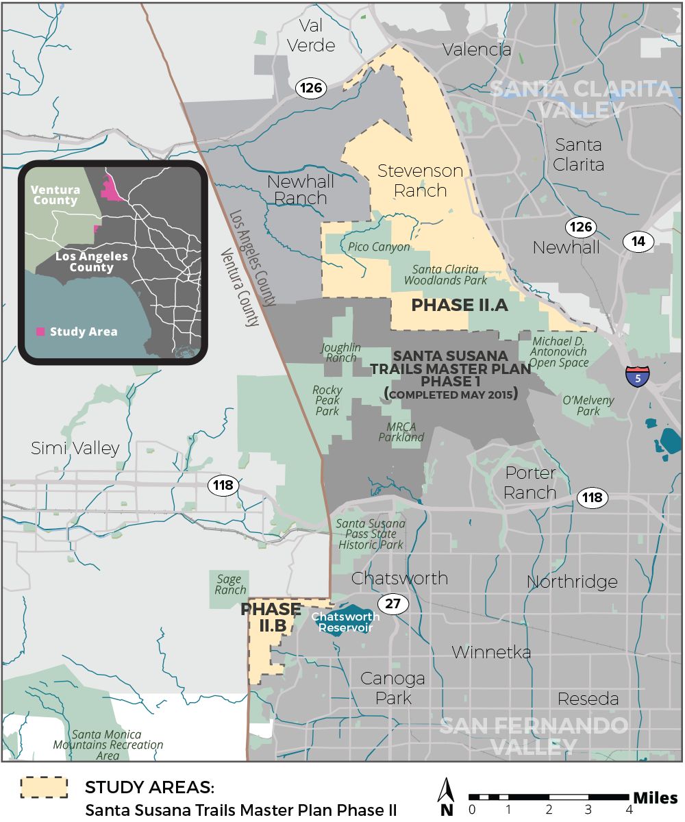
Project Location: The SSMTMP-PII area encompasses approximately 24 square miles in the unincorporated territory of the northwestern portion of the County of Los Angeles, immediately east of the boundary with Ventura County, located entirely within the 5th Supervisorial District. The SSMTMP-PII area is comprised of an approximately 22-square-mile area located in the north-facing slopes of the Santa Susana Mountains and the Santa Clarita Valley (Phase II.a) and an approximately 2-square-mile area located in the foothills of the Santa Monica Mountains, including Bell Canyon, Dayton Canyon, and Woolsey Canyon, west of the San Fernando Valley (Phase II.b). The Phase II.a area is composed of generally mountainous and valley terrain that abuts Henry Mayo Drive (State Route [SR] 126) to the north, the Interstate-5 freeway to the east, the southern edge of the Santa Clarita Valley Area Plan area to the south, and the Newhall Ranch Specific Plan Area to the west. Similarly, Phase II.b area, is composed of generally mountainous and valley terrain that abuts Ventura County to the north and west and the City of Los Angeles to the east and south.

Project Description:

The proposed project includes approximately 70 miles of proposed multi-use (hiking, mountain biking, equestrian) trails and related staging areas, bike skills parks, parking areas, and other supporting trail facilities in the Santa Clarita Valley Planning Area and San Fernando Valley Planning Area. The proposed trails would provide connections to parks and open spaces, a large commercial district, seven schools, numerous natural features, Six Flags Magic Mountain theme park, the proposed Rim of the Valley trail corridor alignment (RIVA), and existing trails in the Cities of Los Angeles and Santa Clarita, and in the Newhall Ranch Specific Plan area, as well as trails within other jurisdictions as identified in the Trails Master Plan. The trails would be multi-use and range from 3 to 12 feet wide based on site conditions, with adequate space for combined pedestrian, equestrian, and mountain biking use, in accordance with the County of Los Angeles Trails Manual guidelines (County Trails Manual). The proposed project would develop a complete multi-use trail system connecting user groups and local populations to desired recreation destinations and experiences, with unified transition to the trails of adjacent jurisdictions, compatibility with adjacent land uses and environmental resources, and incorporate a sustainable design consistent with the County Trails Manual. The plan would recommend conditions for improvement of unmet local recreation demands in the County’s Fifth Supervisorial District.

Comments

Written comments will be accepted via email or at the following street address:

County of Los Angeles Department of Parks and Recreation
Planning Division
Attn: Julie Yom, Park Planner
510 South Vermont Avenue, Los Angeles, California 90020
Email: jyom@parks.lacounty.gov

The public comment period will end on Saturday, December 16, 2017.

All comments must be postmarked or emailed no later than December 16, 2017.

COMMUNITY MEETINGS:

On Thursday, November 9, 2017, the County will host a community meeting to review the project and solicit information in relation to the CEQA analysis for this project.

The meeting will be held from 6:00–8:00 pm at Stevenson Ranch Library, 25950 The Old Road, Stevenson Ranch, CA 91381.

On Thursday, November 16, 2017, the County will host a community meeting to review the project and solicit information in relation to the CEQA analysis for this project.

The meeting will be held from 6:00–8:00 pm at Chatsworth Branch Library, 21052 Devonshire Street, Chatsworth, CA 91311.

Please direct any questions regarding these meetings to Zachary Likins at (213) 351-5149 or zlikins@parks.lacounty.gov.


Public Lands Update

Thursday, November 2nd, 2017

This year we have seen legislation introduced to further protect and enhance our local open spaces and public lands.

HR3039, the San Gabriel Mountains Forever Act. Judy Chu introduced this bill in June. The bill would establish two new units of Wilderness within the Angeles National Forest. CORBA worked for two years with wilderness advocates to ensure these newly-proposed designations would not impact trails used by mountain bikers. The bill establishes the Condor Peak Wilderness and Yerba Buena Wilderness units, separated by the Condor Peak Trail. Condor Peak trail and Trail Canyon trail to the waterfall and campground would remain open to bicycles under this new designation.

Rim of the Valley

Rim of the Valley Corridor Preservation Act, S1993/HR4086.

This bill by Adam Schiff/Diane Feinstein would expand the boundary of the Santa Monica Mountains National Recreation Area to include open spaces around the Conejo, Simi, San Fernando, La Crescenta and Verdugo valleys. It does not change any land ownership or management but allows the National Park Service to partner with current land managers to improve habitat, wildlife corridors, and recreational opportunities. It puts into action the findings of the Rim of the Valley Corridor Study. It does not impact bicycle access to trails and could improve recreational opportunities.

H.R. 2323: San Gabriel Mountains Foothills and Rivers Protection Act. This act introduced by Judy Chu would establish the San Gabriel National Recreation Area as a unit of the National Park System. The NRA would cover river corridors and open spaces from the Angeles National Forest border through the San Gabriel Valley. It does not create any new federally-managed public land. It would allow the National Park Service to partner with existing land managers to improve habitat, biodiversity, and recreational access. It would also expand the boundary of the San Gabriel Mountains National Monument to include areas of the Angeles Front Country that are currently outside the Monument.

While these bills have been introduced, it remains to be seen whether they will make it out of their respective committees.

CORBA’s mission includes the protection of the places we play. Nationally, as the current administration proposes major changes to environmental regulations, national monument boundaries (our San Gabriel Mountains National Monument is not expected to be a target of boundary reductions), forest management practices, permitted uses, we stand ready to speak up for our local public lands and the recreational opportunities they provide and we all cherish.

May 4th Mtn Bikers Meeting for the Santa Susana Mountains Trail Master Plan – Phase II

Saturday, April 1st, 2017

Los Angeles County has begun planning outreach for the Santa Susana Mountains. In 2012, CORBA gave significant input to the Santa Susana Mountains Trail Master Plan (phase I). In 2015 CORBA then spoke in support of the plan before the County Board of Supervisors.

Now they’re about to start on Phase II, which includes the northeastern portions of the Santa Susana Mountains including Stevenson Ranch (Phase II.A), as well as a portion of the west San Fernando Valley foothills (Phase II.B).

We’re encouraged that Supervisor Kathryn Barger is continuing the fifth district’s support for trail planning and outdoor recreation.

An overview public meeting is scheduled for April 18. A meeting for the mountain bike community will be held on May 4th. Unfortunately, that conflicts with the first event of the Race Pedalfest series. However, mountain bikers are welcome to attend the other user group meetings, but the focus may not be on mountain biking needs. Anyone can provide comments at any time through the project website; site-specific comments can be captured through the wikimap tool (to be launched soon on the project website), or trail users can email the project lead, Zachary Likins, directly.

A full meeting schedule and more details are available on the project web site at http://www.santasusanatrailsplan.org/


2016: A Busy, Productive Year

Wednesday, January 4th, 2017

2016 is behind us, and what a year it was for CORBA and mountain bikers! We were extremely busy last year, cutting trails, cutting trees, and working on behalf of the mountain bike community to ensure continued and improved access to mountain biking in the greater Los Angeles and Eastern Ventura County areas.

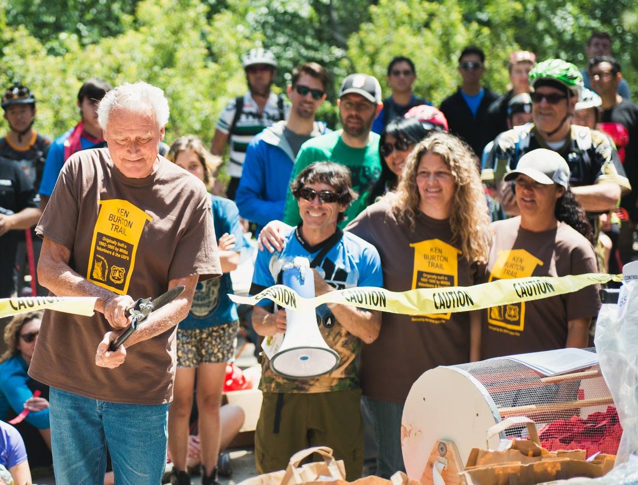
Jim Burton cuts the ceremonial ribbon, as Steve Messer, Matt Lay and Jenny Johnson of MWBA, and Ken's daughters Heather and Tania look on.

Opening of Ken Burton Trail

In 2016, the Gabrielino Trail Restoration project, with REI, Bellfree Contractors, and Los Angeles Conservation Corps, was completed.  Ken Burton Trail restoration with MWBA was completed, opening the Ken Burton trail and a popular loop after seven years of closure, thousands of volunteer hours, and nearly three years of planning.

(more…)

Rim of the Valley Final Study Recommendations Released

Tuesday, February 16th, 2016

Final Study Recommendations

Final Study Recommendations

The National Park Service today released the Final Study Recommendations for the Rim of the Valley Corridor Special Resources Study. CORBA has been involved in the Rim of the Valley process since congress authorized the study in 2008, and even before that when the concept was only for a Rim of the Valley trail. We are pleased to see the final recommendation includes most of what we–and many other groups and individuals–suggested in our comments. The recommendation is a hybrid of Alternatives C and D of the draft released last June.

The Secretary of the Interior transmitted the final study to Congress on February 16, 2016.   The final study recommends a 170,000-acre addition to Santa Monica Mountains National Recreation Area.The selected alternative would add portions of the Los Angeles River and Arroyo Seco corridors, the Verdugo Mountains-San Rafael Hills, the San Gabriel Mountains foothills, the Simi Hills, the Santa Susana Mountains, and the Conejo Mountain area to the national recreation area. Within the expanded area are: habitat types that contribute to the high biodiversity of the Santa Monica Mountains; functioning wildlife corridors; highly scenic landscapes; historic and archeological sites; geologic and paleontological resources; thousands of acres of open space and recreation areas; and miles of trails, all of which provide exceptional public enjoyment opportunities. Expanding Santa Monica Mountains National Recreation Area would provide new recreational opportunities for one of the most densely populated areas in the United States.

No lands currently managed by the Forest Service (Angeles National Forest and Los Padres National Forest) are included in the proposed boundary expansion of the SMMNRA. However, the National Park Service could partner with the Forest Service on projects, as needed, and as permitted under their current “service first authority.”  Existing land managers would continue to manage their lands, but the inclusion of those lands within the expanded boundary of the SMMNRA would allow the NPS to work with them to acquire land from willing sellers, or invest in capitol improvements for recreation or habitat improvements.

The study at this point is just a recommendation from the Secretary of the Interior to Congress. It will be up to congress to take those recommendations and act on them. Or they may not. It many be many years, if ever, before the boundaries of the SMMNRA are adjusted as recommended in the Study.

The final study report, errata from the draft study and an analysis of public comments submitted can be found at http://www.nps.gov/pwro/rimofthevalley/

El Nino Watch: Trail Damage and Riding after it Rains

Tuesday, December 29th, 2015

We are having a severe El Nino event this winter; as a result the weather forecast is for many heavy rainstorms in the early months of 2016. That will help our drought situation, but will have seriously bad impacts on our trails. As well as muddy conditions that interfere with their use, described  below, the rains could be severe enough to erode some trails into huge ruts, and even wash them away in some cases. There may be more mudslides in Pt Mugu State Park (Sycamore Canyon) like we had last year. Furthermore, the rain will spur the chaparral to overgrow the trails, a condition we haven’t had to deal with much over the past couple of years because of the drought. The combination of waterlogged soil and high winds could blow trees over. We’re expecting to have special trailwork days to repair these damaged trails and hope many mountain bikers will want to help us get them back into shape!

Most trails in our local riding area don’t respond well to rain. They have a high content of clay that turns into sticky, slippery muck that binds to everything it touches. It builds up on the tires, like a snowball rolling downhill, until it jams on the frame and the wheels won’t budge. Some models of clipless pedals won’t let go when full of this mud, resulting in the bike and the attached rider lying sideways in a puddle, or worse.
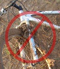
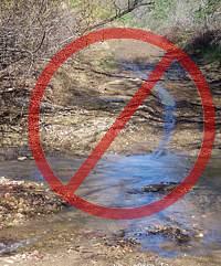
Most wet trails don’t respond well to use until they’ve had time to dry out. Hikers and horses make holes and ridges in the trail that become as hard as concrete when the trail dries. These holes and ridges are good for twisting ankles.

As a rule of thumb, if your foot, tire or hoof makes an impression more than about 1/8 inch deep in the dirt, the trail is still too soft to use. Give it another day or two to dry out before using it!
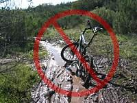
On wet trails, bikes make grooves along the trail. The next time it rains, the water runs down these grooves and turns them into little ruts, then large ruts that destroy the trail.

The mud is particularly hard to remove. It sticks to the bike and shoes, no matter the efforts to remove it, rubbing off on the bike rack, car carpet and gas/brake pedals, making them slippery. Once home, it takes the careful use of a garden hose to remove the mud but not force water into the sensitive parts of the bike.

For these reasons, riders are well advised to stay off the trails after a rain until they have dried. How long to stay off? That depends on a number of factors including the particular trail, how much rain it received, how much sun it gets after the rain (is it in the shade or face south?), how warm and windy the weather is, and so on. After an isolated light rain you can probably ride the next day. After a heavy rain, you should wait several days. This is something where common sense and experience will help. Remember, tracks deeper than 1/8″ mean the trail is still too soft to use!
All is not lost when the trails are soaking! There are a few trails that hold up well when wet because they have more sand and rock that doesn’t hold the water. Here are a few you should know about:

Space Mountain (Los Robles Trail West) to the picnic table is almost always rideable, even right after a big storm. However, it can be pretty mucky from the picnic table to Potrero Road.
Rosewood Trail is pretty good, but not quite as resilient as Space Mountain.
Zuma Ridge Motorway from Encinal (the bottom in Malibu is muddy)
Dirt Mulholland around Topanga State Park.
-Brown Mountain Fireroad
-Most San Gabriel Mountains trails made up of decomposed granite
-Beaudry Fireroad
-Hostetter Fireroad
-Mt. Lukens

Horse/Bike Desensitization Pilot Program

Wednesday, October 14th, 2015

12119096_10153216208687358_3984892478488142217_n-2

With all the equestrians and mountain bikers now sharing many of the multi use trails, we thought it was well over due to get a program going so all are able to share the trails safely and even ride together. In order to accomplish this, there must be protocal and trail etiquette set for both equestrians and mountain bikers.

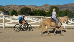
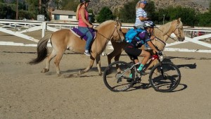
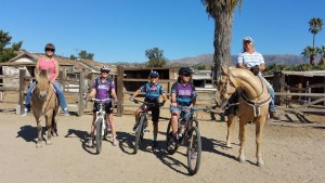
On Sunday, October 11th, we decided to give the program a try with the help of a few of the local equestrians at The Davis Ranch in Chatsworth. I brought 2 other GGR girlz and myself with our mountain bikes to give this a go. We wanted to keep the 1st time very small and more of a pilot program since this was the 1st time I had put this plan into action. We started out in the riding ring which was enclosed, then took it outside of the ring.

12079198_10153216208817358_3305294184480307977_n

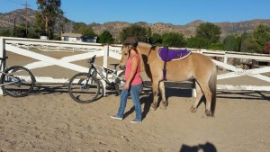
Our equestrians for the day were Dana on Auggie and Jan on Ozzie. We started by lining our bikes up against the fence and Dana and Jan walked their horses dismounted back and forth around the bikes and let Auggie and Ozzie smell the bikes and really get a good look at them. Then all of us cyclists got ON the bikes and they did the same thing. Now it was time for the horses to be mounted.

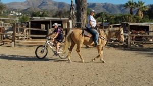
We started riding very slow along side the horses. Then behind the horses, towards the horses, constantly passing them on both sides. Then we picked up speed on the bikes and the horses went from a walk to a trot to a fast trot. The key here was constantly communicating with the equestrians. We asked if it was OK to pass. We said “bikers coming”, we said “passing on the left”, all these things were very loud. We also made sure we told them to have a great ride and a good day!

12141794_10153216209172358_1734544104189208721_n

12079252_10153216209312358_6870417974206090440_n

12079104_10153216209647358_5340819530297984411_n

This was going very well and the horses had no problems with the bikes. Now came the real test. Blind corners! We all left the riding ring for this exercise. Both Auggie and Ozzie were to trot up on a trailer in their parking lot while the cyclists hid behind the trailer and came out across the horses path without being initially seen.

Jan and Ozzie went 1st with Lynn being the cyclist. Sure enough, Ozzie did not like this and shied away quickly and suddenly. We asked Jan what she wants the cyclist to do in this instance. She wants us to just stop and stand still while she gets her horse under control. The slowly approach her horse and talk to them both. Again, the communication.

We did the same scenario again. This time Ozzie wasn’t as scared. By the 3rd time, we didn’t even think twice about it. When we had Auggie do it, no problems at all. Auggie raised his ears and was alert, and that was about it.

The cool thing about The Davis Ranch is that they have hallways/corridors that simulate a single track and double track on their farm. So off we went for some more situations to create!

We started off riding behind the horses with them trotting. We constantly talked to them. Then we practiced the blind corners. Part of the barn did not allow us to see the horses, so this was perfect practice for blind corners. When we as cyclists approached the blind corner and could not see around it, we yelled “BIKERS COMING”. The equestrians immediately stopped before they were even close to the corner because they heard us announcing ourselves. Therefor preventing a run in.

We did this both ways a few times around the corners. Every time constantly communicating when the corner came up. The equestrians were able to react in plenty of time because they heard our voices. Also, they wanted to make it VERY clear to us that it is NOT always safe to pass. If the trail is too narrow, please do NOT pass. Be patient and wait until there is a safe place to pass for both cyclists and equestrians, but let the equestrian decide. They know their animals and what is safe for them.

We initially wanted to call this the Carrot Ride program. But Dana brought up some very good points and had an awesome idea as well! Cyclists who don’t have any experience with horses, will most likely not know to keep their hands flat when feeding a horse a carrot so they don’t loose their fingers. So she thought cyclists feeding carrots to horses on the trails for this reason could open up a whole nother can of worms. We all agreed. Also, its not easy for horses to eat carrots when they have bits in their mouths. Horse cookies are much easier. So, what Dana suggest was that we carry a few horse cookies in a ziplock bag with our business card and just hand it to the rider. Oh and Jan thought it would be a nice touch if we included a mint for the horseback rider as well! I love it! Outstanding input from our horseback riders!

I will have some of these cute little horsey bags available at the CORBA booth at this Sunday’s Rocktober event.

The biggest outtake we took from this pilot program was how critical communication is. Just talk to the equestrians, smile and speak up and slow down when you hit a corner and/or you see horses coming by. Horses have the right of way…not us.

We will have a larger program at the Davis Ranch November 22nd at 8am. We will take 6 mountain bikers and 6 equestrians and their horses and run the same program. The Davis Ranch is in Chatsworth, CA. If you want to participate in this, please email me at: wendy@girlzgoneriding.com or Wendy@corbamtb.com.

I’m so thrilled that after posting our fun pictures of the morning program, we have a program in the works for January for the Altadena area as well.

If you want information on this new CORBA program for a future hosting in your area, please contact me to discuss: email me.

Please remember to smile, slow down, and use your voice and bike bells to alert others you are coming.

Wendy Engelberg
Director, GGR: Girlz Gone Riding
Proud CORBA board member