

Check out this whimsical video that explains how to practice proper social distancing on trails in the open spaces.
Archive for the ‘Trail Hazards’ Category
Social distancing for Mountain Bikers – a brief video guide
Monday, May 18th, 2020Dead Cow Trail Closed by NPS
Saturday, March 7th, 2020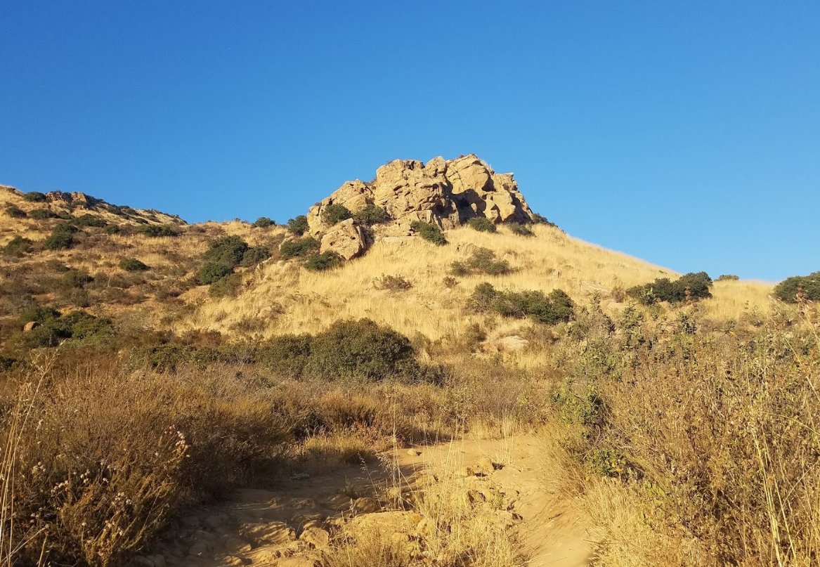
Dead Cow Trail (pre-Woolsey Fire)
The National Park Service has closed Dead Cow trail in the Cheseboro area of the Santa Monica Mountains National Recreation Area. The trail runs between Paolo Comado and Sheep’s Corral. They also closed an illegally constructed trail in the vicinity, which had its own safety concerns and negative impacts to the area.
Dead Cow has been gradually degrading over the years, making it one of the more technical trails on National Park Service land. It is also in dire need of maintenance and safety improvements. When an uptick in injuries and accidents was seen over the last year, NPS rangers attention was drawn to the area. They inspected Dead Cow trail and discovered the unauthorized trail in the vicinity.
This closure is the direct result of a few rogue mountain bikers, who, without concern for the impact of their actions or its repercussions for the mountain biking community, illegally constructed a trail in the vicinity of Dead Cow. This took place as nearby neighborhoods were still in recovery from the Woolsey fire, and the area’s chaparral was especially vulnerable post-fire.
We condemn this action, and cannot condone any rogue or illegal trail construction on public land. It affects our ability to ask for new trails, and hurts both our image and our relationship with land managers.
CORBA has reached out to the National Park Service, with offers to help inform the public of the closure, and to help do needed maintenance on Dead Cow trail. The areas impacted by the illegal trail will also need rehabilitation and restoration.
The closure stands until further notice, and people who ignore the closure are subject to citation. For mountain bikers who desire jumps, berms and other park-like features, join our Dirt Church maintenance at Sapwi Bike Park every Sunday morning, and help us get to stage 3, with expert jump lines and other features.
Please stay off Dead Cow trail, and spread the word. Watch for upcoming volunteer work days in the area.
Station Fire 10 Years Later
Tuesday, August 27th, 2019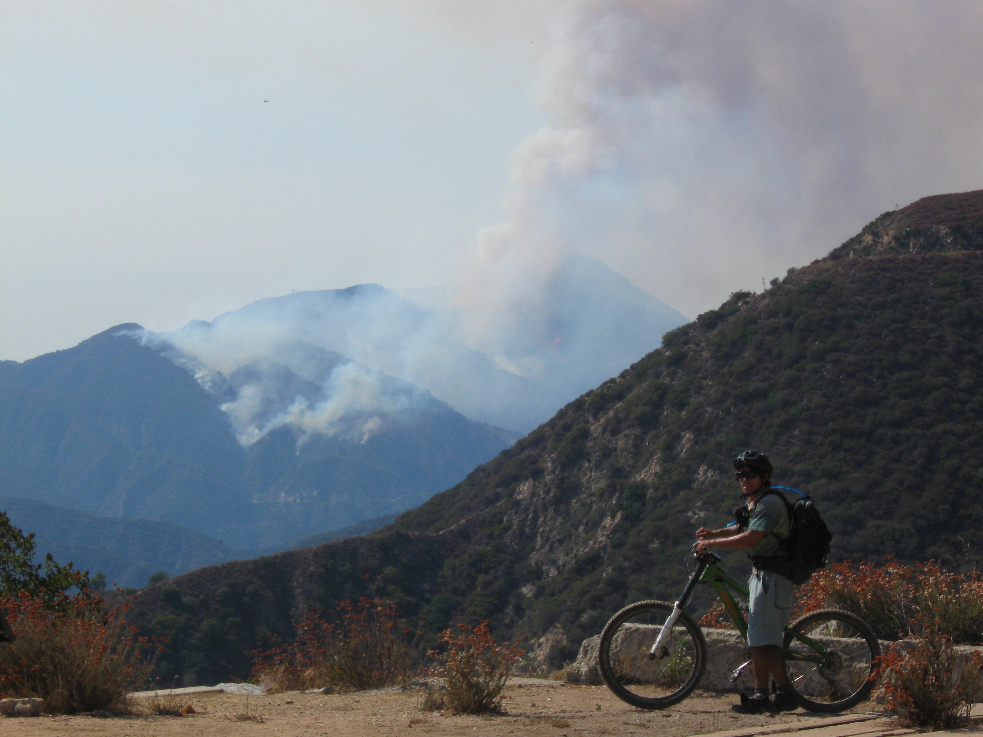
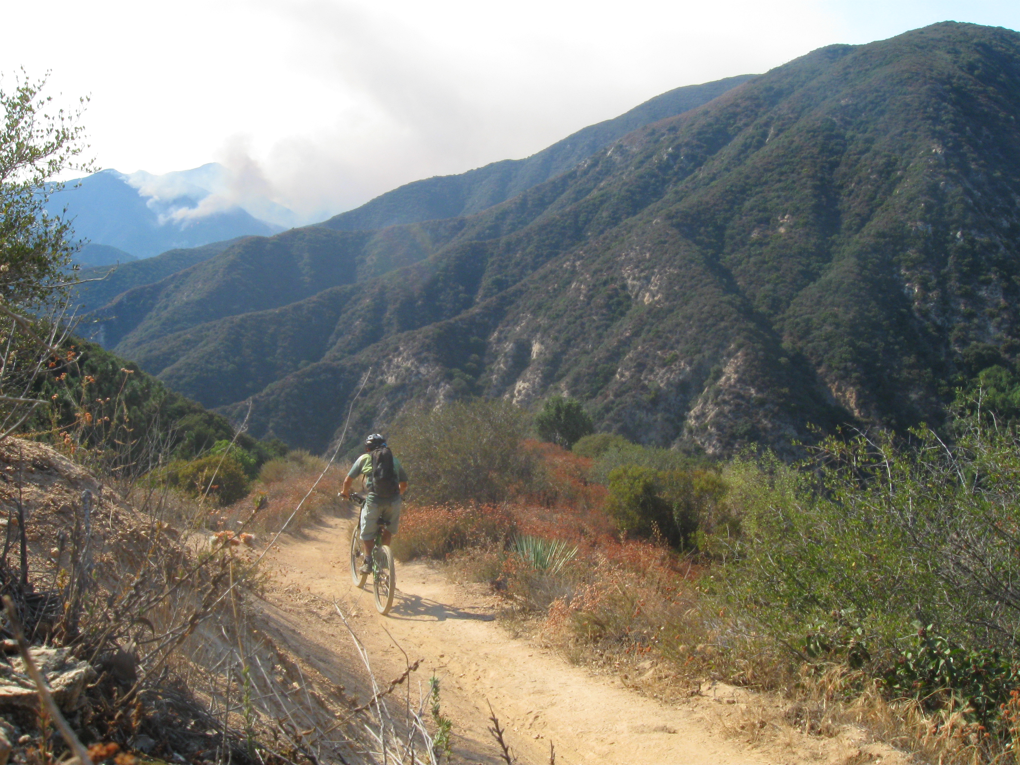
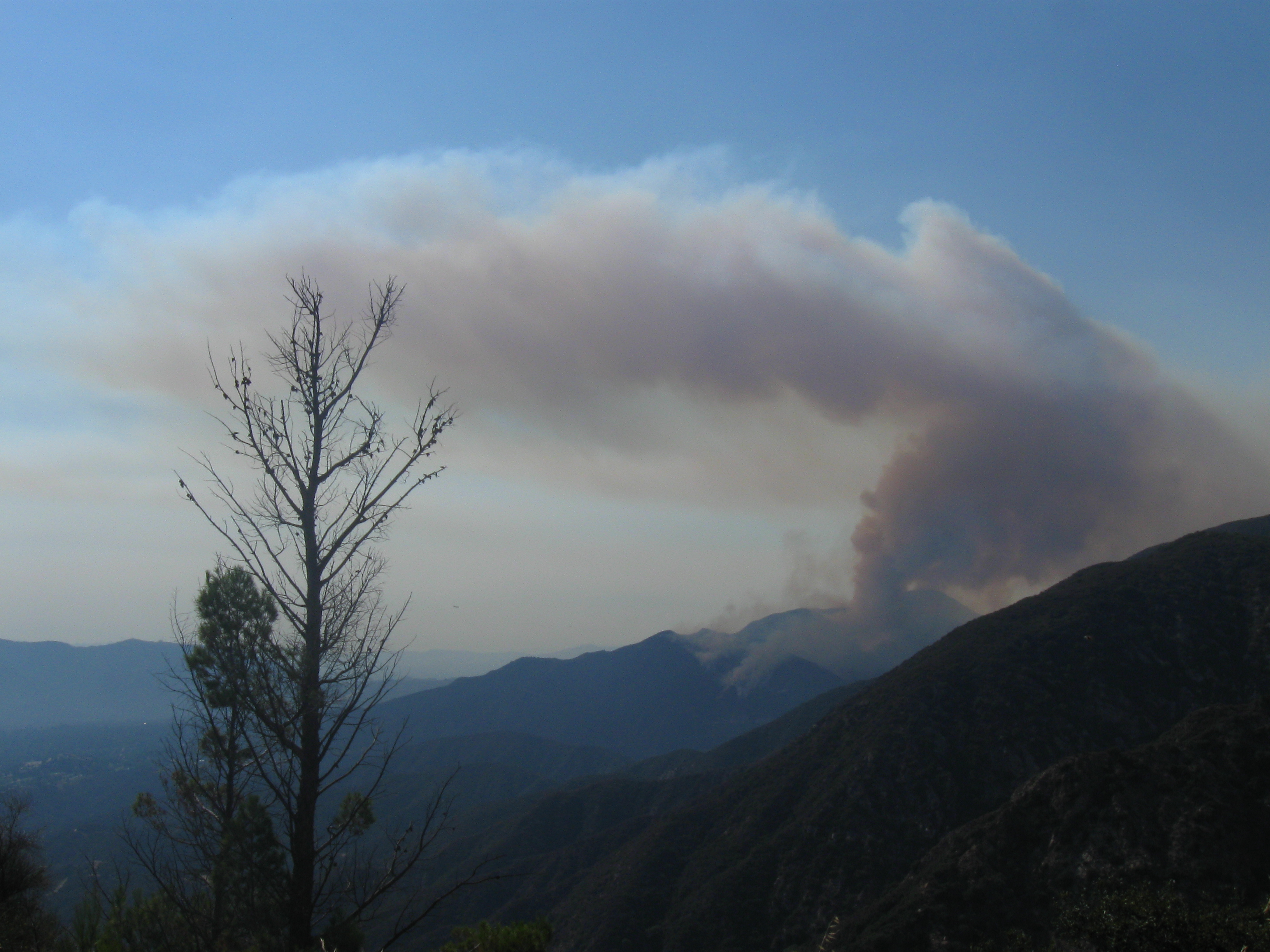
Ten years ago today, CORBA’s trail crew set out to do trailwork on Sunset Ridge trail in the Angeles National Forest. When I arrived at the chaney trail gate, it was closed. I rode up to Millard, from where I could see that a fire was burning in the Arroyo Seco Canyon, on the western flank of Mt. Lukens. We cancelled CORBA trailwork for the day, while I rode Sunset Ridge and El Prieto for what would be the last time in several years. The Station Fire burned for 50 days, until it was essentially extinguished by the first rains of the El Nino winter season in October. Over 160,000 acres burned, including most of our favorite trails.
This changed my life, and changed CORBA’s focus. Trails were closed with no indication of how much destruction there would be. Torrential rains over the next few months dealt a blow to the barren, burned earth. CORBA began focussing on rebuilding trails that had been damaged by the Station Fire.
Over the course of the next nine years, CORBA switched gears to begin rebuilding trails. Sam Merrill trail was our first volunteer work day a year after the fire. We had 70 volunteers show up, many of whom just wanted to get into the closed Forest and see the destruction first hand.
CORBA, working in tandem with other groups, restored: El Prieto, Brown Mountain, Sunset Ridge, Sam Merrill Trail, Rim Trail, Gabrielino Trail (Redbox-Switzers), Silver Moccasin Trail, Colby Canyon Trail, Strawberry Peak trail, Upper Brown Mountain fire road, Ken Burton trail, Mt. Hillyer trail, Doc Larson Trail, Rattlesnake Trail, Fascination Springs Trail, Vetter Mountain Trail, Charlton Connector, Silver Moccasin trail and others. We had tremendous support from the community, with grants from REI and Edison International. More than 10,000 volunteer hours were recorded.
A year ago CORBA and MWBA re-opened the last trail still closed because of the Station Fire. The Gabrielino National Recreation Trail. Since then, we have restored the Los Pinetos Trail (closed due to the Sand Fire), and have begun work on Woolsey Fire restoration efforts in the Santa Monica Mountains.
In the aftermath of the Station Fire, many in the mountain biking community gave back to get trails reopened for which we are truly appreciative. In that time the sport has grown, there are more people than ever using the trails, and the need for continued volunteerism and efforts to maintain our public lands is growing.
Thank you to the mountain biking community and the trails community at large for giving back to our trails over these last ten years. Let’s keep up the momentum as we look forward to maintaining the trails we’ve restored and ensuring we all have places to ride our bicycles and connect with our public lands.
Los Pinetos Trailwork with SCVTU and LA County
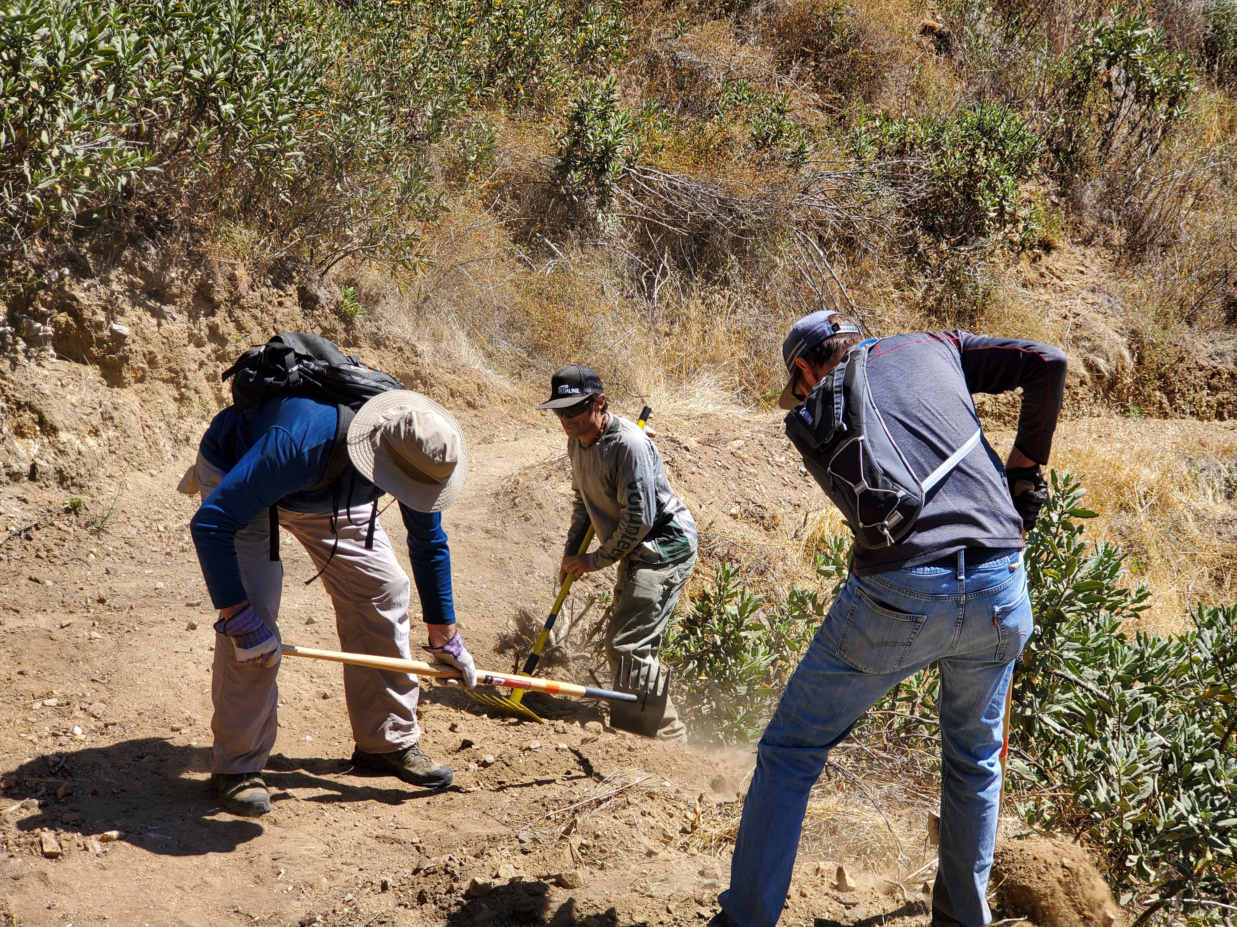
Monday, August 12th, 2019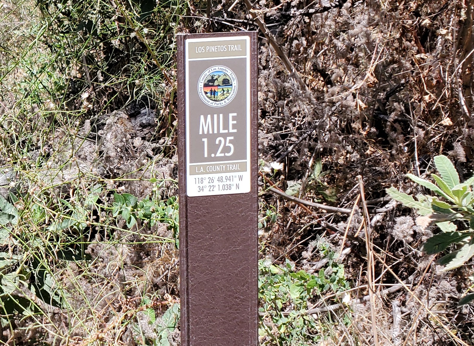 On Saturday, August 10, 30 volunteers converged on Walker Ranch in Santa Clarita to put some finishing touches on the Los Pinetos trail. We were also joined by 6 LA County Parks department staff.
Originally scheduled for earlier in Spring this year, a few weeks ago LA County’s trail maintenance staff finally were able to work on Los Pinetos trail. As an agency, LA County doesn’t have a volunteer program tailored for doing trailwork. Instead, their staff runs trail dozers and do what appears to be a single-pass scraping of the trail, without paying any attention to drainage, outslope, or other sustainability features that the County’s own trail’s manual calls for.
This has led to much disappointment from the trails community in the County’s approach to maintaining their celebrated trails. Many, including Los Pinetos, are not sustainably aligned, and/or lack the suitable infrastructure to improve their sustainability.
The Santa Clarita Valley Trail Users, a committee of CORBA dedicated to the SCV and surrounding areas, have been busy building and maintaining City of Santa Clarita trails in East Walker Ranch and Golden Valley Ranch. This was their first opportunity to do trailwork with LA County and the USFS. Los Pinetos trail is a County-managed trail, partially on National Forest land, and partially on County-managed State Park land, which required additional coordination between the agencies.
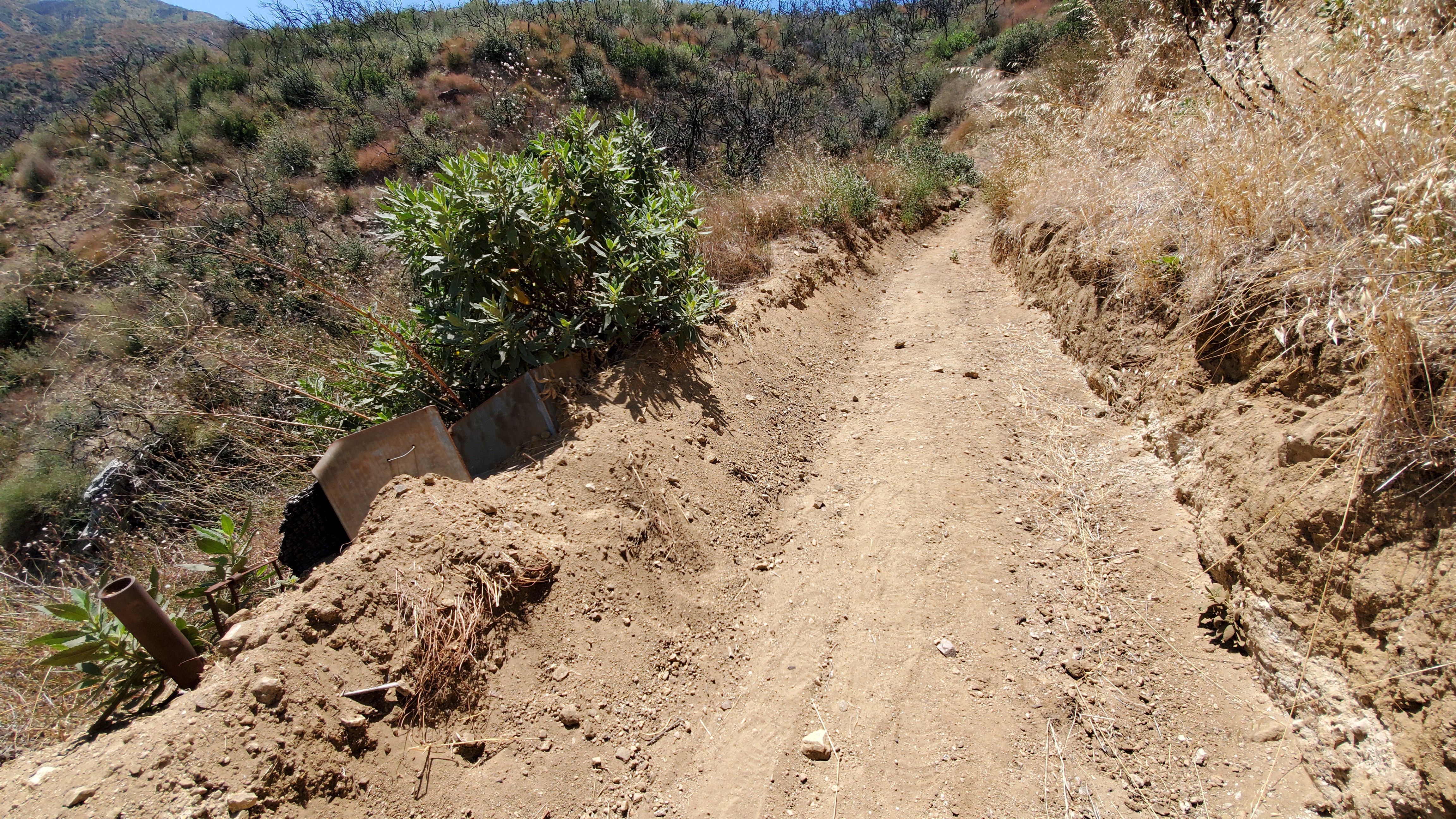
Machine work has deepened the tread to the point where this county-installed culvert is now completely useless, showing the size of the berm created by machines.
The machine-work done on the trail by LA County’s mechanized trail crew left no drainage and a water-trapping berm that would ensure the trail becomes eroded and rutted with the next rains. In fact, they bladed over existing drainage such as the failed the culvert pictured above. About 20 Volunteers constructed more than 20 drains on the first mile of the trail from the bottom. Meanwhile, a second crew were shuttled to the top of the trail by LA County staff, and cut back overgrown brush on the upper mile or so of trail.
Constructing a rolling-grade dip drain
While our goal had been to remove the berm and outslope the trail where possible, the depth and extent of the machine work made removing the berm by hand nearly impossible, and certainly not feasible for a one-day volunteer event. Instead we installed drains, rolling grade dips and nicks where feasible, every hundred feet or so. The upper crews brushed more than a mile of trail, where treadwork was not really needed.
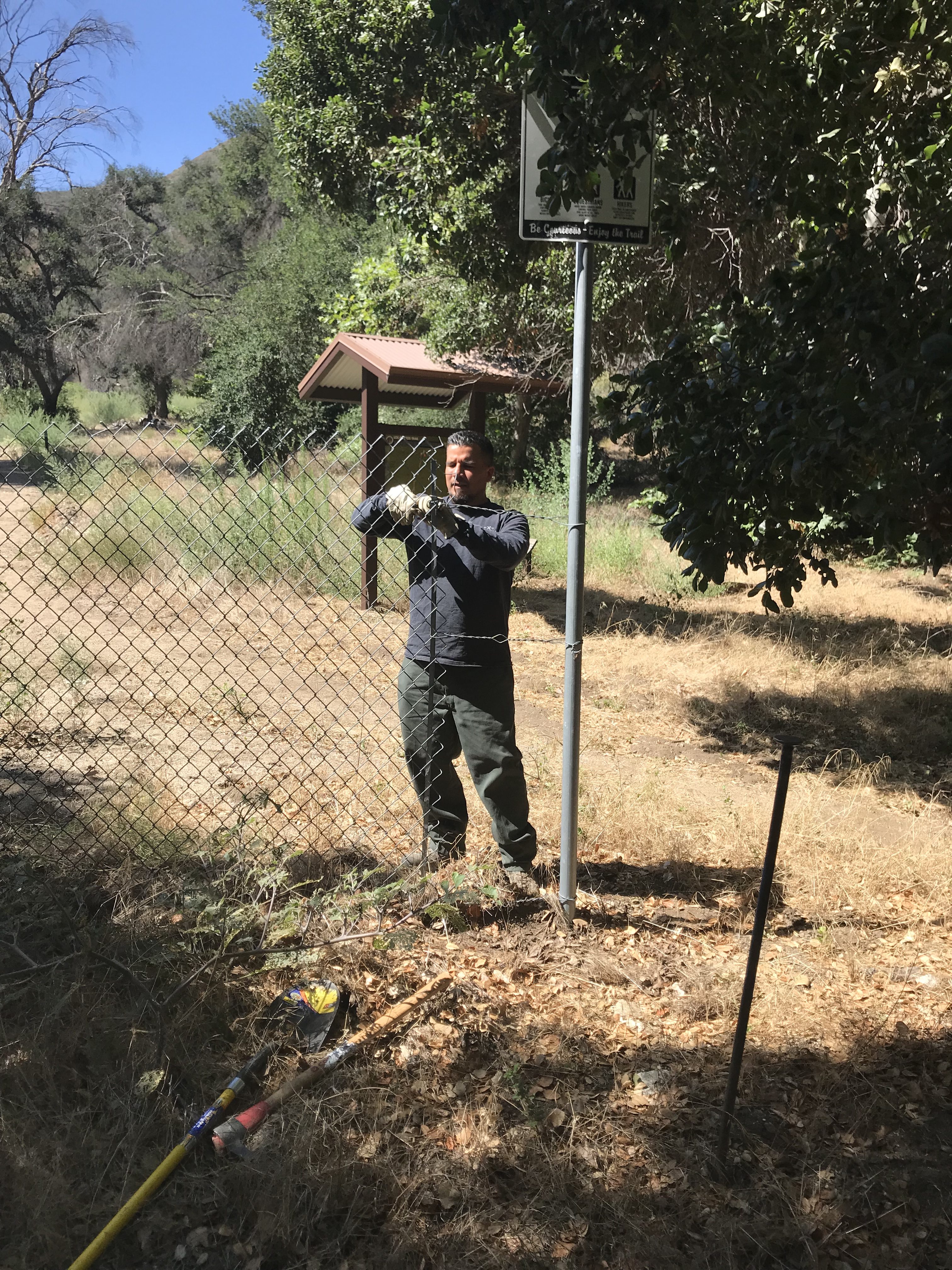
LA County Parks Staff remove the fence at the trailhead, opening the trail
By the end of the day, the 30 volunteers and 6 County staff put in four solid hours of trailwork, for approximately 216 volunteer hours. In 90 degree heat and direct sun. At about noon the County staff pulled the trail closed notice and fencing from the trailhead at Walker Ranch. The trail is now officially open after three years of closure following the Sand Fire.
We thank LA County, the USFS, and the dedicated volunteer crews of the SCVTU for helping advocate for and participate in the restoration of this trail. Currently our plan is to return to the trail in the fall, to improve the drains created and add a more in time for winter.
There remains one large downed oak tree at the last switchback near the bottom. The County crews will remove the tree this week.
Climbing 3N17 “the beast,” and descending Los Pinetos is now possible. To ride the loop, you’ll have to ride Placerita Canyon road back to the start for now. The Canyon trail is scheduled for reconstruction by LA County crews this fall. Stay tuned for updates.
The trail is popular with hikers, (and will be more popular when the Canyon trail is reopened). We encourage descending cyclists to use bells and common courtesy towards those hiking on or riding up the trail.
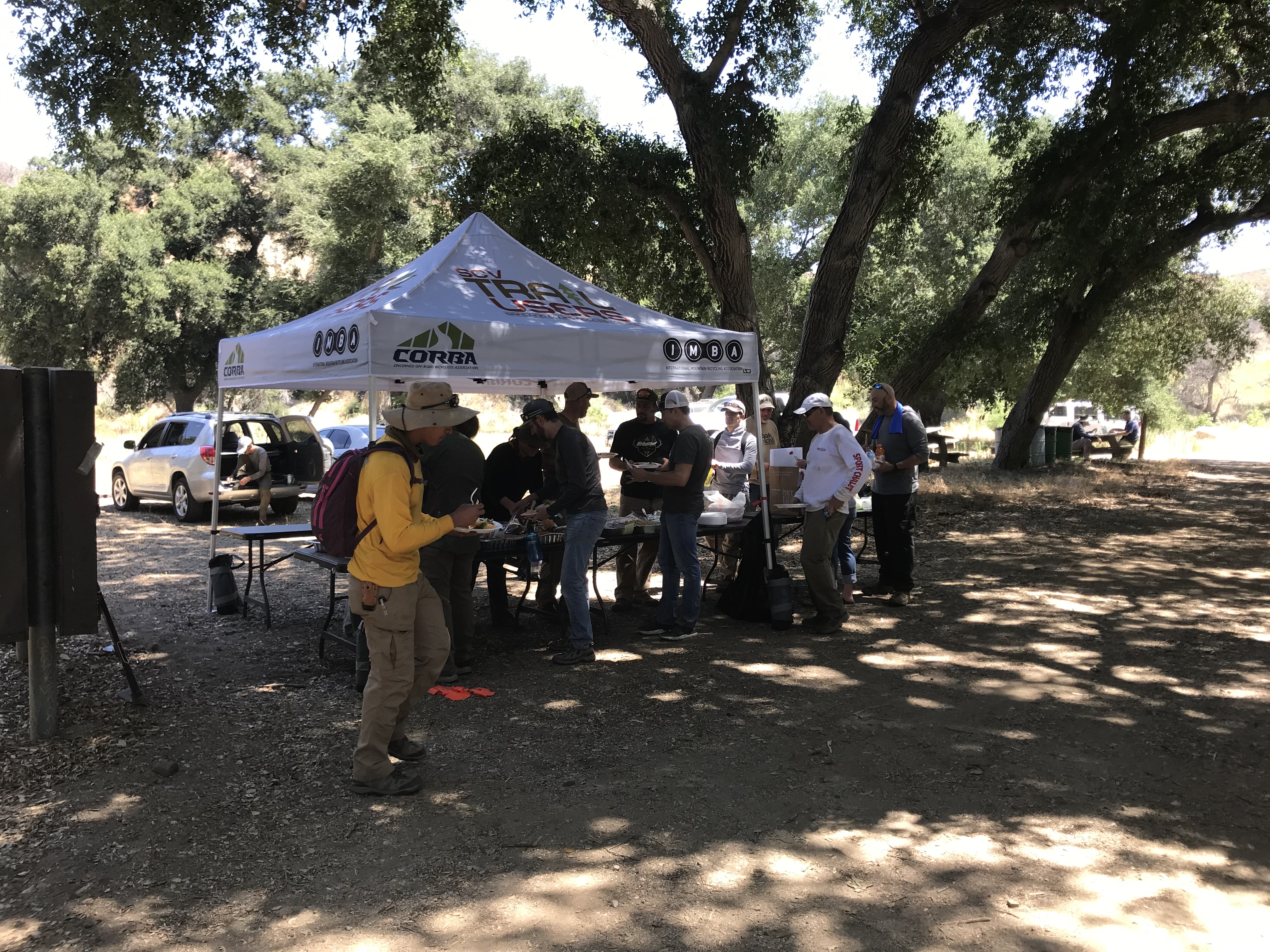
Enjoying a post-trailwork lunch
Sullivan Canyon Closure Update: 6/24/2019 – 8/2/2019
Wednesday, June 19th, 2019Following our previous report we have received an updated from SoCalGas. Here are the new details:

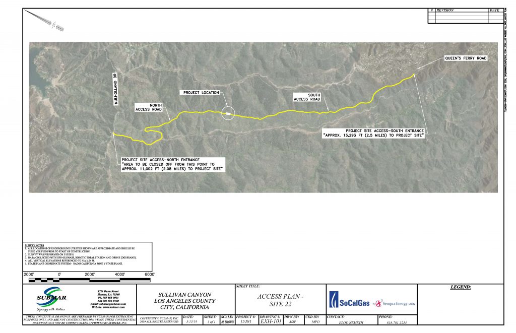
Sullivan Canyon Temporary Closure:
6/24/2019 – 8/2/2019 Pipeline Exposure Remediation
-South side (Queensferry Entrance) will be open during construction
-The location of the exposure is on the map (approx. middle of the canyon)
-Project site will NOT allow hikers, bikers, and runners to pass.
-The maintenance crew will be using the North Entrance to access the site.
-Between the North Entrance and the project site, the canyon will be inaccessible. However, from the South Side (Queensferry Road) everyone will be able to access the canyon until the project site.
Sullivan Canyon to Close for Maintenance 6/3 – 7/12
Thursday, May 16th, 2019 SoCalGas has two upcoming projects in Sullivan Canyon. This trail is popular for mountain bikers, and we want the public to be aware that upcoming maintenance projects will impact public use of the trail.
The popular Sullivan Canyon trail is on land owned by SoCalGas. The old road along the canyon bottom is a service road for the gas company to access gas transmission pipelines that run underground through Sullivan Canyon to cross the Santa Monica Mountains. SoCalGas is gracious enough to allow public use of their land and the trail through it, except when they need work on the roadbed, trail or pipeline. This is a temporary closure, and we ask that all trail users respect it.
5/17/2019 – 5/31/2019 Sullivan Canyon Open during Brush clearance (watch for maintenance workers): Crews will clear vegetation along the canyon from the Queensferry entrance to Mullholland. They will clear the vegetation along the roadway toward the bottom of the canyon. Their focus will be on the North Side of the roadway. Please use caution as you pass construction equipment, and we recommend keeping dogs on a leash so they are not harmed by equipment as well.
- The canyon will be fully open.
- Minor impact to walkers, bikers, runners, etc. They will need to slow down for the landscape crews.
- We will have signs up at both ends of the work area warning of the work taking place.
- LMI (Landscape Maintenance Inc), our contractor, will be accessing the canyon from Queensferry entrance on the South side.
6/3/2019 – 7/12/2019 Sullivan Canyon Closed for Pipeline Exposure Remediation: Heavy equipment will be brought in and staged on site. Signs will be placed at each end of the closed area.
- -South side (Queensferry Entrance) will be open during construction
- -The location of the exposure is on the map (approx. middle of the canyon)
- -Project site will NOT allow walkers, bikers, and runners to pass.
- -Crew will be using the North Entrance to access the site.
- -Between the North Entrance and the project site, the canyon will be inaccessible. However, from the South Side (Queensferry Road) everyone will be able to access the canyon up to the work area.
If there are any changes to the schedule, we’ll post them here and on our social media. For the latest information, you can contact SoCalGas Public Affairs Manager, Mike Harriel at 213 244-4633.
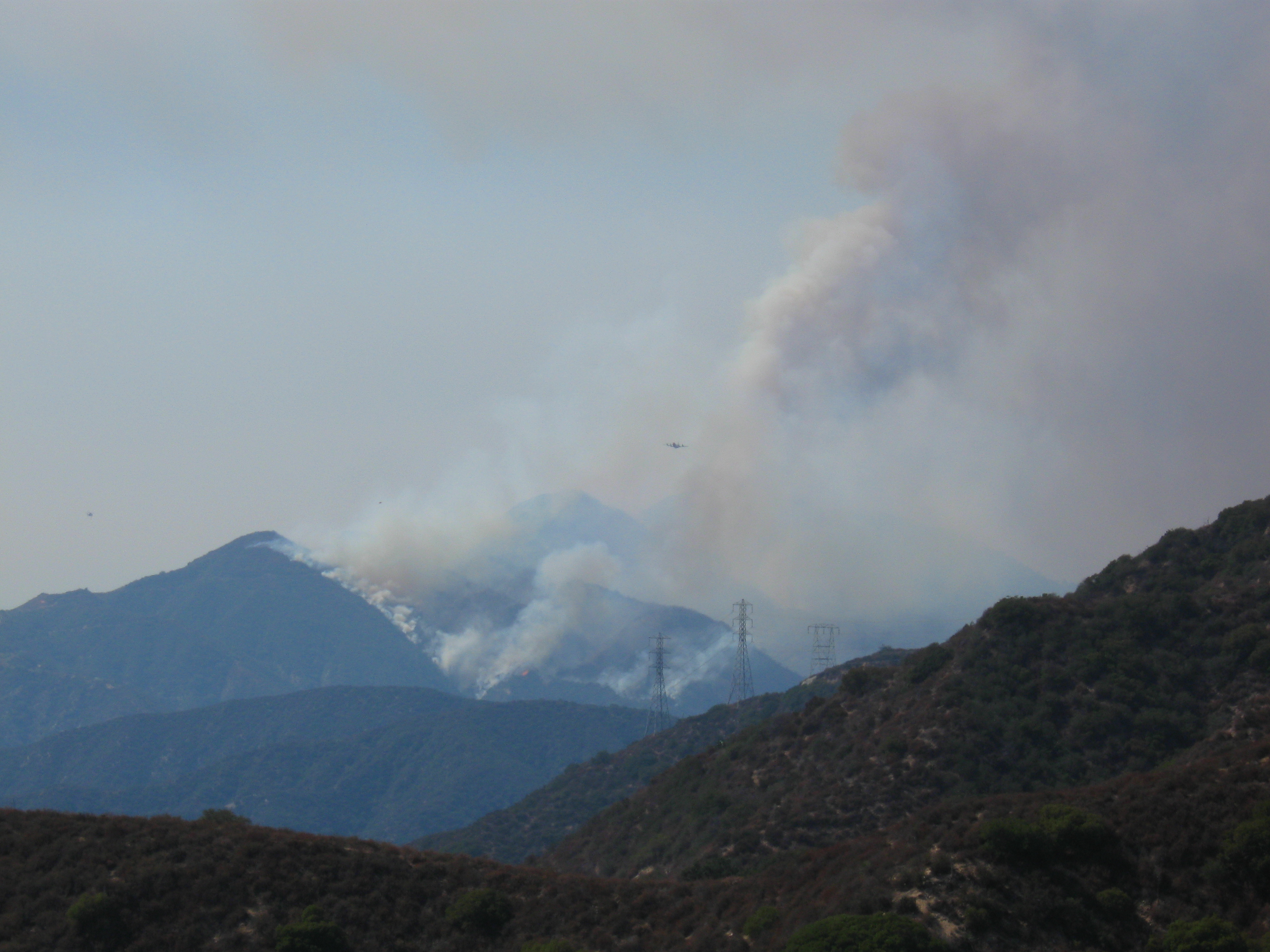
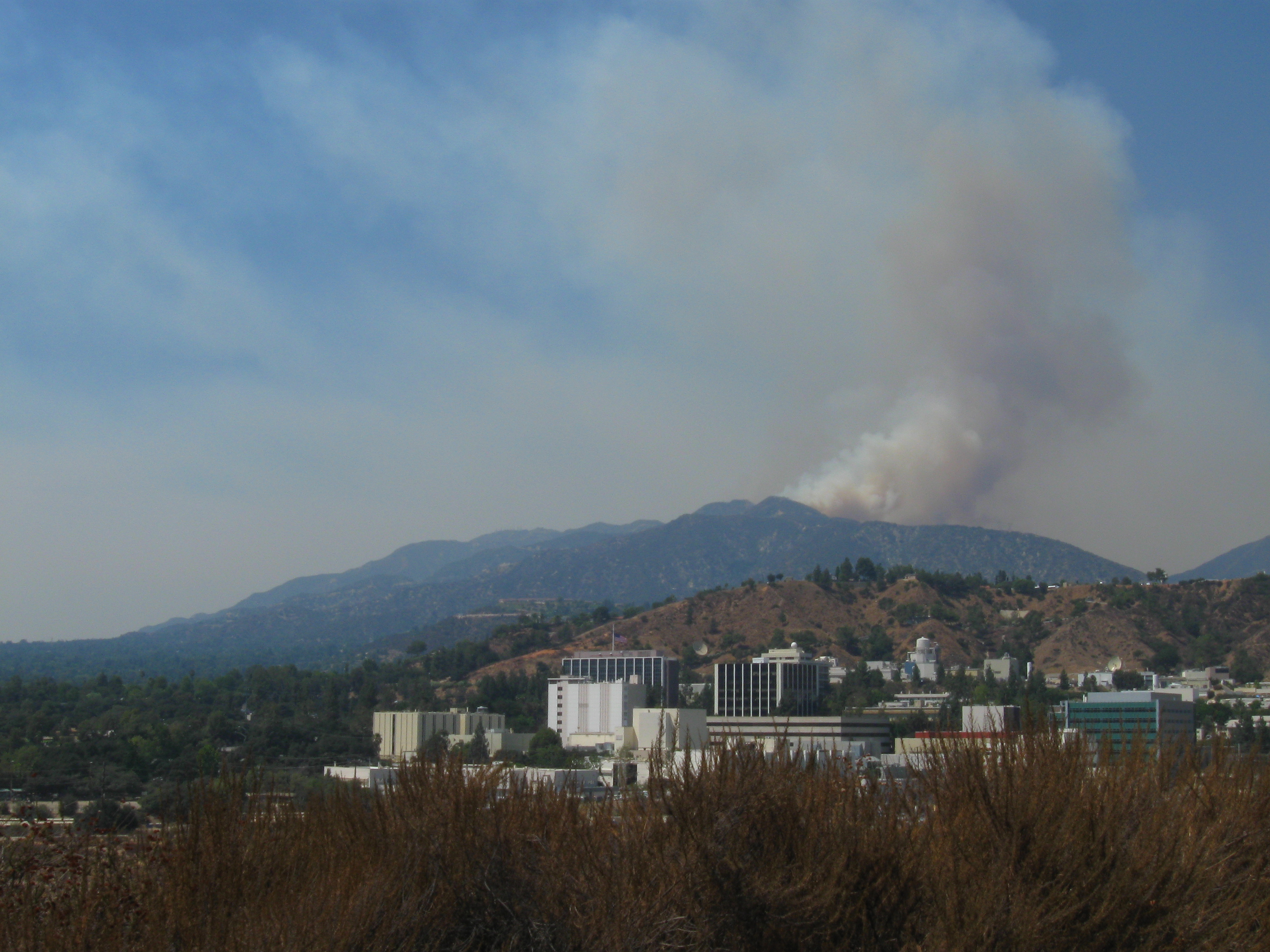
July 2019 Trail Fire Closures Update for the Santa Monica Mountains
Saturday, March 2nd, 2019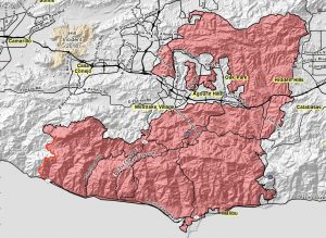
This article has been updated since it was originally posted on January 4th:
– January 12: The Mountains Recreation and Conservation Authority (MRCA) opened most of their open space areas
– March 2: The Backbone Trail between Kanan Road west to Yerba Buena Road has been opened.
– March 25: All COSCA trails in Thousand Oaks except the Hill Canyon Bridge are now open.
– April 30: The Backbone Trail fromYerba Buena Road west to the Mishe Mokwa trailhead is open
– July 18: The remaining sections of the Backbone Trail are now open, so the entire trail is open. (Note that not all of it is open to mountain biking, as always.)
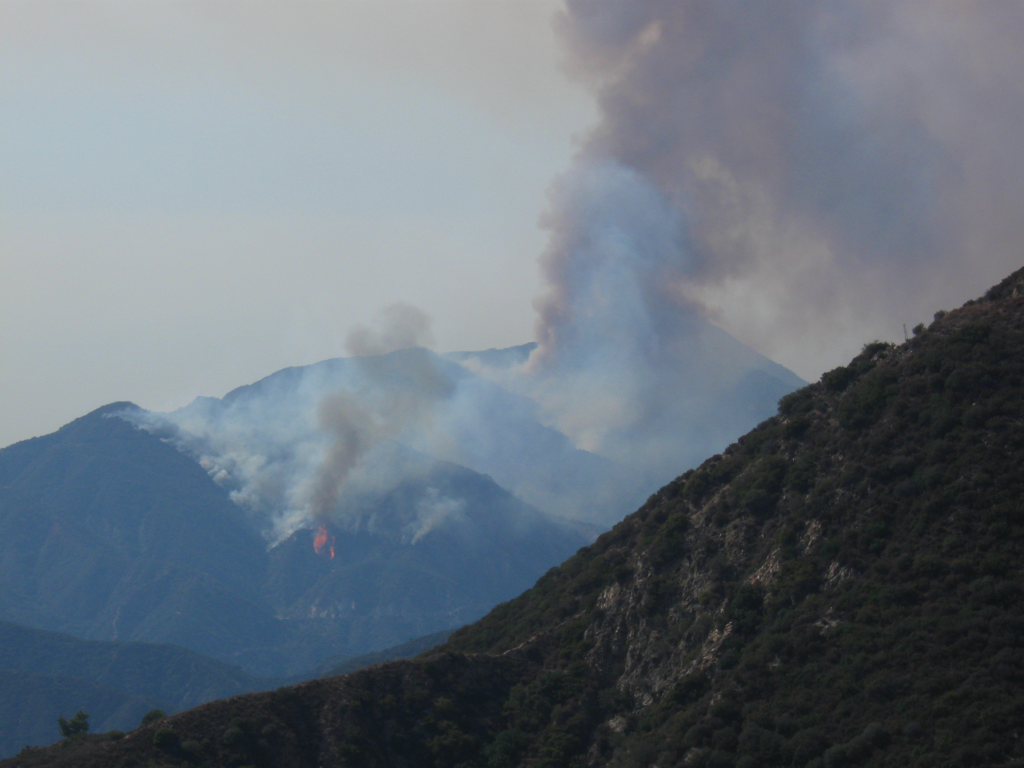
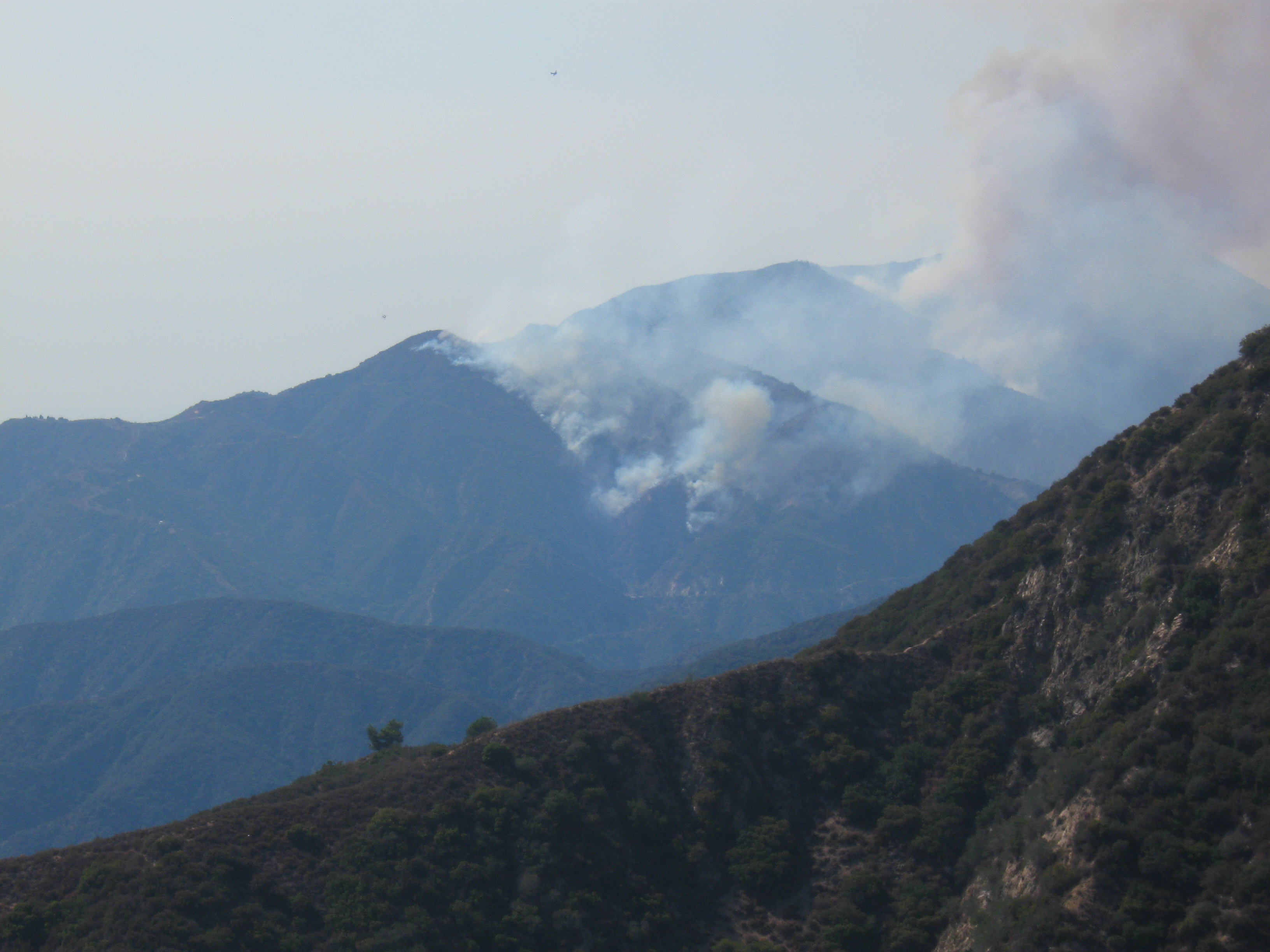
South of the 101 Freeway, the Woolsey Fire completely decimated most of the open space between Las Virgenes/Malibu Canyon Road on the east and Point Mugu State Park (Sycamore Canyon) on the west. North of the 101, most of the open space south of Simi Valley and between Valley Circle on the east and Erbes Road to the west was destroyed.
With the recent rains, the regeneration process has begun and new growth can be seen on the burned hillsides.
Nevertheless, many of the trails are still closed until they are assessed for damage, and repaired as necessary. In addition, heavy rains my result in mudslides that may damage sections of the trail that survived the fire.
The good news is that many of the trails are now open to use. The bad news is that during the Federal Government partial shutdown, the National Park Service is not able to work on their trails, prolonging the time that they will be closed.
The following list is not exhaustive – there are many smaller trails not listed that may be open or closed. If you see that a trail is marked as closed or cordoned off, please stay off it.
Areas that are open
- Malibu Creek State Park. Keep in mind that the two wooden bridges on the Grasslands/Las Virgenes Trail were destroyed, but you can hike-a-bike across the streams if they don’t contain too much water. Also, the “Creek of Doom” section of Crags Rd has experienced rock slides. The MASH end of the concrete bridge on Crags Road has been washed away making the stream impossible to cross at that location. People are using a makeshift crossing through the stream a little beyond the bridge, towards the MASH site.
- Point Mugu State Park (Sycamore Canyon). The areas of the park with biking trails weren’t affected by the fires.
- Topanga State Park. This area is east of where the fire burned.
- Most of the Conejo Opens Space Conservation Agency (COSCA) trails in Thousand Oaks. Exceptions are
- Closed: The Hill Canyon bridge in Conejo Canyons/Western Plateau
- Cheeseboro and Palo Comado Canyons
- Upper Las Virgenes Canyon Open Space Preserve (Las Virgenes Canyon and Ahmanson Ranch; opened on Jan 11)
- Las Virgenes View Park (opened on Jan 11). This includes
- Las Virgenes View Trail
- The north, west and southern sections of the New Millennium Loop
- The top of the Bark Park Trail
- The Backbone Trail west from Kanan Road to the Mishe Mokwa trailhead
Areas that are still closed
For your own safety and to protect the plants and creatures that live in the open space, please stay off closed trails completely, and where the trails are open to use, please stay on the trails! Also, watch for new hazards on the trails such as large ruts, debris slides, washouts and fallen trees.
Edison Grant for Trail Restoration at Sturtevant Falls
Wednesday, February 27th, 2019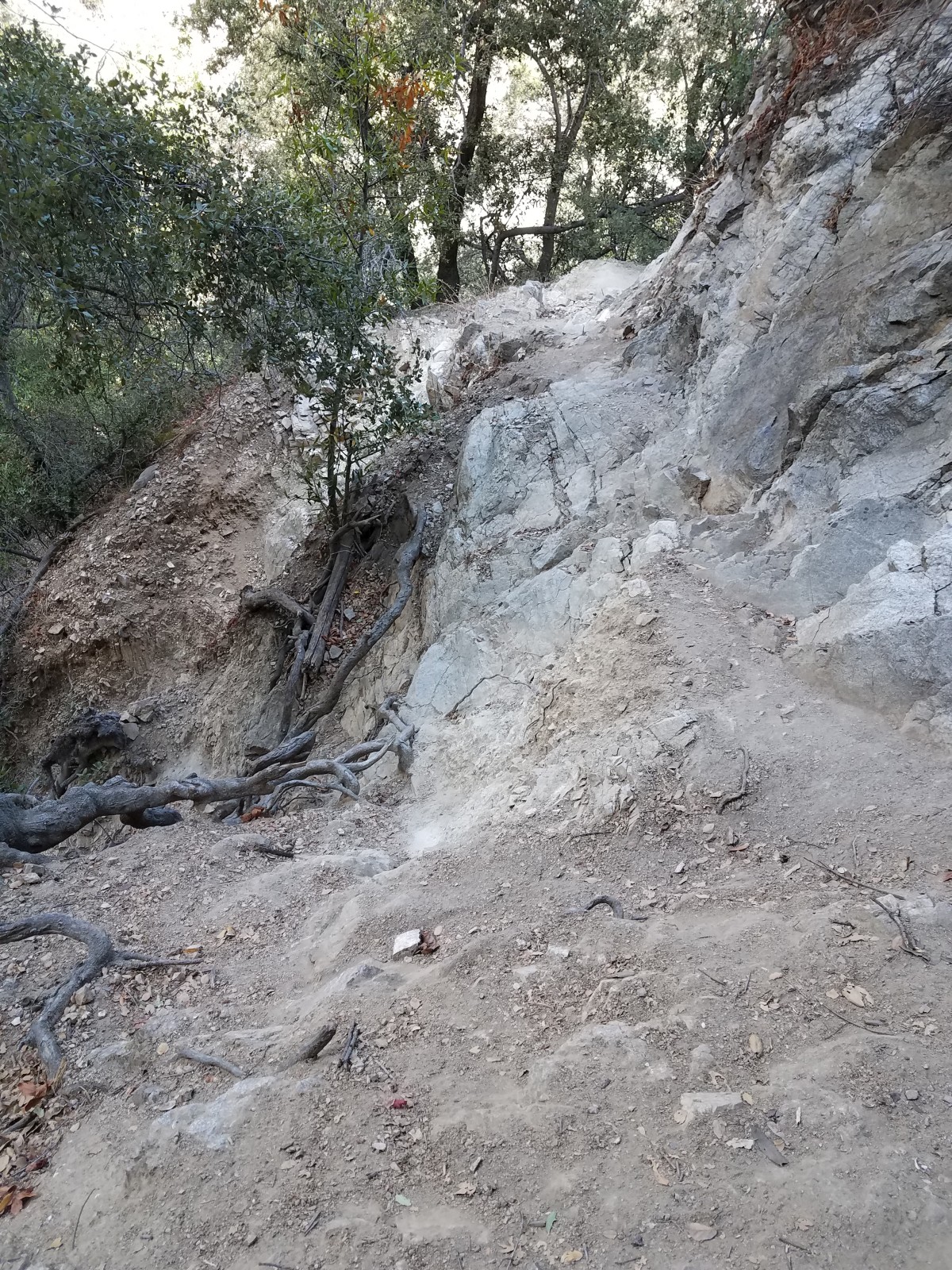
Trail Damage near Sturtevant Falls
CORBA is once again honored and grateful to receive a grant from Southern California Edison. The $15,000 grant will cover restoration and resource damage along a section of the Gabrielino Trail near Sturtevant Falls. For the past three years, we’ve worked on reopening the western end of the trail and maintaining much of the rest.
At Sturtevant Falls, one of the most-visited waterfalls in the San Gabriel Mountains, there has been significant resource damage from people scrambling up a steep slope to get to the top of the waterfall. The erosion caused by that off-trail travel has caused a section of the Gabrielino trail to collapse. While not a popular section for mountain bikers, this is one of the most beautiful trails in the Angeles, following the watercourse with views of the waterfall.
Woolsey and Hill Fire Closures (Updated 12/21)
Tuesday, November 27th, 2018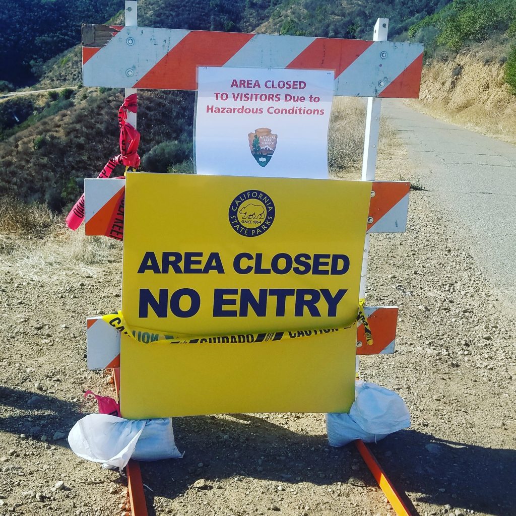
This past week has been devastating. Our hearts go out to all those who were impacted by the Woolsey Fire and the Hill Fire, which have ravaged our local mountains. We know that a good portion of CORBA’s membership are in areas affected by the fire. A few lost homes and property. CORBA’s storage shed near Malibu Creek State Park survived, though we weren’t able to confirm so until after Thanksgiving. We truly appreciate the firefighters and first responders who put themselves at incredible risk to battle these fires and save as much as they could.
With so much loss, it may sound a little selfish to be concerned about trails. Being able to go for a mountain bike ride can brighten your day and bring a sense of normalcy to these tumultuous times. But with most of the Santa Monica Mountains National Recreation Area closed, where can we ride? We’ve provided a listing below, with links to each park’s web site for the latest updates. We’ll do our best to keep this information current.
Please respect trail and park closures. Our land management agencies have their hands full with fire recovery and damage assessments. Trails in burned areas can be extremely hazardous, even after the fire is “out.” Fine particulate ash is a lung irritant and can cause severe health problems. Burned, weakened trees can fall at any time, especially in the early days after the fire, or as the ground softens with rain and no vegetation. Once our first big rains hit, trails will be heavily damaged and may become impassable. Just don’t ride closed trails.
As soon as we are able, CORBA will be scheduling trailwork events to help restore trails that will be heavily damaged this coming winter. It might be some time before we can do trailwork or ride. Watch our meetup group or Facebook page for upcoming trailwork events in the new year.
OPEN Areas (Updated Dec 21, 2018):
- All of Thousand Oaks (COSCA) open space areas except
- The Hill Canyon bridge in Conejo Canyons/Western Plateau
- Hawk Canyon in Conejo Canyons/Western Plateau
- Oakbrook Regional Park and Chumash Museum.
- Rancho Sierra Vista
- Cheeseboro
- Palo Comado Canyon
- Rocky Peak Mountain Park
- Mountain biking trails in Point Mugu State Park (Sycamore Canyon)
- Topanga State Park
- Malibu Creek State Park (12/21)
- Will Rogers State Park
CLOSED Mountains Recreation and Conservation Authority (Facebook Page, Twitter)
- Cameron Nature Preserve at Puerco Canyon
- Charmlee Wilderness Park
- Corral Canyon Park – Sara Wan Trailhead
- Escondido Canyon Park
- Fran Pavley Meadow
- Las Virgenes View Trail
- Lechuza Beach
- Liberty Canyon Trailhead
- Triunfo Creek Park
- Upper Las Virgenes Canyon Open Space Preserve (formerly Ahmanson Ranch)
- Zev Yaroslavsky Las Virgenes Highlands Park
CLOSED California State Parks (Facebook, Twitter):
- Malibu Creek State Park – closed until further notice due to the Woolsey Fire. State Parks lost some structures, such as employee residences, the historic Sepulveda Adobe, Red House, Hope Ranch also known as the White Oak Barn (including historic Adamson rowboats) and Reagan Ranch. – Update 12/21: Malibu Creek State Park is now open. Campgrounds are closed, but trails are open. Please stay on the trails!
CLOSED Conejo Open Space Areas:
- The Hill Canyon bridge in Conejo Canyons/Western Plateau
- Hawk Canyon in Conejo Canyons/Western Plateau
- Oakbrook Regional Park and Chumash Museum.
CLOSED Santa Monica Mountains National Recreation Area (Facebook, Twitter):
- All Santa Monica Mountains National Recreation Areas managed by the National Park Service are closed, except as noted above for Open Areas.
CLOSED Roads:
Last updated: Nov 26, 2018.
Bright Night Riding Lights Blind Other Trail Users
Saturday, January 20th, 2018By Tony Hoffman, Resident of Thousand Oaks and frequent trail user
Fellow Trail Users, mountain bicyclists who are out for exercise and to enjoy nature are riding at night in greater numbers than ever before, likely due to improved lighting technology. The newer LED lighting systems are brighter and run longer than the previous generations of bicycle lights. But do you ever think of their impact on other trail users or wildlife?
 I frequently hike at night and become momentarily blinded by the LED lights from oncoming mountain bicyclists. Often times it is group of night riders who also leave me seeing spots for 15-30 minutes after they passed me. I’ve noticed that most of the time it is two lights per bicycle, one on the helmet and one on the handlebars, so 5 bikes equals 10 extremely bright lights blinding me.
I’ve politely requested the approaching bicyclists “dim” their lights but have been ignored or told the lights will not dim. We all know that cars should dim their brights when approaching other cars to keep the driver from being blinded. Shouldn’t bicycle lights also be dimmed when approaching other trail users for the same reason? If the lights cannot be dimmed, what is wrong with turning off the lights and riding or walking past other trail users and turning your lights back on after you are past us?
Technology always outpaces the law but courtesy never goes out of style. Please consider the impact of your lighting systems on us hikers who enjoy a walk in the park in the dark.

