Archive for the ‘Trail Access’ Category

Don’t Shoot the Messenger

Tuesday, July 31st, 2012

It has come to our attention through dialogue with representatives from National Park Service that over the last few months there have been several incidents involving cyclists traversing the trails unsafely. It has gotten to the point that rangers will now be stepping up their patrols and being more proactive in citing cyclists who they deem to be endangering the safety of themselves and other trail users. The following information was provided to us from the National Park Service (NPS) and would be enforced in such areas as Cheeseboro Canyon and the Backbone Trail. State Parks will likely begin increasing patrols in Pt. Mugu State Park as it is also an area of increased unsafe incidents.

In NPS property, citations would be issued under 36 CFR (Code of Federal Regulations); 36 CFR 4.2(b) dictates that NPS adopt California State law for vehicles and traffic safety. California code 4.30(c) states that bicycles are under vehicles and traffic safety regulations:

 36 CFR 4.22 (b) (1) Operating a motor vehicle without due care or at a speed greater than that which is reasonable and prudent considering wildlife, traffic, weather, road and light conditions and road character. ($350 plus $25 processing fee or mandatory appearance)

 36 CFR 4.22 (b) (2) Operating a motor vehicle in a manner which unnecessarily causes its tires to squeal, skid or break free of the road surface. ($150 plus a $25 processing fee)

36 CFR 4.22 (b) (3) Failing to maintain that degree of control of a motor vehicle necessary to avoid danger to persons, property or wildlife (Mandatory appearance).


Send your comments: Open the Canyon Trail, Reconsider the Heritage Trail

Monday, July 16th, 2012

On June 26, Los Angeles County Parks and Recreation released the draft reports on the Canyon Trail in Placerita Canyon Natural Area and the Heritage Trail in Vasquez Rocks Natural Area.  Those reports were the result of petitions signed by hundreds of people who wanted to see these trails opened to bicycles. The Canyon Trail was especially important, as it provides extensive connectivity to other trails in that are open to bicycles, and cyclists had been using the trail for four years without incident, because of an incorrectly placed multi-use sign.

At the first meeting held by the County, over 90% of the 90 or so attendees were mountain bikers. It was clear that this was an important issue, and the newly formed SCV Trail Users rallied local support. On July 12, 2012 the second meeting took place. This time about 200 were in attendance, with a little under half being mountain bikers.

The draft reports recommended that the Canyon Trail be opened to bicycles, after modifications to improve safety. These modifications include the installation of pinch points, additional signage, a posted speed limit, and the application of a “walk zone” close to the nature center, where docent-led interpretive nature hikes are often held.

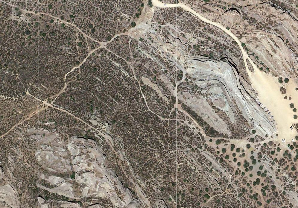
Only one official County trail exists among all these at Vasquez Rocks

Only one official County trail exists among all these at Vasquez Rocks

Vasquez Rocks Natural Area has two named trails, the Pacific Crest Trail (closed to bikes), and the Heritage trail, a half-mile trail connecting the two parking lots in the park. What we learned at the public meeting last Thursday was that the Heritage trail is the only County trail within the park. The extensive network of trails are all unofficial “social” trails, and as such, could not be considered for opening to bikes. Primarily because the Heritage trail does not connect to any other official trail, and there is a dirt road alternative, the recommendation was to keep the trail closed to bikes.

CORBA has put together our comments on the two proposals, available after the page break. We encourage everyone to send a quick email to lbradley@parks.lacounty.gov, stating:

Thanks to the County for considering opening the Canyon and Heritage trails to bicycles. We fully support the opening of Canyon Trail to bicycles. We’d like to see the recommended safety modifications prioritized and installed as soon as possible, so that bicycles can return to the Canyon trail. Opening of the Canyon trail to bicycles should not be made contingent upon the completion of the other recommended improvements to the trail.

We’d also like to see the Heritage trail re-considered for bicycle access, taking into account the potential for future routes as the numerous social trails are either rehabilitated or brought up to County multi-use standards and made official trails.

Comments are only being accepted until July 19, so don’t wait. The final decision will be made by the County Board of Supervisors. The more emails and letters of support they receive, the better our chances of having the County move forward on the recommendations and open the Canyon trail to bicycles.


(more…)

Canyon Trail and Vasquez Rocks – Meeting Thursday July 12

Tuesday, July 10th, 2012

The County’s objective assessments of the Canyon Trail in Placerita Canyon Natural Area, and the Heritage trail in Vasquez Rocks, have been completed.  By applying the State’s Change In Use survey, objective data was gathered about these two trails.

The study concluded that Canyon Trail can be made suitable for multi-use designation including bicycles. It will require some modifications including pinch points, signage, and a designated walk-your-bike section. The trail, irregardless its potential for a multi-use designation, was found to be needing additional trailwork and restoration in several areas. We hope that the modifications needed to allow bicycles can be given priority over other needed trailwork.

Heritage trail, on the other hand, was found to be unsuitable for multi-use designation. The primary reasoning behind this finding is a lack of connectivity to other trails that allow bicycles, and the availability of an alternate route. Extensive impacts were noted from existing users (hikers and equestrians) that would require significant restoration.

While these findings might make sense if Heritage trail were the only candidate for opening to bicycles, there are many miles of trails in Vasquez Rocks. Mountain Bikers from the Santa Clarita Valley did not specifically ask for the Heritage trail to be considered for multi-use, they asked for the Vasquez Rocks Natural Area to be considered for multi-use including all its trails.

In fact, CORBA would like to know what objective data the County’s “no bicycles in Natural Areas” was based. By what process was this policy formulated?

CORBA supports the County’s assessment of the Canyon trail and the recommendation to open it to bikes. We do feel, however, that the assessment of Vasquez Rocks is incomplete as only one trail has been assessed. The fact that the only trail assessed in Vasquez Rocks has seen such significant impacts from existing users, underscores the point that all users have impacts, and bicycles in that respect are very similar to other trail users. We urge the County to complete the assessment of Vasquez Rocks’ trails and to consider future potential connectivity of all trails as a whole.

We also feel that the inclusion of State draft studies should not be cited as evidence until they are fully vetted and published, and the classification of bicycling as an incompatible “active recreation” is inaccurate.

The County will be hosting a public meeting on Thursday, July 12 to formally present the findings and take public comments. There is expected to be a large and organized opposition from other user groups present at tomorrow’s meeting, unlike the first meeting in which mountain bikers made up the vast majority of the attendees. The SCV Trail Users group did a great job of gathering and organizing local mountain bikers during the first meeting, and have continued to provide leadership on these issues, with the full support of CORBA and IMBA.

Please attend this meeting and let your voice be heard:


6pm, Thursday, July 12, 2012. 

William S. Hart Park – Hart Hall  (map)

24151 Newhall Ave, Newhall, CA 91321, USA

Consider RSVP’ing to the SCV Trail Users Facebook event: https://www.facebook.com/events/246695458775275/

Vote For CORBA for Hall of Fame, Deadline July 15

Monday, July 9th, 2012

As posted here recently, CORBA has been nominated for the Mountain Bike Hall of Fame by Hall of Fame member and long-time CORBA Supporter Dr. Al Farrell. The deadline for voting is July 15, and you must be a member of the Hall of Fame to vote.

CORBA is in a category with some very well-deserving nominees, all important to the sport of mountain biking. However, considering CORBA’s involvement not just locally in an area that sets the tone for advocacy, but also as a major contributor to the existence and growth of the International Mountain Bicycling Association (IMBA), we feel that on our 25th Anniversary it would be a fitting tribute to all those who have made mountain biking a legitimate open space activity in the United States and around the world to receive this honor. Please go to the Mountain Bike Hall of Fame and Museum’s web site, join, then vote for CORBA for induction into the Mountain Bike Hall of Fame!

Placerita Canyon, Vasquez Rocks Trails Public Meeting Announced for July 12

Wednesday, June 20th, 2012

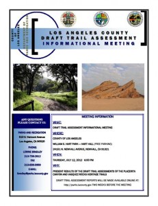
LA County Public MeetingThe County of Los Angeles has completed their assessment of trails in Placerita Canyon Natural Area, and Vasquez Rocks.  They have scheduled a meeting to discuss their findings and draft report for:


July 12, 2012, 6 p.m. 

William S. Hart Park – Hart Hall

24151 N. Newhall Avenue, Newhall, Ca 91321

The Canyon Trail was closed to mountain bikes, after having been posted open for several years, in 2011. Mountain bikers came out en masse at the initial public meeting, and we hope for a similar turnout at this next meeting. Los Angeles County has applied the State Parks Change-in-use Assessment tool to evaluate the trails, and will make recommendations based on their objective findings. The State has been actively developing and testing the tool over the past two years. It’s initial test in Southern California was on the Tapia Spur trail. In that case it was found that with some modifications, the trail could be made safe and sustainable for all users, including mountain bikes. Tapia Spur is currently in the process of being upgraded with those recommended modifications. We would hope for a similar outcome in the County’s application of the tool.

The draft report itself will be released on June 28, twelve days before the public meeting.  We will post a notice and a quick review of the report once it is made publicly available.


Angeles National Forest Land Management Plan Ammendment Comments

Friday, June 8th, 2012

We recently put out an alert  about court-ordered changes to the Land Management Plans for our four Southern California National Forests. We’ve now attended the public meetings, pored over maps and GIS data and have put together our official comments on the plan, available as a PDF, and copied below.

IMBA has recently put out an action alert and petition to preserve mountain bike access to all existing multi-use trails in our four National Forests. We encourage everyone to sign the petition.

In the Angeles National Forest the only area in which we see the potential for problems is the proposed change of the Salt Creek and Fish Canyon Inventoried Roadless Areas into the combined Fish Canyon Recommended Wilderness (RW).  The Golden Eagle trail is an extremely popular, well-documented trail used frequently by bicycles. It is not on any forest service maps and is not an offiicial forest service trail, though it has existed for at least 25 years. We would of course like to see this brought into the trail inventory, and excluded from any recommended wilderness. The trail lies outside the RW, except for one section where it is impossible to tell from the data supplied whether it touches the RW boundary, or crosses it.  We would like to see the boundary adjusted to provide a reasonable buffer between this trail and the RW.

Similar incursions into or across the RW boundaries appear to occur on the fire roads to Knapp Ranch and Atmore Meadows. They are probably just anomalies of the scale of maps used and data supplied, but must be clarified to be sure these fire roads are outside any RW.

The RW includes several miles of singletrack trails that have a history of bicycle access. These include the Burnt Peak Canyon trail and Fish Canyon trail. However, both of these trails are in a dilapidated state and have seen very little use by bicycles, or other users for that matter. In his 1990 guidebook to the area, Mike Troy describes the Fish Canyon trail (16W05) as a difficult hike a bike and the trail as unmarked and difficult to follow. The Burnt Peak Canyon trail, on the other hand, is described as a fun, non-technical double-track.  We will endeavor to gather more data about the existing conditions of these trails, but for the moment we are asking that they be left as Backcountry Non-Motorized (BCNM) rather than RW.

While we support the ongoing preservation of our remaining open space and prevention of future disruptive development or extractive use of the land, trails are a limited resource and losing trails reduces our future options for recreational access. A RW designation will make these trails more difficult to restore or maintain, and we risk losing them forever.

We encourage everyone to send comments via email to socal_nf_lmp_amendment@fs.fed.us or snail mail to: Attn: LMP Amendment, Cleveland National Forest, 10845 Rancho Bernardo Road, Suite 200, San Diego, CA 92127-2107.

CORBA’s submitted comments follow the break.


(more…)

Recommended Wilderness Proposals in our National Forests

Thursday, May 31st, 2012

In response to a lawsuit, the four Southern California Forests are proposing amendments to their 2006 plans. They are proposing new Backcountry Non Motorized Recreation zones as well as new Recommended Wilderness designations. Several mountain bikers attended the informational workshop at the Angeles National Forest Headquarters on May 30, along with concerned forest users, and many from groups like the Sierra Club, The Wilderness Society and others.

In the Angeles National Forest there is a recommended Salt Canyon, Fish Creek roadless areas were combined to create a 40,000 acre Recommended Fish Creek Wilderness in an area that was Backcountry Non-Motorized. It is now Forest Service policy that a Recommended Wilderness designation will be managed as if it were wilderness and the area will be closed to bikes.

Concerns have been raised about the status of several significant nearby trails that bicyclists ride. We’re happy to report that the Golden Eagle Trail and the Warm Springs/Elderberry Forebay/Fish Canyon fire road Loop are unaffected by this proposal. Wilderness boundaries have been drawn with “cherry stems,” areas of non-wilderness along the existing fire road corridors. the same has been done for the Burnt Peak fire road.

We do have concerns about the Fish Canyon Trail (1GW05) and the Burnt Peak Trail (1GW02). These run generally north-south right in the middle of what would be the new Wilderness. We heard from several people that these trails may be overgrown and quite deteriorated. We need to know if riders have ridden them and are currently riding them. Despite their current condition, if they go into Wilderness, bikes will be excluded and the trails will likely never be restored due to Wilderness Trail maintenance issues. We might lose a significant future opportunity for a ride in a wild landscape. If you have information about these trails, let Steve Messer (steve@corbamtb.com) and Jim Hasenauer (imbajim@aol.com) know.

There are also many changes including Recommended Wilderness Proposals in the Cleveland National Forest, the Los Padres National Forest, and the San Bernadino National Forest. Unfortunately for those who visit all four forests, only the Angeles National Forest proposed management plan revisions were available for review at last night’s event.  If you are concerned about changes in other forests, it will be necessary to meetings. Mountain bike advocates are monitoring the meetings and will soon have talking points for your comments. The deadline for comments is June 11, 2012.

Information about the Forest Manamagement Plan revision process is at http://www.fs.fed.us/nepa/nepa_project_exp.php?project=35130

CORBA”s first comment is that the online data supplied is not of sufficient detail or quality to make informed decisions about any new proposed changes in the management plans for the forests. Without real data that we can zoom in on (digitally) and use with the mapping and GIS tools with which we’re familiar, it is impossible to see what areas and trails may be affected in the detail needed to make informed comments. We’d like to see KML or Shapefiles that can be used with the most popular mapping tools for this, and any future NEPA or CEQA documents.

Though we don’t know the current state or conditions of the Fish Canyon and Burnt Peak singletracks, we would like to see the boundaries adjusted to allow continued bicycle access to these trails. We’ll formulate our final comments after we gather more information on these and other affected trails.  Deadline for comments in June 11.

The current designation: Backcountry non-motorized:

The proposed Recommended Wilderness (in dark green):


Remaining meetings are scheduled as follows:


• May 31,2012, 4:00PM to 7:00PM, Santa Maria Red Cross, 3030 Skyway Drive, Santa Maria, CA 93455 (Hosted by Los Padres National Forest)
• May 31, 2012, 4:00PM to 7:00PM, Santa Clara Mojave Rivers Ranger District Office, 33708 Crown Valley Road, Acton, CA 93510
• May 31,2012,4:00 PM to 7:00PM, San Bernardino National Forest Headquarters, 602 S. Tippecanoe Ave., San Bernardino, CA 92408.
• May 31, 2012,4:00 PM to 7:00PM, Palomar RangerDistrictOffice, 1634 Black Canyon Road, Ramona, CA 92065 ·
• June 1, 2012, 1:00PM to 4 PM, Frazier Park Library, 3732 Park Drive, Frazier Park, CA 93225 (Hosted by Los Padres National Forest)
• June 5, 2012, 4:00PM to 7:00PM, Descanso Ranger District office, 3348 AlpineB!vd, Alpine, CA 91901
• June 5, 2012,4:00 PM to 7:00PM, Trabuco Ranger District office, 1147 E. 6th Street, Corona, CA 92879


Angeles National Forest Open and Closed Trails – May 2012

Friday, May 25th, 2012

As we approach three years since the Station Fire began, the Forest Service has revised the closure order which has been in place to allow the forest to recover, and to protect the safety of forest visitors. This is an updated list from our May 2011 list of open and closed trails.

The two questions we have been asked more than any other recently: “which trails are closed in the Angeles National Forest?  and “which trails are open in the Angeles National Forest?”

According to the Forest Service map of the station fire closure area at http://maps.fs.fed.us/stationfire/ the list below shows the status, effective May 25 2012, of some of the more popular trails that were affected by the Station Fire. Keep in mind that even though these trails are in the newly opened areas of the forest, the individual trails may be signed closed.  Please respect any trail closure signs and stay off those trails for your own safety and the recovery of the forest.

Many of the trails will not be in good shape, so be prepared for surprises like downed trees, slides, washouts, ruts, and other hazards. Many trails have been drastically changed from before the Station Fire. Many fire roads have not yet been graded and may be much narrower and in very poor condition with ruts and washouts. All the usual caveats about trail safety apply so use the trails safely and responsibly, and be especially careful the first time you travel on one of the newly opened trails.

Opened Trails (As of May 25, 2012) 

  • Brown Mountain (to the saddle)
  • El Prieto
  • Gabrielino (JPL to Paul Little)
  • Gabrielino (Switzers to Redbox to Chantry)
  • Bear Canyon Trail
  • Sam Merrill Trail
  • Castle Canyon Trail
  • Sunset Ridge Trail
  • Mt. Lowe West Trail
  • Idlehour Trail
  • Kenyon Devore Trail
  • Rim Trail
  • Sturtevant Trail
  • Santa Clara Divide Truck Trail (Dillon Divide to Mt. Gleason to Three Points – non-motorized only)
  • Chilao Loop/Mt. Hillyer
  • Silver Mocassin
  • Valley forge
  • Mueller Tunnel
  • Mt. Disappointment
  • San Gabriel Peak
  • Earl Canyon
  • Haines Canyon
  • Rim of the Valley
  • Hoyt
  • Stone Canyon
  • Trail Canyon
  • Condor Peak
  • Fall Creek Canyon
  • Mt Lukens Fire Road
  • Grizzly Flat Fire Road
  • Doc Larsen
  • Rattlesnake Trail
  • Everything east of Chilao

Keep in mind that even though these trails are in the opened area, the individual trails may be signed closed (And those signs mustl be respected). Many of the trails will not be in good shape, so be prepared for surprises like downed trees, massive ruts or slides, washouts, and other hazards.

Closed Trails (Until Further Notice)

  • Strawberry Peak
  • Tom Sloan
  • Dawn Mine
  • Millard Falls
  • Upper Brown Mountain (Saddle to the Summit/Ken Burton)
  • Ken Burton
  • Gabrielino from Switzers to Paul Little
  • Crescenta View
  • Alder Creek
  • Colby Canyon
  • Josephine
  • Vetter Mountain

In addition to the above a separate closure remains in effect for the Williamson Rock area  (Closure Map is available).

Urgent Rancho Palos Verdes City Council Mtg May 15

Wednesday, May 2nd, 2012

On May 15th at 7:00 pm, the Rancho Palos Verdes City Council will review and approve the final trails plan for the Palos Verdes Nature Preserve. This is mountain bikers’ last chance to ask for changes.

CORBA Palos Verdes has proposed allowing bike access on more trails.
For information go to: www.mtbpv.org or email info@mtbpv.org

We need your support. Attend the meeting even if you don’t want to speak. Write the Rancho Palos Verdes City Council, CC@rpv.com. Please make the letters positive.

When:
May 15th 7:00 PM

Where:
Fred Hesse Community Center
29301 Hawthorne Boulevard
Rancho Palos Verdes, CA 90275

LA County Trail Assessment Public Meeting

Thursday, February 16th, 2012
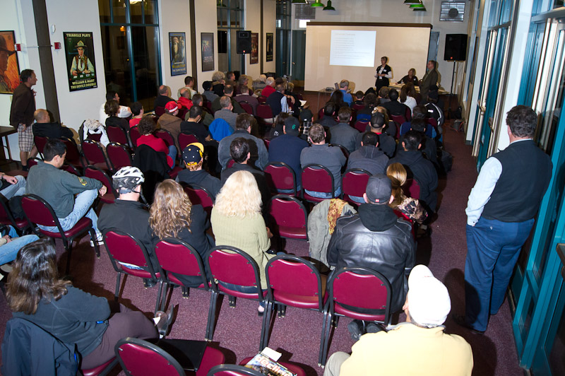
A packed room hears the County and DC&E's presentation

A packed room hears the County and DC&E's presentation

On February 15, 2012, more than 80 people gathered at Hart Park Hall in Santa Clarita Valley to hear and weigh in on the County’s plans. Of those 80 or more people, more than 70 identified themselves as mountain bikers. The SCV Trail Users did an outstanding outreach effort to get people to come to the meeting. Many brought helmets, identifying themselves as off-road cyclists. The closure of the Canyon trail in Placerita Nature Center to bicycles has united the cycling community in the area.

The meeting was being conducted by DCE Planning, the contractor retained by the County to perform the trail assessment and make a recommendation.  After a brief round of introductions by Melissa Erikson, Sarah Sutton gave background on DC&E’s experience related to trails and planning and the trails assessment process they will be using. Stephen Copely is the non-motorized trails manager for the fifth district, and will be the contact person for the County as the process moves forward, though he did not speak during the meeting.

Melissa then gave some background of the DOJ ruling from March 2011 regarding accessibility and ADA compliance, which is her specialty. There’s a lot of misunderstanding about this DOJ  ruling. Trail and open space managers must allow personal mobility devices–which in the broadest interpretation could mean anything from quads to motorcycles to segways to wheelchairs–on any trail that pedestrians/hikers are allowed, unless they can show a “good reason” they shouldn’t be allowed. In order to show a good reason, an objective assessment of the trail is needed.  Essentially the assessment will kill two birds with one stone: determining the feasibility of personal mobility devices for the disabled and permitted uses on a trail.

(more…)