Archive for the ‘Advocacy’ Category

Recommended Wilderness Proposals in our National Forests

Thursday, May 31st, 2012

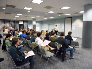
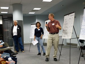
In response to a lawsuit, the four Southern California Forests are proposing amendments to their 2006 plans. They are proposing new Backcountry Non Motorized Recreation zones as well as new Recommended Wilderness designations. Several mountain bikers attended the informational workshop at the Angeles National Forest Headquarters on May 30, along with concerned forest users, and many from groups like the Sierra Club, The Wilderness Society and others.

In the Angeles National Forest there is a recommended Salt Canyon, Fish Creek roadless areas were combined to create a 40,000 acre Recommended Fish Creek Wilderness in an area that was Backcountry Non-Motorized. It is now Forest Service policy that a Recommended Wilderness designation will be managed as if it were wilderness and the area will be closed to bikes.

Concerns have been raised about the status of several significant nearby trails that bicyclists ride. We’re happy to report that the Golden Eagle Trail and the Warm Springs/Elderberry Forebay/Fish Canyon fire road Loop are unaffected by this proposal. Wilderness boundaries have been drawn with “cherry stems,” areas of non-wilderness along the existing fire road corridors. the same has been done for the Burnt Peak fire road.

We do have concerns about the Fish Canyon Trail (1GW05) and the Burnt Peak Trail (1GW02). These run generally north-south right in the middle of what would be the new Wilderness. We heard from several people that these trails may be overgrown and quite deteriorated. We need to know if riders have ridden them and are currently riding them. Despite their current condition, if they go into Wilderness, bikes will be excluded and the trails will likely never be restored due to Wilderness Trail maintenance issues. We might lose a significant future opportunity for a ride in a wild landscape. If you have information about these trails, let Steve Messer (steve@corbamtb.com) and Jim Hasenauer (imbajim@aol.com) know.

There are also many changes including Recommended Wilderness Proposals in the Cleveland National Forest, the Los Padres National Forest, and the San Bernadino National Forest. Unfortunately for those who visit all four forests, only the Angeles National Forest proposed management plan revisions were available for review at last night’s event.  If you are concerned about changes in other forests, it will be necessary to meetings. Mountain bike advocates are monitoring the meetings and will soon have talking points for your comments. The deadline for comments is June 11, 2012.

Information about the Forest Manamagement Plan revision process is at http://www.fs.fed.us/nepa/nepa_project_exp.php?project=35130

CORBA”s first comment is that the online data supplied is not of sufficient detail or quality to make informed decisions about any new proposed changes in the management plans for the forests. Without real data that we can zoom in on (digitally) and use with the mapping and GIS tools with which we’re familiar, it is impossible to see what areas and trails may be affected in the detail needed to make informed comments. We’d like to see KML or Shapefiles that can be used with the most popular mapping tools for this, and any future NEPA or CEQA documents.

Though we don’t know the current state or conditions of the Fish Canyon and Burnt Peak singletracks, we would like to see the boundaries adjusted to allow continued bicycle access to these trails. We’ll formulate our final comments after we gather more information on these and other affected trails.  Deadline for comments in June 11.

The current designation: Backcountry non-motorized:

The proposed Recommended Wilderness (in dark green):


Remaining meetings are scheduled as follows:


• May 31,2012, 4:00PM to 7:00PM, Santa Maria Red Cross, 3030 Skyway Drive, Santa Maria, CA 93455 (Hosted by Los Padres National Forest)
• May 31, 2012, 4:00PM to 7:00PM, Santa Clara Mojave Rivers Ranger District Office, 33708 Crown Valley Road, Acton, CA 93510
• May 31,2012,4:00 PM to 7:00PM, San Bernardino National Forest Headquarters, 602 S. Tippecanoe Ave., San Bernardino, CA 92408.
• May 31, 2012,4:00 PM to 7:00PM, Palomar RangerDistrictOffice, 1634 Black Canyon Road, Ramona, CA 92065 ·
• June 1, 2012, 1:00PM to 4 PM, Frazier Park Library, 3732 Park Drive, Frazier Park, CA 93225 (Hosted by Los Padres National Forest)
• June 5, 2012, 4:00PM to 7:00PM, Descanso Ranger District office, 3348 AlpineB!vd, Alpine, CA 91901
• June 5, 2012,4:00 PM to 7:00PM, Trabuco Ranger District office, 1147 E. 6th Street, Corona, CA 92879


Angeles National Forest Open and Closed Trails – May 2012

Friday, May 25th, 2012

As we approach three years since the Station Fire began, the Forest Service has revised the closure order which has been in place to allow the forest to recover, and to protect the safety of forest visitors. This is an updated list from our May 2011 list of open and closed trails.

The two questions we have been asked more than any other recently: “which trails are closed in the Angeles National Forest?  and “which trails are open in the Angeles National Forest?”

According to the Forest Service map of the station fire closure area at http://maps.fs.fed.us/stationfire/ the list below shows the status, effective May 25 2012, of some of the more popular trails that were affected by the Station Fire. Keep in mind that even though these trails are in the newly opened areas of the forest, the individual trails may be signed closed.  Please respect any trail closure signs and stay off those trails for your own safety and the recovery of the forest.

Many of the trails will not be in good shape, so be prepared for surprises like downed trees, slides, washouts, ruts, and other hazards. Many trails have been drastically changed from before the Station Fire. Many fire roads have not yet been graded and may be much narrower and in very poor condition with ruts and washouts. All the usual caveats about trail safety apply so use the trails safely and responsibly, and be especially careful the first time you travel on one of the newly opened trails.

Opened Trails (As of May 25, 2012) 

  • Brown Mountain (to the saddle)
  • El Prieto
  • Gabrielino (JPL to Paul Little)
  • Gabrielino (Switzers to Redbox to Chantry)
  • Bear Canyon Trail
  • Sam Merrill Trail
  • Castle Canyon Trail
  • Sunset Ridge Trail
  • Mt. Lowe West Trail
  • Idlehour Trail
  • Kenyon Devore Trail
  • Rim Trail
  • Sturtevant Trail
  • Santa Clara Divide Truck Trail (Dillon Divide to Mt. Gleason to Three Points – non-motorized only)
  • Chilao Loop/Mt. Hillyer
  • Silver Mocassin
  • Valley forge
  • Mueller Tunnel
  • Mt. Disappointment
  • San Gabriel Peak
  • Earl Canyon
  • Haines Canyon
  • Rim of the Valley
  • Hoyt
  • Stone Canyon
  • Trail Canyon
  • Condor Peak
  • Fall Creek Canyon
  • Mt Lukens Fire Road
  • Grizzly Flat Fire Road
  • Doc Larsen
  • Rattlesnake Trail
  • Everything east of Chilao

Keep in mind that even though these trails are in the opened area, the individual trails may be signed closed (And those signs mustl be respected). Many of the trails will not be in good shape, so be prepared for surprises like downed trees, massive ruts or slides, washouts, and other hazards.

Closed Trails (Until Further Notice)

  • Strawberry Peak
  • Tom Sloan
  • Dawn Mine
  • Millard Falls
  • Upper Brown Mountain (Saddle to the Summit/Ken Burton)
  • Ken Burton
  • Gabrielino from Switzers to Paul Little
  • Crescenta View
  • Alder Creek
  • Colby Canyon
  • Josephine
  • Vetter Mountain

In addition to the above a separate closure remains in effect for the Williamson Rock area  (Closure Map is available).

In My Backyard (IMBY)

Saturday, May 12th, 2012

By Mark Langton

Please slow down on Rosewood Trail

You might not know that in addition to being President of CORBA, I am also the chair of the Conejo Open Space Trails Advisory Committee (COSTAC), a Thousand Oaks city-appointed committee to the Conejo Open Space  Conservation Agency (COSCA).  So while I ride all over the Santa Monica mountains and beyond, COSCA is IMBY.

At our most recent COSTAC meeting, a member of the public brought to our attention that several local residents who use the Santa Rosa Trail off Lynn Road on a frequent basis have been seeing increased speed and discourteous behavior by mountain bikers coming downhill on the trail. The Santa Rosa Trail just so happens to be the closest trail to my house and I literally ride it at least once a week, if not more. So this is really IMBY!

One of the more disturbing reports was that riders are not slowing down while passing hikers and other mountain bikers. All I can say is, please slow down on Rosewood Trail and the Los Robles Trail as well (aka Switchbacks or Space Mountain).

Rangers will be increasing their presence on these routes and reminding people to slow down when approaching corners and around other users. While they are not usually prone to writing citations, they do have the authority to do so. Please respect COSCA’s shared use policies and ride respectfully around other users on these and all shared use trails. Thanks!


Urgent Rancho Palos Verdes City Council Mtg May 15

Wednesday, May 2nd, 2012

On May 15th at 7:00 pm, the Rancho Palos Verdes City Council will review and approve the final trails plan for the Palos Verdes Nature Preserve. This is mountain bikers’ last chance to ask for changes.

CORBA Palos Verdes has proposed allowing bike access on more trails.
For information go to: www.mtbpv.org or email info@mtbpv.org

We need your support. Attend the meeting even if you don’t want to speak. Write the Rancho Palos Verdes City Council, CC@rpv.com. Please make the letters positive.

When:
May 15th 7:00 PM

Where:
Fred Hesse Community Center
29301 Hawthorne Boulevard
Rancho Palos Verdes, CA 90275

2012 Trails and Greenways Conference

Tuesday, April 24th, 2012
Multi-use trail event.

Multi-use trails. We can and must get along.

CORBA was very much involved in last week’s California Trails and Greenways Conference. This annual event brings together land managers at the Federal, State, County and City levels, along with resource planners, volunteers, non-profit organizations and professional landscape architects and trail builders.

The theme for this year’s conference was “Navigating Radical Change.”  The most radical of all changes that land managers are facing is the shrinking of budgets for trail and open space projects. Another is the changing demographic of trail users.

Navigating radical change - mutli-use friendly pinch points

Navigating radical change - mutli-use friendly pinch points on Tapia Spur

Many sessions at the conference talked about the importance of engaging volunteers, of reaching out to foster public-private partnerships between land managers and non profit advocacy groups.
CORBA has already been putting into practice many of these principles, partnering with the Forest Service and State Parks to help maintain trails; partnering with the So Cal High School League to empower the next generation of off-road cyclists as advocates and stewards.

CORBA President Mark Langton participated in a rousing panel presentation on the Conejo Open Space Conservation Agency, a multi-use trail system that has worked successfully with minimal conflict for more than two decades.  An entertaining keynote address was given by conservation celebrity Ed Begley Junior. He treated the attendees to stories of how and why he came to be so ingrained within the conservation movement.

Among the volunteer groups in attendance, there were at least five bicycling advocacy groups represented. IMBA’s new regional director Patrick Kell was there, along with representatives from the San Diego Mountain Bike Association, Central Coast Concerned Mountain Bikers, Santa Barbara Trail Volunteers, CORBA, the Los Angeles County Bicycle Coalition and other groups.

Cycling trail advocates from across California

Cycling trail advocates from across California

On Friday morning of the conference, 8 bicycle adovocates joined Steve Messer and past CORBA board member Hans Kiefer in a tour of Rocky Peak. They had a great ride, showing once again that there is some great mountain biking around Los Angeles.

A conference such as this is vital for bringing disparate user groups, land managers and trail stewards together, where we always learn we have much more in common than we think. The fact that working together is often the only way anything can be accomplished was one of the most important take-home messages from the conference.

Everyone can get along

Everyone can get along

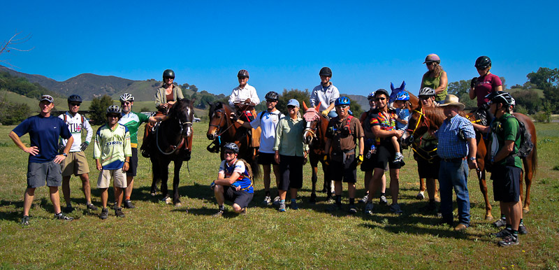
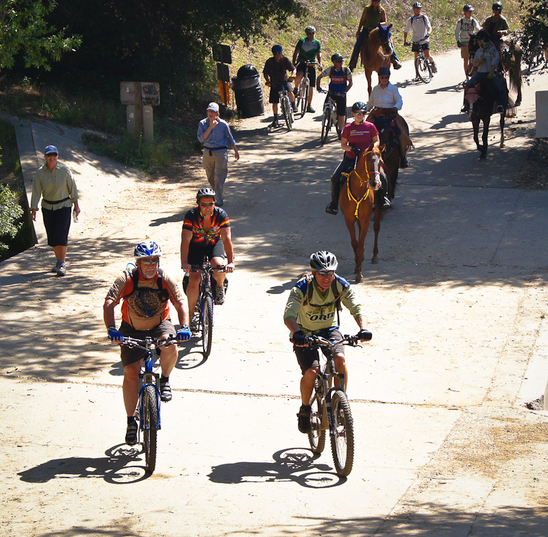
On Saturday, after the conference, Orange County’s Trails4All brought 6 equestrians, 4  hikers, and about a dozen mountain bikers from CORBA, SHARE, SDMBA, CCCMB together for a ride/hike/run/hoof event. We travelled together on the trails of Malibu Creek State Park, showing again that where there is respect and cooperation it is very possible for all user groups to co-exist peacefully on the trails.

Our since thanks to the organizers, the presenters, the sponsors, and to all our fellow attendees at the conference. These meetings underscore the importance of working together, and create at an atmosphere conducive to constructive and informative exchanges of information and viewpoints. We look forward to next year’s Trails and Greenways conference in Lake Tahoe.

Bikes, horses, hikers and runners

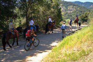
Bikes, horses, hikers and runners. We all love trails.


Lang Ranch Community Park Meeting #3 Sees Another Good Turnout

Thursday, March 1st, 2012
Jim Friedl talks about the process

Jim Friedl talks about the process

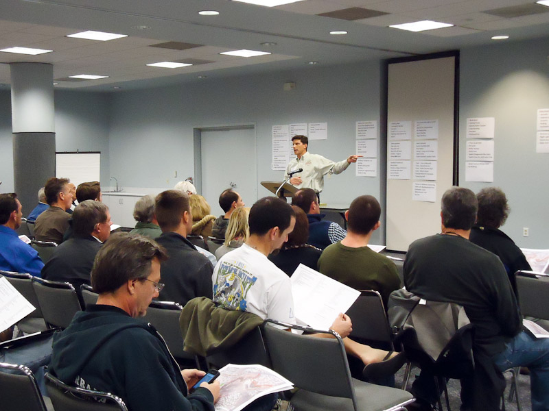
It was another good turnout at Wednesday’s community input meeting for the Lang Ranch Community Park Conceptual Recreational Use Plan process. This, the third of four meetings, was aimed at further prioritizing the list of potential uses supplied by community members.

Another great turnout

Another great turnout

Approximately 75 attendees were given maps of the planned park site and were encouraged to indicate locations where they thought they might want to put certain amenities. On the back of the maps were lists of potential uses, divided up into three categories; Green: Those the agency (Conejo Recreation and Park District, CRPD) felt were appropriate uses based on the plan’s criteria; Red: Those that did not meet the criteria; and Yellow: Those that were “on the bubble” and could go into either the Green or Red categories. Attendees were divided into five groups with two facilitators each and provided input on any amenities that were missing, as well as any amenities that should move from one category to another. Afterward, groups summarized their input.

Based on group summaries, bicycle related amenities, including a pump track and skills features, were still a high priority. A new term came up in the list of prospective bike amenities, “dual slalom course,” which while new to the process, is not a new concept. It’s basically the same thing as slalom ski racing; two parallel downhill courses run through gates with jumps and berm turns. Sort of like downhill BMX (but it can be done on mountain bikes as well).

Members of the public talk about their proposed changes

Members of the public talk about their proposed changes

CRPD facilitators reminded attendees that this is still very early in the process and that they are in “big picture” mode. To quote Jim Friedl, CRPD General Manager, “We’re not yet looking at the gnat’s eyebrow at this point.” The next and final community meeting takes place March 21, and from there CRPD staff will produce a report and recommendation to present to the CRPD board. According to Friedl, an optimistic estimate for delivering that presentation could be 4-6 months.

“Hey CORBA, Stop Ruining Our Trails!”

Wednesday, February 29th, 2012

By Mark Langton

Does this trail look "ruined"?

Seems like every time there is maintenance on our local trails, we hear from some very passionate people within the mountain bike community: “Leave the trails the way they are!” Along with this we also get the usual “How can CORBA do this?” A recent comment even alleged that CORBA is trying to take away our freedoms by doing trail work; “CORBA is conspiring with the State to ruin a beautiful single track trail—The Guadalasca.” As I and several others said in recent blog responses, trails are dynamic, they need maintenance every so often. CORBA doesn’t decide what work needs to be done, but agrees that it does and feels that we should participate as advocates of shared open space trails.

Many times people making these comments start off by saying “I have been riding these trails for several years…” If that were true, then they’d know that trails return to a more natural, “challenging” appearance after any kind of trail work. The Sulphur Springs Trail in Cheeseboro Canyon and Solstice Canyon Trail section of the Backbone Trail are two such trails that come to mind. Both were widened and smoothed over, and many people said they’d be “ruined.” Look at them now; they are as challenging and natural—and fun—as ever.

I’ll admit, I am not always in favor of trails becoming less challenging, but at the same time, I have to balance it with the fact that I can ride the trail in the first place. Guadalasca (and other sections of the Backbone Trail) is open to bicycles thanks to the advocacy efforts of CORBA. Some people might say that even if it were closed, they’d ride it. That’s your personal choice, but I’d like to think that as someone who enjoys the open space, you’d like to do it without the cloud of breaking the rules hanging over your head. Just because you can break the rules, it doesn’t mean you should.

Here’s an analogy I came up with while out riding (always good therapy): Let’s say the agency that maintains the street you live on proclaimed that, due to budgetary constraints, they would only be able to do limited maintenance on the street. The street and sewer system falls into disrepair, so you and your neighbors put together a volunteer group to help the agency; you get trained in road and sewer repair, and enlist other neighbors to help. Still, the street becomes riddled with potholes and cracks because the agency just can’t afford the materials and equipment to do the repairs. Soon, off-road vehicle owners start using your street to challenge their vehicles’ capabilities because there’s nowhere else nearby they can do it, which make the street conditions worse. Not to mention these vehicles can go much faster than the passenger cars most of you and your neighbors are driving, making it unsafe for you and your neighbors to even drive down the street. You caution the off-roaders that they shouldn’t drive their vehicles on your street, especially at high speeds, because it is creating an unsafe situation, but they still do because “it’s public and they have a right to drive there. And besides, we’re not going that fast.” Finally, after several years, you and the agency start making repairs, but the off-roaders keep coming and start complaining that you are ruining their fun zone. They come to your volunteer maintenance days and complain you are making the street too smooth and it’s no fun to drive there. They write letters to you saying you are trying to take away their freedoms. All because you are trying to do the right thing for your community.

Here’s an idea: The next time you think someone is trying to take something away from you in your local riding area, ask yourself, “what can I do to help improve the situation?” That could mean getting more involved with your local community. Or it could mean going someplace where the trails are more challenging, where riding them at higher speeds does not impact the rest of the trail user community. Such places exist, whether it be a race or a bike park like Mammoth Mountain. Our local trails are for shared use by many different types of users, so you’re just going to have to adjust your riding style accordingly. Kind of like on the street when driving your car or motorcycle; you may have a high-performance vehicle, but to drive it to its capabilities on public streets just wouldn’t smart or safe. Just because you can break the rules, it doesn’t mean you should.


Bike Park – CRPD 3rd meeting on 2/29/2012 at 7pm

Saturday, February 25th, 2012

If you live in the Conejo Valley or a nearby community, please attend a meeting to be held by the Conejo Recreation and Park District (CRPD) and press for a pump track and bike park to be included in the plans for the Lang Ranch Community Park.

On Wednesday, February 29th, CRPD will have a meeting to get public input into recreational activities they would like to see included in the Lang Ranch Community Park and other parks in Zone 2, roughly north of Hillcrest Drive and east of the 23 Freeway.

This is our chance to lobby for a bike park and pump track in a semi-urban area. Our kids and the young-at-heart could use to improve their balance, coordination, upper body strength, and generally have fun! In this age of video games, “sweet/salty snacks” and increasing obesity among our youth, everyone should appreciate a healthful, outdoor activity to engage them.

CRPD has plans for two more public meetings:


Meeting 3 – More Brainstorming & Bubble Diagrams
Wednesday Feb 29, 7:00 pm – 9:00 pm
Hillcrest Center Community Room

Meeting 4 – Report Back and Recommendations
Wednesday March 21, 7:00 pm – 9:00 pm
Hillcrest Center Community Center

Directions to the Hillcrest Community Center. From the 101 Freeway in Thousand Oaks, exit at Lynn Road, turning north, then turn right onto Hillcrest Drive. After 0.3 miles, turn left onto McCloud Ave, then turn right immediately at the sign for the National Park Service and Conejo Recreation and Park District. At the stop sign at the top of the drive, turn left and drive the short distance to #403, on the left.  Google Map and Directions

LA County Trail Assessment Public Meeting

Thursday, February 16th, 2012
A packed room hears the County and DC&E's presentation

A packed room hears the County and DC&E's presentation

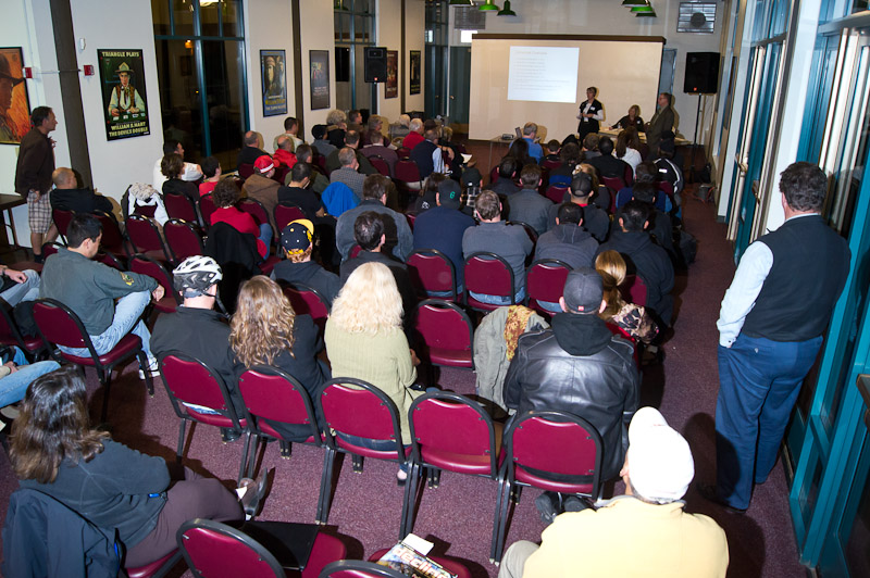
On February 15, 2012, more than 80 people gathered at Hart Park Hall in Santa Clarita Valley to hear and weigh in on the County’s plans. Of those 80 or more people, more than 70 identified themselves as mountain bikers. The SCV Trail Users did an outstanding outreach effort to get people to come to the meeting. Many brought helmets, identifying themselves as off-road cyclists. The closure of the Canyon trail in Placerita Nature Center to bicycles has united the cycling community in the area.

The meeting was being conducted by DCE Planning, the contractor retained by the County to perform the trail assessment and make a recommendation.  After a brief round of introductions by Melissa Erikson, Sarah Sutton gave background on DC&E’s experience related to trails and planning and the trails assessment process they will be using. Stephen Copely is the non-motorized trails manager for the fifth district, and will be the contact person for the County as the process moves forward, though he did not speak during the meeting.

Melissa then gave some background of the DOJ ruling from March 2011 regarding accessibility and ADA compliance, which is her specialty. There’s a lot of misunderstanding about this DOJ  ruling. Trail and open space managers must allow personal mobility devices–which in the broadest interpretation could mean anything from quads to motorcycles to segways to wheelchairs–on any trail that pedestrians/hikers are allowed, unless they can show a “good reason” they shouldn’t be allowed. In order to show a good reason, an objective assessment of the trail is needed.  Essentially the assessment will kill two birds with one stone: determining the feasibility of personal mobility devices for the disabled and permitted uses on a trail.

(more…)

State Parks Upgrading Tapia Spur Trail

Wednesday, February 15th, 2012
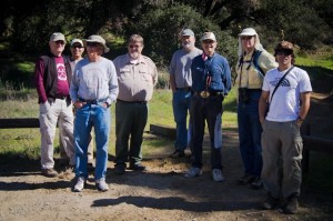
Stakeholders from several groups inspect the upgrades

Stakeholders from several groups inspect the upgrades

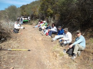
On February 14, 2012, CORBA board member Steve Messer met with State Parks officials and representatives from hiking, conservation and equestrian groups. Together they walked the Tapia Spur trail which was slated for upgrades meet multiple use standards last year. The trail remains open to the public, though the work is well underway.

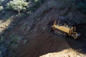
Originally constructed in the mid nineties, since being opened to multiple use there have been some reports of user conflicts, mostly due to excessive speed of bicycles. This was exacerbated by poor sight lines with blind corners and switchbacks.  One of the significant trail upgrades is a reroute that will eliminate four switchbacks. The new section is still being machine cut, and like the rest of the trail, will be extensively hand-finished.

The entire trail is being re-cut to a 5′ width with a Sweco. Visibility is being improved on many sections by cutting back brush and, where appropriate, cutting back the backslope. The entire trail is being outsloped for improved drainage and to reduce long term maintenance needs.

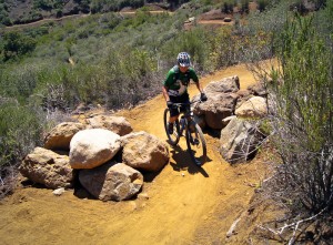
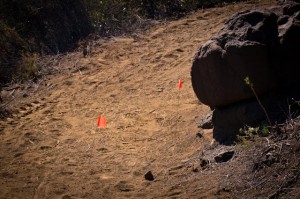
The most significant change is the inclusion of approximately 17 “pinch points.”  These consist of large 500 pound-plus rocks at least 18″ high strategically placed on the uphill side of blind corners. They will be embedded into the tread and placed about 36″ apart, in such a manner as to require a bicycle to weave between them. This will slow down cyclists at the spots with the most potential for startling of other trail users. These features are a key component of IMBA’s recommended speed control measures. They can add challenge and fun to a trail for cyclists, while allowing horses, hikers and personal mobility devices to pass easily. But most importantly, they improve the overall safety of the trail.

Flags show approximate locations of pinch point rocks

Flags show approximate locations of pinch point rocks

Another feature being added at key locations on the trail are rock-armored swales. The rock armoring leaves a rough tread while also protecting the natural drain from erosion by water or trail users. The rough tread is also expected to slow cyclists and add interest and challenge to the trail. Rocks were being imported from Malibu Canyon to create the pinch points, and harvested locally for the rock-armoring and rip-rap. The heavy rocks were being brought up the trail on mechanized carriers.

According to Knapp, “these features will slow cyclists and reduce the potential for them startling other trail users. We hope that good trail etiquette will then kick in and reduce conflict. However,” he continued, “we can’t control attitude or behavior.”  We concur, and will continue encouraging proper etiquette through our outreach and education efforts, including our free Mountain Bike Skills Clinics.

Knapp also commented on the mission of the State Park to protect the natural resource. “Trails are there for people to enjoy the resource,” he said, “not for thrillseeking.”  He talked about the fact that they must adapt to the changing trail user demographic, while keeping within their mission. These multi-use standards and the objective Change In Use process are a part of that adaptation to accommodate the growing number of off-road cyclists.

Everyone present seemed pleased with the trail improvements. “I like what I see,” remarked one of the Santa Monica Mountains Trails Council representatives “we’ll just need to give it a chance.”

Tapia Spur Re-Route being cut

Tapia Spur Re-Route being cut

The trail improvements are not inexpensive, and funds are being funneled to this project from Sacramento. The State’s new Change In Use procedures will hinge upon their ability to implement these design standards on trails that are candidates for a change to multi-use, but currently closed to bikes. CORBA has a long-standing list of requests for trail Change In Use in the Santa Monica Mountains. While Tapia Spur was already designated multi-use, the upgrades will hopefully allay the concerns of the trail community at large about the pending changes to Lookout and Yearling trails. These two trails have been recommended for a change in use, and could be the next to receive such a treatment.

The trail will be showcased at the upcoming Parks Conference and the Trails and Greenways Conference. The work is expected to be completed by the first week of April. L.A. County is considering implementing a similar trail review process for County trails in the Fifth District. Overall, we believe improvements will not negatively impact the user experience for cyclists, and by reducing conflicts, they will in fact enhance the experience for all users.


(more…)