Posts Tagged ‘trail closures’

Pt. Mugu SP Closure Update

Monday, January 12th, 2015

SAMSUNG CAMERA PICTURES
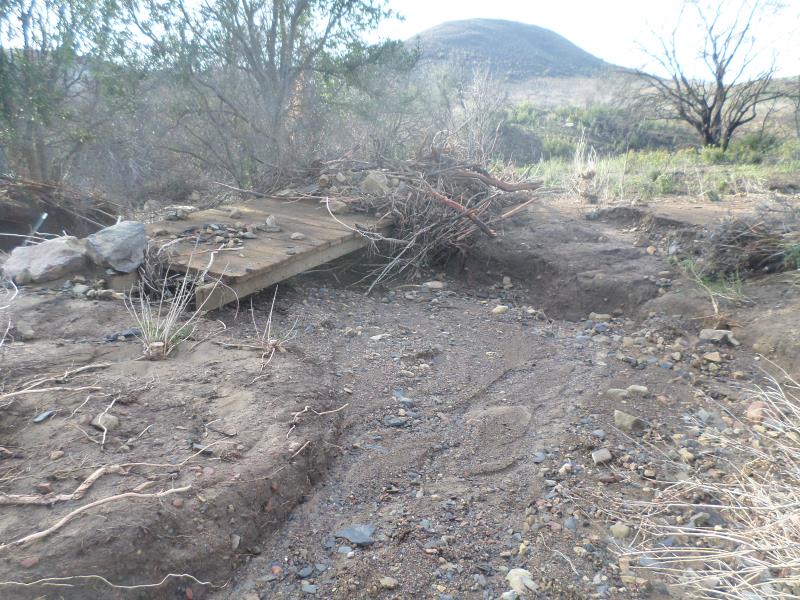
As reported earlier this month, Point Mugu State Park has been closed to the public while the damage to the trails is being assessed and repaired. Heavy equipment has been working to reestablish Sycamore Canyon and the public is still being asked to stay out of the park until such time as it is safe. Trucks will be bringing in dirt from the slides that covered Pacific Coast Highway to aid in repair. State Parks’ Angeles District Superintendent Craig Sap stated that the closure will extend until February 1, but that all attempts will be made to lift the closure sooner if possible.

Click here to see additional photos by Craig Sap of the mud slides effecting PCH and Point Mugu State Park.

Below is current trail damage assessment of the condition of the trails in Point Mugu State Park:

Blue Canyon Trail: Fair

Chumash Trail: Good

Chamberlain Trail: Excellent

Coastal Trail: Gone

Coyote Trail: Lower portion covered with debris

Fire Line Trail: Unknown

Fossil Trail: Poor condition

Great Dune View Trail: Good

Guadalasca Trail: Fair

Hidden Pond Connector Trail: Good

Hidden Pond Trail: 25% of repairs Complete

La Jolla Canyon Trail: Devastated

La Jolla Valley Loop Trail:  75% of repairs complete

La Jolla Valley Connector Trail: Fair

La Jolla Pond Trail: Cleared

Mugu Peak Loop Trail: Debris across trail needs to be smoothed out

Mugu Peak Spur Trail: Good

Old Boney Trail: Fair from Sycamore to Blue Canyon

Old Cabin Trail: Poor

Ray Miller Trail: 25% of repairs complete

 Sage Trail: Excellent

Scenic Trail: Fair

Serrano Canyon Trail: Good

Serrano Valley Loop Trail: Minor erosion

Serrano Valley Trail: Old Roadbed from gate has several large washouts, all stream crossings need rebuilding

Sin Nombre Trail: Fair

Sycamore Creek Trail: Heavy Damage to Stairs and Gabions                                 

Tri Peaks Trail: Unknown

Two Foxes Trail: Debris flows across the trail at the drainage crossings

Upper Sycamore Trail: Devastated

 Waterfall Trail: Good

Wood Canyon Vista Trail: Good


West End of Etz Meloy Gets Another Gate

Friday, October 31st, 2014

IMG_2132CORBA was alerted to the fact that a private property owner at the west end of Etz Meloy Motorway (a section of the Backbone Trail) at Yerba Buena Road has erected a second, new gate to deter the public from using the route. From the National Park Service:
The 1-mile stretch of Etz Meloy Mtwy. heading east from Yerba Buena Rd. is not open to the public.  The stretch of Etz Meloy Mtwy. across this area is not to be used by trail visitors. By using it, visitors will only aggravate the situation.

CORBA reminds everyone to respect private property and not go over/around the gate as this action is not only illegal, it can also jeopardize negotiations with the landowners and NPS moving toward some kind of easement agreement.

An earlier blog has more details, history and several comments on the gate that prevents access to the Etz Meloy Mtwy from the west end.

BBT_EtzMeloyGap_Nov17_2011

Sullivan Canyon Work Update, July 3

Thursday, July 3rd, 2014

The latest news from Mike Harriel of So Cal Gas regarding construction as they move closer to the mandated test on its pipelines in Sullivan Canyon.

Beginning July 8th

·         We will conduct a bird survey to determine if any nesting birds are in the area of our work. If there are, the project will be delayed.

·         If all is well with the nesting birds, we will work with a certified arborist to trim trees that could sustain damaged by construction equipment. The trimming will occur at the direction of the arborist and only the minimum necessary.

·         An active beehive will have to be removed for the safety of our employees and users of the canyon.

 Beginning July 14th

·         Construction mobilization will occur. You will notice the moving in of water tanks and other construction equipment. Tanks and equipment will be staged away from the trail. All soil will be returned to the excavation it is removed from.

·         A fire prevention plan is in effect to protect the canyon.

 As mentioned previously, the canyon trail will remain open. Signs will provide advance notice when the canyon is closed for hydro testing, which will occur over the course of one day. Signs will also be posted at the drop-in trails. For safety reasons, we don’t want any members of the public dropping in to the canyon during the test, so please abide by the posted closing.

As always, if you have any questions or comments, please don’t hesitate to contact me.

Mike Harriel

Public Affairs Manager

Office: 213 244-4633

More Work Scheduled for Sullivan Canyon in June

Wednesday, May 28th, 2014

Since 1960, Southern California Gas Company (“SoCaIGas”) has owned much of the land that comprises Sullivan Canyon (more than 4 miles in length).  This property is used as a corridor for two transmission pipelines that provide Los Angeles residents with a safe and reliable supply of natural gas.  Periodically, SoCalGas must perform maintenance on these pipelines. The purpose of this letter is to provide information on pipeline maintenance and repair work that will occur in the coming weeks.

SoCalGas will conduct a hydrostatic pressure test on a segment of one of our natural gas transmission pipelines in Sullivan Canyon.  Hydrostatic pressure testing is a process that uses water to exert pressure on a pipeline at levels greater than its usual operating pressure to assess its soundness, often referred to as its integrity.

This test involves digging around the underground pipeline and safely venting natural gas from the pipeline. We will then fill the pipeline with water, and increase the pressure to a level that is higher than the pipeline’s normal operating pressure.  If the pipe holds the pressure without any leaks, it will be put back in service. If the pipeline leaks during the test, SoCalGas will repair the pipeline and retest it, or replace it with new, pre-tested pipeline.

What to expect

The construction work will take place at several locations starting west of the Sullivan Canyon trailhead at the end of Queensferry Road and about a quarter-mile northwest of the trailhead.  Work will begin in June 2014, and last about four to six weeks, although weather and other factors affecting safe working conditions could change the schedule. Normal work days will be Monday through Friday 7:00 a.m. to 7:00 p.m., however, some activities may extend the hours.

Test Start Location:

At Sullivan Canyon Trailhead at Queensferry Road, a test-start location will be staged just west of the trail with an excavation site, water tanks, and other equipment. This area will be closed to the public.

Test End Location:

About a quarter-mile northwest of the trailhead, a test-end location with excavation site and support equipment will be staged alongside the trail.  This area will also be closed to the public.

Hikers, bikers, and others traversing the trail should use caution while passing by both test site locations. For safety reasons, Sullivan Canyon Trail will not be accessible by the public on the actual test day for the duration of the test. Check local signage with updates on construction activity.

The local community may notice truck traffic bringing test equipment and water tanks to the test sites and then removing them. Nearby residents may hear some work-related noise.

Your gas service should continue without interruption. If that changes, a SoCalGas representative will contact you.

The odor of natural gas

At times, you may smell the odor of natural gas and hear a loud, steady noise as we vent natural gas from the pipeline using safe and common techniques. Although this is normal when crews are working, we encourage anyone who has concerns about the smell of gas to call us from a safe location at 1-800-427-2200. We are available 24 hours a day, seven days a week.

We apologize for any inconvenience while we’re performing this test and appreciate your patience and cooperation.

Mike Harriel

Public Affairs Manager – Southern California Gas Company

Tel: (213) 244-4633 

Sullivan Canyon Pipeline Work Begins January 6

Friday, December 20th, 2013

From the Public Affairs Office of Southern California Gas:

Since 1960, Southern California Gas Company (“SoCaIGas”) has owned much of the land that comprises Sullivan Canyon (more than 4 miles in length). This property is used as a corridor for two transmission pipelines that provide Los Angeles residents with a safe and reliable supply of natural gas. Periodically, SoCalGas must perform maintenance on these pipelines. The purpose of this letter is to provide information on pipeline maintenance and repair work that will occur in 2014.

Purpose of this Work

We recently internally inspected our pipeline. By code, we have areas we are required to perform a visual inspection of the pipeline as part of a validation process. This work is required to maintain the pipeline’s safety and integrity.

Location and Logistics

There are two work areas along the access road within the canyon that will require excavation.

Location 1: 0.7 (seven tenths) of a mile south from fire road #26 at the Mulholland entrance

Location 2: 2.8 miles in from fire road #26, or 1.4 miles from the Queensferry entrance

Partial Canyon Closures

The Canyon path will be closed from the Mulholland entrance at fire road #26 to location 1.

There is no change to the Queensferry entrance. Signs will be posted along the path indicating construction status.

The following impacts are to be expected in the canyon and surrounding neighborhood. I will keep you apprised of any changes.

-Work will commence on or about January 6, 2014.

-Work is estimated to be completed in 8 weeks.

-Information signs will be posted in advance at the beginning of each entrance.

-Work hours are sun up to sun down, Monday through Friday. No work will be performed on Saturday and Sunday.

-Intermittent loud noise in the immediate work areas.

-Increased dust in the immediate work areas.

-Increased traffic at the Mulholland entrance from work crews and equipment.

SoCalGas appreciates your understanding and apologizes for any inconveniences caused by this necessary work. It is our goal to minimize disruptions. We value our relationship with the community and will communicate with you when our work has the potential of impacting our neighbors. Again, there are two high-pressure transmission pipelines located in the canyon and we will continue to periodically perform maintenance work to them as-needed to ensure safety.

Safety is our first priority. Should you have any questions, please call me 213 244-4633 or email me at mharriel@semprautilities.com.

Sincerely,

Mike Harriel

Public Affairs Manager

Temporary Trail Closures In Cheeseboro and Palo Comado Canyons in April and May

Tuesday, April 2nd, 2013

THOUSAND OAKS, Calif. – The National Park Service (NPS) is advising visitors that trails at Cheeseboro and Palo Comado Canyons will be intermittently closed during April and May due to the demolition and removal of surplus water conveyance infrastructure.

Several days of trail closures are expected, though limited to weekdays between 8:00 a.m. and 5:00 p.m. Visitors can find up-to-date information on trailhead signs, by calling 818-889-8996 or by visiting www.nps.gov/samo.

The Cheeseboro Reservoir, capable of holding four million gallons of water, can be seen in the distance. Along with a pump station at Palo Comado Canyon, the reservoir will be demolished and removed during April and May. Courtesy of National Park Service

The Cheeseboro Reservoir, capable of holding four million gallons of water, can be seen in the distance. Along with a pump station at Palo Comado Canyon, the reservoir will be demolished and removed during April and May. Courtesy of National Park Service

Triunfo Sanitation District (TSD) will be removing the Palo Comado Pump Station and the Cheeseboro Reservoir. These facilities, owned by TSD, were built in 1959 at the behest of comedian Bob Hope, who had hoped to build thousands of homes in the surrounding area as part of a master-planned community. TSD is decommissioning the facilities as part of an agreement with the NPS and other agencies.

Large trucks will be hauling salvaged materials along both the Palo Comado and Cheeseboro Canyon trails to recycling centers. For their safety, visitors are asked to refrain from using these trails when posted as closed.

Entrance to trails from Cheeseboro Canyon, Doubletree and Smoketree trailheads will be periodically closed. The China Flat trailhead and trailheads for Upper Las Virgenes Canyon Open Space Preserve will remain open.

The NPS and TSD appreciate the public’s cooperation with this effort. Additional information is available by calling 818-889-8996.

Wilderness Proposal Public Hearings – Be there to help save access to trails Apr 9, 10

Friday, March 22nd, 2013

Fellow cyclists, the four Southern California National Forests Land Management Plan Amendment is currently in its public comment period. The amendment makes changes to Land Management plans in the Los Padres, Angeles, San Bernadino and Cleveland National Forests. Within that proposal are two alternatives that will forever impact bicycle access to public lands in the Angeles National Forest.

Maps of the proposals are available here.

Fish Canyon Salt Creek Wilderness - Alternative 2

Alternative 2 Map – Click for a larger version

Alternative 1, the “no-action” alternative, is the only alternative we can presently support.

Alternative 2 retains a backcountry non-motorized status for Red Mountain and Tule districts, but it appears that the trails in the Fish Canyon/Salt creek areas may be forever closed. These trails have appeared in guidebooks dating back to the 90’s, and we have ride reports from much more recent times. We asked for these trails to be left out of any wilderness proposals.  There are many other trails, official and unofficial, in the area, and we’re seeking documentation of those trails. If you have knowledge of these potentially affected trails, let us know. We could support Alternative 2 if the trails in question are cherry-stemmed out of the wilderness proposal.

In Alternative 3, the Fish Canyon/Salt Creek proposed wilderness on which we commented last year has now been expanded to include the Red Mountain and Tule districts of the Angeles National Forest. These two areas lie to the east and south of the Fish Canyon/Salt Creek area. These two areas were not included as potential wilderness in the original scoping documents, and we therefore made no comment on them, other than to offer our general support for their designation for non-motorized backcountry use.  Now, in Alternative 3, these two areas and the many trails that traverse them are included as wilderness. Local riders have been riding these trails for more than 30 years, right up to the present. We cannot allow Alternative 3 to be adopted.

We too would like to see these areas protected, and feel that backcountry non-motorized designation gives the area adequate protection, but the environmental lobby is pushing for federal wilderness. We have proposed a compromise, a federally designated Special Conservation Area, which prohibits extractive use, development and road-building and can be custom tailored to allow for non-motorized recreational use, while affording stronger protection for and monitoring of the environment. This would require special legislation.

After the public meetings in March, we will be compiling and submitting our comments on the proposals. We encourage everyone to submit comments on the proposals, along with supporting documentation (GPS tracks, photos) of bicycle use of the trails. The comment period will close on May 16, 2013.

The Forest Service will be hosting multiple open house meetings during the comment period. The content and format of each meeting will be the same. Meetings will begin with an open house where Forest Service staff will be available to answer questions about the Draft SEIS. A brief presentation will begin 30 minutes after the meeting opens, followed by an opportunity to ask questions. Maps of the alternatives will be available for viewing. The meeting times and locations are:

  • March 26, 2013, 4:00 PM to 7:00 PM, Angeles National Forest Headquarters, 701 North Santa Anita Avenue, Arcadia, CA 91006 
  • March 26, 2013, 4:00 PM to 7:00 PM, Alpine Community Center, 1830 Alpine Blvd, Alpine, CA 91901 (Hosted by the Cleveland National Forest)
  • March 27, 2013, 4:00 PM to 7:00 PM, Palomar Ranger District Office, 1634 Black Canyon Road, Ramona, CA 92065
  • March 28, 2013, 4:00 PM to 7:00 PM, Santa Clara Mojave Rivers Ranger District Office, 33708 Crown Valley Road, Acton, CA 93510 
  • March 28, 2013, 5:00 PM to 7:30 PM, San Bernardino National Forest Headquarters, 602 S. Tippecanoe Ave., San Bernardino, CA 92408
  • April 9, 2013, 4:00 PM to 7:00 PM, Mt. Pinos Ranger District office, 34580 Lockwood Valley Road, Frazier Park, CA 93225
  • April 10, 2013, 4:00 PM to 7:00 PM, Southern California Edison, 103 David Love Place, Goleta, CA 93117 (Hosted by Los Padres National Forest)

For Further Information Contact Bob Hawkins, Project Manager atsocal_nf_lmp_amendment@fs.fed.us, or visit the
project website at http://www.fs.fed.us/nepa/fs-usda-pop.php?project=35130.


Update 3/25/2013:  We have learned more about the draft proposals and reported here.


Sullivan Canyon Closed to Public Until End of December

Wednesday, October 31st, 2012

The Southern California Gas Company recently released information regarding the closing of Sullivan Canyon to the public (see below for the press release).

A comment was made on our blog alleging that the area had been closed due to an incident involving a mountain biker  being seriously injured. According to Public Affairs Manager Krista Phipps, the area was not closed as a direct result of the incident, but in response to several factors. “I was told by the Project Manager that [the incident which caused injury to the mountain biker] did not occur at the construction site.  However, it was serious and required the person to be airlifted out of the canyon.  Overall, there have been a series of close calls in and around the construction site and we just do not want to risk injury to the public or our employees,” said Phipps.

Please note that Sullivan Canyon is NOT public property. It is owned and operated by the Southern California Gas Company which maintains it as open to the public unless work to the gas line is necessary. The Gas Co. can rescind permission to access Sullivan Canyon at any time. In this case, many users will be effected, not just mountain bikers. This surely will come down to a blame game with mountain bikers bearing the brunt of criticism, and to a large degree rightly so. All we can ask is that you ride safely for the conditions, and remember that your actions represent the entire mountain bike community.

————————————

October 29, 2012

RE: Sullivan Canyon Closure – Southern California Gas Company Pipeline Protection Project

Dear Neighbor:

In follow up to the notice of September 17, 2012 regarding the Sullivan Canyon Maintenance Project, this correspondence is to inform you that in spite of our efforts to complete the project without impeding public access, we have determined that in order to maintain public safety, Sullivan Canyon will be closed to the public during the hours of 6am to 6pm Monday thru Saturday, effective immediately. This schedule will be maintained throughout the duration of the project to ensure safe operation of two high-pressure transmission pipelines located in the canyon. The project is expected to be completed by December 31, 2012. Please note that this completion date is an approximation and may change due to the needs of the project.

Additional closures and/or further restrictions will be posted on the gate at Queensferry Road and at the entrance to the property off of Mulholland Drive in advance, to the extent feasible. We apologize for the inconvenience caused by this necessary work to ensure pipeline safety and maintenance of a reliable natural gas supply to the Los Angeles basin area. SoCal Gas appreciates your understanding of the need for this maintenance work and temporary disruption of canyon access. It is our goal to keep disruptions to a minimum and we regret temporary inconveniences.

Safety is our first priority. We appreciate customers and members of the community keeping us informed on conditions surrounding our facilities. Please feel free to share this notice with your networks which have an interest in the canyon.

Thank you for your understanding while we perform this necessary maintenance and repair work. Should you have any questions, please call me at (323) 371-0011 or email me at kphipps@semprautilities.com.

All Fun at June 18th CORBA Beginner Ride

Monday, June 20th, 2011


Nine beginners at Sycamore Canyon (Point Mugu State Park)

Nine mountain bikers turned up for CORBA’s Beginner Ride in Sycamore Canyon (Rancho Sierra Vista/Point Mugu State Park). We started our ride on nice double track leading through the meadows of the National Park Service property of Rancho Sierra Vista. Once at the top of famous Blacktop Hill we took a moment to talk about safety of descending the hill: Watch ahead for gravel on the corners, control speed (max 15 mph), slow down for other trail users, perhaps say “Hello” and last but not least… have fun!

Once down the hill we turned west onto Ranch Center Road, unfortunately passing by the fun side route known as Art’s Trail, which was closed a year ago due to archeological concerns (read here about Art’s trail). After some climbing on the paved road … our reward. Wood Canyon fire road and two great single tracks, Two Foxes and Sin Nombre. I think I speak for all of us when I say we had a great time! No one even complained that we had to finish our ride with a final climb back up Blacktop to  Rancho Sierra Vista. Not only that, they smiled! Just check out the picture.

14 miles, 1300 feet of climbing, all smiles!


The 14-mile ride took us about three hours and had 1,300 feet of climbing, and by all accounts was pure fun!

I would like to thank everyone for joining the CORBA/North Ranch Mountain Bikers Beginner Ride. Check out the pictures.

Hope to see you on my next ride! Visit CORBA calendar and see you on the trails!

– Danusia Bennett-Taber

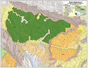
Giant Sequoia National Monument – Public Comments Extended
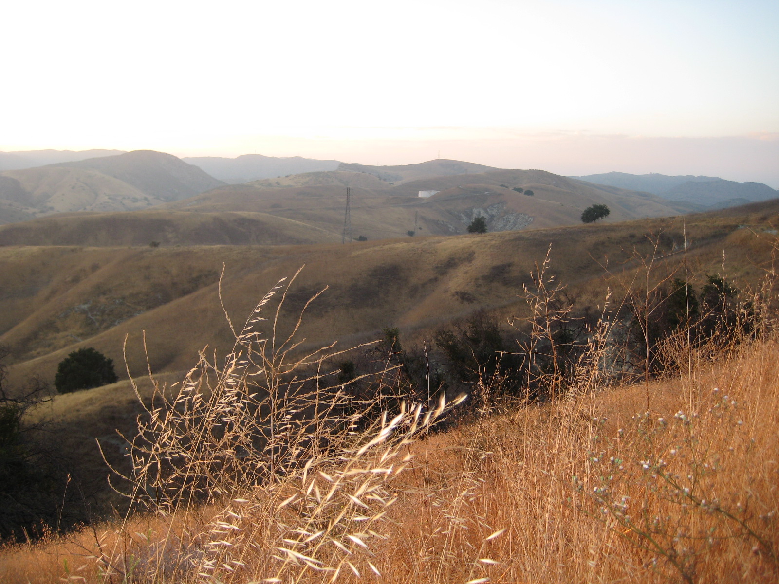
Thursday, November 4th, 2010

Many mountain bikers from Southern California venture out to the trails of the Southern Sierras.  Places like Freeman Creek Trail, Quaking Aspen, Camp Nelson and other areas have been enjoyed by off-road cyclists for many years.

Camp Nelson Trail

Camp Nelson Trail, at the heart of the Monument

The Sequoia National Forest is currently accepting public comments on the Giant Sequoia National Monument draft Environmental Impact Statement, which includes several Management Alternatives. This Draft Environmental Impact Statement (draft EIS) describes six alternatives that would amend the 1988 Sequoia National Forest Land and Resource Management Plan to manage the Giant Sequoia National Monument. The draft EIS document will implement President Clinton’s 2000 Proclamation which established the Monument.

Of the six management alternatives presented, Alternative C  could result in a ban for mountain bikes on trails in the Monument, while Alternative D would limit mountain bikes to existing trails without any future expansion. Dispersed camping and other activities are also adversely affected. The remaining options allow for most current trails to be grandfathered in, with varying degrees of flexibility for trail use designations.

We prefer Alternative B, which allows for existing bicycle use and future expansion of recreational opportunities. Alternative F is also favorable to multi-use and bicycles, with the only difference between B and F being the way that fuels reduction and fire control are managed. The complete draft statement is available online for review.

For those who are concerned about California trails being forever closed to mountain bikers, please make your comments to the Sequoia National Forest. This National Monument is bordered by extensive Wilderness areas and a National Park, all of which is off-limits to mountain bike use. We can’t afford to lose more! If you haven’t ridden this area, it offers some spectacular high-country riding and is well worth a visit. It is also very much worth protecting for it’s unique ecological and recreational value.

IMBA is also reviewing the document drafts and will issue their official comments soon.  We encourage everyone to write in support of Alternative B, and strongly against Alternatives C and D. Note that you must login and/or register on the SNF Public Comment Portal to post your comments.

Comments are being accepted through December 3rd, 2010.