Archive for the ‘Trail Hazards’ Category

Sullivan Canyon Pipeline Work Begins January 6

Friday, December 20th, 2013

From the Public Affairs Office of Southern California Gas:

Since 1960, Southern California Gas Company (“SoCaIGas”) has owned much of the land that comprises Sullivan Canyon (more than 4 miles in length). This property is used as a corridor for two transmission pipelines that provide Los Angeles residents with a safe and reliable supply of natural gas. Periodically, SoCalGas must perform maintenance on these pipelines. The purpose of this letter is to provide information on pipeline maintenance and repair work that will occur in 2014.

Purpose of this Work

We recently internally inspected our pipeline. By code, we have areas we are required to perform a visual inspection of the pipeline as part of a validation process. This work is required to maintain the pipeline’s safety and integrity.

Location and Logistics

There are two work areas along the access road within the canyon that will require excavation.

Location 1: 0.7 (seven tenths) of a mile south from fire road #26 at the Mulholland entrance

Location 2: 2.8 miles in from fire road #26, or 1.4 miles from the Queensferry entrance

Partial Canyon Closures

The Canyon path will be closed from the Mulholland entrance at fire road #26 to location 1.

There is no change to the Queensferry entrance. Signs will be posted along the path indicating construction status.

The following impacts are to be expected in the canyon and surrounding neighborhood. I will keep you apprised of any changes.

-Work will commence on or about January 6, 2014.

-Work is estimated to be completed in 8 weeks.

-Information signs will be posted in advance at the beginning of each entrance.

-Work hours are sun up to sun down, Monday through Friday. No work will be performed on Saturday and Sunday.

-Intermittent loud noise in the immediate work areas.

-Increased dust in the immediate work areas.

-Increased traffic at the Mulholland entrance from work crews and equipment.

SoCalGas appreciates your understanding and apologizes for any inconveniences caused by this necessary work. It is our goal to minimize disruptions. We value our relationship with the community and will communicate with you when our work has the potential of impacting our neighbors. Again, there are two high-pressure transmission pipelines located in the canyon and we will continue to periodically perform maintenance work to them as-needed to ensure safety.

Safety is our first priority. Should you have any questions, please call me 213 244-4633 or email me at mharriel@semprautilities.com.

Sincerely,

Mike Harriel

Public Affairs Manager

Guadalasca rejuvenation started on June 12th

Friday, June 14th, 2013
The huge rut in front of the Sweco is filled in behind it.

The huge rut in front of the Sweco is filled in behind it.

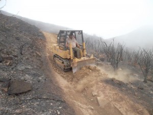
On Wednesday, California State Parks staff started the rejuvenation process of Guadalasca Trail in Pt Mugu State Park (Sycamore Canyon). They’re running a Sweco (mini bulldozer) down the trail, pulling down the berm on the outside and filling in the huge rut that runs almost the length of the trail.This is part of a process that was started in late 2011 and CORBA has been helping with over various trailwork days.

State Parks will be running the Sweco down to the point where it is to be eventually rerouted, just below the second lowest switchback, about 1.1 miles from the top of the singletrack section.

On Saturday, the 30 people or so who have signed up for trailwork will be knocking down any loose berm left behind, removing rocks and filling in any big holes.

I rode from the top down to where the work had progressed at the time, about 200 yards or so. The trail is currently pretty rough and somewhat loose. If you’re looking for a really good workout, try riding up this trail once the work is complete!

The loose rough conditions are temporary. Slowly the trail will be packed down as people ride it (mostly downhill, I expect) and eventually it will be in great shape. Some people will be upset at it’s current state, but this trail really needs the ruts fixed, and when it recovers, it will be much more fun to ride than it is now. In some places the rut is so deep I can’t ride in it without banging my pedals on the side. The result is that people ride up the edges, widening the trail on both sides. That may be easy to do now, but it makes for a really wide and ugly scar on the hillside, and the trail edges won’t be viable for riding once the vegetation that was removed by the Springs Fire a month ago grows back.

Wood Canyon Vista Trail (Backbone) was Sweco’d two years ago and has been in really good shape for over a year now, and is in fantastic shape now, especially after the trailwork we did there last week.

But be warned, unless you want an extreme challenge, I suggest you avoid trying to climb Guadalasca until it’s been packed down a bit. Even riding down it will be more challenge than some people will welcome!

Springs Fire Trail Repair in Pt Mugu State Park on June 8th

Friday, May 24th, 2013

P1220118Join CORBA, the Santa Monica Mountains Trails Council and others as we repair the trail damage caused by the recent Springs Fire. Initial efforts will focus on removing debris from the trails (fallen trees, rocks, small landslides, etc) so they can be safely used by park visitors. Later work will involve repairing drainage so that rainwater running off the denuded hillsides will not wash the trails away.

The trail we work on will be determined by State Park Staff a few days beforehand. This is the first of two work days we are scheduling to help fix up the trails.

After the trailwork is finished, CORBA will have prizes for some (or all) lucky volunteers, and treat you to lunch after that.

More rockfall to clearNo experience is necessary to help out with trailwork. Tools and instructions on how to use them safely and effectively will be provided. Children must be over 7-years old to attend, and children under 14 must be constantly and directly supervised by their parent or guardian who brought them. And you don’t need to be a mountain biker to help out – Everybody is welcome! For more information on trailwork in general, visit our trail crew web page.

Be sure to wear protective clothing (sturdy shoes, long pants and sleeves, hat, golves) and bring snacks, sunscreen and water. CORBA will provide the tools and training.

We request that you pre-register online so that we’ll know how many tools to provide. Remember, by registering here, CORBA will treat you to lunch afterwards, and enter you in the drawing for mountain biking prizes! We have some great 2.25″ CST tires, for both 26ers and 29ers.

CORBA’s thank-you lunch will be after trailwork ends at 2:00 pm, so bring some snacks to tide you over.

Meeting location and details are on the online registration page.

Springs Fire Trail Repair Progress

Tuesday, May 21st, 2013

By Steve Clark, Trail Crew Coordinator

Twice in the past week at the request of the State Parks trails maintenance department, a group of about 8 volunteers from the Santa Monica Mountains Trails Council headed into Point Mugu State Park to begin cleanup and repair of the trails after the Springs Fire swept through just over a week earlier. This work was undertaken before the park is open to the general public to help assess the situation, clear and repair trails to make them safe for park visitors, and to limit damage to the fragile web of wildlife that survived the fire. The initial focus will be to protect park resources and make them safe for visitors. When that is complete, we’ll concentrate on repairing the drainage so rainwater that runs down the denuded hillsides doesn’t wash the trails away this winter.
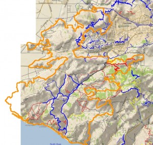
Outline of the Springs Fire burn area (orange), overlaid on a trail and topo map.

Outline of the Springs Fire burn area (orange), overlaid on a trail and topo map.

The park is currently scheduled to reopen on Friday, May 24, with some trails still closed for further repair. The park will be only open during daylight hours until further notice. When the park does open, please protect the wildlife that did survive the fire by not going off the trails.This is a report of what we saw and got accomplished during those two trailwork days.

The first day (8:30 am to 2:00 pm) was spend entirely on Upper Sycamore Trail. We parked at the bottom of the blacktop hill in the large dirt area on the east side of the road, where the outhouse used to be. In it’s place is a piece of a metal frame and a stain of melted plastic in the dirt. Across the road is the remains of an old oak tree that had burned through the base and then toppled over. The tops of the railings on the bridge have been cut off and the surface planks are chared around the edges. The superstructure is steel so it is still strong enough to support fire trucks, but we drove our pickups across one at a time even so.
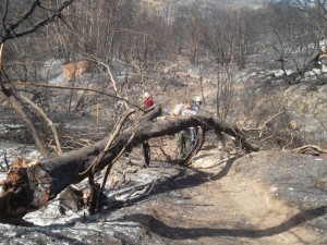
One of many trees fallen over the Upper Sycamore Canyon Trail

One of many trees fallen over the Upper Sycamore Canyon Trail

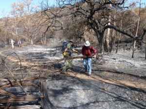
It was eerie on the trail itself. The fire seems to have burned about 10 feet up from the ground so the leaves are stripped off of the chaparral, but taller oaks and sycamores still have leaves in various states of scorched to dead. Being able to see through the leafless chaparral, we discover that there’s a lot of junk lying on the ground near the trail, including a metal windmill that must have fallen over years ago.The tread of the trail was in good shape. The leaves from the overhead trees that normally carpet it were all gone so we were walking on bare dirt. Unfortunately many of the oaks near the bottom of the trail had burned through the trunk and fallen over. Four or five of them blocked the trail and we spent considerable time cutting them up with a chainsaw and hand saws into pieces small enough for us to drag off the trail.
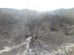
One of the many 'ash ghosts'

One of the many ‘ash ghosts’

There were a lot of ‘ash ghosts’ on the ground: markings left when whole trees or large limbs had fallen and been completely consumed, leaving a pattern of ash where branches used to be.Fortunately not all the oaks fell to the ground, but too many of them did.

The oaks were not the only trees that fell across the trail. Dozens of large chaparral bushes, about 8 feet tall, had collapsed across the trail. Many were burned completely through at the base so we just picked them up and tossed them off the trail, but others were still attached to their roots, so we needed to cut them through with hand saws before we could unblock the trail.
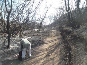
We had to clear a lot of chaparral that had fallen across the trail

We had to clear a lot of chaparral that had fallen across the trail

The amount of fire damage varied a lot from place to place. In some places the grass and most of the chaparral was almost completely gone. Some places weren’t burned at all, but most were singed to some degree. We could see on the hillsides patches where the fire had burned, surrounded by chaparral, and patches of chaparral surrounded by burn. We even saw a few shoots of brand new growth in some heavily burned areas.All of the collapsed oaks blocking the trail were near its lower end. Further up the trail were a few sections with minor rockfalls that we cleared. We also cleaned out three drains in a heavily rutted segment. The top section was relatively unaffected and we were relieved to see the giant oaks at the top of the trail, where it meets Danielson Road, were singed but not seriously damaged.
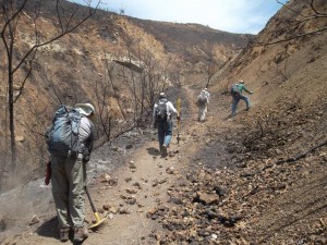
More rockfall to clearOn the second trailwork day, we covered Hidden Pond Trail between the bottom of the blacktop hill and Ranch Center Rd, Sin Nombre and about 2/3 of Blue Canyon Trail. We were able to cover much more ground because there were no fallen oak trees to clear and the two large fallen sycamore boughs shattered into pieces that were small enough to remove without using a chainsaw.

The surrounding land was much the same as Upper Sycamore Trail, except there were large meadows here and they were completely burned. It’s amazing to see how many gopher holes there are — it seems like there are several in each square foot!
P1220118On both days we saw animals that had survied. We saw lots of ants, some beetles, a few lizards, one snake, a tree squirrel and even a large bobcat resting in the shade of some sycamore trees. Some areas had lots of funnel spider webs even thought the grass was completely burned, but other areas had none. We saw and heard birds, including a couple of small flocks of screeching parrots.

We also came across a group of about a half-dozen mountain bikers on Hidden Pond Trail. They said they heard the trails were open; they claimed they phoned a park agency and were told the trails were open. However, we know they snuck in bacause the main entry points were blocked off and manned by rangers to keep people out. As an open space enthusiast, I was angered more by the fact that they were in the park when it was closed to the public for their safety and to protect the surviving wildlife than by the fact that they were on a trail that is never open to mountain biking. As a mountain biker, I was angered by the fact that these boneheads were putting into jeapardy the goodwill and standing that CORBA has worked hard to establish for the mountain biking community with the various land managers in the Santa Monica Mountains. These were the only unauthorized people we saw in the park over our two workdays there.

Normally I would provide lots of pictures to go along with an article like this one but we have been asked by State Parks not to publish any photos of trailwork or fire damage until after the parks have reopened to the public. They don’t want anyone to see the photos of people working on the trails and assume that the trails are open to everyone.

As a final note, let me remind you, for the sake of the remaining wildlife, to stay on the trails when the park reopens, and I thank you for your cooperation in helping the open space to grow back to it’s former self!

If you would like to help repair the trails, a volunteer workday has been scheduled for Saturday June 8th. For more information and to sign up to help, please visit CORBA’s June 8th trailwork registration page.

Update Friday May 24, 2013. Point Mugu State Park is now completely open, but there is still some debris on some trails, including fallen trees. Use caution on these trails until they are completely cleared of all debris!

View the photo gallery of trailwork on Upper Sycamore Canyon Trail.
View the photo gallery of trailwork on Hidden Pond, Sin Nombre and Blue Canyon Trails.

SCE Construction on Brown Mountain Fire Road

Thursday, November 1st, 2012
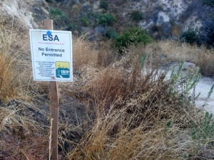
TRTP Signs on Brown Mountain

TRTP Signs on Brown Mountain

Many people have been wondering about the signs that were placed along Brown Mountain fire road (FS 2N70) over the past few months. The signs are ESA notices (Environmentally Sensitive Areas) which state “No Entrance Permitted” and have been placed there by the Tehachapi Renewable Transmissions Project (TRTP).

This is one of the most popular trails for off-road cyclists in the Angeles National Forest, because of its proximity to JPL and the Altadena/Pasadena community. It lies in Segment 11 of the project, which includes much of the Angeles National Forest front country through La Canada and Altadena.

The TRTP Environmental Impact Report states that this fire road is not intended to be part of the project. Elsewhere along the transmission line project towers are being replaced by helicopter and in some cases, by road access. The towers accessed along Brown Mountain fire road are not being replaced, but they are being re-wired from the Chaney Trail road access to the east.  The re-wiring will nearly double the power-carrying capacity of the transmission lines, helping bring more renewable energy from Kern County to greater Los Angeles.

When the EIR for the project was completed the fire road was a wide fire road and easily traveled by high-clearance vehicles. Since the Station Fire it has grown in to a narrow single track in many places, and is not accessible to vehicles.  We anticipate the fire road will eventually be graded back to its original width, and if we learn of any plans, we’ll be sure to pass them on.

According to local SCE Public Affairs officer Shannon Widor, the following information was supplied by the construction team in response to our questions:

  • There will not be full closures of the trails in the area of trail 2N70 and Brown Mountain Road as part of SCE’s Tehachapi project.  While trails will remain accessible for trail users, there may be periodic, brief delays on trails in construction areas at times when work activities cross those trail sites.
  • SCE’s work will also include the use of temporary guard structures (to keep wires elevated during installation) at street and trail crossings to enhance safety during construction.
  • Additionally, SCE has no plans to grade Brown Mountain Road at this time.

We can only assume that the signs are meant to remind employees and construction workers of sensitive areas to avoid, and in no way indicate any intention to close the trail/s.

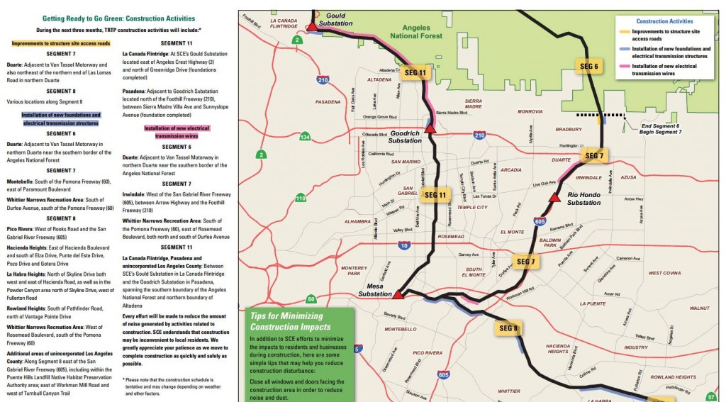
The project also includes an eastern corridor that will include Van Tassell Motorway and fire roads above the Monrovia/Duarte area, as well as Workman Hill and other Habitat Authority lands around Turnbull Canyon.   Construction updates, in the form of quarterly newsletters, are available online. The current newsletter indicates that road improvements will be taking place in some areas in preparation for construction, and that re-wiring of Segment 11 between the Gould and Goodrich Substations will begin.

TRTP 3rd Quarter Construction Update

Double-Click the image for a larger version


The project is estimated to be completed in 2015, but for the moment we can continue to enjoy Brown Mountain fire road in its current narrow configuration for the immediate future.


Mesa Peak Singletrack Trailwork Report and Photos

Monday, September 17th, 2012

On Saturday morning, September 15, fifteen volunteers from the Santa Monica Mountains Trails Council trail crew, Calabasas Day Hikers Meetup group and CORBA gathered in the parking area at the bottom of the Mesa Peak Motorway singletrack, a segment of the Backbone Trail in Malibu Creek State Park. We had learned the evening before that possibly hundreds of road cyclists and onlookers would be gathering at the corner of Piuma and Malibu Canyon Roads for the annual LaGrange Piuma Hill Climb. This was less than 1/4 mile away, and we could envision all the parking being taken up by this group, but as it turned out, there was just enough parking for the trailwork volunteers.

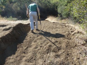
Looking at the huge rut and planning how to fix it.

Our job for the day was to fix an extremely serious rut near the trailhead, clean out existing drainages and install new ones to prevent further water damage and rutting, and cut back several years of overgrowing brush.

The challenge of the work would be compounded by temperatures expect to reach just over 100 degrees. Fortunately 90% of the work was in the shade. Also, CORBA provided lots of water for those who ran short, and two of us had mist bottles to spray down coworkers from time to time.

The rut is filled in and the surface is smooth, but very loose

The Trails Council crew did most of the the treadwork, filling in the huge rut much more quickly than I had expected, then going on to clean out old or build new drainages. These drainages are critical to preserving the trail by shunting the water off the side, so it doesn’t run down the middle of the trail and cause further errosion and huge ruts.

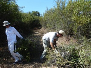
Meanwhile, the CORBA and Calabasas Day Hiker volunteers mostly grabbed loppers and saws and went to work on the overgrowth. The brush to be removed had previously been marked with bright orange surveyor’s tape. After cutting down the brush, the tape was removed and pocketed, then the clippings were tossed over the edge, hidden from view of the trail as much as possible. We took off the orange plastic tape because it would become trash on the hillsides as the clippings slowly decomposed.

Remove the cuttings of overgrown brush

We finished up the workday about an hour earlier than planned because of the temperature. Besides, we had already accomplished almost everything that could be done.

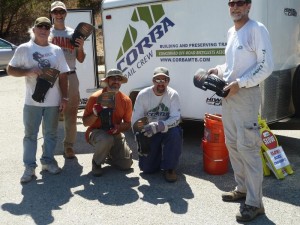
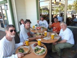
CORBA volunteers selected a mtn bike tire, courtesy of IMBA and CST, as a reward for all their diligent work. Then CORBA treated the CORBA and Calabasas Day Hiker volunteers to lunch at the Urbane Cafe to further show our appreciation. (The Trails Council crew packs their own lunch and eat it on the trail in the middle of the workday.)

CORBA volunteers show off their new CST tires, courtesy of CST and IMBA

A word of warning: The trail is fairly smooth where we filled in the huge rut, but it is very loose due to the dry conditions. Be careful when riding through this section! The loose dirt extends down at least a foot, and is up to two feet deep where this rut was filled in.

View all the photos in our trailwork photo gallery!

Lunch at the Urbane Cafe

Mesa Peak Backbone Singletrack Trailwork Sept 15

Friday, July 27th, 2012

Come out to help us fix up the singletrack at the bottom of Mesa Peak Motorway on September 15th! We’ll be removing some overgrowing bushes and fixing major ruts at the bottom of the trail.

CORBA will treat participants to lunch afterwards and provide some great mountain biking prizes, including CST tires.

For full details and to register, see our registration page. We hope to see a good turnout of local mountain bikers at this event!

Angeles National Forest Open and Closed Trails – May 2012

Friday, May 25th, 2012

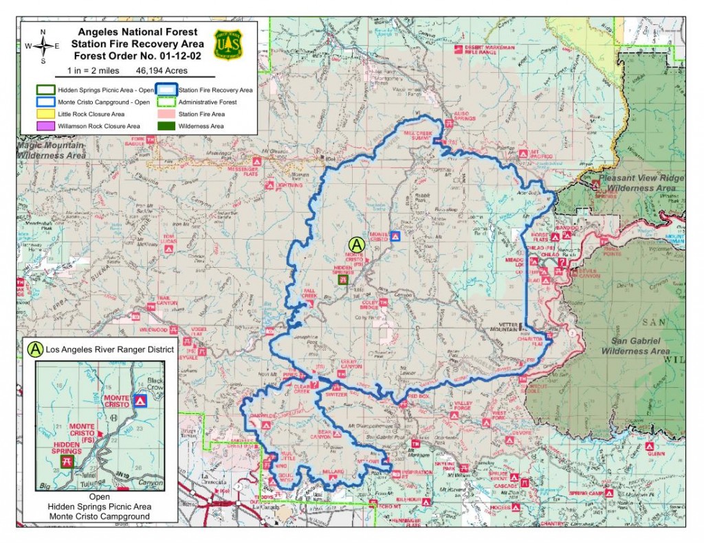
As we approach three years since the Station Fire began, the Forest Service has revised the closure order which has been in place to allow the forest to recover, and to protect the safety of forest visitors. This is an updated list from our May 2011 list of open and closed trails.

The two questions we have been asked more than any other recently: “which trails are closed in the Angeles National Forest?  and “which trails are open in the Angeles National Forest?”

According to the Forest Service map of the station fire closure area at http://maps.fs.fed.us/stationfire/ the list below shows the status, effective May 25 2012, of some of the more popular trails that were affected by the Station Fire. Keep in mind that even though these trails are in the newly opened areas of the forest, the individual trails may be signed closed.  Please respect any trail closure signs and stay off those trails for your own safety and the recovery of the forest.

Many of the trails will not be in good shape, so be prepared for surprises like downed trees, slides, washouts, ruts, and other hazards. Many trails have been drastically changed from before the Station Fire. Many fire roads have not yet been graded and may be much narrower and in very poor condition with ruts and washouts. All the usual caveats about trail safety apply so use the trails safely and responsibly, and be especially careful the first time you travel on one of the newly opened trails.

Opened Trails (As of May 25, 2012) 

  • Brown Mountain (to the saddle)
  • El Prieto
  • Gabrielino (JPL to Paul Little)
  • Gabrielino (Switzers to Redbox to Chantry)
  • Bear Canyon Trail
  • Sam Merrill Trail
  • Castle Canyon Trail
  • Sunset Ridge Trail
  • Mt. Lowe West Trail
  • Idlehour Trail
  • Kenyon Devore Trail
  • Rim Trail
  • Sturtevant Trail
  • Santa Clara Divide Truck Trail (Dillon Divide to Mt. Gleason to Three Points – non-motorized only)
  • Chilao Loop/Mt. Hillyer
  • Silver Mocassin
  • Valley forge
  • Mueller Tunnel
  • Mt. Disappointment
  • San Gabriel Peak
  • Earl Canyon
  • Haines Canyon
  • Rim of the Valley
  • Hoyt
  • Stone Canyon
  • Trail Canyon
  • Condor Peak
  • Fall Creek Canyon
  • Mt Lukens Fire Road
  • Grizzly Flat Fire Road
  • Doc Larsen
  • Rattlesnake Trail
  • Everything east of Chilao

Keep in mind that even though these trails are in the opened area, the individual trails may be signed closed (And those signs mustl be respected). Many of the trails will not be in good shape, so be prepared for surprises like downed trees, massive ruts or slides, washouts, and other hazards.

Closed Trails (Until Further Notice)

  • Strawberry Peak
  • Tom Sloan
  • Dawn Mine
  • Millard Falls
  • Upper Brown Mountain (Saddle to the Summit/Ken Burton)
  • Ken Burton
  • Gabrielino from Switzers to Paul Little
  • Crescenta View
  • Alder Creek
  • Colby Canyon
  • Josephine
  • Vetter Mountain

In addition to the above a separate closure remains in effect for the Williamson Rock area  (Closure Map is available).

50% of Station Fire Closure to Re-open

Thursday, May 24th, 2012

Angeles National Forest supervisor Tom Contreras and District Ranger Mike McIntyre, on Wednesday announced that they were hoping to get approval from the regional director to open approximately 50% of the Station Fire closure area. It only requires a review and a signature, and we hope to have that on Thursday [May 24], in time for the Memorial Day weekend.

Last year the closure order was revised a few days before the memorial day weekend.

The area slated for opening includes everything west of Fall Creek fire road (3N27), which descends from Mount Gleason Road to Big Tujunga Canyon.  Trails in the newly opened area include Stone Canyon, Condor Peak, Trail Canyon and Mendenhall Ridge. Some work has been done on Stone Canyon, Condor Peak trail, and Trail Canyon trail, though their readiness for bicycling is unknown. If these or other trails are not in safe enough condition for public use, the trails will be signed as closed, even though the area is technically open.

Condor Peak was once slated for a wilderness designation, and as a show of protest, CORBA and IMBA led a mass group ride up Condor Peak to demonstrate its viability as a backcountry multi-use trail including bicycles. It’s a steep and challenging trail, and we’ll be very happy to see it opened again.

The announcement was made at a Sierra Club event at Eaton Canyon Nature Center on Wednesday evening, March 23, 2012.  Forest Service staff reported on the station fire recovery efforts. Nathan Sill, staff biologist for the forest reported pre- and post-fire population counts of several endangered species including the Arroyo Toad, Arroyo Chubb, Mountain Yellow-legged frog, Spotted Owl and others. Most of the species covered have shown significant population increases since the fire and are recovering well.

Steve Bear, forester for the Angeles National Forest reported on the controversial re-forestation efforts and the plans for the next five years.

This post will updated when the closure revision is officially announced.

Update: Maps have been released showing the closure:


2012-05-24-station-fire-closure-order

Fixing a hazardous turn in Pt Mugu State Park

Monday, April 16th, 2012

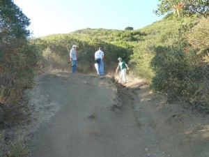
On Sunday April 15, as part of National Volunteer Week, about 40 Amgen volunteers gathered in Pt Mugu State Park to work on the Sin Nombre Trail. Most of them worked on fixing ruts and cutting back overgrowing brush, but 8 of us, all but one mountain bikers, split off to fix up the dangerous corner near the top of the trail at Ranch Center Road.

The problem is at a dip to cross a very small stream, combined with a tight left turn.  After slowing to negotiate the turn at the stream crossing, the rider encounters a short but unexpectedly steep climb out of the stream. Because the trail has been downhill until this point, often people are in too high a gear and stall trying to climb the hill. When they put their foot down, they discover that the trail is also narrower than expected and there is little room for their foot, and they can fall about 6′ down the steep bank to the rocks of the stream. The problem is made worse by a rock near the middle of the trail at the start of the climb out that it high enough to bang your pedal on. Many riders have fallen at this turn; some were taken out by helicopter with serious injuries.

We widened the trail and fortified the outside edge with large rocks. Gaps were filled with smaller rocks, then everything was covered with dirt.

On Sunday, I enlisted a very experienced trailwork volunteer and crew leader for the Santa Monica Mountains Trails Council to figure out what we could do to cut down on the number of accidents on that corner. His solution was to build up the outside edge of the trail with large rocks to make it a little wider, and to remove the protruding rock at the start of the climb out of the dip. So after a lot of digging and relocating really big rocks, the trail is almost a foot wider, all of it on the outside, so there’s more room to put your foot down if you stall out on the climb out. The rocks also armour the outside edge of the trail so it’s less susceptible to errosion and so will last longer.

As we were working, a large number of mountain bikers rode through, the vast majority of them thanked us for fixing up the trail. Some of them told us of stories of having fallen at the corner and injuring themselves. None of them appeared to be beginners.

One fellow fell in and hit his neck. He couldn’t move, being paralyzed in all his limbs and with no feeling in them. That lasted for what must have been for him the longest 10 minutes in his life, before feeling started to come back and he could move again. It turns out he’d sprained his neck. Talk about a close call!

Another rider said he tore his shoulder and broke his collarbone when he fell there.

We believe the trail is safer after our work, but it is still risky to people who are taken by surprise by the steepness of the climb. The trail is wider so it’s easier to put your foot down on the trail, but if you’re riding too close to the edge, you can still go down the bank. So always be careful on this corner, and advise less experienced riders to get off their bikes and walk!

You can see photos of the work on the VenturaCountyTrails.org photo gallery.