Archive for the ‘Trail Hazards’ Category

El Nino Watch: Trail Damage and Riding after it Rains

Tuesday, December 29th, 2015

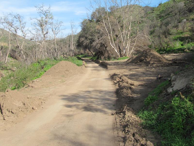
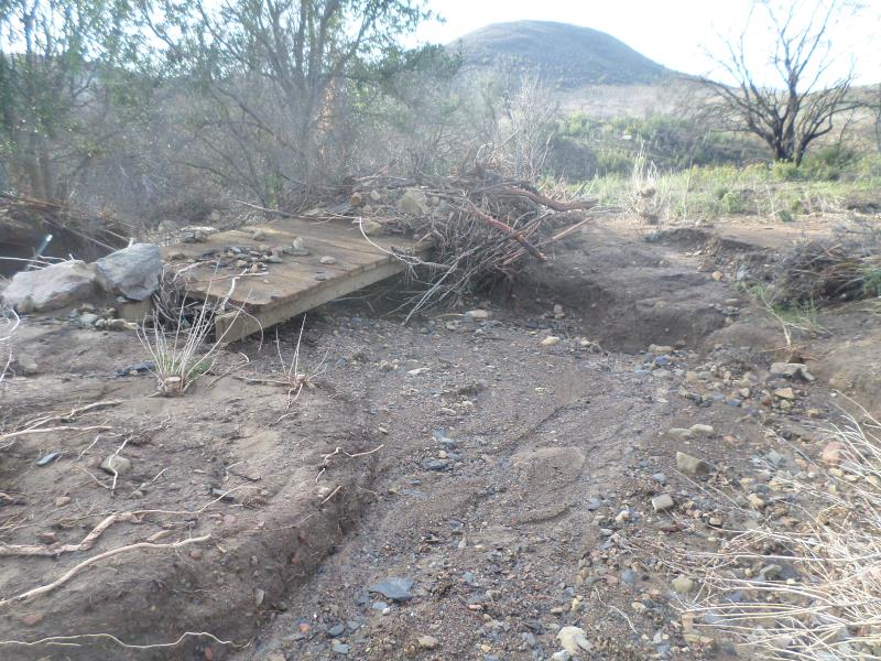
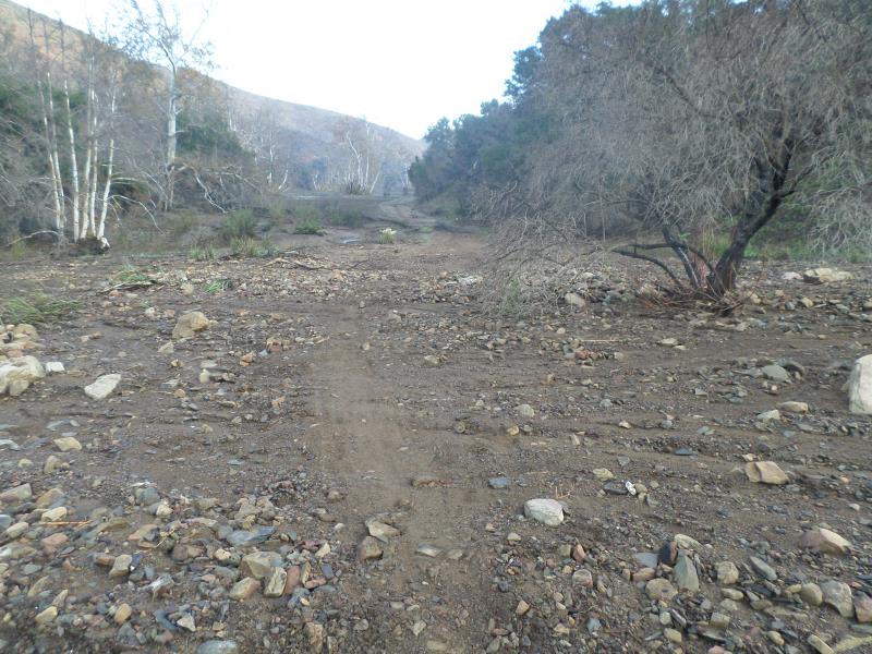
We are having a severe El Nino event this winter; as a result the weather forecast is for many heavy rainstorms in the early months of 2016. That will help our drought situation, but will have seriously bad impacts on our trails. As well as muddy conditions that interfere with their use, described  below, the rains could be severe enough to erode some trails into huge ruts, and even wash them away in some cases. There may be more mudslides in Pt Mugu State Park (Sycamore Canyon) like we had last year. Furthermore, the rain will spur the chaparral to overgrow the trails, a condition we haven’t had to deal with much over the past couple of years because of the drought. The combination of waterlogged soil and high winds could blow trees over. We’re expecting to have special trailwork days to repair these damaged trails and hope many mountain bikers will want to help us get them back into shape!

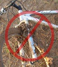
Most trails in our local riding area don’t respond well to rain. They have a high content of clay that turns into sticky, slippery muck that binds to everything it touches. It builds up on the tires, like a snowball rolling downhill, until it jams on the frame and the wheels won’t budge. Some models of clipless pedals won’t let go when full of this mud, resulting in the bike and the attached rider lying sideways in a puddle, or worse.

Most wet trails don’t respond well to use until they’ve had time to dry out. Hikers and horses make holes and ridges in the trail that become as hard as concrete when the trail dries. These holes and ridges are good for twisting ankles.

As a rule of thumb, if your foot, tire or hoof makes an impression more than about 1/8 inch deep in the dirt, the trail is still too soft to use. Give it another day or two to dry out before using it!

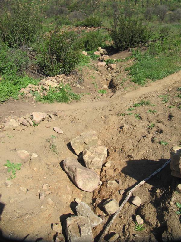
On wet trails, bikes make grooves along the trail. The next time it rains, the water runs down these grooves and turns them into little ruts, then large ruts that destroy the trail.

The mud is particularly hard to remove. It sticks to the bike and shoes, no matter the efforts to remove it, rubbing off on the bike rack, car carpet and gas/brake pedals, making them slippery. Once home, it takes the careful use of a garden hose to remove the mud but not force water into the sensitive parts of the bike.

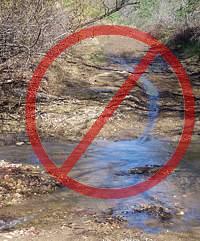
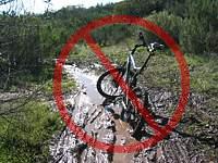
For these reasons, riders are well advised to stay off the trails after a rain until they have dried. How long to stay off? That depends on a number of factors including the particular trail, how much rain it received, how much sun it gets after the rain (is it in the shade or face south?), how warm and windy the weather is, and so on. After an isolated light rain you can probably ride the next day. After a heavy rain, you should wait several days. This is something where common sense and experience will help. Remember, tracks deeper than 1/8″ mean the trail is still too soft to use!

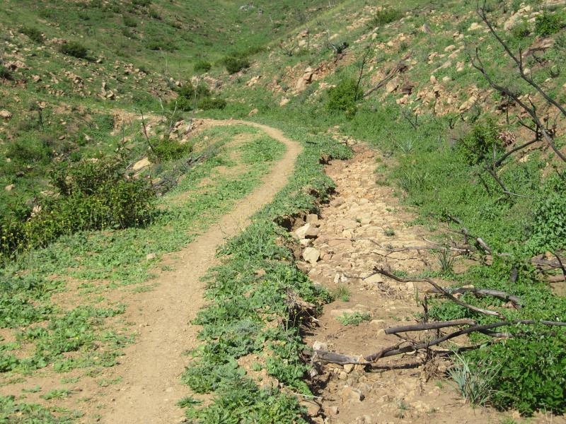
All is not lost when the trails are soaking! There are a few trails that hold up well when wet because they have more sand and rock that doesn’t hold the water. Here are a few you should know about:

Space Mountain (Los Robles Trail West) to the picnic table is almost always rideable, even right after a big storm. However, it can be pretty mucky from the picnic table to Potrero Road.
Rosewood Trail is pretty good, but not quite as resilient as Space Mountain.
Zuma Ridge Motorway from Encinal (the bottom in Malibu is muddy)
Dirt Mulholland around Topanga State Park.
-Brown Mountain Fireroad
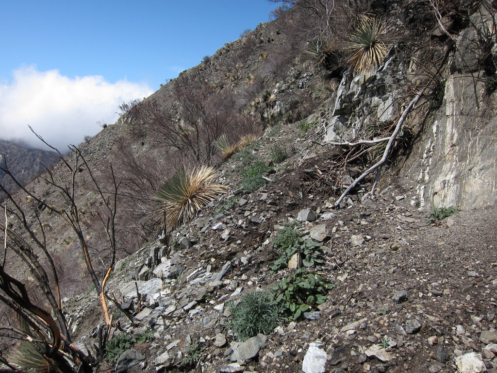
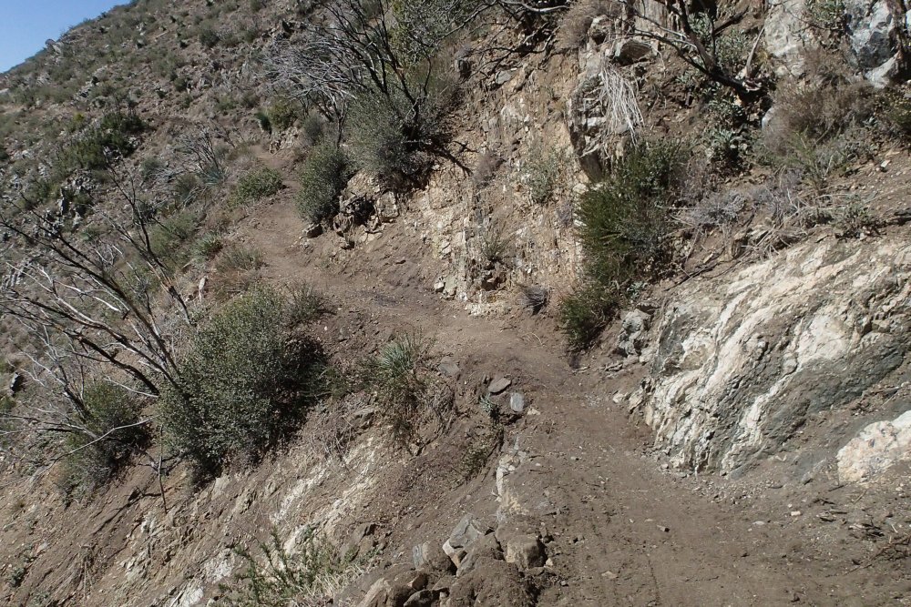
-Most San Gabriel Mountains trails made up of decomposed granite
-Beaudry Fireroad
-Hostetter Fireroad
-Mt. Lukens

Trek to recall nearly 1 million bicycles after injury reports

Friday, April 24th, 2015

Catastrophic failure of 2000 – 2015 model bikes leads to quadriplegia

Source of this article: The Los Angeles Times, April 24, 2015

Trek Bicycle Corp. will recall nearly 1 million bikes in the United States and Canada to correct a brake-safety issue following reports of three injuries, including one that left a rider paralyzed, the U.S. Consumer Product Safety Commission said Wednesday.

The recall covers all models of Trek bicycles from model years 2000 through 2015 that have front disc brakes and a black or silver quick-release lever on the front wheel hub that opens far enough to contact the disc brake, the agency said.

There is a risk on the affected bikes that the lever could become caught in the front disc-brake assembly, causing the front wheel to separate or stop suddenly, the commission said.

The bikes’ owners are urged to “stop using the bicycles immediately and contact an authorized Trek retailer for free installation of a new quick-release on the front wheel,” the commission said.

The recall affects about 900,000 bikes in the United States and 98,000 in Canada that sold for between $480 and $1,650.

Trek reported three incidents of injured riders related to the problem, including one that resulted in quadriplegia, the commission said. The others involved facial and wrist injuries.

Trek is based in Waterloo, Wis., and the bicycles involved in the recall were made in Taiwan and China, the agency said.

“Your safety is very important to us,” Trek said in a recall notice on its website. “We sincerely apologize for the inconvenience this has caused you.”

The commission said customers could contact Trek at 800-373-4594 Monday through Friday or via the company’s website http://www.trekbikes.com/worldwide/.

Scouting the trails of newly re-opened Pt Mugu State Park

Wednesday, February 4th, 2015

Here is what I found when I rode all the multi-use trails a few days after Pt Mugu State Park re-opened on January 30th. The park had been closed since mid-December when heavy rains brought mudslides to the fire-denuded park. During the closure, heavy equipment was used to clear up the extensive damage on the fire roads, and small groups of volunteers were fixing some bad spots on singletrack trails, using hand tools. In fact, volunteer groups will be converging on the park throughout February to help fix the trails. You can help! Here’s the schedule: 2015-01-22 PMSP Trailwork Schedule.

My first impression was that there were a lot of people in the park for a Tuesday morning. No doubt they were as curious about its condition as I was. (There are a number of photos below that show a typical condition, and a much larger photo gallery to show more trail problems, large and small.) One pleasant surprise was that the wildflowers are coming out, in abundance in some places. I’ve included pictures of some of them in the photo gallery.

I entered the park from the north end, through Rancho Sierra Vista/Satwiwa. There are signs posted at the entrance to Pt Mugu State Park (PMSP) indicating that you can’t get through to the coast, and that there is no water in the park.

On the main Sycamore Canyon Fireroad, there were numerous shallow mudslides that had come down the hill and crossed the road. Some were narrow and others were quite wide. All of them had been cleaned up. The whole road was smooth and quite broad. Unfortunately, I wasn’t able to make it to the campground because the road was closed south of the point where Overlook Fireroad comes into it.

Piles of dirt that were removed from the main Sycamore Canyon Fireroad.

Sin Nombre and Two Foxes Trails had had lots of tiny mudflows across them, leaving small ridges perpendicular to the trail. They make for a bit of a bumpy ride. There were several ruts in the hillside above and below the trail where a small stream crossed, but did very little or no damage to the trail. There were a few spots where larger streams did damage the trail, leaving ruts and/or rocks and dirt.

A small stream crossed Sin Nombre but did little damage to the trail.

On the Wood Canyon Vista Trail, a segment of the Backbone Trail, there were five notable kinds of features on the trail. Most noticeable was the lack of serviceable drainage dips. Of the 84 drains we installed after the Springs Fire in 2013, almost all were choked with debris, and many couldn’t even be distinguished from the rest of the trail. Large stretches of trail had mud and water flowing across it, leaving small ridges perpendicular to the trail. Other large stretches had water running down the trail, removing all the dirt and sand, leaving a very rocky surface. The clay stretch about 2/3 of the way up has become deeply trenched and rutted. Finally, some trailwork has already been done, and there the surface was generally smoother and outsloped, but slightly loose.

Water running down the Wood Canyon Vista Trail has removed most of the dirt, leaving a lot of exposed rocks.

Climbing the old ranch road section of Guadalasca, I saw a lot of damage. However, it was mostly easy to avoid because the trail there follows an old wide roadbed. The top 20% of the singletrack downhill, where we had worked after the Springs Fire, was in very good shape. However, it was a different story for the rest, where it had already been quite rutted. Most of it was only slightly worse, but the worst sections were much worse than they had been. You can avoid the ruts now by using the very edge of the trail, but that won’t be an option once the vegetation grows up again. In the two places where the trail crossed a small stream with a culvert under the trail, the culvert had become blocked and the upstream streambed was completely filled with silt, while below the trail, the streambed was scoured down to bare rocks. The trail crossing the stream had acted as a dam and held back the dirt and rocks that were washing downstream. Finally, the lower old ranch road section had also become much more rutted, and the culverts under the trail had become exposed.

A really bad section on Guadalasca

During the Santa Monica Mountains Trail Day in April 2014, a large group of volunteers essentially rebuilt the Sage Trail. After the December flooding, the trail remains mostly intact, but we were very lucky that it wasn’t annihilated. The trail runs near the outside edge of an old roadbed. For most of it’s length, water and mud streamed down between the trail and the hillside creating a wide trench, crossing the trail occasionally and flowing off the edge. Most of the armoring rock walls we built to protect previous washouts were intact, but the water flowed around them to enlarge the washouts, generally on the downhill side. Two of the armoring walls didn’t fare well at all.

The next heavy rain may obliterate sections of the Sage Trail if the rut gets much wider.

Finally, here’s what you can see in one spot at the side of the Wood Canyon Vista Trail.

California Poppies at the side of the Wood Canyon Vista Trail

Don’t forget, you can help restore the trails! Here’s the schedule for volunteer work days: 2015-01-22 PMSP Trailwork Schedule.

Pt. Mugu SP Closure Update

Monday, January 12th, 2015

SAMSUNG CAMERA PICTURESAs reported earlier this month, Point Mugu State Park has been closed to the public while the damage to the trails is being assessed and repaired. Heavy equipment has been working to reestablish Sycamore Canyon and the public is still being asked to stay out of the park until such time as it is safe. Trucks will be bringing in dirt from the slides that covered Pacific Coast Highway to aid in repair. State Parks’ Angeles District Superintendent Craig Sap stated that the closure will extend until February 1, but that all attempts will be made to lift the closure sooner if possible.

Click here to see additional photos by Craig Sap of the mud slides effecting PCH and Point Mugu State Park.

Below is current trail damage assessment of the condition of the trails in Point Mugu State Park:

Blue Canyon Trail: Fair

Chumash Trail: Good

Chamberlain Trail: Excellent

Coastal Trail: Gone

Coyote Trail: Lower portion covered with debris

Fire Line Trail: Unknown

Fossil Trail: Poor condition

Great Dune View Trail: Good

Guadalasca Trail: Fair

Hidden Pond Connector Trail: Good

Hidden Pond Trail: 25% of repairs Complete

La Jolla Canyon Trail: Devastated

La Jolla Valley Loop Trail:  75% of repairs complete

La Jolla Valley Connector Trail: Fair

La Jolla Pond Trail: Cleared

Mugu Peak Loop Trail: Debris across trail needs to be smoothed out

Mugu Peak Spur Trail: Good

Old Boney Trail: Fair from Sycamore to Blue Canyon

Old Cabin Trail: Poor

Ray Miller Trail: 25% of repairs complete

 Sage Trail: Excellent

Scenic Trail: Fair

Serrano Canyon Trail: Good

Serrano Valley Loop Trail: Minor erosion

Serrano Valley Trail: Old Roadbed from gate has several large washouts, all stream crossings need rebuilding

Sin Nombre Trail: Fair

Sycamore Creek Trail: Heavy Damage to Stairs and Gabions                                 

Tri Peaks Trail: Unknown

Two Foxes Trail: Debris flows across the trail at the drainage crossings

Upper Sycamore Trail: Devastated

 Waterfall Trail: Good

Wood Canyon Vista Trail: Good


Opening of Pt Mugu State Park Delayed

Saturday, January 3rd, 2015
Mud has buried the main Sycamore Canyon Trail. Photo by Dave Edwards.

Mud and rocks have buried the main Sycamore Canyon Trail. Photo by Dave Edwards.

When we first posted this blog in mid-December, State Parks anticipated that they would have Pt Mugu State Park open around January 12th. However, Caltrans has determined that it will take at least until the end of January before the Pacific Coast Highway can be re-opened, so the park closure will be extended.

We’ll update this information when we have more to share.

The original article follows…

The rainstorm that swept through the area late last week resulted in several large mudslides in Point Mugu State Park (AKA Sycamore Canyon). As a result, the park has been closed at least until January 12th, 2015. During this time, State Parks staff will be assessing the damage, cleaning up the mess and coordinating volunteers to help with the cleanup.

The mudslides are the direct result of the hillsides being denuded by the Springs Fire in 2013 and over 3″ of rain that fell in one night.

More photos of the damage can be seen in this photo gallery.

You can find the status of the park at the Pt Mugu State Park website home page.

Please stay out of the park until it reopens, for your safety, to prevent further damage to the trails, and to enable a more speedy cleanup.

Sullivan Canyon Closure Update August 11

Monday, August 11th, 2014

From SoCal Gas:

Sullivan Canyon will be closed to visitors Tuesday August 12th for a Hydro-Static Pressure test of the natural gas transmission pipelines. Please schedule your visit accordingly.

This closure if for safety reasons so please do not access the canyon from any of the side trails. The canyon will be open again on Wednesday provided there are no problems with the test. Please use caution as you pass construction equipment, and we recommend keeping dogs on a leash so they are not harmed by equipment as well.

For information, contact:

Mike Harriel

Public Affairs Manager

Regional Public Affairs

555 W. 5th St.

Los Angeles, Ca. 90013

Office: 213 244-4633

Sullivan Canyon Work Update, July 3

Thursday, July 3rd, 2014

The latest news from Mike Harriel of So Cal Gas regarding construction as they move closer to the mandated test on its pipelines in Sullivan Canyon.

Beginning July 8th

·         We will conduct a bird survey to determine if any nesting birds are in the area of our work. If there are, the project will be delayed.

·         If all is well with the nesting birds, we will work with a certified arborist to trim trees that could sustain damaged by construction equipment. The trimming will occur at the direction of the arborist and only the minimum necessary.

·         An active beehive will have to be removed for the safety of our employees and users of the canyon.

 Beginning July 14th

·         Construction mobilization will occur. You will notice the moving in of water tanks and other construction equipment. Tanks and equipment will be staged away from the trail. All soil will be returned to the excavation it is removed from.

·         A fire prevention plan is in effect to protect the canyon.

 As mentioned previously, the canyon trail will remain open. Signs will provide advance notice when the canyon is closed for hydro testing, which will occur over the course of one day. Signs will also be posted at the drop-in trails. For safety reasons, we don’t want any members of the public dropping in to the canyon during the test, so please abide by the posted closing.

As always, if you have any questions or comments, please don’t hesitate to contact me.

Mike Harriel

Public Affairs Manager

Office: 213 244-4633

More Work Scheduled for Sullivan Canyon in June

Wednesday, May 28th, 2014

Since 1960, Southern California Gas Company (“SoCaIGas”) has owned much of the land that comprises Sullivan Canyon (more than 4 miles in length).  This property is used as a corridor for two transmission pipelines that provide Los Angeles residents with a safe and reliable supply of natural gas.  Periodically, SoCalGas must perform maintenance on these pipelines. The purpose of this letter is to provide information on pipeline maintenance and repair work that will occur in the coming weeks.

SoCalGas will conduct a hydrostatic pressure test on a segment of one of our natural gas transmission pipelines in Sullivan Canyon.  Hydrostatic pressure testing is a process that uses water to exert pressure on a pipeline at levels greater than its usual operating pressure to assess its soundness, often referred to as its integrity.

This test involves digging around the underground pipeline and safely venting natural gas from the pipeline. We will then fill the pipeline with water, and increase the pressure to a level that is higher than the pipeline’s normal operating pressure.  If the pipe holds the pressure without any leaks, it will be put back in service. If the pipeline leaks during the test, SoCalGas will repair the pipeline and retest it, or replace it with new, pre-tested pipeline.

What to expect

The construction work will take place at several locations starting west of the Sullivan Canyon trailhead at the end of Queensferry Road and about a quarter-mile northwest of the trailhead.  Work will begin in June 2014, and last about four to six weeks, although weather and other factors affecting safe working conditions could change the schedule. Normal work days will be Monday through Friday 7:00 a.m. to 7:00 p.m., however, some activities may extend the hours.

Test Start Location:

At Sullivan Canyon Trailhead at Queensferry Road, a test-start location will be staged just west of the trail with an excavation site, water tanks, and other equipment. This area will be closed to the public.

Test End Location:

About a quarter-mile northwest of the trailhead, a test-end location with excavation site and support equipment will be staged alongside the trail.  This area will also be closed to the public.

Hikers, bikers, and others traversing the trail should use caution while passing by both test site locations. For safety reasons, Sullivan Canyon Trail will not be accessible by the public on the actual test day for the duration of the test. Check local signage with updates on construction activity.

The local community may notice truck traffic bringing test equipment and water tanks to the test sites and then removing them. Nearby residents may hear some work-related noise.

Your gas service should continue without interruption. If that changes, a SoCalGas representative will contact you.

The odor of natural gas

At times, you may smell the odor of natural gas and hear a loud, steady noise as we vent natural gas from the pipeline using safe and common techniques. Although this is normal when crews are working, we encourage anyone who has concerns about the smell of gas to call us from a safe location at 1-800-427-2200. We are available 24 hours a day, seven days a week.

We apologize for any inconvenience while we’re performing this test and appreciate your patience and cooperation.

Mike Harriel

Public Affairs Manager – Southern California Gas Company

Tel: (213) 244-4633 

Station Fire Closure to Expire, Strawberry Peak Loop Opens

Friday, May 23rd, 2014
Station fire damage to Strawberry Peak trail

Station fire damage to Strawberry Peak trail

The Station Fire burned over 250 square miles of the Angeles National Forest in 2009. The most recent Station Fire Closure Order went into effect on May 25 last year, and is in effect until May 24, 2014.  The Forest Service will not be renewing the general closure order. Instead, some trails that have yet to be restored will remain closed, along with some higher elevation fireroads. This is both for public safety and additional resource protection and recovery.

The following trails will remain closed:

  • Strawberry Peak Trail 12W05.1 (From the junction with Colby Canyon trail north to Upper Big Tujunga)
  • Lower Gabrielino Trail 11W14 (between Bear Canyon trail junction and Paul Little Campground)
  • Ken Burton Trail 12W19 (the complete trail)
  • Millard Waterfall trail (a non-system user-created trail)
  • Barley Flats Trail
  • Santa Clara Divide Road 3N17 (between Alder Saddle westward to the intersection with the BPL road near North Fork Station)
  • Axial roads that connect to the closed portion of 3N17 will also remain closed:
    • 4N32 (BPL Road) between 3N17 and 4N33
    • 4N33 (Moody Truck Trail) between 3N17 and 4N32
    • 4N24 (Beartrap Truck Trail/SCE Service Road) between 3N17 and Aliso Canyon Road
    • 3N90 (Roundtop) between 3N17 and Roundtop Peak
    • 3N32 (Mendenhall Ridge Road) between 3N17 and Indian Ben Saddle

Additionally, the following campgrounds will remain closed:

  • Messenger Flats Campground
  • Lightning Point Campground
  • Big Buck Campground

Note that some media reports have indicated that the Colby trail would be closed, without specifying which segments. Rest assured that the segments of the Colby Canyon trail that comprise the classic “Strawberry Peak Loop” will be opened. The segment of Colby Canyon trail north from Josephine Ridge to Highway 2 is still in very poor condition and not recommended for bicycles, though it will be opened.

Strawberry Peak after restoration

Strawberry Peak after restoration

We must acknowledge once again the generous support we received from REI to help fund the professional services of Bellfree Contractors, tools and food for volunteers, that allowed us to complete the restoration of the Strawberry Peak Trail. The restoration effort included a re-route of a particularly troublesome section, which was planned out as a part of the IMBA Trail Care Crew visit in 2012. We coordinated our efforts with The National Forest Foundation, Los Angeles Conservation Corps, and the Sierra Club Angeles Chapter trail crew. And of course, our biggest thanks go to the many volunteers who came out to our trailwork days on Strawberry Peak. We’ll be doing more trailwork there as we continue to maintain the trail in the future.

The Gabrielino Trail will be our next focus, and stay tuned for important news regarding that effort. We must emphasize that the closed segment of the Gabrielino trail is not ready for public use. At least three groups of trail users who ignored the closure have had to be extracted by Search and Rescue. Please stay off the closed trails listed above for your own safety.


Strawberry Peak Trailwork – February 16

Tuesday, January 28th, 2014

On February 16, we’ll be heading back up to work on Strawberry Peak trail.

Drainage in need of repair

Drainage in need of repair

The trail is still closed to public use, and while much work has been completed, there is still much more to be done. Our goal is to get the classic Colby Trail/Strawberry Peak trail loop in good enough condition that the forest service will consider lifting the closure on that trail this year.

Details of where on the trail we will work will depend on how much is accomplished by a professional trailbuilder who will be doing some major repairs the week prior. Final meeting place will be announced closer to the trailwork day, but should be either Redbox or Clear Creek. Carpooling from ACH just north of the 210 freeway is also an option.

There will be some preparatory work on Friday, Feb 14 and/or Saturday Feb 15, and we’d welcome a small number (3 – 5 people) for the prep work. Contact Steve Messer if you’re interested in the prep work, or sign up on Meetup for the trailwork day on Sunday, Feb 16. We will probably meet at 8 a.m. and work through until about 2 p.m. Lunch will be provided afterwards.

The Forest Service requires you to wear long sleeves and long pants, sturdy work boots or hiking shoes. Bring a water bottle/hydration pack, sunscreen and trail snacks, but lunch will be provided afterwards. We will supply tools and other required safety gear, including hard hats and gloves (though you’re welcome to bring your own if you have them).

No experience is necessary, as trail crew leaders will cover safety training and tool use. We always have a great time, and while the work is hard, the reward of being able to later ride a trail that you helped restore is a huge reward by itself.

This is one of the most iconic and classic Southern California backcountry rides, and we’re excited to get it completely restored with the generous support of REI and the National Forest Foundation.