Archive for the ‘San Gabriel Mountains’ Category

Study Considering Shared Use of the PCT Begins in Spring 2013

Monday, November 19th, 2012

By Jim Hasenauer

You may have heard that there are a number of people working to re-open non-Wilderness sections of the Pacific Crest Trail (PCT) to bicycles.  When the PCT was closed to bikes in 1988, that regulation was supposed to have been reviewed annually.  It has never been reviewed.  We brought this to the attention of the National Forest Service (who are the lead agency for managing the PCT) , and they have agreed to review the regulation.  That process has not started yet.  We expect it to happen in the Spring.  At that time we will need high levels of participation from the mountain bike community.

Meanwhile, we’ve created a website www.sharingthepct.org and a facebook page “sharing the pct”.  Both are chock full of information about the initiative.  Unfortunately, some folks who oppose this idea have become quite strident and aggressive on the pct-l listserv and other venues.  We are trying to keep this initiative high-road with an emphasis on civility and fact-based decision making.  Don’t get into word wars with opponents.  Their insults (and threats of booby traps) and violence hurt them more than help them in the public process.

We think re-opening the PCT is good public policy.  It will help the trail and all of its trail users.

Right now, we are looking for organizations to sign on to our initiative and for specific information on different sections of the PCT itself and its suitability for multiple use.  Check out the website.  Your input is welcome.

SCE Construction on Brown Mountain Fire Road

Thursday, November 1st, 2012
TRTP Signs on Brown Mountain

TRTP Signs on Brown Mountain

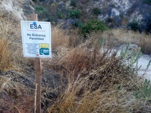
Many people have been wondering about the signs that were placed along Brown Mountain fire road (FS 2N70) over the past few months. The signs are ESA notices (Environmentally Sensitive Areas) which state “No Entrance Permitted” and have been placed there by the Tehachapi Renewable Transmissions Project (TRTP).

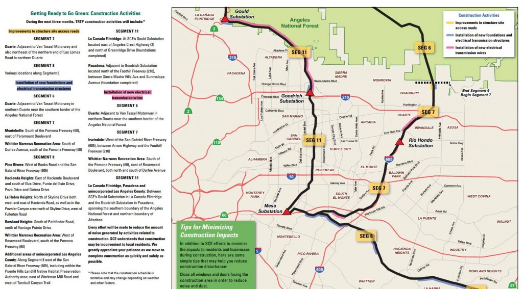
This is one of the most popular trails for off-road cyclists in the Angeles National Forest, because of its proximity to JPL and the Altadena/Pasadena community. It lies in Segment 11 of the project, which includes much of the Angeles National Forest front country through La Canada and Altadena.

The TRTP Environmental Impact Report states that this fire road is not intended to be part of the project. Elsewhere along the transmission line project towers are being replaced by helicopter and in some cases, by road access. The towers accessed along Brown Mountain fire road are not being replaced, but they are being re-wired from the Chaney Trail road access to the east.  The re-wiring will nearly double the power-carrying capacity of the transmission lines, helping bring more renewable energy from Kern County to greater Los Angeles.

When the EIR for the project was completed the fire road was a wide fire road and easily traveled by high-clearance vehicles. Since the Station Fire it has grown in to a narrow single track in many places, and is not accessible to vehicles.  We anticipate the fire road will eventually be graded back to its original width, and if we learn of any plans, we’ll be sure to pass them on.

According to local SCE Public Affairs officer Shannon Widor, the following information was supplied by the construction team in response to our questions:

  • There will not be full closures of the trails in the area of trail 2N70 and Brown Mountain Road as part of SCE’s Tehachapi project.  While trails will remain accessible for trail users, there may be periodic, brief delays on trails in construction areas at times when work activities cross those trail sites.
  • SCE’s work will also include the use of temporary guard structures (to keep wires elevated during installation) at street and trail crossings to enhance safety during construction.
  • Additionally, SCE has no plans to grade Brown Mountain Road at this time.

We can only assume that the signs are meant to remind employees and construction workers of sensitive areas to avoid, and in no way indicate any intention to close the trail/s.

The project also includes an eastern corridor that will include Van Tassell Motorway and fire roads above the Monrovia/Duarte area, as well as Workman Hill and other Habitat Authority lands around Turnbull Canyon.   Construction updates, in the form of quarterly newsletters, are available online. The current newsletter indicates that road improvements will be taking place in some areas in preparation for construction, and that re-wiring of Segment 11 between the Gould and Goodrich Substations will begin.

TRTP 3rd Quarter Construction Update

Double-Click the image for a larger version


The project is estimated to be completed in 2015, but for the moment we can continue to enjoy Brown Mountain fire road in its current narrow configuration for the immediate future.


IMBA Trail Care Crew comes to the Angeles National Forest

Wednesday, October 31st, 2012

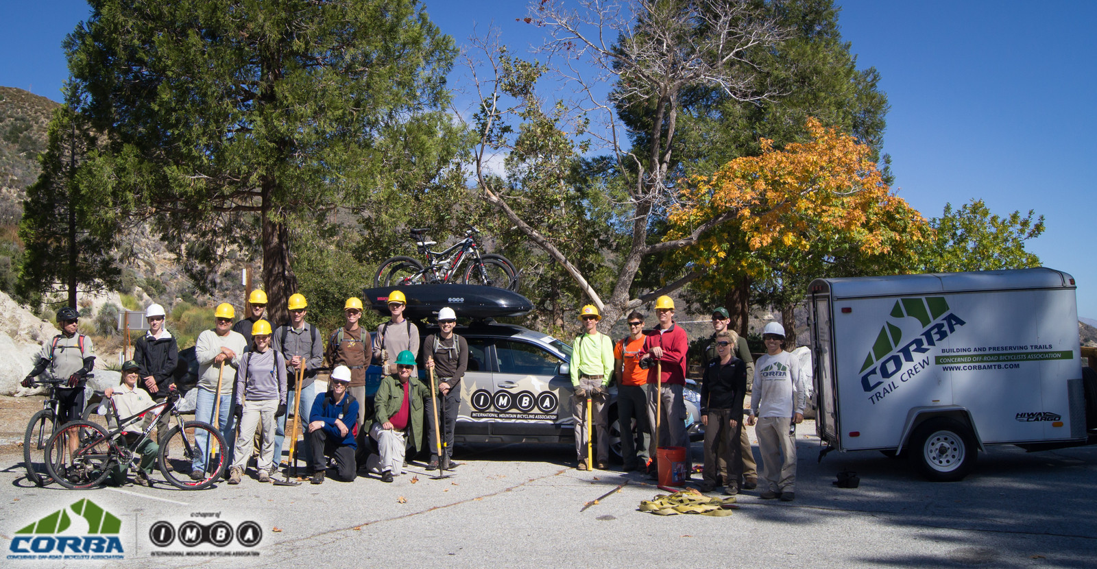
The weekend of October 20, together with the Mount Wilson Bicycling Association, CORBA hosted the IMBA Trail Care Crew for a visit to the Angeles National Forest. By all measurements, the visit was a great success, even as over 180 volunteers, 30 of them from CORBA, helped build trails in the Conejo Open Space on a conflicting event.

IMBA Trail Care Crew Visit with CORBA

IMBA Trail Care Crew Visit with CORBA


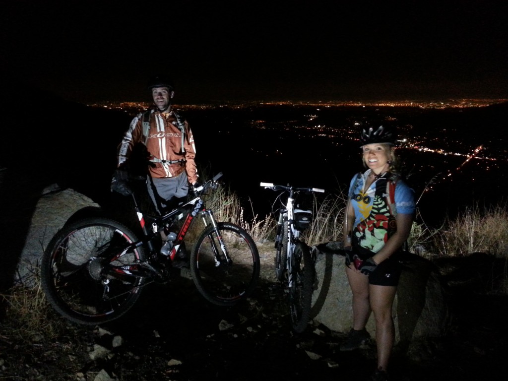
Jesse and Lori, Night Ride

Jesse and Lori, natives of Missouri, are six months into their two-year tour as the IMBA Trail Care crew.  Their visit to the San Gabriels started with a Thursday Night ride on the most recently re-opened singletrack trail in the San Gabriels, the Rim of the Valley Trail on Mount Lukens. This trail has undergone extensive restoration by a dedicated crew of City of Glendale volunteers, with earlier work done by CORBA’s former Trail Crew leader, Hans Kiefer a professional trailbuilding contractor and owner of Bellfree Contractors. The trail was in the best condition it has ever been in, aside from a burnt and mangled bridge near the bottom. The volunteer crew were able to cut a narrow trail around the bridge, though for most it will be a hike-a-bike. It’s a steep trail, with lots of very tight switchbacks and cliff-side exposure, definitely not for everyone.

Friday, October 19, day two of the visit, Steve Messer, and the TCC’s Jesse and Lori were joined by Gabriel Wanderley who is touring the country to learn about trail issues to take back to his native Brazil. He is hoping to get IMBA Brazil up and running over the coming year, expanding IMBA’s international presence. The four went up to Strawberry Peak Trail, for which CORBA has received a generous grant from REI to help rebuild, to map out a re-route. Messer had previously hiked the general corridor of the re-route with the Forest Service archaeologist, after the previous planned re-route was found to pass through a sensitive area.  As the crew familiarized themselves with the terrain, the general route was marked and rough-flagged in prep for the following day’s class.


(more…)

Rim of the Valley Corridor Preliminary Findings – Public Hearings in November

Thursday, October 25th, 2012

The Special Resource Study for the Rim of the Valley Corridor has been released. While we have not yet had a chance to look at the proposed alternatives, we will do so in the coming weeks and after the first round of meetings. We reported on the ROTV corridor study’s release of Scoping comments in 2011.  The alternatives presented in Newsletter #3 should address and consider these comments.

The four alternatives presented are:

  • Alternative A: No Action (A continuation of current management)
  • Alternative B: Cooperative Conservation Partnership
  • Alternative C: Connecting Urban Parks – Santa Monica Mountain National Recreation Area Boundary Adjustment
  • Alternative D: Connecting Natural Habitat – SMMNRA Boundary Adjustment

While all these alternatives have their advantages and disadvantages, there is an overlapping study for the San Gabriel Watershed and Mountains Special Resource Study. It’s unclear from these preliminary documents how these two studies overlap, and how much of the effort in each is a duplication.

It is within CORBA’s mission to help protect and preserve our open spaces and public lands, in addition to providing access to those public lands through natural-surface, shared use trails. None of the alternatives presented in this newsletter outline any specific actions with regards to the Rim of the Valley Trail, but rather, provide an outline for the role the National Park Service might play in its future development and management.

We’ll look over these alternatives and publish our comments, and strongly encourage others to also comment by the January 7 deadline.

Below the break is the meeting schedule and offical notice for the study, which can be downloaded here.

——————————————————————————————————————

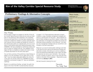
Preliminary Findings & Alternative Concepts Newsletter Available for

Rim of the Valley Corridor Special Resource Study

Dear Friends,

We are happy to report our progress on the Rim of the Valley Corridor Special Resource Study, and we invite your feedback on the preliminary ideas which are presented in our recently published Newsletter #3. The newsletter includes preliminary study findings that address whether resources of the study area are nationally significant, and whether they are suitable and feasible for inclusion in the national park system as a new park unit or as an addition to Santa Monica Mountains National Recreation Area (SMMNRA). Based on these preliminary findings, four preliminary alternative concepts are also presented in the newsletter for your consideration. Please send us your comments by January 7, 2013. 

The four preliminary alternative concepts presented in the newsletter illustrate different ways of providing protection and public enjoyment of resources that have been identified as potentiallynationally significant.  They include different levels and types of involvement by the National Park Service (NPS). Most importantly, these preliminary alternative concepts serve as a starting point for discussion and public input.

Please tell us what you think about the alternative concepts. Do you like one particular concept more than the others? Do you like various elements of each of the concepts? Do you have an entirely different vision of how the area should be managed? Your comments will help us refine the concepts and will ultimately lead to a recommendation to Congress.

We have scheduled seven public meetings extending through the month of November, concluding with a final meeting in early December. During these meetings, we will update you on our progress on the Rim of the Valley Corridor Special Resource Study and listen to your thoughts and ideas. Dates, times and locations of these meetings are listed below.  The NPS will also host a virtual public meeting online. Information on the virtual public meeting will be posted on the study website.

We look forward to hearing from you!


Wednesday, November 7, 7 – 9 p.m.
Conejo Recreation and Parks District, Community Room
403 W. Hillcrest Dr., Thousand Oaks,CA 91360

Thursday, November 8, 7 – 9 p.m.
George A. Caravalho Santa Clarita Sports Complex, Activities Center Building
20880 Centre Point Parkway
Santa Clarita, CA 91350

Tuesday, November 13, 6:30 – 8:30 p.m.***
Pacific Community Center
501 S. Pacific Ave.
Glendale, CA 91204

Thursday, November 15, 7 – 9 p.m.
Mason Recreation Center
10500 Mason Ave.
Chatsworth, CA 91311

Tuesday, November 27, 6:30 – 8:30 p.m.
Encino Community Center Women’s Club
4935 Balboa Blvd.
Encino, CA 91316

Thursday, November 29, 7 – 9 p.m.***
Moorpark Community Center
799 Moorpark Ave.
Moorpark, CA 93021

Saturday, December 1, 10 a.m. – noon
Eaton Canyon Nature Center
1750 North Altadena Dr.
Pasadena, CA 91107

CORBA Awarded Grant from REI

Wednesday, October 10th, 2012

CORBA’s trail crew was recently awarded a grant from REI for the restoration of the Strawberry Peak trail. Strawberry Peak Trail was severely damaged in the Station Fire of 2009, and remains closed to all users.

Most of the trail was devastated by winter rains in the two winters after the great fire had decimated the vegetation. Above average rainfall and heavy storms sent debris flows across the trails. Wooden retaining walls that supported the trail were burned away and need to be replaced. The trail is in need of much work.

We hope to re-route around this troublesome section near Redbox

We hope to re-route around this troublesome section near Redbox

The REI grant will be matched with funds from the National Forest Foundation, as much of the trail lies in the Big Tujunga drainage, a designated NFF Treasured Landscape. The funds will be used for the purchase of additional tools, materials needed for the repairs and supplies for volunteers. Additionally, the funds allow for a private contractor to be utilized to do some of the heavy work, allowing volunteers to repair the retaining walls and do the finish tread work. We will also work alongside other groups, including the Sierra Club to restore this iconic and much-loved trail.

When reviewing the trail post-fire, the particularly troublesome section of trail where the trail leaves the old Barley Flats fire road, was a deep and long ravine. We proposed re-routing this section of trail to avoid the fall line rocky section. That re-route is pending review by the Forest Service. We hope to have approval for the re-route in time for the IMBA Trail Care Crew’s visit on October 20/21.

Over the coming year we will have regular work days on the Strawberry Peak trail. If you care about this trail, watch our calendar for upcoming trailwork dates, and email trailcrew@corbamtb.com to let us know your interest. We plan to kick off the trailwork with an upcoming visit from the IMBA Trail Care Crew.

A previous REI grant allowed CORBA to restore several trails in the Station Fire burn area which are now open and in use. We are truly grateful to REI for their ongoing support of this, and many other CORBA programs.

CORBA Presentation for Land Managers, October 19, 2012

Monday, October 1st, 2012

CORBA and our neighboring IMBA chapter, the Mount Wilson Bicycling Association, will be co-hosting the IMBA Trail Care Crew for a visit to our local mountains. As a part of their visit, we are together hosting a session for Land Managers. The session will introduce you to IMBA as an organization. Attendees will learn how we, as local IMBA Chapters, can help land managers with their trails and open space programs, as well as up-to-date techniques and principles of trail design and construction. Additionally the Trail Care Crew will teach a one-day trailbuilding and maintenance class for volunteers.

The IMBA Trail Care Crew is world-renowned for their expertise in trail design, maintenance, and other issues. This is a unique opportunity to learn from those who live, breathe, and eat multi-use trails year-round, and to exchange ideas about trail construction, conflict resolution and other issues shared by most land managers.

The session is being held at the Angeles National Forest headquarters.

From the IMBA web site: “The Land Manager training educates land managers on IMBA and the practice of designing, building and maintaining sustainable trails; as well as the importance of partnerships with local mountain biking organizations to achieve great trails. The curriculum is geared toward land managers who oversee land that is either provides, or has the potential to provide mountain biking opportunities. This presentation is essential to inform land managers and community leaders on how to partner with clubs to build responsible, thoughtful trails. This presentation helps grow local group’s trust in IMBA, trail building and mountain biking.”

Besides the United States Forest Service, California State Parks, and Los Angeles County Parks and Recreation, we cordially invite all local government agencies and trail advocacy organizations in our area. The session size is limited to 30 people.

Please RSVP or email any questions to steve at corbamtb.com, or call 323-743-3682. 

IMBA Trail Care Crew with CORBA and MWBA
Land Managers’ Workshop
Friday, October 19, 2012, 1pm – 4pm.
Angeles National Forest Headquarters
701 N. Santa Anita Ave,
Arcadia, CA 91006

Directions: Google Map. If you are on the 210 freeway heading east, exit Santa Anita Avenue, and turn right at the off-ramp. Then turn immediately right into the ANF Headquarters, just a few yards south of the off-ramp. From the 210 west, turn left, proceed under the freeeway, and look for the first driveway after passing the eastbound freeway off ramp.

Canyon Trail and Vasquez Rocks – Meeting Thursday July 12

Tuesday, July 10th, 2012

The County’s objective assessments of the Canyon Trail in Placerita Canyon Natural Area, and the Heritage trail in Vasquez Rocks, have been completed.  By applying the State’s Change In Use survey, objective data was gathered about these two trails.

The study concluded that Canyon Trail can be made suitable for multi-use designation including bicycles. It will require some modifications including pinch points, signage, and a designated walk-your-bike section. The trail, irregardless its potential for a multi-use designation, was found to be needing additional trailwork and restoration in several areas. We hope that the modifications needed to allow bicycles can be given priority over other needed trailwork.

Heritage trail, on the other hand, was found to be unsuitable for multi-use designation. The primary reasoning behind this finding is a lack of connectivity to other trails that allow bicycles, and the availability of an alternate route. Extensive impacts were noted from existing users (hikers and equestrians) that would require significant restoration.

While these findings might make sense if Heritage trail were the only candidate for opening to bicycles, there are many miles of trails in Vasquez Rocks. Mountain Bikers from the Santa Clarita Valley did not specifically ask for the Heritage trail to be considered for multi-use, they asked for the Vasquez Rocks Natural Area to be considered for multi-use including all its trails.

In fact, CORBA would like to know what objective data the County’s “no bicycles in Natural Areas” was based. By what process was this policy formulated?

CORBA supports the County’s assessment of the Canyon trail and the recommendation to open it to bikes. We do feel, however, that the assessment of Vasquez Rocks is incomplete as only one trail has been assessed. The fact that the only trail assessed in Vasquez Rocks has seen such significant impacts from existing users, underscores the point that all users have impacts, and bicycles in that respect are very similar to other trail users. We urge the County to complete the assessment of Vasquez Rocks’ trails and to consider future potential connectivity of all trails as a whole.

We also feel that the inclusion of State draft studies should not be cited as evidence until they are fully vetted and published, and the classification of bicycling as an incompatible “active recreation” is inaccurate.

The County will be hosting a public meeting on Thursday, July 12 to formally present the findings and take public comments. There is expected to be a large and organized opposition from other user groups present at tomorrow’s meeting, unlike the first meeting in which mountain bikers made up the vast majority of the attendees. The SCV Trail Users group did a great job of gathering and organizing local mountain bikers during the first meeting, and have continued to provide leadership on these issues, with the full support of CORBA and IMBA.

Please attend this meeting and let your voice be heard:


6pm, Thursday, July 12, 2012. 

William S. Hart Park – Hart Hall  (map)

24151 Newhall Ave, Newhall, CA 91321, USA

Consider RSVP’ing to the SCV Trail Users Facebook event: https://www.facebook.com/events/246695458775275/

National Trails Day at Redbox, Angeles National Forest

Thursday, May 31st, 2012

Saturday June 2, 2012 – Saturday June 2, 2012

Angeles Crest Highway at Mt. Wilson Road.

View MapMap and Directions | Register

Description:

Join CORBA, the Mount Wilson Bicycling Association, the National Forest Foundation and the Boy Scouts of America on National Trails Day, June 2nd. We’ll be working on the Gabrielino trail between redbox and switzers, and/or the Strawberry Peak trail. REI is sponsoring the event by providing lunch.

You must wear long pants and long sleeves, with sturdy shoes. Bring gardening gloves if you have them, but if not gloves will be supplied. Hard hats will also be supplied, but you’re welcome to bring your own. No shorts, t-shirts, flip flops or sandals please. Bring a water bottle or hydration pack, trail snacks and sunscreen.


Register

Recommended Wilderness Proposals in our National Forests

Thursday, May 31st, 2012

In response to a lawsuit, the four Southern California Forests are proposing amendments to their 2006 plans. They are proposing new Backcountry Non Motorized Recreation zones as well as new Recommended Wilderness designations. Several mountain bikers attended the informational workshop at the Angeles National Forest Headquarters on May 30, along with concerned forest users, and many from groups like the Sierra Club, The Wilderness Society and others.

In the Angeles National Forest there is a recommended Salt Canyon, Fish Creek roadless areas were combined to create a 40,000 acre Recommended Fish Creek Wilderness in an area that was Backcountry Non-Motorized. It is now Forest Service policy that a Recommended Wilderness designation will be managed as if it were wilderness and the area will be closed to bikes.

Concerns have been raised about the status of several significant nearby trails that bicyclists ride. We’re happy to report that the Golden Eagle Trail and the Warm Springs/Elderberry Forebay/Fish Canyon fire road Loop are unaffected by this proposal. Wilderness boundaries have been drawn with “cherry stems,” areas of non-wilderness along the existing fire road corridors. the same has been done for the Burnt Peak fire road.

We do have concerns about the Fish Canyon Trail (1GW05) and the Burnt Peak Trail (1GW02). These run generally north-south right in the middle of what would be the new Wilderness. We heard from several people that these trails may be overgrown and quite deteriorated. We need to know if riders have ridden them and are currently riding them. Despite their current condition, if they go into Wilderness, bikes will be excluded and the trails will likely never be restored due to Wilderness Trail maintenance issues. We might lose a significant future opportunity for a ride in a wild landscape. If you have information about these trails, let Steve Messer (steve@corbamtb.com) and Jim Hasenauer (imbajim@aol.com) know.

There are also many changes including Recommended Wilderness Proposals in the Cleveland National Forest, the Los Padres National Forest, and the San Bernadino National Forest. Unfortunately for those who visit all four forests, only the Angeles National Forest proposed management plan revisions were available for review at last night’s event.  If you are concerned about changes in other forests, it will be necessary to meetings. Mountain bike advocates are monitoring the meetings and will soon have talking points for your comments. The deadline for comments is June 11, 2012.

Information about the Forest Manamagement Plan revision process is at http://www.fs.fed.us/nepa/nepa_project_exp.php?project=35130

CORBA”s first comment is that the online data supplied is not of sufficient detail or quality to make informed decisions about any new proposed changes in the management plans for the forests. Without real data that we can zoom in on (digitally) and use with the mapping and GIS tools with which we’re familiar, it is impossible to see what areas and trails may be affected in the detail needed to make informed comments. We’d like to see KML or Shapefiles that can be used with the most popular mapping tools for this, and any future NEPA or CEQA documents.

Though we don’t know the current state or conditions of the Fish Canyon and Burnt Peak singletracks, we would like to see the boundaries adjusted to allow continued bicycle access to these trails. We’ll formulate our final comments after we gather more information on these and other affected trails.  Deadline for comments in June 11.

The current designation: Backcountry non-motorized:

The proposed Recommended Wilderness (in dark green):


Remaining meetings are scheduled as follows:


• May 31,2012, 4:00PM to 7:00PM, Santa Maria Red Cross, 3030 Skyway Drive, Santa Maria, CA 93455 (Hosted by Los Padres National Forest)
• May 31, 2012, 4:00PM to 7:00PM, Santa Clara Mojave Rivers Ranger District Office, 33708 Crown Valley Road, Acton, CA 93510
• May 31,2012,4:00 PM to 7:00PM, San Bernardino National Forest Headquarters, 602 S. Tippecanoe Ave., San Bernardino, CA 92408.
• May 31, 2012,4:00 PM to 7:00PM, Palomar RangerDistrictOffice, 1634 Black Canyon Road, Ramona, CA 92065 ·
• June 1, 2012, 1:00PM to 4 PM, Frazier Park Library, 3732 Park Drive, Frazier Park, CA 93225 (Hosted by Los Padres National Forest)
• June 5, 2012, 4:00PM to 7:00PM, Descanso Ranger District office, 3348 AlpineB!vd, Alpine, CA 91901
• June 5, 2012,4:00 PM to 7:00PM, Trabuco Ranger District office, 1147 E. 6th Street, Corona, CA 92879


Angeles National Forest Open and Closed Trails – May 2012

Friday, May 25th, 2012

As we approach three years since the Station Fire began, the Forest Service has revised the closure order which has been in place to allow the forest to recover, and to protect the safety of forest visitors. This is an updated list from our May 2011 list of open and closed trails.

The two questions we have been asked more than any other recently: “which trails are closed in the Angeles National Forest?  and “which trails are open in the Angeles National Forest?”

According to the Forest Service map of the station fire closure area at http://maps.fs.fed.us/stationfire/ the list below shows the status, effective May 25 2012, of some of the more popular trails that were affected by the Station Fire. Keep in mind that even though these trails are in the newly opened areas of the forest, the individual trails may be signed closed.  Please respect any trail closure signs and stay off those trails for your own safety and the recovery of the forest.

Many of the trails will not be in good shape, so be prepared for surprises like downed trees, slides, washouts, ruts, and other hazards. Many trails have been drastically changed from before the Station Fire. Many fire roads have not yet been graded and may be much narrower and in very poor condition with ruts and washouts. All the usual caveats about trail safety apply so use the trails safely and responsibly, and be especially careful the first time you travel on one of the newly opened trails.

Opened Trails (As of May 25, 2012) 

  • Brown Mountain (to the saddle)
  • El Prieto
  • Gabrielino (JPL to Paul Little)
  • Gabrielino (Switzers to Redbox to Chantry)
  • Bear Canyon Trail
  • Sam Merrill Trail
  • Castle Canyon Trail
  • Sunset Ridge Trail
  • Mt. Lowe West Trail
  • Idlehour Trail
  • Kenyon Devore Trail
  • Rim Trail
  • Sturtevant Trail
  • Santa Clara Divide Truck Trail (Dillon Divide to Mt. Gleason to Three Points – non-motorized only)
  • Chilao Loop/Mt. Hillyer
  • Silver Mocassin
  • Valley forge
  • Mueller Tunnel
  • Mt. Disappointment
  • San Gabriel Peak
  • Earl Canyon
  • Haines Canyon
  • Rim of the Valley
  • Hoyt
  • Stone Canyon
  • Trail Canyon
  • Condor Peak
  • Fall Creek Canyon
  • Mt Lukens Fire Road
  • Grizzly Flat Fire Road
  • Doc Larsen
  • Rattlesnake Trail
  • Everything east of Chilao

Keep in mind that even though these trails are in the opened area, the individual trails may be signed closed (And those signs mustl be respected). Many of the trails will not be in good shape, so be prepared for surprises like downed trees, massive ruts or slides, washouts, and other hazards.

Closed Trails (Until Further Notice)

  • Strawberry Peak
  • Tom Sloan
  • Dawn Mine
  • Millard Falls
  • Upper Brown Mountain (Saddle to the Summit/Ken Burton)
  • Ken Burton
  • Gabrielino from Switzers to Paul Little
  • Crescenta View
  • Alder Creek
  • Colby Canyon
  • Josephine
  • Vetter Mountain

In addition to the above a separate closure remains in effect for the Williamson Rock area  (Closure Map is available).