Archive for the ‘Angeles National Forest’ Category

Angeles National Forest Land Management Plan Ammendment Comments

Friday, June 8th, 2012

We recently put out an alert  about court-ordered changes to the Land Management Plans for our four Southern California National Forests. We’ve now attended the public meetings, pored over maps and GIS data and have put together our official comments on the plan, available as a PDF, and copied below.

IMBA has recently put out an action alert and petition to preserve mountain bike access to all existing multi-use trails in our four National Forests. We encourage everyone to sign the petition.

In the Angeles National Forest the only area in which we see the potential for problems is the proposed change of the Salt Creek and Fish Canyon Inventoried Roadless Areas into the combined Fish Canyon Recommended Wilderness (RW).  The Golden Eagle trail is an extremely popular, well-documented trail used frequently by bicycles. It is not on any forest service maps and is not an offiicial forest service trail, though it has existed for at least 25 years. We would of course like to see this brought into the trail inventory, and excluded from any recommended wilderness. The trail lies outside the RW, except for one section where it is impossible to tell from the data supplied whether it touches the RW boundary, or crosses it.  We would like to see the boundary adjusted to provide a reasonable buffer between this trail and the RW.

Similar incursions into or across the RW boundaries appear to occur on the fire roads to Knapp Ranch and Atmore Meadows. They are probably just anomalies of the scale of maps used and data supplied, but must be clarified to be sure these fire roads are outside any RW.

The RW includes several miles of singletrack trails that have a history of bicycle access. These include the Burnt Peak Canyon trail and Fish Canyon trail. However, both of these trails are in a dilapidated state and have seen very little use by bicycles, or other users for that matter. In his 1990 guidebook to the area, Mike Troy describes the Fish Canyon trail (16W05) as a difficult hike a bike and the trail as unmarked and difficult to follow. The Burnt Peak Canyon trail, on the other hand, is described as a fun, non-technical double-track.  We will endeavor to gather more data about the existing conditions of these trails, but for the moment we are asking that they be left as Backcountry Non-Motorized (BCNM) rather than RW.

While we support the ongoing preservation of our remaining open space and prevention of future disruptive development or extractive use of the land, trails are a limited resource and losing trails reduces our future options for recreational access. A RW designation will make these trails more difficult to restore or maintain, and we risk losing them forever.

We encourage everyone to send comments via email to socal_nf_lmp_amendment@fs.fed.us or snail mail to: Attn: LMP Amendment, Cleveland National Forest, 10845 Rancho Bernardo Road, Suite 200, San Diego, CA 92127-2107.

CORBA’s submitted comments follow the break.


(more…)

California Bicycle Access Threatened

Wednesday, June 6th, 2012

ALERT! Mountain bikers stand to lose treasured backcountry riding experiences in Southern California’s national forests.

Take Action! Let the U.S. Forest Service (USFS) know that you support IMBA’s position to protect mountain bike access. We made it easy, just sign our petition (click on Take Action! at the beginning of this paragraph). Comments are due Mon., June 11.

In the four Southern California national forests: Los Padres, Angles, San Bernardino and Cleveland the USFS is currently planning for management of their backcountry lands. In order to maximize riding opportunities and not lose mountain bike access to trails, it is imperative that you ask the USFS to use a “Backcountry Non-Motorized” designation.

The plans for these forests will decide where mountain bikes are allowed and where we are banned. Their current proposals include “Recommended Wilderness” (banned) and “Backcountry Non-Motorized” (allowed) designations.

In several previous decisions, the USFS decided to manage “Recommended Wilderness” as if it were congressionally designated Wilderness. IMBA strongly objects to this policy.

IMBA needs your help to maximize the riding opportunities in these great forests.

Read more about the project.

National Trails Day at Redbox, Angeles National Forest

Thursday, May 31st, 2012

Saturday June 2, 2012 – Saturday June 2, 2012

Angeles Crest Highway at Mt. Wilson Road.

View MapMap and Directions | Register

Description:

Join CORBA, the Mount Wilson Bicycling Association, the National Forest Foundation and the Boy Scouts of America on National Trails Day, June 2nd. We’ll be working on the Gabrielino trail between redbox and switzers, and/or the Strawberry Peak trail. REI is sponsoring the event by providing lunch.

You must wear long pants and long sleeves, with sturdy shoes. Bring gardening gloves if you have them, but if not gloves will be supplied. Hard hats will also be supplied, but you’re welcome to bring your own. No shorts, t-shirts, flip flops or sandals please. Bring a water bottle or hydration pack, trail snacks and sunscreen.


Register

Recommended Wilderness Proposals in our National Forests

Thursday, May 31st, 2012

In response to a lawsuit, the four Southern California Forests are proposing amendments to their 2006 plans. They are proposing new Backcountry Non Motorized Recreation zones as well as new Recommended Wilderness designations. Several mountain bikers attended the informational workshop at the Angeles National Forest Headquarters on May 30, along with concerned forest users, and many from groups like the Sierra Club, The Wilderness Society and others.

In the Angeles National Forest there is a recommended Salt Canyon, Fish Creek roadless areas were combined to create a 40,000 acre Recommended Fish Creek Wilderness in an area that was Backcountry Non-Motorized. It is now Forest Service policy that a Recommended Wilderness designation will be managed as if it were wilderness and the area will be closed to bikes.

Concerns have been raised about the status of several significant nearby trails that bicyclists ride. We’re happy to report that the Golden Eagle Trail and the Warm Springs/Elderberry Forebay/Fish Canyon fire road Loop are unaffected by this proposal. Wilderness boundaries have been drawn with “cherry stems,” areas of non-wilderness along the existing fire road corridors. the same has been done for the Burnt Peak fire road.

We do have concerns about the Fish Canyon Trail (1GW05) and the Burnt Peak Trail (1GW02). These run generally north-south right in the middle of what would be the new Wilderness. We heard from several people that these trails may be overgrown and quite deteriorated. We need to know if riders have ridden them and are currently riding them. Despite their current condition, if they go into Wilderness, bikes will be excluded and the trails will likely never be restored due to Wilderness Trail maintenance issues. We might lose a significant future opportunity for a ride in a wild landscape. If you have information about these trails, let Steve Messer (steve@corbamtb.com) and Jim Hasenauer (imbajim@aol.com) know.

There are also many changes including Recommended Wilderness Proposals in the Cleveland National Forest, the Los Padres National Forest, and the San Bernadino National Forest. Unfortunately for those who visit all four forests, only the Angeles National Forest proposed management plan revisions were available for review at last night’s event.  If you are concerned about changes in other forests, it will be necessary to meetings. Mountain bike advocates are monitoring the meetings and will soon have talking points for your comments. The deadline for comments is June 11, 2012.

Information about the Forest Manamagement Plan revision process is at http://www.fs.fed.us/nepa/nepa_project_exp.php?project=35130

CORBA”s first comment is that the online data supplied is not of sufficient detail or quality to make informed decisions about any new proposed changes in the management plans for the forests. Without real data that we can zoom in on (digitally) and use with the mapping and GIS tools with which we’re familiar, it is impossible to see what areas and trails may be affected in the detail needed to make informed comments. We’d like to see KML or Shapefiles that can be used with the most popular mapping tools for this, and any future NEPA or CEQA documents.

Though we don’t know the current state or conditions of the Fish Canyon and Burnt Peak singletracks, we would like to see the boundaries adjusted to allow continued bicycle access to these trails. We’ll formulate our final comments after we gather more information on these and other affected trails.  Deadline for comments in June 11.

The current designation: Backcountry non-motorized:

The proposed Recommended Wilderness (in dark green):


Remaining meetings are scheduled as follows:


• May 31,2012, 4:00PM to 7:00PM, Santa Maria Red Cross, 3030 Skyway Drive, Santa Maria, CA 93455 (Hosted by Los Padres National Forest)
• May 31, 2012, 4:00PM to 7:00PM, Santa Clara Mojave Rivers Ranger District Office, 33708 Crown Valley Road, Acton, CA 93510
• May 31,2012,4:00 PM to 7:00PM, San Bernardino National Forest Headquarters, 602 S. Tippecanoe Ave., San Bernardino, CA 92408.
• May 31, 2012,4:00 PM to 7:00PM, Palomar RangerDistrictOffice, 1634 Black Canyon Road, Ramona, CA 92065 ·
• June 1, 2012, 1:00PM to 4 PM, Frazier Park Library, 3732 Park Drive, Frazier Park, CA 93225 (Hosted by Los Padres National Forest)
• June 5, 2012, 4:00PM to 7:00PM, Descanso Ranger District office, 3348 AlpineB!vd, Alpine, CA 91901
• June 5, 2012,4:00 PM to 7:00PM, Trabuco Ranger District office, 1147 E. 6th Street, Corona, CA 92879


Angeles National Forest Open and Closed Trails – May 2012

Friday, May 25th, 2012

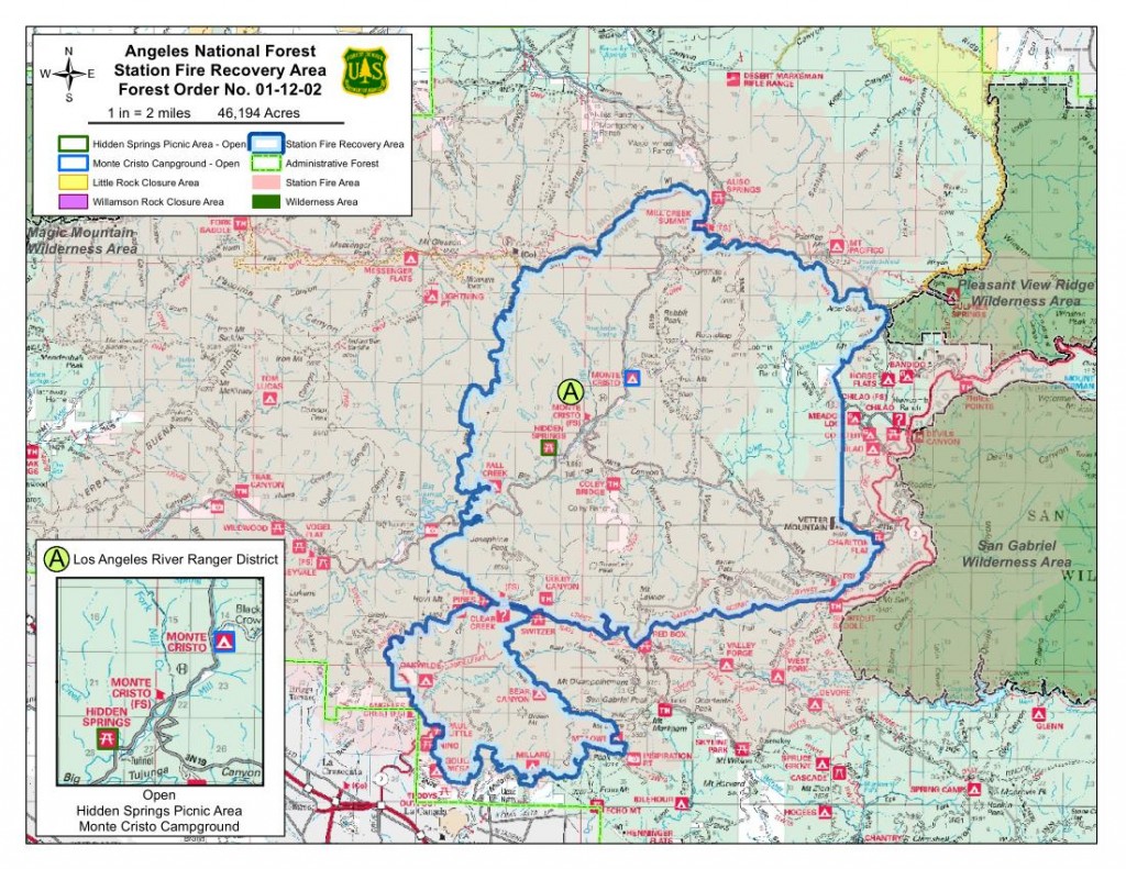
As we approach three years since the Station Fire began, the Forest Service has revised the closure order which has been in place to allow the forest to recover, and to protect the safety of forest visitors. This is an updated list from our May 2011 list of open and closed trails.

The two questions we have been asked more than any other recently: “which trails are closed in the Angeles National Forest?  and “which trails are open in the Angeles National Forest?”

According to the Forest Service map of the station fire closure area at http://maps.fs.fed.us/stationfire/ the list below shows the status, effective May 25 2012, of some of the more popular trails that were affected by the Station Fire. Keep in mind that even though these trails are in the newly opened areas of the forest, the individual trails may be signed closed.  Please respect any trail closure signs and stay off those trails for your own safety and the recovery of the forest.

Many of the trails will not be in good shape, so be prepared for surprises like downed trees, slides, washouts, ruts, and other hazards. Many trails have been drastically changed from before the Station Fire. Many fire roads have not yet been graded and may be much narrower and in very poor condition with ruts and washouts. All the usual caveats about trail safety apply so use the trails safely and responsibly, and be especially careful the first time you travel on one of the newly opened trails.

Opened Trails (As of May 25, 2012) 

  • Brown Mountain (to the saddle)
  • El Prieto
  • Gabrielino (JPL to Paul Little)
  • Gabrielino (Switzers to Redbox to Chantry)
  • Bear Canyon Trail
  • Sam Merrill Trail
  • Castle Canyon Trail
  • Sunset Ridge Trail
  • Mt. Lowe West Trail
  • Idlehour Trail
  • Kenyon Devore Trail
  • Rim Trail
  • Sturtevant Trail
  • Santa Clara Divide Truck Trail (Dillon Divide to Mt. Gleason to Three Points – non-motorized only)
  • Chilao Loop/Mt. Hillyer
  • Silver Mocassin
  • Valley forge
  • Mueller Tunnel
  • Mt. Disappointment
  • San Gabriel Peak
  • Earl Canyon
  • Haines Canyon
  • Rim of the Valley
  • Hoyt
  • Stone Canyon
  • Trail Canyon
  • Condor Peak
  • Fall Creek Canyon
  • Mt Lukens Fire Road
  • Grizzly Flat Fire Road
  • Doc Larsen
  • Rattlesnake Trail
  • Everything east of Chilao

Keep in mind that even though these trails are in the opened area, the individual trails may be signed closed (And those signs mustl be respected). Many of the trails will not be in good shape, so be prepared for surprises like downed trees, massive ruts or slides, washouts, and other hazards.

Closed Trails (Until Further Notice)

  • Strawberry Peak
  • Tom Sloan
  • Dawn Mine
  • Millard Falls
  • Upper Brown Mountain (Saddle to the Summit/Ken Burton)
  • Ken Burton
  • Gabrielino from Switzers to Paul Little
  • Crescenta View
  • Alder Creek
  • Colby Canyon
  • Josephine
  • Vetter Mountain

In addition to the above a separate closure remains in effect for the Williamson Rock area  (Closure Map is available).

50% of Station Fire Closure to Re-open

Thursday, May 24th, 2012

Angeles National Forest supervisor Tom Contreras and District Ranger Mike McIntyre, on Wednesday announced that they were hoping to get approval from the regional director to open approximately 50% of the Station Fire closure area. It only requires a review and a signature, and we hope to have that on Thursday [May 24], in time for the Memorial Day weekend.

Last year the closure order was revised a few days before the memorial day weekend.

The area slated for opening includes everything west of Fall Creek fire road (3N27), which descends from Mount Gleason Road to Big Tujunga Canyon.  Trails in the newly opened area include Stone Canyon, Condor Peak, Trail Canyon and Mendenhall Ridge. Some work has been done on Stone Canyon, Condor Peak trail, and Trail Canyon trail, though their readiness for bicycling is unknown. If these or other trails are not in safe enough condition for public use, the trails will be signed as closed, even though the area is technically open.

Condor Peak was once slated for a wilderness designation, and as a show of protest, CORBA and IMBA led a mass group ride up Condor Peak to demonstrate its viability as a backcountry multi-use trail including bicycles. It’s a steep and challenging trail, and we’ll be very happy to see it opened again.

The announcement was made at a Sierra Club event at Eaton Canyon Nature Center on Wednesday evening, March 23, 2012.  Forest Service staff reported on the station fire recovery efforts. Nathan Sill, staff biologist for the forest reported pre- and post-fire population counts of several endangered species including the Arroyo Toad, Arroyo Chubb, Mountain Yellow-legged frog, Spotted Owl and others. Most of the species covered have shown significant population increases since the fire and are recovering well.

Steve Bear, forester for the Angeles National Forest reported on the controversial re-forestation efforts and the plans for the next five years.

This post will updated when the closure revision is officially announced.

Update: Maps have been released showing the closure:


2012-05-24-station-fire-closure-order

Upper Brown Mountain Trailwork with the SoCal High School League, April 7, 2012

Thursday, April 12th, 2012

Upper Brown Mountain before the 2009 Station Fire was a wide fire road in generally in good shape.  The rains of two winters and eighteen months without public use because of the forest closure have allowed nature to re-claim much of the old fire road. Many large drainages were completely washed out, the hillsides had slid into the road bed, trees were down, and brush was growing back with a vengeance.

Banner gives a safety talk and JHA

Banner gives a safety talk and JHA

Though still officially closed, the Forest Service closure signs have been gone for some time. People have been venturing up there to explore the now dead-end fire road. The fire road has narrowed to a singletrack for most of its length, narrowed by a combination of slough from above, severe erosion from below, and vegetation. Several of the newly narrowed sections were within inches of the edge of the old fire road, a potential hazard when two people are passing each other, or if riding the area at night as the edges were hidden behind grass. There was at least one large tree down, and several killer “snags” dead trees that were partially fallen, leaning against or resting on top of other trees along the trail. These can give at any time, and are a major safety concern on all trails in the burn area. Now two and a half years after the fire, many of these burned trees are rotting and weakening, and the likelihood of them falling increases with time.

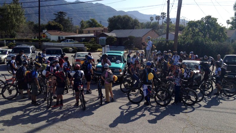
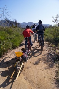
Saturday’s trailwork was led by Banner Moffat of the Friends of El Prieto, and all the SoCal High School League teams and their coaches were invited to participate. Though there were only 35 RSVP’s, 52 people came to the event, a few ready to hike in, but the vast majority ready to ride up to the work site. A few stronger students and a couple of coaches towed BOB trailers full of tools.

Towing the tools up the hard way

Towing the tools up the hard way

Split into crews led by Mitch Marich and Matt Lay of the Mount Wilson Bicycling Association, Steve Messer of CORBA, St. Francis coaches Lee Bird and Joel Sercel and others, the crews spread out along the length of the trail from the Ken Burton trailhead, all the way down to saddle. Downed trees were removed, killer snags taken down, and some drainages were rock-armored and reinforced. The student athletes got a lot done covering most of the sections from the Ken Burton down to the saddle.

The forest service is considering opening Upper Brown Mountain in its next revision of the forest closure order. Without some attention to safety and a demonstration that the community is willing to maintain it as singletrack, it might be a candidate for reopening until graded back to a fire road.

There were in total at least 54 people who volunteered their time. Of those ten were women and 41 were high school students. Teams represented included Crescenta Valley, St. Francis, San Gabriel Composite, Burroughs Burbank, and independent riders from South Pasadena and other areas.

CORBA is proud to support the SoCal High school league, and we applaud their efforts to create a high school program that includes such a balanced mix of teamwork, sportsmanship, competition and stewardship of our trails.


Meet Supervisor Tom Contreras

Friday, April 6th, 2012
Steve Messer, Jim Hasenauer, Tom Contreras, Mike and Robin McGuire and Banner Moffat at Brown Mountain Saddle

Steve Messer, Jim Hasenauer, Tom Contreras, Mike and Robin McGuire and Banner Moffat and Beau at Brown Mountain Saddle

Tom Contreras took the position of Supervisor of the Angeles National Forest in August 2011. Already he’s making an impact, and a very positive one at that.

Tom started his career in 1976 in Utah, and has worked in National Forests all over the western states. He served as the Winter Sports Specialist for the Intermountain Region, where he oversaw ski areas. His most recent post was supervisor of Mendocino National Forest.  His hands-on approach is refreshing and welcomed.

At the first Forest Service Volunteer meeting he attended, he was overwhelmed by the number of people present. Forty-one volunteers, representing many different volunteer groups welcomed him at that meeting. “It was far above my expectations for a volunteer meeting,” he said.  He asked to be invited to visit and work with each group. Today, April 6, 2012, we took him up on that offer.

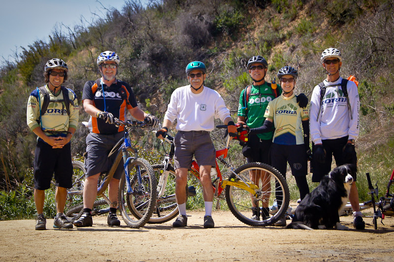
Mike and Robin McGuire of the Angeles Mountain Patrol, Jim Hasenauer of IMBA/CORBA, and CORBA board member Steve Messer of joined Tom for a ride up Brown Mountain to the saddle. Along the way we were caught by Banner Moffatt of the Friends of El Prieto. Banner was prepping for tomorrow’s trailwork on Upper Brown Mountain. Tom is still learning the forest, and though he’s seen most of it from the air, there’s nothing like getting out on the trails on a bicycle.

Already the impact he’s having on the Forest is visible through his direct engagement with the volunteer groups. He can see the passion the many volunteer groups have for the mountains and the trails, and his passion is equally evident. He brings a new sense of urgency and passion to solving the many problems faced by the forest, and we are confident the forest is in good hands.

We look forward to working with Supervisor Tom as we continue to restore and maintain trails within the Angeles National Forest for the enjoyment of all.


SoCal High School League Trailwork – Brown Mountain 4/7/2012

Wednesday, March 14th, 2012

Saturday April 7, 2012 – Saturday April 7, 2012

North Windsor Avenue

View MapMap and Directions | Register

Description:

On April 7, 2012, CORBA will be combining forces with the Friends of El Prieto, Pasadena Mountain Bike Club, and Mount Wilson Bicycling Association to invite So Cal High School league athetes, coaches and team managers to work on Upper Brown Mountain. This trailwork event is only for those groups. 

This trail is still officially closed from the saddle to the top of Ken Burton due to the station fire, though we and the forest service are aware that many people have been using it. There are a few dangerous sections near exposed cliff edges that we’ll be moving and/or repairing. We will cut back brush, and prepare the trail to be officially opened for public use by the Forest Service.

Though it is officially a fire road, most of Upper Brown Mountain has narrowed down to singletrack since the Station fire. Sloughing off of the slopes above, and growth of vegetation have narrowed it to a fun trail. The Forest service has no immediate plans to grade the fire road back to its full width, though it will happen eventually, especially if needed to attend to a fire or other emergency. In the meantime, we get to enjoy the extra singletrack out-and-back, and with this trailwork, make it a little safer.

Remember you’ll be required to bring long pants and a long sleeve shirt. We will supply a hard-hat and gloves.  Sunglasses or other eye protection are required if you will be using swinging tools.

It will be a unique experience for many, as we’ll be riding in to the trailwork site. The trailwork is happening on Upper Brown Mountain, from the saddle up to the top of Ken Burton trail where there is no vehicle access. Approximately five or six stronger riders will tow trailers full of tools, and others may carry smaller tools in backpacks. Be prepared for a climb of between 3 and 5 miles, depending where you start working on the trail. Since long pants and long sleeves are required, we suggest bringing them in your backpack. Bring plenty of water and snacks for the trailwork.

Afterwards we’ll ride back out to the parking area. Be sure to RSVP by Friday, April 6.  The Forest Service has asked us to collect additional demographic data for all volunteers such as age group and gender.

The SoCal High School League encourages all teams to put in at least one day of volunteer trailwork on the trails on which they ride, race and/or train. If you’ve never done trailwork, don’t worry. There will be plenty of options to learn, and group leaders will be there to make sure everything gets done correctly.

Register

CORBA is part of a larger multi-use oriented Volunteer Community in the Angeles National Forest

Tuesday, February 28th, 2012

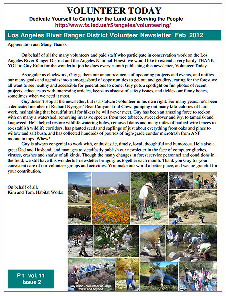
Feb 2012 Volunteer NewsletterIn many discussions between different trail user groups, the fact often emerges that we all share many common goals and attitudes about trails. Most trail user groups want to help maintain trails for the benefit of all; they want to minimize damage to our public lands, while preserving recreational access in perpetuity. We want to protect and preserve what precious little open space remains for future generations to enjoy and recreate; we want our children and successors to be able to experience the great outdoors, learn from it, and be inspired by the wonders of nature. We want to see responsible trail use, with mutual respect for other trail users, for wildlife and nature, and for the environment.

Where all these groups sometimes differ is how we choose to enjoy our public lands, and the extent or methods of the protections needed to achieve those goals. Some choose to ride mountain bikes; others prefer to hike, trail run, climb, ride horses, take OHV’s, sail, kayak, camp and and any number of other activities. We all seek the peace of the forest and to escape the city in our great mountains. While there are differences, the common grounds are what should bring us together.

This is nowhere more evident than in the Angeles National Forest, where trails (outside of wilderness areas) are all multi-use. The Forest Service’s multi-use policy fosters cooperation and where needed, compromise between these groups. Every other month volunteers from the LA River Ranger District of the Angeles National Forest gets together with forest officials to be updated on what’s happening in the forest, what each group is working on. We share information and first-hand reports of our accomplishments, our upcoming projects and our observations with each other and Forest Service officials. It’s a great way to coordinate activities, and set up collaborations that further our common goals. Similar meetings take place in other districts in this, and other National Forests.

The various volunteers groups are each passionate about what they do, whether it is acting as campground hosts, patrolling trails, doing trailwork, protecting and documenting forest history, restoring habitat, removing invasive plants, or just disseminating information and respect for the forest among their members and supporters.

Each month intrepid volunteer Guy Kuhn puts together the volunteer newsletter, a summary of the reports and interactions from each of the meetings and gleaned from the web sites of each volunteer group. CORBA reports on our trailwork projects, completed and upcoming, along with fellow IMBA chapter Mount Wilson Bicycling Association. Forest officials give us the inside information on what’s happening in the forest, and what we can expect in the coming months. We learn the fiscal and other challenges faced by the forest, and look for ways to contribute.

The multi-use policy and resulting cooperation between user groups is a win-win for everyone involved. The Forest would be hard-pressed to function without its volunteers.

If you’d like to learn more read the latest volunteer newsletter featuring reports on trailwork projects from CORBA, MWBA, San Gabriel Mountains Trailbuilders, Mounted Patrol (equestrian), Angeles Mountain Bike Patrol, Sierra Club, Boy Scouts, Forest Lookout association and other groups.