Archive for the ‘Angeles National Forest’ Category

San Gabriel Watershed and Mountains Special Resource Study – Revised Draft Released

Friday, October 28th, 2011

The National Park Service is conducting a “special resource study” of portions of the San Gabriel River watershed and the San Gabriel Mountains. CORBA attended the previous round of public input sessions and reported on the process in 2009.  In the original study proposal there were three alternatives presented, A, B, and C.  We supported and recommended a combination of the areas proposed in Alternative A and the management strategies proposed in Alternative C.

In the recently released executive summary, the NPS reports that it has made the following determinations about the study area:

  • Natural and cultural resources of the San Gabriel Mountains and Puente-Chino Hills are nationally significant, in that they meet all four of the NPS criteria for national significance.
  • The study area is suitable for inclusion in the national park system because it represents natural and cultural resource types that are not already adequately represented in the national park system or protected by another land managing entity.
  • The NPS determined that a collaborative partnership based park unit which respects the complex mix of land use, ownership, and regulatory authority in the study area would be a feasible addition to the national park system. A large traditional national park unit, owned and operated solely by the National Park Service, is not feasible.
  • Need for NPS Management: NPS management in partnership with existing agencies and organizations is the best option for enhancing protection of significant resources, for improving access to recreational opportunities in the region, and for providing coordinated interpretation and education about significant resources.

Multi-Use Signs on El Prieto

Monday, August 29th, 2011

Since the trail re-opened in May this year, El Prieto has seen heavy use by cyclists eager to get back to the trails Friends of El Prieto, Banner Moffat mounts the multi-use sign to the newly installed post.they love. Recently there have been a few complaints from hikers being startled by bicycles on El Prieto.

Multi-Use SignCORBA donated to the Forest Service a set of IMBA multi-use trail guideline signs to be installed on El Prieto. Signs are needed to help inform and remind cyclists to be aware of other trail users and slow down and yield to hikers and equestrians. If cyclists want respect on the trails, we have to give respect to other trail users. IMBA’s “Rules of the Trail” are the standard to which we need to hold ourselves and our fellow riders.

Banner Moffat of the Friends of El Prieto and Steve Messer from CORBA spent Thursday afternoon, August 25, carrying in the signs, posts and tools. They installed the first sign near the picnic bench mid-trail that afternoon. The remaining signs at the top and bottom of the trail were installed by Banner and volunteer Ben Bertiger the following day.

All of the trails open to bicycles in Southern California are multi-use, and hikers or equestrians love the trails as much as we do. We urge riders to be respectful of other trail users, to help ensure that these trails remain multi-use, and to strengthen our case to open new trails to bicycles.


Banner and Steve with the newly installed sign


Canyon Trail Closure in Placerita Canyon Nature Center

Monday, August 29th, 2011

The Canyon trail winds its way for 1.85 miles along Placerita Creek between Walker Ranch and the Placerita Canyon Nature Center. It makes a great loop with the Santa Clara Truck Trail and Los Pinetos. For many years cyclists have been riding this great loop, and it is a local favorite. It is one of very few beginner- and kid-friendly trails in the Santa Clarita Valley.

In July 2011 the trail was posted closed to bikes with no public notice, warning or input. Law enforcement have been on hand to ticket cyclists who ignore the signs, or didn’t notice them.

The alternative return route after riding Los Pinetos  is to ride pavement from Walker Ranch out to the Nature Center and back to the usual parking area. This paved, narrow two-lane road has no shoulder and no bike lanes, and is much more dangerous.  There is no alternative easy out-and-back off-road ride for beginners or those looking for an easy ride.

In County Nature Preserves like Placerita Canyon, it is at the sole discretion of the director whether trails are opened or closed to bikes. Local riders have been in contact with the park’s management about the closure, and are working to find solutions to mitigate the concerns that have led to the closure of the trail to bikes.

While it is encouraging to know the County is open to hearing the concerns of local trail users who are directly affected by this closure, to have received no prior official or public notice of the closure has left the local cycling community frustrated and angered. The reasons for the closure were unclear, though environmental impacts to Placerita Creek were initially mentioned. However the trail remains open to equestrians who have much more impact than bicycles. Trail user conflicts seem to be the real reason, though to our knowledge no specific injuries or instances have been cited. 

CORBA has long argued that excluding a user group from a trail only leads to further division among user groups, whereas including all users helps bring the trail user community together to find solutions. As the local cycling community works with the County to find a reasonable compromise to re-open the trail, cyclists should avoid riding the Canyon Trail and obey all posted signs in the area.

Read more of the local perspective from the RightOnSCV.com blog or coverage from The Signal.


Beware the Poodle Dog Bush

Thursday, July 21st, 2011

Poodle Dog Bush, this example about six feet tallThis pretty but toxic native bush is wreaking havoc on many trail users in the recently opened Station Fire area.

Many people have been returning to the Angeles National Forest since the opening of the trails in May. As summer weather entices riders to the high country, many are getting their first glimpses of a changed forest. One of those changes is the abundant Poodle Dog Bush.

Poodle Dog Bush, also known as Common Turricula, or Purple Flower Poodle Bush, is a beautiful purple flowered native bush. It’s an opportunist. Its seeds will lie dormant in chaparral areas for many years waiting for a major disturbance of the soil. Fire is one such disturbance, and the Station Fire has brought the bush back to life with a vengeance.

People often stop on the Angeles Crest Highway or along trails to pick the pretty purple flowers. It is unfamiliar to most people, and quite attractive. It has long slender serrated leaves and flower stems similar in appearance to Phacelia, though it has an upleasant, slightly pungeant odor. The stems grow from the base of the plant and it can grow to eight feet tall.

What people don’t realize is that the bush is covered with tiny hairs similar to stinging nettle, seen clearly in the close-up image below. However, there is no immediate pain or sensation like nettle gives. Poodle Dog hairs will latch on to bare skin or clothing and release a toxin to which most people will have a severe contact dermatitis type reaction. The swelling, rash and itching appear twelve hours to two days after contacting the bush, and the rash can last for two weeks or more and require medical attention. Severe cases can result in large blisters.

Poodle Dog Bush Stalks, clearly showing the fine hairs

The bush is more prevalent at higher elevations, but can appear throughout the recently burned areas. Forest Service officials have stated that the current post-Station Fire bloom is the largest in recent history. Trail users and trail maintenance volunteers need to be especially cautious, as it has appeared along many trails including narrow single track trails where it is difficult to avoid.

If exposed to the bush, avoid scratching the affected area. Clothes, tools or other equipment that has come into contact should be handled with caution and washed separately from other clothes. Calamine or over-the-counter Hydrocortizone cream may provide some relief, but if blisters begin to form medical attention may be required. Poison Oak remedies such as Zanfel or Tecnu have little effect, but washing the area as soon as possible after exposure is advised.

We need to be aware of Poodle Dog Bush. It’s life-cycle can last up to ten years after a significant fire or other disturbance. Eventually it will die off and lay dormant once again, waiting for the next big fire to come back to life.

Charleton Flats/Chilao: Trail Conditions two years after the Station fire – ride report

Sunday, July 17th, 2011

July 9, 2011 – With some trepidation we headed up to the San Gabriels to ride our favorite trail Charleton Flats to Mt. Hilliard. This was our first time seeing the trail after two years of waiting for the area to recover from the devastating Station fire. We wondered if we would find any remnants of the trails that had given us so many of our favorite challenges, weekend warrior tales and weary pleasure savored for days afterwards. Our questions were soon answered with both good news and bad.

First the bad news. From the Charleton Flats picnic area parking lot , the single track heading up towards Vetter Mtn. was mostly rideable but there is some eroded soft spots, a few trees down across the trail and tall purple flowers blooming in profusion everywhere whacked us in the face as we navigated along the faint trace of the trail. We lost the trail somewhere near the road crossing and pedaled up the main road the rest of the way to the summit. Just before reaching the summit, I saw that the Vetter single track is signed “Closed” and to please respect the closure. It is closed from top to bottom. As if it wasn’t badly eroded enough before, I could well imagine it might be completely demolished now. The Lookout burned completely to the ground. The Lookout volunteer who was there explained money is being raised to rebuild it with the help of volunteers.

We descended on the road and turned left to head over to the Silver Moccasin fire road and Chilao. The Silver Moccasin was in pretty good shape not drastically different than two years ago. Perhaps more loose rock and sand. Picking up the single track I was pleased to see it completely intact with little to no damage. However, the surrounding areas on either side of the trail were completely burned. Dead blackened trees and shrubs stood out in stark contrast to the purple flowering plants and greenery beginning to establish itself. This area that was moderately tree and chaparral covered is now so open you can clearly see the Mt. Wilson radio towers in the distance.

Crossing the Chilao Road the trail continued intact with intermittent burned areas merging with swaths of green that survived the blaze untouched. Although we did not meet any other bikers, we did see a pair of hikers and a group of four equestrians. There were several cars parked at Chilao and other vehicles busily zoomed up and down the road. The only significant change to the Silver Moccasin was the creek crossing just before hitting the paved road which used to be rideable, now requires a hike-a-bike across the creek on two fallen trees. At the Chilao Ranger Station, we stopped briefly to get water when we saw the Forest Service staff who were loading a truck start to run, grabbing equipment and stuffing tools into their pockets. The loudspeaker blared out names of units to respond to a small brush fire somewhere I couldn’t make out. Pedaling out the road, we had barely reached the gate down to Alder Creek when we heard the “thwack, thwack, thwack” of helicopter blades as it lifted off bound for the fire no doubt.

The road towards Mt. Hilliard seemed much the same as before. The only slightly unusual thing was the traffic on the road. One off road motorcyclist and three SUV’s barreled past us where we usually encounter no one. Perhaps they were just as curious as we were to see the extent of the fire’s damage. As we arrived at the single track leading up to Mt. Hilliard, I was stunned by the barren slope stripped of the manzanita, trees and chaparral leading up to the first big impossible (for me) hill climb up to Hilliard. I was relieved to see tall green conifers still standing majestically on the hill. The sandy single track was still there slightly modified by several rain run-off berms. The rest of Hilliard was as I remembered – that was the really good news. I was so busy grinning from ear to ear I barely caught a glimpse of two groups of hikers sitting in the shade of the boulders.

CORBA’s trail crew is waiting on the Forest service to schedule work up there, but nothing is planned just yet. Please come out with the trail crew and lend a hand to repair Charleton/Chilao and other trails we love to ride. Upcoming work days will be posted on the CORBA calendar so check the calendar and stay tuned!

By: Louisa Bonnie

Station Fire Recovery Efforts Covered in Mountain Bike Magazine

Friday, June 25th, 2010

The Station fire has been a devastat
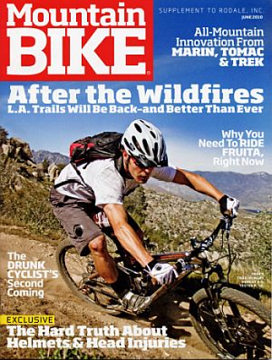
ing blow to outdoor recreation throughout Southern California. CORBA’s Steve Messer was recently interviewed by Mountain Bike Magazine about the extensive damage and impact to the trails, and pondered on how the recovery efforts might proceed.

Messer was probably the last person to ride Sam Merrill, Sunset Ridge and El Prieto trails before the fire swept through the area. Ironically, he was on his way with CORBA’s trail crew to do some trail repair work on Sunset Ridge trail as the fire broke out.

It’s clear that the recovery will take many years. At present it is too early in the process to speculate on when the forest and severely damaged trails may re-open. The Mountain Bike magazine story does a nice job of laying out the challenges and opportunities, and showing how CORBA, the Mount Wilson Bicycling Association and others might be called to action going forward.

The full article is available as PDF document.


Federal Judge Orders Species Protection in the ANF

Thursday, June 30th, 2011

This week on June 28, 2011, U.S. District Court judge Marilyn Hall Patel ordered the U.S. National Forest Service, U.S. Fish and Wildlife, and the National Marine Fisheries Service to take “all necessary measures” to better protect 40 endangered species. The order specifically covers the Angeles, Cleveland, Los Padres and San Bernadino National Forests in Southern California.

The agencies have been given six months to develop a long-term strategy to protect 40 endangered species. The order came as a result of a lawsuit by the Center for Biological Diversity, who claimed the Forest Management Plans for the respective forests failed to provide adequate protection for these endangered species. The species include the Santa Ana Sucker, the Arroyo toad, the California Gnatcatcher and the California Condor, among others.

Recently hopes had been raised for the opening of the Williamson Rock closure which has been in effect since 2005 to protect the Mountain Yellow-Legged Frog. That is now highly unlikely and construction that was taking place in the area has been halted. There are less than 200 known individuals of this species left in a few select pockets in the San Gabriel mountains. The Williamson Rock closure affects Hikers, and has shut off access to climbers who regard the rock as one of the premier sport climbing destinations in Southern California.

CORBA will work with the Forest Service to determine which trails in the San Gabriel Mountains, if any, may be affected by this federal court order.

Sunset Ridge Trailwork

Monday, June 6th, 2011


Angeles Mountain Patrol and CORBA Volunteer Robin McGuire

On Saturday June 4th, CORBA volunteers worked with Mount Wilson Bicycling Association to restore the Lower Sunset Ridge trail. The one-mile trail runs between Millard Campground and the Mt. Lowe Fire Road. This portion of the National Forest had just been opened a few weeks prior, and the trail was in relatively good shape, but severely overgrown in places.

The original plan was to split into two crews and tackle both the Lower Sunset Ridge and brushing on the Sunset Ridge trail.  It was a disappointingly low turnout, with only five people coming out to give back to the trails. However, the five who came out were all experienced trailworkers, and we were able to get the entire trail brushed. That includes all the poison oak. We also rebuilt a basket that supports the trail through a drainage, carrying several tons of rock by hand to fill the void in the trail and restore the tread.

Mount Wilson Bicycling Association had done a previous day of work on State Trails day, repairing another problem drainage along this trail. We’re happy to see the MWBA getting more active once again, and look forward to working with them on future trailwork days.

Thanks to Mitch Marich of the Mount Wilson Bicycle Association, Angeles Mountain Patrol and intrepid trailwork volunteers Mike and Robin McGuire for all your sweat.

More before and after pictures after the break.

(more…)

Angeles Crest Highway Open to the Angeles National Forest

Saturday, June 4th, 2011

Cyclist and others gather for the ACH highway 2 opening ceremony and press release This morning, June 3, 2011, at 10 a.m. the Angeles Crest Highway was opened to motor traffic, bicycles and pedestrians. It has been closed since the Station Fire of 2009, while numerous repairs were made to the highway. It had been scheduled to open last November, but one of last winter’s heavy storms brought down the hillside onto the newly repaired road. Repairs have been completed on the section between La Canada and Clear Creek. Construction continues on a few sections beyond the Mt. Wilson road junction, but traffic is being flagged through the construction zone.

Caltrans also removed the winter closure of the highway at Islip Saddle. ACH is now open all the way through to Wrightwood.

Dozens of cyclists were among the first to pass the ceremonially opened gate, just outside the Angeles National Forest border. CORBA volunteers Steve Messer, Mike and Robin McGuire were also on hand, and took the opportunity to do some trailwork along the Grizzly Flat fire road after climbing Mt. Lukens.

This has been a much-anticipated day, welcomed by hikers, mountain bikers, and everyone who just wants easier access to the forest.

Angeles Crest Highway 2 openingThe highway opening has come just a few weeks after the May 16 opening of many trails that had been closed due to the Station Fire. A complete list of opened trails can be found in our previous story.

Sunset Ridge Trailwork, National Trails Day (June 4)

Friday, May 27th, 2011

On Saturday, June 4, 2011, join CORBA and the Mount Wilson Bicycling Association for a day of trailwork on Sunset Ridge trail in the Angeles National Forest front country.

The Sunset Ridge trail is among those that was recently re-opened to the public. It is a popular hiking and mountain biking trail in the foothills above Altadena and Pasadena. It is often ridden as a loop with the Sam Merril Trail or Mt. Lowe Fireroad.

The trail has seen many days of volunteer maintenance since the station fire by several different volunteer groups, and the tread is in reasonably good shape. However, this season’s ample rains and a lack of traffic on the trail have allowed the trail to become severely overgrown in many sections. Our primary focus for this trailwork day will be brush removal, with some treadwork on sections that need it.

Meet at 8:00 a.m. at the Millard Campground parking lot at the top of Chaney Trail in Altadena. From there we will carpool one group to the upper section of trail while another group starts at the bottom and works upwards. Be sure to wear long pants, long sleeves, and sturdy shoes, as you may be turned away if you don’t meet these minimum Forest Service requirements for trail volunteers.  We will have gloves and hard-hats for volunteers (required for all trailwork volunteers in the National Forest), but bring your own if you have them.

Where:   Millard Parking Lot   (Top of Chaney Trail in Altadena)

When:  Saturday, June 4, 2011, 8:00 a.m. to 2 p.m.

Bring:  Long sleeves, long pants, sturdy shoes, water/snack or energy food, gloves and hard hats (These will be supplied if you don’t have them).

Let us know:  RSVP to  trailcrew@corbamtb.com or on our Facebook Event