Archive for the ‘Environment’ Category

Rim of the Valley Corridor Preliminary Findings – Public Hearings in November

Thursday, October 25th, 2012

The Special Resource Study for the Rim of the Valley Corridor has been released. While we have not yet had a chance to look at the proposed alternatives, we will do so in the coming weeks and after the first round of meetings. We reported on the ROTV corridor study’s release of Scoping comments in 2011.  The alternatives presented in Newsletter #3 should address and consider these comments.

The four alternatives presented are:

  • Alternative A: No Action (A continuation of current management)
  • Alternative B: Cooperative Conservation Partnership
  • Alternative C: Connecting Urban Parks – Santa Monica Mountain National Recreation Area Boundary Adjustment
  • Alternative D: Connecting Natural Habitat – SMMNRA Boundary Adjustment

While all these alternatives have their advantages and disadvantages, there is an overlapping study for the San Gabriel Watershed and Mountains Special Resource Study. It’s unclear from these preliminary documents how these two studies overlap, and how much of the effort in each is a duplication.

It is within CORBA’s mission to help protect and preserve our open spaces and public lands, in addition to providing access to those public lands through natural-surface, shared use trails. None of the alternatives presented in this newsletter outline any specific actions with regards to the Rim of the Valley Trail, but rather, provide an outline for the role the National Park Service might play in its future development and management.

We’ll look over these alternatives and publish our comments, and strongly encourage others to also comment by the January 7 deadline.

Below the break is the meeting schedule and offical notice for the study, which can be downloaded here.

——————————————————————————————————————

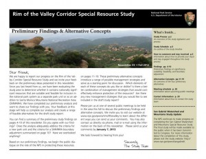
Preliminary Findings & Alternative Concepts Newsletter Available for

Rim of the Valley Corridor Special Resource Study

Dear Friends,

We are happy to report our progress on the Rim of the Valley Corridor Special Resource Study, and we invite your feedback on the preliminary ideas which are presented in our recently published Newsletter #3. The newsletter includes preliminary study findings that address whether resources of the study area are nationally significant, and whether they are suitable and feasible for inclusion in the national park system as a new park unit or as an addition to Santa Monica Mountains National Recreation Area (SMMNRA). Based on these preliminary findings, four preliminary alternative concepts are also presented in the newsletter for your consideration. Please send us your comments by January 7, 2013. 

The four preliminary alternative concepts presented in the newsletter illustrate different ways of providing protection and public enjoyment of resources that have been identified as potentiallynationally significant.  They include different levels and types of involvement by the National Park Service (NPS). Most importantly, these preliminary alternative concepts serve as a starting point for discussion and public input.

Please tell us what you think about the alternative concepts. Do you like one particular concept more than the others? Do you like various elements of each of the concepts? Do you have an entirely different vision of how the area should be managed? Your comments will help us refine the concepts and will ultimately lead to a recommendation to Congress.

We have scheduled seven public meetings extending through the month of November, concluding with a final meeting in early December. During these meetings, we will update you on our progress on the Rim of the Valley Corridor Special Resource Study and listen to your thoughts and ideas. Dates, times and locations of these meetings are listed below.  The NPS will also host a virtual public meeting online. Information on the virtual public meeting will be posted on the study website.

We look forward to hearing from you!


Wednesday, November 7, 7 – 9 p.m.
Conejo Recreation and Parks District, Community Room
403 W. Hillcrest Dr., Thousand Oaks,CA 91360

Thursday, November 8, 7 – 9 p.m.
George A. Caravalho Santa Clarita Sports Complex, Activities Center Building
20880 Centre Point Parkway
Santa Clarita, CA 91350

Tuesday, November 13, 6:30 – 8:30 p.m.***
Pacific Community Center
501 S. Pacific Ave.
Glendale, CA 91204

Thursday, November 15, 7 – 9 p.m.
Mason Recreation Center
10500 Mason Ave.
Chatsworth, CA 91311

Tuesday, November 27, 6:30 – 8:30 p.m.
Encino Community Center Women’s Club
4935 Balboa Blvd.
Encino, CA 91316

Thursday, November 29, 7 – 9 p.m.***
Moorpark Community Center
799 Moorpark Ave.
Moorpark, CA 93021

Saturday, December 1, 10 a.m. – noon
Eaton Canyon Nature Center
1750 North Altadena Dr.
Pasadena, CA 91107

More Work Taking Place in Sullivan Canyon Starting Early October

Saturday, September 22nd, 2012

From the Southern California Gas Company Public Affairs Manager

Southern California Gas Company Sullivan Canyon Pipeline Protection Project 

SoCal Gas plans to perform maintenance and repair work to the portion of Sullivan Canyon, which has been owned and maintained by SoCal Gas since 1960, in accordance with State and Federal pipeline safety regulations and a 5-year Maintenance Plan.  We are currently in the second year of that plan.

Heavy rains during 2010 and 2011 caused severe earth erosion and washout damage to the pipeline maintenance access road within the canyon.  As a result, buried SoCal Gas transmission pipelines have been exposed in some areas.  It is important that we repair this damage in order to maintain safety and so that we may continue to provide Southern California residents with a safe and reliable supply of natural gas.

For your consideration, the following impacts are to be expected in your neighborhood.  Please note that these are only approximations and are subject to change.  We will do our best to keep you apprised of any changes.

  • Duration of work (tentatively) – October 6, 2012, temporary restricted public access to certain areas of the canyon, which will remain in effect until work is completed.  At minimum, work is estimated to be completed by January 2013.  Staff will safely guide the public around restricted areas of the canyon.
  • Hours of Operation – 7am-7pm weekdays and 8am -6pm Saturdays.  No work will be performed Sundays;
  • Reduction of public curb parking at entrance to canyon;
  • Intermittent loud noise in the immediate work areas;
  • Increased dust in the immediate work areas;
  • Increased traffic from work crews and equipment; and
  • Signage indicating access restrictions.

Location and Logistics

  • 4.5 mile stretch of land that comprises Sullivan Canyon between Queensferry Rd. and Mulholland Dr. (Farmer’s Fire Rd.) at both ends of the canyon;
  • Equipment and material will be delivered via Queensferry Rd.;
  • Mulholland Drive will be the primary delivery/export route to avoid hindering traffic in the neighborhood near Queensferry Rd.; and
  • On-site construction management who will manage work crews to ensure that work is performed neatly and that a limited footprint is left in the canyon.

Purpose and Project Scope

  • Restoration of access road including grading and fill for safe pedestrian and vehicular use; the road will remain essentially an earthen road. and
  • Repair of cover to two high – pressure transmission pipelines.

Environmental Impacts

In order to re-establish the road and repair the pipelines while minimizing environmental impacts to the canyon, SoCal Gas has commissioned and will be working closely with professional environmental consultants during project planning and implementation.  To date, a survey has been conducted by the project biologist and an arborist recommended by the City of Los Angeles.  The survey identified and the City concurred upon the removal of two hazardous oak trees within the project alignment.  A hazard tree removal permit will be issued for this work and these trees will be mitigated at a 5:1 ratio (10 new trees will be planted as replacements) per the California Department of Fish and Game.  No additional oak trees or other native trees will be removed.

Oversight Agencies and Additional Advisory Assistance

  • United States Army Corps of Engineers
  • Los Angeles Region California Regional Water Quality Control Board
  • California Department of Fish and Game
  • Los Angeles Fire Department (fire prevention plan)
  • Sage Institute (environmental advisement)

Updates regarding additional closures and/or canyon restrictions, or changes to the project plan will be distributed periodically throughout the duration of the project.  Closures or restrictions will also be posted on the gate at Queensferry Road and at the entrance to the property off of Mulholland in advance, to the extent feasible.

We apologize for the inconvenience caused by this necessary work to ensure pipeline safety and maintenance of a reliable natural gas supply to the Los Angeles basin area.  SoCal Gas appreciates your understanding of the need for this maintenance work and temporary disruption of canyon access.

Please know that safety is our first priority.  We appreciate customers and members of the community keeping us informed on conditions surrounding our facilities.  Likewise, we believe it is important to communicate with you when we know our work will impact our neighbors. Again, there are two high-pressure transmission pipelines located in the canyon and we will continue to periodically perform maintenance work to them as-needed to ensure safety.  We will provide notification when projects are scheduled and we will do our best to work with neighbors and the public to minimize impacts to customers and stakeholders.  It is our goal to keep disruptions to a minimum and we regret temporary inconveniences.

Thank you for your understanding while we perform this necessary maintenance and repair work.  Should you have any questions, please call Krista Phipps at (323) 578-2650 or email kphipps@semprautilities.com.

It’s not Strava’s Fault Mountain Bikers are Ignorant

Monday, September 3rd, 2012

By Mark Langton

It has come to our attention that it is possible that small group of mountain bikers is using the web site Strava to have “competitions” in various locations around the Santa Monica Mountains National Recreation area.

Strava allows you to track and upload your outings onto their web site via a GPS tracking device. The data ncludes the time it took you to traverse a particular route. It seems that some mountain bikers are using this feature to create a “time trail” competition and posting their times to see who is fastest. Obviously, trying to go as fast as possible on our shared use trails is not acceptable as it can endanger other users, including but not limited to mountain bikers. In response to this situation, we have learned that National Park Service rangers will be intensifying their presence at locations known to be experiencing this time trial scenario, Cheeseboro Canyon Park in Agoura Hills being one of them.

Currently it is the policy of the Santa Monica Mountains National Recreation Area’s managing agencies that events that displace or affect the safety of other trail users on public open space trails are prohibited. If you want to race, go to a sanctioned race (usacycling.org). If you want to go fast, go to a location that is set up for high speed mountain biking, such as Mammoth Mountain (mammothmountain.com).

Angeles National Forest Land Management Plan Ammendment Comments

Friday, June 8th, 2012

We recently put out an alert  about court-ordered changes to the Land Management Plans for our four Southern California National Forests. We’ve now attended the public meetings, pored over maps and GIS data and have put together our official comments on the plan, available as a PDF, and copied below.

IMBA has recently put out an action alert and petition to preserve mountain bike access to all existing multi-use trails in our four National Forests. We encourage everyone to sign the petition.

In the Angeles National Forest the only area in which we see the potential for problems is the proposed change of the Salt Creek and Fish Canyon Inventoried Roadless Areas into the combined Fish Canyon Recommended Wilderness (RW).  The Golden Eagle trail is an extremely popular, well-documented trail used frequently by bicycles. It is not on any forest service maps and is not an offiicial forest service trail, though it has existed for at least 25 years. We would of course like to see this brought into the trail inventory, and excluded from any recommended wilderness. The trail lies outside the RW, except for one section where it is impossible to tell from the data supplied whether it touches the RW boundary, or crosses it.  We would like to see the boundary adjusted to provide a reasonable buffer between this trail and the RW.

Similar incursions into or across the RW boundaries appear to occur on the fire roads to Knapp Ranch and Atmore Meadows. They are probably just anomalies of the scale of maps used and data supplied, but must be clarified to be sure these fire roads are outside any RW.

The RW includes several miles of singletrack trails that have a history of bicycle access. These include the Burnt Peak Canyon trail and Fish Canyon trail. However, both of these trails are in a dilapidated state and have seen very little use by bicycles, or other users for that matter. In his 1990 guidebook to the area, Mike Troy describes the Fish Canyon trail (16W05) as a difficult hike a bike and the trail as unmarked and difficult to follow. The Burnt Peak Canyon trail, on the other hand, is described as a fun, non-technical double-track.  We will endeavor to gather more data about the existing conditions of these trails, but for the moment we are asking that they be left as Backcountry Non-Motorized (BCNM) rather than RW.

While we support the ongoing preservation of our remaining open space and prevention of future disruptive development or extractive use of the land, trails are a limited resource and losing trails reduces our future options for recreational access. A RW designation will make these trails more difficult to restore or maintain, and we risk losing them forever.

We encourage everyone to send comments via email to socal_nf_lmp_amendment@fs.fed.us or snail mail to: Attn: LMP Amendment, Cleveland National Forest, 10845 Rancho Bernardo Road, Suite 200, San Diego, CA 92127-2107.

CORBA’s submitted comments follow the break.


(more…)

2012 Trails and Greenways Conference

Tuesday, April 24th, 2012
Multi-use trail event.

Multi-use trails. We can and must get along.

CORBA was very much involved in last week’s California Trails and Greenways Conference. This annual event brings together land managers at the Federal, State, County and City levels, along with resource planners, volunteers, non-profit organizations and professional landscape architects and trail builders.

The theme for this year’s conference was “Navigating Radical Change.”  The most radical of all changes that land managers are facing is the shrinking of budgets for trail and open space projects. Another is the changing demographic of trail users.

Navigating radical change - mutli-use friendly pinch points

Navigating radical change - mutli-use friendly pinch points on Tapia Spur

Many sessions at the conference talked about the importance of engaging volunteers, of reaching out to foster public-private partnerships between land managers and non profit advocacy groups.
CORBA has already been putting into practice many of these principles, partnering with the Forest Service and State Parks to help maintain trails; partnering with the So Cal High School League to empower the next generation of off-road cyclists as advocates and stewards.

CORBA President Mark Langton participated in a rousing panel presentation on the Conejo Open Space Conservation Agency, a multi-use trail system that has worked successfully with minimal conflict for more than two decades.  An entertaining keynote address was given by conservation celebrity Ed Begley Junior. He treated the attendees to stories of how and why he came to be so ingrained within the conservation movement.

Among the volunteer groups in attendance, there were at least five bicycling advocacy groups represented. IMBA’s new regional director Patrick Kell was there, along with representatives from the San Diego Mountain Bike Association, Central Coast Concerned Mountain Bikers, Santa Barbara Trail Volunteers, CORBA, the Los Angeles County Bicycle Coalition and other groups.

Cycling trail advocates from across California

Cycling trail advocates from across California

On Friday morning of the conference, 8 bicycle adovocates joined Steve Messer and past CORBA board member Hans Kiefer in a tour of Rocky Peak. They had a great ride, showing once again that there is some great mountain biking around Los Angeles.

A conference such as this is vital for bringing disparate user groups, land managers and trail stewards together, where we always learn we have much more in common than we think. The fact that working together is often the only way anything can be accomplished was one of the most important take-home messages from the conference.

Everyone can get along

Everyone can get along

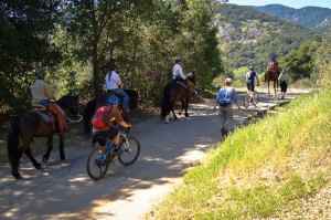
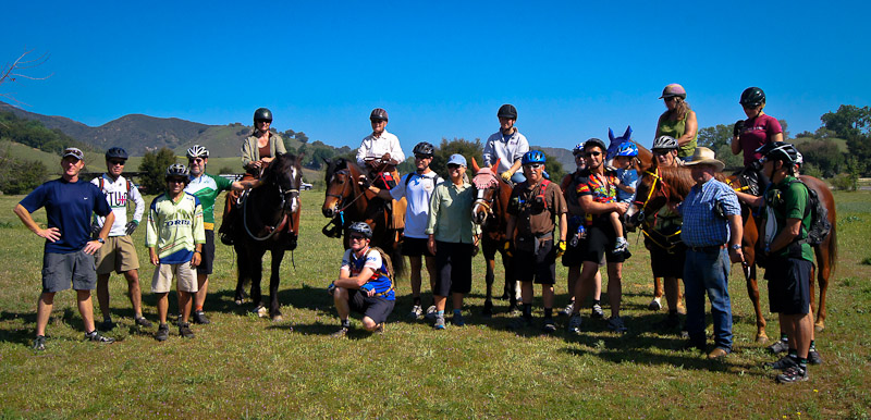
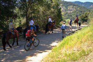
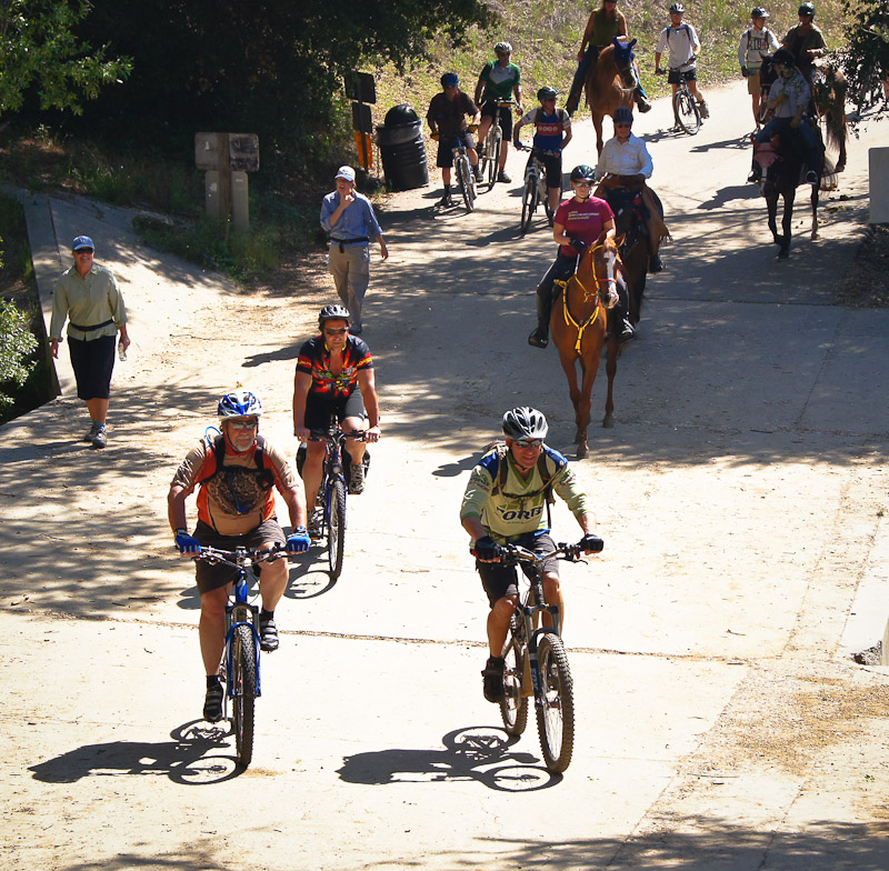
On Saturday, after the conference, Orange County’s Trails4All brought 6 equestrians, 4  hikers, and about a dozen mountain bikers from CORBA, SHARE, SDMBA, CCCMB together for a ride/hike/run/hoof event. We travelled together on the trails of Malibu Creek State Park, showing again that where there is respect and cooperation it is very possible for all user groups to co-exist peacefully on the trails.

Our since thanks to the organizers, the presenters, the sponsors, and to all our fellow attendees at the conference. These meetings underscore the importance of working together, and create at an atmosphere conducive to constructive and informative exchanges of information and viewpoints. We look forward to next year’s Trails and Greenways conference in Lake Tahoe.

Bikes, horses, hikers and runners

Bikes, horses, hikers and runners. We all love trails.


Save the Date: California Trails & Greenways Conference, April 18-20, 2012

Thursday, February 23rd, 2012

The California Trails & Greenways Conference is

Coming to Los Angeles!!!

Excitement is building as California State Parks and its trail allies prepare for the 27th California Trails & GreenwaysConference taking place April 18 to 20 at the Woodland Hills Marriott.

Conference registration is scheduled to open February 22nd. For the registration link and further details about the 2012 California Trails & Greenways Conference, including sponsor, exhibit and raffle donation information log onto our website at www.parks.ca.gov/trails/conference or call 877.776.3619.

The California Trails & Greenways Conference is a forum for networking and building support for accessible, inter-connected, quality trail systems; and a venue for trail professionals and advocates to learn practical, up-to-date, trail skills.  This endeavor by California State Parks and the California Trails Conference Foundation helps ensure effective trail stewardship and leadership for generations to come.

The California Trails & Greenways Conference provides opportunities to:

  • Network with, and talk directly to, California’s leading trail experts
  • Find collaborative partners to build support for trail endeavors
  • Learn a full range of trail topics in high quality, innovative sessions
  • Experience hands-on learning through day-long field workshops
  • Address your specific concerns through our table topic sessions
  • Explore exhibits featuring innovative trail-related products and services

All activities are designed to increase the knowledge of trail, recreation and wild land management professionals and advocates, both novice and expert, in order to improve non-motorized, recreational and heritage trail systems and programs throughout California.

Day-long workshops, 27 concurrent sessions, keynote presentations and exhibits all serve to draw California’s leading trail designers, builders and managers to this 3-day event.  The theme for the 2012 Conference is “Navigating Radical Change — The New Normal.” With attendance expected to reach 500, we anticipate the theme will elicit stimulating and creative discussions that will generate new ideas and partnerships.

We live in a tumultuous time, unprecedented in many respects. Believing that “knowledge is power,” the 2012 California Trails & Greenways Conference will explore the multiple challenges facing trails and public lands, what’s known about the trends affecting those challenges, and how to pursue creative solutions while preserving the integrity of the resources we hold dear. We’ll also explore innovative approaches and new collaborations that may inspire your own new solutions for navigating the path ahead.


The preliminary schedule for this 3-day event is as follows:

  • ·        April 18th, Wednesday

o       Optional day-long workshops

o       Exhibits open at 4:00 p.m.

o       Opening reception, dinner, keynote presentation

  • ·        April 19th, Thursday

o       Concurrent sessions throughout the day (5 sets)

o       Awards & Remembrance Luncheon

o       Celebration reception, dinner, keynote presentation

  • ·        April 20th, Friday

o       Breakfast with Table Topic Discussions

o       Concurrent sessions (2 sets)

o       Closing plenary

o       Conference ends at 1:00 p.m.

Planning is also underway for the 3rd Annual Hike, Bike, Ride, Run Event taking place Saturday, April 21st. This post-conference outing and BBQ is a wonderful way for all trail users to come together to show that we can share our trails and all get along. Conference attendees and friends are invited. Reservation and other details will be posted on the conference website March 1.

For further details about the 2012 California Trails & Greenways Conference, including sponsor, exhibit and raffle donation information log onto our website at www.parks.ca.gov/trails/conference or call Lauralee at 877.776.3619 or541.547.3640.

New San Vicente Mountain Communications Tower Public Presentation (the Nike Site)

Thursday, January 12th, 2012
A new communications tower is being proposed for the top of San Vicente Mountain, near the location of the Nike site at Westridge and Mulholland in the Santa Monica Mountains. This is a highly popular destination for trail users and visitors to the Santa Monica Mountains.

UltraSystems, a company specializing in environmental planning, will be conducting a public  presentation on the project for interested parties:

7:00 p.m., Tuesday, January 17, 2012, West Los Angeles City Council Office, 1645 Corinth Ave., Second Floor Hearing Room, LA, CA 90025.  

The presentation will help the public and the trail user communities understand exactly what the impacts of this new 200′ tower will be.

While this meeting will concentrate solely on the the San Vicente Mountain project, at least four other sites are being proposed for similar projects.  Mount Lee is within Griffith Park, behind the Hollywood sign and is off-limits to cyclists.

The other peaks are Mount Lukens in the Angeles National Forest, Verdugo Peak at the top of  Hostetter Fire Road (AKA “La Tuna”), and the Baldwin Hills.  The Mount Lee and Baldwin hills projects are for new equipment buildings within existing facility boundaries. Mount Lukens and Verdugo Peak are both slated to have existing towers replaced and upgraded. These projects will be discussed at a later meeting.

SMMNRA Superintendent Smeck to Leave for New Yosemite Position

Wednesday, December 14th, 2011

Woody Smeck, Santa Monica MountainsCORBA congratulates Woody Smeck, Superintendent of the Santa Monica Mountains National Recreation Area (SMMNRA) on his new appointment.  He’s leaving on March 30 to become Deputy Superintendent at Yosemite National Park.  Woody came to the SMMNRA as a landscape architect in 1990.  He worked his way up and was appointed Superintendent in 2001.  During his tenure, the SMMNRA grew in stature in the National Park system.  Woody helped politicians understand the importance of National Parks near developed urban areas.  He helped foster interagency coordination and cooperation with the California Department of Parks and Recreation, the Santa Monica Mountains Conservancy, the Mountains Recreation and Conservation Authority, and other agencies in the SMMNRA.  He helped keep park programs on track in difficult budgetary times.

Most important to the mountain bike community, Woody was always accessible, fair, and honest in his dealings with us.  There is more mountain bike access on NPS land in the SMMNRA than anywhere else in the country.  Woody has been clear that responsible mountain biking is manageable on public lands and has expressed that view to his NPS peers.  We owe him a huge debt of gratitude.

Woody has been a pleasure to work with and we’ll miss him.  Our loss is Yosemite’s gain.  A search is underway for a new NPS Superintendent in the SMMNRA.

San Gabriel Watershed – CORBA Supports Alternative D

Wednesday, November 30th, 2011

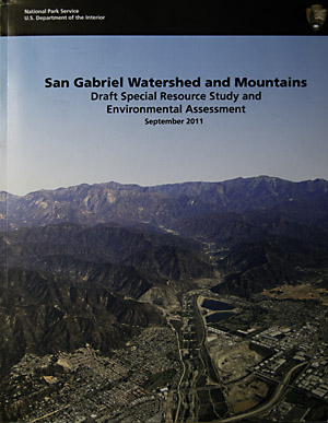
San Gabriel Watershed and Mountains Special Rescource Study CoverThe process of determining the future of the San Gabriel Watershed region started in 2005 in a series of initial scoping sessions. In 2009 the first draft alternatives were presented for public comment, as we reported in 2009. After the 2009 series of public hearings, the alternatives were revised and released In October 2011.

In October and November of 2011, the National Park Service (NPS) held another series of public meetings to discuss their preliminary study findings about the San Gabriel region, and present their revised draft alternatives. There were between 75 and 150 stakeholders at each meeting, a clear indication of how important the San Gabriel Mountains are to Southern California residents.

The report is an extensive 300 page document. It discusses a broad spectrum of the natural, cultural and recreational resources in the study area. For those interested in the geologic, cultural and natural history of the San Gabriels it is a handy reference, well worth reading. The document further describes the national significance of the resource, and ultimately finds the region suitable for NPS protection. It discusses the feasibility of NPS involvement, then presents the alternatives as to how the NPS may be involved.

As we reported in October, one of the original Alternatives, B, had been dropped, and one, D, added. The three remaining Alternatives, A, C and D were summarized and outlined by Barbara Butler, who is leading the study for the NPS. The presentations essentially recapped the Executive Summary. Members of the audience were then invited to ask questions.

Many of the questions were very specific, addressing the current shortfalls in maintenance, funding, staffing and infrastructure within the Angeles National Forest. People asked for more rangers to patrol for litterers and graffiti, funds for trail restoration and maintenance, more staff to handle volunteers and funding for recreation facilities.

Some were concerned that there may be an increase in bureaucracy and red tape if the NPS were to come in. The presenters again assured everyone present that all land use decisions would continue be made by the current land managers. They defined the NPS roles more as “Management Partners,” sharing resources with the Forest Service and other agencies, as well as facilitating better coordination and cooperation between agencies.

(more…)

Study Finds Multi-Use Trails Improve Property Values

Monday, November 21st, 2011

From a story which appeared on the University of Cincinnati Web Site, October 11, 2011

New Research Finds that Homeowners and City Planners Should ‘Hit the Trail’ When Considering Property Values

Two University of Cincinnati researchers will present interdisciplinary research at a national conference on planning and development of communities.

Date: 10/11/2011 12:00:00 AM

By: Dawn Fuller

Location, location, location – it is often touted as affecting the value of residential property. Now, new University of Cincinnati research suggests that location near nature trails could hold a financial benefit for homeowners and ultimately neighboring communities.

University of Cincinnati researchers Rainer vom Hofe, an associate professor of planning, and Olivier Parent, an assistant professor of economics, will present their findings on Sunday, Oct. 16, at the 52nd Annual Association of College Schools of Planning (ACSP) ENVISION Conference in Salt Lake City, Utah.

The two researchers examined how the Little Miami Scenic Trail – a 12-mile southern stretch of the trail that runs through the Cincinnati metropolitan region – impacted residential property values in Hamilton County, Ohio. The scenic, multipurpose trail beckons walkers, hikers, skaters and bicycle enthusiasts and also has horseback riding paths.

“For the ‘New Urbanist,’ multipurpose trails provide the potential for bicycle commuting; help alleviate noise, pollution and congestion, and expand the means for green transportation and a community’s walkability,” write the authors.

Using a research model they developed, Parent and vom Hofe found that from a real estate perspective, trails can have significant, positive spillover effects on property values when these properties are located within reasonable distances to the trails.

To be more specific, housing prices went up by nine dollars for every foot closer to the trail entrance. Ultimately, the study concluded that for the average home, homeowners were willing to pay a $9,000 premium to be located one thousand feet closer to the trail.

The researchers say their study is among the first to quantify the impact of multipurpose trail proximity on residential property values while isolating the results from the biasing effect of nearby property values.


(more…)