Archive for the ‘Environment’ Category

Springs Fire Closure Update 5/6/13

Monday, May 6th, 2013

As of 5/5/13, this is the status of State Parks open space and other public facilities effected by closures due to the “Springs Fire”.

-Leo Carrillo SP was reopened Saturday at 3 pm

-Point Mugu-Thornhill Broome campground will reopen later this week

-Sycamore Cove and Mugu Beach day use areas have reopened

-Point Mugu back country will remain closed until further notice

-Point Mugu-Sycamore Campground is planned to reopen before Memorial Day

-Point Mugu-La Jolla Group Camp and Day Use to reopen by May 15th

The burn area perimeter (unofficial):


2013 Springs Fire Perimeter


Skills Class 5/4/13 CANCELLED

Friday, May 3rd, 2013

As of 5 pm on Friday May 3, Malibu Creek State Park was closed due to high fire danger, and it was unclear as to whether it would be open on Saturday. In addition, air quality was poor due to smoke moving south into the area from the fires burning in the Santa Monica Mountains to the north. Therefor we have cancelled the 5/4/13 Introduction to Mountain Biking Skills Class. Hope to see you next month, June 1!


Lyme Disease Detected in Ticks at Paramount Ranch

Friday, April 12th, 2013

Officials from Los Angeles county and Santa Monica Mountains National Recreation Area (SMMNRA) are advising visitors that ticks from Paramount Ranch in Agoura Hills recently tested positive for Lyme disease. Three separate pools of western black-legged ticks (Ixodes pacificus) found along the Coyote Trail were found to be positive.

“This is a good reminder for visitors to stick to the trail and avoid the vegetated areas where ticks like to hang out,” said Evan Jones, SMMNRA chief ranger. “Though Lyme disease can be very serious, simply following a few basic steps can greatly minimize exposure.”

Jones also advises the public to check clothing and exposed skin before heading home, making sure to brush off any small creatures. Wearing light-colored clothing with long sleeves and long pants is also recommended.

Lyme disease is an infectious disease that can start as a mild flu-like illness and develop into severe chronic health problems over time. If identified in the early stages, it can be successfully treated with antibiotics, but the potential for long-term complications increases if the disease progresses untreated.

Paramount Ranch was one of three Santa Monica Mountains park sites that came back positive for Lyme disease in tests conducted by Los Angeles County West Vector and Vector-Borne Disease Control District. The other two locations were Tapia Park and Malibu Creek State Park, both located within a short distance of one another.

Robert Saviskas, executive director of the L.A. county agency responsible for conducting the tests, said this was the first year his agency tested for Lyme disease at Paramount Ranch, among approximately 12 sites tested within the Santa Monica Mountains. The first tick known to carry Lyme disease was found in the mountains in 1998.

“We’re finding that about 1 or 2 percent of western black-legged ticks in the area carry the Lyme disease bacteria, so it’s important for us to identify where the problem is occurring,” said Saviskas. “This particular tick is most active from late November through May.”

More information is available at www.lawestvector.org or by calling 310-915-7370.

Temporary Trail Closures In Cheeseboro and Palo Comado Canyons in April and May

Tuesday, April 2nd, 2013

THOUSAND OAKS, Calif. – The National Park Service (NPS) is advising visitors that trails at Cheeseboro and Palo Comado Canyons will be intermittently closed during April and May due to the demolition and removal of surplus water conveyance infrastructure.

Several days of trail closures are expected, though limited to weekdays between 8:00 a.m. and 5:00 p.m. Visitors can find up-to-date information on trailhead signs, by calling 818-889-8996 or by visiting www.nps.gov/samo.

The Cheeseboro Reservoir, capable of holding four million gallons of water, can be seen in the distance. Along with a pump station at Palo Comado Canyon, the reservoir will be demolished and removed during April and May. Courtesy of National Park Service

The Cheeseboro Reservoir, capable of holding four million gallons of water, can be seen in the distance. Along with a pump station at Palo Comado Canyon, the reservoir will be demolished and removed during April and May. Courtesy of National Park Service

Triunfo Sanitation District (TSD) will be removing the Palo Comado Pump Station and the Cheeseboro Reservoir. These facilities, owned by TSD, were built in 1959 at the behest of comedian Bob Hope, who had hoped to build thousands of homes in the surrounding area as part of a master-planned community. TSD is decommissioning the facilities as part of an agreement with the NPS and other agencies.

Large trucks will be hauling salvaged materials along both the Palo Comado and Cheeseboro Canyon trails to recycling centers. For their safety, visitors are asked to refrain from using these trails when posted as closed.

Entrance to trails from Cheeseboro Canyon, Doubletree and Smoketree trailheads will be periodically closed. The China Flat trailhead and trailheads for Upper Las Virgenes Canyon Open Space Preserve will remain open.

The NPS and TSD appreciate the public’s cooperation with this effort. Additional information is available by calling 818-889-8996.

Wilderness Proposal Public Hearings – Be there to help save access to trails Apr 9, 10

Friday, March 22nd, 2013

Fellow cyclists, the four Southern California National Forests Land Management Plan Amendment is currently in its public comment period. The amendment makes changes to Land Management plans in the Los Padres, Angeles, San Bernadino and Cleveland National Forests. Within that proposal are two alternatives that will forever impact bicycle access to public lands in the Angeles National Forest.

Maps of the proposals are available here.

Fish Canyon Salt Creek Wilderness - Alternative 2

Alternative 2 Map – Click for a larger version

Alternative 1, the “no-action” alternative, is the only alternative we can presently support.

Alternative 2 retains a backcountry non-motorized status for Red Mountain and Tule districts, but it appears that the trails in the Fish Canyon/Salt creek areas may be forever closed. These trails have appeared in guidebooks dating back to the 90’s, and we have ride reports from much more recent times. We asked for these trails to be left out of any wilderness proposals.  There are many other trails, official and unofficial, in the area, and we’re seeking documentation of those trails. If you have knowledge of these potentially affected trails, let us know. We could support Alternative 2 if the trails in question are cherry-stemmed out of the wilderness proposal.

In Alternative 3, the Fish Canyon/Salt Creek proposed wilderness on which we commented last year has now been expanded to include the Red Mountain and Tule districts of the Angeles National Forest. These two areas lie to the east and south of the Fish Canyon/Salt Creek area. These two areas were not included as potential wilderness in the original scoping documents, and we therefore made no comment on them, other than to offer our general support for their designation for non-motorized backcountry use.  Now, in Alternative 3, these two areas and the many trails that traverse them are included as wilderness. Local riders have been riding these trails for more than 30 years, right up to the present. We cannot allow Alternative 3 to be adopted.

We too would like to see these areas protected, and feel that backcountry non-motorized designation gives the area adequate protection, but the environmental lobby is pushing for federal wilderness. We have proposed a compromise, a federally designated Special Conservation Area, which prohibits extractive use, development and road-building and can be custom tailored to allow for non-motorized recreational use, while affording stronger protection for and monitoring of the environment. This would require special legislation.

After the public meetings in March, we will be compiling and submitting our comments on the proposals. We encourage everyone to submit comments on the proposals, along with supporting documentation (GPS tracks, photos) of bicycle use of the trails. The comment period will close on May 16, 2013.

The Forest Service will be hosting multiple open house meetings during the comment period. The content and format of each meeting will be the same. Meetings will begin with an open house where Forest Service staff will be available to answer questions about the Draft SEIS. A brief presentation will begin 30 minutes after the meeting opens, followed by an opportunity to ask questions. Maps of the alternatives will be available for viewing. The meeting times and locations are:

  • March 26, 2013, 4:00 PM to 7:00 PM, Angeles National Forest Headquarters, 701 North Santa Anita Avenue, Arcadia, CA 91006 
  • March 26, 2013, 4:00 PM to 7:00 PM, Alpine Community Center, 1830 Alpine Blvd, Alpine, CA 91901 (Hosted by the Cleveland National Forest)
  • March 27, 2013, 4:00 PM to 7:00 PM, Palomar Ranger District Office, 1634 Black Canyon Road, Ramona, CA 92065
  • March 28, 2013, 4:00 PM to 7:00 PM, Santa Clara Mojave Rivers Ranger District Office, 33708 Crown Valley Road, Acton, CA 93510 
  • March 28, 2013, 5:00 PM to 7:30 PM, San Bernardino National Forest Headquarters, 602 S. Tippecanoe Ave., San Bernardino, CA 92408
  • April 9, 2013, 4:00 PM to 7:00 PM, Mt. Pinos Ranger District office, 34580 Lockwood Valley Road, Frazier Park, CA 93225
  • April 10, 2013, 4:00 PM to 7:00 PM, Southern California Edison, 103 David Love Place, Goleta, CA 93117 (Hosted by Los Padres National Forest)

For Further Information Contact Bob Hawkins, Project Manager atsocal_nf_lmp_amendment@fs.fed.us, or visit the
project website at http://www.fs.fed.us/nepa/fs-usda-pop.php?project=35130.


Update 3/25/2013:  We have learned more about the draft proposals and reported here.


Recreation and The Future of Conservation

Tuesday, March 19th, 2013

As CORBA prepares for discussions about wilderness proposals in the Angeles National Forest, we found the following Tedx Talk by Brady Robinson, Executive Director of the Access Fund, timely and relevant.

One of CORBA’s missions is to protect and preserve the open spaces and public lands on which we pursue our joint passions for cycling and nature. While we feel that our open spaces need protection from development and other activities that would forever change the landscapes we love so much, doing so in a way that precludes future bicycle access, or takes away existing public, multi-use trails is something that we and the growing off-road cycling community have difficulty supporting.

Robinson’s assertion that we tend to protect that with which we are familiar rings so true. If we never get our younger generations to experience nature in a way that is compelling and entices them to return, we’ll all have a much harder time convincing them of the need to protect our public lands. He says: “By remembering what we love and why we love it, we find the inspiration to protect it and nurture it for future generations.”

After watching the video, let us know what you think.


TEDxBoulder – Brady Robinson – Recreation and the Future of the Conservation Movement from Access Fund.

Learn more about this TedxBoulder talk here.

Southern California National Forests Land Management Plan Amendment, Draft Supplemental EIS Available for Review

Thursday, February 21st, 2013

National Forest Draft Land Managment PlanThis was recently recieved from the Forest Service, regarding the Land Management Plan Amendment, which will guide the management of land in the Los Padres, Angeles, San Bernadino and Cleveland National Forests.  We previously commented on the process, but now everyone is encouraged to look over the draft to see what might affect our access to trails, and the protection of the lands we love.

CORBA (and I’m sure many other local advocacy groups from the mountain biking world and beyond) will be reviewing the drafts and posting our comments after the public meetings.

——————————————————————————————–

Dear Interested Agencies, State and Local Governments, Tribes, and Public:

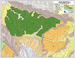
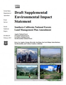
On behalf of the Angeles, Cleveland, Los Padres, and San Bernardino National Forests, I am pleased to announce the release of our “Draft Supplemental Environmental Impact Statement (SEIS), Southern California National Forests Land Management Plan (LMP) Amendment” for review and comment. The proposed amendment would revise land use zone allocations for select Inventoried Roadless Areas within the four forests and amend LMP monitoring protocols. The Draft SEIS considers alternatives for the land use zone allocations and monitoring, as well as the No Action alternative. The Notice of Intent for this SEIS was published in the Federal Register on April 27, 2012 (Vol. 77, No. 82, page 25128).

The Draft SEIS is available for review and comment on the project website at:
http://www.fs.fed.us/nepa/fs-usda-pop.php?project=35130

The purpose of this comment period is to provide an opportunity for the public to provide early and meaningful participation on a proposal before a decision is made. Additionally, those who provide substantive comments during this comment period will be eligible to file an objection to the proposed amendment pursuant to the 36 CFR part 219 subpart B regulations at the time the Final Environmental Impact Statement is released.

How to Comment and Timeframe

The Environmental Protection Agency published a Notice of Availability (NOA) for the Draft SEIS in the Federal Register on Friday, February 15, 2013. The opportunity to provide comments and thereby establish eligibility to object under 36 CFR Part 219 Subpart B ends 90 days following that date. The publication date of the NOA in the Federal Register is the exclusive means for calculating the comment period for a proposed action documented in a Draft SEIS. Those wishing to comment should not rely upon dates or timeframe information provided by any other source. The comment period will close on May 16, 2013.

Comments may be filed through the project website at:

http://www.fs.fed.us/nepa/fs-usda-pop.php?project=35130

or send via e-mail to:

socal_nf_lmp_amendment@fs.fed.us.

Send written comments to the Cleveland National Forest, 10845 Rancho Bernardo Road, Suite 200, San Diego, CA 92127-2107, ATTN: LMP Amendment. In cases where no identifiable name is attached to a comment, a verification of identity will be required for objection eligibility.

It is the responsibility of persons providing comments to submit them by the close of the comment period. Only those who submit timely and substantive comments will have eligibility to object to the proposed decision under 36 CFR Part 219 Subpart B. Persons providing comment should also note that if they wish to file an objection during the pre-decisional review process, their objections will have to be based on their previously submitted substantive comments unless their objection concerns an issue that arose after this comment opportunity.

Comments received in response to this notice, including names and addresses of those who comment, will be part of the public record for this proposal. Comments submitted anonymously will be accepted and considered; however, anonymous comments will not provide the Forest Service the ability to provide the respondent with subsequent environmental documents.

Public Meetings

The Forest Service will be hosting multiple open house meetings during the comment period. The content and format of each meeting will be the same. Meetings will begin with an open house where Forest Service staff will be available to answer questions about the Draft SEIS. A brief presentation will begin 30 minutes after the meeting opens, followed by an opportunity to ask questions. Maps of the alternatives will be available for viewing. The meeting times and locations are:

      • March 26, 2013, 4:00 PM to 7:00 PM, Angeles National Forest Headquarters, 701 North Santa Anita Avenue, Arcadia, CA 91006
      • March 26, 2013, 4:00 PM to 7:00 PM, Alpine Community Center, 1830 Alpine Blvd, Alpine, CA 91901 (Hosted by the Cleveland National Forest)
      • March 27, 2013, 4:00 PM to 7:00 PM, Palomar Ranger District Office, 1634 Black Canyon Road, Ramona, CA 92065
      • March 28, 2013, 4:00 PM to 7:00 PM, Santa Clara Mojave Rivers Ranger District Office, 33708 Crown Valley Road,Acton, CA 93510
      • March 28, 2013, 5:00 PM to 7:30 PM, San Bernardino National Forest Headquarters, 602 S. Tippecanoe Ave., San Bernardino, CA 92408
      • April 9, 2013, 4:00 PM to 7:00 PM, Mt. Pinos Ranger District office, 34580 Lockwood Valley Road, Frazier Park, CA 93225
      • April 10, 2013, 4:00 PM to 7:00 PM, Southern California Edison, 103 David Love Place, Goleta, CA 93117 (Hosted by Los Padres National Forest)

For Further Information Contact Bob Hawkins, Project Manager at socal_nf_lmp_amendment@fs.fed.us, or visit the project website at http://www.fs.fed.us/nepa/fs-usda-pop.php?project=35130.


Sincerely,

WILLIAM METZ
Forest Supervisor

Randy Rogers Had it Right

Tuesday, January 29th, 2013

By Mark Langton

IMG_23141When I first met North Ranch Mountain Bike Club (nrmbc.org) founder Randy Rogers, he told me of his simple concept when encountering others on the trail. “You should slow down enough to have a brief conversation with them. Like, ‘How are you? Have a nice day.’” I told him I thought that this was overly courteous, and if you simply slowed down and said “hi” as you passed, it would be sufficient.

Now, 20 or so years later, I have to admit that Randy was right. Because in having that brief conversation, you not only slow down, you also show care and concern for the other trail user. And if we want to promote a backcountry that is harmonious and safe, then we all must act as if we are a family. Sure, like most families we may have our differences, but in the end our goal should be to care for, and be kind to, each other. After all, we’re out on the trails for the same reasons; to enjoy nature and to renew our spirit.

I challenge you to try this simple, easy experiment: When safely passing someone, including other cyclists, slow down to the point you’re almost going their speed (or stop if necessary), and ask “how are you doing?” (or the abbreviation “howdy!”). Pause just long enough to let them reply. If they don’t, at least you initiated the pleasantry. If they do reply, recognize the feeling you get from the exchange. They feel comforted and cared for, and you have done something nice. If that’s not a win/win, I don’t know what is. And at the risk of sounding cliché, you are paying good karma forward, which in most cases is contagious. And please drop me an email at mark@corbamtb.com or post a reply and let me know how it goes when you try this experiment. I’d really like to hear your experiences. Thanks!

(By the way, if you’re already using this method of trail courtesy, Thank You!)

Conejo Open Space Challenge Starts February 1

Friday, January 11th, 2013

Photo_092910_001From February 1 through May 1, 2013, mountain bikers, hikers, trail runners and equestrians of all ages are challenged to experience ten of the best and most beautiful multi-use trails in the Conejo Open Space Conservation Agency (COSCA).  This is a “virtual” event, where you will take photos of specific landmarks along trails and email them in for validation to show you have completed all of the event’s trail segments.  The goal is to create a unique event to benefit COSCA that involves all trail users, from people completely unfamiliar with the trails to long time veterans.  Participants who complete all 10 segments by May 1 will be entered into a raffle to win prizes donated by event sponsors: Michaels Bicycles, Roadrunner Sports, Boney Mountain Coffee, and Billy D’z BBQ.  Prizes will also be given for best photos as judged by the Conejo Open Space Foundation (cosf.org). Photos will also be available on COSCA’s Facebook page and at COSF’s website.

For event or sponsorship information contact Steve Bacharach at steve.bacharach@gmail.com or 805-405-7635.

Click here for an event flyer.

SCE Construction on Brown Mountain Fire Road

Thursday, November 1st, 2012
TRTP Signs on Brown Mountain

TRTP Signs on Brown Mountain

Many people have been wondering about the signs that were placed along Brown Mountain fire road (FS 2N70) over the past few months. The signs are ESA notices (Environmentally Sensitive Areas) which state “No Entrance Permitted” and have been placed there by the Tehachapi Renewable Transmissions Project (TRTP).

This is one of the most popular trails for off-road cyclists in the Angeles National Forest, because of its proximity to JPL and the Altadena/Pasadena community. It lies in Segment 11 of the project, which includes much of the Angeles National Forest front country through La Canada and Altadena.

The TRTP Environmental Impact Report states that this fire road is not intended to be part of the project. Elsewhere along the transmission line project towers are being replaced by helicopter and in some cases, by road access. The towers accessed along Brown Mountain fire road are not being replaced, but they are being re-wired from the Chaney Trail road access to the east.  The re-wiring will nearly double the power-carrying capacity of the transmission lines, helping bring more renewable energy from Kern County to greater Los Angeles.

When the EIR for the project was completed the fire road was a wide fire road and easily traveled by high-clearance vehicles. Since the Station Fire it has grown in to a narrow single track in many places, and is not accessible to vehicles.  We anticipate the fire road will eventually be graded back to its original width, and if we learn of any plans, we’ll be sure to pass them on.

According to local SCE Public Affairs officer Shannon Widor, the following information was supplied by the construction team in response to our questions:

  • There will not be full closures of the trails in the area of trail 2N70 and Brown Mountain Road as part of SCE’s Tehachapi project.  While trails will remain accessible for trail users, there may be periodic, brief delays on trails in construction areas at times when work activities cross those trail sites.
  • SCE’s work will also include the use of temporary guard structures (to keep wires elevated during installation) at street and trail crossings to enhance safety during construction.
  • Additionally, SCE has no plans to grade Brown Mountain Road at this time.

We can only assume that the signs are meant to remind employees and construction workers of sensitive areas to avoid, and in no way indicate any intention to close the trail/s.

The project also includes an eastern corridor that will include Van Tassell Motorway and fire roads above the Monrovia/Duarte area, as well as Workman Hill and other Habitat Authority lands around Turnbull Canyon.   Construction updates, in the form of quarterly newsletters, are available online. The current newsletter indicates that road improvements will be taking place in some areas in preparation for construction, and that re-wiring of Segment 11 between the Gould and Goodrich Substations will begin.

TRTP 3rd Quarter Construction Update

Double-Click the image for a larger version


The project is estimated to be completed in 2015, but for the moment we can continue to enjoy Brown Mountain fire road in its current narrow configuration for the immediate future.