Posts Tagged ‘Station Fire’

CORBA Awarded Grant from REI

Wednesday, October 10th, 2012

CORBA’s trail crew was recently awarded a grant from REI for the restoration of the Strawberry Peak trail. Strawberry Peak Trail was severely damaged in the Station Fire of 2009, and remains closed to all users.

Most of the trail was devastated by winter rains in the two winters after the great fire had decimated the vegetation. Above average rainfall and heavy storms sent debris flows across the trails. Wooden retaining walls that supported the trail were burned away and need to be replaced. The trail is in need of much work.

We hope to re-route around this troublesome section near Redbox

We hope to re-route around this troublesome section near Redbox

The REI grant will be matched with funds from the National Forest Foundation, as much of the trail lies in the Big Tujunga drainage, a designated NFF Treasured Landscape. The funds will be used for the purchase of additional tools, materials needed for the repairs and supplies for volunteers. Additionally, the funds allow for a private contractor to be utilized to do some of the heavy work, allowing volunteers to repair the retaining walls and do the finish tread work. We will also work alongside other groups, including the Sierra Club to restore this iconic and much-loved trail.

When reviewing the trail post-fire, the particularly troublesome section of trail where the trail leaves the old Barley Flats fire road, was a deep and long ravine. We proposed re-routing this section of trail to avoid the fall line rocky section. That re-route is pending review by the Forest Service. We hope to have approval for the re-route in time for the IMBA Trail Care Crew’s visit on October 20/21.

Over the coming year we will have regular work days on the Strawberry Peak trail. If you care about this trail, watch our calendar for upcoming trailwork dates, and email trailcrew@corbamtb.com to let us know your interest. We plan to kick off the trailwork with an upcoming visit from the IMBA Trail Care Crew.

A previous REI grant allowed CORBA to restore several trails in the Station Fire burn area which are now open and in use. We are truly grateful to REI for their ongoing support of this, and many other CORBA programs.

Angeles National Forest Open and Closed Trails – May 2012

Friday, May 25th, 2012

As we approach three years since the Station Fire began, the Forest Service has revised the closure order which has been in place to allow the forest to recover, and to protect the safety of forest visitors. This is an updated list from our May 2011 list of open and closed trails.

The two questions we have been asked more than any other recently: “which trails are closed in the Angeles National Forest?  and “which trails are open in the Angeles National Forest?”

According to the Forest Service map of the station fire closure area at http://maps.fs.fed.us/stationfire/ the list below shows the status, effective May 25 2012, of some of the more popular trails that were affected by the Station Fire. Keep in mind that even though these trails are in the newly opened areas of the forest, the individual trails may be signed closed.  Please respect any trail closure signs and stay off those trails for your own safety and the recovery of the forest.

Many of the trails will not be in good shape, so be prepared for surprises like downed trees, slides, washouts, ruts, and other hazards. Many trails have been drastically changed from before the Station Fire. Many fire roads have not yet been graded and may be much narrower and in very poor condition with ruts and washouts. All the usual caveats about trail safety apply so use the trails safely and responsibly, and be especially careful the first time you travel on one of the newly opened trails.

Opened Trails (As of May 25, 2012) 

  • Brown Mountain (to the saddle)
  • El Prieto
  • Gabrielino (JPL to Paul Little)
  • Gabrielino (Switzers to Redbox to Chantry)
  • Bear Canyon Trail
  • Sam Merrill Trail
  • Castle Canyon Trail
  • Sunset Ridge Trail
  • Mt. Lowe West Trail
  • Idlehour Trail
  • Kenyon Devore Trail
  • Rim Trail
  • Sturtevant Trail
  • Santa Clara Divide Truck Trail (Dillon Divide to Mt. Gleason to Three Points – non-motorized only)
  • Chilao Loop/Mt. Hillyer
  • Silver Mocassin
  • Valley forge
  • Mueller Tunnel
  • Mt. Disappointment
  • San Gabriel Peak
  • Earl Canyon
  • Haines Canyon
  • Rim of the Valley
  • Hoyt
  • Stone Canyon
  • Trail Canyon
  • Condor Peak
  • Fall Creek Canyon
  • Mt Lukens Fire Road
  • Grizzly Flat Fire Road
  • Doc Larsen
  • Rattlesnake Trail
  • Everything east of Chilao

Keep in mind that even though these trails are in the opened area, the individual trails may be signed closed (And those signs mustl be respected). Many of the trails will not be in good shape, so be prepared for surprises like downed trees, massive ruts or slides, washouts, and other hazards.

Closed Trails (Until Further Notice)

  • Strawberry Peak
  • Tom Sloan
  • Dawn Mine
  • Millard Falls
  • Upper Brown Mountain (Saddle to the Summit/Ken Burton)
  • Ken Burton
  • Gabrielino from Switzers to Paul Little
  • Crescenta View
  • Alder Creek
  • Colby Canyon
  • Josephine
  • Vetter Mountain

In addition to the above a separate closure remains in effect for the Williamson Rock area  (Closure Map is available).

50% of Station Fire Closure to Re-open

Thursday, May 24th, 2012

Angeles National Forest supervisor Tom Contreras and District Ranger Mike McIntyre, on Wednesday announced that they were hoping to get approval from the regional director to open approximately 50% of the Station Fire closure area. It only requires a review and a signature, and we hope to have that on Thursday [May 24], in time for the Memorial Day weekend.

Last year the closure order was revised a few days before the memorial day weekend.

The area slated for opening includes everything west of Fall Creek fire road (3N27), which descends from Mount Gleason Road to Big Tujunga Canyon.  Trails in the newly opened area include Stone Canyon, Condor Peak, Trail Canyon and Mendenhall Ridge. Some work has been done on Stone Canyon, Condor Peak trail, and Trail Canyon trail, though their readiness for bicycling is unknown. If these or other trails are not in safe enough condition for public use, the trails will be signed as closed, even though the area is technically open.

Condor Peak was once slated for a wilderness designation, and as a show of protest, CORBA and IMBA led a mass group ride up Condor Peak to demonstrate its viability as a backcountry multi-use trail including bicycles. It’s a steep and challenging trail, and we’ll be very happy to see it opened again.

The announcement was made at a Sierra Club event at Eaton Canyon Nature Center on Wednesday evening, March 23, 2012.  Forest Service staff reported on the station fire recovery efforts. Nathan Sill, staff biologist for the forest reported pre- and post-fire population counts of several endangered species including the Arroyo Toad, Arroyo Chubb, Mountain Yellow-legged frog, Spotted Owl and others. Most of the species covered have shown significant population increases since the fire and are recovering well.

Steve Bear, forester for the Angeles National Forest reported on the controversial re-forestation efforts and the plans for the next five years.

This post will updated when the closure revision is officially announced.

Update: Maps have been released showing the closure:


2012-05-24-station-fire-closure-order

Rim Trail Trailwork – Report and Upcoming Jan 8

Wednesday, January 4th, 2012

After CORBA’s productive trailwork day on the Rim trail in December, Belfree contractors went in and worked their magic on the most dangerous sections of the trail.

On December 28, 29, and 30th, they hiked in with hand tools and professional know-how and achieved what would seem impossible. The narrowest, most dangerous sections of trail have been restored to a much safer width.

The slide areas near the top and the large one about two miles in have been repaired, with rock retaining walls built and/or repaired. At least 6 rock retaining walls were built, repaired or replaced, and one large tree which had fallen onto the trail and was standing nearly vertically, leaning against the rock face above, was removed. CORBA contracted Bellfree Contractors for the work using a trail restoration grant from REI. When combined with our volunteer work, the grant money has helped open at least three popular trails in the Angeles.

The Rim trail is possibly in the best shape it has been in the last 10 – 15 years. Because only natural, local rock was used for reinforcement, the trail still retains a very rugged feel, and has not lost any of it’s backcountry character. In the before and after photo two retaining walls that were built and one that was repaired can be seen. We thank Bellfree Contractors for working with us to stay within our grant budget, and yet achieve so much.

We plan another day of trailwork with a small volunteer crew this weekend, on January 8, and continue brushing and benching the last two miles of the trail down to Newcombe’s Saddle. Please RSVP to trailcrew@corbamtb.com/ We’ll be cutting back slough and re-establishing the bench starting two miles in, and for as much of the trail as we can get to in one day. This will mean a two mile hike down to the work site. You’re welcome to ride a bike and continue on to Chantry Flat, or ride/hike back up, but will need to make your own shuttle arrangements. Wear sturdy shoes, long pants, long sleeves, and gloves if you have them (we’ll supply gloves and hard hats if you don’t). Meet at Mt. Wilson by the observatory at 8:30 a.m. Carpool from the ACH, just north of the 210 freeway at 7:45 a.m. Thanks for making a difference to our trails.

2011-12-29 rim trail before and after

Beware the Poodle Dog Bush

Thursday, July 21st, 2011

Poodle Dog Bush, this example about six feet tallThis pretty but toxic native bush is wreaking havoc on many trail users in the recently opened Station Fire area.

Many people have been returning to the Angeles National Forest since the opening of the trails in May. As summer weather entices riders to the high country, many are getting their first glimpses of a changed forest. One of those changes is the abundant Poodle Dog Bush.

Poodle Dog Bush, also known as Common Turricula, or Purple Flower Poodle Bush, is a beautiful purple flowered native bush. It’s an opportunist. Its seeds will lie dormant in chaparral areas for many years waiting for a major disturbance of the soil. Fire is one such disturbance, and the Station Fire has brought the bush back to life with a vengeance.

People often stop on the Angeles Crest Highway or along trails to pick the pretty purple flowers. It is unfamiliar to most people, and quite attractive. It has long slender serrated leaves and flower stems similar in appearance to Phacelia, though it has an upleasant, slightly pungeant odor. The stems grow from the base of the plant and it can grow to eight feet tall.

What people don’t realize is that the bush is covered with tiny hairs similar to stinging nettle, seen clearly in the close-up image below. However, there is no immediate pain or sensation like nettle gives. Poodle Dog hairs will latch on to bare skin or clothing and release a toxin to which most people will have a severe contact dermatitis type reaction. The swelling, rash and itching appear twelve hours to two days after contacting the bush, and the rash can last for two weeks or more and require medical attention. Severe cases can result in large blisters.

Poodle Dog Bush Stalks, clearly showing the fine hairs

The bush is more prevalent at higher elevations, but can appear throughout the recently burned areas. Forest Service officials have stated that the current post-Station Fire bloom is the largest in recent history. Trail users and trail maintenance volunteers need to be especially cautious, as it has appeared along many trails including narrow single track trails where it is difficult to avoid.

If exposed to the bush, avoid scratching the affected area. Clothes, tools or other equipment that has come into contact should be handled with caution and washed separately from other clothes. Calamine or over-the-counter Hydrocortizone cream may provide some relief, but if blisters begin to form medical attention may be required. Poison Oak remedies such as Zanfel or Tecnu have little effect, but washing the area as soon as possible after exposure is advised.

We need to be aware of Poodle Dog Bush. It’s life-cycle can last up to ten years after a significant fire or other disturbance. Eventually it will die off and lay dormant once again, waiting for the next big fire to come back to life.

Station Fire Recovery Efforts Covered in Mountain Bike Magazine

Friday, June 25th, 2010

The Station fire has been a devastat
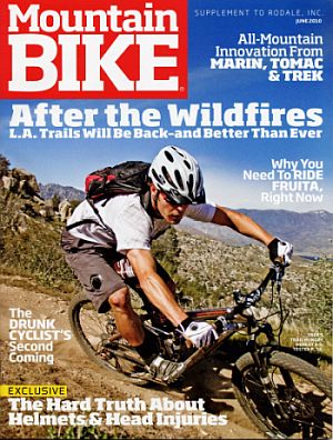
ing blow to outdoor recreation throughout Southern California. CORBA’s Steve Messer was recently interviewed by Mountain Bike Magazine about the extensive damage and impact to the trails, and pondered on how the recovery efforts might proceed.

Messer was probably the last person to ride Sam Merrill, Sunset Ridge and El Prieto trails before the fire swept through the area. Ironically, he was on his way with CORBA’s trail crew to do some trail repair work on Sunset Ridge trail as the fire broke out.

It’s clear that the recovery will take many years. At present it is too early in the process to speculate on when the forest and severely damaged trails may re-open. The Mountain Bike magazine story does a nice job of laying out the challenges and opportunities, and showing how CORBA, the Mount Wilson Bicycling Association and others might be called to action going forward.

The full article is available as PDF document.


Angeles Crest Highway Open to the Angeles National Forest

Saturday, June 4th, 2011

Cyclist and others gather for the ACH highway 2 opening ceremony and press release This morning, June 3, 2011, at 10 a.m. the Angeles Crest Highway was opened to motor traffic, bicycles and pedestrians. It has been closed since the Station Fire of 2009, while numerous repairs were made to the highway. It had been scheduled to open last November, but one of last winter’s heavy storms brought down the hillside onto the newly repaired road. Repairs have been completed on the section between La Canada and Clear Creek. Construction continues on a few sections beyond the Mt. Wilson road junction, but traffic is being flagged through the construction zone.

Caltrans also removed the winter closure of the highway at Islip Saddle. ACH is now open all the way through to Wrightwood.

Dozens of cyclists were among the first to pass the ceremonially opened gate, just outside the Angeles National Forest border. CORBA volunteers Steve Messer, Mike and Robin McGuire were also on hand, and took the opportunity to do some trailwork along the Grizzly Flat fire road after climbing Mt. Lukens.

This has been a much-anticipated day, welcomed by hikers, mountain bikers, and everyone who just wants easier access to the forest.

Angeles Crest Highway 2 openingThe highway opening has come just a few weeks after the May 16 opening of many trails that had been closed due to the Station Fire. A complete list of opened trails can be found in our previous story.

Angeles National Forest Trails to Open May 16, 2011

Friday, May 13th, 2011

The two questions we have been asked more than any other recently: “which trails are closed in the Angeles National Forest?  and “which trails are open in the Angeles National Forest?”

According to the Forest Service map of the station fire closure area at http://maps.fs.fed.us/stationfire/ the list below shows the status, effective May 16 2011, of some of the more popular trails that were affected by the Station Fire. Keep in mind that even though these trails are in the newly opened areas of the forest, the individual trails may be signed closed.  Please respect any trail closure signs and stay off those trails for your own safety and the recovery of the forest.

Many of the trails will not be in good shape, so be prepared for surprises like downed trees, slides, washouts, ruts, and other hazards. Many trails have been drastically changed from before the Station Fire. Many fire roads have not yet been graded and may be much narrower and in very poor condition with ruts and washouts. All the usual caveats about trail safety apply so use the trails safely and responsibly, and be especially careful the first time you travel on one of the newly opened trails.

Opened Trails (As of May 16, 2011 – Updated July 31, 2011) – 

  • Brown Mountain (to the saddle)
  • El Prieto
  • Gabrielino (JPL to Paul Little)
  • Gabrielino (Switzers to Redbox to Chantry)
  • Bear Canyon Trail
  • Sam Merrill Trail
  • Castle Canyon Trail
  • Sunset Ridge Trail
  • Mt. Lowe West Trail
  • Idlehour Trail
  • Kenyon Devore Trail
  • Rim Trail
  • Sturtevant Trail
  • Santa Clara Divide Truck Trail (Dillon Divide to Mt. Gleason to Three Points – non-motorized only)
  • Chilao Loop/Mt. Hillyer
  • Silver Mocassin
  • Shortcut
  • Valley forge
  • Mt. Lukens road (once the highway opens)
  • Earl Canyon
  • Haines Canyon
  • Mt Lukens Fire Road (as of June 3 opening of Angeles Crest Highway)
  • Graveyard Truck Trail
  • Grizzly Flat Fire Road
  • Doc Larsen
  • Everything east of Chilao

Keep in mind that even though these trails are in the opened area, the individual trails may be signed closed (And those signs mustl be respected). Many of the trails will not be in good shape, so be prepared for surprises like downed trees, massive ruts or slides, washouts, and other hazards.

Closed Trails (Until Further Notice)

  • Strawberry Peak
  • Tom Sloan
  • Dawn Mine
  • Millard Falls
  • Upper Brown Mountain (Saddle to the Summit/Ken Burton)
  • Ken Burton
  • Gabrielino from Switzers to Paul Little
  • Hoyt
  • Stone Canyon
  • Crescenta View
  • Rim of the Valley
  • Condor Peak Trail
  • Trail Canyon
  • Alder Creek
  • Colby Canyon
  • Josephine
  • Mueller Tunnel
  • Vetter Mountain

In addition to the above a separate closure remains in effect for the Williamson Rock area  (Closure Map is available).

GAO Station Fire Investigation Update

Thursday, April 28th, 2011
Congressman Schiff, Stephen Gaty, Tom Harbour and Marty Dumpis.

Congressman Schiff's Panel

Today, April 28, 2011, Congressman Adam Schiff (D-CA) hosted a panel discussion on the ongoing investigation into the Station Fire being conducted by the Government Accountability Office (GAO). The room at Altadena Public Library was filled to capacity with standing room only, with several TV cameras and members of the Media there to cover the event.

CORBA’s Steve Messer was also in attendance, looking for answers to unresolved questions about how the fire was managed. Messer was in the forest the day the Station Fire began, scheduled to do trailwork on the Sam Merrill trail with CORBA’s volunteer trail crew.

On the panel were Congressman Schiff, Stephen Gaty from the GAO’s Natural Resources and Environment team, Tom Harbour, director of Fire and Aviation for the USFS, and Deputy Superintendent of the Angeles National Forest, Marty Dumpis.

After Congressman Schiff gave a brief outline of the process and a summary of people’s concerns about the fire, each of the panel members gave opening remarks outlining where they are in the ongoing evaluation, and what we can look forward to. We learned from Gaty that the investigation is expected to continue until the end of the year, at which time the full report will be published on the GAO’s web site. The objectives of the investigation are to determine: how the Forest Service responded to the fire, whether or not they followed established procedures, the key questions their response to the fire raised, and what they can learn from the incident moving forward.

Tom Harbour gave a rundown of how things have changed, and how the FS has prepared for the upcoming fire season. According to Harbour, the FS has renewed and strengthened its communications and agreements with the L.A. County fire department, and that they will be prepared. We were assured that it will be easier for the FS to summon assets from L.A. County in the event of another fire.

There are 80 rotor-wing aircraft and 18 tankers in the FS fleet, he said, though he didn’t make it clear that this is for the USFS nationwide. It is an aging fleet including WWII era craft, which they don’t want to “wear out” by double-shifting. Many were dismayed at this revelation.  He assured people that life and property are the FS first priority, while on the other hand seeming to indicate that the wearing out of an aging fleet takes precedence in the management of assets.

Harbour also reiterated that the FS continues to evaluate the addition of night-flying capability to their fire fighting assets, something that could have quelled the fire on its first day. The evaluation is expected to take a further two months. Cost is the biggest issue at this time. Audience members raised the question of whether a 25 million investment in additional aircraft could be weighed against the cost of damage and recovery efforts. According to Gaty, that would be beyond the scope of the GAO investigation.

Many in the audience were not impressed by what they were hearing. One Big Tujunga canyon resident asked about the FS policy regarding structures on leased land within the forest, vs. the policy regarding structures on private land within the forest. He turned and asked the gathered crowd how many had lost homes in the fire. More than a dozen hands went up. Mr. Harbour was placed on the spot several times in succession as members of the audience questioned a policy that left their homes undefended.

The biggest criticisms laid against the FS by Schiff and echoed by many in the audience, was the length of time this investigation is taking to complete. La Canada-Flintridge council member Laura Olhasso rebuked the FS for drawing out this process for so long, and urged them to speed up this process. The audience applauded her comments.

More Forest Openings Expected

Of particular interest to many is the length of time the forest has remained closed. Marty Dumpis publicly announced that approximately 98,000 acres of the 180,000 acres in the current closure are expected to open by memorial day weekend. That will include about 110 miles of re-opened trails. The openings will mostly occur in the northern, eastern and western borders of the current closure.  Trails may not be in the best shape, he said, but many FS personnel have expressed frustration at their inability to enforce the closure. An open forest is easier to manage than a closed one.

Dumpis made no mention of the Angeles Front Country. We will continue to work with the Forest Service to help survey and restore trails in the closure area.  Dumpis also added that the Big Tujunga Canyon area will likely remain closed for at least another year, as they monitor the recovery of endangered species and sensitive plant species.

Through a grant from the Air Quality Management District, they have begun re-planting about 11,000 acres of forest, mostly in the high country. 4,000 of those acres will be completed this year.

Public Input Requested

Gaty extended an invitation to anyone with information that may be relevant to the investigation to contact his office. Though he couldn’t confirm that every question would be answered by the investigation, he felt it important to gather as many of those questions and observations as people had.

Though the session was important, many left dissatisfied with what they learned, or rather, didn’t learn today.  We thank Congressman Schiff for continuing to move this investigation forward, and for involving the public in the process.

Friends of the Angeles Formation Meetings

Monday, April 18th, 2011

The Forest Service and the National Forest Foundation (NFF) are planning to host several meetings with existing and potential supporters of the Angeles National Forest to determine public interest in forming a Friends of the Angeles organization. The meetings will be held during the last week of April in three locations. A CORBA representative will be attending, and we hope to see other mountain bikers and multi-use trail advocates attend as well.

During the course of each meeting, there will be talk about the challenges the Angeles National Forest faces–particularly in light of the Station Fire–and how a Friends group could help. There will be a discussion of what form such a group might take, what supportive activities it might take on, and the steps involved in creating the organization.

All users of the Angeles National Forest to attend one of these sensing sessions, both to provide input and also to hear what others have to say. These meetings will provide an opportunity for us to share what we are already doing as “friends” of the Angeles, and how our efforts may be helped by an official Friends organization.

The information gathered at the meetings will be used to shape a Friends group that truly meets the needs and passions of all who care about the well-being of the Angeles National Forest.

Other similar groups can be found in the Inyo National Forest (Friends of the Inyo) and the San Bernadino National Forest (San Bernadino National Forest Association). The National Park Service has a web page with information on how to start a Friends group at http://www.nps.gov/partnership/friends_groups.htm.

If you have questions about the meeting, call Kathy Peterson, the partnership coordinator for the forest at 626-437-5789.

Meetings will be held:

Tuesday, April 26, 2011, 6:30 pm – 8:30 pm
Angeles National Forest Supervisor’s Office, 701 N. Santa Anita Ave, Arcadia, CA 91006.

Wednesday, April 27, 2011, 6:30 pm. – 8:30 pm
Big Pines Information Center, Angeles Crest Highway (Hwy 2), Wrightwood, CA 92397.

Thursday, April 28, 2011, 6:30 pm – 8:30 pm
San Gabriel Canyon Gateway Center, 1990 North San Gabriel Canyon Road (Hwy 39), Azusa, CA 91702