
Parks officials show the abandoned plan
On Wednesday evening, February 8, 2012, a packed house was far more than the Conejo Recreation and Parks District was expecting. But they were very pleased with the turnout, and encouraged to see so many local residents take an interest in the future of this large, but undeveloped park.
The Lang Ranch Community Park appears on the District’s Master Plan and has already had its own master plan drawn up. The plan included numerous wonderful improvements, but the reports of geologically unstable ground made the cost of implementing this plan beyond feasible. The cost of stabilizing the park’s sloping hillsides–a necessary step before any improvements could be made–proved prohibitive. The plan had to be retired and a new one envisaged.

A packed house of more than 90 participants
This meeting was to gain public input on what could be done with the park without major construction, without digging, without the need for water. After this history and the given parameters the attendees were divided up into nine groups, each to discuss what they’d like to see in the park. A facilitator from the parks department took notes on easel boards, listing the table’s priorities. Each group then assigned a spokesperson to summarize the groups wishlist.
A common theme among all the groups was the call for a pump track/bike park/dirt jumps and trails. This was probably helped by the last minute efforts of local bike park advocates putting out the word through facebook and other social outlets. It was referred to as a Bike Skills Park, a Pump Track, a Dirt Jump Park, a Mountain Bike park, but the common thread was there: a facility for off-road bicycles.
Also high on the suggestion list were trails, connectivity to Conejo Open Space trails, off-leash dog park, radio-controlled car and plane facility, landscaping with native plants, disc golf, playground facilities, picnic benches, bathrooms at the one place in the park that was deemed suitable for construction, through-trails/bike paths to connect students at the neighboring residential areas to the school at the western end of the park, and many other options. The parks staff were notably pleased with the input.

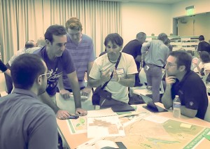
Facilitators seek public input from each table
Subsequently, on Saturday February 11, a second meeting took place during which interested parties walked the park property with parks staff to discuss the possibilities. While fewer people attended this, some key proponents of a bike skills park were there to ensure the City continued to hear of the desire for a bike park facility.
Over the coming weeks and months the parks department will be distilling the key requests from the public into an updated vision for this Community Park and inviting more feedback.
The next meeting is on February 29, 2012, 7 – 9 pm at the Hillcrest Center Community Room, 403 W. Hillcrest Drive, Thousand Oaks, CA 91360. This meeting is listed as a “Brainstorming and Bubble Diagram” event. The public will be asked to put their ideas on maps of the park property.
On March 21, 2012, also 7 – 9 pm at the Hillcrest Center Community Room, CRPD will be reporting back to the public on what they’ve garnered from the public’s input, and their recommendations. There may be additional meetings so stay tuned for further announcements. If you are unable to attend the meeting, you can email your input to parks@crpd.org.

Presenting his table's ideas for a bike park
We’re especially pleased that the Conejo Recreation and Parks Department is reaching out to the public, and engaging people directly in this early stage of the planning process. While a Conejo Bike Park is not yet a done deal, it seems that the idea is alive and well and has a good chance of becoming reality. We urge people to stay involved in the process and keep pushing for a bike park. Opportunities like this don’t come very often, especially right here in our own back yards… or city parks. For more information, follow the progress on facebook and at the parks department web site, www.crpd.org.


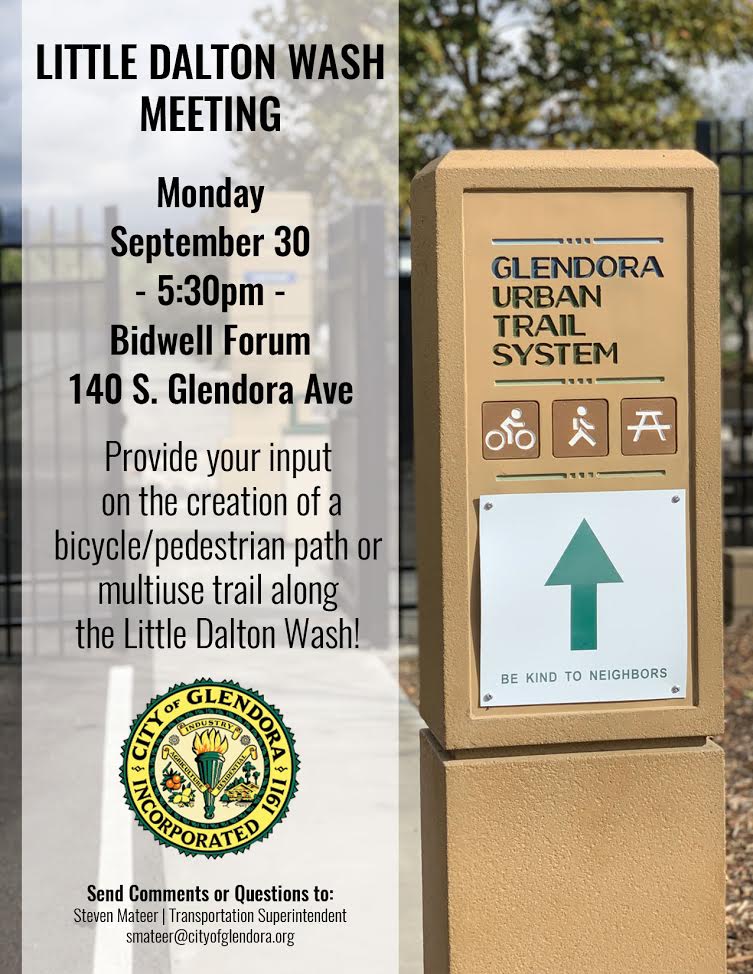 The City of Glendora invites you to a public workshop held in conjunction with a proposed grant application to the California Natural Resources Agency under Proposition 68. The City is proposing to submit an application for the Little Dalton Wash. The project would construct a bike/pedestrian path similar to the existing Glendora Urban Trail and extend from Finkbiner Park to just south of the spreading grounds near Glendora Mountain Road. The City will be holding a workshop to solicit input and feedback on this exciting opportunity to create and enhance open space, trail connectivity, and recreational opportunities for Glendora, on Monday, Sep 30th.
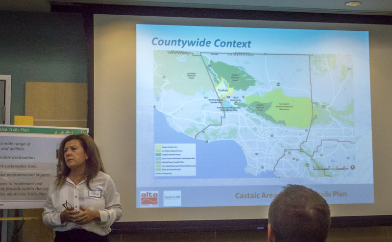
 Some important issues came up, such as the preservation of iconic and unique trails in the Tapia Canyon area, access to Forest Service and Tapia Canyon blocked by the Tesoro development, and potential impacts of the Hidden Ranch at Tapia Canyon Development. It is these and other development proposals that have prompted the County to take on this important planning task. There are more people coming to the Castaic area, more homes, more business, more kids on bikes and more demand for recreational trails.


