January 2016 Skills Clinic and Beginners’ Ride Photos Posted December 3

January 3rd, 2016

Malibu Creek State Park was busy with visitors on the second day of 2016. The morning started off overcast and chilly for 15 riders at the Basic Skills Clinic.  The clinic is always held the first Saturday of the month. You can see the photos in our January photo gallery. This month, the clinic was followed by a Beginners’ Ride, sponsored by Cynergy Cycles and led by CORBA and GGR Director Wendy Engelberg. Photos of the ride can be seen at the end of the skills clinic photo gallery.

January 2016 eTerraTimes Newsletter Published December 31

December 31st, 2015

The January 2016 edition of CORBA’s monthly newsletter, the eTerraTimes, was published today, December 31. If you don’t get it by email, you can view it online.

As always, the eTerraTimes has all the latest news for mountain bikers in the Santa Monica Mountains and surrounding areas.

President’s Message: 2015 – A Year in Review

December 31st, 2015

2015 has been one of the most active in CORBA’s history. There has been so much happening in our local mountains, in our sport, in our public lands, in the political landscape, and in bicycle advocacy in general. As always, CORBA has done its best to stay on top of the issues, to be leaders in the trail community, and to have a positive impact on our trails, our public lands, our community and our sport. Here’s a quick recap of what’s been happening this year, showing how your membership dollars and donations are being used to benefit all mountain bikers in the Los Angeles and Eastern Ventura Counties.

Advocacy

Puente Hills Landfill Meeting

Puente Hills Landfill Meeting

Much has happened this year on the mountain bike advocacy front. One of the biggest issues has been the start of the process to develop a Management Plan for our year-old San Gabriel Mountains National Monument. The National Forest Foundation convened a Community Collaborative group to develop a broad base of support from a diverse range of stakeholders to help guide the Forest Service in its management of the Angeles National Forest and the SGMNM. CORBA has been involved from the start, in 2014 on the committee to establish the Collaborative, and this year as an active participant in the Collaborative. Forty-five diverse interests are represented, some of whom have traditionally found themselves at odds with our community. This has truly expanded our outreach and strengthened our place in the community.

We’re also continuing to work with Los Angeles County on several fronts: the Castaic Area Trail Master Plan, the Los Angeles County Trails Manual, the now-completed Santa Susana Mountains Trail Master plan, the LA County Park Needs assessment, the Altadena Crest Trail Restoration, the Puente Hills Landfill and bicycle access to trails in general.

This year we joined the Los Angeles Bike Park Collective. We have pending Bike Park proposals with Los Angeles County, the City of Los Angeles, City of Glendale, and Thousand Oaks. Fillmore Bike Park opened this past Spring.

We’re closely monitoring the development of the Santa Monica Mountains Trail Master Plan, which is expected to come out in draft form in 2016. We saw the Rim of the Valley Study completed. Legislation was introduced to create a new National Recreation Area, and expand our new National Monument. We’ve worked with legislators on a pending Wilderness bill, to ensure that it has minimum impact on mountain biking. We’re continuing to work with the Sierra Club and Wilderness Society to ensure that their efforts to protect our public lands do not impact our ability to enjoy them.

This year new e-bike legislation was introduced. Early drafts could have been interpreted to allow electric mountain bikes on non-motorized trails. We worked to clarify that this does not makes e-bike legal on trails. We’ll be watching the e-bike debate closely as they become more popular.

There’s a pending application to build a hotel on the DeAnza Trailhead. CORBA took the lead on asking the City of Calabasas to do a full EIR.

Outside the area, we’re keeping an eye on wilderness proposals in the Sierra Nevada mountains and BLM land swap proposals in the San Jacinto Mountains, both with the potential to close trails to bikes.

Read the rest of this entry »

Vetter Mountain Trail Restoration Progress

December 30th, 2015

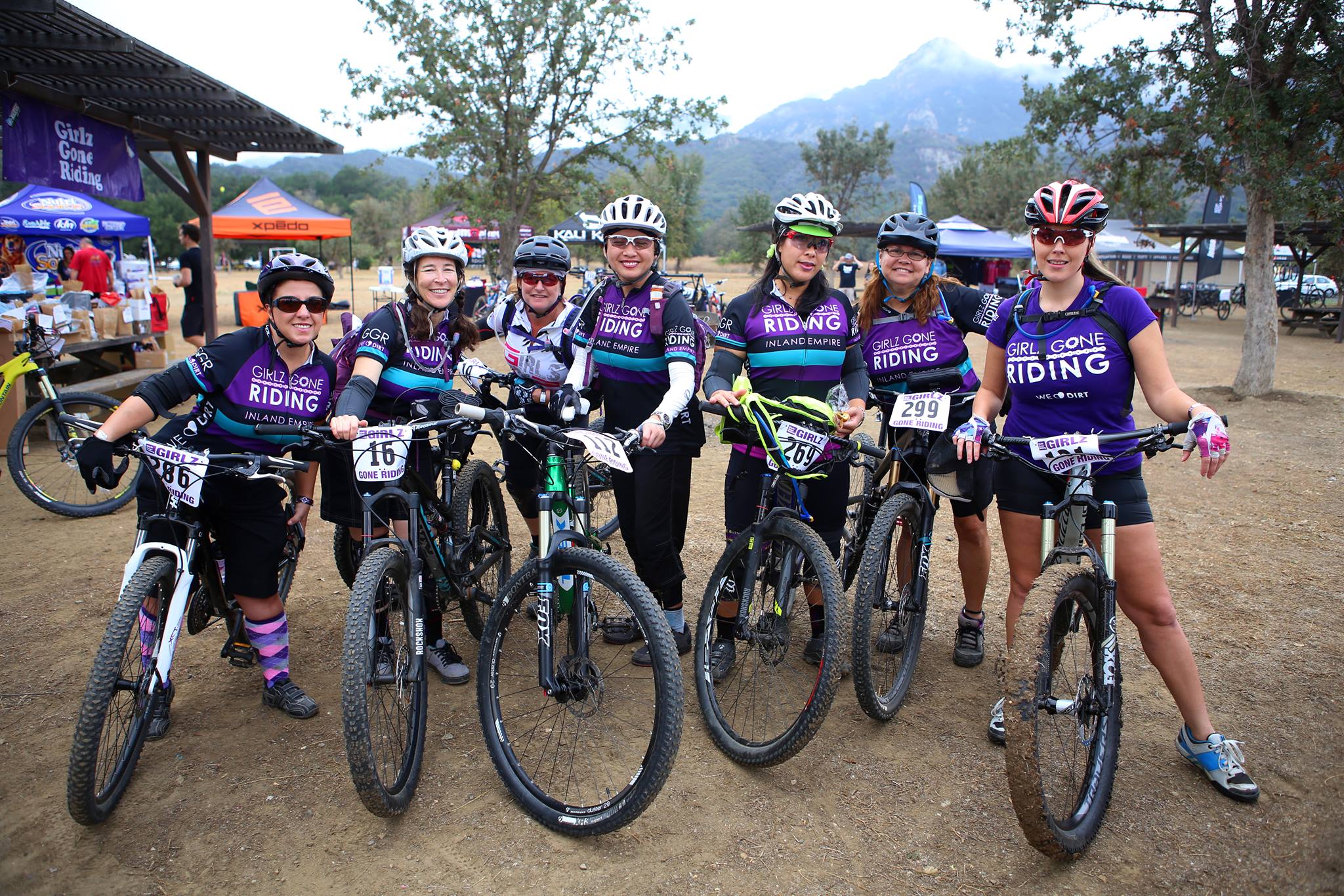
Last January the Forest Service allowed some experienced trail maintenance volunteers, who had been previously certified to use chainsaws at the “A” level, to step up their training to a “B” level. Under current regulations, A level sawyers are restricted to 8 inch trees or smaller, and must be supervised. B-level Sawyers are allowed to work unsupervised, on trees up to 24″ in diameter, and can supervise and work with A-level sawyers.

Chainsaw Certification Class of 2015

B Level Chainsaw Certification Class of 2015

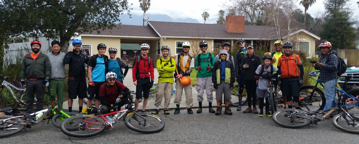
CORBA President Steve Messer, and volunteer Mike McGuire both received their B level certification, and have been putting them to use all year. MWBA volunteers Mitch Marich, Brad Benam and Erik Hillard also received their A level certification, along with several other individuals and volunteers from other organizations and areas outside Los Angeles.

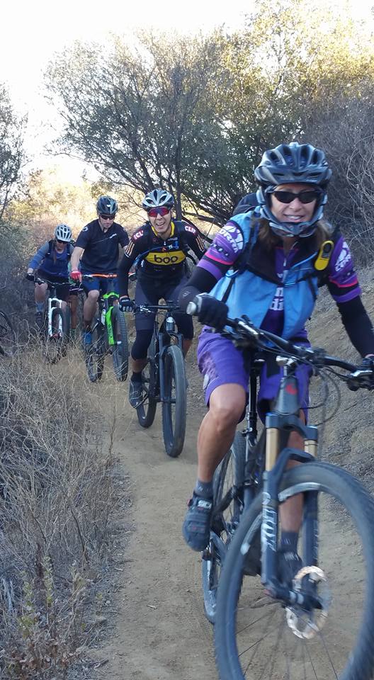
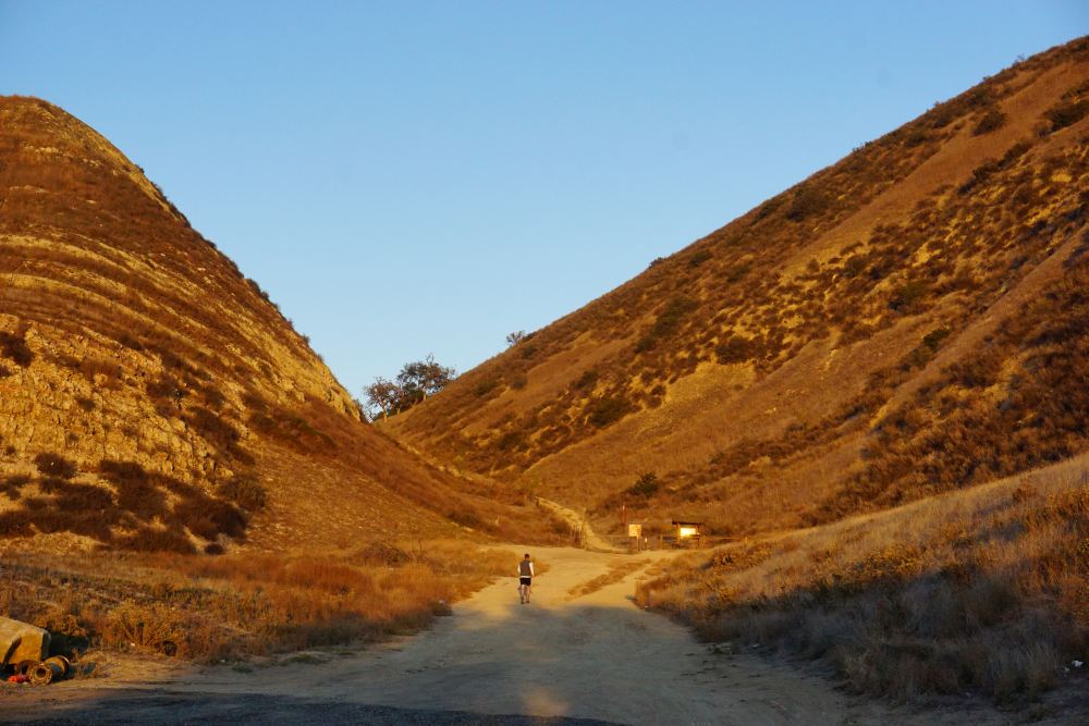
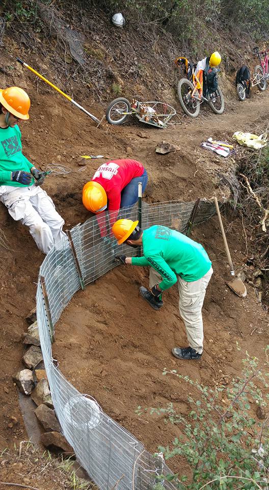
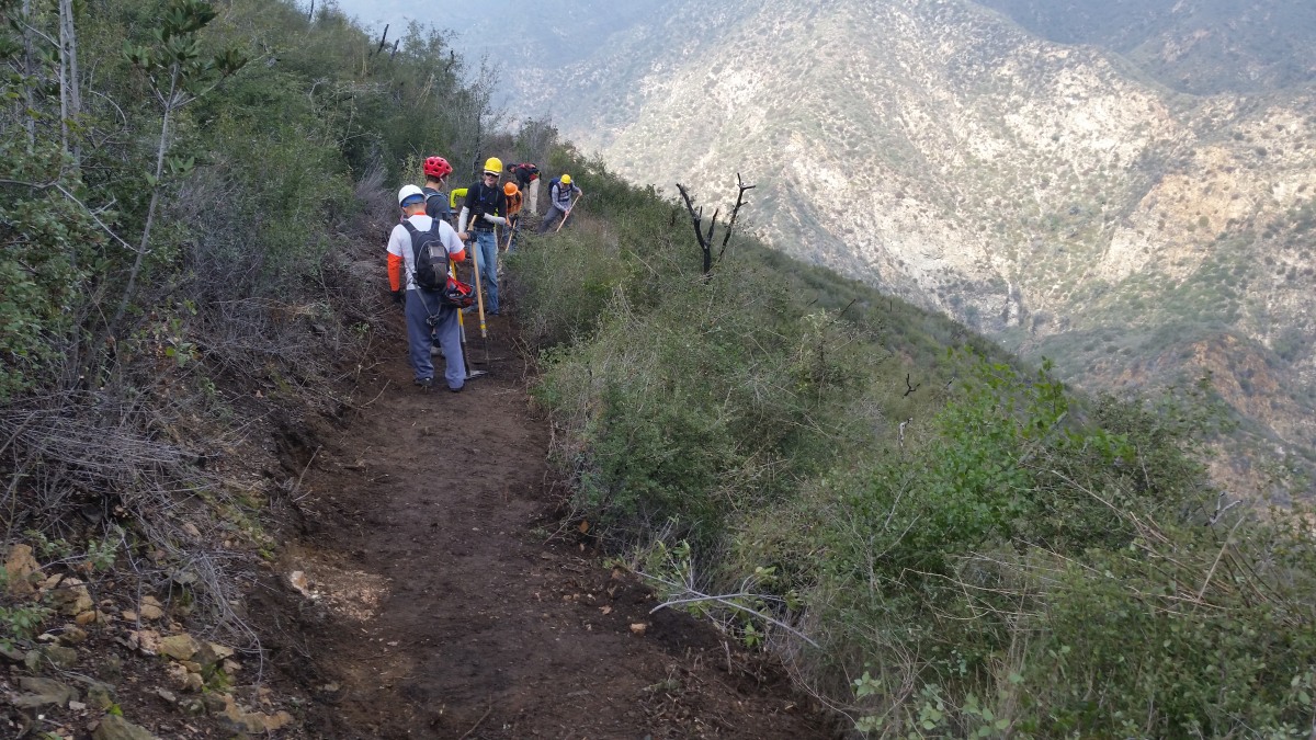
Together the CORBA and MWBA sawyer team has been cutting trees from trails all year. We’ve cut trees from Brown Mountain, El Prieto, Sunset Ridge, Gabrielino, Strawberry Peak, Colby Canyon, Mount Lowe East, Sam Merrill and Silver Moccasin trails. Six years after the Station Fire, downed trees are becoming a major and constant problem.

Our biggest project has been Vetter Mountain trail. This was a favorite of local mountain bikers, as the first descent of the classic Chilao Loop (or, more accurately, the Chilao Figure-8). The area was one of the most heavily impacted areas of the forest by the Station Fire. Drought has slowed the area’s recovery, and there are still thousands of dead trees waiting to fall.

We began in early spring 2015, first clearing the Charlton Flats loop road of more than two dozen downed trees just to get to the bottom of the Vetter Mountain Trail and Silver Moccasin trail. We cleared all the deadfall from the lower section of Vetter through to the first road crossing. There were many trees beyond our chainsaw certification level, the largest being just over 50 inches in diameter. These were taken care of by Little Tujunga Hot Shots Captain Greg Stenmo, whose support we were grateful to have.

After the summer heat and when fire danger levels and wind conditions allowed, on October 3rd CORBA and USFS volunteers Mike and Robin McGuire returned to begin work on the next section of the trail. In a day’s work, they were only able to clear the first hundred feet of the trail, with the sheer number of trees stacked like Chinese pickup sticks.

image

We returned on October 8th. In the five days since Mike and Robin were up there, another four trees had fallen across the road. Finally getting to the trail, we began cutting downed trees, poodle dog bush and buckthorn from the overgrown tread. In places it was impossible to see any remnant of trail through the brush and deadfall, so having been familiar with the trail in its pre-fire glory was a must.  The time lapse below gives a pretty good indication of what’s been involved in clearing the trail. This is six hours of work compressed to nine minutes.

We returned on October 23, and November 5. On November 5 we started from the top of the trail, near the site of the old lookout and worked our way down. It was a glorious moment for us to finally have cut and cleared over 150 trees from Vetter Mountain trail, Charlton trail, and the Charlton Loop road. After finishing, we went back and inspected the trail from top to bottom, and found a dozen more trees fallen in areas we’d previously cleared.

Once again we returned on December 17, first clearing downed trees off the road, then several new trees that had fallen across Vetter and Charlton trails. Afterwards we joined the Chilao hotshots crew, who were clearing downed trees from Silver Moccasin trail after the particularly strong windstorms of December.  With our help, they were able to get the job finished in one day.

The trail remains closed to the public. There are still too many dead trees that have been rotting away for six years, waiting to fall every time the wind blows. More than once, when we finished our day’s chainsaw work as the afternoon winds started blowing, we heard more trees falling. Because of these dangers, we are not willing to take in volunteer crews to begin restoring the trail. Since winds have been blowing steadily this past month (over 70mph the week before Christmas), there are probably many more trees down again.

Currently the Forest Service, along with Fire Crews and us as Volunteer Sawyers, are developing a plan to clear remaining standing trees in the trail and road corridors, so that they don’t continue to fall across the trail every time the wind blows. Currently crews are doing that along the Santa Clara Divide Road so that it can be reopened to vehicles next year.

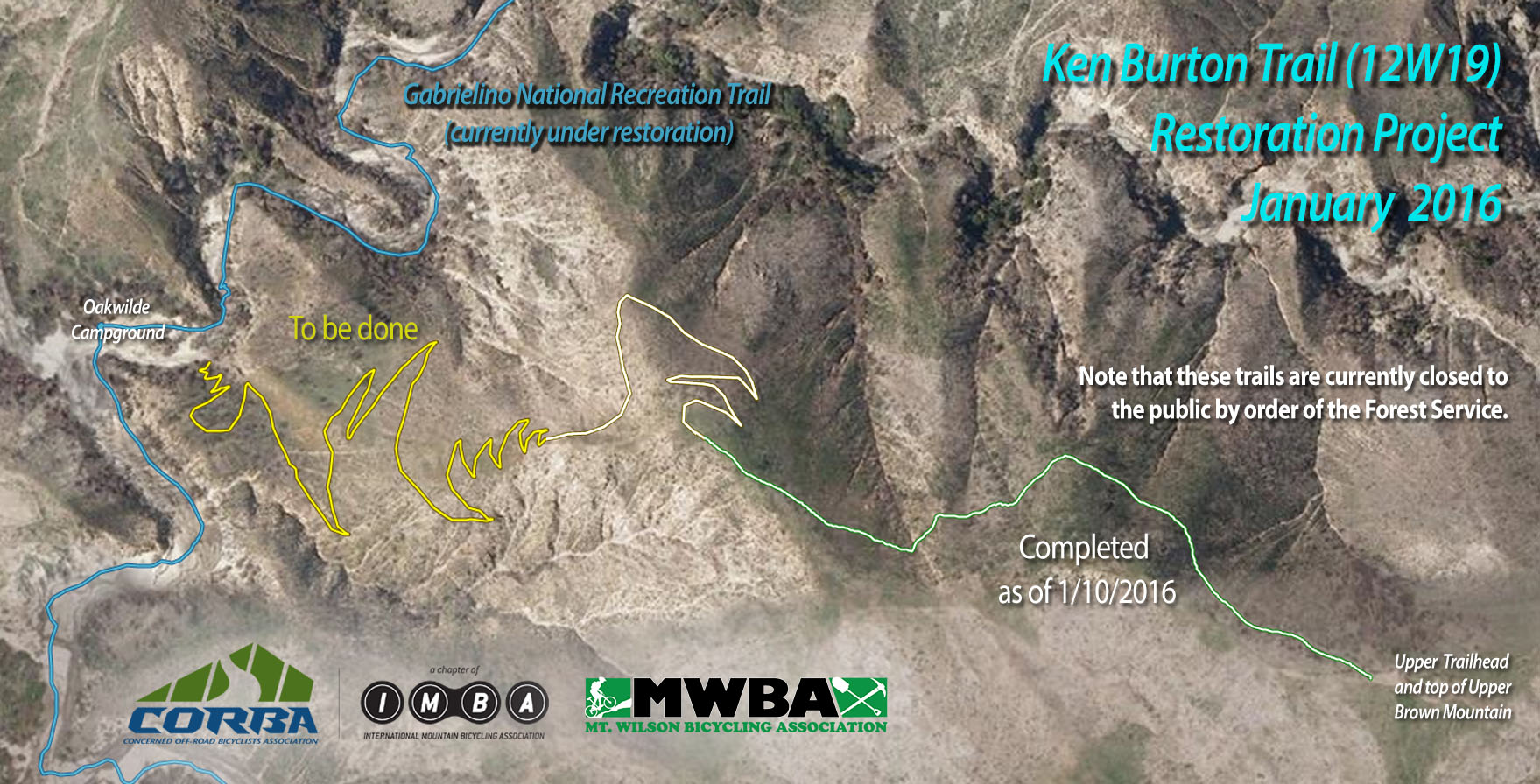
We hope to begin restoration work on the Vetter Mountain trail next year, after we finish the Ken Burton trail. Stay tuned for details.

El Nino Watch: Trail Damage and Riding after it Rains

December 29th, 2015

We are having a severe El Nino event this winter; as a result the weather forecast is for many heavy rainstorms in the early months of 2016. That will help our drought situation, but will have seriously bad impacts on our trails. As well as muddy conditions that interfere with their use, described  below, the rains could be severe enough to erode some trails into huge ruts, and even wash them away in some cases. There may be more mudslides in Pt Mugu State Park (Sycamore Canyon) like we had last year. Furthermore, the rain will spur the chaparral to overgrow the trails, a condition we haven’t had to deal with much over the past couple of years because of the drought. The combination of waterlogged soil and high winds could blow trees over. We’re expecting to have special trailwork days to repair these damaged trails and hope many mountain bikers will want to help us get them back into shape!

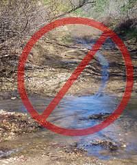
Most trails in our local riding area don’t respond well to rain. They have a high content of clay that turns into sticky, slippery muck that binds to everything it touches. It builds up on the tires, like a snowball rolling downhill, until it jams on the frame and the wheels won’t budge. Some models of clipless pedals won’t let go when full of this mud, resulting in the bike and the attached rider lying sideways in a puddle, or worse.

Most wet trails don’t respond well to use until they’ve had time to dry out. Hikers and horses make holes and ridges in the trail that become as hard as concrete when the trail dries. These holes and ridges are good for twisting ankles.

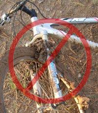
As a rule of thumb, if your foot, tire or hoof makes an impression more than about 1/8 inch deep in the dirt, the trail is still too soft to use. Give it another day or two to dry out before using it!

On wet trails, bikes make grooves along the trail. The next time it rains, the water runs down these grooves and turns them into little ruts, then large ruts that destroy the trail.

The mud is particularly hard to remove. It sticks to the bike and shoes, no matter the efforts to remove it, rubbing off on the bike rack, car carpet and gas/brake pedals, making them slippery. Once home, it takes the careful use of a garden hose to remove the mud but not force water into the sensitive parts of the bike.

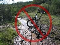
For these reasons, riders are well advised to stay off the trails after a rain until they have dried. How long to stay off? That depends on a number of factors including the particular trail, how much rain it received, how much sun it gets after the rain (is it in the shade or face south?), how warm and windy the weather is, and so on. After an isolated light rain you can probably ride the next day. After a heavy rain, you should wait several days. This is something where common sense and experience will help. Remember, tracks deeper than 1/8″ mean the trail is still too soft to use!

All is not lost when the trails are soaking! There are a few trails that hold up well when wet because they have more sand and rock that doesn’t hold the water. Here are a few you should know about:

Space Mountain (Los Robles Trail West) to the picnic table is almost always rideable, even right after a big storm. However, it can be pretty mucky from the picnic table to Potrero Road.
Rosewood Trail is pretty good, but not quite as resilient as Space Mountain.
Zuma Ridge Motorway from Encinal (the bottom in Malibu is muddy)
Dirt Mulholland around Topanga State Park.
-Brown Mountain Fireroad
-Most San Gabriel Mountains trails made up of decomposed granite
-Beaudry Fireroad
-Hostetter Fireroad
-Mt. Lukens

Girlz Gone Riding 2015 Wrap UP!

December 24th, 2015

The year in GGR has really been a spectacular one! Lots of new women riding, improving, trying their hand at racing and the biggest Rocktober showing yet of both participants and exhibitors!
12045374_10153685681042497_8851658558837191906_o12109887_10153685675882497_7874100621296408214_o
12094966_10153685672152497_8234281562571921285_o12091229_10153685670097497_5118586874100220593_o
We closed the year out with our annual CO-ED Holiday Ride & Luncheon. 40 Riders showed up to enjoy 3 levels of guided rides in the Santa Monica Mountains and have fun at our lunch buffet & gift exchange. This year Susan Hall won the Most Improved Rider for 2015 and was presented with a large purple plaque!
535052_10153326407797358_4808420004864114068_n 12391111_10153326407122358_6805171305530086525_n 10273720_10153326405882358_8833758330063551026_n12359885_10153326392877358_6765449669205999645_n 
12294841_10153326394582358_5816626393219422598_n

12369207_10153326394072358_4671500243106498280_n 12366232_10153326409042358_2124911002105356579_n


There are so many exciting things to look forward to in 2016 for women’s cycling and GGR! Here are just some of our events for 2016!

  • January 7th: Mountain Bike Action Magazine hits the streets! THIS is the issue to purchase! That’s all I can say!
  • January 9th: Ladies only group ride
  • January 27th, 28th: GGR leadership team are guests at Specialized!
  • February 27th: This starts the monthly ladies only group rides to be the LAST Saturday of every month except when larger events takes precedence
  • March 26th: Ladies only group ride
  • April 30th: No group ride for April, we will be participating along with G2 bikes in the Rwanda 50 charity ride: Rwanda 50 GGR Sign up
  • May 28th: Danusia Taber’s annual CO-ED memorial ride and fund raiser for the Sarcoma Alliance. This is CO ED. This will be the group ride for May.
  • August 6th & 7th: GGR’s annual Women’s Weekend in Big Bear! We only except 60 women for this, so keep an eye out for the Event Brite link to get registered! 11794060_10153091920092358_546504680413202656_o
  • October: ROCKTOBER #6! Date to be announced late: GGR welcomes REI as a 2016 Rocktober Sponsor with 3 booths featuring their line of ghost bikes!

Not yet scheduled:

  • 1st quarter of 2016: Suspension set up clinic
  • Rim Nordic Enduro Pre Rides
  • So Cal Endurance Enduro Pre Rides

GGR wishes the entire mountain biking community a happy, safe and absolutely fabulous New Year! May you descend that tight switchback without dabbing! May you get that rock garden line just right, and may you hit that drop like there is no tomorrow!

GGR Girl Wendy E

Ken Burton Trail Restoration Day 4

December 18th, 2015

Ride in 8 miles and 2000′ to the work site

On Sunday, December 13, more than 25 CORBA and Mount Wilson Bicycling Association volunteers came out to help restore the Ken Burton Trail. It was another highly successful day, with another quarter mile of trail brushed, re-cut and restored back to better-than-before-the-fire condition. Following much the same pattern our previous trailwork days have followed, our lead crew rough-cleared brush to reveal the old tread. Others followed with loppers to fine tune, then mcleods and pulaskis to remove the years of accumulated slough and restore outslope and drainage to the tread. We worked on approximately a quarter mile of tread, including the first three (of more than 20) switchbacks, and began prepping the trail beyond that.

first switchback on Ken Burton trail

First Switchback finished on Ken Burton

Our crew was excited to have John Watson from The Radavist join us with a crew to shoot video and photos of our day’s work. They did a great story and photo gallery, available at: http://theradavist.com.  Click on the photo to scroll through their gallery of great shots.  They also put together a great video capturing the day’s efforts.

Our next work day, weather permitting, will be on January 10, followed by January 24.  Sign up to our event on Meetup.com/corbamtb, or on Facebook.


December 2015 Skills Clinic Photos Posted December 5

December 5th, 2015

It was practically deserted in Malibu Creek State Park this month on a sunny but cool morning for the five riders at the Basic Skills Clinic.  The clinic is always held the first Saturday of the month. You can see the photos in our December photo gallery.

Comments needed by December 4th to opposed hotel plan that would block historic trail in Calabasas

November 30th, 2015
 A hiker approaches the De Anza trailhead, which will be hidden behind a hotel

A hiker approaches the De Anza trailhead, which will be hidden behind the proposed hotel.

The city of Calabasas is pushing plans for the building of the Rondell Oasis Hotel that would block access to the Juan Bautista de Anza Historic Trail (“DeAnza Trail”). The trail is designated as a National Historic Trail and got congressional approval and went to the white house in 2000.  This is part of the original El Camino Real route and has over 200 years of history! It is one of only nineteen such trails in the country.

The hotel will be bounded by Las Virgenes Road to the West and the 101 Freeway to the north.

The hotel will be bounded by Las Virgenes Road to the West and the 101 Freeway to the north, as indicated by the yellow outline. The wide yellow line would be a new road.

The hotel is to be built on the currently vacant property on the east side of Las Virgenes Road, immediately south of the 101 freeway, next to the Mobile station. It will occupy the area where people now park to access the DeAnza trail and the adjoining New Millennium Loop trail system.

The developer is proposing to mitigate its impact to the trail by installing approximately 4 parking spaces, a water fountain and a doggy poo-bag station. What is not said clearly is because of the flood hazards on the site, the developer is putting in concrete drainages that would block all access to the trail, and in order to access the trail they would install steps up and over the drainage to the trailhead. This is hardly bicycle or equestrian friendly. In fact, this parking area is the only one that is large enough to accommodate horse trailers for equestrians who want to ride these trails. That access would be lost.

The city of Calabasas believes that these minor accommodations would mitigate the access issues to the trail, but the proposed number of spaces is completely inadequate for this popular trail. There are other significant issues with this development that concern the citizens of Calabasas, but the city believes that they are all minor, and that no Environmental Impact Report is needed to explore the full impact and propose appropriate changes to the plan.

You can get a copy online of the city’s report, “Rondell Oasis Hotel Project: Initial Study…” Page 56 is the checklist where nothing is deemed as having any potential significant impact on a historical or archaeological resource, which isn’t the case.

An artist's rendering of the proposed hotel.

An artist’s rendering of the proposed hotel. Trail access would be via a staircase from the hotel parking lot.

We urge you to send your comments to the City of Calabasas, expressing the need for a full Environmental Impact Report. Comments must be received by December 4th, 2015! Send them to Michael Klein, the planner for this project. His email address is mklein@cityofcalabasas.com

CORBA’s comments can be found here. Below is a sample letter that you are free to copy and send in under your own name. Of course, it would be even better if you add a sentence or two of your own to make it more individual. Don’t forget to add a catchy subject line!

Dear Mr. Klein,

I have just learned of the Rondell Oasis Hotel Project that is to be situated on the the east side of Las Virgenes Road, immediately south of the 101 freeway. This project would block access to the popular Juan Bautista de Anza Historic Trail that was used by the missionaries over 200 years ago when traveling up the coast of California, and eliminate the current large parking area at the trailhead. The few parking spots that the developers plan to provide for trailhead parking would not be nearly adequate for the number of people who like to use it. Currently this is the only parking area for accessing this historic trail and the New Millennium Loop trail system that is large enough for equestrians with their horse trailers, so the project would completely eliminate their access.

The City of Calabasas’ conclusion that a full environmental impact report is not needed for this project is incorrect in my view. I urge the city to require a full Environmental Impact Report for this project!

Yours Sincerely,


Ken Burton Trail Restoration Continues December 13

November 25th, 2015
MWBA and CORBA Trail Crew

Most of the Sunday, 11/22 crew after they arrived. Thanks guys and gals!

On Sunday, November 22nd, 2015, we had our third full trail restoration work day on Ken Burton trail with the Mount Wilson Bicycling Association. 23 volunteers made the 7 mile, 2000′ climb to pitch in. Bob trailers were used once again to get needed tools and supplies to the work site.

We continued on from where we finished last time. The crews worked feverishly for a solid four hours, clearing an additional 1600′ of trail. We’re making rapid progress, thanks in part to the excellent original construction by the Mount Wilson Bicycling Association in the 1990’s.


Ken Burton Hike a Bike

Before: A group who poached the closed trail in 2013. The brush is only thicker and taller now.


Completed trailwork Ken Burton

After our crew had been through


Ken Burton Trail Restoration

After: looking the other direction

The before and after is quite dramatic. Where the trail was previously completely obscured by brush, it is now in better shape than before the fire. Our crews are getting it down to a fine art. We’re using power hedge trimmers for the initial brush clearance, followed by swampers (who remove and stash the cut brush), then loppers and hand saws to fine tune the brush and stump removal.  The lead crew is followed by a tread crew, working to remove stumps and roots from the tread, and pull down slough to restore the original trail tread.  We’re cutting the trail to its original 36 – 48″ tread width where possible, knowing that it will narrow down again with time.

Ken Burton Trailwork

Getting close to the memorial and the top of the switchbacks


Ken Burton Memorial. Plaque has been long gone.

Ken Burton Memorial. The plaque is long gone.

Our target for the day was to reach the Ken Burton Memorial, a plaque dedicated to USFS Battalion Chief Ken Burton, who was killed in a car crash in November 1985. For those who remember the trail, the memorial was just before the very first switchback descending into the Arroyo Seco canyon. We made it to the Memorial at about 1 p.m., leaving time for people to gather tools, load up trailers and ride back down for lunch at 2. Pat Phillips, a local Altadena resident and one of the original construction crew in the 1990’s, graciously hosted us for lunch afterwards.

Failed wire basket retaining wall

Failed wire basket retaining wall


We’ve also reached the first failed retaining wall structure. In my survey of the trail, only two sections of retaining wall structure failed out of the dozens used, a testament to the work of the original MWBA crew. Those dozens of structures have survived three major El Nino winters and one Station Fire.

Completed-Map

Project Status. Click for a larger view.

So far we’ve cleared approximately .7 miles of the trail, about 1/3 of the work. We have a couple more days of very similar work before it will get especially thick and tough near the bottom. At that time we’ll need to coordinate with the Los Angeles Conservation Corps who are working on the Gabrielino trail, near where it meets the bottom of Ken Burton trail.

Thanks again to all the volunteers who came out to help. Our next work day is December 13 (weather permitting). Our tentative dates starting next year are January 10 and January 24, to be confirmed soon. The more people who contribute, the better our chances of riding this trail next summer!