Archive for the ‘Trail Crew’ Category

January 22nd Update on the Pt Mugu State Park Trails

Monday, January 26th, 2015

On Thursday January 22nd, we got an update of the status and future of Pt Mugu State Park by Dale Skinner. Dale manages trail maintenance for the State Parks for the SMMtns.

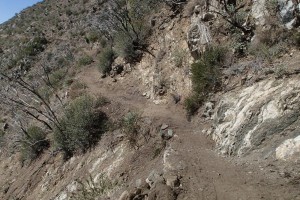
By way of background… The Springs Fire of May 2013 burned all the chaparral and some of the large trees throughout the park and the plant roots that normally hold the soil together were destroyed. Without this support, the heavy rains in December resulted in large mudslides in the park, burying or washing away some of the trails and impacting almost all of them. The photo below shows what remains of the main Sycamore Canyon Fireroad.

SAM_0886.jpg

You can see more photos of the damage in this Pt Mugu State Park mudslide gallery.

Since the mudslides, the park has been closed while bulldozers and other heavy equipment are used to restore the trails.

State Parks superintendent for the SMMtns, Craig Sap, is considering opening the north half of the park before repairs are completed on the south (ocean) side. The boundary would be the Wood Canyon Vista Trail, both at the bottom on the main Sycamore Canyon Trail and at the top on Overlook. That is, the trails would be closed south of the Wood Canyon Vista Trail.

It’s not yet know if this would happen, and if it does, when it would take effect. We may not know until the end of the month, when the current closure order expires and a new one would be posted.

It seems certain that at least the south half of the park will be closed past Jan 31. That’s because the damage to Sycamore Fireroad was extensive. Dale mentioned some ruts that are 4′ deep. Basically the stream overflowed its banks and decided that the road would be the new streambed. State Parks is trucking in tons of dirt to replace what was washed away. The dirt is coming from the PCH and other areas where stuff was washed down from the hillsides. It sounds like they’re going to elevate the road a little, I guess so future floods won’t go down the road.

The parking area for Chumash Trail was filled with several feet of dirt and the bottom of the trail was washed away. The dirt has been removed and it sounds like the bottom of the trail has been rebuilt (I’m not certain about this, but I do know that the Chumash Trail is one of the most popular trails in the SMMs).

Other trails didn’t fare so well. The La Jolla Canyon Trail was completely eliminated at the waterfall, not too far from the bottom. It’s just moved itself to the bottom of the ocean. Dale figures that trail will be closed for a year while they rebuild it. If you’ve every hiked up that trail, you’ll understand why it will be a huge effort to rebuilt it. To get past the waterfalls, they essentially had to carve steps into the rock cliff.

The Upper Sycamore Canyon Trail is also washed away in at least one spot, but Dale hopes that can be re-opened in a month or two.

Regarding the PCH, Dale thinks CalTrans is optimistic in their assessment of when it will re-open. There are two washouts where the road, at least in part, has collapsed all the way down to beach level.

I hope this has been somewhat illuminating about what’s going on. For now, it looks like we’ll have to wait until the end of the month to see when the upper part of the park will be opened.

As we wait for the park to re-open, the Santa Monica Mountains Trails Council, with support from CORBA and other groups, has organized a number of work days for volunteers to help restore the trails. Because of many years of budget cutbacks, State Parks is not able afford to fix the park by themselves and they rely on volunteers to help.

Our Meetup group is having a work day on Feb 21st to help with restoration work on the Wood Canyon Vista Trail segment of the Backbone Trail. Everyone would be grateful if you’re able to volunteer to help out! No experience is necessary, and we’ll provide the tools and instructions on how to use them safely and effectively.

You can sign up for the restoration event here: http://www.meetup.com/CORBAmtb/events/219897835/

We’re hoping to get 15 volunteers but currently we are far short of that goal (Thanks to those who have signed up already!).

The Trails Council trail crew has a number of other work days set up for February on various trails. Below is the schedule and contact information if you’d like to help out. The meeting time is 8:30 am and return to the cars by 2:30 pm.

Saturday, January 31: Wood Canyon Vista Trail (multiuse segment of the Backbone Trail), contact John Kross/Jerry Mitcham (805) 587-0721

Wednesday, February 4: Serrano Canyon Trail, contact Barry Dydyk 805-499-5627.

Saturday, February 7: Chumash Trail, contact Dave Edwards 805-985-3728 h 805-279-3029 c

Wednesday, February 11: Chumash Trail, contact George Sherman/Dave Edwards (805) 490-0381

Saturday, February 14: Blue Canyon Trail (segment of the Backbone Trail), contact Jerry Mitcham 818-406-1269

Wednesday, February 18: Hidden Pond Trail, contact Norm Simmonds (805) 523- 7250

Saturday, February 21: Wood Canyon Vista Trail (multiuse segment of the Backbone Trail), contact the CORBA Meetup Event.

Wednesday, February 25: Wood Canyon Vista Trail (multiuse segment of the Backbone Trail), contact Norm Simmonds (805) 523-7250.

Saturday, February 28: Fossil Trail, contact John Kross/Jerry Mitcham (805) 587-0721.

Report on December 6th Backbone Trailwork and Photos

Thursday, December 11th, 2014

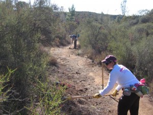
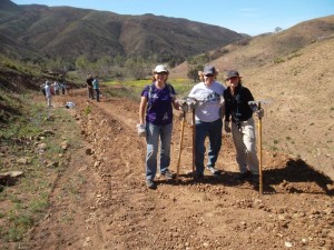
IMG_0461[1]On Saturday, December 6th, a dozen CORBA volunteers and about half as many from the Santa Monica Mountains Trails Council returned to the 2.5-mile long singletrack section of the Backbone Trail between Mulholland Hwy and Etz Meloy Motorway to continue the work we had started on November 8th. As before, the Trails Council crew hiked up to where they had previously worked down to, and continued down. CORBA volunteers worked up the trail from where we had left off last month.

We focused on clearing brush from the edge of the trail, but four volunteers took tread working tools to clear out old drains, and install new ones if needed. It had rained a few days earlier so we could clearly see where the water was running down the trail.

We’ll have to return in 2015 to finish off this section of the backbone trail.

Check out our photo gallery to see more dedicated volunteers at work!

IMBA Trail Building School in San Diego, Dec 6

Monday, November 17th, 2014
IMBA Trail Care Crew Visit with CORBA

IMBA Trail Care Crew’s last Visit with CORBA

Our friends and colleagues at the San Diego Mountain Bike Association will be hosting the IMBA Trail Care Crew on Saturday, December 6, from 9 a.m to 4 p.m.  If you missed out on the class hosted by CORBA and Mount Wilson Bicycling Association and would like to attend, you’re in luck. The IMBA Trail Care Crew trailbuilding class is free and open to anyone. Below are the details from SDMBA.


Trail Building School featuring the IMBA Trail Care Crew

Saturday, December 6th, from 9am ­ – 4pm

Locations:

IMBA Trail Building School: Crest Elementary School, 9am ­ – Noon, 2000 Suncrest Blvd., Crest, CA 92021

Field Demonstration/Trail Work: Crestridge Ecological Reserve, 1pm ­ – 4pm, 1171 Horsemill Road, Crest, CA 92021

The San Diego Mountain Biking Association regularly invites the International Mountain Bicycling Association’s (IMBA) Subaru/IMBA Trail Care Crew to visit our area. They will be in San Diego the weekend of December 4th­ – 7th to talk trails, teach people proper trail building technique and spend quality time digging in the dirt. The visit is one of 38 stops on the 2014 schedule. Each crew visit is anchored around IMBA’s highly­respected Trail Building School, during which the crew teaches sustainable trail construction and maintenance via a classroom session, followed by hands­on trail work.

If you’d like to learn more about sustainable trail design, building, and maintenance then you’ll get a lot out of this day. We’ll provide a light breakfast before the Trail School and lunch after the classroom session and before the field demonstration/trail work.

Cost: Through the generous support of Subaru, Trek, Yakima and REI we provide this training day at no cost.

Registration: For more information and to register for the IMBA Trail building School, contact:  Gardner Grady, SDMBA Crestridge Liaison: gardner(at)sdmba(dot)com

Register online here. Scroll down and click “Register Now” and then click the “yes” button under “TCC ­ Attending the IMBA Trail Building School?”


Report on the November 8th Backbone Trailwork and Photos

Sunday, November 9th, 2014
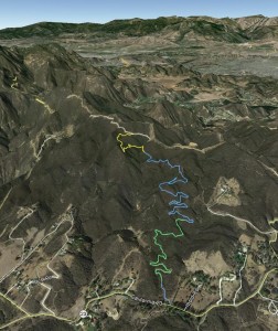
Google Earth view of our work area, looking north-west. The CORBA crew worked the bottom (green) and the Trails Council crew worked the top (yellow) of this 2.5-mile long segment of the Backbone Trail. Mulholland Hwy (23-S) is at the bottom of the image. The trail ends at Etz Meloy Motorway.

Google Earth view of our work area, looking north-west. The CORBA crew worked the bottom (green) and the Trails Council crew worked the top (yellow) of this 2.5-mile long segment of the Backbone Trail. Mulholland Hwy (23-S) is at the bottom of the image. The trail ends at Etz Meloy Motorway.

On Saturday, November 8th, 13 CORBA volunteers and 6-8 from the Santa Monica Trails Council combined forces to fix up the 2.5-mile long singletrack section of the Backbone Trail between Mulholland Hwy and Etz Meloy Motorway. The gentle grade of this trail, combined with sweeping turns, easy switchbacks, great views and connections to the rest of the Backbone Trail make this a favorite for mountain bikers.

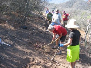
Being more used to working a distance from the trailhead, the Trails Council crew hiked to the top and worked their way down while the CORBA crew started near the bottom and worked up the trail. We skipped the first few hundred feet because of the presence of invasive weeds; we didn’t want to spread the seeds around by disturbing these aggressive plants. Both groups completed about a half-mile of trail.

We focused on removing brush at the side of the trail, but a few workers concentrated on removing silt and other debris from the drains. Our priority is generally to make sure the trails are well drained so rainwater doesn’t erode ruts down the middle. The drains on this trail were plentiful and well designed when the trail was built about seven years ago, so we didn’t need to build any new ones as we do on most trails.

Check out our photo gallery to see more dedicated volunteers at work!

IMG_0388

COSCA Annual Trailwork Day attracts 150 volunteers; 0.6 miles of trail built/repaired

Monday, October 20th, 2014

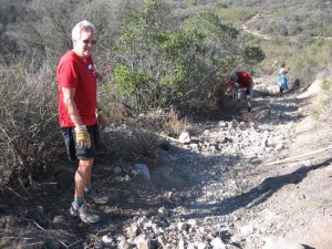
This past Saturday, October 18, almost 150 volunteers turned out to help rebuild the Conejo Crest Trail and a connector between this trail and the White Horse Canyon Trail in Thousand Oaks. This included 20 CORBA volunteers and several riders from nearby high school mountain biking teams. The work was divided into 5 distinct projects.

Chopping out a stump on the new trail to bypass the Descent of Death

Chopping out a stump on the new trail to bypass the Descent of Death

The most important was to build a reroute around the Descent of Death (watch the video of mountain bikers on the Descent of Death). This new trail is just over 1000′ long, compared to 680′ for the Descent itself, so it is about 1/3 less steep. Three crews were assigned to this challenging section with lots of big rocks, some very steep cross slopes, and many sturdy stumps to remove. The amount of work needed was more than could be accomplished by the available volunteers in just 3 working hours, so COSCA will complete this section later. However, the most difficult parts were completed so the bypass trail is open for use.

The connector to White Horse Canyon Trail is very rocky because rainwater has washed away all the soil. We removed the biggest and loosest of these rocks.

The connector to White Horse Canyon Trail is very rocky because rainwater has washed away all the soil. We removed the biggest and loosest of these rocks.

At the bottom of the bypass trail is a connector trail to the White Horse Canyon Trail. This 835′ long connector goes straight down the hill with no diversions to get the water off it. As a result, rainwater has run straight down it for years and it has become very rutted, and rocky where the soil, sand and smallest rocks have been washed away. In addition, it was somewhat overgrown. Three crews were assigned to this section to clear the brush, remove the worst of the loose rocks and build drainages to get the water off and minimize future runoff erosion. These crews finished early and went on to help build the bypass trail. Another crew was working to remove loose rocks from the Conejo Crest Trail for about 1100′ from the top of the Descent of Death. The bypass trail crossed an illegally built trail that ran from the top of the Descent of Death almost straight down the hill to the Los Robles East Trail (Edison Road). A ranger-led crew worked to rehabilitate the ground around this trail, to restore as much as possible the natural contour of the land. Berms and jumps were knocked down and raked over. The trail was blocked to prevent future use and further erosion and degradation of the public open space. Finally, a group of youngsters worked to beautify the trailhead to the Triunfo Trail at Triunfo Community Park by raking out the trail, building a pretty border out of rocks, and planting native plants in the bare area next to the trail.

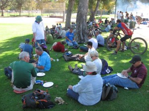
Enjoying the lunch prepared by the COSCA rangers after trailwork was finished

Enjoying the lunch prepared by the COSCA rangers after trailwork was finished

After the work period, the volunteers gathered at Triunfo Park to enjoy a barbecue lunch prepared by the COSCA Rangers. About a dozen people won prizes in the give-away to thank the workers, including one lucky volunteer who won a Giant mountain bike. You can see more photos of the work in our gallery of trailwork photos. The trail crew leaders were COSCA rangers and volunteers from CORBA and the Santa Monica Mountains Trails Council. These folks and the organizations they represent would like to give a hearty thanks and shout-out to all the volunteers who help keep the trails in great shape for all trail users!

COSCA Annual Trailwork Day Oct 18th

Monday, September 1st, 2014

Come out and join the Conejo Open Space Conservation Agency (COSCA), CORBA, the Santa Monica Trails Council and other volunteers for the 24th Annual COSCA Trailwork Day in Thousand Oaks on October 18, 2014. The trail we will be building/repairing will be announced soon.

COSCA will treat participants to lunch afterwards and have a drawing for some great door prizes. Participants who register with our Meetup event will also be eligible for the end-of-year drawing for a Niner frame and other prizes!

For full details and to register, see our registration page. We hope to see a good turnout of local mountain bikers at this event!

President’s Message: The Station Fire

Thursday, June 5th, 2014

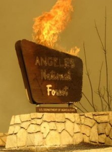
20110401-Station_Fire_sign_burning_3It has been almost five years since the Station Fire was set by arsonists along Highway 2 near the base of Mount Lukens. I was there on August 26, 2009 when it started. I was also there last week when the Station Fire General Closure Order expired. This opened up Strawberry Peak loop, a trail system that has been the focus of several different groups for the past eighteen months. Though it’s a significant milestone, there is much more to be done.

Mountain Bike Magazine Station Fire

Mountain Bike Magazine Station Fire

This takes me back to a June 2010 Mountain Bike Magazine article about the Station Fire. While the magazine is no longer published, a copy of the story is archived on our web site. Reading it will help you realize what has been accomplished since.

We all wish that things could have happened faster, but the assumptions of the article have held up. Matt Lay/Mount Wilson Bicycling Association (MWBA), and I were featured in the article as mountain bikers on a mission to help restore the trails. Both CORBA and the MWBA have lived up to that promise, with many trails affected by the fire now open due (at least in part) to our efforts. We have to thank our volunteers, our members, and REI for their generous support, all of whom helped make it possible.

Of course, mountain bikers were not alone in the effort to restore trails. Many nonprofit groups, trail user groups, and individual volunteers continue to make significant contributions to restoration and maintenance. Professional crews including Bellfree Contractors and the LA Conservation Corps have also been involved.

As mentioned,  the work is not yet done. The general closure expired and was replaced by a much more manageable list of closed trails. Among them are several fire roads and at least two local mountain biking favorites: a section of the Gabrielino Trail and the Ken Burton Trail. CORBA and the MWBA have pending work plans for both trails, and the Forest Service is working to reopen the fire roads. Stay tuned.

And there will always be a need to do trail maintenance, above and beyond restoration efforts.

Trails don’t maintain themselves. Join us.

– Steve Messer

Station Fire Closure to Expire, Strawberry Peak Loop Opens

Friday, May 23rd, 2014
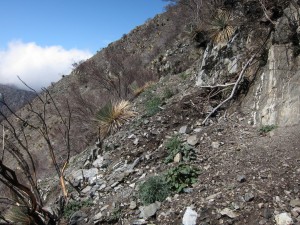
Station fire damage to Strawberry Peak trail

Station fire damage to Strawberry Peak trail

The Station Fire burned over 250 square miles of the Angeles National Forest in 2009. The most recent Station Fire Closure Order went into effect on May 25 last year, and is in effect until May 24, 2014.  The Forest Service will not be renewing the general closure order. Instead, some trails that have yet to be restored will remain closed, along with some higher elevation fireroads. This is both for public safety and additional resource protection and recovery.

The following trails will remain closed:

  • Strawberry Peak Trail 12W05.1 (From the junction with Colby Canyon trail north to Upper Big Tujunga)
  • Lower Gabrielino Trail 11W14 (between Bear Canyon trail junction and Paul Little Campground)
  • Ken Burton Trail 12W19 (the complete trail)
  • Millard Waterfall trail (a non-system user-created trail)
  • Barley Flats Trail
  • Santa Clara Divide Road 3N17 (between Alder Saddle westward to the intersection with the BPL road near North Fork Station)
  • Axial roads that connect to the closed portion of 3N17 will also remain closed:
    • 4N32 (BPL Road) between 3N17 and 4N33
    • 4N33 (Moody Truck Trail) between 3N17 and 4N32
    • 4N24 (Beartrap Truck Trail/SCE Service Road) between 3N17 and Aliso Canyon Road
    • 3N90 (Roundtop) between 3N17 and Roundtop Peak
    • 3N32 (Mendenhall Ridge Road) between 3N17 and Indian Ben Saddle

Additionally, the following campgrounds will remain closed:

  • Messenger Flats Campground
  • Lightning Point Campground
  • Big Buck Campground

Note that some media reports have indicated that the Colby trail would be closed, without specifying which segments. Rest assured that the segments of the Colby Canyon trail that comprise the classic “Strawberry Peak Loop” will be opened. The segment of Colby Canyon trail north from Josephine Ridge to Highway 2 is still in very poor condition and not recommended for bicycles, though it will be opened.

Strawberry Peak after restoration

Strawberry Peak after restoration

We must acknowledge once again the generous support we received from REI to help fund the professional services of Bellfree Contractors, tools and food for volunteers, that allowed us to complete the restoration of the Strawberry Peak Trail. The restoration effort included a re-route of a particularly troublesome section, which was planned out as a part of the IMBA Trail Care Crew visit in 2012. We coordinated our efforts with The National Forest Foundation, Los Angeles Conservation Corps, and the Sierra Club Angeles Chapter trail crew. And of course, our biggest thanks go to the many volunteers who came out to our trailwork days on Strawberry Peak. We’ll be doing more trailwork there as we continue to maintain the trail in the future.

The Gabrielino Trail will be our next focus, and stay tuned for important news regarding that effort. We must emphasize that the closed segment of the Gabrielino trail is not ready for public use. At least three groups of trail users who ignored the closure have had to be extracted by Search and Rescue. Please stay off the closed trails listed above for your own safety.


2014 Santa Monica Mountains Trail Days Trailwork Report and Photo Galleries

Monday, April 28th, 2014
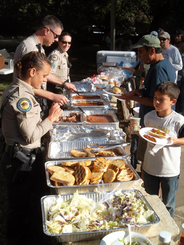
Rangers serve the barbecue on Saturday night. As well as hot dogs, there was chicken, tri-tip beef and veggie-burgers.

Rangers serve the barbecue on Saturday night. As well as hot dogs, there was chicken, tri-tip beef and veggie-burgers.

This past weekend, a large number of volunteers from CORBA, the Santa Monica Mountains Trails Council, the Sierra Club and other organizations, and individuals gathered for the 33rd annual Santa Monica Mountains Trail Days at the Danielson campground in Pt Mugu State Park. Folks could arrive Friday evening, camp overnight, help with the trails on Saturday, enjoy the barbecue dinner prepared by park staff, win some cool swag in the prize give-away during dinner, camp overnight, help with the trails on Sunday, have lunch back at the campground, then depart for home. Of course only a few people stayed for the whole weekend, but many camped for at least one night, and most stayed for the Saturday BBQ and prize give-away.

On Saturday, there were about 110 volunteers who split into five groups. The largest groups worked on Old Boney Trail in the State Wilderness Area and Sage Trail. Others went to the top of Hidden Pond Trail and youngsters under 10 cleared small rockfalls off the Sin Nombre and Two Foxes Trails. A dozen hardy souls (with hardy soles) hiked almost three miles (and up about 1400′) carrying tools to work on the Chamberlain Trail, also in the wilderness area.

The group of about 30 volunteers who worked on Sage consisted of CORBA folks, a few geocachers, and others. The trail had just been SWECO’d (plowed by a small trail-sized bulldozer) to level the trail, smooth out the ruts, and narrow it. The trail is narrower now because it used to be the full width of a fire road, and now the travel surface is about half as wide. The SWECO is only able to get so close to the edge, so the work consisted of pulling down the berm (pile of dirt) the machine left at the outside edge of the trail, sloping the trail about 5-degrees to the outside so rainwater will run off, rather than down the middle, and removing the larger rocks.

Putting the finishing touches on the Sage Trail on Saturday after it was leveled, smoothed and narrowed by the SWECO trail bulldozer.

Putting the finishing touches on the Sage Trail on Saturday after it was leveled, smoothed and narrowed by the SWECO trail bulldozer.

There were also a few spots of severe erosion and rutting on the side of the trail where rain water had run off, taking some of the trail with it. In one case, the erosion extended about half-way into the trail. To prevent future rain from extending these ruts and eventually washing the trail away completely, we built rock walls down the ruts to reinforce the side next to the trail. The idea is that the water will run off the trail and down the rock wall, protecting the dirt underneath from being washed away. The rocks will also slow and disperse the water, so it doesn’t wash away the dirt below the wall and undermine it.

Overall we worked about 2300 feet of trail, from the bottom to where the now-closed Art’s Trail joins it.

We headed back to the campground at about 2:00 pm, although crew leader Virginia from the Trails Council stayed about a half hour longer, and CORBA’s Steve Messer stayed even longer. Some people just won’t quit until the job is finished!

We always have a much smaller group for the Sunday work day, so all 30 of us returned to Sage Trail to finish off the top 1700′. It only took until about noon to get this shorter section completed.

Sage Trail is a little loose after our trailwork, but it’s not too loose to ride. It should be packed down in two or three weeks, as Guadalasca Trail was after we did the same work there last spring. The trail will also regain its single-track width after enough people have ridden it to define a preferred course.

CORBA, the Trails Council, local chapters of the Sierra Club, California State Park, the National Park Service and other would like to give a tremendous Thank-You to all the volunteers who helped over the weekend, both working on the trails to keep them in top shape, and organizing and coordinating in the camping and registration area!

You can view more photos of the trailwork in the Saturday photo gallery and the Sunday photo gallery.

Strawberry Peak Restoration Update

Wednesday, April 2nd, 2014
Station fire damage to Strawberry Peak trail

Station fire damage to Strawberry Peak trail

Strawberry Peak is one of the most loved areas in the Angeles National Forest. It suffered devastating damage during the El Niño storms following the Station Fire. After the fire the trail was impassable and has remained closed to all users, even as much of the surrounding burn areas have opened up.

The Strawberry Peak and Colby Canyon trails together comprise the classic Strawberry Peak Loop. CORBA and the Boy Scouts have worked to restore the Gabrielino trail, the third leg of the classic loop, over several trailwork days since the Station Fire. It is open and in good shape.

During our initial surveys of Strawberry Peak trail, it became clear that one particularly problematic section of the trail could benefit from a complete re-route. This section, where the Strawberry Peak trail leaves the old Barley Flats fire road, is a fall-line rocky chute that was difficult to ride even before the fire. After the fire, it became a 4′ deep rocky rut for most of its length. Trail users (who should not be in the closed area) have been steadily widening this section of trail as they go around the ruts and rocks.

Restored Strawberry Peak trail

Restored Strawberry Peak trail

CORBA planned the re-route during our IMBA Trail Care Crew visit in 2012. About 30 class attendees and volunteers worked on the trail and learned how to flag out and prepare a new trail route. The re-route plans were submitted to the Forest Service for environmental review. The review process took about six months. We were required to power wash tools, among other things, to avoid spread of invasives. (CORBA’s tools are used in many different jurisdictions in Southern California).

In late 2012, CORBA received an REI grant of $10,000 for the restoration of the Strawberry Peak loop. We purchased some new tools, and fed volunteers on our trailwork days, and sought professional help. The National Forest Foundation funded the Los Angeles Conservation Corps for this and several other Station Fire damaged trails. Together, we solicited the services of Bellfree Contractors, a professional trailbuilding company, to restore many of the larger slide areas, burned sutter walls and downed trees. CORBA also paid over $2500 of our discretionary funds for professional trailbuilding services. We coordinated with the Sierra Club volunteer trail crew who also worked on the Strawberry Peak and Colby Canyon trails.

strawberry peak trail crew Volunteers, February 16, 2014

Volunteers, February 16, 2014

On February 16, CORBA had 22 volunteers come out for trailwork. We rode or hiked in the 3 miles to the Strawberry-Lawlor saddle, and worked on the trail as far down as Strawberry Springs. Those who rode or hiked in were very happy to be back on the closed trail. We accomplished a lot, clearing about .6 miles of trail, building three rock retaining walls at drainages, cutting and widening the trail bench, and removing slough.

The LACC and Bellfree Contractors had cleared and restored much of the Colby Canyon trail from Josephine Saddle to the Strawberry Potrero. After their work, it was in better shape than before the fire.

On March 16 we returned with about 17 CORBA and MWBA volunteers. We rode in 2.5 with Bob trailers about 2.5 miles, and restored the trail all the way to Strawberry-Lawlor saddle. With the re-route completed, the ride in was much better. There was poodle dog to remove, and slough from the one big winter storm of 2014. 

We will return to the trail during May, date TBD. There is still work to be done, including the repair of composite retaining walls, brushing and the ongoing need for routine maintenance.

With CORBA, Mount Wilson Bicycling Association, Sierra Club, Los Angeles Conservation Corps, National Forest Foundation and a professional contractor working together, the Strawberry Peak loop restoration has been progressing nicely.

Riding in to trailwork with Bob trailers

Riding in to trailwork with Bob trailers

The Station Fire Closure order is in effect until May 24, 2014. The Forest Service is assessing the burn area and the trails to determine whether to renew the closure order, modify it, or let it expire. The section of the Strawberry Peak trail north to Upper Big Tujunga Canyon needs a substantial re-route, planning for which has begun. Even if the Forest Service lifts the closure, we expect the Strawberry Peak trail from the junction with Colby Canyon trail north to Upper Big Tujunga to remain closed, or be subject to a seasonal or temporary closure. Because of the need for a re-route, this section of the trail has not yet been worked on.

CORBA would like to thank all the volunteers who came out to our trailwork days; to REI for their generous grant that made the restoration and professional help possible; to the Sierra Club, National Forest Foundation and Los Angeles Conservation Corps for their efforts, and to Bellfree Contractors for their professional assistance.