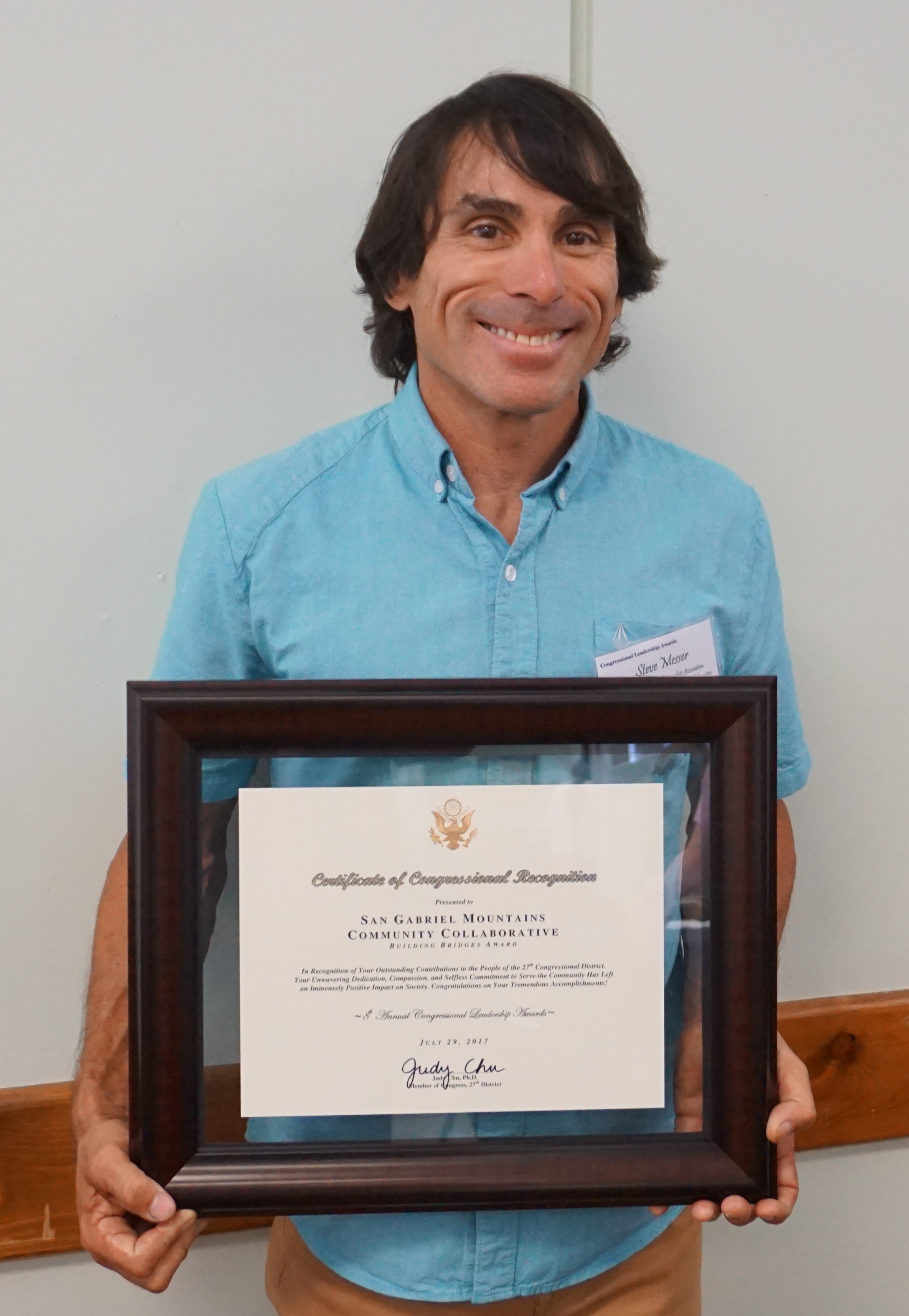
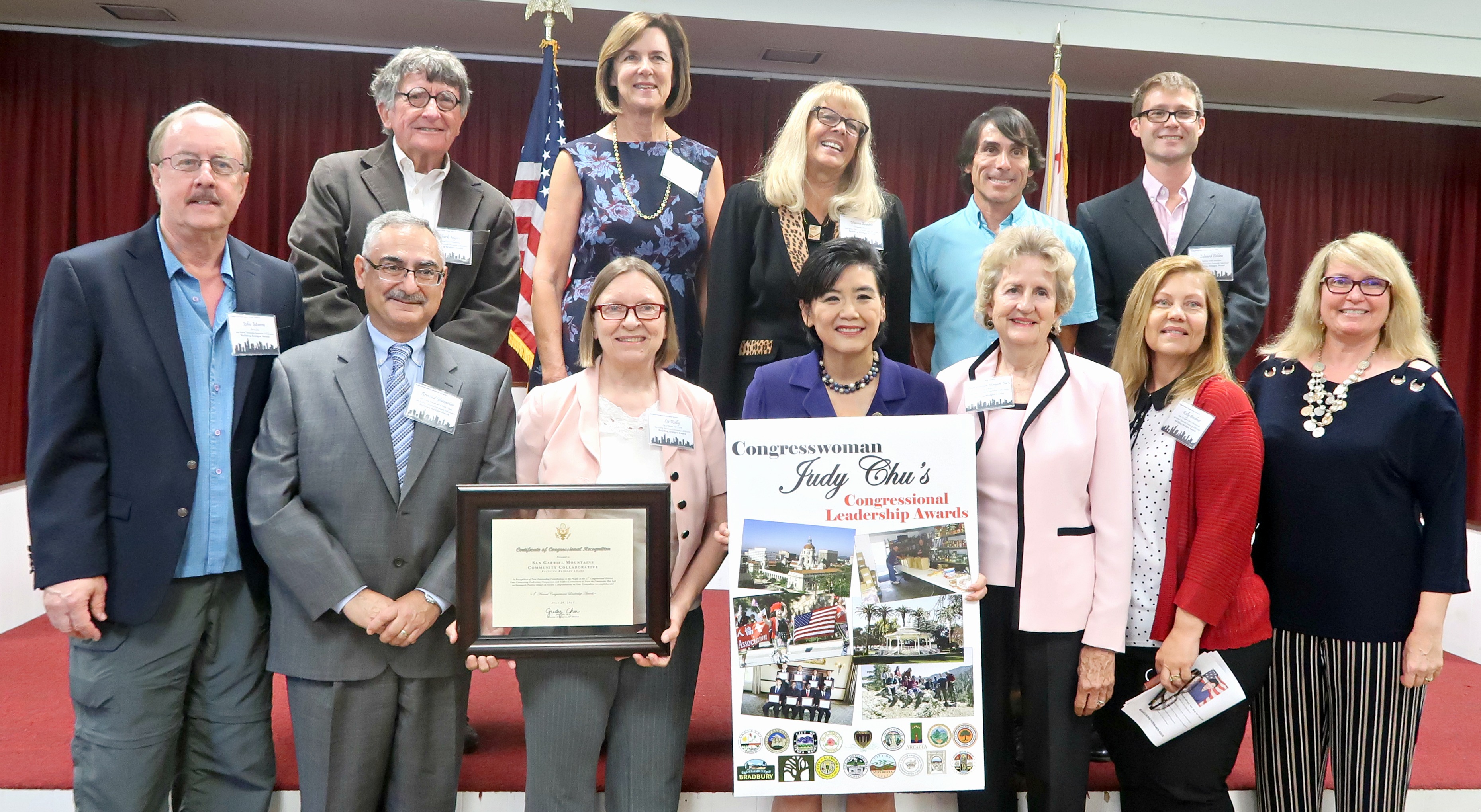
Archive for the ‘San Gabriel Mountains’ Category

Gabrielino Trail Restoration Update

Thursday, March 1st, 2018

CORBA has been working behind the scenes on restoring the Gabrielino National Recreation Trail. The Gabrielino is the last trail still closed because of damage due to the Station Fire. It’s been an ongoing effort since 2011 to open up sections of the trail and then keep them clear of downed trees.

In early 2015 the Los Angeles Conservation Corps worked with Bellfree Contractors to rebuild the Gabrielino from Paul Little to Oakwilde Campground. CORBA helped fund that effort with a generous grant from REI. We subsequently concentrated on the Ken Burton trail, a project that rallied volunteers in an intensive 8-months of bi-monthly work days.

Searching for the trail in February 2016

Only the section from Oakwilde to the junction with Bear Canyon trail remains closed to public use. CORBA has been awarded grants from both REI and Edison International to help fund the restoration of this section. Those funds support volunteers, buy tools and materials and will pay for professional services to improve the sustainability of the trail and reduce future maintenance needs. We are grateful for their support.

The trail was littered with downed trees in 2016

In early 2016 we did a hike-through inspection of the trail with Forest Service staff, Bellfree Contractors, Los Angeles Conservation Corps and Boy Scout volunteers. The arduous journey involved climbing over and under dozens and dozens of downed trees, searching for remnants of trail where it had been washed away, and dodging and ducking heavy brush. Sections of the trail were completely gone, the only route was to hike along the streambed, which was also covered in downed trees.

After more than a year of internal Forest Service review, the go-ahead was given to us by District Ranger Bob Blount last summer. Sadly, Ranger Bob passed away last week and won’t see this trail completed. He was especially excited for us to be working on this trail and bringing it back to its earlier glory. We hope to finish the project by summer in his honor.

After months of extreme fire danger (meaning no chainsaw use), last fall CORBA and MWBA volunteer sawyers spent six solid days wielding chainsaws to cut through the deadfall along the trail.

With the corridor opened up, MWBA have devoted their monthly trailwork day to the project since December. In three work days the volunteer crews have worked on just over two miles of the trail.

There is so much enthusiasm for getting this trail restored and opened that there have been more volunteers that tools for the last two days. The volunteer effort has been astounding, with more than 40 volunteers signed up each day. Some sections that have been worked on are now in better shape than before the Station Fire. But there is still much to do.

So far, over 50 individual volunteers have devoted more than 1000 hours to the restoration effort.


A recently restored section

This is truly a team effort, with the Angeles Forest 50k Run trail crew having worked on another section of the Gabrielino near Switzers; the Sierra Club have been working on the section around Devore camp; and previous work was done by the Los Angeles Conservation Corps and the Boy Scouts on other sections.

Thanks to all the volunteers who have contributed to this restoration effort. Special thanks to our partners at the Mount Wilson Bicycling Association for organizing group work days and REI and Edison International for their financial support.

There is still more to do. The trail is not officially open to the public, but we hope to change that soon.. Watch for upcoming announcements for March and April volunteer work days from MWBA, or CORBA’s Meetup group.

Getting in The Holiday Spirit: Giving back to trails

Monday, December 4th, 2017

Building a berm on a trailside bike feature

This past weekend the holidays seemed to come into full swing, and there was a lot of giving. On Saturday morning, members of our Sapwi Bike park committee gave their time building the first trailside feature at Sapwi Bike Park. Contractors have cleared and graded the bike park area, and the final bike park plan from FlowRide Concepts is close to completion. Lots of people have given to our IMBA Dig In campaign now standing at $1900, in addition to the generous grant of $15,000 from REI. We need to raise close to $100,000 so there’s a long way to go. Keep the donations coming!

Also on Saturday, former CORBA Chair and current volunteer Mark Langton was conducting our monthly Free Basic Mountain Bike Skills Clinic. Mark has been teaching new mountain bikers the basics of bike handling, safety and etiquette for more than 20 years. Eight riders attended the last skills clinic of the year.


(more…)

Public Meetings Dec 5: Rosemead Blvd and East Fork San Gabriel Canyon

Thursday, November 30th, 2017

On Tuesday, December 5th there are two conflicting public meetings of interest to those who ride bicycles in the San Gabriel Mountains or the San Gabriel Valley.

San Gabriel River Confluence with Cattle Canyon Improvements Project

The other public meeting is to seek public input on the Draft Environmental Impact Statement (DEIS) for the San Gabriel River Confluence with Cattle Canyon Improvements Project. CORBA, through our involvement with the San Gabriel Mountains Community Collaborative, have expressed our full support for the project as proposed.

Click to Enlarge

This project will add much-needed trailhead improvements, interpretive and scenic trails, parking, bike racks, shuttle stops, multilingual signage, river access points and habitat restoration to this heavily-impacted area of the Forest. While not heavily used by mountain bikers, all of us who care about our Forest are supportive of these improvements.

The project is within the San Gabriel Mountains National Monument, and is being developed in partnership with the Watershed Conservation Authority. The meeting will be held at the Angeles National Forest headquarters:

Tuesday, December 5, 2017
5:30 p.m. to 7:30 p.m.
Angeles National Forest Headquarters
701 N Santa Anita Ave,
Arcadia, California 91006

Comments must be submitted by December 26, 2017, to:

EFSGR/Cattle Canyon Improvements Project
110 N. Wabash Ave.
Glendora, California 91741

or via email to: EFSGR@wca.ca.gov


LA County Rosemead Blvd Complete Streets Project

LA County’s Rosemead Blvd Complete Streets project proposes to add bike lanes, pedestrian walkways and other improvements to Rosemead Blvd through the Whittier Narrows area. This is the initial scoping meeting, where the County will be seeking public input on how to best improve this six-lane stretch of road to better accommodate cyclists and pedestrians. The meeting will be held at the More information can be found at:

Tuesday, December 5, 2017, 6:00 – 8:00 p.m.
Pico Rivera Municipal Golf Course,
3260 Fairway Dr.,
Pico Rivera, CA 90660.

http://dpw.lacounty.gov/pdd/proj/rosemeadcs/

This project will have great value to our community, as it will improve safety for pedestrians and cyclists accessing the Whittier BMX track, Whittier Narrows recreation area, and existing bike paths along the San Gabriel River and Rio Hondo. It is also close to the proposed Puente Hills Landfill, with its two planned and approved Bike Skills Parks.

We can’t be at both meetings, but want to encourage those with an interest in either to attend these meetings and be engaged in the process.

Public Lands Update

Thursday, November 2nd, 2017

This year we have seen legislation introduced to further protect and enhance our local open spaces and public lands.

HR3039, the San Gabriel Mountains Forever Act. Judy Chu introduced this bill in June. The bill would establish two new units of Wilderness within the Angeles National Forest. CORBA worked for two years with wilderness advocates to ensure these newly-proposed designations would not impact trails used by mountain bikers. The bill establishes the Condor Peak Wilderness and Yerba Buena Wilderness units, separated by the Condor Peak Trail. Condor Peak trail and Trail Canyon trail to the waterfall and campground would remain open to bicycles under this new designation.

Rim of the Valley

Rim of the Valley Corridor Preservation Act, S1993/HR4086.

This bill by Adam Schiff/Diane Feinstein would expand the boundary of the Santa Monica Mountains National Recreation Area to include open spaces around the Conejo, Simi, San Fernando, La Crescenta and Verdugo valleys. It does not change any land ownership or management but allows the National Park Service to partner with current land managers to improve habitat, wildlife corridors, and recreational opportunities. It puts into action the findings of the Rim of the Valley Corridor Study. It does not impact bicycle access to trails and could improve recreational opportunities.

H.R. 2323: San Gabriel Mountains Foothills and Rivers Protection Act. This act introduced by Judy Chu would establish the San Gabriel National Recreation Area as a unit of the National Park System. The NRA would cover river corridors and open spaces from the Angeles National Forest border through the San Gabriel Valley. It does not create any new federally-managed public land. It would allow the National Park Service to partner with existing land managers to improve habitat, biodiversity, and recreational access. It would also expand the boundary of the San Gabriel Mountains National Monument to include areas of the Angeles Front Country that are currently outside the Monument.

While these bills have been introduced, it remains to be seen whether they will make it out of their respective committees.

CORBA’s mission includes the protection of the places we play. Nationally, as the current administration proposes major changes to environmental regulations, national monument boundaries (our San Gabriel Mountains National Monument is not expected to be a target of boundary reductions), forest management practices, permitted uses, we stand ready to speak up for our local public lands and the recreational opportunities they provide and we all cherish.

SGM Collaborative Recognized by Congresswoman Chu

Saturday, July 29th, 2017

On Saturday, July 29, 2017, a representative group of the San Gabriel Mountain Community Collaborative were on hand at Congresswoman Judy Chu’s Congressional Leadership Awards.  The Collaborative was honored with the “Building Bridges” award. CORBA President Steve Messer has served on the Collaborative since its initiation and formation committee, with MWBA President Jenny Johnson as his alternate bike/trails and recreation representative.  Together, we are the voice on the collaborative representing Mountain Biking, trails, and recreation, as one of 45 interest groups and stakeholder members. Steve also serves on the Steering Committee and is chair of both the Projects Committee and newly formed Trails/Recreation Ad-Hoc committee.

This is a truly appropriate award, as one of the Collaborative’s big successes has been to build bridges between National Monument supporters and opponents, environmentalists and recreationists, disparate interests and stakeholders, and to help build a bridge between the Forest Service and the public.  The collaborative has strived for consensus towards a common goal and has truly grown into a passionate Community of individuals and organizational representatives, with the shared goal of helping better communicating the needs of stakeholders and the public to the Forest Service in the management of our public lands.

Together, the Collaborative members have come to a deeper appreciation and understanding of each other’s perspectives and the diversity of needs, challenges, and opportunities facing our National Monument and the community of forest visitors, volunteers, permittees, and others who depend on and cherish these special mountains.

We must also thank Congresswoman Judy Chu for her tireless and ongoing efforts to support, protect, and now defend our San Gabriel Mountains and National Monument and Angeles National Forest, as well as the National Forest Foundation who have helped facilitate the tremendous work of the Collaborative.

Back Row, L-R: Chuck Myers, National Forest Homeowners Association, Judy Nelson, Glendora City Councilmember, Diane Erskine-Helrigel, Community Hiking Club, Steve Messer, CORBA, Edward Belden, National Forest Foundation; front row: John Monson, Sierra Club, Armond Garcia, LA County DPW, Liz Reilly, Duarte Councilmember, Congresswoman Judy Chu, Margaret Clark, Rosemead Councilmember, Kelly Gardner, San Gabriel Valley Water Association, and Michelle Nuttall, Southern California
Edison. The full Collaborative member list can be found here.

HR3039, the San Gabriel Mountains Forever Act

Wednesday, June 28th, 2017
Condor Peak Trail before the Station Fire

Condor Peak Trail (2007)

On June 23, 2017, Congresswoman Judy Chu (CA-27) introduced a new bill to expand wilderness areas in the Angeles National Forest, and protect several rivers as wild and scenic rivers. Spearheaded by the San Gabriel Mountains Forever group, the bill is the result of many years of efforts to protect our local mountains.

A previous success of the San Gabriel Mountains Forever group was the establishment of the San Gabriel Mountains National Monument. CORBA President Steve Messer has been representing mountain bikers on the San Gabriel Mountains Community Collaborative, working alongside representatives of the Sierra Club, The Wilderness Society, and other environmental and social justice organizations.

For the past eighteen months we’ve been working together to ensure that mountain biking gets due consideration in these proposals. CORBA has opposed previous wilderness efforts that hurt bicyclists’ access to trails. With support from IMBA and MWBA, we worked out boundary adjustments that expand the Sheep Mountain and San Gabriel wilderness areas, but do not impact any trails that are currently open to bicycles.

The bill also establishes two new units of the Wilderness Preservation System, the Condor Peak Wilderness and the Yerba Buena Wilderness. These two wilderness areas protect the majestic Condor Peak, while leaving the Condor Peak trail outside the wilderness areas with a wide buffer.  While Condor Peak is not a popular trail for cyclists, it offers an increasingly-unique wilderness-type backcountry experience for those seeking to challenge themselves in nature. The trail can continue to be maintained using mechanized tools.

The western boundary of the proposed Yerba Buena Wilderness is the Yerba Buena Ridge trail, which could provide an epic backcountry loop ride with Condor Peak trail. Both trails, however, are in need of maintenance and are on our radar for future restoration work.

Condor Peak Trail

The following areas will be designated as wilderness in HR 3039:

Condor Peak Wilderness: Located in the Lower and Upper Big Tujunga Watersheds this designation preserves 8,417 acres of public lands. The unit rises abruptly from 1,800 feet on its southern flanks to over 6,000 feet at its northern boundary near Mt. Gleason. The Condor Peak Trail will be outside the Western boundary of this unit. Yerba Buena Wilderness: Preserves one of the most spectacular undeveloped landscapes in the San Gabriel Mountains (6,774 acres). The Condor Peak trail is just outside the eastern boundary of this unit. The western boundary is 300′ from the Yerba Buena Ridge trail, leaving both open to bicycles. The Trail Canyon Trail is cherry-stemmed (excluded from wilderness) up to the campground and waterfall. San Gabriel Wilderness Additions: This adds 2,027 acres to the existing San Gabriel Wilderness encompassing areas with dramatically rising slopes and a variety of flora and fauna. Sheep Mountain Wilderness Additions: Adds 13,851 acres to the established Sheep Mountain Wilderness. The Sheep Mountain Wilderness Additions are contiguous with the existing wilderness and add important landscapes to the wilderness area’s northwest and southwest/southern flanks.The bill also protects the 25.3 miles of the East, West and North Forks of the San Gabriel River, and 20.2 miles of Little Rock Creek as Wild and Scenic Rivers.

We truly appreciate being able to be proactive, working with the Sierra Club, The Wilderness Society, CalWild, and the San Gabriel Mountains Forever group. We also benefited greatly from IMBA’s support at the national level, and our partnership with the Mount Wilson Bicycling Association locally.

While this wilderness bill does not hurt mountain bikers’ access to trails, it does nothing to expand or directly improve existing opportunities. It does however, protect the remote backcountry experiences provided by the Condor Peak trail, the Yerba Buena Ridge trail, and the lower Trail Canyon Trail, ensuring these trails through this pristine landscape will be preserved, ready to be experienced by foot, hoof or bicycle.

Support the San Gabriel Mountains National Monument

Thursday, June 8th, 2017

CORBA, IMBA, REI, and NFF at the Oaks Unveiling

CORBA has submitted a letter supporting the preservation of the San Gabriel Mountains National Monument. President Trump’s executive order 13792 called for a revision of the many National Monuments that were presidentially-designated under the Antiquities Act from the last two decades. Department of Interior Secretary Zinke has been charged with overseeing the review of these National Monuments for a number of specific items:

In making the requisite determinations, the Secretary is directed to consider, and is seeking public comment on:

(i) The requirements and original objectives of the Act, including the Act’s requirement that reservations of land not exceed “the smallest area compatible with the proper care and management of the objects to be protected”;

(ii) whether designated lands are appropriately classified under the Act as “historic landmarks, historic and prehistoric structures, [or] other objects of historic or scientific interest”;

(iii) the effects of a designation on the available uses of designated Federal lands, including consideration of the multiple-use policy of section 102(a)(7) of the Federal Land Policy and Management Act (43 U.S.C. 1701(a)(7)), as well as the effects on the available uses of Federal lands beyond the monument boundaries;

(iv) the effects of a designation on the use and enjoyment of non-Federal lands within or beyond monument boundaries;

(v) concerns of State, tribal, and local governments affected by a designation, including the economic development and fiscal condition of affected States, tribes, and localities;

(vi) the availability of Federal resources to properly manage designated areas; and

(vii) such other factors as the Secretary deems appropriate. 82 FR 20429-20430 (May 1, 2017).

As a participating member of the San Gabriel Mountains Community Collaborative, CORBA agrees with the findings expressed in the Collaborative’s letter to Secretary Zinke. While there are both supporters and one-time opponents of the Monument on the Collaborative, the Collaborative’s letter specifically addressed each of the seven points of consideration listed above without expressing support or opposition to the monument itself. The findings are that the Monument meets or exceeds the criteria established above. The Collaborative’s letter can be found HERE

CORBA has submitted a letter of support as well, and we urge our members and constituents to submit your own comments at https://www.regulations.gov/document?D=DOI-2017-0002-0001.

CORBA’s letter can be found HERE.


Report on the San Gabriel Watershed and Mountains Special Resources Study

Thursday, September 3rd, 2009

September 3, 2009
by Steve Messer

Last night Hans Keifer, Steve Messer and Jim Hasenauer attended the public comment meeting put on by the National Park Service in Santa Clarita. The following is a summary of the presentation and our thoughts, concerns and feedback on the study.

History:

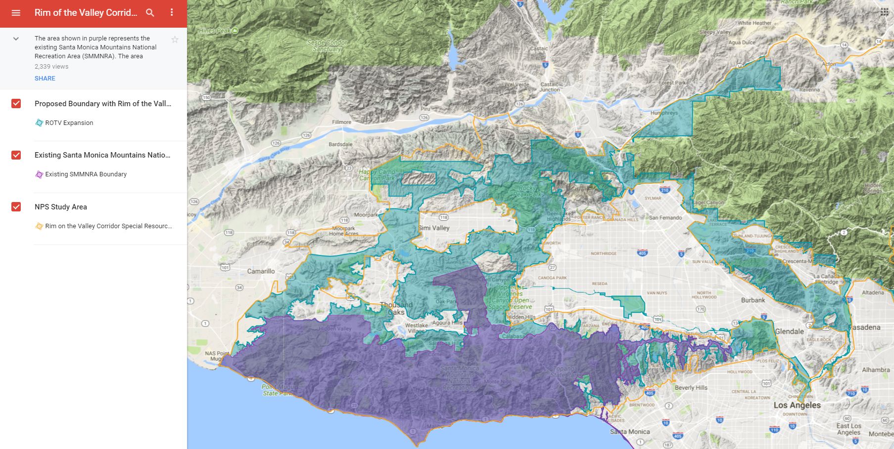
This study was mandated by Congress through a bill introduced by Hilda Solis back in about 2002 and passed in 2003. The study began in 2005, but this is the first much of the public has heard of the process, including me and other CORBA and IMBA volunteers. The study area includes much of the San Gabriel mountains, as well as the San Gabriel Watershed. The watershed includes the San Gabriel River drainage area within the national forest, as well as cities along the river and its watershed such as El Monte, Hacienda Heights, La Habra, Brea, Walnut, West Covina, Baldwin Park, Monrovia, La Verne,  and the Puente-Chino Hills area. See more on the study and the process.

Study Area:

The goal of the first stage of the study was to determine:

1. the “Significance” in biological, historical and recreational terms, of the study area.

2. the “Suitability” of the area for inclusion in the National Park system. That’s to say that it fills a gap in the National Park system that can’t be filled by anything else… ie. its uniqueness.

3. The “Feasibility” of bringing it into the National Park system in some manner.


So far the study has found that there is Significance worthy of national park protection. The mountains, the biodiversity, the unique geological character, architecture and history all make it significant.

There is “Suitability” in that there is nothing else quite like it already within the National Park System.

It was deemed to be infeasible to make any of the study area a National Park. There are too many land owners and land managers, too many private holdings even within the National Forest, and in many respects, would be re-inventing the wheel to start from scratch with what the Forest service has already accomplished in managing the forest.

However, it would be feasible for the National Parks service to come in and participate in the management and development of the area, in collaboration with the Forest Service and other land managers in the study area.

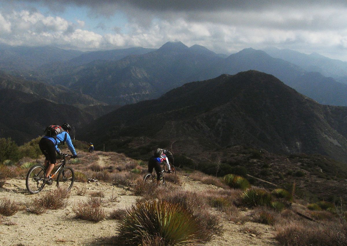
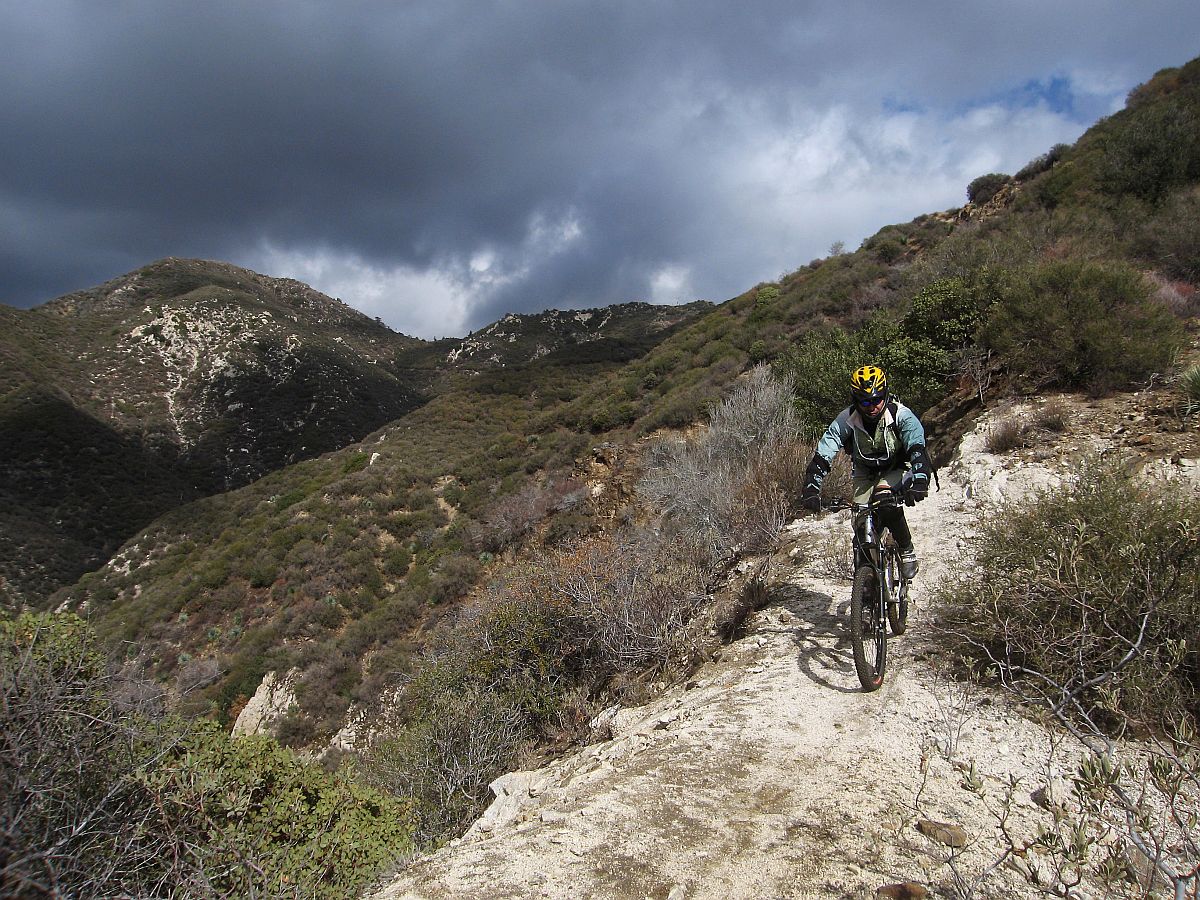
Of particular concern to us, as mountain bikers, is the continued access to the trails to which we have access, the possibility of new trails being built, and to avoid any further wilderness designations.

The final goal of the study is to present to congress a report on the Significance, Suitability and Feasibility of the area, and make a final recommendation as to the most effective and efficient way for the NPS to be involved in the management of the San Gabriel Mountains and San Gabriel River watershed.

What is not covered at this stage of the study is what happens after the study is complete.

Once the final recommendation is made, it would then be up to congress to decide what to do with the recommendation. Of particular note is that Hilda Solis is now Labor Secretary, and is no longer involved in the committee that would be receiving the results of the study she helped start. The recommendation may linger on a shelf and never be implemented, or it may get picked up, brought to committee, a further recommendation made to the full house, and then may or may not pass.

This introduces some concerns. Alternative A and Alternative C both have the largest federal presence, and both would require an act of Congress to implement. Whenever an act of congress is proposed, it will be debated and most likely amended. Amendments may introduce language to weaken our position as mountain bikers, to introduce more wilderness legislation, or to to pander to certain special interest groups with large lobbying powers. It opens the door for a whole range of uncertainties in the implementation of the plan.

But that scenario would be a long way off. The study is still (four years along) at a very preliminary stage. They expect to have the draft proposal ready in a year, another round of public meetings and comments, and present their findings to congress in 2011.

Several times during the presentation and the Q&A group sessions, it was expressed that the NPS would continue to allow the Forest Service to manage the forest, and other land managers would continue to manage their own jurisdictions. From our point of view as mountain bikers, this seems good policy, since the Forest Service has just spent five years or so developing the Forest Management Plan <http://www.fs.fed.us/r5/angeles/projects/ForestPlan.shtml> in which the most productive use of the forest was deemed to be Recreation. It sounded like the Forest Service would be able to continue to implement that plan, which is not at odds with the concept of a “National Recreation Area.”

Jim, Hans, and myself split up and each joined a different discussion group. Nowhere was there any strong or vocal anti-mountain bike sentiment, and in Jim’s group four of the fifteen people were mountain bikers. My group were all hikers from Santa Clarita who wanted more trails and access from the northern slopes of the San Gabriels, which are greatly under-utilized in comparison to the more populated southern slopes. There was no equestrian presence, but a few in my group said that the equestrians were supportive and would be doing a letter writing campaign. Given the past positions of the Equestrian Trails, Inc. (ETI), their campaign will likely be very anti-mountain bike.

But this meeting wasn’t really about what people wanted more or less of (trails, signage, interpretive centers, etc) though that is what came up most in the group discussions. It was about how the forest and watershed would be managed, and the alternate proposals for how that partnership would function. Management includes the ability to meet the needs and provide the resources that the public want, something that just isn’t presently happening given the current financial situation of the FS. 85% of their budget presently goes to fire management (well spent at the moment) leaving little for improvements.

To summarize the three alternative plans:


Alternative A
, the forest would get the largest involvement by the NPS, the largest land area that would be covered (most of the Lower Angeles National Forest) and management would come mostly from the National Forest Service with assistance, input, and funding from the NPS. This seems to us, as the better option, with less agencies involved, more land area, and more funding. It incorporates most of the Southern Angeles National Forest, and little outside the forest.

Alternative B would have the NPS creating a Master Plan for the whole area, San Gabriel mountains, rivers, all of the cities and land managers along the river and into the Chino hills. After that master plan is developed, the NPS would have little involvement, and it would be up to each individual jurisdiction to implement that master plan as a the San Gabriels Parks and Open Space Network. It includes the southern Slopes and the San Gabriel mountains and the river corridors.

Alternative C would have the NPS taking a leadership role and overseeing a partnership between the FS and the many local land managers. The area would include only the San Gabriel watershed and river corridor. This would exclude most of the current southern Angeles National forest.

There was no mention of new wilderness areas, as this is strictly a study for inclusion in a National recreation area, or Recreational Open Space area, not a wilderness study. Not much was addressed among the group discussions about the lower watershed, including the various cities and the Chino-Puente hills area, though the meetings in El Monte and Diamond bar would have had more involvement in those areas.

There is a comment period on the current presentation through October 30th. At the above web site, click on “Newsletter 4” then click on the “Comment on Document” link on the left side of the screen.

They need to hear from as many mountain bikers as possible, to ensure that we are represented as a large and growing user group of the forest. To make comments, here’s my list of my answers and talking points:

NPS Public Comment Topic Questions:

1. Is there one alternative concept or idea presented that you think is most valuable in terms of improving recreational opportunities and protecting significant resources? Tell us why you think this idea is valuable.

The inclusion of the largest land area, Alternative A, would give the most coverage and likely bring the most resources in to manage the national forest.   A combination of Alternatives A & C would provide the most coverage of important natural resources, including both mountain and river protections and opportunities for interpretation.  A combination of A & C would create a strong federal management partnership between the USFS and NPS and a strong recreational identity for the San Gabriel Mountains and watershed.


2. What suggestion do you have for strengthening or improving on the alternative concepts? Do you have an entirely different vision of how the area should be managed? If so, please describe your vision.

However, the inclusion of the lower watershed portions of Alternatives B and C, which incorporates much of the green belts along the rivers and the Chino-Puente hills, would present the most recreational opportunities to the largest number people. Perhaps some hybrid of these proposals in which the NPS and USFS manage the San Gabriel Mountains portion, and together oversee the partnership outlined in Alternative C as an open space network.

3. What concerns do you have about the current alternatives?

Recreation. The most productive use of the forest should continue to be recreation, as outlined in the current Forest Plan, and recreational access should be increased through a more streamlined process for getting new recreational projects approved. Recreational projects should be given administrative and considerational priority over commercial and other proposals, since the most productive and valuable use of the forest has been deemed recreational. We would hope that the NPS could bring in additional staff to more rapidly complete studies required by the NEPA process. These goals would seem to be in line with a National “Recreation” area.

Mountain bike access. There is a strong need for an area for mountain bike specific trails for this fast growing user group, both to take pressure off existing multi-use trails and minimize disparate user group conflicts. However, this should not be at the expense of continued access to the existing trail network, which are currently enjoyed by many thousands of mountain bikers annually with few conflicts. A mountain-bike specific area or trail network would serve a subset of the mountain bike community whose major preference is technical downhill riding, and whose need has been demonstrated by the continued construction of illegal trails that meet that need within the region. This would remain under Forest Service management within the proposal, and no NPS policy should preclude the fulfilling of this recognized need.

Protection. Wilderness designations should be actively discouraged from any recommendation, legislation or amendments to legislation, as such designations do not meet the requirements for the best recreational use or protection of wild areas. Other protections are available that allow better management and access to wild areas without compromising biological protection. Other political and user groups are seeing this study and proposal as a way to slip in more wilderness designations. This is contrary to the recreational nature of the forest and not in the best interest of the public as a whole.

Management.  The Forest Service should be allowed to continue to implement its Forest Master Plan, albeit with additional resources and funding provided by the NPS within their shared goals and objectives. They have already invested years of study into the area, and have developed a master plan that at present provides the best guideline for the management and further development of the forest.

4. What are your thoughts or comments on the study findings (significance, suitability or feasibility)?

There is no doubt among any who have hiked, mountain biked, soared (hang gliders), ridden horses, off-highway vehicles, rock climbed, or done any geological, biological  or archaeological study, that the area is significant, unique, and worthy of including in the NPS system.

The biggest concern then becomes the addition of an additional layer of bureaucracy when trying to make improvements in access, recreational opportunities or facilities. Based on information in the presentation, those concerns appear to be minimized in the present proposals. The political manipulation of legislation that may be introduced as a result of the study favoring one user group over another, or one type of biological protection over another, then becomes the major future consideration, and that is largely beyond the scope of the present study.

Summary and Future:

There is nothing presently in the study that would threaten mountain bike access to the Naitonal Forest. In fact, all indications are that the increased funding and NPS administrative assistance, as Alternatives A and C would provide, would be beneficial to all forest user groups. Perhaps some hybrid of the alternatives would be best. The NPS will hopefully determine that from the comments and meetings.

At present, we should keep monitoring the web site <http://www.nps.gov/pwro/sangabriel> for changes and updates. The newsletters (Currently number 4) outline the progress of the study and explain each of the currently proposed alternatives in detail, including the vision, concept, management structure and funding.

Post your comments to the NPS web site as mentioned previously, and feel free to use what has been provided above or to elaborate or put your own thoughts into words.

The next round of public meetings will take place once the draft proposal is ready (Q4 2010), and we’ll have the opportunity to make our voices heard again then.

San Gabriel Watershed and Mountains Special Resource Study

Monday, August 24th, 2009

August 24, 2009

From the National Park Service, http://www.nps.gov/pwro/sangabriel/index.htm

The National Park Service is conducting a “special resource study” of portions of the San Gabriel River watershed and the San Gabriel Mountains. Our current newsletter presents several draft alternative concepts for the area, each of which offers a different collaborative, partnership-based approach to resource protection and public use and enjoyment, while respecting existing land management and ownership. You may download newsletter #4 from this web site or you may request a printed copy from our office. If you would like to provide comments on the newsletter online, click here.

In a special resource study, a proposed addition to the national park system receives a favorable recommendation from the National Park Service only if it meets all of the following criteria:

  • it possesses nationally significant natural or cultural resources;
  • it is a suitable addition to the system;
  • it is a feasible addition to the system; and
  • it requires direct NPS management, instead of alternative protection by other public agencies or the private sector.

We will be hosting five public meetings between August 31 and September 15 in cities throughout the study area. The schedule is listed below. Please join us at one of the public meetings to learn more about the draft alternative concepts, and to share your ideas, thoughts and concerns. Your comments by mail, e-mail and internet are welcome through October 30, 2009.

Public Meeting Locations and Times

We look forward to meeting you and hearing your ideas and comments at one of the following public meetings:

(Note: Because of the Station Fire burning in the area, some of these meeting times or locations may be changed. Check here for updates!)

El Monte (map)
Monday, August 31st
7pm – 9pm
City of El Monte Senior Center
3120 N. Tyler Avenue
Diamond Bar (map)
Wednesday, September 2nd

7pm – 9pm
Diamond Bar Center Ballroom
1600 S. Grand Avenue

Santa Clarita (map)
Thursday, September 3rd

7pm – 9pm
George A. Caravalho Activities Center
Santa Clarita Room A
20880 Centre Point Parkway

Glendora (map)
Monday, September 14th

7pm – 9pm
Glendora Public Library
140 South Glendora Avenue
Palmdale (map)
Tuesday, September 15th

7pm – 9pm
Larry Chimbole Cultural Center,
Lilac Room
38350 Sierra Highway

As directed by Congress in July 2003 (P.L. 108-042) , the National Park Service (NPS) is conducting a “special resource study” of portions of the San Gabriel River and its tributaries from the city of Santa Fe Springs to the north, and the San Gabriel Mountains within the territory of the San Gabriel and Lower Los Angeles Rivers and Mountains Conservancy. This area includes portions of the Angeles National Forest, as well as many communities along the San Gabriel River. Many people, organizations, and agencies are working to conserve resources in this area to provide recreational opportunities, habitat restoration, watershed improvement, and flood protection. This study is intended to build on and complement the efforts that are underway.

Quick links:


Mt Lowe Truck Trail Closure

Friday, June 19th, 2009

June 19, 2009

Due to a recent rock slide, the section of the Mt. Lowe Truck Trail (Forset Trail No. 2N50) is closed from its intersection with Eaton Saddle, continuing west 1/2 mile to its intersection with Markham Saddle as shown in the picture. The trail was closed starting on June 9th and the closure is in effect until June 8, 2010.

A 150 foot portion of the Mt. Lowe Truck Trail collapsed during a rock slide making it dangerous for public access. The rock slide has created a narrow section requiring trail users to traverse on a narrow section with loose gravel and soil. The remainder of the trail will remain open with signs posted at the beginning and end of the trail in addition to signs at the actual slide area.