Archive for the ‘Regions’ Category

Skills Clinic Photos for April 6, 2013

Tuesday, April 9th, 2013

It was another perfect day to be riding in Malibu Creek State Park to participate in the free monthly basic skills clinic. This month we had 26 riders and I’m sure eveyone had a great time with the clear and warm weather! You can see the photos in the April Skills Clinic Photo Gallery.

Temporary Trail Closures In Cheeseboro and Palo Comado Canyons in April and May

Tuesday, April 2nd, 2013

THOUSAND OAKS, Calif. – The National Park Service (NPS) is advising visitors that trails at Cheeseboro and Palo Comado Canyons will be intermittently closed during April and May due to the demolition and removal of surplus water conveyance infrastructure.

Several days of trail closures are expected, though limited to weekdays between 8:00 a.m. and 5:00 p.m. Visitors can find up-to-date information on trailhead signs, by calling 818-889-8996 or by visiting www.nps.gov/samo.

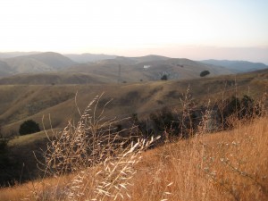
The Cheeseboro Reservoir, capable of holding four million gallons of water, can be seen in the distance. Along with a pump station at Palo Comado Canyon, the reservoir will be demolished and removed during April and May. Courtesy of National Park Service

The Cheeseboro Reservoir, capable of holding four million gallons of water, can be seen in the distance. Along with a pump station at Palo Comado Canyon, the reservoir will be demolished and removed during April and May. Courtesy of National Park Service

Triunfo Sanitation District (TSD) will be removing the Palo Comado Pump Station and the Cheeseboro Reservoir. These facilities, owned by TSD, were built in 1959 at the behest of comedian Bob Hope, who had hoped to build thousands of homes in the surrounding area as part of a master-planned community. TSD is decommissioning the facilities as part of an agreement with the NPS and other agencies.

Large trucks will be hauling salvaged materials along both the Palo Comado and Cheeseboro Canyon trails to recycling centers. For their safety, visitors are asked to refrain from using these trails when posted as closed.

Entrance to trails from Cheeseboro Canyon, Doubletree and Smoketree trailheads will be periodically closed. The China Flat trailhead and trailheads for Upper Las Virgenes Canyon Open Space Preserve will remain open.

The NPS and TSD appreciate the public’s cooperation with this effort. Additional information is available by calling 818-889-8996.

Santa Monica Mtns Trail Days at Sycamore Canyon Apr 20-22

Tuesday, April 2nd, 2013

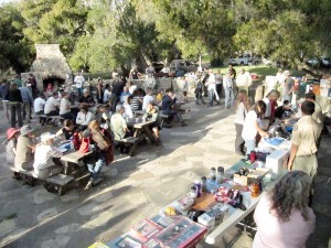
SMM Trail DaysOnce a year we have an opportunity to work on the trails and then BBQ and camp at Danielson Ranch in Pt Mugu State Park. It is opened annually for the Santa Monica Trail Days! This is a unique opportunity to work on the trails that we enjoy so much in Sycamore Canyon, and the Saturday workday is followed by a BBQ and prizes, with free camping available on Friday and/or Saturday night. This is hands down the best day to get in some trail maintenance work! Camping is optional; you may leave with the escort after the BBQ. There will be trailwork projects on both Saturday and Sunday. Sign up for one or both! Pre-registration is requested by April 17th so we’ll know how many people to prepare for.

Schedule at a glance

Friday night April 19 – arrive for overnight camping (optional). Bagels and hot beverages supplied Saturday morning for campers.

Saturday April 20Trailwork, barbecue dinner, prize give-away. Bring your own lunch. Optional overnight camping. Bagels and hot beverages supplied Sunday morning for campers.

Sunday April 21Trailwork, prize give-away. Bring your own lunch.

You can volunteer to help out on Saturday, Sunday, or both.

BRING: LUNCHES, BEVERAGES, SNACKS AND WATER. Tools and instruction on using them are provided.

WEAR: Gloves, hat, long pants, protective clothing, and work boots or sturdy shoes.

REGISTRATION: Advance registration is required for the activities shown below, and appreciated by April 17th!

Saturday Registration: http://www.meetup.com/CORBAmtb/events/106405302/
Sunday Registration: http://www.meetup.com/CORBAmtb/events/106408382/

TRAILWORK: Saturday and/or Sunday. Help out with one or both! There are also opportunities to help out in the camp instead of trailwork.

CAMPING: Free camping Friday and/or Saturday nights for volunteers at the Danielson Multi-use Area located under the sycamores and oaks in the heart of Point Mugu State Park. Bring your own gear.

DINNER: Sat. Night Barbecue Free FOR VOLUNTEERS. Bring appetizers and beverages.

PRIZES: Thank-you prize give-aways will be held Saturday after dinner and Sunday after trailwork.

VEHICLE ACCESS: You will be able to caravan into and out of the park by vehicle only at these few designated times:

ARRIVE: Friday – 5 pm and 7 pm Saturday – 8 am and 4:30 pm Sunday – 8:30 am

DEPART: Saturday – 4 pm and after campfire Sunday – 8 am and 2:30 pm

Full details and camping/dining details are also provided on the registration pages.


CORBA Kids Club News

Tuesday, April 2nd, 2013

The CORBA Kids Club returned to Sullivan Canyon for our monthly ride. Four dads, one mom, and 6 kids participated. You can view photos from the ride here.

On Saturday April 6 the CORBA Kids ride Malibu Creek State Park. Meet in the lower parking lot at 9 a.m. Email corbakids@corbamtb.com for more information.


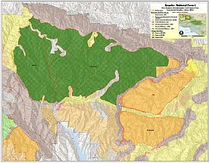
Angeles National Forest Wilderness Proposal Update

Monday, March 25th, 2013
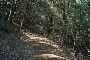
Burnt Peak Canyon Trail - one of the good sections

Burnt Peak Canyon Trail

Today, March 25, 2013, in a stakeholder meeting with the Forest Service and Wilderness advocates, we learned that our initial assessments of the National Forest Land Management Plan Amendments were based on an inaccurate interpretation of the draft proposal. Neither the maps supplied nor their descriptions show that the Forest Service had taken our comments into consideration.

In Alternative 2, the FS cherry-stemmed out the three official Forest Service trails in the area–Burnt Peak trail, Fish Canyon trail, and Gillette Mine trail–as per our initial requests. By “cherry-stemmed” we mean that they have drawn the wilderness boundary so that the trails retain a Backcountry Non-Motorized designation, allowing bicycles, while the surrounding area would become Recommended Wilderness. In this case the “cherry stems” are comprised of a 25-foot buffer either side of the historic trail alignment, as it is recorded in the Forest Service database.

While we greatly appreciate the Forest Service’s willingness to accommodate bicycles, there are a number of problems with this approach. First and foremost is the fact that sections of the official system trails are in disrepair and some sections have disappeared. Most of the trails in this area have been neglected for years, and for a portion of their length, have been reclaimed by nature. We have been led to believe that in some sections the only way to travel the “trail” is a wet-feet hike down the middle of the streambed. If true, this presents a problem for the future, as a 25’ buffer is not realistically wide enough to reconstruct these trails in a sustainable way, out of the streambed, or away from precipitous canyon walls. Having a trail corridor cherry-stemmed out of the wilderness will do us no good if we are unable to rebuild the trail because of the sensitive nature of the riparian habitat through which it passes, or trail engineering limitations.

We also learned that the Forest Service does not have a current Trail Master Plan or Travel Management Plan that clearly identifies official and unofficial trails and assesses their condition. Such a plan would ideally make recommendations for rerouting existing trails to more sustainable alignments, and also provide guidance on where new trails should be constructed or existing unofficial trails be made official, to accommodate growing future demands for recreational access, connectivity and diversity of experience.

At this point we must remain fully opposed to Alternative 3, which designates the Fish Canyon/Salt Creek, Tule and Red Mountain areas as recommended wilderness with no allowance for multi-use trails now or in the future. Alternative 3 would forever remove most recreational opportunities, including cycling, from tens of thousands of acres of land near the Santa Clarita and Antelope Valley areas, leaving precious little land for future generations of mountain bikers and others who value both conservation and outdoor recreation.

Alternative 2 is the Forest Service preferred alternative. While far better for us than Alternative 3, because of the problems with the current trails and cherry-stems based on those apparently non-existent trails, we are reluctant to support Alternative 2 in its current form. We do, however, agree that the area as a whole is worthy of protection from development, infrastructure, road building, and extractive use. Such protections are already provided by a Backcountry Non-Motorized designation, and existing critical habitat designations. In fact, in Appendix 2 of the current draft, the Fish Canyon IRA Evaluation states “….a change in land status may not substantially increase protection.” Similar statements are made for each of the areas under consideration for recommended wilderness.

We believe that it is premature and irresponsible to designate a recommended wilderness for this area without a full assessment of the existing trails and future trail needs by Forest Service staff and/or trained professional trailbuilders. We urge the Forest Service to complete a trail master plan and/or travel management plan that includes full assessments of existing system and non-system trails, proposed re-routes of existing trails to more sustainable alignments, and the identification of desired new trail alignments that provide missing connectivity and a more diverse range of trail experiences. We could subsequently support the stronger protections of a special conservation area or recommended wilderness that cherry stems out the trail corridors identified in such a plan.

Further, we continue to have concerns about the Golden Eagle trail. While not an official Forest Service trail, it is the most popular singletrack trail for cyclists in the area. The trail appears to cross the proposed wilderness boundary, but only for very short distances. We and the wilderness advocates both agree that the proposed wilderness boundary should be adjusted to exclude this popular trail. But without data gathered by the Forest Service in a trail master plan, the exact location of an adjusted boundary would be an educated guess at best. Again, this is an issue that would be addressed by a travel management and/or trail master plan.

We must therefore express our support for Alternative 1, the no-change alternative, unless the aforementioned concerns are addressed within Alternative 2. Something that everyone recognizes is that the populations of Santa Clarita and Antelope Valleys are growing. The mountain biking community is also growing rapidly. The most popular trails for SCV cyclists are in Tapia Canyon, private land that will one day be developed. We need to consider and allow for future demand for trails and balance that need with protecting remaining open space from development. Only Alternative 1 allows for future growth, while providing protection for this special area.

We have no additional comments on proposed changes in other areas of the Angeles National Forest, and defer to local advocacy groups for proposed changes in the Los Padres, San Bernardino and Cleveland National Forests.

After the public meetings, we’ll be putting together our official comments for the Angeles National Forest, and will encourage everyone to send their own comments to the Forest Service.

Report on the Annual Conejo Open Space Trailwork Day, March 23

Monday, March 25th, 2013

About 60 volunteers showed up on Saturday morning to help with the annual spring trailwork day, including nine with CORBA. We met at the new bridge in Hill Canyon, then walked a mile, picked up our tools, then hiked another few hundred yards to the work site.

The morning started off quite chilly, waiting in the shade of the canyon, but as soon as we emerged into the sun, it became quite pleasant.

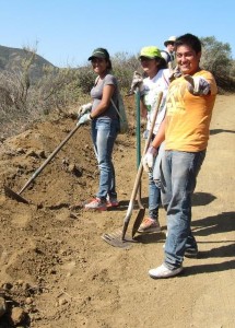
IMG_3848The work was to clean up after the bulldozer that had scraped the hill at the north-east end of the Western Plateau Trail.

In some ways we were sad to see that this hard-packed, rutted dirt road had been smoothed out because it had been a challenge to climb through the ruts, and was really fun to come back down it. However, the road was in such bad shape that the COSCA rangers weren’t able to get their trucks up it.

There are plans to build new trails in the area of the Western Plateau. Being able to drive people and equipment up means that it will be easier to plan and build these new trails, so we’ll be able to use them sooner. Also, 4×4 vehicles have been illegally driving on the Western Plateau, damaging the trails, roads and creating tracks and bare spots in the open space. They had been doing this with relative impunity because the rangers weren’t able to get up there to stop them. Now that the risks are higher, hopefully the off-roaders will find somewhere legal to drive their vehicles.

The trailwork consisted mostly of knocking down a low berm the bulldozer left at the side of the road so rainwater can run off the road, and building drainages to help channel the water off. The CORBA crew was also assigned the task of blocking off the top of a very steep and loose road that had been chewed into the hillside by illegal 4×4 vehicles.

The ‘dozer driver did a really good job so there wasn’t as much berm to knock down as expected, allowing us to finish up about a half hour early, and head for lunch.

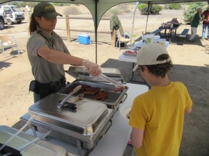
IMG_3916The COSCA (Conejo Open Space Conservation Agency) rangers barbecued up a lunch of hot dogs, beef- and vegie-burgers, with all the typical condiments, chips, fruit and ice-cold drinks. A real bonus was something you rarely see these days – ripe tomatoes!

After lunch, the CORBA workers picked up their bike tire, supplied by IMBA and CST to show appreciation for our volunteer work.

I think we had all hoped to be working on building a new trail on Saturday. Even though we were just putting the finishing touches on a dirt road, most people came away satisfied with the knowledge that we’re making it easier for the rangers and volunteers to preserve the open space and improve trail access in the future. CORBA thanks the many volunteers, especially the mountain bikers, who came out to help with this effort!

View the photo gallery of the volunteers at work and enjoying lunch afterwards!

The Ventura County Star wrote about this event on March 26, and included photos of two CORBA volunteers, including the lead photo. Here’s the link to check it out:

http://www.vcstar.com/news/2013/mar/26/conejo-open-space-gets-hand-from-volunteers-to/

Wilderness Proposal Public Hearings – Be there to help save access to trails Apr 9, 10

Friday, March 22nd, 2013

Fellow cyclists, the four Southern California National Forests Land Management Plan Amendment is currently in its public comment period. The amendment makes changes to Land Management plans in the Los Padres, Angeles, San Bernadino and Cleveland National Forests. Within that proposal are two alternatives that will forever impact bicycle access to public lands in the Angeles National Forest.

Maps of the proposals are available here.

Fish Canyon Salt Creek Wilderness - Alternative 2

Alternative 2 Map – Click for a larger version

Alternative 1, the “no-action” alternative, is the only alternative we can presently support.

Alternative 2 retains a backcountry non-motorized status for Red Mountain and Tule districts, but it appears that the trails in the Fish Canyon/Salt creek areas may be forever closed. These trails have appeared in guidebooks dating back to the 90’s, and we have ride reports from much more recent times. We asked for these trails to be left out of any wilderness proposals.  There are many other trails, official and unofficial, in the area, and we’re seeking documentation of those trails. If you have knowledge of these potentially affected trails, let us know. We could support Alternative 2 if the trails in question are cherry-stemmed out of the wilderness proposal.

In Alternative 3, the Fish Canyon/Salt Creek proposed wilderness on which we commented last year has now been expanded to include the Red Mountain and Tule districts of the Angeles National Forest. These two areas lie to the east and south of the Fish Canyon/Salt Creek area. These two areas were not included as potential wilderness in the original scoping documents, and we therefore made no comment on them, other than to offer our general support for their designation for non-motorized backcountry use.  Now, in Alternative 3, these two areas and the many trails that traverse them are included as wilderness. Local riders have been riding these trails for more than 30 years, right up to the present. We cannot allow Alternative 3 to be adopted.

We too would like to see these areas protected, and feel that backcountry non-motorized designation gives the area adequate protection, but the environmental lobby is pushing for federal wilderness. We have proposed a compromise, a federally designated Special Conservation Area, which prohibits extractive use, development and road-building and can be custom tailored to allow for non-motorized recreational use, while affording stronger protection for and monitoring of the environment. This would require special legislation.

After the public meetings in March, we will be compiling and submitting our comments on the proposals. We encourage everyone to submit comments on the proposals, along with supporting documentation (GPS tracks, photos) of bicycle use of the trails. The comment period will close on May 16, 2013.

The Forest Service will be hosting multiple open house meetings during the comment period. The content and format of each meeting will be the same. Meetings will begin with an open house where Forest Service staff will be available to answer questions about the Draft SEIS. A brief presentation will begin 30 minutes after the meeting opens, followed by an opportunity to ask questions. Maps of the alternatives will be available for viewing. The meeting times and locations are:

  • March 26, 2013, 4:00 PM to 7:00 PM, Angeles National Forest Headquarters, 701 North Santa Anita Avenue, Arcadia, CA 91006 
  • March 26, 2013, 4:00 PM to 7:00 PM, Alpine Community Center, 1830 Alpine Blvd, Alpine, CA 91901 (Hosted by the Cleveland National Forest)
  • March 27, 2013, 4:00 PM to 7:00 PM, Palomar Ranger District Office, 1634 Black Canyon Road, Ramona, CA 92065
  • March 28, 2013, 4:00 PM to 7:00 PM, Santa Clara Mojave Rivers Ranger District Office, 33708 Crown Valley Road, Acton, CA 93510 
  • March 28, 2013, 5:00 PM to 7:30 PM, San Bernardino National Forest Headquarters, 602 S. Tippecanoe Ave., San Bernardino, CA 92408
  • April 9, 2013, 4:00 PM to 7:00 PM, Mt. Pinos Ranger District office, 34580 Lockwood Valley Road, Frazier Park, CA 93225
  • April 10, 2013, 4:00 PM to 7:00 PM, Southern California Edison, 103 David Love Place, Goleta, CA 93117 (Hosted by Los Padres National Forest)

For Further Information Contact Bob Hawkins, Project Manager atsocal_nf_lmp_amendment@fs.fed.us, or visit the
project website at http://www.fs.fed.us/nepa/fs-usda-pop.php?project=35130.


Update 3/25/2013:  We have learned more about the draft proposals and reported here.


Recreation and The Future of Conservation

Tuesday, March 19th, 2013

As CORBA prepares for discussions about wilderness proposals in the Angeles National Forest, we found the following Tedx Talk by Brady Robinson, Executive Director of the Access Fund, timely and relevant.

One of CORBA’s missions is to protect and preserve the open spaces and public lands on which we pursue our joint passions for cycling and nature. While we feel that our open spaces need protection from development and other activities that would forever change the landscapes we love so much, doing so in a way that precludes future bicycle access, or takes away existing public, multi-use trails is something that we and the growing off-road cycling community have difficulty supporting.

Robinson’s assertion that we tend to protect that with which we are familiar rings so true. If we never get our younger generations to experience nature in a way that is compelling and entices them to return, we’ll all have a much harder time convincing them of the need to protect our public lands. He says: “By remembering what we love and why we love it, we find the inspiration to protect it and nurture it for future generations.”

After watching the video, let us know what you think.


TEDxBoulder – Brady Robinson – Recreation and the Future of the Conservation Movement from Access Fund.

Learn more about this TedxBoulder talk here.

Skills Clinic Photos for March 2, 2013

Saturday, March 2nd, 2013

We had a surprisingly small class today. I had expected more, given what a warm day it was, especially compared to recent weekends. But just a dozen people when riding with us in Malibu Creek State Park to participate in the free monthly basic skills clinic. You can see the photos in the March Skills Clinic Photo Gallery.

Why? Good Question!

Tuesday, February 26th, 2013

20120421111-Malibu-Creek-State-Park-Hike-Bike-Run-Hoof-300x199

By Mark Langton

It was recently brought to our attention that newly elected president of Equestrian Trails, Inc. (ETI) Robert Foster, a retired law enforcement officer, donates his time as an emergency medical technician at So Cal High School Mountain Bike Racing League races. Mr. Foster is a staunch supporter of the league, and in his president’s message in ETI’s most recent newsletter he stated that it’s a new era in our public open space trail systems, and mountain bikers are part of the trail user community so we all should try to figure out ways to get along.

Now I’ve been doing this advocacy thing for over 25 years, and I’ve experienced a lot of encouraging progress in the areas of shared use, especially when it comes to opening more trails to bicycle use. To hear the president of an organization that has historically had some of its members rally against mountain bikes say that we need to get along is truly groundbreaking. But things like this come fewer and more far between than I’d like, and during these 25 years I have often asked myself “why am I doing this?” The answer is always “because it’s the right thing to do.” This might sound insane (insanity once being defined by Albert Einstein as “doing the same thing over and over again and expecting different results), and in many ways this might be true. But then something like Robert Foster’s reasonable position comes along and I think to myself, maybe we have been doing the right thing after all.

Over the years we have heard many reasons people feel mountain bikes don’t mix on shared use trails, but only one is valid; people riding their bikes too fast at the wrong time and place (around other trail users) is just not a pleasant experience for the people being passed at an inappropriate speed. As I’ve said many times before, we all have within our power the ability to solve this issue: slow down. In other words, use caution when around others. Let me put it another way; your actions represent the entire mountain bike community. The smile you create through a pleasant trail encounter goes a long way.