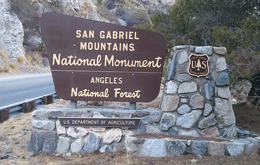
As part of President Obama’s proclamation declaring the San Gabriel Mountains National Monument, the Forest Service was tasked with creating a management plan within three years. Meetings about the plan are being held this week.
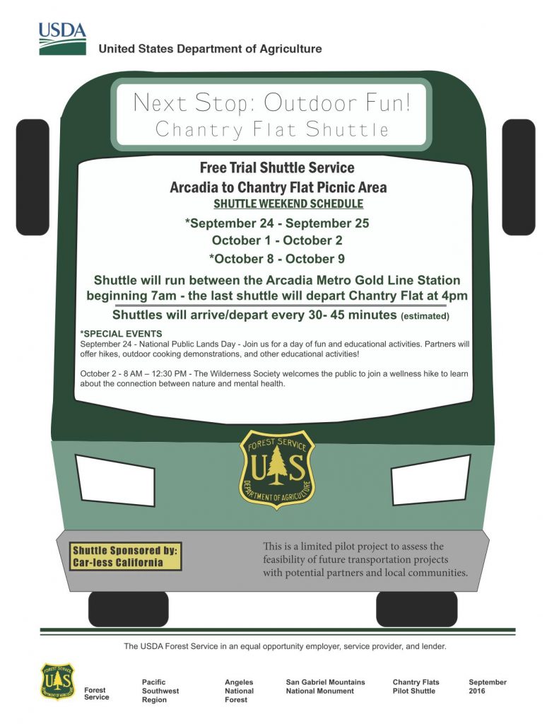
For the first time in Forest Service history, the agency was also tasked with the development of a Transportation Plan that would achieve a number of goals: provide access for those without vehicles or other means to get to the Monument, mitigate parking and over-use problems, and address environmental justice.
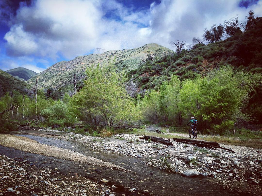
Over the summer, the city of Duarte did a trial run of shuttles from the newly opened Gold Line light rail station to Fish Canyon falls trailhead, giving Forest visitors a vehicle-free way to access the forest.
Over the next few weeks, a second pilot program will be running shuttles from the Arcadia Gold Line station to Chantry Flat, where there is a historic mule pack station, numerous multi-use trails, picnic facilities, historic cabins and at least two waterfalls. The free shuttle is being operated in partnership with Car-less California and the Forest Service.
For this pilot program, unfortunately the smaller buses aren’t equipped to carry bicycles, but for those who want to ride a bicycle to the rail line, there are bike lockup facilities at the Gold Line station. The Forest Service is already aware of our desire to have bike racks available when and if a permanent shuttle service is provided.
The shuttle will operate for three weekends with the first shuttle leaving Arcadia at 7 am and the last shuttle leaving Chantry Flat at 4pm. The shuttle will run continuously, approximately every 30 – 45 minutes. Dates:
September 24 (National Public Lands Day), and 25, then October 1 and 2, and October 8 and 9. The shuttle is free, no reservations are required.
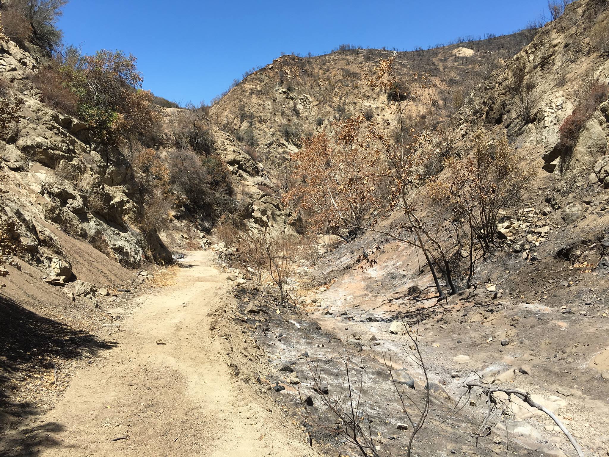
Last Saturday, September 10, about 30 mountain bikers joined 50 or so HandsOn Santa Clarita volunteers to help with Sand Fire cleanup at the Placerita Canyon Nature Center.
The HandsOn crew focused on the west end of the trail and the parkland surrounding the Nature Center. Meanwhile the SCV Trail Users headed up to the more heavily burned area at Walker Ranch campground.
We split up and built eight debris check dams in drainages that lead into the streambed of Placerita Creek. After a fire, soil and ash denuded of vegetation, can become major debris flows with a relatively small amount of rain. These debris flows do more damage to trails than anything else. We saw it in many areas of the Station Fire. I did an interview for Mountain Bike Action magazine, discussing the impacts of fire to trails.
The eight debris check dams will help capture sediment and slow down flows before they cross the trail and enter the canyon. They were constructed of native rock and sand bags filled from the dry streambed, upstream of the check dams.
Thanks to all the volunteers who came out to help, LA County for allowing us to help protect the trail we lobbied for access to, and to the SCV Trail Users for coordinating the effort.
We’re fulfilling our promise of being both responsible trail users, and stewards of our trails and public lands.
Graham took over the photographer duties again for Steve, who was out of town, in Malibu Creek State Park this month at the Basic Skills Clinic. There was a smallish group with nine participants this Labor Day Weekend. The clinic is always held the first Saturday of the month. You can see the photos in our September photo gallery.
In 2011, The Canyon Trail in Placerita Canyon State Park was closed to mountain bikes without warning. It had been mistakenly posted as open, with many mountain bikers using the trail for years. Local mountain bikers united with CORBA to successfully lobby the County to open the trail bikes. From that effort the SCV Trail Users were formed and together we continue to confront local trail issues.
Canyon Trail post Sand Fire
Recently the Sand Fire scorched this area, and the County has asked for help to protect the Canyon Trail and the Placerita Canyon State Park from mud and debris flow when the winter rains come.
Please save the date, Saturday September 10, 8 am, at the Placerita Canyon Nature Center. Give up one day of riding, and come help build debris check dams to reduce the flow of mud and debris from the Sand Fire onto the Canyon Trail and into the Park area.
We’ll be working alongside other volunteer groups including HandsOn Santa Clarita. Bring gloves, lots of water and snacks. The County will provide the materials and supplies for the check dams.
On August 17, the Forest Service released the remaining chapters of the draft Environmental Analysis (EA) and draft Management Plan. The plan will guide the management of the San Gabriel Mountains National Monument (Monument) by the Forest Service.
The biggest changes are those mandated by the Presidential Proclamation, including the development of a Transportation Plan, to address parking and overcrowding. Nothing in the draft plan changes mountain bike access to trails within the Monument or the National Forest. It does however, update the current Management Plan to include the Pleasant View Ridge and Magic Mountain Wilderness areas which were designated after the current Forest Management Plan plan was last updated in 2005.
Some sources have described the draft plan as “toothless.” It is short on specifics and lacks details of how many of the objectives and desired conditions will be achieved. However, it isn’t meant to cover specifics. Those are on-the-ground project-level decisions, that must be in compliance with the Plan. The draft Plan takes much of the current Forest Management Plan’s existing language and direction, which provides management guidance that was deemed to be in compliance with the mandates of the Presidential Proclamation. Therefore many of those sections weren’t considered to be in need of change. The Plan appears as Appendix C of the draft EA.
That doesn’t mean that there isn’t room for improvement and more specific direction. The San Gabriel Mountains Community Collaborative (Collaborative) is undertaking a deep analysis of the plan. CORBA will be submitting comments, and will also submit comments as a member organization of the Collaborative. We encourage all to attend a meeting or the online webinar and submit comments, expressing your support for continued and improved mountain biking recreation.
September 14, 3 – 8 pm, Pico House, 430 N. Main Street, Los Angeles, CA 90012
September 15, 4 – 8 pm, The Centre, 20880 Centre Pointe Pkwy, Santa Clarita, CA 91350
September 17, 10 am – 2 pm, ANF Headquarters, 701 N. Santa Anita Avenue, Arcadia, CA 91006
October 4, 3:30 – 7:30 pm, Big Pines Lodge, Angeles Crest Highway, Wrightwood, CA 92397
The Collaborative have requested that at least one of the public meeting presentations be recorded and made available online for those whose schedules don’t allow them to attend one of the public meetings.
The Forest Service aims to have the final plan, addressing any comments received, next spring, followed by a formal objection period for anyone who submitted comments and believes they were not addressed. The proclamation mandates the plan be completed by October 10, 2017.
Graham took over the photographer duties again for Steve, who was out of town, in Malibu Creek State Park this month at the Basic Skills Clinic. This month there were 11 participants. The clinic is always held the first Saturday of the month. You can see the photos in our June photo gallery.
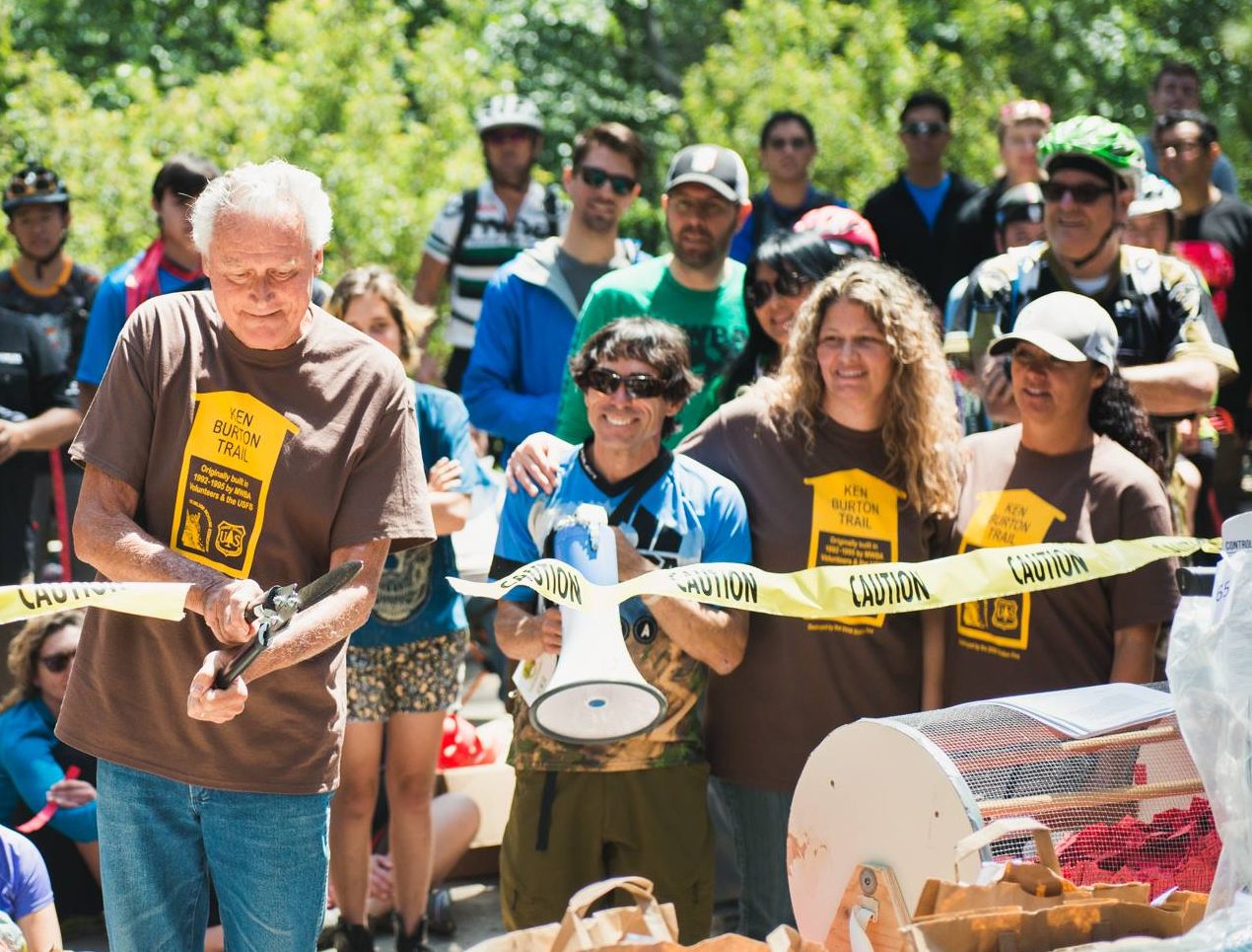
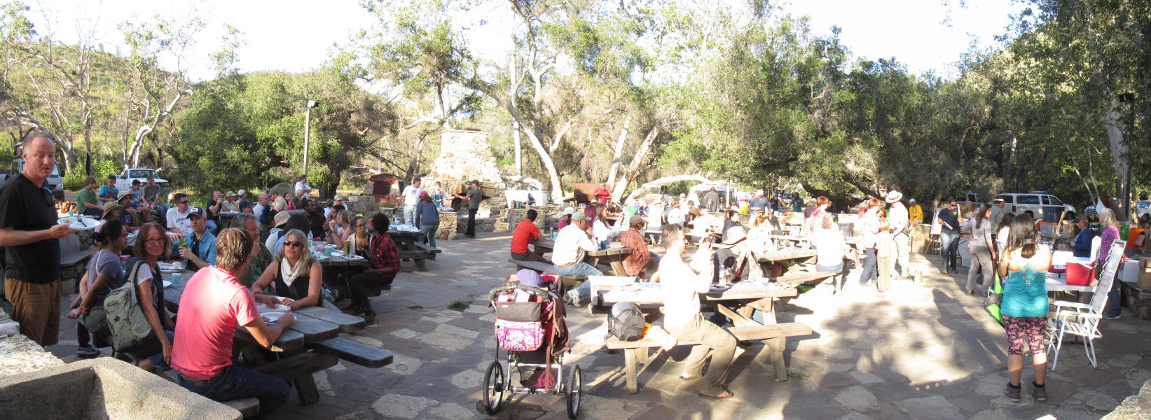
We recently posted a report on the completion of scheduled work on the Ken Burton Trail. On May 1st the Mount Wilson Bicycling Association, who partnered with CORBA to restore the trail, held their annual Pancake Breakfast fundraiser at Gould Mesa Campground in the Angeles National Forest. It was perfect timing for all to celebrate the completion of the Ken Burton trail.
Jim Burton cuts the ceremonial ribbon, as Steve Messer, Matt Lay and Jenny Johnson of MWBA, and Ken’s daughters Heather and Tania look on. Photo by Mark Skovorodko.
While the Pancake Breakfast was an all MWBA event, many CORBA members were also present to enjoy the celebration. Through the wonders of social media, we were able to connect with Ken Burton’s family, many of whom came to the event to celebrate the reopening of their “dad’s trail.” The cermonial ribbon cutting was performed by Jim Burton, Ken’s brother, with Ken’s daughters Heather and Tania, Steve Messer from CORBA, and MWBA’s Jenny Johnson as MC. Heather gave an inspiring speech about her dad, his love of trails, bicycles, and the National Forest where he served as Battallian Chief before being killed by a drunk driver on Angeles Crest Highway in 1988. A moment of silence was observed in honor of Ken Burton before the ribbon was cut.
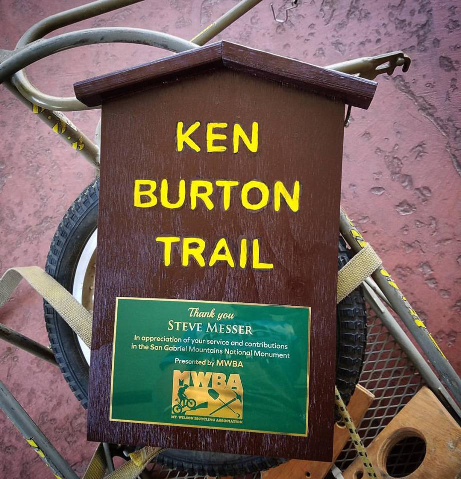
Plaque of recognition for Steve Messer
MWBA thoughtfully honored Steve Messer with a special plaque of appreciation, made in the style of the original Ken Burton trail sign. Volunteers who gave two or more days of volunteer work received a commemorative T-shirt and a certificate of appreciation from the Forest Service. While the project was initiated and led by Steve Messer of CORBA, it was truly a partnership with both CORBA and MWBA volunteers working together to complete the trail restoration project.
It was a great day to celebrate the completion of one trail project, as we prepare to move on to the next project: restoration of the Gabrielino trail from Ken Burton trail junction to Switzers. CORBA has applied for a grant from REI, and will partner with the Los Angeles Conservation Corps, Bellfree Contractors, and again, the Mount Wilson Bicycling Association to complete the project.
The largest trailwork event in the Santa Monica Mountains is held every year at the end of April in Pt. Mugu State Park. This past weekend, volunteers from CORBA, the Santa Monica Mountains Trails Council (who organize the event every year), the Sierra Club and others converged on the Danielson campground to help out. Besides trailwork on Saturday and Sunday, the festivities included a barbecue dinner, a huge prize give-away and optional overnight camping.
Clearing mustard on the Sin Nombre Trail
On Saturday morning, 140 volunteers split up into crews of about 10 and dispersed to various trails. The crew that included most of CORBA’s volunteers shuttled to the top of the Sin Nombre Trail and started the day by cutting back mustard that was crowding the trail. When that was finished, we worked our way south, spending our time fixing deep ruts. That involved cutting down the berm that forms on the outside of the trail and dragging the dirt back into the rut, and also building up the inside of the trail to restore a gentle outslope. The outslope allows water to run off the outside of the trail, rather than running down it and eroding a new rut.
Fixing a rut on the Sin Nombre Trail
The north end of the Sin Nombre trail is very rocky in sections, so it took a considerable amount of work to restore the trail to it’s original condition.
While the CORBA crew was working southward, two other crews were working north from the bottom of the trail. They also were fixing ruts.
After lunch on the trail, a few from the other crews came up to help the CORBA crew. The extra hands allowed us to finish our work an hour early – the help was very much appreciated! With three crews working, we were able to repair all of the ruts along the length of Sin Nombre that were repairable.
Fixing the tight, rocky switchback at the bottom of the Wood Canyon Vista Trail, part of the Backbone Trail.
A crew consisting of mostly MBU members and led by Steve Messer, CORBA’s president, worked their way up the Wood Canyon Vista Trail. They started by rebuilding the first very tight switchback which had become rocky and difficult to navigate in recent years. When that was done, they headed up the hill to generally clean out old drains and build new ones where needed.
Other crews worked on Sage Trail, rebuilding walls and drainages, Old Boney Trail near Sorreno Valley in the Boney Mountain Wilderness Area, and a group of youngsters and their parents cleared brush from the side of the Blue Canyon Trail. Building Bridges to the Outdoors Sierra Club worked on Coyote Trail.
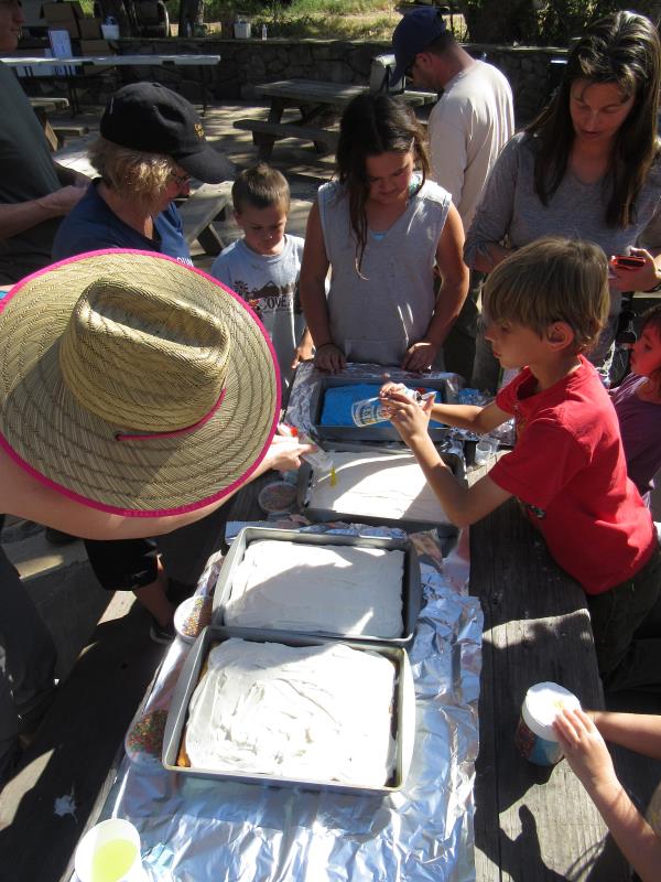
Decorating the dessert cakes for Saturday’s dinner
There hasn’t been any rain recently so the dirt was bone-dry and turns to dust when we dig into it. Because of this, it’s not possible to pack it down firmly despite our best efforts. Be careful when riding these newly worked trails – parts of them are pretty loose still!
Saturday afternoon was spent relaxing around camp, chatting with friends and rehydrating, often with light- to dark-brown beverages. Some people went hiking or riding and youngsters helped decorate the desert cakes with colored icing and sprinkles.
The barbecue dinner, cooked and served by Park staff, was fabulous as always – barbecued tri-tip, chicken and veggie burgers along with salad, garlic toast and baked beans. During dinner, Tony Hoffman from State Parks, along with a pair of young volunteers, called ticket numbers for the prize give-away. The very best prizes (tents, sleeping bags and such) were gone by the time this correspondent’s number was called; even so I got a gift certificate to a nice restaurant in Thousand Oaks that I like.
David Szymanski, superintendent of the Santa Monica Mountains National Recreation Area, and Craig Sap, superintendent of State Parks Angeles District dropped in during the afternoon and dinner to chat and thank the volunteers for all their help.
After it got dark, slide shows were given by State Park scientists on the archeology of the area, especially with respect to mudslides over hundreds of years and their effect on native inhabitants, and the ecology of recovery after the Springs Fire two years ago.
Saturday night barbecue dinner and prize give-away
The number of volunteers for Sunday’s trailwork was much smaller, as happens every year. Two dozen people broke into three crews; one worked on “Toe-stubber” a second continued clearing overgrowth from the Blue Canyon Trail, and the kids did some easy trail smoothing nearby with their parents.
CORBA would like to thank all the volunteers and Park staff who made this year’s event a rousing success!
On Sunday, April 17, 2016, 32 volunteers converged on the Windsor/Ventura parking area, the Gabrielino trailhead, in Altadena. The day, hosted by our partners at the Mount Wilson Bicycling Association, was a complete success by all measures. It was our last scheduled group trailwork day on this restoration project, which began in earnest last Fall. In October last year, I declared that all these tools we were hauling up to the top of Brown Mountain would not be coming back down Brown Mountain. They’d be going out the bottom of the trail and the Gabrielino, once the trail was finished. Last Sunday, the tools were brought out of the bottom, as planned.
In reality, the project started long before last fall. In 2013, we scouted the Gabrielino trail north of Paul Little campground, up to Oakwilde campground and the Ken Burton trail. The trail was devastated, with two major slides (think hundreds of cubic yards of earth sliding off the mountain and taking the trail with it). Before we could work on the Ken Burton trail, we had to complete the Gabrielino trail to which it connects, otherwise the two trails would be dead-ends. So our first task was to restore the Gabrielino, up and over the Brown Mountain Dam to Oakwilde/Ken Burton trail.
While our experienced volunteers could tackle the project, we were much more confident having a professional take care of it. At the same time, the Los Angeles Conservation Corps signed a contract with the Forest Service to work on the Gabrielino trail. They didn’t feel comfortable repairing some of the major damage either.
CORBA applied for and received a generous grant from REI for this section of the project. We applied that grant primarily to pay professional trailbuilders Bellfree Contractors for their expertise and work with the LACC. That work required Forest Service engineers to inspect and approve the work plan, the removal of chainlink fencing, and the re-routing of two sections of trail to avoid the major slides.
Over winter 2014-2015, the work was completed by Bellfree and the LACC. They discovered the original trail alignment near Oakwilde Campground, a fully-benched trail segment 30 or more feet above the stream bed on the eastern side slope of the creek. There were sections of rock and cement retaining wall that we estimate were built as a part of the Gabrielino in the 1950s. The LACC and Bellfree restored the trail through that section, rather rebuilding it along the streambed that everyone had been using before the Station Fire.
This segment of trail was completed last winter, but the Forest Service wouldn’t open it to the public as it was a dead-end, and too many people had already been rescued trying to find their way through the Arroyo. The completion of that section allowed us to ask permission from the Forest Service to begin on Ken Burton trail.
Oakwilde campground was devastated, and was buried under 3 feet or more of silt and sediment as the Arroyo Seco swelled well above its banks, bringing with it all the dirt and sediment from the naked hills after the station Fire. Only the tops of the picnic tables, now a few inches above “ground”, are all that remain in the campground. We’re hoping the campground can be restored to a primitive hike-in backcountry camp in the future.
So while we’ve been working on the Ken Burton for just six months, more than two years of planning and pre-requisite projects have needed to take place.
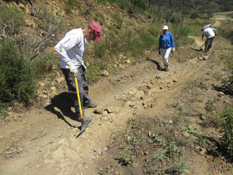
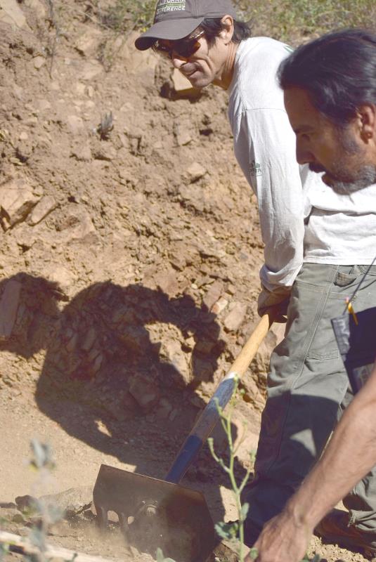
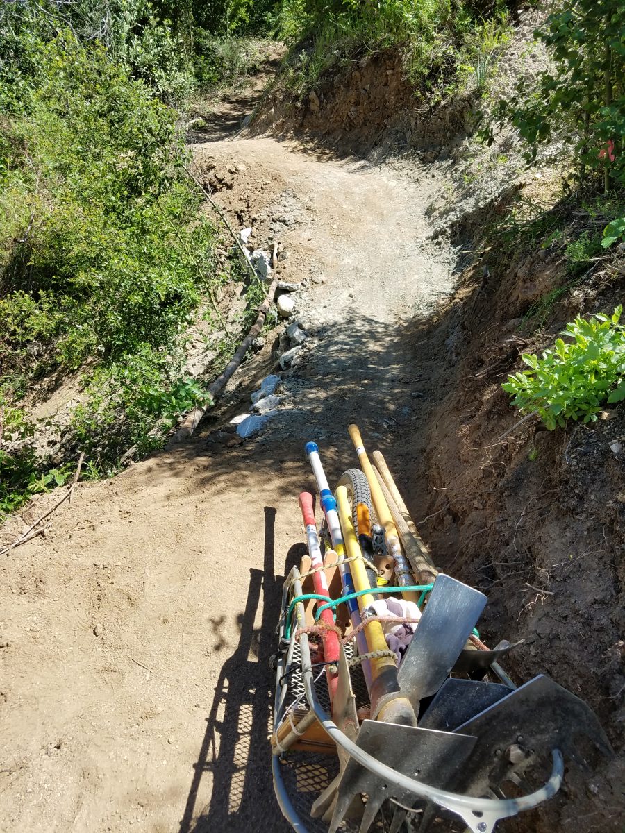
Last Sunday we had a long list of tasks to finish Ken Burton trail. With so many volunteers to help, we completed: the complete rebuilding of three switchacks; widened and cleaned up three additional switchbacks; re-cut bench on a quarter mile of trail; rock-armored two switchbacks; installed a half-dozen drains; rock-armored and rebuilt two major washed out drainages; cleared brush from the upper trail that had grown in since we worked on it six months ago; and cleared additional brush and poison oak near the bottom, all on the Ken Burton trail.
Installing rock retaining walls on the Gabrielino trail
A finished rock retaining wall on the Gabrielino
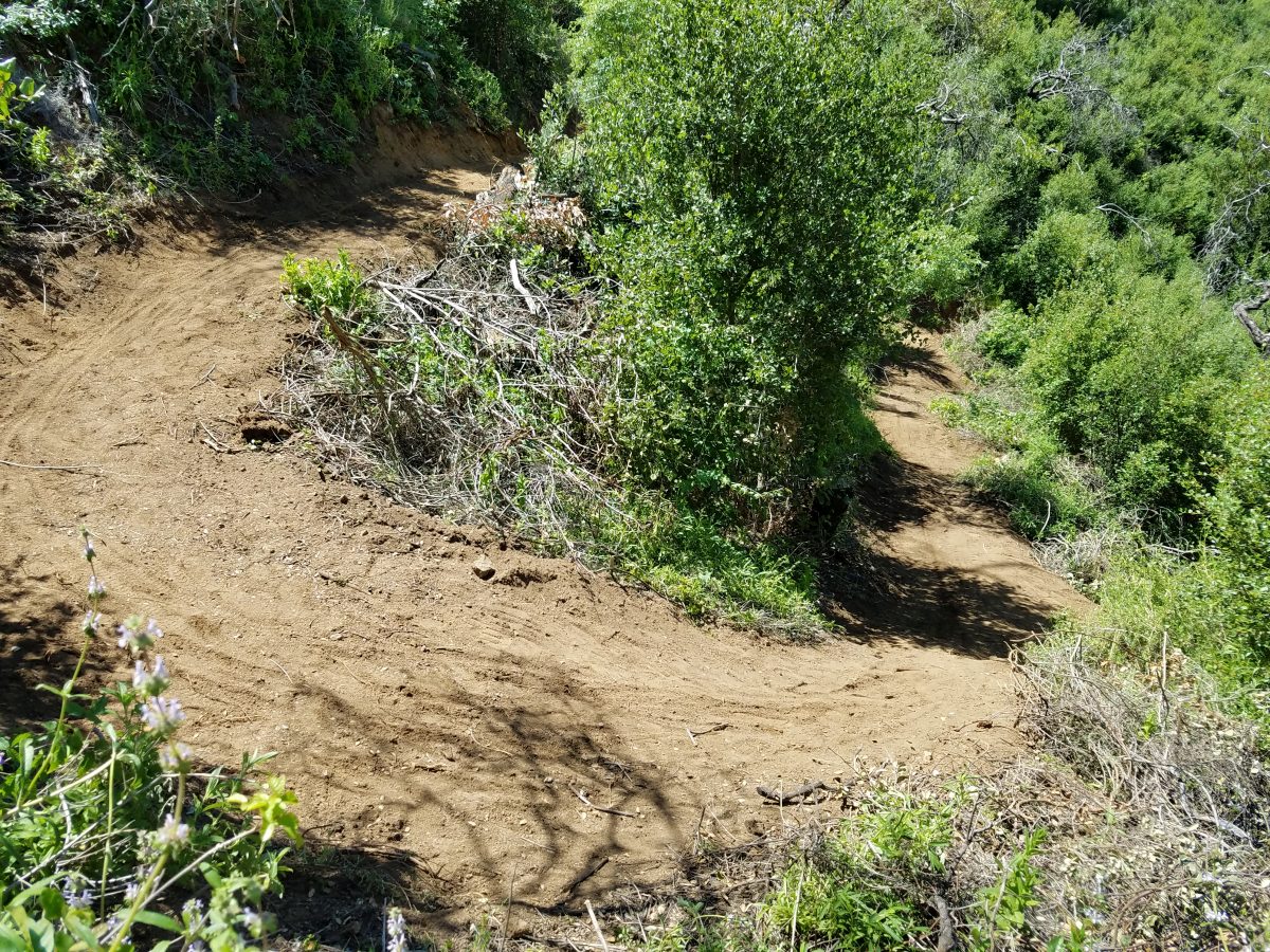
With the additional manpower, we also installed two rock retaining walls, and widened two sketchy segments of the newly re-established route of the Gabrielino trail, just south of Ken Burton. That segment will be a part of the Brown/Burton/Gabrielino trail loop, and was an important project to complete for us to feel comfortable with the trail being opened to the public.
Walk-through of our day’s work
What the bottom section looked like before our work
While working, several mountain bikers and a couple of trail runners came through the trail. It’s nice to see the trail getting use after being closed for seven years. The trail and switchbacks near the top have packed down and hardened up beautifully, having had a longer time and a lot of traffic from all the volunteers riding and hiking in to work on the lower trail. Many of the switchbacks towards the bottom that are still very loose, having had little to no rain over the past few months as we’ve worked on the trail.
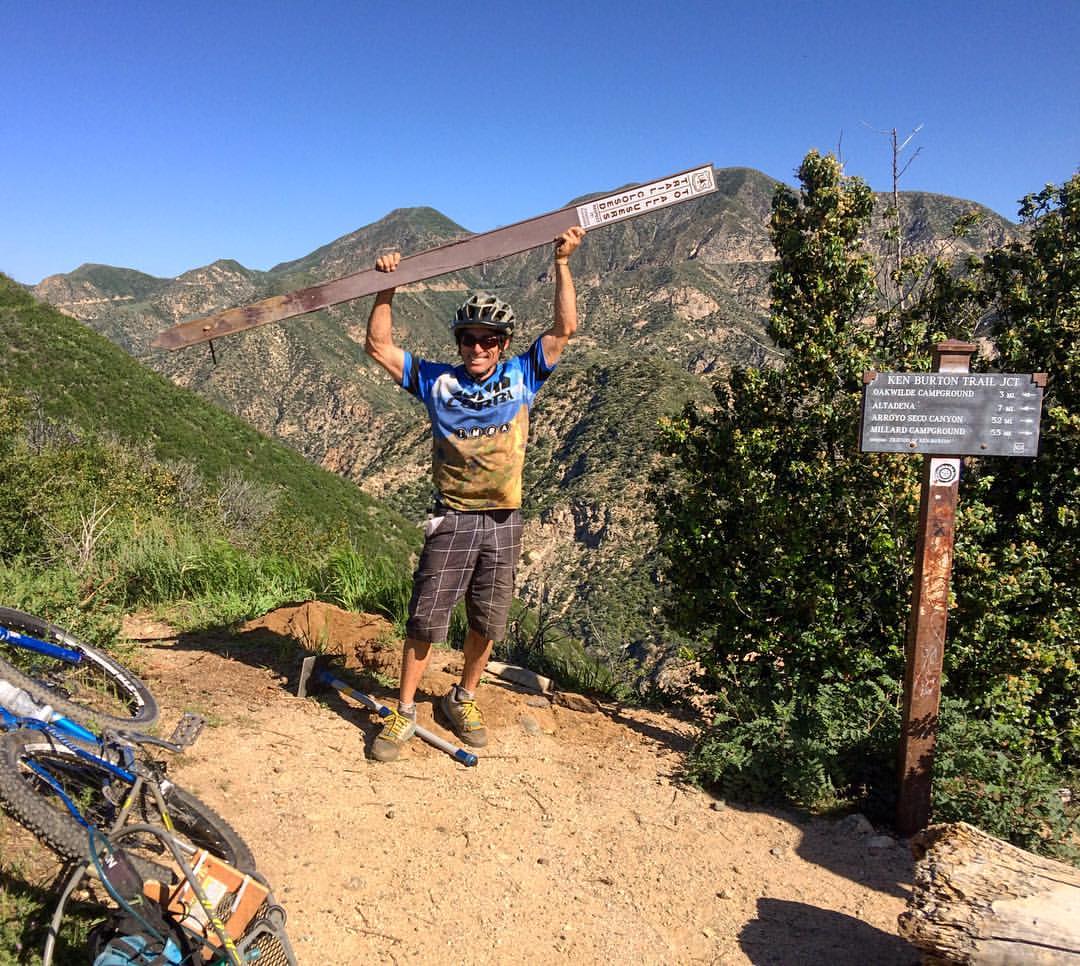
The most defining moment of the day, was when we, with Forest Service authorization, removed the “trail closed” sign from the upper Ken Burton trailhead at the end of Brown Mountain Road. A Forest Service ranger inspected the trail two weeks ago, and recommended the trail be opened to the public, once we completed today’s work. The ranger’s only comment was that the Ken Burton trail “is in way better shape now than many Forest Service trails that are already open to the public.”
Removing the Trail Closed sign
We concur. The trail is in better shape than most of us remember it from before the fire. With the brush not nearly as tall now, there are some incredible views that were blocked before the Station Fire. Eventually the brush will grow taller and obscure the views again, but right now, it can’t be beat. You can see downtown Los Angeles, all the way up the Arroyo Seco canyon, highway 2 and the historic Slide Canyon Bridge.
A rebuilt switchback, still soft.
The trail includes 22 switchbacks that get progressively steeper and more technical as you descend. It’s great practice! But locking up and sliding your back wheel around the turn is not the correct, or the fastest way to ride a switchback. Practice until you can ride without sliding! Until we get another rain and some time for the trail to pack down, we all need to take it easy.
Riding the Arroyo Wash along the Gabrielino Trail
The return ride on the Gabrilieno trail is always an adventure. On Forest Service maps the trail appears as “unmaintained, unimproved, primitive trail.” For about 1.25 miles, you’re riding in the sediment that has been trapped behind the Brown Mountain dam. It can be something of a maze to pick your way through, but as more and more people begin to ride Ken Burton trail, a more defined line will be developed through the arroyo wash. Then with a big rain storm, the stream may change course and we’ll find a new route through the wash.
That’s the beauty of this trail. It really feels like you’re in the backcountry and riding in a wild place.
The trail leaves the wash at a rocky hike-a-bike chute on the right side of the river. It’s marked by ribbons and tire tracks in the sand leading up to it. Eventually we’ll need to improve that section to create a rideable/hikeable ramp out of the wash. But for the moment, prepare for a 50’ hike-a-bike up through the boulders. The trail then meanders through the alluvium, before crossing the stream and beginning the climb up and over Brown Mountain Dam.
At the crest, there are great views of the Brown Mountain Dam from above. The chainlink fence that previously lined that section has been removed, with the materials from the fence being re-purposed as retaining wall structures for segments of the Gabrielino trail. The result is a much more pleasant segment with better views. The trail through this section is extremely loose, with three very loose, tight and steep switchbacks that most people will hike their bikes through. Coming the other direction, they will be a hike-a-bike for most.
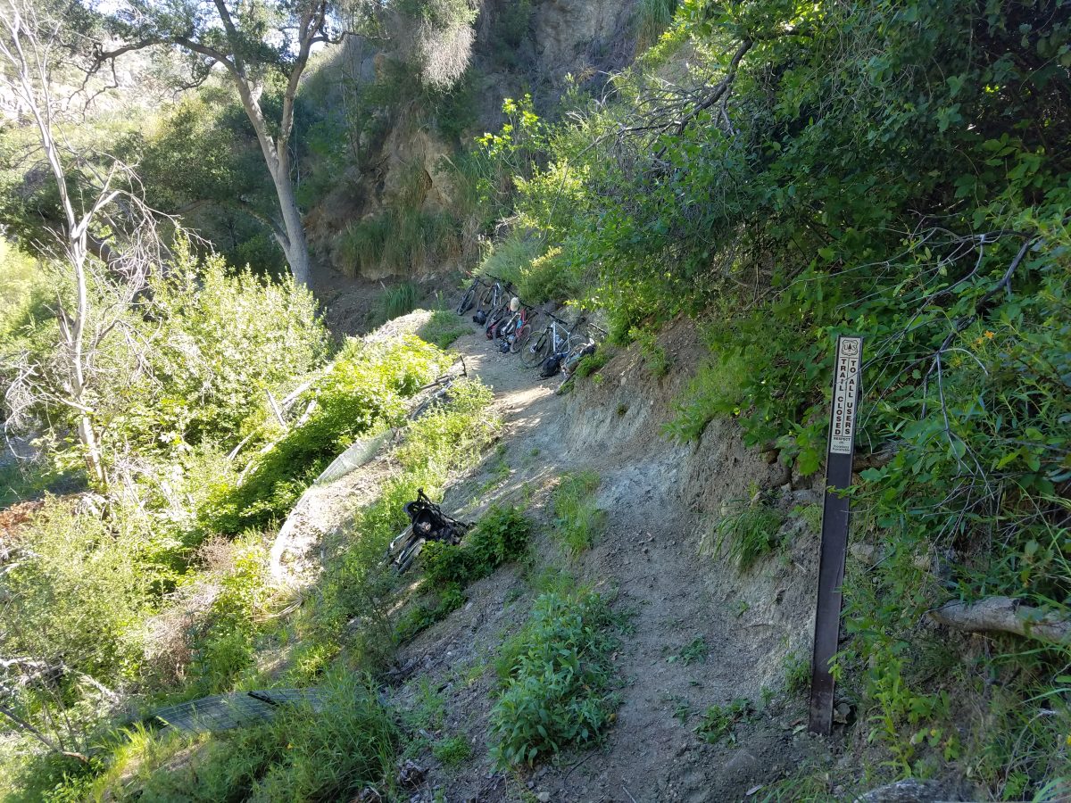
The Gabrielino trail remains closed north of Ken Burton Trail junction. This “Trail closed” sign was moved from the top of Ken Burton to here.
Our next project in our ongoing mission to reopen all front country trails will be the completion of the Gabrielino trail through to Switzers and Redbox. Work has been underway on that segment for the past year by the Los Angeles Conservation Corps, but they’re down to a similar situation where the trail is so bad they are going to need professional help. Once again, CORBA has applied for an REI grant to help complete the section. CORBA volunteer chainsaw operators will help clear more than 60 downed trees through that segment of the trail. It may be another year before the Gabrielino is opened all the way through to Switzers.
The effort this has taken is remarkable. We’ve had at least 97 individual volunteers who have given over 1650 volunteer hours, spread over 15 scheduled work days and another 14 prep days with smaller crews. Volunteers have collectively ridden (or hiked/run) over 4000 miles with over 400,000′ of climbing to and from the work site over the past six months. We’ve had volunteers from four high school mountain bike teams participating, and people traveling from as far away as Long Beach, Orange County and Santa Clarita.
Ken Burton
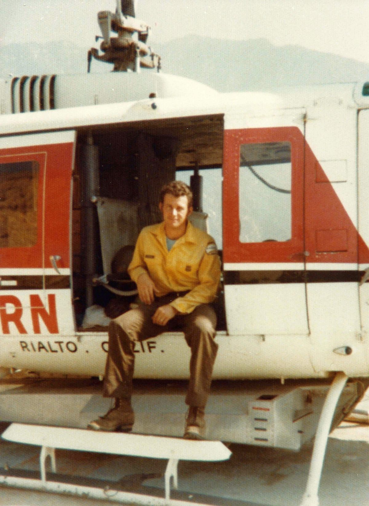
So with the Ken Burton trail reopening, the question has been asked by several people. Who was Ken Burton? The Mount Wilson Bicycling Association did a great history of the trail. It was built from 92 – 95 by the Forest Service and the Mount Wilson Bicycling Association. Ken Burton was a much-loved Forest fire fighter who was struck and killed by a drunk driver near Chilao in 1988. The trail was named in his honor, and a memorial placed at the top of the switchbacks, the section with some of the best views.
While there is still a little fine-tuning to do, we’ll be having an official ribbon-cutting and volunteer recognition on May 1st at Gould Mesa campground, as a part of the Mount Wilson Bicycling Association’s annual Pancake Breakfast. Come out on out, ride the trail before chowing down on delicious pancakes, and check on your chances to win some amazing prizes. Volunteers who did at least two days of volunteer work on the project will be presented with a commemorative T-shirt. It’s the least we could do to thank everyone for such a great effort.
Now go and ride it. We’ve earned it.
Here’s a timeline of progress reports on the project:
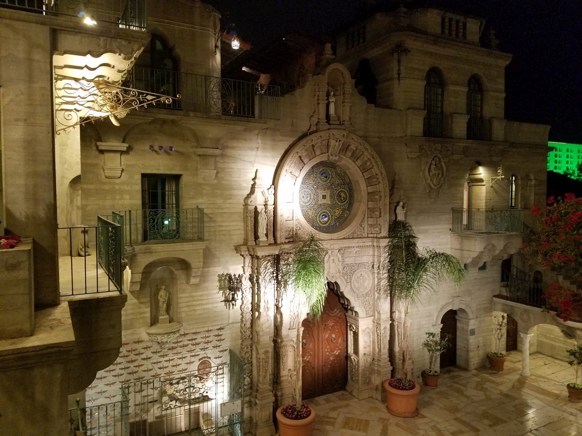
The Historic Mission Inn, Riverside, was the official conference hotel.
The 2016 California Trails and Greenways conference was held in historic downtown Riverside from April 7 – 10, 2016. The conference theme was “loving our trails to death,” something many long-time trail users are realizing is becoming the norm, not the exception. This is especially true on our crowded and increasingly popular trails in the Greater Los Angeles Area.
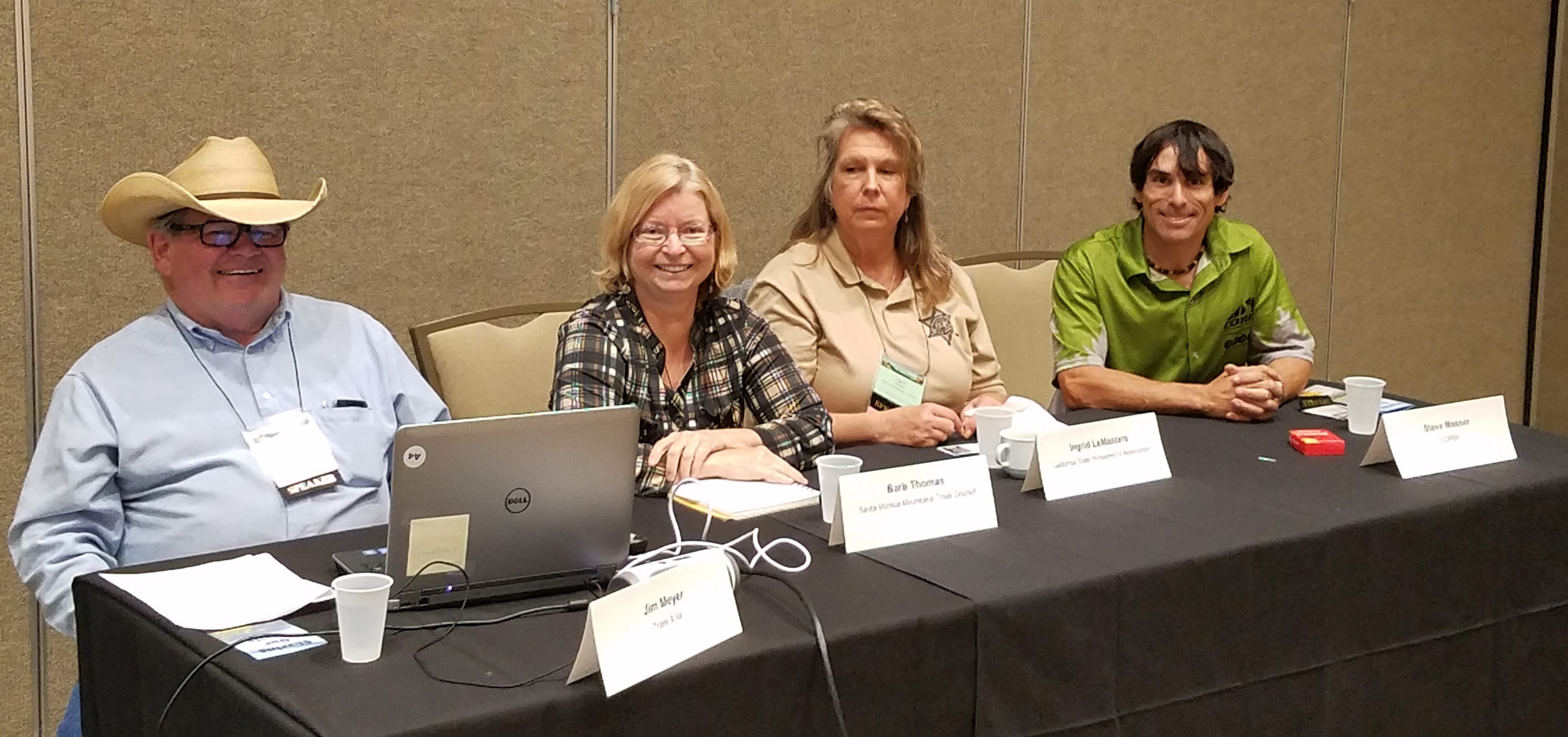
Equestrians, hikers and mountain bikers talk trail etiquette
Steve Messer, CORBA’s President, was on hand. Laurel Harkness, IMBA’s California Regional Director, had a booth and gave a presentation on “providing great, sustainable trail experiences. IMBA chapters from Orange County, San Diego County, Folsom, and the Central Coast were also represented. We took the opportunity to get the IMBA chapters together for an update on issues, strategies, and directions for each of the chapters.
The conference is also a great way to network with land managers, decision makers, trail professionals, and other user group advocates. In the six years that I’ve been attending these conferences, it’s becoming increasingly apparent that Mountain Bikers are, more and more, being considered a legitimate and valuable contributors to the trail user community. With more IMBA chapters attending, and many presentations by mountain bikers and mountain-bike-friendly land managers and professionals, its obvious we are here to stay.
CORBA Founder Kurt Loheit introduces the dignitaries from the Santa Monica Mountains NRA
As a great example of the improving relations with the trail community, Steve Messer teamed up with the California State Horsemen’s Association, Trails4All, Riverside County Backcountry Horsemen and the Santa Monica Mountains Trails Council to give a presentation on trail etiquette best practices. The presentation was well-received, but it was apparent we were “preaching to the choir.” The last slide of the presentation actually thanked the choir for listening to us preach! During the presentation, Dale Skinner, State Park Trails Manager for the Angeles District (Santa Monica Mountains), gave Steve and CORBA kudos for our approach to providing solutions and being exemplary stewards of our trails.
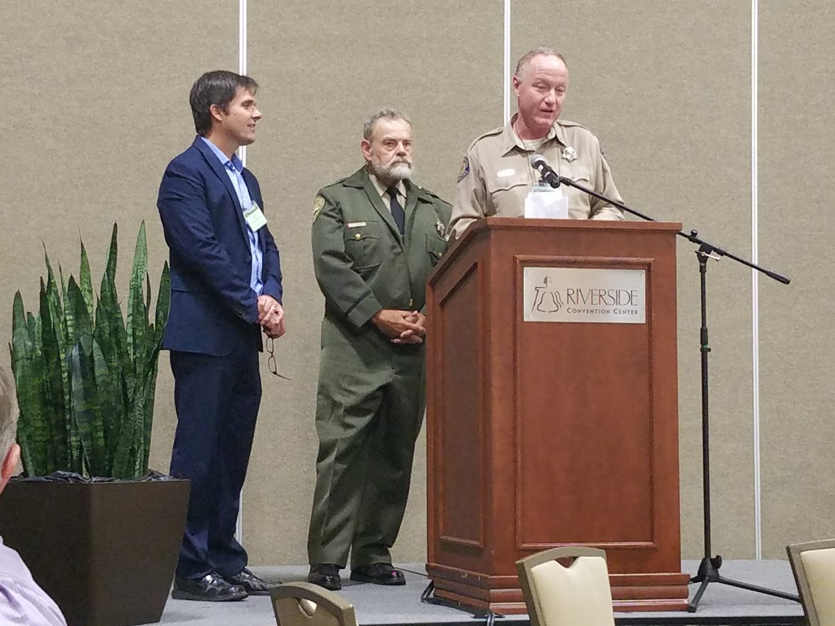
David Szymanski, Joe Edmiston and Craig Sap talk about completing the Backbone Trail
Another important presentation was Thursday’s lunch time plenary by Santa Monica Mountains National Recreation Area superintendent David Szymanski, State Parks Angeles District Superintendent Craig Sap, and Santa Monica Mountains Conservency executive director Joe Edmiston. They discussed the current status of the Backbone Trail, and the 65 years it has taken to bring a 65 mile trail from concept to completion. Currently there are two incomplete segments. One is the bypass around the gates at the west end of Etz Meloy motorway. The NPS has begun construction on a re-route that will bypass the closed gates. It’s constrained by a narrow easement from the private property owners, forcing a less-than-ideal alignment, but it will be much better than a closed segment of trail and no alternative. The other outstanding issue is a private parcel owned by former governer Arnold Schwarzenneger, west of Kanan. The NPS is hoping to secure a trail easement from Schwarzenneger and his partners soon.
During the talk Craig Sap gave a noteworthy shoutout to CORBA and to the Santa Monica Mountains Trails Council for our contributions to keeping the trails in good shape, and making up for some of the agency’s deficiencies with their reduced budgets.
They hope to open the complete Backbone trail on June 4th, as part of National Trails Day. They also plan to submit the trail for inclusion in the National Recreation Trail system. We believe the trail is worthy of such recognition.
Other notable presentations were from Rick Gunn who rode a bike around the world. Not only was he an amazing storyteller, he had an amazing story to tell. As a former journalist and photographer, his photography and the range of emotional lows and highs he experienced over two years had all the conference attendees in silence, awe, and at times, even in tears.
Aside from the State Parks employee training, for which they get continuing education credit, the sessions covered a range of topics, from sustainable trail building, trail surveying, working with public-private partnerships, and a number of project-specific presentations.
Project specific presentations were given on the current status of the Castaic Trail Master Plan, the LA River Trail (bike path), and a number of other project-related presentations. There were presentation by the Backcountry Horsemen on how they can assist in trail maintenance by packing in tools and supplies.
Ride, Hike, and Bike event on Santa Ana River Trail
After the conference sessions were completed, a group headed out for the traditional multi-use ride/hike/bike event. Local equestrians, mountain bikers and hikers converged on the Santa Ana River Trail to ride/hike together, as an expression of solidarity and multi-use cooperation.
Each year we look forward to participating in this increasingly useful and relevant conference. It covers issues unique to California, is attended by both land managers, conservancies, trail advocates and user groups. It brings everyone together, simply for a passion for trails. We are loking forward to next year, to be held in Monterey about the same time as Sea Otter.