

On Sunday, April 17, 2016, 32 volunteers converged on the Windsor/Ventura parking area, the Gabrielino trailhead, in Altadena. The day, hosted by our partners at the Mount Wilson Bicycling Association, was a complete success by all measures. It was our last scheduled group trailwork day on this restoration project, which began in earnest last Fall. In October last year, I declared that all these tools we were hauling up to the top of Brown Mountain would not be coming back down Brown Mountain. They’d be going out the bottom of the trail and the Gabrielino, once the trail was finished. Last Sunday, the tools were brought out of the bottom, as planned.
In reality, the project started long before last fall. In 2013, we scouted the Gabrielino trail north of Paul Little campground, up to Oakwilde campground and the Ken Burton trail. The trail was devastated, with two major slides (think hundreds of cubic yards of earth sliding off the mountain and taking the trail with it). Before we could work on the Ken Burton trail, we had to complete the Gabrielino trail to which it connects, otherwise the two trails would be dead-ends. So our first task was to restore the Gabrielino, up and over the Brown Mountain Dam to Oakwilde/Ken Burton trail.
While our experienced volunteers could tackle the project, we were much more confident having a professional take care of it. At the same time, the Los Angeles Conservation Corps signed a contract with the Forest Service to work on the Gabrielino trail. They didn’t feel comfortable repairing some of the major damage either.
CORBA applied for and received a generous grant from REI for this section of the project. We applied that grant primarily to pay professional trailbuilders Bellfree Contractors for their expertise and work with the LACC. That work required Forest Service engineers to inspect and approve the work plan, the removal of chainlink fencing, and the re-routing of two sections of trail to avoid the major slides.
Over winter 2014-2015, the work was completed by Bellfree and the LACC. They discovered the original trail alignment near Oakwilde Campground, a fully-benched trail segment 30 or more feet above the stream bed on the eastern side slope of the creek. There were sections of rock and cement retaining wall that we estimate were built as a part of the Gabrielino in the 1950s. The LACC and Bellfree restored the trail through that section, rather rebuilding it along the streambed that everyone had been using before the Station Fire.
This segment of trail was completed last winter, but the Forest Service wouldn’t open it to the public as it was a dead-end, and too many people had already been rescued trying to find their way through the Arroyo. The completion of that section allowed us to ask permission from the Forest Service to begin on Ken Burton trail.
Oakwilde campground was devastated, and was buried under 3 feet or more of silt and sediment as the Arroyo Seco swelled well above its banks, bringing with it all the dirt and sediment from the naked hills after the station Fire. Only the tops of the picnic tables, now a few inches above “ground”, are all that remain in the campground. We’re hoping the campground can be restored to a primitive hike-in backcountry camp in the future.
So while we’ve been working on the Ken Burton for just six months, more than two years of planning and pre-requisite projects have needed to take place.
Last Sunday we had a long list of tasks to finish Ken Burton trail. With so many volunteers to help, we completed: the complete rebuilding of three switchacks; widened and cleaned up three additional switchbacks; re-cut bench on a quarter mile of trail; rock-armored two switchbacks; installed a half-dozen drains; rock-armored and rebuilt two major washed out drainages; cleared brush from the upper trail that had grown in since we worked on it six months ago; and cleared additional brush and poison oak near the bottom, all on the Ken Burton trail.

Installing rock retaining walls on the Gabrielino trail
A finished rock retaining wall on the Gabrielino
With the additional manpower, we also installed two rock retaining walls, and widened two sketchy segments of the newly re-established route of the Gabrielino trail, just south of Ken Burton. That segment will be a part of the Brown/Burton/Gabrielino trail loop, and was an important project to complete for us to feel comfortable with the trail being opened to the public.
Walk-through of our day’s work
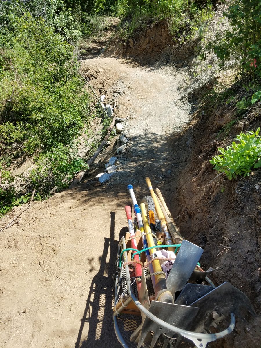
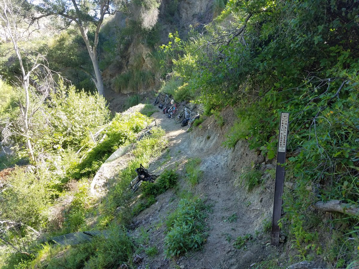
What the bottom section looked like before our work
While working, several mountain bikers and a couple of trail runners came through the trail. It’s nice to see the trail getting use after being closed for seven years. The trail and switchbacks near the top have packed down and hardened up beautifully, having had a longer time and a lot of traffic from all the volunteers riding and hiking in to work on the lower trail. Many of the switchbacks towards the bottom that are still very loose, having had little to no rain over the past few months as we’ve worked on the trail.
The most defining moment of the day, was when we, with Forest Service authorization, removed the “trail closed” sign from the upper Ken Burton trailhead at the end of Brown Mountain Road. A Forest Service ranger inspected the trail two weeks ago, and recommended the trail be opened to the public, once we completed today’s work. The ranger’s only comment was that the Ken Burton trail “is in way better shape now than many Forest Service trails that are already open to the public.”
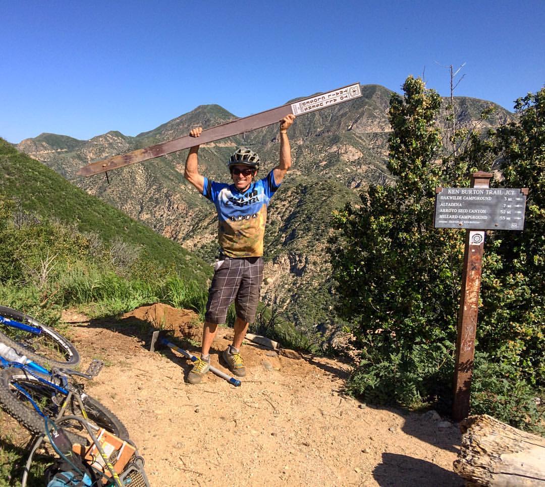
Removing the Trail Closed sign
We concur. The trail is in better shape than most of us remember it from before the fire. With the brush not nearly as tall now, there are some incredible views that were blocked before the Station Fire. Eventually the brush will grow taller and obscure the views again, but right now, it can’t be beat. You can see downtown Los Angeles, all the way up the Arroyo Seco canyon, highway 2 and the historic Slide Canyon Bridge.
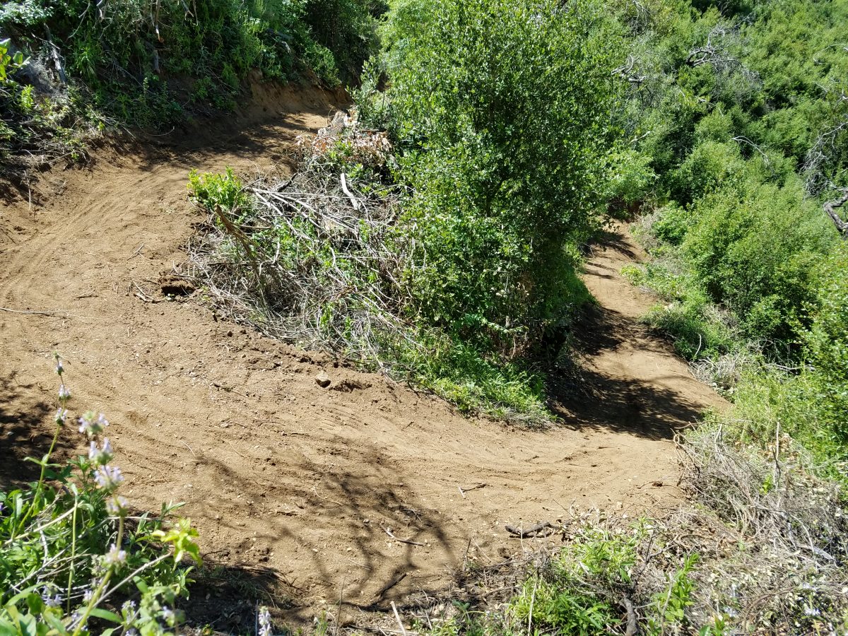
A rebuilt switchback, still soft.
The trail includes 22 switchbacks that get progressively steeper and more technical as you descend. It’s great practice! But locking up and sliding your back wheel around the turn is not the correct, or the fastest way to ride a switchback. Practice until you can ride without sliding! Until we get another rain and some time for the trail to pack down, we all need to take it easy.
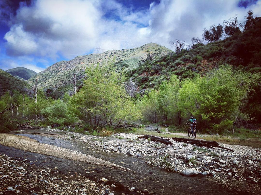
Riding the Arroyo Wash along the Gabrielino Trail
The return ride on the Gabrilieno trail is always an adventure. On Forest Service maps the trail appears as “unmaintained, unimproved, primitive trail.” For about 1.25 miles, you’re riding in the sediment that has been trapped behind the Brown Mountain dam. It can be something of a maze to pick your way through, but as more and more people begin to ride Ken Burton trail, a more defined line will be developed through the arroyo wash. Then with a big rain storm, the stream may change course and we’ll find a new route through the wash.
That’s the beauty of this trail. It really feels like you’re in the backcountry and riding in a wild place.
The trail leaves the wash at a rocky hike-a-bike chute on the right side of the river. It’s marked by ribbons and tire tracks in the sand leading up to it. Eventually we’ll need to improve that section to create a rideable/hikeable ramp out of the wash. But for the moment, prepare for a 50’ hike-a-bike up through the boulders. The trail then meanders through the alluvium, before crossing the stream and beginning the climb up and over Brown Mountain Dam.
At the crest, there are great views of the Brown Mountain Dam from above. The chainlink fence that previously lined that section has been removed, with the materials from the fence being re-purposed as retaining wall structures for segments of the Gabrielino trail. The result is a much more pleasant segment with better views. The trail through this section is extremely loose, with three very loose, tight and steep switchbacks that most people will hike their bikes through. Coming the other direction, they will be a hike-a-bike for most.
The Gabrielino trail remains closed north of Ken Burton Trail junction. This “Trail closed” sign was moved from the top of Ken Burton to here.
Our next project in our ongoing mission to reopen all front country trails will be the completion of the Gabrielino trail through to Switzers and Redbox. Work has been underway on that segment for the past year by the Los Angeles Conservation Corps, but they’re down to a similar situation where the trail is so bad they are going to need professional help. Once again, CORBA has applied for an REI grant to help complete the section. CORBA volunteer chainsaw operators will help clear more than 60 downed trees through that segment of the trail. It may be another year before the Gabrielino is opened all the way through to Switzers.
The effort this has taken is remarkable. We’ve had at least 97 individual volunteers who have given over 1650 volunteer hours, spread over 15 scheduled work days and another 14 prep days with smaller crews. Volunteers have collectively ridden (or hiked/run) over 4000 miles with over 400,000′ of climbing to and from the work site over the past six months. We’ve had volunteers from four high school mountain bike teams participating, and people traveling from as far away as Long Beach, Orange County and Santa Clarita.
Ken Burton
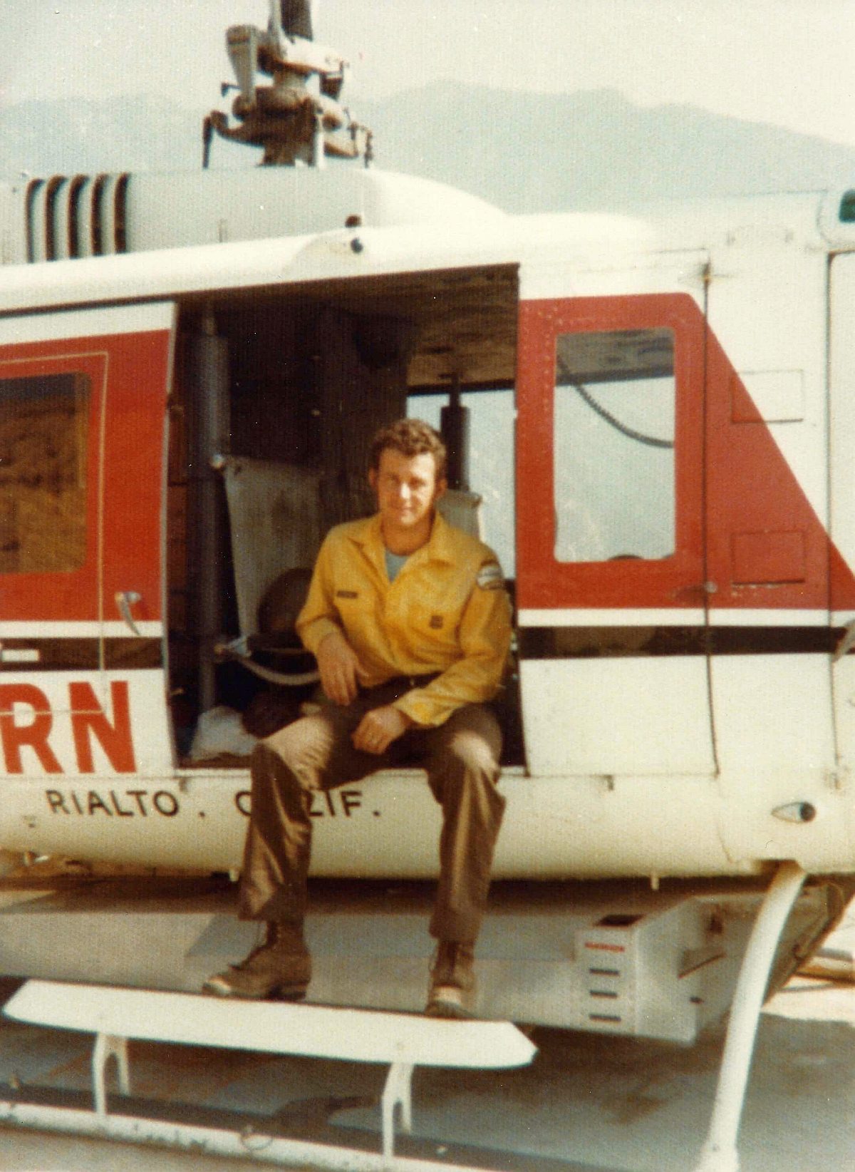
So with the Ken Burton trail reopening, the question has been asked by several people. Who was Ken Burton? The Mount Wilson Bicycling Association did a great history of the trail. It was built from 92 – 95 by the Forest Service and the Mount Wilson Bicycling Association. Ken Burton was a much-loved Forest fire fighter who was struck and killed by a drunk driver near Chilao in 1988. The trail was named in his honor, and a memorial placed at the top of the switchbacks, the section with some of the best views.
While there is still a little fine-tuning to do, we’ll be having an official ribbon-cutting and volunteer recognition on May 1st at Gould Mesa campground, as a part of the Mount Wilson Bicycling Association’s annual Pancake Breakfast. Come out on out, ride the trail before chowing down on delicious pancakes, and check on your chances to win some amazing prizes. Volunteers who did at least two days of volunteer work on the project will be presented with a commemorative T-shirt. It’s the least we could do to thank everyone for such a great effort.
Now go and ride it. We’ve earned it.

Here’s a timeline of progress reports on the project:
History of the trail: https://mwba.org/news/ken-burton-trail/
Announcement of our project: http://corbamtb.com/news/2015/10/29/ken-burton-trail/
Days 1,2,3 report: http://corbamtb.com/news/2015/11/25/ken-burton-trail-restoration-continues-december-13/
Day 4 report (CORBA): http://corbamtb.com/news/2015/12/18/ken-burton-trail-restoration-day-4/
Day 4 report (MWBA): https://mwba.org/trail-work/the-radavist-features-mwba-corba-the-ken-burton-trail/
Day 4 report (The Radavist): http://theradavist.com/2015/12/working-with-corba-and-mwba-on-the-ken-burton-trail-in-the-san-gabriel-mountains/#1
Day 5 report: http://corbamtb.com/news/2016/01/12/ken-burton-trail-restoration-day-5/
Day 7 report: https://mwba.org/trail-work/ken-burton-trail-work-update/
Day 8 report: http://corbamtb.com/news/2016/01/24/ken-burton-trail-restoration-day-8/
Day 9,10 report: http://corbamtb.com/news/2016/02/23/ken-burton-trail-restoration-days-9-and-10/
Day 12,13 report: http://corbamtb.com/news/2016/03/14/ken-burton-trail-restoration-days-12-and-13/
Day 14 report: http://corbamtb.com/news/2016/03/27/ken-burton-trail-restoration-day-14/

