Archive for the ‘Environment’ Category

Federal Judge Orders Species Protection in the ANF

Thursday, June 30th, 2011

This week on June 28, 2011, U.S. District Court judge Marilyn Hall Patel ordered the U.S. National Forest Service, U.S. Fish and Wildlife, and the National Marine Fisheries Service to take “all necessary measures” to better protect 40 endangered species. The order specifically covers the Angeles, Cleveland, Los Padres and San Bernadino National Forests in Southern California.

The agencies have been given six months to develop a long-term strategy to protect 40 endangered species. The order came as a result of a lawsuit by the Center for Biological Diversity, who claimed the Forest Management Plans for the respective forests failed to provide adequate protection for these endangered species. The species include the Santa Ana Sucker, the Arroyo toad, the California Gnatcatcher and the California Condor, among others.

Recently hopes had been raised for the opening of the Williamson Rock closure which has been in effect since 2005 to protect the Mountain Yellow-Legged Frog. That is now highly unlikely and construction that was taking place in the area has been halted. There are less than 200 known individuals of this species left in a few select pockets in the San Gabriel mountains. The Williamson Rock closure affects Hikers, and has shut off access to climbers who regard the rock as one of the premier sport climbing destinations in Southern California.

CORBA will work with the Forest Service to determine which trails in the San Gabriel Mountains, if any, may be affected by this federal court order.

Third Public Meeting for Topanga State Park General Plan on June 14th

Tuesday, May 24th, 2011

California State Parks is inviting the public to the third public meeting for the Topanga State Park General Plan. The purpose of this meeting is to present the single (preferred) plan and support materials. After the presentation, the General Plan team, comprised of CSP landscape architects environmental scientists, historians, archaeologists and park staff will be available to discuss this preferred plan. The single plan was developed with the input received at the first and second public meetings held in September 2009 and July 2010.

Following the third public meeting, the General Plan team will prepare the preliminary General Plan which will then be available for public review and comment as per the California Environmental Quality Act (CEQA) process.

After the completion of the CEQA process, the General Plan Document will be presented to the California Parks and Recreation Commission which will entail a public hearing process including additional opportunity for public comment.

A General Plan is mandated for state parks units by the Public Resources Code. The plan becomes the primary management document for a unit of the State Park System, establishing its purpose and management direction for the future. The plan does not provide specific physical designs but does provide a vision for the park and guidelines for future development.

Meeting location:

June 14, 2011 (Tuesday)

6:30 pm to 8:00 pm

Stewart Hall @ Temescal Gateway Park

Sunset Blvd. & Temescal Canyon Road

Pacific Palisades

March CORBA Kids Ride: Single Track, Stairs, and Turkey Vultures

Friday, March 25th, 2011

The CORBA Kids Club had another successful fun ride Sunday March 6 in Malibu Creek State Park. We met in the lower parking lot because the upper lot was full due to the marathon.  We scouted  around the upper lot looking for additional participants, and by 9:30 we began our ride.

We started with a mini skills clinic, reviewing the importance of speed control, body positioning, and trail etiquette. The adults demonstrated descending the stairs, and those kids who were comfortable doing so also gave it a try. A few of them wanted to do it again and again.

We then descended down the small dirt path leading to the pavement and led the kids up the hill leading to the Grasslands trail. Once we made it up the first big hill (some riding, most walking), we continued riding until we reached Mulholland Highway.  There we waited for the rest of the group to catch up and catch their breath. During one of these break-and-waits, the older kids attempted to climb off-trail, and we pointed out the erosion and how hiking a non-designated area could damage the terrain. We assured them that there would be an opportunity for
a good climb later.

One at a time, we walked the bikes and the kids across Mulholland where we resumed our ride on the North Grasslands Trail. While riding the single track Grasslands Trail, we saw a member of the Equestrian MVP.  The kids knew to go off to the side and let the horse pass, and the rider complimented us on our trail etiquette. We continued past the power station and determined our turn-around point shortly thereafter.

On the way back, We stopped at the trail leading to the water tower, so the kids could hike up to it and enjoy the views. Two adults were with the kids at all times and the other adults watched the bikes. We then rode back to the cars, while some Turkey Vultures hovered overhead. The two vultures actually landed on the grass near the parking lot, and then took off again, so kids and adults got to see their wing span as they took flight.

You can view the photo gallery for this ride.

Our next ride is scheduled for Saturday April 2. Meet at Cheeseboro Canyon in the upper parking lot. Hope to see you there!

Local Spin on Great Outdoors Program

Wednesday, February 23rd, 2011

Click here for an article by KCET.

Mountain Bike Access Threatened in Cheeseboro Canyon

Thursday, February 3rd, 2011

Recent comments by National Park Service ranger personnel indicate that resource damage caused by mountain bikers in Cheeseboro Canyon Park in Agoura Hills could threaten future access.

Over the last few years increased off-trail “bonus runs” have been created by mountain bikers and is a fairly serious breech of accepted activity. These bonus runs include parallel routes along designated trails for the purposes of creating a more challenging experience.

Bonus runs are a direct example of mountain bikers not adhering to posted designated trail routes. Continuing this practice could lead to access restrictions. Please think twice about going off-trail: A little personal fun now could cost a lot of fun for a lot of people in the future. Remember, your individual actions speak for the entire mountain biking community.

Mountains Restoration Trust is now taking reservations for the 2011 Rattlesnake Avoidance Clinic for Dogs

Friday, January 28th, 2011

MRT is pleased to announce the 2011 Rattlesnake Avoidance Training Clinic For Dogs with Tracy Jenson-Presson of High on Kennels, San Diego County. Tracy has many years of experience training dogs to avoid rattlesnakes. She is well known for being a problem solver when it comes to difficult dogs. We have checked her out and you’re welcome to visit her website at: www.highonkennels.us

The training is conducted in a safe, humane, controlled environment ensuring the safety of your dog, as well as the safety of the rattlesnakes. The training process is repeated several times to insure that the dog understands the sight, smell and sound of a rattlesnake (Rattlesnakes have a distinctive odor that dogs can discern from other snakes) We have found that some dogs seem to forget over a period of time and recommend annual training for all dogs.

March 19 & 20 and April 16 & 17
Where: Headwaters Corner, Masson House, 23075 Mulholland Hwy, Calabasas, CA 91302
When: 8 am to 5 pm
And
May 14 & 15 and June 11 & 12
Where: Tapia Park, 884 North Las Virgenes Rd, Calabasas, CA 91302
When: 8 am to 5 pm

Go to the MRT rattlesnake clinic page to register your dog for training.

Park to Playa Trail Feasibility Study Public Workshop on January 25

Wednesday, January 12th, 2011

The Park to Playa Vision

In 2000, the “Park to Playa” vision was first articulated: a seamless trail connecting urban residents with the natural coast. The trail will connect approximately 13 miles from the Baldwin Hills along Ballona Creek to the Ballona Wetlands and the beach bicycle path. The Ballona Creek portion of the trail is now implemented. The current study will define the location and design of the eastern portion of the trail, passing through several parks and jurisdictions in the Baldwin Hills area, starting at the Stocker Corridor to the east and connecting parts of the trail systems of Ruben Ingold Park, Norman O. Houston Park, Kenneth Hahn State Recreation Area, and Baldwin Hills Scenic Overlook to the west.

When: Tuesday, January 25   7pm-9pm

Where: Kenneth Hahn State Recreation Area Community Meeting Room
4100 La Cienega Blvd
Los Angeles, CA

Directions: The community meeting room is located in the Community Center past the park entrance gates and Gwen Moor Lake on the south side of the road.

Click here to open pdf flyer

Riding after It Rains

Thursday, December 30th, 2010

Most trails in our local riding area don’t respond well to rain. They have a high content of clay that turns into sticky, slippery muck that binds to everything it touches. It builds up on the tires, like a snowball rolling downhill, until it jams on the frame and the wheels won’t budge. Some models of clipless pedals refuse to yield when full of this mud, resulting in the bike and the attached rider lying sideways in a puddle.

Most wet trails don’t respond well to bikers, hikers or equestrians until they’ve had time to dry out. Hikers and horses make holes and ridges in the trail that become as hard as concrete when the trail dries. These holes and ridges are good for twisting ankles of trail users who aren’t constantly watching their step.

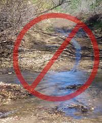
On wet trails, bikes make grooves down the middle. These grooves collect water when it rains again, turning first into little channels to move the water downhill, then into little ruts, then large ruts that destroy the trail. You’ve heard about the beat of a butterfly wing that causes a hurricane? Then remember the tire track that turns a tail into one large rut!

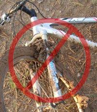
And the mud is particularly hard to remove. It sticks to the bike and shoes, no matter the efforts to remove it, rubbing off on the bike rack, car carpet and floor pedals. Once home, it takes the careful use of a garden hose to remove the mud but not force water into the sensitive parts of the bike.

For these reasons, riders are well advised to stay off the trails after a rain until they have dried. How long to stay off? That depends on a number of factors including the particular trail, how much rain it received, how much sun it gets after the rain (is it in the shade or face south?), how warm and windy the weather is, and so on. After an isolated light rain you can probably ride the next day. After a heavy rain, you should wait several days. This is something where common sense and experience will help.

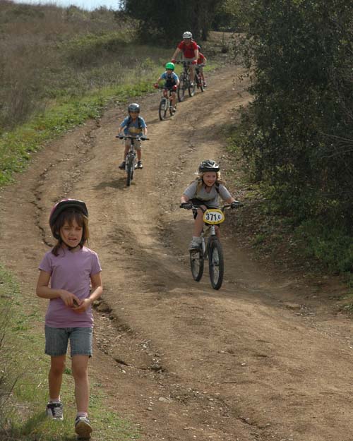
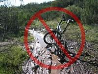
But if the trails are soaking, all is not lost if you need to ride! There are a few trails that hold up well when wet because they have more sand and rock that doesn’t hold the water. Here are a few you should know about:

Space Mountain (Los Robles West) to the picnic table is almost always rideable, even right after a big storm. However, it can be pretty mucky from the picnic table to Potrero Road.
Rosewood Trail is pretty good, but not quite as resiliant as Space Mountain.
Zuma Ridge Motorway from Encinal (the bottom in Malibu is muddy)
Dirt Mulholland around Topanga State Park.
-Brown Mountain Fireroad
-Most San Gabriel Mountains trails made up of decomposed granite
-Beaudry Fireroad
-Hostetter Fireroad
-Mt. Lukens

MRCA Announces key Santa Monica Mountains Trail Acquisition

Saturday, December 18th, 2010

From Dash Stolarz, Director of Public Affairs Mountains Recreation and Conservation Authority.

Topanga and Calabasas, California, December 17, 2010 — The Mountains Recreation and Conservation Authority (MRCA) announced today its acquisition of more than 100 acres of prime Santa Monica Mountains open space that straddles Topanga Canyon and San Fernando Valley  watershed divide.  The purchase was made with Los Angeles County funding sources offered by 3rd District Supervisor Zev Yaroslavsky to expand the Los County Trail system in the Santa Monica Mountains.

The new 101-acre parkland, which is accessible from Old Topanga Road, bolsters public ownership of existing trail networks in Topanga Canyon near the Santa Monica Mountains Conservancy-owned Summit Valley Ed Edelman Park.  The principal trail is the Summit-to-Summit Motorway, a historic fire road  that connects the Calabasas Peak Motorway on the west side of Old Topanga Canyon Road  eastward to the Henry Ridge Trail and ultimately to Topanga Canyon Boulevard.  These trails have been recognized since the County adopted its Trail Master Plan in 1980.  They are all wide with easy grades, making them accessible to almost all potential users.

“Zev’s commitment to the preserving open space and creating accessible public parkland is rock solid,” said Joseph T. Edmiston, Executive Director of the Santa Monica Mountains Conservancy.

The long-coveted open space and trail network are part of a large habitat area that abuts the southern boundary of the City of Calabasas and descends into Topanga State Park.  The oak and walnut forested property offers stunning views of the San Fernando Valley and the many rugged peaks and valleys of the more interior Santa Monica Mountains.   This new parkland provides optimal habitat for people and the full complement of mammals, reptiles and birds that occupy the Santa Monica Mountains, National Recreation Area.

The MRCA is a Joint Powers Agency of the State of California which includes the Santa Monica Mountains Conservancy, the Rancho Simi Recreation and Park District, and the Conejo Recreation and Park District.  The MRCA provides natural resources and scientific expertise, critical regional planning services, park construction services, park operations, fire prevention, ranger services, educational and leadership programs for thousands of youth each year, and is one of the lead agencies providing for the revitalization of the Los Angeles River.

# # #

Elsmere Canyon Now Public Land

Saturday, November 6th, 2010

The city of Santa Clarita recently closed escrow on the 842 parcel of land known as Elsmere Canyon. Elsmere was slated to become the largest landfill in Los Angeles during the 1990’s, before Senator Barbara Boxer and Congressman Howard McKeon fought to prevent the devastating landfill project.

Elsmere Canyon Map

(more…)