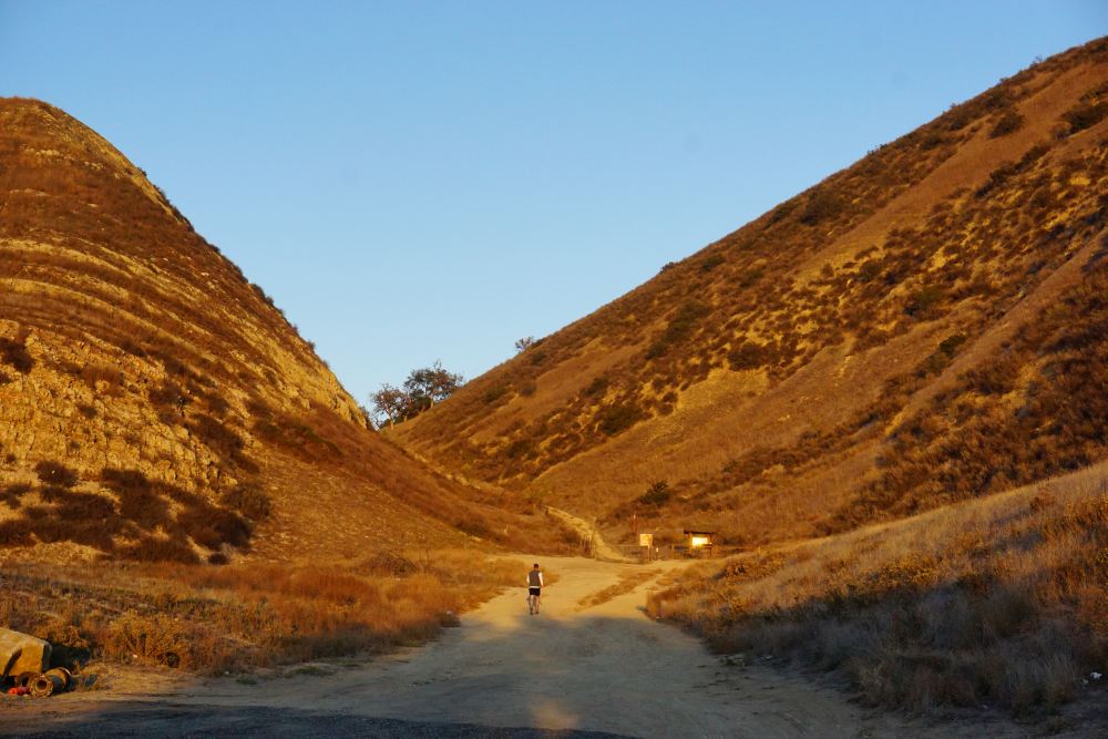
Join CORBA, SMMTC, COSCA and other volunteer groups to work on the Conejo Open Space trails in Thousand Oaks.
This year we’ll be building a new trail, about 0.7 miles long, that leads from the top of the steep ‘Baxter Road’ in Newbury Park around and down to near the south end of the Hawk Canyon Trail in the Western Plateau / Conejo Canyons.
There will be a thank you lunch and prize drawings at noon after the work. This is a great event with lots of like-minded folks to help out. If you use the trails in Thousand Oaks, come out and help build and maintain them! No prior experience is necessary and all volunteers work at their own pace, taking plenty of time to rest and chat with other trail enthusiasts!
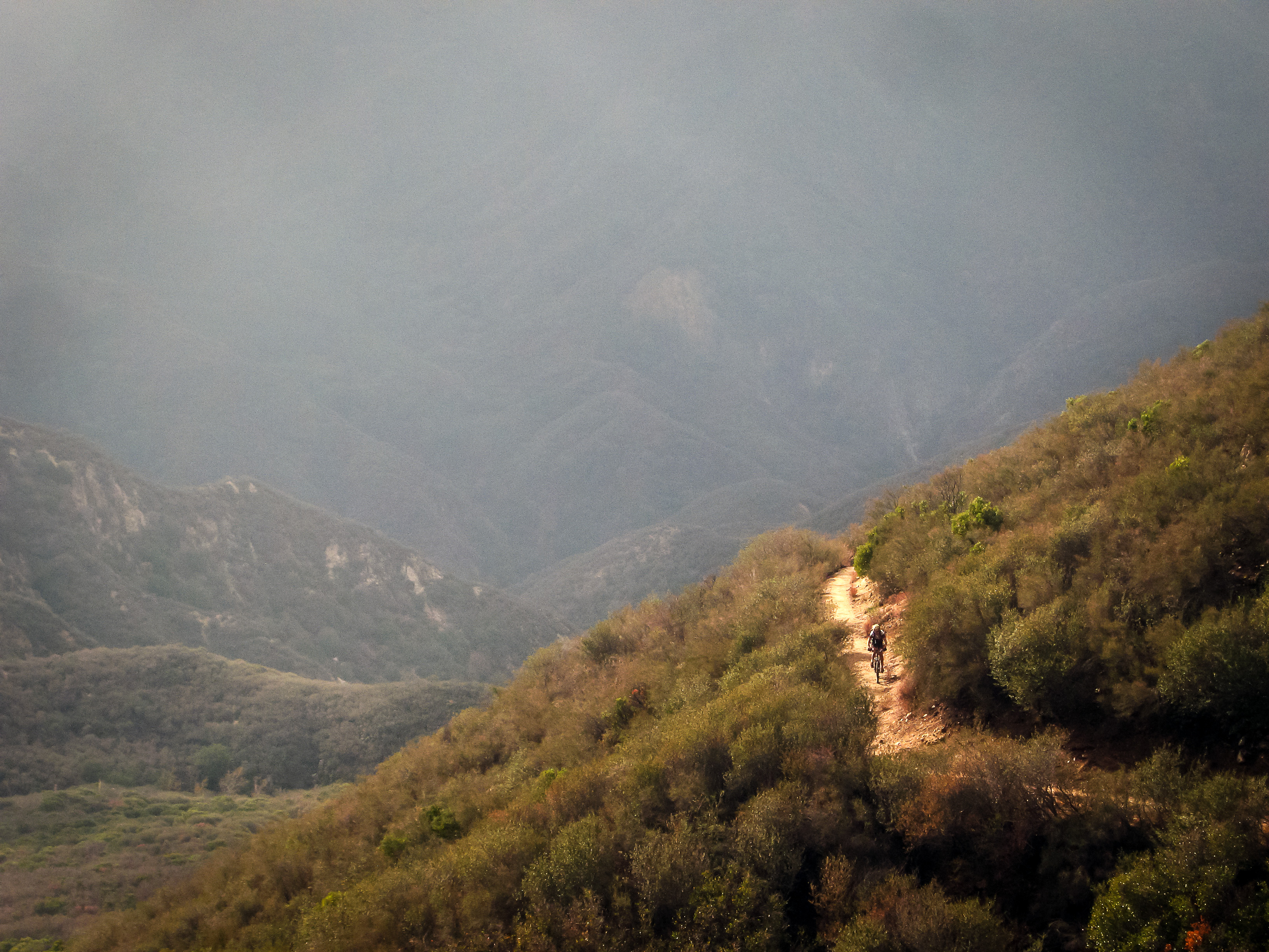
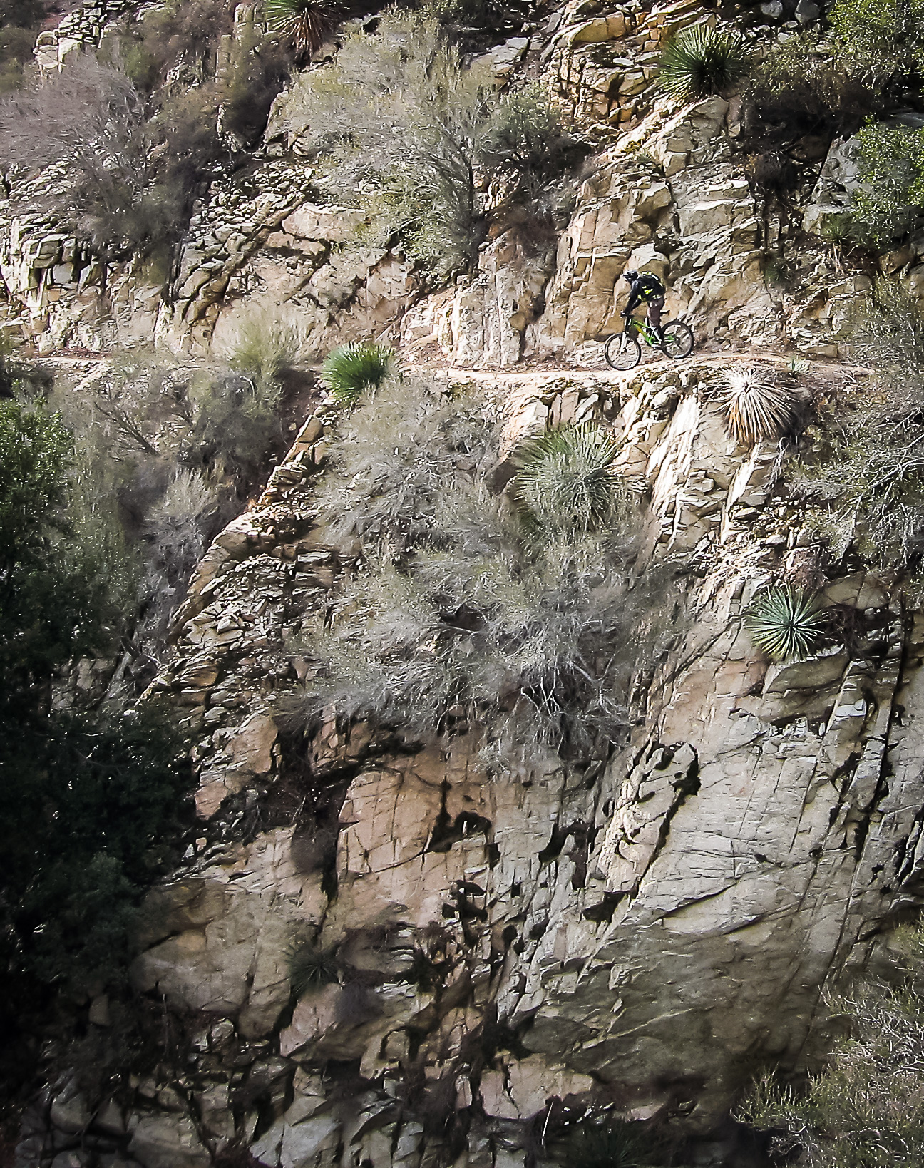
This annual Conejo Valley event always helps to put some very sweet trails into good shape. Be sure to stay afterwards for the free lunch and raffle.
• work gloves
• long pants and long sleeved shirt
• water, snack
• sunglasses and sunblock
Tools and instructions on how to use them safely will be provided. There will be a free thank-you lunch and prize give-away afterwards from noon until 2:00 pm.
Currently mountain bike advocacy is facing one of the the most important long-term issues in our history. The issue is whether mountain bikes should be allowed on trails in Wilderness areas. How mountain bikers and advocacy leaders respond to this can either be polarizing or make us an even stronger voice in the trail user and land stewardship community.
In Idaho Montana, the Wood River Bicycle Coalition, an IMBA chapter, worked with IMBA to build support for a National Monument rather than a Wilderness area. Over a period of several years, negotiations with wilderness advocates, motorized and other recreation groups and elected officials formed a broad coalition of support. However, raw ugly politics ultimately produced a Congressional designation for the Boulder White Clouds Wilderness. This was a painful and well-publicized loss to the mountain biking community. The land protection provisions they had negotiated in good faith to produce a bicycle-friendly National Monument designation were ultimately lost to a crass political maneuver to deny President Obama any semblance of a success. Congress passed a Wilderness bill and the Castle Divide and Ant’s Basin trails were closed to bikes.
Meanwhile, attorney Ted Stroll had been continuing his research into the Wilderness Act, and the congressional debates and intent surrounding that landmark legislation as it was enacted in 1964. He had concluded that the original intent was never to exclude bicycles, as a human-powered form of low-impact recreation, from Wilderness areas. Further research led him to believe that, in accordance with our constitution, we have the right to bring our grievances to the U.S. government. To do this, he formed the Sustainable Trails Coalition (STC), whose sole mission is to pass legislation that would allow local land managers to open trails to bicycles in Wilderness, and to authorize the use of machinery that would allow the most cost-effective and efficient maintenance on Wilderness trails, on a case-by-case, trail-by-trail basis.
How many mountain bikers view the wilderness ban on bikes
The timing of the Idaho defeat brought heightened attention to the STC and their focused, single-issue mission. It cast doubt in the mountain biking community about the effectiveness of IMBA’s approach of building broad partnerships and seeking compromises to both protect bicycle access, while protecting the landscapes through which we ride bikes with a mix of Wilderness boundary adjustments, cherry-stems, and alternative designations. This approach has been highly successful in many instances, but there have been some exceptions, with this loss in Idaho being the most recent and the most publicized.
Condor Peak Trail – Wilderness advocates are still proposing a Condor Peak Wilderness.
Here in the Angeles National Forest, we’ve lost access to much of the backcountry trail network on our Forest. This has placed increased use pressure on non-Wilderness trails by all user groups. Trail maintenance on Wilderness trails has come to a near-halt in many areas, and all user groups are losing those trails to nature. We don’t have any bicycle-legal singletrack options to traverse the San Gabriel Mountains north-south, or east-west, because of numerous closed trails, Wilderness designations, and restrictions on bicycles on the Pacific Crest Trail. Similarly, in the Sierra, Inyo, and Sequoia National Forests there are vast swaths of Wilderness and a few isolated areas that are open to bikes, many of which are currently being evaluated for Wilderness (and, remarkably, the folks who maintain many Wilderness trails and can’t keep up with the workload have objected to any new Wilderness.).
These Wilderness losses are very much a localized issue, affecting California and the Western States disproportionately to other areas. California has the most Wilderness areas of any state, and is second only to Alaska in Wilderness acres. Here in CORBA’s territory, we have the largest population base in the country near a National Forest. 1 in 20 Americans live within easy driving distance of the Angeles National Forest, with its five Wilderness areas and additional Recommended Wilderness taking nearly one third of the Forest.
Condor Peak Trail
Recreational activities are greatly reduced in Wilderness areas compared to non-wilderness areas, even if bicycles are left out of the equation. Maintenance efforts are greatly reduced and near-impossible for the Forest Service to schedule, as the cost of manual labor to rebuild trails (no mechanized tools allowed, even wheelbarrows) means these trails often don’t get worked on. While the same can be said of many lesser-used non-wilderness trails, this doesn’t bode well for the future of Wilderness trail recreation.
It also disproportionately affects a smaller subset of the mountain biking community who seek out, relish, and live for backcountry wilderness-type settings that can be experienced by bicycle. It’s why I started mountain biking, and what inspires me to continue exploring and experiencing these majestic landscapes. Sure, I love purpose-built flow trails, downhill trails, and our many favorite local trails. They are needed, but they don’t offer the same experience and escape that some of us live for. We need a broad spectrum of experiences and trail types to cover the many diverse reasons for which people ride mountain bikes, including wilderness-type experiences.
There have been calls for IMBA to take a stronger stand on the Wilderness access issue in print media, the blogosphere, and on social media. In fact, if you have followed closely, the amount of grandstanding on both sides of the bikes in wilderness debate has escalated. From reading some of what has been published, one could easily come away with the assumption that mountain bikers have to pick a side: either support the Sustainable Trails Coalition or support IMBA. Over the past month there have been many calls, emails and forum posts asking to cancel IMBA memberships.
Some writers in the print media have accused IMBA of taking a hardline stance against the STC, but there is much more nuance to their statements that has been overlooked. IMBA hasn’t condemned the STC or opposed their efforts. In fact, IMBA has for many months taken a neutral public policy position toward STC’s strategy, neither supporting nor opposing. Publicly, IMBA has simply stated that the STC approach is not appropriate for IMBA’s mission, given STC’s single focus, uphill battle, risks and uncertain future.
Pressure continues to mount calling for IMBA to support the STC, or at the bare minimum, take a more conciliatory stance and acknowledge the common ground that exist between the two organizations. IMBA have held a press conference explaining their position, posted an FAQ on land protection strategies they will continue to utilize, and conducted four Chapter Leader Executive Briefings with question and answer sessions with approximately 100 chapter leaders nationwide, which I attended. Many forum comments have construed their public arguments and tone as denigrating and dismissive of the STC, but in direct conversations with IMBA staff, that tone is much more nuanced.
With all this attention on Wilderness, one could be misled into thinking that this was the only issue facing mountain bikers. Admittedly, it is probably the most far-reaching issue that could fundamentally change our approach, as mountain bikers, to land protections nationwide, and especially in the Western states like California. But there are still plenty of more immediate issues and opportunities that need immediate, focussed attention, and that is where IMBA has chosen to put its limited resources and energy.
We see this “us vs. them” dichotomy as far from the case. The fact that IMBA has chosen not to support STC does not infringe upon anyone’s first amendment right to speak up for and support the STC, including us as a chapter of IMBA. IMBA’s (and CORBA’s, for that matter) plate is full with current mountain biking issues, and the vast amount of attention and resources needed to achieve the STC’s mission and focus on Wilderness access would hinder our ability to tend to more immediate threats, identify new opportunities, take advantage of current opportunities, and just get things done now.
We believe we need both organizations. STC’s single, focussed mission is to enact legislation that will allow management of wilderness trail access (and mechanized maintenance) to happen at the most local level feasible. STC is not a membership organization and as such is not structured for or able to do anything on the ground right now to open closed trails to bikes or develop and maintain positive relationships with land managers that are key to our future successes. It will be a difficult struggle and take some time before STC’s efforts may prove fruitful.
IMBA chapters are currently doing the vast majority of advocacy and access work at the local levels. If STC is eventually successful in passing their legislation it will likely be IMBA chapters doing the necessary outreach and hands-on work to give the STC’s legislation teeth, by working directly with local land managers to open trails under the authority of STC’s Human Powered Wildlands Travel Management Act of 2016 (HPWTMA).
Despite what has been claimed by the Wilderness Society and others opposed to bicycles in Wilderness, the STC bill doesn’t open ANY trails to bikes or mechanized maintenance. It allows the “most local” land managers feasible (likely district rangers and supervisors) to make those determinations on a case-by-case, trail-by-trail basis. That’s why IMBA chapters will need those strong relationships when and if the time comes.
You can bet the opposition to bikes will only get louder when that happens, both locally and nationally. It will be IMBA chapters with current, strong land manager relations that will be best positioned to follow through on any STC success. Land managers aren’t just going to open trails to bikes in wilderness areas if the STC bill is eventually enacted. If the STC bill does go through–and let’s be clear that we hope it eventually will–IMBA Chapters will need to actively engage with local land managers to open trails to bikes under the newly granted authority of STC’s legislation. Even then, those trail openings will probably require a lengthy NEPA process, and may come with restrictions. Permits, capacity limits, mandatory leave-no-trace classes, or other hurdles could be put in place as a part of that Wilderness access. Passing of the HPWTMA is just the starting point to opening trails in Wilderness.
In the meantime if people start choosing to drop support for IMBA chapters to support the STC, that will impede our ability to get things done now, such as bike parks, trail maintenance, new trails, and being a crucial voice in current land management and trail planning efforts. If CORBA/IMBA is weakened by an attrition of supporters now, it will hinder our ability in the future to build upon any STC success, and open trails currently closed to bikes by Wilderness designations.
One of the best things that STC is doing is bringing more attention to this major access issue. What saddens and frustrates us is that social media are misinterpreting some of IMBA’s responses, and turning this into an “us vs. them” situation, which will weaken our efforts on both fronts. We’d much preferred to have a more conciliatory tone from IMBA towards STC, even in the absence of outright support. IMBA has alienated a portion of their members through their statements and firm stance. That just doesn’t need to be so.
There is room–and a great need–for another group like STC to give the Wilderness issue the razor-sharp focus it will need to see through.
IMBA is a 501c3 and cannot directly lobby our government to introduce new legislation, endorse political candidates, and other restrictions. IMBA (and CORBA) are set up as 501c3 public benefit corporations, that can only influence existing laws and policies through public comments, broad-based partnerships with other organizations, and encouraging our members to speak up with their own comments and letters to elected representatives and land managers.
STC is set up as a 501c4, with the specific purpose of directly lobbying congress and our elected officials to enact change at the legislative level. They are able to do things that IMBA and CORBA cannot. It’s important to note that the Sierra Club is a 501c4, just like the STC. They have a companion 501c3, the Sierra Club Foundation, which collects tax-deductible donations that can then be used to support the lobbying efforts of their 501c4. They also operate under budgets 100 times larger than IMBA’s. Most mountain bikers are decidedly lackadaisical in their approach to advocacy–until their favorite trail is closed, or threatened to be closed. And as previously mentioned, while most mountain bikers support opening some trails in Wilderness to bicycles, the number of riders who may eventually utilize wilderness trails is likely much lower.
The mountain biking community has never had a 501c4 organization to stand behind before the STC came along. Just as the Sierra club leverages both a 501c3 and a 501c4 for various, but related, purposes, the mountain biking community has needed both a 501c3 and a 501c4 voice. As mentioned, where we see things have gone awry is that IMBA’s firm but neutral stance has been twisted and construed in social media and the blog/print media as an “us vs. them” situation.
IMBA’s approach is appropriate for IMBA. The STC approach is appropriate for STC. Together, they have brought more attention to this contentious debate, and hopefully helped engage a new cadre of concerned mountain bikers ready to advocate for continued access to trails–both inside and outside of Wilderness. Both organizations are advocating for increased trail access. They are just employing different strategies and tactics.
Let me re-iterate that in the long run, if STC is successful, strong IMBA chapters will be best positioned to make the changes that STC’s bill will authorize. We’ll then need to leverage our ongoing track record of being good land and trail stewards, and work side-by-side with local land managers to open trails in Wilderness areas. We’ll need to work hard to usher those requests through the NEPA process, and deal with the opposition to bikes that will inevitably emerge. If our voice is weakened by a lack of support now, we’ll be in a more difficult position to ask for trails to be opened under the STC bill’s authority in the future.
If STC is unsuccessful, IMBA chapters like CORBA will continue to work to make a difference, just as we have been doing for more than 29 years. We just hope to have the continued–and even increased– level of support we now get from our members.
But things at IMBA have changed somewhat. Their 2016 advocacy position clearly states that they will continue to fight more aggressively to keep trails open in the face of Wilderness proposals, wherever there are local chapters available to do the local on-the-ground work needed. They have been emboldened to take a firmer stance than ever before to prevent trail closures, within the constraints they operate under as a 501c3. Wilderness and environmental advocates are finding it increasingly difficult to pass Wilderness legislation when advocacy groups like IMBA and its chapters are directly and strongly opposed. IMBA is also investigating the merits of a legal challenge to recent trail access losses in the Bitterroot National Forest in Idaho. They have expressed a desire to legislatively adjust existing Wilderness boundaries to open trails that have been closed to bikes (without any changes to the Wilderness Act itself). But their stance falls short of lobbying for sweeping change at the legislative level, which is precisely what STC is positioned to do.
CORBA and IMBA have on a number of occasions asked for “language-based exemptions” to prohibitions on bikes on specific trails in new Wilderness proposals. We’ve usually been turned down on these requests as being “incompatible with the intent of the Wilderness Act” even though numerous language-based exemptions exist for purposes other than bicycle travel and recreation, and the STC’s contention that the “intent” of the Wilderness Act has been misinterpreted in current regulations. Yet what STC is proposing is making such language-based exemptions (or, more accurately, allowing Forest Service orders to authorize access) for bicycles and trail maintenance, an integral part of an amended Wilderness Act.
Let’s not have this issue divide us, weaken us, and allow us to be conquered. Our members can support both STC and CORBA/IMBA, and both organizations will be stronger for it. While we applaud the STC for their approach, CORBA will continue to work on efforts that have immediate, near-term benefit to all mountain bikers and our public lands: trail maintenance, management plan advocacy, currently pending bills, land manager relations, education, and stewardship.
We also hope that one day, CORBA will be in a position to ask our local land managers to open trails in current Wilderness areas to bikes, under the authority of STC’s legislation. But until then, we have to stay strong, stay united, and keep striving towards making immediate, short-term differences, happy in the knowledge that STC is working on a long-term strategy that most of our members agree would be a step in the right direction for all of us.
Come and join us to learn about current issues and let us know what concerns you! Always open to the public, the CORBA Board of Directors’ meeting is held the 4th Monday of the month in Woodland Hills. REI is kind enough to let us use their meeting room, for which we thank them profusely!
Every month (except December, when we have no meeting), we discuss these topics:
Issues of trail access for mountain bikers
Mountain bike advocacy and ambassadorship
Public involvement
The latest news from the land managers, including State Parks and National Park Service
Trail building and restoration
Furthering woman’s mountain biking
Bike parks and other dedicated mountain bike facilities or trails
Education and etiquette
Anything brought forward by members of the public
The meetings are 6:30 – 8 pm at the REI in Woodland Hills:
6220 Topanga Canyon Blvd
Woodland Hills, CA 91367
P: (818) 703-5300
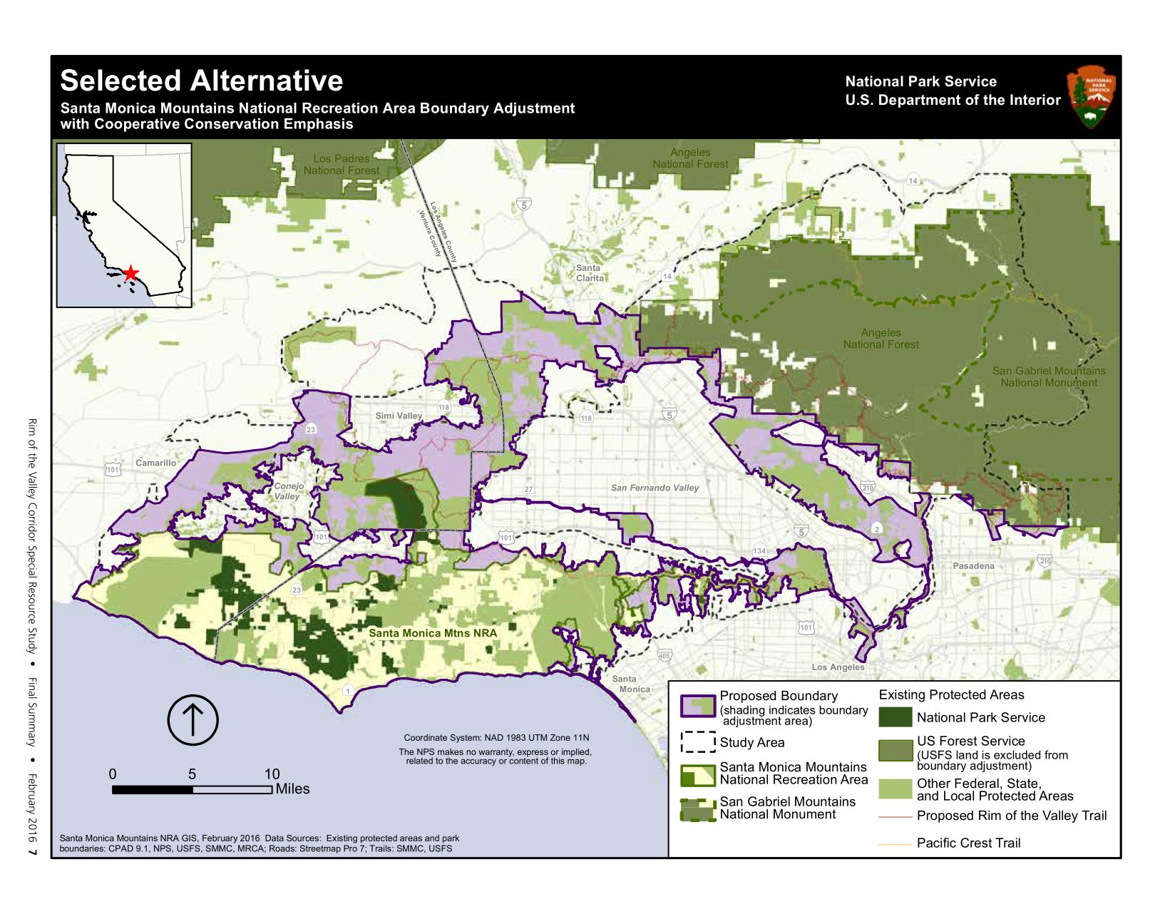
The National Park Service today released the Final Study Recommendations for the Rim of the Valley Corridor Special Resources Study. CORBA has been involved in the Rim of the Valley process since congress authorized the study in 2008, and even before that when the concept was only for a Rim of the Valley trail. We are pleased to see the final recommendation includes most of what we–and many other groups and individuals–suggested in our comments. The recommendation is a hybrid of Alternatives C and D of the draft released last June.
The Secretary of the Interior transmitted the final study to Congress on February 16, 2016. The final study recommends a 170,000-acre addition to Santa Monica Mountains National Recreation Area.The selected alternative would add portions of the Los Angeles River and Arroyo Seco corridors, the Verdugo Mountains-San Rafael Hills, the San Gabriel Mountains foothills, the Simi Hills, the Santa Susana Mountains, and the Conejo Mountain area to the national recreation area. Within the expanded area are: habitat types that contribute to the high biodiversity of the Santa Monica Mountains; functioning wildlife corridors; highly scenic landscapes; historic and archeological sites; geologic and paleontological resources; thousands of acres of open space and recreation areas; and miles of trails, all of which provide exceptional public enjoyment opportunities. Expanding Santa Monica Mountains National Recreation Area would provide new recreational opportunities for one of the most densely populated areas in the United States.
No lands currently managed by the Forest Service (Angeles National Forest and Los Padres National Forest) are included in the proposed boundary expansion of the SMMNRA. However, the National Park Service could partner with the Forest Service on projects, as needed, and as permitted under their current “service first authority.” Existing land managers would continue to manage their lands, but the inclusion of those lands within the expanded boundary of the SMMNRA would allow the NPS to work with them to acquire land from willing sellers, or invest in capitol improvements for recreation or habitat improvements.
The study at this point is just a recommendation from the Secretary of the Interior to Congress. It will be up to congress to take those recommendations and act on them. Or they may not. It many be many years, if ever, before the boundaries of the SMMNRA are adjusted as recommended in the Study.
The final study report, errata from the draft study and an analysis of public comments submitted can be found at http://www.nps.gov/pwro/rimofthevalley/
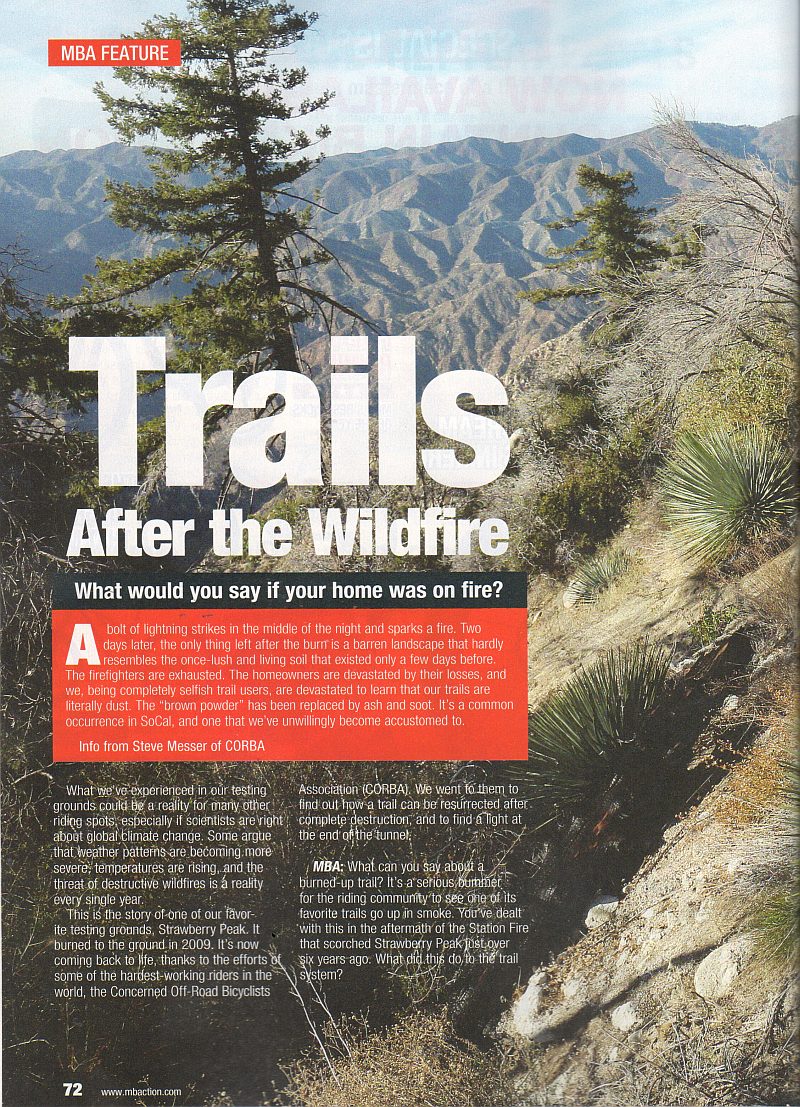
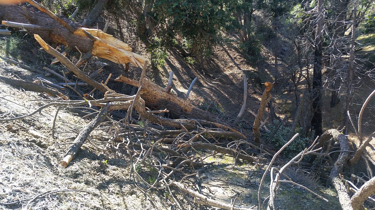
As we reported last year, Over this past year, CORBA has stepped up our Volunteer Sawyer program within the CORBA Trail Crew. CORBA’s two B-Level Sawyers, Mike McGuire and Steve Messer have worked almost year-round cutting trees off trails around the Station Fire burn area of the Angeles National Forest. We’ve worked side-by-side with Hot Shots fire crews, with Mount Wilson Bicycling Association, with volunteers from other groups, with the Restoration Legacy Crew and others. We’ve cleared trees from more than a dozen trails in the past year, most recently 89 trees from Dawn Mine trail in February.
In the current March 2016 issue of Mountain Bike Action, CORBA President and trail crew leader Steve Messer was interviewed for a story on wildfire impacts to trails, something we’ve been dealing with since the Station Fire. The article is a five-page spread, and features several photos of a typical day of volunteer sawyer work, as we cut a very large tree off Strawberry Peak trail. The article is not yet available online on the Mountain Bike Action web site, but we hope it will be posted publicly in the coming months. Right now it is only available in the print magazine.
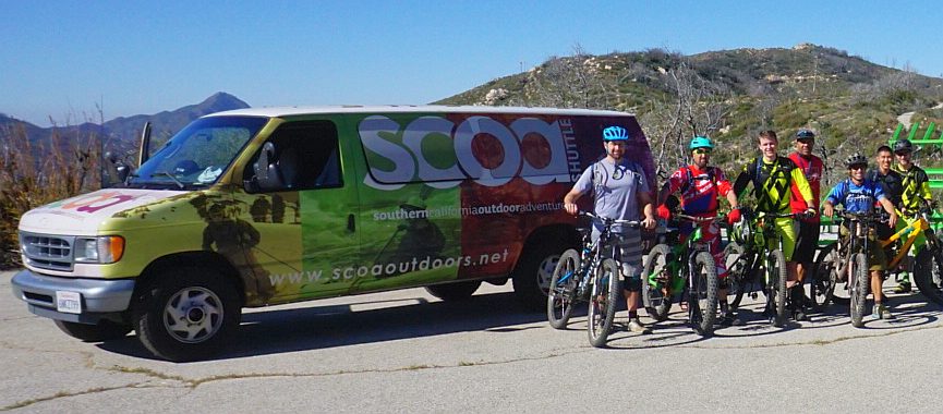
This past week Chris from Southern California Outdoor Adventures generously donated a brand new Stihl 291 20″ chainsaw to CORBA. Chris understands the importance of what we’re doing and was happy to make sure we have the best, most efficient equipment needed to get the job done. This helps his shuttle customers enjoy the trails without obstruction. Our current fleet of saws includes a Stihl 16″, the new 20″ and a 25″ saw. The donated 20″ is a great balance between the portability of the 16″ and the capability of the 25″, and will probably become our go-to saw for most jobs. We truly appreciate the support of Southern California Outdoor Adventures, one of the most respected shuttle operators here in Southern California.
The day we received the new saw, Thursday, February 11, we went out to check on trails in the Chilao area. Given the recent storms and high wind–now followed by a heat wave– we knew there was work to be done. We found a number of trees in the Charlton Flat area, along the closed Vetter Mountain trail, and along Silver Moccasin trail. We removed two large trees from Silver Moccasin, before weather conditions (wind and low humidity) forced us to end the day’s work. The new saw was a dream to run! Thanks SCOA!
New sawyer training is being scheduled sometime in March 2016. Candidate Sawyers must have an existing volunteer agreement with the Forest Service, have first aid and CPR certification. First you will be certified as A-level sawyers, allowing you to cut smaller trees under supervision of a B-level sawyer or higher. After a year at the A-level, sawyers can do the additional training and upgrade to a B-level after which they can cut unsupervised and deal with larger, more complex trail clearing operations. These certifications are restricted to bucking and limbing only, meaning we can clear fallen trees from trails, but we can’t fell standing dead trees. Nor do we need to. Let us know if you’d like to become a certified sawyer and help keep our trails clear.
Six years after the station fire, the number of standing dead trees within striking distance of trails, roads, campgrounds and other facilities, is staggering. These trees will continue to fall every time there is a weather event. The Forest Service is actively working to remove hazard trees from around vital infrastructure such as campgrounds and roads, but it’s going to be up to volunteer groups like CORBA, Mount Wilson Bicycling Association, Boy Scouts of America, Angeles Crest 100, and San Gabriel Mountains Trailbuilders sawyer crews to keep our trails clear of downed trees as best we can.
If you find a new downed tree along a trail, or any potentially dangerous or environmentally damaging trail conditions, snap a photo with your phone, record the location and send a quick email to let us know. We’ll either take care of it, or get it to the people who can. It’s best to include a GPS waypoint or position (or simply turn on location tagging on your phone’s camera app).
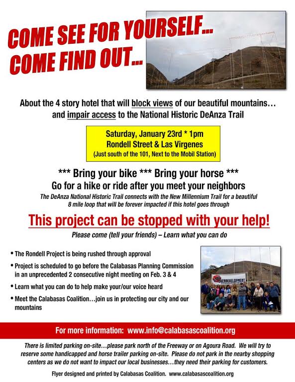
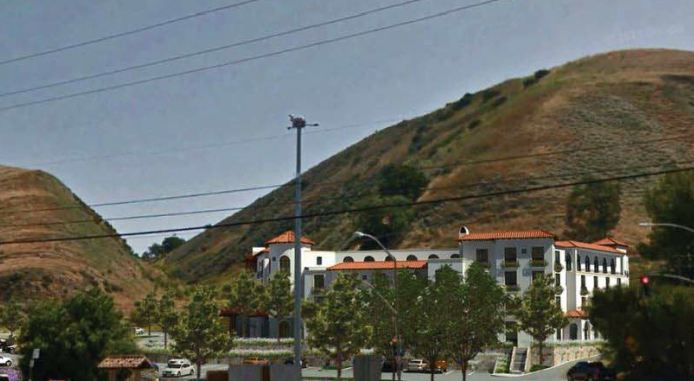
Next weekend we’d like to help stop the 4-Story hotel that is going to forever block views and access to the National Historic DeAnza Trail if it is built. We need to get a good turnout of ALL trail users so please help me by spreading the word and getting these flyers distributed to your friends, riding buddies, the greater mountain biking community and anyone who cares about the views of the Santa Monica Mountains.
(CORBA is hosting an intermediate ride from Bark Park to this event. Learn more about it and sign up on this Meetup event page.)
This trail is located right off the 101 at Las Virgenes and next to the Mobil Station, the trail connects to the New Millennium and is only one of two access points to the New Millennium trail. The designated National Historic DeAnza trail runs from south of Arizona in Mexico to San Francisco and celebrates the discoveries by Juan Bautista DeAnza. It is one of only 16 trails in the nation that went before congress and the White House (according to the MND report).
De Anza/New Millenium Rally.
The developer is being encouraged by the city to build a 4-Story hotel that will require that he put in substantial flood control measures, including a wall that will block access to the trail. Originally, they designed steps up and over the wall…and have since proposed an ADA ramp. One of the developer’s claims is that he is improving the trail for the community by putting in parking (4 shared spots with commuters and hotel guests), a doggie poo station and a trash can to justify the variance to the city’s height restrictions and building in the Las Virgenes Scenic Corridor. There will be no vehicle access to the trail anymore from the west side of Calabasas…only from Calabasas Road further east.
We want to make sure that all trail users are there (most impacted will be the equestrians)…because all will have impaired access to the trail. The developer has no plans for horse trailer parking and in fact has limited parking for other trail users unless the city “gifts” him the currently public Rondell street easement, that is currently used by trail users of all types, daily by commuters as a park and ride and now as a construction staging area for local infrastructure projects.
Please come…and spread the word to others too…at 1pm on January 23rd. We need a big group of trail users and the community to make sure that our voices are heard. We’re asking that mountain bikers ride in…, and park their cars either on Agoura Road or north of the freeway on Las Virgenes, since it is easier for us to ride in to the site. Or make a day of it and ride New Millennium Loop before or after, parking along Lost Hills Road and starting at the Bark Park.
We also want to be respectful of local businesses who are already victimized by transient parking and need their lots for their customers. It will only get worse for local businesses if the two hotels go and housing development goes in with inadequate parking. That is why we are asking people to park legally on the street and hike/ride in.
(CORBA is hosting an intermediate ride from Bark Park to this event. Learn more about it and sign up on this Meetup event page.)
Thank you for helping us spread the word…this development is not a done deal. We need all the support we can get.
A hiker approaches the De Anza trailhead, which will be hidden behind a hotel
We are having a severe El Nino event this winter; as a result the weather forecast is for many heavy rainstorms in the early months of 2016. That will help our drought situation, but will have seriously bad impacts on our trails. As well as muddy conditions that interfere with their use, described below, the rains could be severe enough to erode some trails into huge ruts, and even wash them away in some cases. There may be more mudslides in Pt Mugu State Park (Sycamore Canyon) like we had last year. Furthermore, the rain will spur the chaparral to overgrow the trails, a condition we haven’t had to deal with much over the past couple of years because of the drought. The combination of waterlogged soil and high winds could blow trees over. We’re expecting to have special trailwork days to repair these damaged trails and hope many mountain bikers will want to help us get them back into shape!
Most trails in our local riding area don’t respond well to rain. They have a high content of clay that turns into sticky, slippery muck that binds to everything it touches. It builds up on the tires, like a snowball rolling downhill, until it jams on the frame and the wheels won’t budge. Some models of clipless pedals won’t let go when full of this mud, resulting in the bike and the attached rider lying sideways in a puddle, or worse.
Most wet trails don’t respond well to use until they’ve had time to dry out. Hikers and horses make holes and ridges in the trail that become as hard as concrete when the trail dries. These holes and ridges are good for twisting ankles.
As a rule of thumb, if your foot, tire or hoof makes an impression more than about 1/8 inch deep in the dirt, the trail is still too soft to use. Give it another day or two to dry out before using it!
On wet trails, bikes make grooves along the trail. The next time it rains, the water runs down these grooves and turns them into little ruts, then large ruts that destroy the trail.
The mud is particularly hard to remove. It sticks to the bike and shoes, no matter the efforts to remove it, rubbing off on the bike rack, car carpet and gas/brake pedals, making them slippery. Once home, it takes the careful use of a garden hose to remove the mud but not force water into the sensitive parts of the bike.
For these reasons, riders are well advised to stay off the trails after a rain until they have dried. How long to stay off? That depends on a number of factors including the particular trail, how much rain it received, how much sun it gets after the rain (is it in the shade or face south?), how warm and windy the weather is, and so on. After an isolated light rain you can probably ride the next day. After a heavy rain, you should wait several days. This is something where common sense and experience will help. Remember, tracks deeper than 1/8″ mean the trail is still too soft to use!
All is not lost when the trails are soaking! There are a few trails that hold up well when wet because they have more sand and rock that doesn’t hold the water. Here are a few you should know about:
–Space Mountain (Los Robles Trail West) to the picnic table is almost always rideable, even right after a big storm. However, it can be pretty mucky from the picnic table to Potrero Road.
–Rosewood Trail is pretty good, but not quite as resilient as Space Mountain.
–Zuma Ridge Motorway from Encinal (the bottom in Malibu is muddy)
–Dirt Mulholland around Topanga State Park.
-Brown Mountain Fireroad
-Most San Gabriel Mountains trails made up of decomposed granite
-Beaudry Fireroad
-Hostetter Fireroad
-Mt. Lukens
A hiker approaches the De Anza trailhead, which will be hidden behind the proposed hotel.
The city of Calabasas is pushing plans for the building of the Rondell Oasis Hotel that would block access to the Juan Bautista de Anza Historic Trail (“DeAnza Trail”). The trail is designated as a National Historic Trail and got congressional approval and went to the white house in 2000. This is part of the original El Camino Real route and has over 200 years of history! It is one of only nineteen such trails in the country.
The hotel will be bounded by Las Virgenes Road to the West and the 101 Freeway to the north, as indicated by the yellow outline. The wide yellow line would be a new road.
The hotel is to be built on the currently vacant property on the east side of Las Virgenes Road, immediately south of the 101 freeway, next to the Mobile station. It will occupy the area where people now park to access the DeAnza trail and the adjoining New Millennium Loop trail system.
The developer is proposing to mitigate its impact to the trail by installing approximately 4 parking spaces, a water fountain and a doggy poo-bag station. What is not said clearly is because of the flood hazards on the site, the developer is putting in concrete drainages that would block all access to the trail, and in order to access the trail they would install steps up and over the drainage to the trailhead. This is hardly bicycle or equestrian friendly. In fact, this parking area is the only one that is large enough to accommodate horse trailers for equestrians who want to ride these trails. That access would be lost.
The city of Calabasas believes that these minor accommodations would mitigate the access issues to the trail, but the proposed number of spaces is completely inadequate for this popular trail. There are other significant issues with this development that concern the citizens of Calabasas, but the city believes that they are all minor, and that no Environmental Impact Report is needed to explore the full impact and propose appropriate changes to the plan.
You can get a copy online of the city’s report, “Rondell Oasis Hotel Project: Initial Study…” Page 56 is the checklist where nothing is deemed as having any potential significant impact on a historical or archaeological resource, which isn’t the case.
An artist’s rendering of the proposed hotel. Trail access would be via a staircase from the hotel parking lot.
We urge you to send your comments to the City of Calabasas, expressing the need for a full Environmental Impact Report. Comments must be received by December 4th, 2015! Send them to Michael Klein, the planner for this project. His email address is mklein@cityofcalabasas.com
CORBA’s comments can be found here. Below is a sample letter that you are free to copy and send in under your own name. Of course, it would be even better if you add a sentence or two of your own to make it more individual. Don’t forget to add a catchy subject line!
Dear Mr. Klein,
I have just learned of the Rondell Oasis Hotel Project that is to be situated on the the east side of Las Virgenes Road, immediately south of the 101 freeway. This project would block access to the popular Juan Bautista de Anza Historic Trail that was used by the missionaries over 200 years ago when traveling up the coast of California, and eliminate the current large parking area at the trailhead. The few parking spots that the developers plan to provide for trailhead parking would not be nearly adequate for the number of people who like to use it. Currently this is the only parking area for accessing this historic trail and the New Millennium Loop trail system that is large enough for equestrians with their horse trailers, so the project would completely eliminate their access.
The City of Calabasas’ conclusion that a full environmental impact report is not needed for this project is incorrect in my view. I urge the city to require a full Environmental Impact Report for this project!
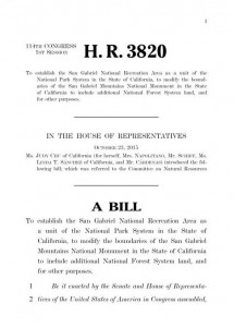
Today, October 23, 2015, Congresswoman Judy Chu kept a commitment made at the San Gabriel Mountains National Monument One Year Anniversary celebration last week, and revealed to CORBA and MWBA in a meeting a few weeks prior to that. She has introduced House Bill 3820, The San Gabriel Mountains Foothills and Rivers Protection Act.
This act goes to great lengths in protecting existing water, property, utility and infrastructure rights, and expressly prohibits the use of Eminent Domain to acquire property. It establishes an Advisory Committee under the Federal Advisory Committee Act (FACA), which includes water agencies, infrastructure, local governments, conservancies, environmentalists, recreation including OHV, and other stakeholders. It doesn’t, however, specifically mention bicycles. It also establishes a partnership committee to support the NRA.
The bill authorizes the National Park Service to establish the San Gabriel National Recreation Area as a new unit of the NPS. It allows them to enter into partnerships and collaborate with existing and willing land managers with the proposed boundary. This includes the Army Corps of Engineers who own and operate much of the flood control infrastructure along the river. It permits and encourages collaborations and partnerships to be leveraged to improve habitat, recreation, resource protection, water quality, infrastructure or any of the purposes for which the NRA will be established ( as specified in Section 102(A) of the bill). The NPS can only acquire land from willing sellers and enter into partnership with willing entities, agencies, and nonprofits. Despite claims to the contrary, this is not a “land grab.”
The bill gives the National Park Service three years to develop a management plan and a visitor services plan, in conjunction with the Advisory Committee (and as required by NEPA, the public). There are however two words that appear highly subjective. In Section 108 (a)(3)(B) In the development of a Visitor Services Plan, the Secretary Shall consider the demand for various types of recreation (including hiking, picnicking, horseback riding, and the use of motorized and mechanized vehicles) where permissible and appropriate; [Emphasis added]. The word “appropriate” in this context is too subjective, without any reference to who makes the determination for appropriateness, and by what criteria. We know there are many who deem bicycles inappropriate anywhere, and we would hope that any determination of appropriateness of bicycles or any other form of recreation be transparent and include public involvement beyond the Advisory Committee and Partnership.
Also required is the establishment of the San Gabriel National Recreation Partnership, consisting of the many land managers, utility managers, and local governments within the boundary. The partnership includes “One designee of San Gabriel Mountains National Monument Community.” We wonder if this is a referral to the Community Collaborative, on which CORBA President Steve Messer serves to represent bicycle recreation interests.
That original SGWMSR Study and the Alternative D supported by CORBA included most of the San Gabriel Watershed within the Angeles National Forest. This study concluded in in 2011, and was the precursor to our National Monument. In early 2014, Chu introduced legislation to establish a National Recreation Area in accordance with the study, but it was clear it was not going to make it out of committee in the congressional climate at that time. This urged her and other advocates to seek alternative protection for the San Gabriel Watershed, ie. to have President Obama declare a San Gabriel Mountains National Monument (SGMNM), which included all of the San Gabriel Watershed, and then some.
One of our concerns with Alternative D of the SGWSRS was how it was going to be funded. At the time, in 2011, the Nation’s economy was in a much sorrier state than it is today, so the financial and administrative burdens a new NPS unit would create were, and still remain a concern. While we are doing better economically, we all know that our public land agencies are all dealing with reduced budgets and severe cutbacks over the past decades. As we commented in 2011, we would hope that funding be secured from additional sources that do not impact or reduce the budgets of other NPS or USFS units, including our local Santa Monica Mountains National Recreation Area and Angeles National Forest/San Gabriel Mountains National Monument.
Another concern we had with the SGWMSRS was that Forest Service land outside the San Gabriel Watershed Study area under Alternative D would receive reduced services and resources from the Forest Service. We didn’t want to see all the priorities going to the National Recreation Area. Much of the area left out of the National Monument was not in the original San Gabriel Watershed Special Resource Study, which some have speculated is a reason for the exclusion from the National Monument. With our SGMNM, we have the same concerns: that areas outside the Monument under Forest Service control would be the forgotten stepchild of the National Monument. While much attention is being placed on the National Monument, we are also seeing benefits to the rest of the Forest.
Chu’s legislation aims to correct the omission of those Forest Service lands from the SGMNM. Title 2 of HR3820 appears to expand the boundary of the existing SGMNM to include all of the Angeles National Forest south of the 14 and east of the 5. It makes no other claims and places no additional burdens on the Forest Service with respect to additional time to prepare a Management Plan. We are beginning to see the impacts of the additional funding the National Monument designation has brought to the Angeles National Forest. Thus far, we see it as good for the Forest. While we do have concerns that when and if the current bill is enacted, the Monument Management plan currently in development will need to be revised once again. Chu’s bill simply applies whatever existing National Monument management plan is in place or in development to the expanded Monument. While sounding simple in theory, the burden of changing boundaries and evaluating the additional cultural, historical, ecological and recreational resources within the expansion will take additional time.
The expansion of the existing National Monument in HR3820 already has much support within the community. Tim Brick from the Arroyo Seco Foundation has been especially vocal about his disappointment with the way the current National Monument boundaries were drawn, and that it happened without any public process or explanation of the reasoning. His feelings are widely echoed in the community, especially now that we are seeing additional funds being allocated to the Forest Service since the National Monument designation.
Our initial thoughts on the bill are positive but guarded; we need more time to digest the content of the bill and its long-term ramifications. Its intentions are in line with those of CORBA’s mission: enhancing recreation, and protecting the lands on which we recreate. If you have strong feelings about the bill please let us know as we formulate our official position.
Map of the proposed San Gabriel National Recreation Area and San Gabriel Mountains National Monument Expansion:
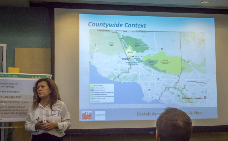
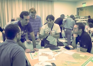
Last night, September 17, 2015, LA County held the second in the series of planning meetings announced last month. Last night’s meeting was well-attended by mountain bikers, but also by local residents who are concerned about trails and fire roads through their properties at Tapia Canyon and other locations within the study area.
It was made clear at the meeting’s outset that the County trails policy is multi-use, and that nothing in this process takes away any property owners’ rights. Just because a trail is drawn somewhere on this plan doesn’t mean it will be constructed exactly where it is drawn, or that it will be constructed at all. It will guide the County’s planning efforts for future growth.
Disrespectful and illegal behavior by a small non-representative group of riders has tarnished the image of mountain bikers in the area, while at the other end of the spectrum the NICA SoCal League teams in the area have done an outstanding job of representing our sport responsibly.
About 50 people gathered around four tables packed with maps to point out where there are important existing trails, brainstorm on where they’d like to see new connections and access points, and what types of features they’d like to see at a bike skills park. Property owners pointed out where their properties are on the map, and expressed valid concerns about trails that pass through their properties.
Some important issues came up, such as the preservation of iconic and unique trails in the Tapia Canyon area, access to Forest Service and Tapia Canyon blocked by the Tesoro development, and potential impacts of the Hidden Ranch at Tapia Canyon Development. It is these and other development proposals that have prompted the County to take on this important planning task. There are more people coming to the Castaic area, more homes, more business, more kids on bikes and more demand for recreational trails.
For example, there’s strong demand for a regional-quality bike park facility at Grasshopper Canyon in the Castaic Lake State Recreation Area, as proposed by CORBA some time ago. We’d like to go big, including tot, beginner, intermediate and advanced pump tracks, progressive dirt jumps, a downhill flow trail, a permanent cyclocross/XC training and racing track, dual slalom tracks, four-cross course, progressive dirt jumps and skills areas. We’d also like to see smaller community pump tracks at easily-accessible locations through the area.
Among the other items being discussed were:
A long-distance, multi-use trail around Castaic Lake including access to secluded bays and beaches.
Trail connections from the Sports Complex to Castaic Lake SRA and to Charlie and Wayside canyons.
Easier access to Tapia Canyon trails through the Tesoro development
Continued access to Tapia via Wayside/Junkyard through the Hidden Ranch at Tapia development.
Connections to Forest Service trails and fire roads
Connections to Ventura County and Los Padres NF trails
Preservation of iconic and unique Tapia trails such as Dog Tag, G-Out and others.
What else would you like to add? You can still let them know.
The County understands that many people are unable to attend public meetings, or need more than just a meeting to consider their needs. An online Interactive Map allows members of the public to draw in where they’d like to see trails, bike park facilities or trailhead facilities such as parking, bathrooms and water fountains. This new planning tool also allows the public to upload gps tracks of existing trails. However, the interactivity goes both ways, once something is added to the map it becomes part of the public record that others can see an comment on. There are two more meetings scheduled, aimed at the hiking and equestrian communities respectively, though all meetings are open to all members of the public.
If trails and bike parks around Castaic and Santa Clarita Valley are important to you, visit http://castaicmultiusetrails.org to see what others are asking for and share your own thoughts with the County and planning consultants.


 This annual Conejo Valley event always helps to put some very sweet trails into good shape. Be sure to stay afterwards for the free lunch and raffle.
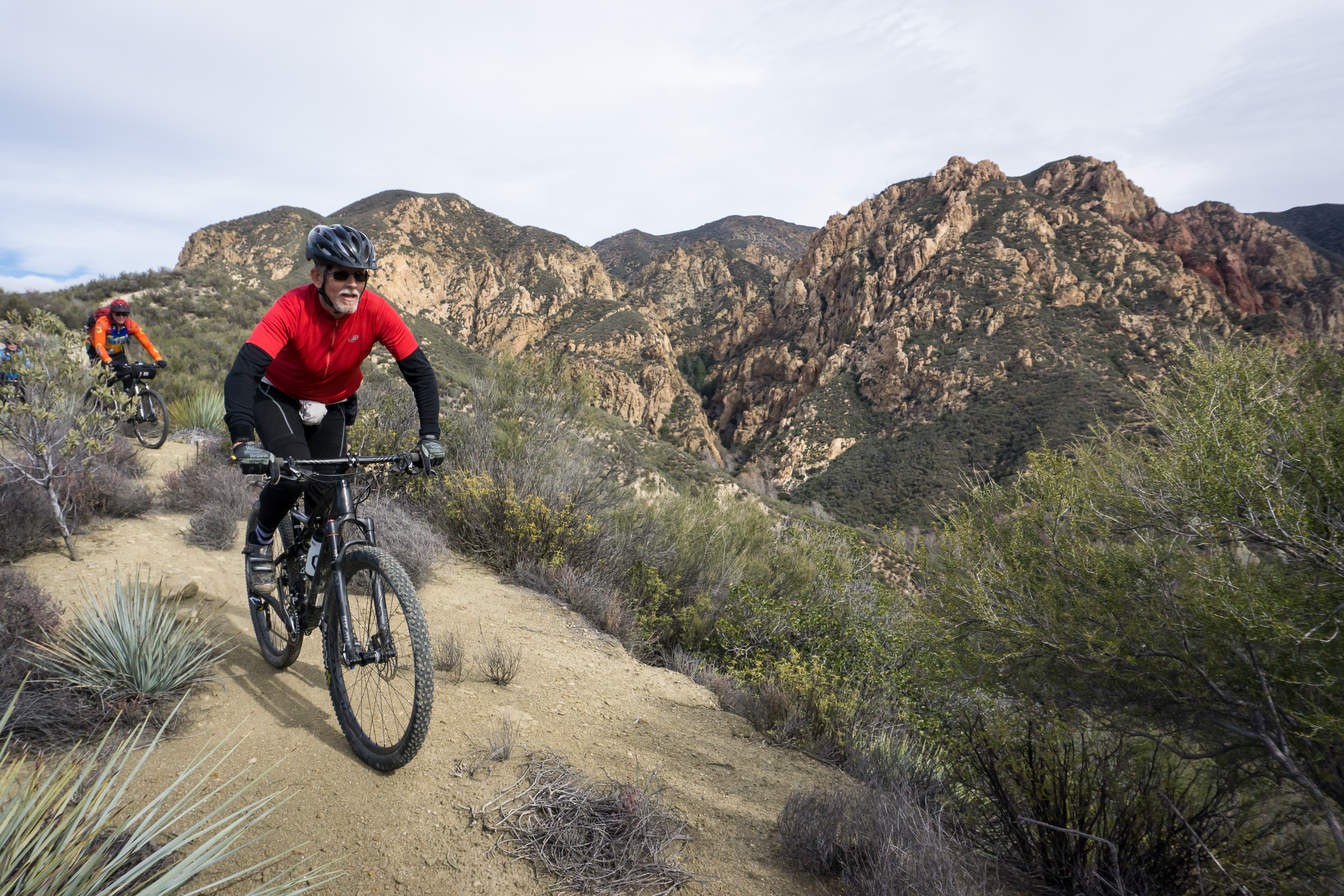

 Most trails in our local riding area don’t respond well to rain. They have a high content of clay that turns into sticky, slippery muck that binds to everything it touches. It builds up on the tires, like a snowball rolling downhill, until it jams on the frame and the wheels won’t budge. Some models of clipless pedals won’t let go when full of this mud, resulting in the bike and the attached rider lying sideways in a puddle, or worse.
 As a rule of thumb, if your foot, tire or hoof makes an impression more than about 1/8 inch deep in the dirt, the trail is still too soft to use. Give it another day or two to dry out before using it!
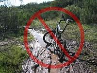 For these reasons, riders are well advised to stay off the trails after a rain until they have dried. How long to stay off? That depends on a number of factors including the particular trail, how much rain it received, how much sun it gets after the rain (is it in the shade or face south?), how warm and windy the weather is, and so on. After an isolated light rain you can probably ride the next day. After a heavy rain, you should wait several days. This is something where common sense and experience will help. Remember, tracks deeper than 1/8″ mean the trail is still too soft to use!
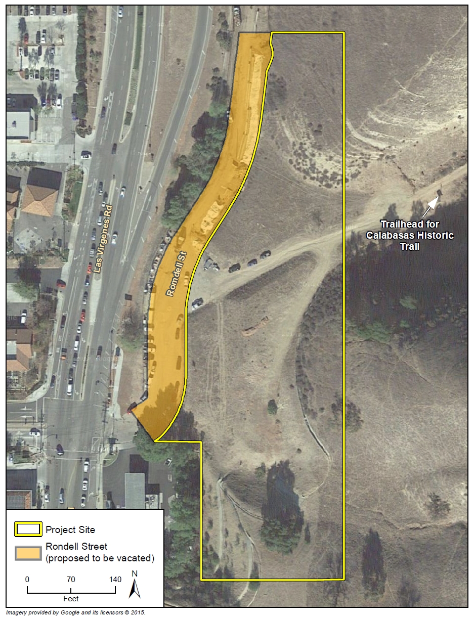

 Some important issues came up, such as the preservation of iconic and unique trails in the Tapia Canyon area, access to Forest Service and Tapia Canyon blocked by the Tesoro development, and potential impacts of the Hidden Ranch at Tapia Canyon Development. It is these and other development proposals that have prompted the County to take on this important planning task. There are more people coming to the Castaic area, more homes, more business, more kids on bikes and more demand for recreational trails.
