Archive for the ‘Advocacy’ Category

Packed House asks for a bike park at the Lang Ranch Community Park

Sunday, February 12th, 2012
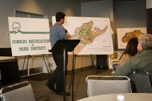
Parks officials show the abandoned plan

Parks officials show the abandoned plan

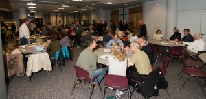
On Wednesday evening, February 8, 2012, a packed house was far more than the Conejo Recreation and Parks District was expecting. But they were very pleased with the turnout, and encouraged to see so many local residents take an interest in the future of this large, but undeveloped park.

The Lang Ranch Community Park appears on the District’s Master Plan and has already had its own master plan drawn up. The plan included numerous wonderful improvements, but the reports of geologically unstable ground made the cost of implementing this plan beyond feasible. The cost of stabilizing the park’s sloping hillsides–a necessary step before any improvements could be made–proved prohibitive. The plan had to be retired and a new one envisaged.

A packed house of more than 90 participants

A packed house of more than 90 participants

This meeting was to gain public input on what could be done with the park without major construction, without digging, without the need for water. After this history and the given parameters the attendees were divided up into nine groups, each to discuss what they’d like to see in the park. A facilitator from the parks department took notes on easel boards, listing the table’s priorities. Each group then assigned a spokesperson to summarize the groups wishlist.

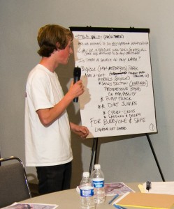
A common theme among all the groups was the call for a pump track/bike park/dirt jumps and trails. This was probably helped by the last minute efforts of local bike park advocates putting out the word through facebook and other social outlets.  It was referred to as a Bike Skills Park, a Pump Track, a Dirt Jump Park, a Mountain Bike park, but the common thread was there: a facility for off-road bicycles.

Also high on the suggestion list were trails, connectivity to Conejo Open Space trails, off-leash dog park, radio-controlled car and plane facility, landscaping with native plants, disc golf, playground facilities, picnic benches, bathrooms at the one place in the park that was deemed suitable for construction, through-trails/bike paths to connect students at the neighboring residential areas to the school at the western end of the park, and many other options. The parks staff were notably pleased with the input.

Facilitators seek public input from each table

Facilitators seek public input from each table

Subsequently, on Saturday February 11, a second meeting took place during which interested parties walked the park property with parks staff to discuss the possibilities. While fewer people attended this, some key proponents of a bike skills park were there to ensure the City continued to hear of the desire for a bike park facility.

Over the coming weeks and months the parks department will be distilling the key requests from the public into an updated vision for this Community Park and inviting more feedback.

The next meeting is on February 29, 2012, 7 – 9 pm at the Hillcrest Center Community Room, 403 W. Hillcrest Drive, Thousand Oaks, CA 91360. This meeting is listed as a “Brainstorming and Bubble Diagram” event. The public will be asked to put their ideas on maps of the park property.

On March 21, 2012, also 7 – 9 pm at the Hillcrest Center Community Room,  CRPD will be reporting back to the public on what they’ve garnered from the public’s input, and their recommendations. There may be additional meetings so stay tuned for further announcements.  If you are unable to attend the meeting, you can email your input to parks@crpd.org.

Presenting his table's ideas for a bike park

Presenting his table's ideas for a bike park

We’re especially pleased that the Conejo Recreation and Parks Department is reaching out to the public, and engaging people directly in this early stage of the planning process. While a Conejo Bike Park is not yet a done deal, it seems that the idea is alive and well and has a good chance of becoming reality. We urge people to stay involved in the process and keep pushing for a bike park. Opportunities like this don’t come very often, especially right here in our own back yards… or city parks. For more information, follow the progress on facebook and at the parks department web site, www.crpd.org.


Proposed State Park Closures Threaten Bicycle Access

Tuesday, January 31st, 2012

Via the California Bicycle Coalition

This summer the state could begin closing 70 state parks, many of them popular for bike touring, bike camping and mountain biking. That’s why there’s a campaign to help keep them open.

Locally, the Santa Susanna State Historic Park is slated for closure.  This park is South of the 118 freeway, between Chatsworth and Rocky Peak. It includes some multi-use trails, including the old Santa Susanna Stagecoach road and El Camino Nuevo.

Statewide, there’s a lot at stake for bicyclists. Eighteen parks could be closed along the Pacific Coast Bike Route, an international bike touring destination and California’s only state-designated bike route, including two in Mendocino County that are crucial stops for bike tourists. Five parks popular for mountain biking, including Annadel, Brannan Island, China Camp, Henry Coe and Sugarloaf, are also on the closure list. Nineteen of the 58 state parks that offer low-cost “hike or bike” campsites for those arriving by bike or on foot are set to be closed.

Tell your legislators and Gov. Jerry Brown there are better solutions to the state’s budget crisis than closing state parks. Make the case in person at the 10th annual Park Advocacy Day on March 20 in Sacramento. If you own a business that would suffer due to the proposed state park closures, join the California State Parks Foundation’s “Closing Parks is Bad for Business” campaign.

New U.S. Forest Service Planning Rules Presents Opportunities for Mountain Bike Groups

Friday, January 27th, 2012

Via IMBA

For Immediate Release 1-27-2012

Contact: Mark Eller
IMBA Communications Director
markeller@imba.com
303-545-9011

The U.S Forest Service recently announced a new set of rules that will shape the way foresters oversee its lands, including planning for and implementing trails and other recreational facilities. The Department of Agriculture, which oversees the Forest Service, posted the new procedures online today.

“This is welcome news for IMBA and its affiliated chapters and clubs,” said Mike Van Abel, the executive director for the world’s largest association of mountain bike organizations. “IMBA’s outstanding relationship with the Forest Service sets the stage for our local affiliates to partner with individual forest units as they make plans for shared-use trails.”

IMBA sent dozens of representatives to the Forest Service’s national series of listening sessions as it was preparing for the just-announced rule change. “Those efforts proved to be really worthwhile,” says Jeremy Fancher, IMBA’s lead attorney. “It’s particularly encouraging to see a renewed emphasis on following best practices and considering scientific evidence. IMBA’s partnership agreement with the Forest Service will help us provide the right information for effective recreation planning.”

Fancher frequently advises IMBA-affiliated chapters and clubs on forest planning efforts. IMBA also offers scientific studies on the impacts of mountain biking and guidance on trail design on its website. Learn more about planning efforts in the forests near you by visiting the Forest Service’s Schedule of Proposed Actions (SOPA) website.

To raise public awareness about how mountain bikers and Forest Service staff interact, IMBA helped sponsor Pedal-Driven, an award-winning documentary. The Forest Service has officially endorsed the hour-long film, and IMBA’s local chapters and clubs are currently hosting dozens of screenings. “This production documents the great things we can accomplish when we work together to solve problems,” said Okanogan-Wenatchee National Forest Supervisor Becki Heath, whose forest is featured prominently in the documentary.

CORBA comments on Topanga General Plan

Monday, January 23rd, 2012

Topanga State Park General PlanAs we reported last year, a new Topanga General Plan is being developed by California State Parks. The plan will guide Topanga State Park’s future, ensuring that management practices are in line with the mission and objectives of the Park.

The general plan does not govern trail use designations, and instead defers to the Santa Monica Mountains Trails Master Plan, which is still in development.

The current draft of the plan was released in December.  The public comment period ends today, January 23, 2012.  Below are the comments that CORBA is submitting. Members of the public are also welcome to comment on the plan, which can be found at http://parks.ca.gov/?page_id=25956.


February 23, 2012

Luke Serna, Environmental Coordinator
Topanga General Plan Team
California State Parks
Southern Service Center
8885 Rio San Diego Drive, Suite 270
San Diego, CA 92108

Re.:  Topanga State Park General Plan

Dear Mr. Serna,

Thank you for the opportunity to comment on the Topanga State Park General Plan. We have been involved in the process from the first public hearings, and are happy to see the plan approach its final iterations.  We congratulate you and the staff for moving the plan forward.  However, as CORBA represents off-road cyclists, there are a few items and omissions in the current draft about which we have some concerns.

1.  We read on page 49 “Eight additional focus group meetings were held to better understand a few site specific issues.” Then number 5 on page 50 mentions a focus group on user conflicts. CORBA as an organization representing off-road cyclists was not made aware of, and did not attend any such focus group. Nor did any of our members or anyone we can find in the bicycling community. There aren’t any details of who called the group or how that group’s findings may have affected the final plan. Without cyclists present, we are concerned that an unbalanced representation of user conflicts may have been made. Exclusion of one user group from such a focus group cannot possibly foster multi-use principles, just as excluding a user group from a trail furthers and deepens user conflicts when they do occur. Please document and clarify the process used to form this focus group and its findings as they pertain to the general plan. This would perhaps be suitable for inclusion as an appendix.

2. On page 65, it states “1. a. This management plan will address the ability of bikes, horses and other pack animals, and fire, construction and Park vehicles to carry and spread exotic plant seed throughout the Park.”  There is no mention of hiking boots, running shoes, shoe tread, socks or clothes as a vector for the spread of exotic seed. This should also be of concern and should be addressed, especially since hikers are much more likely than cyclists to go off-trail where they can be exposed to more seed than would otherwise be encountered by those staying on the trail. We feel this is an omission.

3. Page 53 states that “trail-use designations are not part of this plan…. However, trail corridors, as well as trail goals and guidelines, will be established as a part of this process.”  While these “trail corridors” appear in the legend of the map on page 105, the scale of the map and the visual indicators used in the legend do not allow for the easy identification of or distinction between “corridors” and existing trails.  A verbal description of each trail corridor proposed and/or a larger scale map would do much to alleviate and prevent any confusion. We feel we cannot adequately comment on the proposed trail corridors without fully understanding them.

4.  In Table 3, “Planning Matrix” on page 113, the Lagoon, Watershed Zone and Lower Topanga zones are listed as being restricted to “hiking on designated trails only.” To list an entire zone off-limits to other user groups will hamper the efforts to complete the Coastal Slope trail as it is envisioned–a multi-use long distance trail–that will pass through that zone. The Coastal Slope trail itself appears on the Lower Topanga/Lagoon Preferred Plan “Range of possible features” on page 115.  Making trail use decisions on a trail-by-trail basis, rather than a blanket closure of an entire area, will allow for better management of users in the area, and reduce impediments to the planned Coastal Slope Trail.

5.  According to the plan Musch Campground is open to bicycles.  However, the Musch Trail is currently closed to bicycle use. A formal change-in-use request has been submitted to convert that trail to multi-use including bicycles. How is Musch Campground currently accessed by bicycles?

Off-road cycling is a healthy outdoor recreational activity that entices people away from their couches and computers and into our treasured open spaces. Cyclists comprise a large portion of State Park visitors, yet only fire roads and Rogers Road are currently open to bikes in Topanga SP, concentrating bicycles on fewer trails, and placing them on wide fire roads that encourage high rates of downhill speed. This contributes to user conflicts and creates further divisiveness between user groups. We would like to see the General Plan recognize cycling as a legitimate, welcomed and, when managed appropriately, sustainable activity in Topanga State Park.

CORBA has a long history with State Parks in the Santa Monica Mountains. Our trail crew volunteers have worked on Rogers Road and many other trails in neighboring State Park units for many years. We note in the plan that there is a recommendation to continue to work with volunteer and non-profit groups. We work side-by-side with other user groups at State Trails Day and other events. CORBA works constantly to educate, inform and encourage off-road cyclists to practice good trail etiquette, and the vast majority do. We look forward to continuing and furthering our relationship with Topanga State Park and other SP units in the Santa Monica Mountains.

Thank you,

Concerned Off-Road Bicyclists Association

New San Vicente Mountain Communications Tower Public Presentation (the Nike Site)

Thursday, January 12th, 2012
A new communications tower is being proposed for the top of San Vicente Mountain, near the location of the Nike site at Westridge and Mulholland in the Santa Monica Mountains. This is a highly popular destination for trail users and visitors to the Santa Monica Mountains.

UltraSystems, a company specializing in environmental planning, will be conducting a public  presentation on the project for interested parties:

7:00 p.m., Tuesday, January 17, 2012, West Los Angeles City Council Office, 1645 Corinth Ave., Second Floor Hearing Room, LA, CA 90025.  

The presentation will help the public and the trail user communities understand exactly what the impacts of this new 200′ tower will be.

While this meeting will concentrate solely on the the San Vicente Mountain project, at least four other sites are being proposed for similar projects.  Mount Lee is within Griffith Park, behind the Hollywood sign and is off-limits to cyclists.

The other peaks are Mount Lukens in the Angeles National Forest, Verdugo Peak at the top of  Hostetter Fire Road (AKA “La Tuna”), and the Baldwin Hills.  The Mount Lee and Baldwin hills projects are for new equipment buildings within existing facility boundaries. Mount Lukens and Verdugo Peak are both slated to have existing towers replaced and upgraded. These projects will be discussed at a later meeting.

Santa Clarita Trails Public Hearing Announced

Wednesday, January 11th, 2012

From the Santa Clarita Valley Trail Users:

Dear Friends,

Our fight to re-open The Canyon Trail and Vasquez Rocks to mountain biking continues.

As a part of the “trail assessment process” the County is undertaking, a “first” public hearing will be held on this matter on Wednesday, February 15 at 7PM at William S. Hart Park in the “Hart Hall” building.  This is a very important meeting and we need all hands on deck.  So please mark your calendar and plan on bringing your spouse and kids and maybe a few “Share the Trails” signs.  More information will follow as we plan for this meeting.

Additionally, next week, some of our committee members will be meeting with Russ Guiney to discuss the status of our request to re-open these trails and to express our concerns about the process and approach they are undertaking to address this issue.  Mr. Guiney is the Director of LA County Parks and Rec and the buck does stop with him.  Ultimately, this is his decision.  Wish us well.

Thank you for your support and letters to Supervisor Antonovich.  We would not have made it this far without it.

See you on the trials!

Please sign our petition:  http://www.ipetitions.com/petition/canyon_trail_mtb_access/
Join our Facebook Group:  http://www.facebook.com/groups/saveplaceritatrail/


SCV Trail Users
Safe and Equal Access for All Trail Users
SCVTrailUsers@gmail.com
To add your name to our email list, please email SCVTrailUsers@gmail.com with such a request.

Notice of EIR for Topanga State Park General Plan

Friday, December 9th, 2011

NOTICE OF AVAILABILITY AND INTENT TO ADOPT
AN ENVIRONMENTAL IMPACT REPORT FOR THE PROPOSED
TOPANGA STATE PARK GENERAL PLAN

Date: December 5, 2011

The California Department of Parks and Recreation (CDPR) has directed the preparation of and intends to adopt an Environmental Impact Report (EIR) for the proposed project, in compliance with the California Environmental Quality Act (CEQA) and State CEQA Guidelines. CDPR is the lead agency for the proposed project under CEQA.

PROJECT LOCATION: Topanga State Park is a CDPR park unit located within Los Angeles County.

DESCRIPTION OF THE PROPOSED PROJECT: The General Plan directs the long-range management, development and operation of Topanga State Park by providing broad policy and program guidance including goals, guidelines and objectives for the management of the Park. The plan will set aside a number of management zones including; a I/Ihldlands Zone constituting over 70% of the Park’s acreage that shall contain minimal development with modest camping opportunities; a Cultural Presen/e to heighten the interpretation and protection of outstanding cultural resources; a Historic Zone whose core includes the former Rancho Las Lomas Celestiales (now known as Trippet Ranch); as well as other zones for resource management, visitor use and accessible interpretive and recreational programs. The Plan also contains specific proposals to consolidate the Park’s trail system through eliminating duplicate trails and relocating trails away from sensitive resources.

PUBLIC REVIEW PERIOD: The Draft EIR is being circulated for public review and comment for a period of 45 days, beginning Thursday December 8, 2011 and ending on Monday January 23, 2012. Your views, comments and questions regarding this Plan are welcomed. They should be directed to:

Luke Serna, Park & Recreation Specialist
8885 Rio San Diego Dr., Suite 270
San Diego, CA 92108

or by email at

enviro@parks.ca.gov

Copies of the EIR may be reviewed at the following locations during normal business hours or downloaded from the CDPR website at the following web address:

http://www.parks.ca.gov/?page_id=25956

California State Parks, Angeles District Office, 1925 La Virgenes Road, Calabasas, CA 91302

San Gabriel Watershed – CORBA Supports Alternative D

Wednesday, November 30th, 2011

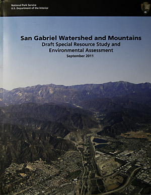
San Gabriel Watershed and Mountains Special Rescource Study CoverThe process of determining the future of the San Gabriel Watershed region started in 2005 in a series of initial scoping sessions. In 2009 the first draft alternatives were presented for public comment, as we reported in 2009. After the 2009 series of public hearings, the alternatives were revised and released In October 2011.

In October and November of 2011, the National Park Service (NPS) held another series of public meetings to discuss their preliminary study findings about the San Gabriel region, and present their revised draft alternatives. There were between 75 and 150 stakeholders at each meeting, a clear indication of how important the San Gabriel Mountains are to Southern California residents.

The report is an extensive 300 page document. It discusses a broad spectrum of the natural, cultural and recreational resources in the study area. For those interested in the geologic, cultural and natural history of the San Gabriels it is a handy reference, well worth reading. The document further describes the national significance of the resource, and ultimately finds the region suitable for NPS protection. It discusses the feasibility of NPS involvement, then presents the alternatives as to how the NPS may be involved.

As we reported in October, one of the original Alternatives, B, had been dropped, and one, D, added. The three remaining Alternatives, A, C and D were summarized and outlined by Barbara Butler, who is leading the study for the NPS. The presentations essentially recapped the Executive Summary. Members of the audience were then invited to ask questions.

Many of the questions were very specific, addressing the current shortfalls in maintenance, funding, staffing and infrastructure within the Angeles National Forest. People asked for more rangers to patrol for litterers and graffiti, funds for trail restoration and maintenance, more staff to handle volunteers and funding for recreation facilities.

Some were concerned that there may be an increase in bureaucracy and red tape if the NPS were to come in. The presenters again assured everyone present that all land use decisions would continue be made by the current land managers. They defined the NPS roles more as “Management Partners,” sharing resources with the Forest Service and other agencies, as well as facilitating better coordination and cooperation between agencies.

(more…)

Help Preserve Trails and Parks Funding in 60 Seconds

Monday, November 28th, 2011

Open space. City parks. Thousands of miles of singletrack across all 50 states. If you value those things, you will take just 60 seconds to help IMBA support the Land and Water Conservation Fund (LWCF). All you have to do is sign a petition.

The petition asks the Obama Administration to fully and permanently fund the LWCF and its work buying open space and helping cities and counties build parks, many of which contain mountain bike trails and are in your own backyard.

TAKE ACTION! If we reach 25,000 individual signers by Dec. 16, the Obama Administration will look at the issue and give an official response. Please sign today!

LWCF funds are being diverted from their intended use. Of the $900 million authorized this year, very little of that is actually going toward America’s parks and outdoor recreation areas. Be part of a united voice. Help us urge the White House to restore full, dedicated and permanent funding for the LWCF.

It only takes a minute. Sign the petition today!

Study Finds Multi-Use Trails Improve Property Values

Monday, November 21st, 2011

From a story which appeared on the University of Cincinnati Web Site, October 11, 2011

New Research Finds that Homeowners and City Planners Should ‘Hit the Trail’ When Considering Property Values

Two University of Cincinnati researchers will present interdisciplinary research at a national conference on planning and development of communities.

Date: 10/11/2011 12:00:00 AM

By: Dawn Fuller

Location, location, location – it is often touted as affecting the value of residential property. Now, new University of Cincinnati research suggests that location near nature trails could hold a financial benefit for homeowners and ultimately neighboring communities.

University of Cincinnati researchers Rainer vom Hofe, an associate professor of planning, and Olivier Parent, an assistant professor of economics, will present their findings on Sunday, Oct. 16, at the 52nd Annual Association of College Schools of Planning (ACSP) ENVISION Conference in Salt Lake City, Utah.

The two researchers examined how the Little Miami Scenic Trail – a 12-mile southern stretch of the trail that runs through the Cincinnati metropolitan region – impacted residential property values in Hamilton County, Ohio. The scenic, multipurpose trail beckons walkers, hikers, skaters and bicycle enthusiasts and also has horseback riding paths.

“For the ‘New Urbanist,’ multipurpose trails provide the potential for bicycle commuting; help alleviate noise, pollution and congestion, and expand the means for green transportation and a community’s walkability,” write the authors.

Using a research model they developed, Parent and vom Hofe found that from a real estate perspective, trails can have significant, positive spillover effects on property values when these properties are located within reasonable distances to the trails.

To be more specific, housing prices went up by nine dollars for every foot closer to the trail entrance. Ultimately, the study concluded that for the average home, homeowners were willing to pay a $9,000 premium to be located one thousand feet closer to the trail.

The researchers say their study is among the first to quantify the impact of multipurpose trail proximity on residential property values while isolating the results from the biasing effect of nearby property values.


(more…)