Archive for the ‘Trail Crew’ Category

REI Supports CORBA

Thursday, July 22nd, 2010

Recently CORBA received news of two significant financial contributions to CORBA’s trail work and advocacy efforts by Recreational Equipment, Inc. (REI). First, we were notified by REI that our application for REI’s Trail Upkeep grant was accepted. The $5,000 grant will help CORBA purchase and maintain tools and equipment for upcoming trail work projects, including projects in the Angeles National Forest’s Station Fire area.

REI also confirmed that they will be supporting CORBA’s Fat Tire Fest with a Platinum Level sponsorship ($3,500). REI is the Fat Tire Fest’s first ever Platinum Level sponsor. The Fat Tire Fest takes place October 17 at Castaic Lake. For more information go to www.fattirefest.com.

Roger’s Road Trail Maintenance Report

Wednesday, July 21st, 2010

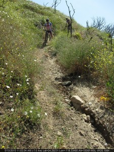
Thanks to all who came out on Saturday 7/17/10 to help out with some brush clearing on Rogers Road in Will Rogers State Historic Park/Topanga State Park. It was a hot day and that made it tough. We had 13 volunteers show up.  We hiked in just over 2 miles to the lone Oak and worked back from there. We managed to clear 1/2 mile of the trail. There are a few more miles that are getting very overgrown so we will be scheduling a few more work session in the next few months.

View the photo gallery of Saturday’s trailwork.

Albertson and Montgomery Fireroads Graded

Thursday, July 8th, 2010

By Steve Clark

In the past few weeks, or maybe days, after the winter rains and in plenty of time for the upcoming fire season, Albertson Fireroad has been graded to a wide, smooth and slightly loose surface. Albertson Fireroad is a popular trail that starts at the east end of Lang Ranch Parkway in Thousand Oaks and continues generally eastward through the southern reaches of Simi Valley, connecting to China Flat along the way.

Today we rode from the bottom to the top, about 2.3 miles beyond China Flat. We found that a grader has been through recently, making the trail soft across more than 90% of it. This softness greatly increased our workout on the way up, but we had to be really careful not to wash out on the way down even on some very gentle curves. The surface has the consistancy of sand in some places.

There were only a very few bike tracks on the road once we were east of China Flat, suggesting that the work is very recent. From the top, we could see that the grading continued down Montgomery Fireroad into Simi Valley. It looked like Albertson Fireroad east of the fork with Montgomery (heading towards Rocketdyne)  was not graded, but that could change if the grading really took place in the last few days; it might be ongoing.

The road will be packed down through use soon enough and will then be broad, smooth and very fast. Until then, take its softer condition into account when planning your biking route.

Los Angeles County trail access meeting July 20 – mark your calendar!

Thursday, July 8th, 2010

Backbone Trail Maintenance June 2010

Friday, June 25th, 2010

By Mark Langton 

Latigo Canyon section of the Backbone Trail just west of Newton Mtwy.

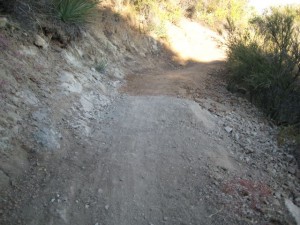
Over the last couple of weeks some new maintenance has occurred on the Backbone Trail along sections at Solstice and Latigo Canyons (National Park Service-held property). The crew that did the work is unknown at this time, but it is assumed that it was National Park Service or contracted by them.  It was very professionally done. Hand-worked tread leveling and minor widening has taken place, with a few sections being filled in with soft dirt. The depth of these short fill sections does not exceed one inch at their deepest. 

The trail heading east from Newton Motorway: Natural rock formations along the upper section and at the bottom as it enters the canyon bottom  have been left intact.  Switchbacks were left intact or filled slightly. 

Another section of the Backbone West of Newton Mtwy. where some rock was left in the tread.

The section of trail most affected is directly to the west of Newton Motorway. The tread surface of the first half-mile of this mildly rolling, somewhat technical section has been leveled and filled, and slightly widened, and three or four short rocky sections were removed, making it much less technical. Further to the west, where the trail has notoriously seen heavy erosion due to its steep pitch, it has been slightly re-routed and leveled, and several drainages have been added to assist with water runoff. This is a significant improvement for both uphill and downhill travel.  When contacted by CORBA, Melanie Beck, an outdoor recreation planner for the National Park Service, stated that the work was considered routine and done for resource maintenance and safety concerns. At the time of this report no information was available regarding any additional trail work in the immediate future. 

Over the last 23 years I have seen this type of trail work and it is indeed not out of the ordinary, nor is it overly aggressive (of which I have also seen). In fact, the soft sections of tread surface resemble that of a just-completed new trail. Compacting will take place over the next few months with use and moisture, and hydro-erosion will begin sculpting ruts and other natural formations. Climbing the filled sections was a little more work than usual, but they should get packed down soon enough. And descending required only slightly more attention paid to washing out. I am a little disappointed that the short rocky sections were removed, but that’s a personal selfishness—the trail is still a blast and is one of the best and most scenic sections in the Santa Monica Mountains National Recreation Area.

Trailwork Days: Doc Larson Trail June 26, July 10

Monday, June 21st, 2010

CORBA will be assisting Chris Sercel with his Eagle Scout project to restore the Upper Doc Larson trail in the Sunland area of the Angeles National Forest. Doc Larson trail is a multi-use singletrack. We’ll be working on the upper section, and a singletrack connector trail that ties it into a loop with the surrounding fire roads. Meet in Lake View Terrace at the address above and either carpool or ride to the trailhead.  Meet at 7:30 at the address listed on the CORBA trailwork calendar, and we’ll carpool or ride up from there. Be sure to bring sturdy shoes, long pants and long sleeve shirts. We’ll be doing brushwork and some treadwork. This area is still within the Station Fire closure area, so we’ll be working with special permission from the Forest Service. A second day of work will happen on July 10th to complete the project. Lunch will be provided so please RSVP to csizzles99@gmail.com and/or to trailcrew@corbamtb.com, or on the CORBA Google Calendar if you have a google account.

Angeles National Forest Recovery Plans

Tuesday, June 1st, 2010

There was an informational meeting on the recovery plans for the Angeles National Forest May 26, 2010 at the Eaton Canyon Nature Center.  Representatives from the U.S. Forest Service, San Gabriel Mountains Trailbuilders, the Sierra Club, TreePeople, Student Conservation Association, Caltrans, and Outward Bound were present.

The intent of the Recovery Plan is to create a more ecologically sustainable forest than before and to build a community of involved users.

There was a brief mention of San Gabriel Mountains Forever, a group the Sierra Club supports and that has the goals of promoting the proposed San Gabriel National Recreation Area and of increasing wilderness in the San Gabriels.  CORBA is investigating this wilderness proposal and its potential impact on multi-use trails.

An intern from Congressman Schiff’s office announced an upcoming informational meeting on the Rim of the Valley Corridor Special Resource Study.  The Corridor is a Santa Monica Mountains Conservancy project to expand the National Recreation Area. The meeting will be at the Nature Center at 10 am, Friday, June 4.

Mike MacIntyre, the River District Ranger for the Angeles National Forest discussed the new closure order.  Details of that are on the ANF web site.  He showed some photos of the extensive damage to the upper Arroyo Seco, Gould Mesa Road, several fire stations, Grizzly Flats Road, and Vogel Flats area.  He reported that a large boulder had been blasted from the Mt. Wilson Toll  Road near Mt. Harvard. He also confirmed that Millard campground is open, but not El Prieto, Sunset Ridge or other trails.  They are looking to open more areas by the July 4th weekend.

He noted about 35,000 acres of forested land burned, 24,000 of that was pretty much denuded and may not come back on its own.  There are plans to reforest about 11,000 acres of the 24,000.  Seedlings were not available to get started this year, and planting is expected to start with an initial 4400 acres in early 2011.  Carbon credits, grants, and Congressional sources will fund the project.<

A representative from the Tree People explained that there is a narrow window for replanting because the soil has to warm and be moist. If they wait too long it is too hot and dry for the seedlings to survive without watering, which is usually not practical.  They are recruiting and training for 2011 now.  Tree People are the lead group on the reforestation efforts.

Bob Cates reported that the Sierra Club’s Angeles Forest Restoration Project will be working on trails the 2nd and 4th Saturday of every month starting in July. They have 380 volunteers signed up. They focus on the area up Highway 39 to Crystal Lake.

The Student Conservation Association is 50+ years old, but until 2004 did not have a presence in SoCal.  They have both paid workers and non-paid volunteers. Besides doing all kinds of conservation related work, they encourage participants to consider careers in forestry, wildlife management, conservation, etc.  They have some crews working with the USFS on the fire recovery.  These crews work for several weeks at a time, so can get into back country and handle more complex jobs.

The final speaker was Patrick Chandler from Caltrans District 7.  There were 25 washouts or slides along the closed section of Highway 2.  Caltrans are hoping to have it open by mid-July.  Most of the problem was that the debris flows blocked all the drains, then the water washed across the road and off the down side eroding the shoulders and below and undermining the roadbeds. Although the engineers wanted to, they are not going to build any bridges, as there are no funds available.

Thanks to CORBA member Mitch Marich for the report.

New Millennium Trail Maintenance Report.

Tuesday, June 1st, 2010

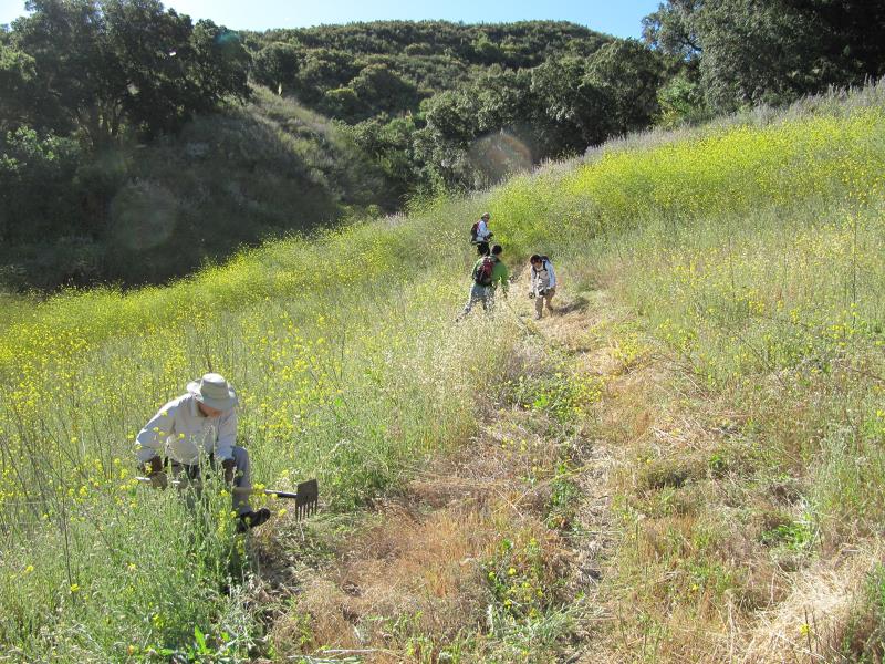
Clearing out the weeds that choked the trailOn Saturday 5/29/2010 a dozen CORBA volunteers and a hand full of men from the MRCA fire crew spent the day cutting back brush and doing some tread work.  We worked the Calabasas Crest Trail starting just South of Calabasas Road up to the water tank at the top of the switchbacks.  We had a hard working crew and managed to clear weeds and do tread work on 1.5 miles of trail!  There was a lot of thistle along the trail so it was not an easy task! you can view our work in the photo gallery.

The following day we returned to ride the entire trail to survey the conditions of the remainder of the loop.  The MRCA fire crew has maintained much of the North end of the trail and it is now clear of brush.  The South and West sides from Normans Way to the Bark Park Trail is in need of some brush work but it is passable for those not minding a little bushwhacking.  Keep in mind there is some thistle in there so long pants or knee/shin guards would be a good idea.

CORBA will be checking in with the Land Managers to coordinate getting the remainder of the trail maintained.

CORBA has adopted Conejo Open Space Los Robles Trail West (aka Space Mountain to Potrero Rd.)

Saturday, May 22nd, 2010

"Space Mountain" gets its name from the radio towers at the top of the Mountain.

CORBA is proud to announce our adoption of the Los Robles Trail West (aka Space Mountain to Potrero Rd.) under COSCA’s Adopt-a-Trail program. This program allows individuals, civic groups and private companies to adopt trails. Adopting entities agree to provide maintenance for their selected trails on a quarterly basis, as well as regularly monitor conditions on the trail. This is great news for users of this trail. It is a favorite of mountain bikers locally and from all over Southern California. Los Robles West is unique for its tolerance to rain. Good drainage and low clay soil make it ridable after even heavy rainfall, so it is heavily used during the winter. But “good drainage” is not “perfect drainage,” and heading into the summer there are often some rutted sections in need of repair, as well as brush clearance is always required after spring growth. The Thousand Oaks area is fortunate to have a large selection of Conejo Open Space trails open for multiple use. Unfortunately a shortage of resources limits the maintenance performed by the land managers. CORBA is stepping in here to help fill the shortfall.  We hope to engage local trail users to help provide ongoing trail maintenance to this trail. We are looking for volunteers and trail crew leaders to help maintain our newly adopted trail. If you would like to get involved please email us, or call us at 818-206-8213. 

View Los Robles West in a larger map

Verdugos: City Requests Illegal Features be Removed

Sunday, May 9th, 2010

At a recent meeting of the Burbank Trails Committee, City Officials notified us that illegal features that have been built along Preston Ridge in the Verdugo Mountains must be removed.

The features have appeared over the past year or two.  Near the top of the Vital Link trail (a hiker-only trail), there is a small wooden feature. Beyond that, there are some small tabletop jumps and bermed turns. The City is giving the builders until the end of May to remove the features and the materials used before they go in and take them out.

“Preston Ridge is not an official trail” according to the City representative. However, the trail was created by hikers hiking across firebreaks along the ridge line more than two decades ago. One Committee member has hiked there “his whole life.”  The City is in a dilemma as to what to do with the “trail” itself, as it has such a long use history, but has never been through any process to become an official trail. The City Attorney has determined that the features themselves are a liability.

The work on the ridge is that of many different people and groups. The City has been in contact with some of the builders, but they are only responsible for a small portion of what has been constructed.  Many of the recently altered sections of the trail were not done “up to safe, sustainable standards” and did not follow the original line of the existing unofficial but long-used trails along the ridge.

Meanwhile, CORBA has submitted a draft proposal to construct a new section of trail with mountain-bike specific features. The City Attorney and others are going over the proposal in detail, but have not yet accepted or denied the proposal. They have expressed hope that it can eventually be accepted and completed. The City needs more time to study the proposal and has requested information and examples of how other cities around the country have dealt with new mountain-bike enhanced trails.

Currently most single track trails in Burbank open space are closed to bicycles. There has not been a new official trail constructed since 1998 when the Vital Link trail was completed.