Archive for the ‘Regions’ Category

Help with Backbone Trail Restoration on January 13!

Wednesday, January 3rd, 2018

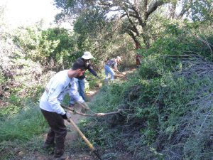
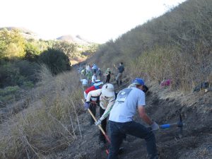
Clearing brush on the BBT east of Kanan Rd in April 2016

On Saturday Jan 13, CORBA and the Santa Monica Mountains Trails Council will be working together to restore the Backbone Trail from Kanan Road east towards Newton Motorway. We worked here in the spring of 2016, less than two years ago, installing drains and cutting back brush. Now many of the drains are clogged with silt and of course the brush needs cutting back to clear the trail.

We will be meeting at the paved parking lot immediately north of Tunnel #1 (closest to the ocean) on Kanan Rd at 8:30 am on Saturday January 13th. As a thank-you, CORBA will be taking volunteers to lunch afterwards. Trailwork days normally run to about 2:00 pm, so bring a snack to tide you over!

Registering online at our Meetup event will help us plan for this event so we’ll know how many tools to bring and have a better idea of how much we’ll be able to accomplish. Thanks for registering in advance!

This is a popular trail so we hope to see a lot of our mountain biking friends there to help out!

No experience is necessary to help out with trailwork. Tools and instructions on how to use them safely and effectively will be provided. Children under 18 must be accompanied by a parent or guardian and be must over 7-years old to attend, and children under 14 must be constantly and directly supervised by their parent or guardian who brought them.

Please leave your 4-legged children at home!

And you don’t need to be a mountain biker to help out – Everybody is welcome! For more information on trailwork in general, visit our trail crew web page (http://corbamtb.com/programs/trail-crew.shtml).

Be sure to wear protective clothing (sturdy shoes, long pants and sleeves, hat, gloves) and bring snacks, sunscreen and water. CORBA will provide the tools and training. Everybody works at their own pace.

Getting in The Holiday Spirit: Giving back to trails

Monday, December 4th, 2017

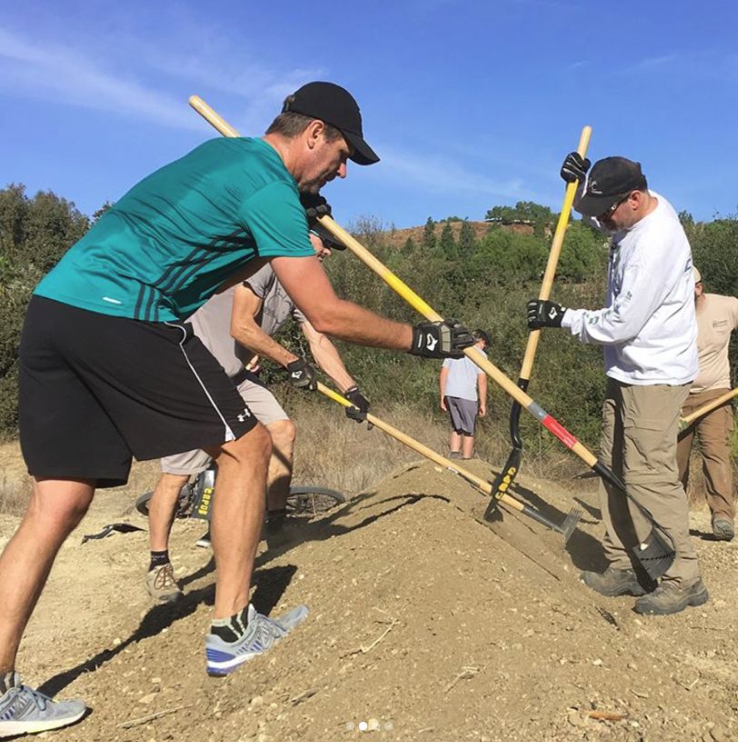
Building a berm on a trailside bike feature

This past weekend the holidays seemed to come into full swing, and there was a lot of giving. On Saturday morning, members of our Sapwi Bike park committee gave their time building the first trailside feature at Sapwi Bike Park. Contractors have cleared and graded the bike park area, and the final bike park plan from FlowRide Concepts is close to completion. Lots of people have given to our IMBA Dig In campaign now standing at $1900, in addition to the generous grant of $15,000 from REI. We need to raise close to $100,000 so there’s a long way to go. Keep the donations coming!

Also on Saturday, former CORBA Chair and current volunteer Mark Langton was conducting our monthly Free Basic Mountain Bike Skills Clinic. Mark has been teaching new mountain bikers the basics of bike handling, safety and etiquette for more than 20 years. Eight riders attended the last skills clinic of the year.


(more…)

December Skills Clinic photos posted December 3rd

Sunday, December 3rd, 2017

Like last month, we had 8 riders on a sunny day in the park. A couple of the riders had to leave half way through for another appointment, but said they’d be back for the January class. Again we rode through the creek, which is completely dry, and most riders went down the steps on the way to the hill-climbing exercise.

The Basic Skills Clinic is always held the first Saturday of the month at Malibu Creek State Park.

You can see the photos in our December photo gallery.

Public Meetings Dec 5: Rosemead Blvd and East Fork San Gabriel Canyon

Thursday, November 30th, 2017

On Tuesday, December 5th there are two conflicting public meetings of interest to those who ride bicycles in the San Gabriel Mountains or the San Gabriel Valley.

San Gabriel River Confluence with Cattle Canyon Improvements Project

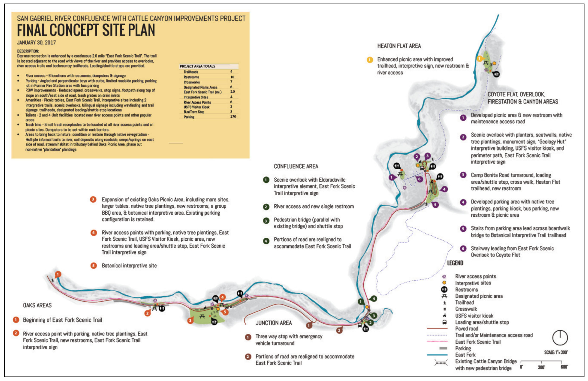
The other public meeting is to seek public input on the Draft Environmental Impact Statement (DEIS) for the San Gabriel River Confluence with Cattle Canyon Improvements Project. CORBA, through our involvement with the San Gabriel Mountains Community Collaborative, have expressed our full support for the project as proposed.

Click to Enlarge

This project will add much-needed trailhead improvements, interpretive and scenic trails, parking, bike racks, shuttle stops, multilingual signage, river access points and habitat restoration to this heavily-impacted area of the Forest. While not heavily used by mountain bikers, all of us who care about our Forest are supportive of these improvements.

The project is within the San Gabriel Mountains National Monument, and is being developed in partnership with the Watershed Conservation Authority. The meeting will be held at the Angeles National Forest headquarters:

Tuesday, December 5, 2017
5:30 p.m. to 7:30 p.m.
Angeles National Forest Headquarters
701 N Santa Anita Ave,
Arcadia, California 91006

Comments must be submitted by December 26, 2017, to:

EFSGR/Cattle Canyon Improvements Project
110 N. Wabash Ave.
Glendora, California 91741

or via email to: EFSGR@wca.ca.gov


LA County Rosemead Blvd Complete Streets Project

LA County’s Rosemead Blvd Complete Streets project proposes to add bike lanes, pedestrian walkways and other improvements to Rosemead Blvd through the Whittier Narrows area. This is the initial scoping meeting, where the County will be seeking public input on how to best improve this six-lane stretch of road to better accommodate cyclists and pedestrians. The meeting will be held at the More information can be found at:

Tuesday, December 5, 2017, 6:00 – 8:00 p.m.
Pico Rivera Municipal Golf Course,
3260 Fairway Dr.,
Pico Rivera, CA 90660.

http://dpw.lacounty.gov/pdd/proj/rosemeadcs/

This project will have great value to our community, as it will improve safety for pedestrians and cyclists accessing the Whittier BMX track, Whittier Narrows recreation area, and existing bike paths along the San Gabriel River and Rio Hondo. It is also close to the proposed Puente Hills Landfill, with its two planned and approved Bike Skills Parks.

We can’t be at both meetings, but want to encourage those with an interest in either to attend these meetings and be engaged in the process.

Report on the ‘Creek of Doom’ trail restoration in MCSP on November 11th

Tuesday, November 14th, 2017

Over 20 volunteers, including 9 from CORBA, 8 from Girlz Gone Riding and 6 from the Santa Monica Mountains Trails Council, worked for four hours this past Saturday morning to fix up a seriously degraded part of Crags Road in Malibu Creek State Park. This section, just before the M*A*S*H site, is fondly known at the ‘Creek of Doom’ or the ‘Rock Garden’ because of the rocky and narrow nature of the trail, going along the edge, and then the middle, of the dry creek bed. This trail has not seen any work on it for years and had become very overgrown and eroded. As a result of the rains last winter, several trees had fallen on the trail and now were lying at the side, their branches still poking into the trail itself.

Under the guidance of experience trail crew leaders, mostly from the Trails Council but also from CORBA, the volunteers split into several groups, most of which focused on clearing back the fallen trees and other brush, with the rest focusing on fixing the trail tread.

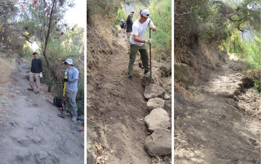
Before, during and after photos of one section of the trail that was restored.

Overall, almost a half mile of trail was restored. This included about 100′ of narrow, rocky and off-camber trail where very large rocks were dug out and the tread made more smooth and level. The large rocks were used to build up a section about 20′ long that had almost completely disappeared into the creek. (See photos above.)

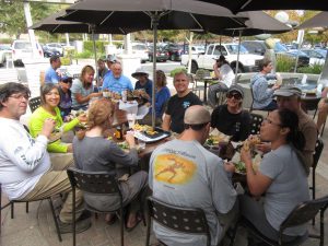
Lunch at the Urbane Cafe afterwards to thank all the volunteers who did such a great job!

After the work ended, CORBA treated the volunteers to a lunch at the Urbane Cafe and the Habit Hamburger Grill.

You can see more pictures of the trailwork in CORBA’s photo gallery.

November Skills Clinic photos posted November 7th

Tuesday, November 7th, 2017

This month we had only 8 riders on a sunny day in the park. A couple of the riders didn’t participate in many of the skills. Again we rode through the creek, which is completely dry, but we did not go down the steps. And again, Graham was covering for Steve who’s bike was temporarily out of commission.

The Basic Skills Clinic is always held the first Saturday of the month at Malibu Creek State Park.

You can see the photos in our November photo gallery.

Santa Susana Mountains Trails Master Plan Draft Released

Thursday, November 2nd, 2017

The Draft Santa Susana Mountains Trails Master Plan and Initial Study/Proposed Mitigated Negative Declaration are available for public review beginning today (November 2, 2017) at http://www. santasusanatrailsplan.org/

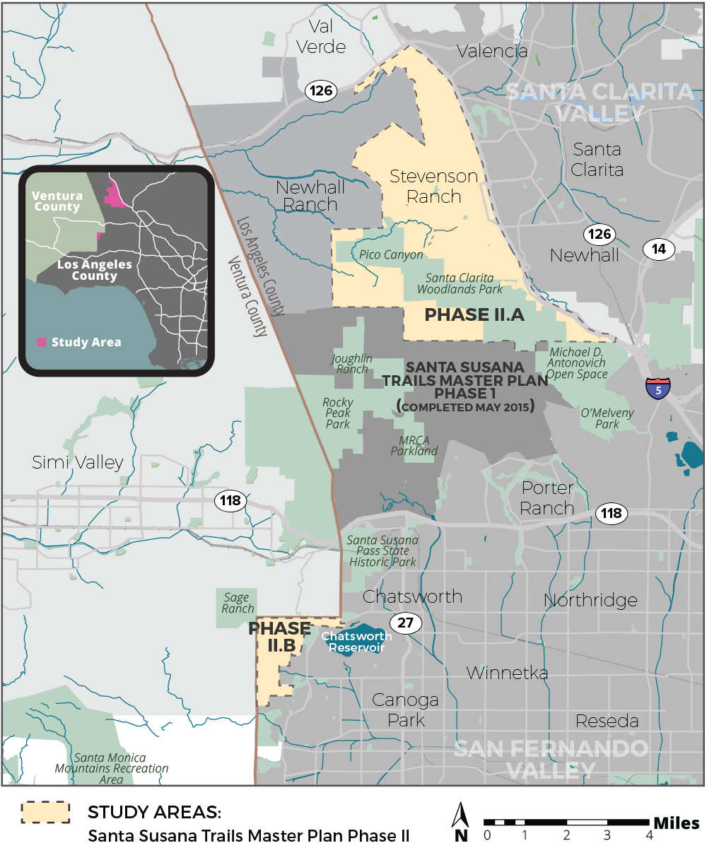
Project Location: The SSMTMP-PII area encompasses approximately 24 square miles in the unincorporated territory of the northwestern portion of the County of Los Angeles, immediately east of the boundary with Ventura County, located entirely within the 5th Supervisorial District. The SSMTMP-PII area is comprised of an approximately 22-square-mile area located in the north-facing slopes of the Santa Susana Mountains and the Santa Clarita Valley (Phase II.a) and an approximately 2-square-mile area located in the foothills of the Santa Monica Mountains, including Bell Canyon, Dayton Canyon, and Woolsey Canyon, west of the San Fernando Valley (Phase II.b). The Phase II.a area is composed of generally mountainous and valley terrain that abuts Henry Mayo Drive (State Route [SR] 126) to the north, the Interstate-5 freeway to the east, the southern edge of the Santa Clarita Valley Area Plan area to the south, and the Newhall Ranch Specific Plan Area to the west. Similarly, Phase II.b area, is composed of generally mountainous and valley terrain that abuts Ventura County to the north and west and the City of Los Angeles to the east and south.

Project Description:

The proposed project includes approximately 70 miles of proposed multi-use (hiking, mountain biking, equestrian) trails and related staging areas, bike skills parks, parking areas, and other supporting trail facilities in the Santa Clarita Valley Planning Area and San Fernando Valley Planning Area. The proposed trails would provide connections to parks and open spaces, a large commercial district, seven schools, numerous natural features, Six Flags Magic Mountain theme park, the proposed Rim of the Valley trail corridor alignment (RIVA), and existing trails in the Cities of Los Angeles and Santa Clarita, and in the Newhall Ranch Specific Plan area, as well as trails within other jurisdictions as identified in the Trails Master Plan. The trails would be multi-use and range from 3 to 12 feet wide based on site conditions, with adequate space for combined pedestrian, equestrian, and mountain biking use, in accordance with the County of Los Angeles Trails Manual guidelines (County Trails Manual). The proposed project would develop a complete multi-use trail system connecting user groups and local populations to desired recreation destinations and experiences, with unified transition to the trails of adjacent jurisdictions, compatibility with adjacent land uses and environmental resources, and incorporate a sustainable design consistent with the County Trails Manual. The plan would recommend conditions for improvement of unmet local recreation demands in the County’s Fifth Supervisorial District.

Comments

Written comments will be accepted via email or at the following street address:

County of Los Angeles Department of Parks and Recreation
Planning Division
Attn: Julie Yom, Park Planner
510 South Vermont Avenue, Los Angeles, California 90020
Email: jyom@parks.lacounty.gov

The public comment period will end on Saturday, December 16, 2017.

All comments must be postmarked or emailed no later than December 16, 2017.

COMMUNITY MEETINGS:

On Thursday, November 9, 2017, the County will host a community meeting to review the project and solicit information in relation to the CEQA analysis for this project.

The meeting will be held from 6:00–8:00 pm at Stevenson Ranch Library, 25950 The Old Road, Stevenson Ranch, CA 91381.

On Thursday, November 16, 2017, the County will host a community meeting to review the project and solicit information in relation to the CEQA analysis for this project.

The meeting will be held from 6:00–8:00 pm at Chatsworth Branch Library, 21052 Devonshire Street, Chatsworth, CA 91311.

Please direct any questions regarding these meetings to Zachary Likins at (213) 351-5149 or zlikins@parks.lacounty.gov.


Public Lands Update

Thursday, November 2nd, 2017

This year we have seen legislation introduced to further protect and enhance our local open spaces and public lands.

HR3039, the San Gabriel Mountains Forever Act. Judy Chu introduced this bill in June. The bill would establish two new units of Wilderness within the Angeles National Forest. CORBA worked for two years with wilderness advocates to ensure these newly-proposed designations would not impact trails used by mountain bikers. The bill establishes the Condor Peak Wilderness and Yerba Buena Wilderness units, separated by the Condor Peak Trail. Condor Peak trail and Trail Canyon trail to the waterfall and campground would remain open to bicycles under this new designation.

Rim of the Valley

Rim of the Valley Corridor Preservation Act, S1993/HR4086.

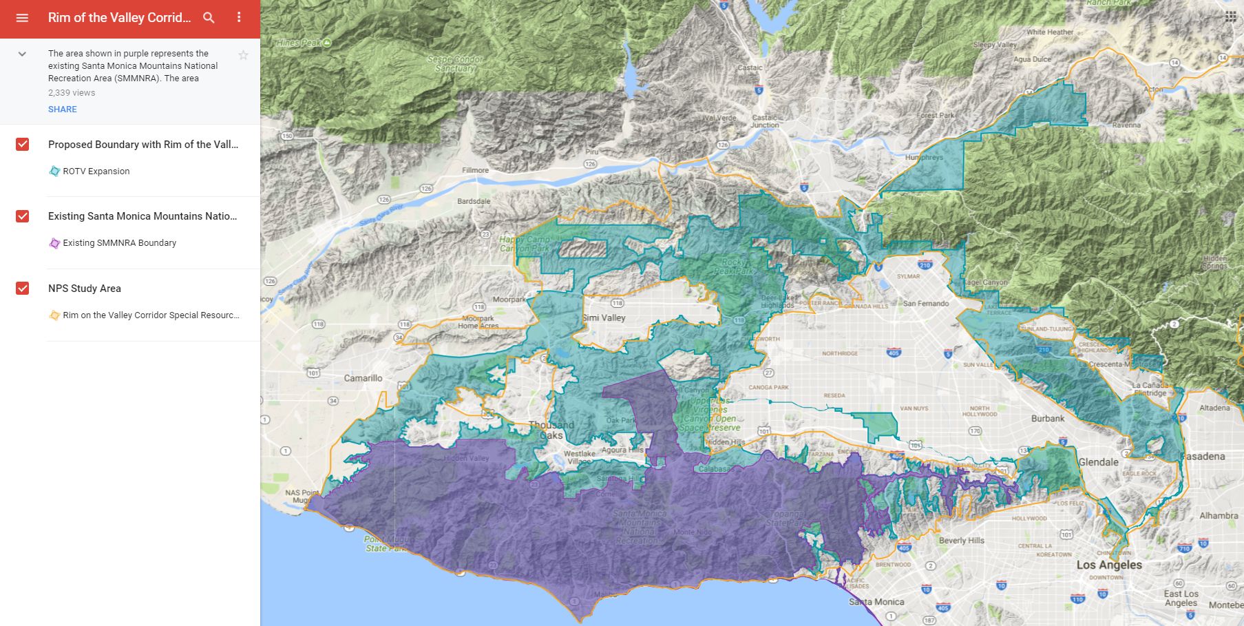
This bill by Adam Schiff/Diane Feinstein would expand the boundary of the Santa Monica Mountains National Recreation Area to include open spaces around the Conejo, Simi, San Fernando, La Crescenta and Verdugo valleys. It does not change any land ownership or management but allows the National Park Service to partner with current land managers to improve habitat, wildlife corridors, and recreational opportunities. It puts into action the findings of the Rim of the Valley Corridor Study. It does not impact bicycle access to trails and could improve recreational opportunities.

H.R. 2323: San Gabriel Mountains Foothills and Rivers Protection Act. This act introduced by Judy Chu would establish the San Gabriel National Recreation Area as a unit of the National Park System. The NRA would cover river corridors and open spaces from the Angeles National Forest border through the San Gabriel Valley. It does not create any new federally-managed public land. It would allow the National Park Service to partner with existing land managers to improve habitat, biodiversity, and recreational access. It would also expand the boundary of the San Gabriel Mountains National Monument to include areas of the Angeles Front Country that are currently outside the Monument.

While these bills have been introduced, it remains to be seen whether they will make it out of their respective committees.

CORBA’s mission includes the protection of the places we play. Nationally, as the current administration proposes major changes to environmental regulations, national monument boundaries (our San Gabriel Mountains National Monument is not expected to be a target of boundary reductions), forest management practices, permitted uses, we stand ready to speak up for our local public lands and the recreational opportunities they provide and we all cherish.

Dig In for Sapwi Bike Park!

Wednesday, November 1st, 2017

IMBA’s Dig In campaign is live!  Our Sapwi Bike Park project is moving forward and you can help make it happen sooner. Sapwi Bike Park will be free to the public, featuring jumps, drops, pump tracks, flow lines, trails, and as much stoke factor as you can have on a bike!

We’ve received a generous grant from REI to get us going, but to make this a reality we need to raise much more.

Visit: https://win.imba.com/digin?chapter=223846 and make a donation towards building a new, free community bike park in Thousand Oaks. There are 68 projects to which you can donate, so be sure to choose CORBA’s Sapwi Bike Park.

It doesn’t matter how big or small your donation, every cent counts.

Building the first trail in the new Sapwi Trails Park on Oct 21.

Sunday, October 22nd, 2017

On Saturday during the Conejo Fall Trailwork Day, a group of 193 volunteers helped build the first trail in Sapwi Trails Park. We completed 0.67 miles, about half of the new trail. Some of it was along a very steep cross-slope so we had to move a lot of dirt to establish the tread.

Much of the rest of the trail was across a gentle cross-slope, so it can be traversed even if it hasn’t been finished.

You can see photos of some of the work that was done in our photo gallery, as well as pictures of the lunch and muk-a-muks who turned out to celebrate the occasion.