Archive for the ‘Regions’ Category

Verdugos: City Requests Illegal Features be Removed

Sunday, May 9th, 2010

At a recent meeting of the Burbank Trails Committee, City Officials notified us that illegal features that have been built along Preston Ridge in the Verdugo Mountains must be removed.

The features have appeared over the past year or two.  Near the top of the Vital Link trail (a hiker-only trail), there is a small wooden feature. Beyond that, there are some small tabletop jumps and bermed turns. The City is giving the builders until the end of May to remove the features and the materials used before they go in and take them out.

“Preston Ridge is not an official trail” according to the City representative. However, the trail was created by hikers hiking across firebreaks along the ridge line more than two decades ago. One Committee member has hiked there “his whole life.”  The City is in a dilemma as to what to do with the “trail” itself, as it has such a long use history, but has never been through any process to become an official trail. The City Attorney has determined that the features themselves are a liability.

The work on the ridge is that of many different people and groups. The City has been in contact with some of the builders, but they are only responsible for a small portion of what has been constructed.  Many of the recently altered sections of the trail were not done “up to safe, sustainable standards” and did not follow the original line of the existing unofficial but long-used trails along the ridge.

Meanwhile, CORBA has submitted a draft proposal to construct a new section of trail with mountain-bike specific features. The City Attorney and others are going over the proposal in detail, but have not yet accepted or denied the proposal. They have expressed hope that it can eventually be accepted and completed. The City needs more time to study the proposal and has requested information and examples of how other cities around the country have dealt with new mountain-bike enhanced trails.

Currently most single track trails in Burbank open space are closed to bicycles. There has not been a new official trail constructed since 1998 when the Vital Link trail was completed.

Sullivan Canyon to Experience More Closures

Wednesday, May 5th, 2010

From Sharon O’Rourke of The Gas Company.

If you’ve been through Sullivan Canyon this year, you have noticed that our maintenance road sustained significant damage from the February heavy rains.  As a result, we will have to repair the road before we resume our pipeline protection plan with the concrete mats.  Despite the rains, the concrete mats performed as expected and over time, it will be covered with natural material.

The road repair is currently scheduled to start on 5/24 and will take between 2-3 weeks.  We will close the canyon while this work takes place.  At this time we do not have a start date for the pipeline protection work so it is possible we may re-open the canyon to the public until we start the pipeline work which is currently scheduled for sometime between mid-June to mid-July.  This work, which includes laying the concrete mats to cover the remaining 12 pipeline exposure areas, is expected to take 3 – 4 months and will involve closing the canyon.

For more information go to www.socalgas.com/sullivancanyon.

Report from CORBA Trail Crew – Santa Monica Mountains Trail Day 4/24/2010

Wednesday, April 28th, 2010

By Danusia Bennett-Taber

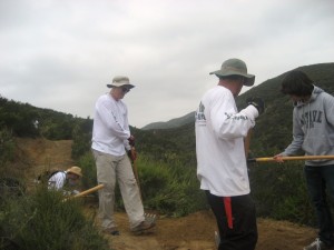
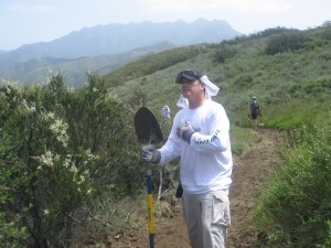
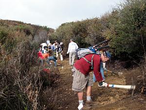
Over twenty mountain bikers joined the CORBA Trail Crew for Santa Monica Trails Days on April 24th in Point Mugu State Park. They came to give something back to the trails they love to ride.

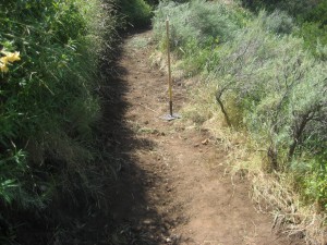
Drain placement is very important. This looks like the right spot?

CORBA crew leader Hans Keifer shuttled a few people and carried all the tools, while most of the group rode their bikes to the work location. The CORBA crew worked mostly on the upper section of  Wood Vista (aka “Backbone”) trail to add drains to eliminate channeling of water down the middle of the trail, forming a rut.

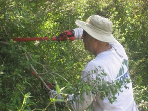
This section of the trail was really overgrown!

Volunteers also cut back brush. Not an easy task considering that a few sections of the trail were overgrown with a poison oak!

No work day could be complete without a quick ride on a newly maintained trail.

Special thanks to the Santa Monica Mountains Trail Days organizers for preparing the BBQ and for the prizes that were raffled off at the conclusion of trail work. Also thanks to IMBA/Clif for donating trail crew snacks.

Last but not least, thanks to all the CORBA crew volunteers that came to support trails. Trail work provides many benefits like creating and maintaining riding opportunities, preserving habitat, burning extra calories, interacting with fellow mountain bikers and making friends with other trail users. Now let’s go and ride! We earned it.

Rut is gone!

I pledge to come to every CORBA trail work day!

Public hearing on plans for Rancho Potrero to take place April 27

Thursday, April 22nd, 2010

From the Thousand Oaks Acorn

The city of Thousand Oaks will have a public hearing on developing the Rancho Potrero park area in Newbury Park on the south side of Lynn Road, opposite Via Andrea and Rancho Dos Vientos Drive, at 6 p.m. Tues., April 27 in the City Council chambers at the T.O. Civic Arts Plaza.

Plans for the area include a trail head for 30 cars and trailers, restrooms, a ride-in corral, a landscaped picnic grove, an outdoor classroom with benches, picnic tables, a native plant garden, 1.4 miles of new dirt trails and a 60person shaded picnic structure.

A conceptual plan has been approved by the National Park Service for changes to the adjacent Rancho Sierra Vista property to provide access to the picnic facility on Rancho Potrero land next door.

The changes include the expansion of an existing parking lot to add 27 spaces for vehicles and the addition of native landscaping surrounding the parking area.

Gated access to the picnic area, an unpaved maintenance road and a steel bridge to span a small creek would also be added.

The city’s proposal calls for expansion of the area’s boundaries in the Thousand Oaks General Plan to include 156 acres presently owned by the Mountains Recreation Conservation Authority.

The area of influence by the city and park district would be expanded to include 326 acres of Rancho Potrero property with annexation, with 306 acres proposed to be zoned as open space. The 20acre Rancho Potrero Equestrian Center site is proposed to be zoned as public land.

Nearby residents expressed concerns about lights, amplified sound, traffic and other factors when the city originally proposed a 200-person pavilion and 100vehicle parking lot in the area. The city downsized the plan to what is currently proposed after listening to those residents.

The public is invited to speak at the hearing.

For more information, call Greg Smith at (805) 449-2329.

San Gabriel Watershed Study Comments Released

Wednesday, April 21st, 2010

Back in September 2009 CORBA representatives attended a series of public hearings on the San Gabriel Watershed and Mountains Special Resources Study.  During those public meetings the NPS outlined possible ways of improving the management of the San Gabriel watershed, as mandated by Congress.

The National Park Service has released their Draft Alternative Concepts Public Outreach Results, including comments sent by CORBA and our members and supporters.  From those results, it is clear that many believed that a hybrid of alternatives A and C would be a viable option. This would provide NPS oversight and funding, and would increase the area served and protected without any apparent adverse impacts on recreational opportunities.  The published results include summaries, and links to all the individual comments received. It does not include NPS responses to any of the comments.

The NPS will now take all the feedback and comments received into consideration as they prepare the draft study report. While mountain bike access to the San Gabriels or the Angeles National Forest is not threatened by anything proposed so far, we want to keep abreast of any developments that affect this treasured natural resource.

Topanga State Park General Plan Meeting CANCELLED

Wednesday, April 21st, 2010

This meeting has been canceled. When State Parks reschedules it, we will let you know. Be a part of Topanga State Park’s future by attending a workshop on May 11, 2010 at Stewart Hall, Temescal Canyon Gateway Park in Pacific Palisades. The California Dept. of Parks and Recreation is preparing a General Plan and an environmental impact report on the potential impacts that the Plan may cause. The Plan will identify management areas/corridors and recommend goals and guidelines for the park that will address future management of park resources, land-use and development, visitor use, and operational issues. The Plan may recommend levels and types of use, capacities and visitation, special designations and protections, as well as location and type of future facilities.

It is important that the agencies hear from mountain bikers as we are key members of the park’s community and stakeholders in the park’s future. The first workshop was held September 29 and focused on the existing conditions and issue identification. State Parks personnel will present project alternatives for public consideration and comment at the upcoming meeting. For more information visit www.parks.ca.gov/default.asp?page_id=25956 and check corbamtb.com for future developments.

Santa Monica Mountains Trails Days 4/23-25 – Join us!

Wednesday, April 21st, 2010

Join CORBA and several other trail user groups for a weekend of camping, riding and trail maintenance or just come out for the day!

The CORBA crew will be riding in to work on the Guadalasca and Wood Canyon Vista section of the Backbone Trail. Driving to the trailhead and hiking in is an option too. We will work on adding drainage to the trail as well as brush work!

There is a lot to do after this winter’s heavy rains so come on out and lend a hand!

See this PDF flier and registration form.

For more information contact Hans at trailcrew@corbamtb.com

MWBA Pancake Breakfast

Tuesday, April 20th, 2010

On Sunday, April 24th, the annual MWBA Pancake Breakfast will be happening at Cobb Estate in the foothills of the Angeles National Forest.

For the past several years, the Pancake Breakfast has been held the same weekend as the Santa Monica Mountains Trail Days, a full-weekend of camping, trailwork and riding at Point Mugu. We’ve always felt it more important to be out getting our hands dirty and working on trails, and CORBA hasn’t been at the pancake breakfast for the past few years.

This year we’ll be able to do both!  A few of the CORBA volunteers will head back from Point Mugu a day early to join in the festivities at Cobb Estate.

CORBA volunteers will be there to talk about trail issues, promote trail stewardship and mountain biking, and to just be a part of the fun. If you’re not a CORBA member, you’ll be able to join on the spot. If you are, you can renew.

Come out to the Pancake Breakfast and show your support for trail stewardship in the area. Now, more than ever, our local trails need it.

See you there!

Red-Flag Protocols Are Changed to Reflect Local Conditions

Monday, April 19th, 2010
 

The National Weather Service will significantly change to the way forecasters issue red-flag fire warnings, which could mean fewer such alerts for fire-prone areas from Santa Barbara to San Diego.

The changes were made after officials determined that the current red-flag protocols were not always the most accurate precursors to major fires.

For example, the National Weather Service office in San Diego issued warnings during period of low humidity — prompting fire departments to marshal resources — even though officials believe a large wildfire is unlikely there without strong winds.

By contrast, large fires in Los Angeles County can start without high winds, pointing up another vulnerability. That was the case with last year’s Station fire, which was sparked during a period of high temperatures but light winds.

The new red-flag warning system is meant to be more selective and to take into account local geography and terrain as well as wind conditions and humidity levels. San Diego County, which is highly vulnerable during strong winds, will have different criteria than Los Angeles County’s foothills and mountains.

Weather experts found that there are a lot more ways for explosive wildfires to happen in the L.A. area than in Orange to San Diego counties.

“We hope to reduce warnings for conditions we learned don’t produce large, damaging fires,” said Mark Jackson, head meteorologist for the National Weather Service in Oxnard.

The changes have major implications not just for fire departments, which often rely on the warnings to mobilize resources, but also for residents in some hillside areas, who are restricted from street parking during red-flag alerts.

The Weather Service in San Diego has enacted the new red-flag warning criteria; Oxnard is expecting to apply them as soon as the fire season begins in earnest, possibly as early as June.

The warnings are not predictions of fires but rather of the kind of conditions that are ripe for large-scale blazes.

Weather experts regularly consult with fire officials about these conditions and about the need to tweak the criteria for determining whether red-flag warnings need to be issued.

More than a year ago, fire officials urged the Weather Service to reexamine protocols for issuing the alerts.

Both in San Diego and Oxnard, weather experts conducted historical studies of the conditions that provoked and fanned large, out-of-control fires. The differences were stark from county to county.

“California has so many microclimates. It’s not a one-size-fits-all,” said Daniel Berlant, a spokesman for the California Department of Forestry and Fire Protection, which determines firefighter staffing in part based on the red-flag warnings.

Although typically drier, San Diego County has less steep terrain and sparser vegetation than L.A. County. In part because of this, the counties farther south tend to experience conditions primed for behemoth wildfires only when there are strong winds. That was the case with the deadly Santa Ana-whipped Cedar fire of 2003, which began in central San Diego County. But weather experts there said that for years, they issued warnings based on extremely low relative humidity alone.

The new criteria call for the San Diego’s Weather Service to issue red-flag warnings generally only when extremely low humidity is accompanied by winds of at least 25 mph.

“We found very few cases of large fires” when the only weather factor was low relative humidity, said Jim Purpura, head meteorologist of the National Weather Service in San Diego.

Counties farther north, including L.A. and Santa Barbara, tend to have more mountainous terrain, thicker forests and denser vegetation. When the humidity drops low enough, these conditions can lead to large fires even without vigorous winds.

That was the case with the Station fire, which last year burned more than 160,000 acres in the San Gabriel Mountains.

“The winds were mostly calm. For the most part, that was not a wind event,” said Frank Vidales, an assistant chief for the L.A. County Fire Department’s forestry division. “But it was very hot and very dry.”

In the past, criteria for calling a red-flag warning for Los Angeles County and some other areas included relative humidity of 15% or less and winds of at least 25 mph. Under new standards, those criteria can also be met with winds as low as 15 mph, as long as the humidity dips below 10%, Jackson said.

He pointed out that based strictly on those guidelines, the Station fire may not have been preceded by a red-flag warning because the winds were so weak. But Jackson said that is why forecaster discretion will remain a key part of making the ultimate call.

Jackson said that if the relative humidity is above 15% but the winds are very strong, an alert could still be issued.

“Conversely, if the forecaster feels there’s an extremely dry fuel situation, and that we’re very volatile, they can still issue that red-flag warning without winds,” he said.

Amgen Tour of California Concludes May 23, 2010 in the Conejo Valley

Friday, April 16th, 2010
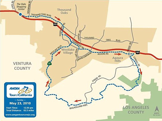
Route for the final stage of the Amgen Tour of California

Route for the final stage of the Amgen Tour of California

The Amgen Tour of California, a breathtaking 8-day cycling event covering California from north to south, is staging the final leg of its race in the Conejo Valley. Similar to the Tour de France, the Amgen Tour of California is known as the “greatest professional cycling event in North America.” The Cities of Agoura Hills, Thousand Oaks, and Westlake Village have partnered to host Stage Eight of the thrilling race plus related events on Sunday, May 23 2010.

The Course: Beginning at The Oaks Shopping Center in Thousand Oaks, the race moves along Thousand Oaks Boulevard to Hampshire Road and enters into Westlake Village on Lakeview Canyon Road from Townsgate Road. The course continues down Agoura Road passing Westlake Village City Hall and into Agoura Hills. The riders then begin a 20-mile stretch, ascending more than 1,800 feet through the Santa Monica Mountains, including the famous “Rockstore Climb.” The fan-friendly course follows this circuit four times, for a total of 80 miles, giving residents several chances to see the action “up close and personal.”

The Finish Line and a Lifestyle Festival are located on Village Glen Road, near the Hyatt Westlake. Street closures to accommodate the many activities are planned; residents can bike, walk, or shuttle to the festivities with their families.

Organizers forecast large crowds for the entire weekend. Local hotels, shops and restaurants can expect heightened business, and streets will see an increase in foot and cyclist traffic. City officials are working closely with organizers to reduce traffic impacts. Traffic plans and closures will be announced prior to the event, however, delays when traveling in and around the race route area may occur.

This is a fantastic opportunity for people to experience the largest professional cycling event in North America. For more information on the event, including related local activities and a video of the race route, or to volunteer to help with the race, visit http://www.amgentourconejo.org.