Archive for the ‘Regions’ Category

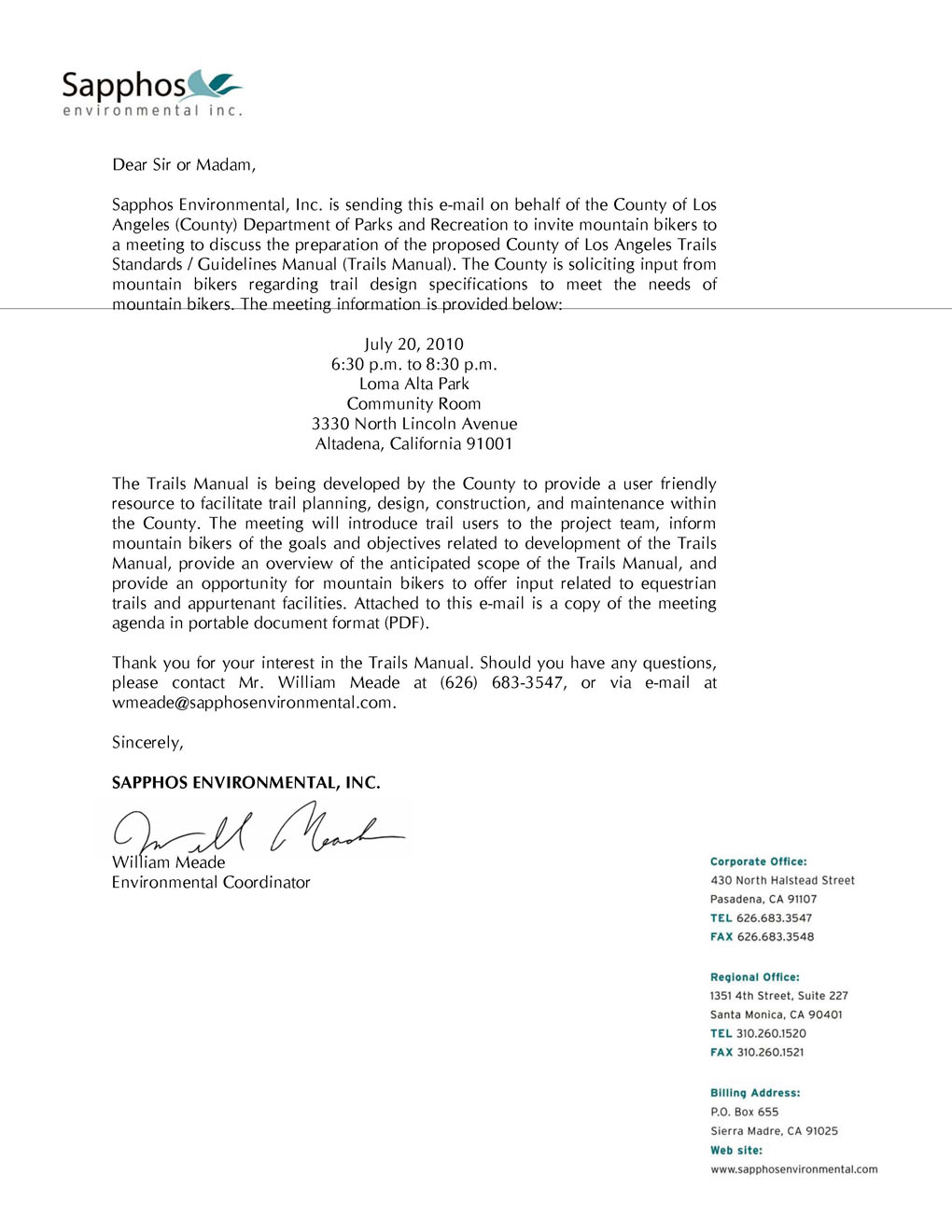
Los Angeles County trail access meeting July 20 – mark your calendar!

Thursday, July 8th, 2010

Special thanks to Youth Adventures program supporter – Simi Cycling Center

Tuesday, June 29th, 2010

CORBA would like to give special thanks to Simi Cycling Center for their generous donations of bike equipment and discounts on bike parts used by our Youth Adventures program.

Because of thoughtful donations such as these, many inner-city and at-risk youth will be able to enjoy the experience of the natural beauty of the Santa Monica Mountains.

Youth Adventures was implemented in 1993 as a way of reaching out to groups of children that have limited exposure to public parklands. Mountain bike rides are scheduled with organizations that serve disadvantaged, inner-city or at-risk youth from ages 8-17 and are held in the Santa Monica Mountains National Recreation Area. Youth Adventures supplies the bikes, helmets, gloves, water and snacks.

Youth Adventures – and all CORBA programs – is an all-volunteer program and relies on donations of not only funds, but mountain bikes and accessories as well. Please help us keep this wonderful program going by giving what you can. Monetary donations can be given online or checks can be sent to: CORBA, PO Box 57576, Sherman Oaks, CA 91413. CORBA is a 501(c)3 non-profit organization and donations are tax deductible. If you would like to donate some equipment you’re no longer using, please contact us at youth@corbamtb.com.

Backbone Trail Maintenance June 2010

Friday, June 25th, 2010

By Mark Langton 

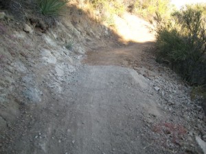
Latigo Canyon section of the Backbone Trail just west of Newton Mtwy.

Over the last couple of weeks some new maintenance has occurred on the Backbone Trail along sections at Solstice and Latigo Canyons (National Park Service-held property). The crew that did the work is unknown at this time, but it is assumed that it was National Park Service or contracted by them.  It was very professionally done. Hand-worked tread leveling and minor widening has taken place, with a few sections being filled in with soft dirt. The depth of these short fill sections does not exceed one inch at their deepest. 

The trail heading east from Newton Motorway: Natural rock formations along the upper section and at the bottom as it enters the canyon bottom  have been left intact.  Switchbacks were left intact or filled slightly. 

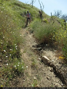
Another section of the Backbone West of Newton Mtwy. where some rock was left in the tread.

The section of trail most affected is directly to the west of Newton Motorway. The tread surface of the first half-mile of this mildly rolling, somewhat technical section has been leveled and filled, and slightly widened, and three or four short rocky sections were removed, making it much less technical. Further to the west, where the trail has notoriously seen heavy erosion due to its steep pitch, it has been slightly re-routed and leveled, and several drainages have been added to assist with water runoff. This is a significant improvement for both uphill and downhill travel.  When contacted by CORBA, Melanie Beck, an outdoor recreation planner for the National Park Service, stated that the work was considered routine and done for resource maintenance and safety concerns. At the time of this report no information was available regarding any additional trail work in the immediate future. 

Over the last 23 years I have seen this type of trail work and it is indeed not out of the ordinary, nor is it overly aggressive (of which I have also seen). In fact, the soft sections of tread surface resemble that of a just-completed new trail. Compacting will take place over the next few months with use and moisture, and hydro-erosion will begin sculpting ruts and other natural formations. Climbing the filled sections was a little more work than usual, but they should get packed down soon enough. And descending required only slightly more attention paid to washing out. I am a little disappointed that the short rocky sections were removed, but that’s a personal selfishness—the trail is still a blast and is one of the best and most scenic sections in the Santa Monica Mountains National Recreation Area.

Art’s Trail Closure Update

Friday, June 25th, 2010

By Mark Langton

Recently I, on behalf of CORBA, sent an email to State Parks District Superintendent Al Pepito regarding an email he sent us. It included a forwarded email from Maintenance Supervisor Dennis Dolinar explaning why they were now closing trails that have for many years been used with knowledge of both the rangers and the maintenance department. (Note: Ranger and maintenance staffs often work independently, and maintenance can and does make decisions without ranger and/or public input.)

Below are the questions I posed and the answers we received from Al Pepito.

CORBA: What is the timetable of the review period Dennis [Dolinar] references in the end of the second paragraph? (From Dennis Dolinar’s email: “It is our intention to keep this area closed to all users until such time as a complete evaluation of the park’s resources can be completed. There will be no attempt to actually remove the trails themselves unless that internal review warrants it.”]

AP: The review process can take anywhere from a year to 18 months.

CORBA: We find it odd that at this point in time CDPR is expending resources for efforts to close prescriptive trails that clearly are not damaging the resources significantly, if at all. Unless there are native resources that are being impacted, there is no clear reasoning behind closing the trails. I understand that it may be a liability concern, but even then, why weren’t these trails closed years ago?

AP: This is a non-system trail not recognized by in our facility inventory.  Thus it has never been through the CEQA review process or permitting process.  Just because it exists and there is use, does not give the trail status as a recognized facility.  It is a resource maintenance issue that needs to be addressed through restoration practices.

CORBA: We are also concerned that your volunteer partners (MBU, CORBA Trail Work Crew) are not being given ample notice in order that they might be able to inform both their own members and the public which they represent.

AP: Without a Trails Supervisor everyone involved are not being communicated with properly.  I have asked that the core staff of the district sit down at our next meeting to discuss this issue.  The position has been advertised and hope to have one in place by the end of July or sooner.

Obviously Ranger Pepito’s answers raise other questions, such as whether or not they intend to perform a CEQA (California Environmental Quality Act) assessment. And of course, if the review process takes from a year to 18 months, wouldn’t that mean the trails will be reclaimed by whatever plant life exists–assuming no one uses the trails? CORBA will continue its involvement with this situation.

America’s Great Outdoors Initiative

Wednesday, June 23rd, 2010

The Obama Administration has announced a second round of Listening Sessions for the America’s Great Outdoors Initiative.  These listening sessions will be crucial opportunities for the trail users to bring the Trail issues and the nation’s trail systems into the spotlight as a priority for the Obama Administration.

CORBA volunteers will be in attendance, and we hope that a large mountain biking contingent will attend the Los Angeles meeting on Thursday, July 8, 2010, 3:00 pm to 7:00 pm.

In the event you are unable to participate in person, please submit your comments and stories via the America’s Great Outdoors website at http://www.doi.gov/americasgreatoutdoors/.

Below is the official announcement

NOTICE OF A PUBLIC LISTENING SESSION ON

THE PRESIDENT’S AMERICA’S GREAT OUTDOORS INITIATIVE

Please join senior representatives of the U.S. Environmental Protection Agency, the White House Council on Environmental Quality, the U.S. Department of Agriculture, the U.S. Department of the Interior and the U.S. Department of Defense for a public listening session and discussion in Southern California on conservation, recreation, and reconnecting people to the outdoors. The session will be held July 8 from 3:00 pm to 7:00 p.m. at Occidental College in Los Angeles.

This past April, at the White House Conference on America’s Great Outdoors,President Obama launched the America’s Great Outdoors Initiative to developa 21st century conservation agenda and to reconnect Americans with ourgreat outdoors.  The President asked his leadership team to engage the fullrange of interested groups, including State and local governments,community-based organizations, recreation and conservation groups, sportingorganizations, youth groups, and others.

This Los Angeles-based listening session, one of several being held around the country, offers an opportunity to hear and describe the challenges and opportunities we face in land and water conservation, in improving recreational opportunities for a large urban population, and in restoring and conserving our vital natural and cultural resources to enable access to a broad array of outdoor recreation.  The July 8th public listening session and discussion is an opportunity for the leaders of the America’s Great Outdoors Initiative to hear from you and other voices in the region about solutions for building a 21st century conservation and recreation agenda and for reconnecting people with the outdoors.

Here are the details:
Listening Session and Discussion Information:

  • When:  Thursday – July 8, 2010, 3:00 pm to 7:00 pm
  • Where:  Thorne Hall, Occidental College, 1600 Campus Road, Los Angeles, CA  90041  (See map at http://www.oxy.edu/x6307.xml)
  • Who:  Senior national and local leaders from US EPA, CEQ, USDA, DOI and DOD will be present to hear your recommendations and to participate in a conversation with you about America’s Great Outdoors.
  • Register: This event is free and open to the public.  For planning purposes, please register by Thursday, July 1st by sending an email to sun.nelly@epa.gov with your name, the name of the organization with which you are affiliated, if any, your telephone number and email address.  We will endeavor to accommodate everyone.

In the event you are unable to participate in person, please submit your comments and stories via the America’s Great Outdoors website at http://www.doi.gov/americasgreatoutdoors/.

If you have questions, please call Nelly Sun at (415) 947-4237.  We look forward to your participation – please join us!

Trailwork Days: Doc Larson Trail June 26, July 10

Monday, June 21st, 2010

CORBA will be assisting Chris Sercel with his Eagle Scout project to restore the Upper Doc Larson trail in the Sunland area of the Angeles National Forest. Doc Larson trail is a multi-use singletrack. We’ll be working on the upper section, and a singletrack connector trail that ties it into a loop with the surrounding fire roads. Meet in Lake View Terrace at the address above and either carpool or ride to the trailhead.  Meet at 7:30 at the address listed on the CORBA trailwork calendar, and we’ll carpool or ride up from there. Be sure to bring sturdy shoes, long pants and long sleeve shirts. We’ll be doing brushwork and some treadwork. This area is still within the Station Fire closure area, so we’ll be working with special permission from the Forest Service. A second day of work will happen on July 10th to complete the project. Lunch will be provided so please RSVP to csizzles99@gmail.com and/or to trailcrew@corbamtb.com, or on the CORBA Google Calendar if you have a google account.

Update on the Art’s Trail Closure

Wednesday, June 16th, 2010

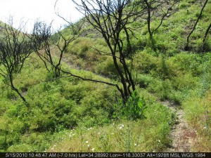
Last week we reported on the closing of the popular Art’s Trail in Pt Mugu State Park. Since then we have heard second-hand reports of more detailed reasons why the trail and its connectors were closed, namely, that there were archeologically interesting areas in the vicinity, and also sensitive plant species. Here is the response we got from Dennis Dolinar, District Maintenance Chief of the Angeles District of the California State Parks:

Good Morning !

While recently working with several people on an updated official park map for Point Mugu SP, I became aware of a set of unauthorized trails that had been developed by unknown individuals in the section of the park that roughly runs parallel to the Ranch Center Road and between the Sage and Sin Nombre Trails. These illegal routes, which likely started out as simple game trails only used by wildlife, pass through sections of the park that have never been thoroughly reviewed by our resource staff with regard to possible impacts to both natural and cultural resources. Also, the trails themselves have never been evaluated by staff regarding safe and appropriate routing through the varied terrain they cross. Subsequent conversations with our staff brought to light that there is at least one recorded culturally sensitive site in the immediate area and the entire meadows area should be further investigated . There also are as yet unconfirmed reports of unusual seasonal plant life in the area.

The opportunity to close these unauthorized routes presented itself last month and, as the District’s Chief of Maintenance, I worked with a local boy scout troop to block-off the four obvious access points to the area in question. It is our intention to keep this area closed to all users until such time as a complete evaluation of the park’s resources can be completed. There will be no attempt to actually remove the trails themselves unless that internal review warrants it. Ultimately, these routes of travel could possibly re-open but that  has yet to be determined.

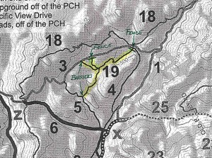
Just to make sure that we are talking about the same set of unauthorized trails, I’m attaching a copy of a portion of a private party trail map that I’ve taken off the Internet. The person that produced that map identifies these routes as being Art’s Trail ( #19 ). I have also heard these same routes called by other names by park visitors.

Any support that the CORBA membership can give us to manage this situation would be greatly appreciated as we strive to protect the park, it’s resources and all our visitors.

I hope this helps you better understand the situation.  Please share this information with others in your group.  ===> Dennis D

Despite the above email, questions still remain surrounding this issue and CORBA will continue to pursue any and all information pertaining to this closure.

For more, see the June 25th update on this issue.

200 Acres of New Open Space in Calabasas

Friday, June 11th, 2010

From the Calabasas Acorn

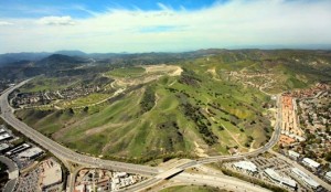
A 200-acre swath of pristine, oak-studded land at Las Virgenes and Mureau roads in Calabasas will be designated as permanent open space after being purchased by Los Angeles County and the Mountains Recreation and Conservation Authority.

The land is referred to as Firehouse Hill because of its proximity to Fire Station 125 in Calabasas, but others call it the Continental Communities or Zuckerman property after the developer,  Robert Zuckerman, who once wanted to build homes and a shopping center on the site.

The land will be dedicated as permanent open space in a 10 a.m. ceremony on Sat., June 12.

“I’ve had my eyes on purchasing this land for nearly 15 years,” Supervisor Zev Yaroslavsky said. “The National Parks Service has viewed this property as a top priority for acquisition because it is in a wildlife corridor and has other resource value.”

Yaroslavsky said that when he took office in 1994, Zuckerman took him on a tour of his property,

“That was the biggest mistake he could have made,” Yaroslavsky said. “My first look at the dozens of mature oak trees and the pristine nature of the property convinced me on the spot that the property should be part of the Santa Monica Mountains park system.”

Zuckerman lost the property more than 10 years ago. It was eventually purchased by Los Angeles real estate broker/developer Fred Sands.

Sands also wanted to develop the property, but Yaroslavsky made it clear that a major zoning change would not be allowed.

The mountains authority purchased the land for $6.25 million.

“Overall, this is one of the most significant acquisitions that has ever been made in the Santa Monicas,” Yaroslavsky said. “This property is the gateway to the Santa Monica Mountains. . . . More people see this property every day driving along the 101 than virtually any other part of the Santa Monica Mountains.”

To attend Satruday’s dedication, take the 101 Freeway to the Malibu/Las Virgenes exit and head north about 1,000 feet.

Sullivan Canyon Closure Update

Tuesday, June 8th, 2010

From Sharon O’Rourke of The Gas Company

As of Friday, June 4th, we completed the initial access road repair work.  Access from Mulholland was re-opened to the public as of Saturday, June 5th.

On Wednesday, June 23rd, we will start the pipeline protection work which will include the final planned access road repairs and covering the remaining pipeline exposure areas with the concrete mats.  This will require closing public access to Sullivan Canyon at both Mulholland and Queensferry Road.  The closure is necessary for public safety due to the equipment needed for the placement of the mats.   The work is estimated to take 3-4 months.

Update August 31: Apparently the canyon will be closed until November 12th.

Las Virgenes “Tar Pits” are a Natural Phenomenon

Friday, June 4th, 2010

Just three days ago a local rider contacted CORBA about an oily sheen seen in some of the still water sections and mud holes along Las Virgenes Canyon. This appeared to be a new phenomena, and the thick, dark mud and oily sheen look suspiciously like petroleum or oil products to the untrained eye. While there are oil pipes in the area, they don’t pass under the creek at this particular area, and it is somewhat alarming to come across.

Nobody at CORBA was familiar with this problem, so we alerted the MRCA. Chief MRCA Ranger Walt Young toured the area and took water samples at the three water crossings. He reported that the petroleum like sheen was present, but there was no smell of petroleum, which is common in other areas where natural seepage occurs. There was also plenty of life in the stream in the form of tadpoles and plant life.

A sample of the dark muck which has the appearance of tarry oil, dries to a fine brown powder with no evidence of the presence of oil.

The local Pipeline operator was also brought in for an assessment. Their pipes are pressurized to 500 PSI, and they noted that any leakage at that pressure would be immediately evident. There was no evidence of any leakage. Also, the dark oily-looking muck would float if it were oil-based, and there would be a strong odor of oil.

The final conclusion is that whatever seepage is there is a natural phenomenon, and is not a cause for concern. It may be the result of an above average rainfall year, or recent earthquake activity, but is not from a man-made source.

There are places in Southern California (Tar Creek in the Sespe Wilderness comes to mind) where large amounts of oil and tar do seep to the surface naturally and globs can be found floating down the stream. This reported seepage along Las Virgenes Canyon is much more subtle.

If anybody riding or hiking any trail sees anything suspicious or out of the ordinary, it is always best to contact the local land manager, law enforcement, rangers or of course you can always contact CORBA and we will notify the land manager. Thanks to rider Gary Artis for bringing this to our attention so that we could have it investigated further.