Archive for the ‘Regions’ Category

Inaugural Youth Adventures ride at Paramount Ranch

Wednesday, August 11th, 2010
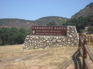
Park entrance on Cornell Road, Agoura Hills CA

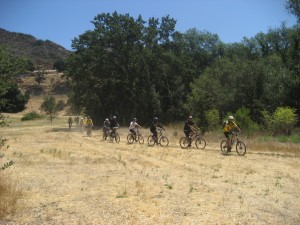
The Santa Monica Mountain National Recreation Area’s Paramount Ranch became a new location for CORBA’s Youth Adventures program rides. The first ever ride at this location took place on Saturday, August 7th, 2010.  If you have ever had a chance to visit Paramount Ranch then you already know the beautiful landscape that surrounds this area. The Youth Adventures program was created to share this beauty with  inner city children. And what is a better way than taking them bike riding through the rolling hills and share the rich history of this place with them?

Youth Adventures began in the summer of 1993 and operates twice per month year-round, serving over 350 kids annually. It was implemented as a way of reaching out to groups of children that have had limited exposure to public parklands. Mountain bike rides are scheduled with organizations that serve disadvantaged, inner-city or at-risk youth from ages 8-17 and are held in the Santa Monica Mountains National Recreation Area. CORBA supplies the bikes, helmets, gloves, water, snacks and transportation. Rides are operated by Mountain Bike Unit volunteers. For more information visit Youth Adventures web page

Taking to the trails

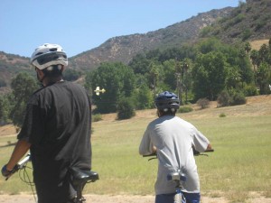
Taking a break watching a radio controlled airplane


Los Angeles Mayor Villaraigosa Announces Aug. 16 As Date For City ‘Bike Summit’

Thursday, August 5th, 2010

From LAWeekly

Mayor Antonio Villaraigosa announced on Tuesday that his aforementioned “Bike Summit” would happen Aug. 16 (from 9:00 to 11:00 a.m. in the board room of the Metropolitan Transportation Authority, One Gateway Plaza, downtown).

Bike activists, city officials, transportation planners and police will discuss a 1,600-mile city bike path plan, police enforcement of traffic laws as it concerns cyclists and integration of “bike ways” with the area’s bus and rail network, according to the mayor’s office. Mountain biking is illegal on unpaved roads and trails in all LA City parks.

“Let’s get together and talk about what we need to do to make the streets safer for cyclists,” said Mayor Villaraigosa. “Whether you depend on your bike for commuting or just take it out for fun, I invite you to come to the Bike Summit to talk about your experiences and learn about what we’re doing in Los Angeles to make streets safer for everyone.

Mayor Villaraigosa first announced his plans for the Bike Summit in July.

Villaraigosa was famously involved in a bike-versus-cab accident earlier this month that left him with a broken elbow and newfound respect for cyclists’ rights.

$700,000 sought to fix trails, roads destroyed in Station fire

Wednesday, August 4th, 2010

From the Glendale News-Press and the LA Times 

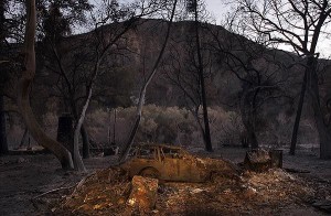
An incinerated car sits in the devastated hamlet of Vogel Flats, which is along Big Tujunga Canyon Road in the Angeles National Forest, in September of 2009 . Credit: Luis Sinco / Los Angeles Times

Roughly $700,000 has been earmarked for improving the forest roads and trails that were destroyed last year during the Station fire, officials said. 

Rep. Adam Schiff (D-Burbank) secured the earmark in the Interior Appropriations bill for restoring the 160,577 acres of scorched landscape that’s in severe need of restoration. 

“The roads and trails have been eroded and degraded,” said Richard Toyon, former forest ranger and president of the local nonprofit Volunteers Organizing in Conserving the Environment. 

Trekking on some trails in the forest is challenging because they eventually disappear, he said, and some roads and trails are no longer recognizable. 

The bill must still pass the full House and Senate before reaching President Obama’s desk, said Schiff’s spokeswoman, Maureen Shanahan. 

If the bill is approved, the funding would be allocated to the U.S. Forest Service to handle the restoration work. 

“This funding will help repair the roads and trails that were damaged in the fire to restore safety and access for families to enjoy one of California’s greatest natural resources,” Schiff said in a statement. 

Engineers for the Angeles National Forest have estimated that about 300 miles of roads and 225 miles of trails were harmed during the Station fire, according to Schiff’s office. 

Damage to roads and trails worsened due to erosion and landslides during the winter. 

Gov. Arnold Schwarzenegger on Feb. 11 declared the footprint of the fire a disaster area. 

Some of the roads have been closed due to the extensive damage, and trails that have been deemed unsafe for hiking have been off limits. 

Officials are planning to focus the funding on the most critically damaged roads with the largest access points. 

Some road improvements include installing retaining walls, reconstructing low water crossings, grading surfaces, repairing drainage, repaving and restoring signage, according to Schiff’s office. 

Trail improvements include drainage repairs, re-stabilizing slopes and restoring walking surfaces. 


Angeles Crest Highway closures cause confusion and frustration

Wednesday, July 28th, 2010

From the Los Angeles Times  

Hundreds of hikers and bicyclists have been spotted in areas closed for construction. Some are genuinely unaware of the roadblocks along the popular trails, while others trespass out of defiance.  

With a small day pack strapped to his back, Scott Groves set out from his home in Pasadena to the foot of the Mt. Wilson Trail in Sierra Madre. He climbed seven miles to the top of the mountain and then proceeded down Mt. Wilson Road before happening upon the closed portion of Angeles Crest Highway.  

About 20 miles of the 66-mile Angeles Crest Highway is closed for construction. The $16.5 million in road repairs is expected to be completed in November. (Raul Roa, La Canada / July 6, 2010)

“It wasn’t even on my radar that this was closed,” Groves said as he stopped to fill his water pouch near the intersection of Angeles Crest and Angeles Forest highways. “I had read that it was clear to come up from the Palmdale side, so I figured everything here was cool.” 

About 20 miles of the 66-mile Angeles Crest Highway, from La Cañada Flintridge to Mt. Wilson Road and 25% of the Angeles National Forest remain off-limits to the public as construction crews rebuild pieces of the route that winter storms caused to wash out. The $16.5 million in repairs, contracted out to Thousand Oaks-based Burns Pacific Construction, is expected to be completed in November.  

Meanwhile, the closures continue to frustrate and confuse those seeking to access some of the most popular portions of the San Gabriel Mountains. Hundreds of motorcyclists, bicyclists and hikers have been spotted in restricted areas, according to officials from the California Department of Transportation and U.S. Forest Service. Some of the trespassing seems to be due to genuine misunderstanding about the status of different portions of the road and forest.  

In late June, Caltrans Public Information Officer Patrick Chandler intercepted a dozen members of a family setting off on a hike.  

“They parked at Angeles Forest Highway where it meets Angeles Crest and walked up to the closure and were going to go down to Switzer Falls,” Chandler said.  

He had to explain to the family that the popular trail was closed. But hikers have not been alone in their confusion: Road repair workers reported that Los Angeles County public safety personnel have attempted to respond to emergency calls by traveling north on Angeles Crest Highway, only to hit roadblocks.  

Los Angeles County Fire Battalion Chief Mitch Brookhyser confirmed one such incident. On May 31, units from La Cañada Flintridge’s Station No. 82 responded to a call of a motorcycle that had gone off the side of Angeles Crest, Brookhyser said. The responders were forced to stop at a locked gate. The call was canceled minutes later, he said.  

Many of those entering closed portions of the highway and forest, however, are doing so with overt disregard for clearly posted signs, Chandler said. A Las Vegas motorcycle crew posted on its blog a dozen photos of members circumventing closures and being cited by the California Highway Patrol during an outing in May.  

And on a recent afternoon, Jim Blake, a Lake View Terrace resident and avid bicyclist, stopped to watch workers repair a 200-foot-deep washout near Brown Canyon — the largest of the two dozen damaged spots. He had pedaled 27 miles, traveling on Big Tujunga Canyon Road, Angeles Forest Highway and Angeles Crest Highway.  

“Big Tujunga Canyon was open,” Blake said. “Then they had some signs on Angeles Forest Highway that it was closed ahead, but cars could go through. At Angeles Crest Highway they had a gate, but I could get through there.”  

He enjoyed having the road to himself, Blake said, although he did have to steer clear of a couple of dump trucks.

Roger’s Road Trail Maintenance Report

Wednesday, July 21st, 2010

Thanks to all who came out on Saturday 7/17/10 to help out with some brush clearing on Rogers Road in Will Rogers State Historic Park/Topanga State Park. It was a hot day and that made it tough. We had 13 volunteers show up.  We hiked in just over 2 miles to the lone Oak and worked back from there. We managed to clear 1/2 mile of the trail. There are a few more miles that are getting very overgrown so we will be scheduling a few more work session in the next few months.

View the photo gallery of Saturday’s trailwork.

New Thousand Oaks bike path will create a shortcut under 23 freeway

Thursday, July 15th, 2010

From the Thousand Oaks Acorn

A new 1.2-mile bike path in Thousand Oaks is slowly taking shape.

The contractor has until March 2011 to finish the $1 million Conejo Creek Park Bicycle Path but may get it done by the end of the year, said city public works engineer Christopher Lynch. It will take three months to have a 20-foot-long by 10-foot-wide pedestrian footbridge made.

“The construction is 100 percent funded by American Recovery and Reinvestment Act funds,” Lynch said.

The 12-foot-wide bike path will begin at the intersection of Janss Road on Conejo Valley Unified School District headquarters’ property and proceed south through Conejo Creek Park South.

That park is usually for soccer and is the location of Conejo Valley Days in the spring.

The path will continue under the 23 Freeway, carving a shortcut to where Gainsborough Road dead ends.

Getting from the beginning of the path where it terminates at the end of the path by city streets would cover 2.5 miles, Lynch said.

The shortcut will help active people get to the teen center, the senior center, the library and Conejo Creek Parks north and south more easily. The path will be made of asphalt, the same material found on many city streets.

“It’s a bike path, but in reality people will be walking on it too, and pushing strollers, using (inline skates) or jogging,” Lynch said.

Conejo Recreation and Park District and the school district are partnering with the city by allowing the path to be on their property. The city is paying the costs and managing the construction, Lynch said.

The park district may someday add a horse path beside the bike path.

Currently the city has a total of 1.2 miles of bike paths, so the new route will double that figure. There are a long-range plans to build more paths, Lynch said.

A future bike path could be constructed from Willow Lane to Haaland Drive, near the city’s transportation center on Rolling Oaks Drive off Rancho Road. That path would be hilly, as it cuts through the California Department of Transportation right of way, but it would shorten the distance for bicycle riders.

The $148,000 design costs for the Conejo Creek Park Bicycle Path were paid with city funds and $16,000 from a federal Congestion Management and Air Quality grant.

The American Recovery and Reinvestment Act grant was for $1.3 million. Total costs for construction are $1.07 million The remaining $229,641 of the grant will be used for street repair.

Saturday July 17 CORBA trail maintenance day at Will Rogers State Historical Park

Tuesday, July 13th, 2010
Where: Will Rogers State Historic Park (map)
When: 7:30am – 2:30pm
Rogers Road is a very popular six mile single track trail in Topanga State Park. The trail has become so overgrown most trail users are avoiding it. We need a lot of help to get this one cleared! We will meet at Will Rogers State Historic Park at 7:30 am. We will hike in from the trailhead to the Oak tree (approximately 2 miles) and work our way back from there. Riding in is an option too. If you want to ride in and meet us be sure to RSVP to trailcrew@corbamtb.com so we can be sure to have enough tools for everyone! Bring sturdy shoes, water, snacks, sunscreen, hat and preferably long pants and shirt. CORBA will provide lunch for the trail crew after the work day is done.

CORBA Endorses Prop 21

Saturday, July 10th, 2010

Passage of Proposition 21, slated for the November 2 state ballot, will help create the State Parks and Wildlife Conservation Trust Fund, providing a stable source of funding for the state park system.

See below for the full article from Yes On 21 For State Parks’ web site. For more information go to yesforstateparks.com. You may also want to consider endorsing the proposition by going to yesforstateparks.com/get-involved/become-a-supporter/organization-endorsement-form.

—————————————————-

From the vast stretches of sandy beaches along California’s magnificent coastline to the towering redwoods and much-needed recreational areas in the state’s bustling urban centers, California’s 278 state parks are priceless public assets and a vital legacy for our children and grandchildren.

But the state’s parks are in peril. Budget cuts are starving state parks, causing them to fall severely behind in needed maintenance and repairs. Twice in the past two years, state parks were on the brink of being shut down. Only last-minute budget reprieves kept them open. Last year, 150 state parks were shut down part-time or suffered deep service reductions because of budget cuts, and more park closure proposals and budget cuts are expected this year. California’s parks are becoming less available to the public and are at serious risk of irreversible damage.

That is why Prop. 21, slated for the Nov. 2 statewide ballot, will create the State Parks and Wildlife Conservation Trust Fund. The fund will provide a stable, reliable and adequate source of funding for the state park system, for wildlife conservation and for increased and equitable access to those resources for all Californians.

Prop. 21 will give California vehicles free year-round day-use admission to state parks in exchange for a new $18 vehicle license fee, which will be specifically dedicated to state parks and wildlife conservation. The surcharge will apply to most California vehicles, including motorcycles and recreational vehicles, and will be collected by the Department of Motor Vehicles as part of the annual vehicle license fee. It will not apply to larger commercial vehicles (those subject to the Commercial Vehicle Registration Act), mobile homes or permanent trailers.

Supporters of Prop. 21 include The Nature Conservancy, Peninsula Open Space Trust, California Teachers Association, California Federation of Teachers, Public Health Institute, California Travel Industry Association, Boy Scouts of America, AFSCME California PEOPLE, Sierra Club California, Audubon California, California State Lifeguard Association, California Lodging Industry Association, Latino Health Access, California State Conference of the NAACP, California State Parks Foundation and Save the Redwoods League.

California State Parks in Peril Because of Chronic Underfunding

·         California’s parks, once considered the best in the nation, are falling apart because of chronic underfunding. Roofs andsewage systems leak, restrooms are not cleaned regularly, bridges have collapsed, trails are washed out, campgrounds and visitor centers are shuttered and buildings and structures throughout the system are badly deteriorated.

·         With no reliable source of funding, the state parks have accumulated a backlog of more than $1 billion in maintenance and repairs.

·         Thousands of scenic acres are closed to the public because of reductions in park rangers, and crime has more than doubled. Destruction and vandalism of the parks themselves has grown fourfold, and beachgoers are often unprotected because of decreases in lifeguards.

·         The parks are in such peril that the National Trust for Historic Preservation has named California state parks one of the 11 most endangered sites in America.

Protect State Parks and Wildlife by Creating a Conservation Trust Fund

·         To ensure Californians have the high-quality, well-maintained state park system they deserve, Prop. 21 will establish the State Parks and Wildlife Conservation Trust Fund in the state treasury where, by law, it could only be spent on state parks, wildlife conservation, natural lands and ocean conservation programs. The Legislature couldn’t reallocate the Trust Fund for other uses.
·         Funding for the Trust Fund will come from an $18 annual State Park Access Pass surcharge on all California cars, motorcycles and recreational vehicles that will be collected by the Department of Motor Vehicles as part of the annual vehicle license fee. Larger commercial vehicles (those subject to the Commercial Vehicle Registration Act), mobile homes and permanent trailers will be exempt.

·         California vehicles subject to the State Park Access Pass surcharge and all occupants of those vehicles will receive free day-use admission to all state parks throughout the year, which currently costs as much as $125 for an annual pass or $10-$15 per day. Out-of-state vehicles will continue to pay full entrance fees at parks.

·         Trust Fund revenues will amount to approximately $500 million each year (based on about 28 million registered vehicles) and 85 percent will be allocated to state parks and 15 percent to other state wildlife and ocean protection agencies.

·         With a new dedicated revenue stream in place, more than $130 million of General Fund dollars -that provide a portion of overall state park funding -will now be available for other vital needs, like schools, health care, social services or public safety.

State Parks Strengthen the Economy and Serve as a Legacy for Future Generations

·         State parks strengthen the economy by attracting millions of tourists, who spend $4.32 billion annually in park-related expenditures in California, according to a recent study. It found state park visitors spend an average of $57.63 in surrounding communities per visit. They generate so much economic activity that every dollar the state spends on state parks generates another $2.35 for California’s treasury.

·         Every year, there are nearly 80 million visits to state parks, where the abundance of outdoor activities entices visitors toexercise and lead healthier lifestyles. Parks contribute to public health by protecting forests and natural areas that aresources of clean air and water and by combating climate change by reducing greenhouse gases. They also protect the state’s wide diversity of plants and animals, preserve an unparalleled collection of historic and cultural assets and provide exciting educational opportunities for young and old alike.

Tough Fiscal & Accountability Safeguards to Protect the Voters’ Investment…

·         The Trust Fund will be subject to an independent audit by the State Auditor every year. The findings will be released to the public, placed on the California Department of Parks and Recreation’s website and submitted to the State Legislature for review as part of the state budget.

·         A Citizens’ Oversight Committee will be created to ensure funds from this measure are spent appropriately.

·         Audit, oversight and administrative costs of this measure will be limited to just 1 percent of the annual revenues.

Unless we take steps now, California’s parks, a priceless community asset, will continue to close or suffer deep service reductions that threaten our state’s economy and job-creation. You can also visit YesforStateParks.com for more information, or endorse at http://yesforstateparks.com/get-involved/become-a-supporter/organization-endorsement-form

The Great Outdoors Initiative Comes to L.A.

Friday, July 9th, 2010
On July 8th CORBA volunteers attended a “listening session” with such dignitaries as Mayor Antonio Villaraigosa, Secretary of the Department of the Interior Ken Salazar, E.P.A. Administrator Lisa Jackson, Chair of the White House Council on Environmental Quality Nancy Sutley, Undersecretary of the U.S. Dept. of Agriculture Harris Sherman and Asst. Secretary of the Army (Civil Works) Jo-Ellen Darcy.  Also represented were Los Angeles City and County department heads, and leaders of hundreds of NGO’s all gathered for this“listening session” by Obama’s environmental “dream team” on-stage.
Each panel member spoke about the challenges in providing recreation, conservation and appreciation of the great outdoors. The speakers discussed how Los Angeles is continually misrepresented as the capital of sprawl, a car culture, a place lacking in the great outdoors. Many Angelenos already enjoy the great open spaces that surround us in the San Gabriels, Santa Monicas, the Arroyo, the LA River and Griffith Park. Most people in the city, however, are unaware of just how much open space is so close by.

An inspiring video outlining the challenges and achievements of the nation’s public lands was shown. The video is available on the DOI web site.

In the audience, local government officials sat side by side with advocates, educators, non-profit directors and conservationists to share their experiences and express their views to the federal representatives. The room was packed to capacity, with over 800 people in attendance.

These high-level Administration officials and White House Cabinet members listened to comments from the audience for about an hour, after which a more intimate opportunity for feedback was offered by way of break-out sessions.

During the public comments, many pointed out the noticeable absences from the panel: Transportation and Education.
Many contended, and CORBA agrees, that getting people outdoors can be achieved by either bringing the people to the outdoors by providing a  better public transport network that reaches the surrounding open space as well as existing city parks; and walkable, livable streets where bicycle transportation and recreation is encouraged and welcomed.

The second option is bringing the outdoors to the people. This is exemplified by grass-roots movements like Ciclovia where several city streets will be closed on September 12th to create a one-day 13 mile long playground for riding, walking and just being outside. The initiative seeks a better balance in zoning and utilization of park land, development and infrastructure: building more livable communities. It encourages urban parkland development and recreation.

Much was said by panelists and public about the need to protect natural resources. In CORBA’s opinion not enough was said about the need for access to those protected resources as recreational opportunities. During breakout sessions CORBA board member Steve Messer brought up the need for alternatives to wilderness designations which exclude user groups and make public land more inaccessible for the majority. Access and conservation are synergistic in many ways: when people can’t or don’t experience these lands, they don’t develop a sense of stewardship or understand the need to conserve.

CORBA’s mission includes preservation, stewardship and access for mountain bikers and the trail systems they ride. Our Youth Adventures, Introduction to Mountain Bike Skills clinics, and Trail Crew programs give people a sense of those values.

Messer also brought up the fact that bicycling is a life-long health-promoting recreational activity. He talked about the Interscholastic Cycling League and the collateral long-term changes it will bring about. Unlike more traditional high school team sports, high school mountain bikers are much more likely to continue to participate in this health-promoting activity well beyond their high school years. He stressed the need to support youth programs, high school programs, and trail access for all users in our City Parks (bringing the outdoors to the people).

For such a diverse group, the breakout session in which CORBA participated went very smoothly, with all the participants tending to agree on most things: The need for funding; The inclusion of alternative transportation; The need to coordinate agencies; The need to bring the classroom outside. Equestrian representatives talked about their youth programs in Compton that allow kids the opportunity to experience a ranching lifestyle. A science teacher talked about his inability to take kids out into the field because of budget cuts. Others referred to “every child left inside, AKA no child left behind.” Other salient points were expressed: the lack of communication and cooperation between government agencies; the need for federal governments to work more at the local level while allowing locals to have a bigger hand in managing lands.

In all, the process went well and–at least in the breakout session CORBA attended–all felt they were heard, and all had something to say. There was no animosity between any of the groups present, from the Sierra Club, to CORBA, to the equestrian community, OHV community, to educators and local government representatives.  If anything, there seemed to be a subtle acknowledgement that all those present have a love of the outdoors, despite the differences in how we experience it.

The goal of this initiative is to produce a set of recommendations expected to be ready in November. All of the comments were recorded and will be considered. The recommendations that result from these listening sessions will help shape policy that will see us through the next hundred years of management of public lands.

Though the term “mountain bike” is relatively new, bicycles are an integral part of America’s history, and have been used in the outdoors since the late 1800’s. Mountain bikers are now part of that history and deserve the same respect when it comes to decisions about outdoor recreation. We need to make sure that we are considered in those decisions.

For those who were not at the listening session, you can make comments online at http://ideas.usda.gov/ago/ideas.nsf/. You can also vote down or vote up the comments of others, or respond to others’ comments. It is a lively discussion, and currently there are anti-mountain biking comments that have been voted down. We need to flood their system with comments supporting mountain biking and access.

The initiative asks individuals and organizations to express what they see as the Challenges, What Works, The Federal Government’s Role and the Tools needed to make it better. Submit your comments and be heard.

CORBA’s preliminary thoughts (our official statement will be made public soon):

Challenges: We face an obesity epidemic and declining participation in outdoor activities. We have mismanaged lands for hundreds of years, allowing sprawl, poorly designed cities and a lack of open space. We need to find, connect to, allow access to and protect public lands. Bicycles, both on and off-road, are a part of that solution.
What Works: We have found that getting access to trails, whether in mountains or city parks, encourages park use and outdoor participation. Mountain Bikes blur transport and recreation lines, and entice people out of doors with healthy exercise disguised as fun. Cycling should be encouraged in all its forms.
Federal Role: The federal government needs to expand trail networks and access for everyone. It should utilize alternative land protection designations that allow for more recreation and more jobs while protecting the land, instead of wilderness designations which by their nature are exclusionary and decrease opportunity.
The Tools: The NEPA and CEQA processes must be overhauled and streamlined; alternative protective designations to wilderness, and establishing better ratios of trail miles to user populations on federal lands. Fund projects at the local level. Fund jobs that expand access to open spaces. The NPS needs to adopt the proposed 2008 rule change (36 CFR 4.30, Federal Register E8-29892) that makes it easier for NPS unit superintendents to open off road facilities to mountain bikes. The current rule is onerous, burdensome and expensive. It deters NPS units from offering off-road cycling opportunities.
Please submit your comments, or take those we’ve suggested and modify them as you see fit.
Comments can be submitted right now at http://ideas.usda.gov/ago/ideas.nsf/. You can have your say and it will be counted.

Albertson and Montgomery Fireroads Graded

Thursday, July 8th, 2010

By Steve Clark

In the past few weeks, or maybe days, after the winter rains and in plenty of time for the upcoming fire season, Albertson Fireroad has been graded to a wide, smooth and slightly loose surface. Albertson Fireroad is a popular trail that starts at the east end of Lang Ranch Parkway in Thousand Oaks and continues generally eastward through the southern reaches of Simi Valley, connecting to China Flat along the way.

Today we rode from the bottom to the top, about 2.3 miles beyond China Flat. We found that a grader has been through recently, making the trail soft across more than 90% of it. This softness greatly increased our workout on the way up, but we had to be really careful not to wash out on the way down even on some very gentle curves. The surface has the consistancy of sand in some places.

There were only a very few bike tracks on the road once we were east of China Flat, suggesting that the work is very recent. From the top, we could see that the grading continued down Montgomery Fireroad into Simi Valley. It looked like Albertson Fireroad east of the fork with Montgomery (heading towards Rocketdyne)  was not graded, but that could change if the grading really took place in the last few days; it might be ongoing.

The road will be packed down through use soon enough and will then be broad, smooth and very fast. Until then, take its softer condition into account when planning your biking route.