Archive for the ‘Los Angeles’ Category

Why? Good Question!

Tuesday, February 26th, 2013

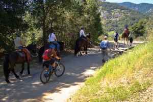
20120421111-Malibu-Creek-State-Park-Hike-Bike-Run-Hoof-300x199

By Mark Langton

It was recently brought to our attention that newly elected president of Equestrian Trails, Inc. (ETI) Robert Foster, a retired law enforcement officer, donates his time as an emergency medical technician at So Cal High School Mountain Bike Racing League races. Mr. Foster is a staunch supporter of the league, and in his president’s message in ETI’s most recent newsletter he stated that it’s a new era in our public open space trail systems, and mountain bikers are part of the trail user community so we all should try to figure out ways to get along.

Now I’ve been doing this advocacy thing for over 25 years, and I’ve experienced a lot of encouraging progress in the areas of shared use, especially when it comes to opening more trails to bicycle use. To hear the president of an organization that has historically had some of its members rally against mountain bikes say that we need to get along is truly groundbreaking. But things like this come fewer and more far between than I’d like, and during these 25 years I have often asked myself “why am I doing this?” The answer is always “because it’s the right thing to do.” This might sound insane (insanity once being defined by Albert Einstein as “doing the same thing over and over again and expecting different results), and in many ways this might be true. But then something like Robert Foster’s reasonable position comes along and I think to myself, maybe we have been doing the right thing after all.

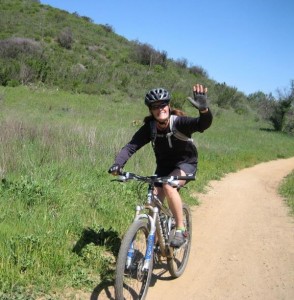
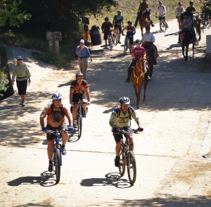
Over the years we have heard many reasons people feel mountain bikes don’t mix on shared use trails, but only one is valid; people riding their bikes too fast at the wrong time and place (around other trail users) is just not a pleasant experience for the people being passed at an inappropriate speed. As I’ve said many times before, we all have within our power the ability to solve this issue: slow down. In other words, use caution when around others. Let me put it another way; your actions represent the entire mountain bike community. The smile you create through a pleasant trail encounter goes a long way.

Randy Rogers Had it Right

Tuesday, January 29th, 2013

By Mark Langton

IMG_23141When I first met North Ranch Mountain Bike Club (nrmbc.org) founder Randy Rogers, he told me of his simple concept when encountering others on the trail. “You should slow down enough to have a brief conversation with them. Like, ‘How are you? Have a nice day.’” I told him I thought that this was overly courteous, and if you simply slowed down and said “hi” as you passed, it would be sufficient.

Now, 20 or so years later, I have to admit that Randy was right. Because in having that brief conversation, you not only slow down, you also show care and concern for the other trail user. And if we want to promote a backcountry that is harmonious and safe, then we all must act as if we are a family. Sure, like most families we may have our differences, but in the end our goal should be to care for, and be kind to, each other. After all, we’re out on the trails for the same reasons; to enjoy nature and to renew our spirit.

I challenge you to try this simple, easy experiment: When safely passing someone, including other cyclists, slow down to the point you’re almost going their speed (or stop if necessary), and ask “how are you doing?” (or the abbreviation “howdy!”). Pause just long enough to let them reply. If they don’t, at least you initiated the pleasantry. If they do reply, recognize the feeling you get from the exchange. They feel comforted and cared for, and you have done something nice. If that’s not a win/win, I don’t know what is. And at the risk of sounding cliché, you are paying good karma forward, which in most cases is contagious. And please drop me an email at mark@corbamtb.com or post a reply and let me know how it goes when you try this experiment. I’d really like to hear your experiences. Thanks!

(By the way, if you’re already using this method of trail courtesy, Thank You!)

Be The Solution

Monday, December 10th, 2012

By Mark Langton

I agree with hikers. I agree that when a mountain biker goes by me too close and too fast, it’s scary and unsettling. And they don’t have to be going fast, just too fast for the conditions. If a mountain biker goes by me at 15 mph on a fire road, no problem. If a mountain biker goes by me at 15 mph on a singletrack trail less than six inches from me, then I have a bit of a problem.

I agree with hikers right up to the point when they say all mountain bikers should be banned from trails because some of them go too fast around other users. You can’t tell me I’m banned from the trails because of someone else’s irresponsible behavior.

I believe there’s nothing wrong with going fast, as long as it’s being done safely (and within reason). If mountain bikers go so fast as to create a danger to themselves–such as crashing and having to utilize tax payer money to get medical treatment and evacuation from the backcountry–then people could point at the mountain bike community as creating an undue burden on the resource management agency. But as we’ve seen, crashes of this nature are relatively few. But the agency still takes notice when there’s an increase.

I know there are those out there, myself included, who are angry at the people who disregard common sense and speed past others with no regard for common courtesy. They’ve replied many times to our blog posts. They are angry because they know that the people who are acting irresponsibly know they are doing it, but continue to do it anyway in spite of the fact they are giving the mountain biking community a bad name; when all they have to do is very simple. Be The Solution. Just slow down around others.

As an experiment today I stopped in the middle of a singletrack trail as a rider approached me coming downhill. Although he had plenty of room to see me, he ran into me, and nearly flew over the handlebar. He was apologetic, and the conversation we had was enlightening; because he was used to others getting out of his way, he just assumed I would, too.  I recounted an instance when I was riding along a trail and I came upon a hiker with her head down, and as I slowed to a stop she looked up, startled, and nearly fell over backward. Had I assumed she heard me and was going to get out of my way, I probably would have run into her.

It’s never going to be completely safe on the trails. There are always going to be accidents, but by slowing down around others (and maybe even slowing down for blind corners), we might be able to avoid a lot of very avoidable ones.


Resolve to Solve in 2013

Monday, December 10th, 2012

How many of you have New Year’s Resolutions that you are hoping to keep? There is one you can make and keep, guaranteed. It will help you, the mountain bike community, and the trail community at large. Ready? Slow down when passing others!

How many things in life can you do that actually solve a problem? On our trails, the one justifiable complaint about mountain bikers is that they sometimes go too fast when passing others, which can be scary and upsetting,even to other cyclists. So all you have to do is slow down when passing, and you SOLVE THE PROBLEM!

Slowing down while passing others on our shared-use trails is a pure win-win proposition. The people who you pass feel good about mountain bikers. WIN! You feel good because you didn’t scare anyone, and everyone has a pleasant exchange. WIN!

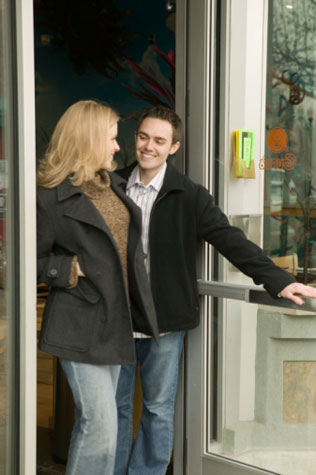
Here’s a suggestion: Treat others you are passing on the trail as if you are holding the door open for them. That brief pause is a show of consideration, courtesy, and humanity that will come back to you and the mountain bike community in many positive ways.

It’s up to you. Would you rather finish your ride knowing you did something positive for mountain bikers and trails users, or that you made it worse for yourself and the mountain bike community? You CAN make a difference. And all it takes is slowing down when passing other users!


Help Walk ‘N Rollers Help Kids

Monday, November 5th, 2012


CORBA members and fans, one of our own needs our help.

Jim Shanman, longtime CORBA member and supporter formed Walk ‘n Rollers last year to encourage kids to bike and walk to school more frequently. His organization has had great success helping schools on the Westside develop basic bike/walk to school programs, host Kids Bike Safety Festivals and works with cities to develop effective encouragement programs. Encouraging kids to bike and walk to school has many benefits, including increasing kids’ daily activity levels, reducing congestion and pollution around schools and, most importantly, teaches kids important life skills such as responsibility and good decision making.

Walk ‘n Rollers is a finalist for a $5,000 grant to help expand their programs, and with a simple click or 2, you can help them bring it home. For the kids in LA County and for Jim, please cast your vote for Walk ‘n Rollers at www.kveller.com/vote . After voting, please share this message with anyone you can. Simply put, the organization with the most votes wins. So while we’re all in a voting mood this week, cast your vote for someone who will make a difference we can all appreciate and then encourage others to do the same. Let’s do what we can to get kids walking and rolling!

To learn more about Walk ‘nRollers, visit www.walknrollers.org


SCE Construction on Brown Mountain Fire Road

Thursday, November 1st, 2012
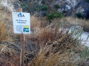
TRTP Signs on Brown Mountain

TRTP Signs on Brown Mountain

Many people have been wondering about the signs that were placed along Brown Mountain fire road (FS 2N70) over the past few months. The signs are ESA notices (Environmentally Sensitive Areas) which state “No Entrance Permitted” and have been placed there by the Tehachapi Renewable Transmissions Project (TRTP).

This is one of the most popular trails for off-road cyclists in the Angeles National Forest, because of its proximity to JPL and the Altadena/Pasadena community. It lies in Segment 11 of the project, which includes much of the Angeles National Forest front country through La Canada and Altadena.

The TRTP Environmental Impact Report states that this fire road is not intended to be part of the project. Elsewhere along the transmission line project towers are being replaced by helicopter and in some cases, by road access. The towers accessed along Brown Mountain fire road are not being replaced, but they are being re-wired from the Chaney Trail road access to the east.  The re-wiring will nearly double the power-carrying capacity of the transmission lines, helping bring more renewable energy from Kern County to greater Los Angeles.

When the EIR for the project was completed the fire road was a wide fire road and easily traveled by high-clearance vehicles. Since the Station Fire it has grown in to a narrow single track in many places, and is not accessible to vehicles.  We anticipate the fire road will eventually be graded back to its original width, and if we learn of any plans, we’ll be sure to pass them on.

According to local SCE Public Affairs officer Shannon Widor, the following information was supplied by the construction team in response to our questions:

  • There will not be full closures of the trails in the area of trail 2N70 and Brown Mountain Road as part of SCE’s Tehachapi project.  While trails will remain accessible for trail users, there may be periodic, brief delays on trails in construction areas at times when work activities cross those trail sites.
  • SCE’s work will also include the use of temporary guard structures (to keep wires elevated during installation) at street and trail crossings to enhance safety during construction.
  • Additionally, SCE has no plans to grade Brown Mountain Road at this time.

We can only assume that the signs are meant to remind employees and construction workers of sensitive areas to avoid, and in no way indicate any intention to close the trail/s.

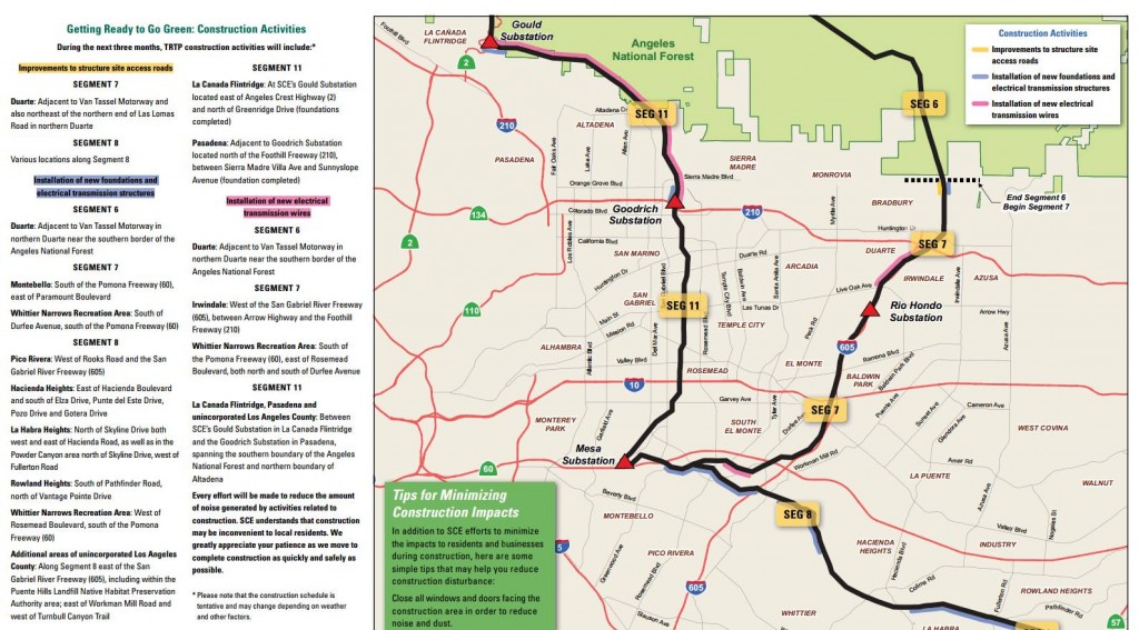
The project also includes an eastern corridor that will include Van Tassell Motorway and fire roads above the Monrovia/Duarte area, as well as Workman Hill and other Habitat Authority lands around Turnbull Canyon.   Construction updates, in the form of quarterly newsletters, are available online. The current newsletter indicates that road improvements will be taking place in some areas in preparation for construction, and that re-wiring of Segment 11 between the Gould and Goodrich Substations will begin.

TRTP 3rd Quarter Construction Update

Double-Click the image for a larger version


The project is estimated to be completed in 2015, but for the moment we can continue to enjoy Brown Mountain fire road in its current narrow configuration for the immediate future.


Sullivan Canyon Closed to Public Until End of December

Wednesday, October 31st, 2012

The Southern California Gas Company recently released information regarding the closing of Sullivan Canyon to the public (see below for the press release).

A comment was made on our blog alleging that the area had been closed due to an incident involving a mountain biker  being seriously injured. According to Public Affairs Manager Krista Phipps, the area was not closed as a direct result of the incident, but in response to several factors. “I was told by the Project Manager that [the incident which caused injury to the mountain biker] did not occur at the construction site.  However, it was serious and required the person to be airlifted out of the canyon.  Overall, there have been a series of close calls in and around the construction site and we just do not want to risk injury to the public or our employees,” said Phipps.

Please note that Sullivan Canyon is NOT public property. It is owned and operated by the Southern California Gas Company which maintains it as open to the public unless work to the gas line is necessary. The Gas Co. can rescind permission to access Sullivan Canyon at any time. In this case, many users will be effected, not just mountain bikers. This surely will come down to a blame game with mountain bikers bearing the brunt of criticism, and to a large degree rightly so. All we can ask is that you ride safely for the conditions, and remember that your actions represent the entire mountain bike community.

————————————

October 29, 2012

RE: Sullivan Canyon Closure – Southern California Gas Company Pipeline Protection Project

Dear Neighbor:

In follow up to the notice of September 17, 2012 regarding the Sullivan Canyon Maintenance Project, this correspondence is to inform you that in spite of our efforts to complete the project without impeding public access, we have determined that in order to maintain public safety, Sullivan Canyon will be closed to the public during the hours of 6am to 6pm Monday thru Saturday, effective immediately. This schedule will be maintained throughout the duration of the project to ensure safe operation of two high-pressure transmission pipelines located in the canyon. The project is expected to be completed by December 31, 2012. Please note that this completion date is an approximation and may change due to the needs of the project.

Additional closures and/or further restrictions will be posted on the gate at Queensferry Road and at the entrance to the property off of Mulholland Drive in advance, to the extent feasible. We apologize for the inconvenience caused by this necessary work to ensure pipeline safety and maintenance of a reliable natural gas supply to the Los Angeles basin area. SoCal Gas appreciates your understanding of the need for this maintenance work and temporary disruption of canyon access. It is our goal to keep disruptions to a minimum and we regret temporary inconveniences.

Safety is our first priority. We appreciate customers and members of the community keeping us informed on conditions surrounding our facilities. Please feel free to share this notice with your networks which have an interest in the canyon.

Thank you for your understanding while we perform this necessary maintenance and repair work. Should you have any questions, please call me at (323) 371-0011 or email me at kphipps@semprautilities.com.

Rim of the Valley Corridor Preliminary Findings – Public Hearings in November

Thursday, October 25th, 2012

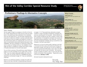
The Special Resource Study for the Rim of the Valley Corridor has been released. While we have not yet had a chance to look at the proposed alternatives, we will do so in the coming weeks and after the first round of meetings. We reported on the ROTV corridor study’s release of Scoping comments in 2011.  The alternatives presented in Newsletter #3 should address and consider these comments.

The four alternatives presented are:

  • Alternative A: No Action (A continuation of current management)
  • Alternative B: Cooperative Conservation Partnership
  • Alternative C: Connecting Urban Parks – Santa Monica Mountain National Recreation Area Boundary Adjustment
  • Alternative D: Connecting Natural Habitat – SMMNRA Boundary Adjustment

While all these alternatives have their advantages and disadvantages, there is an overlapping study for the San Gabriel Watershed and Mountains Special Resource Study. It’s unclear from these preliminary documents how these two studies overlap, and how much of the effort in each is a duplication.

It is within CORBA’s mission to help protect and preserve our open spaces and public lands, in addition to providing access to those public lands through natural-surface, shared use trails. None of the alternatives presented in this newsletter outline any specific actions with regards to the Rim of the Valley Trail, but rather, provide an outline for the role the National Park Service might play in its future development and management.

We’ll look over these alternatives and publish our comments, and strongly encourage others to also comment by the January 7 deadline.

Below the break is the meeting schedule and offical notice for the study, which can be downloaded here.

——————————————————————————————————————

Preliminary Findings & Alternative Concepts Newsletter Available for

Rim of the Valley Corridor Special Resource Study

Dear Friends,

We are happy to report our progress on the Rim of the Valley Corridor Special Resource Study, and we invite your feedback on the preliminary ideas which are presented in our recently published Newsletter #3. The newsletter includes preliminary study findings that address whether resources of the study area are nationally significant, and whether they are suitable and feasible for inclusion in the national park system as a new park unit or as an addition to Santa Monica Mountains National Recreation Area (SMMNRA). Based on these preliminary findings, four preliminary alternative concepts are also presented in the newsletter for your consideration. Please send us your comments by January 7, 2013. 

The four preliminary alternative concepts presented in the newsletter illustrate different ways of providing protection and public enjoyment of resources that have been identified as potentiallynationally significant.  They include different levels and types of involvement by the National Park Service (NPS). Most importantly, these preliminary alternative concepts serve as a starting point for discussion and public input.

Please tell us what you think about the alternative concepts. Do you like one particular concept more than the others? Do you like various elements of each of the concepts? Do you have an entirely different vision of how the area should be managed? Your comments will help us refine the concepts and will ultimately lead to a recommendation to Congress.

We have scheduled seven public meetings extending through the month of November, concluding with a final meeting in early December. During these meetings, we will update you on our progress on the Rim of the Valley Corridor Special Resource Study and listen to your thoughts and ideas. Dates, times and locations of these meetings are listed below.  The NPS will also host a virtual public meeting online. Information on the virtual public meeting will be posted on the study website.

We look forward to hearing from you!


Wednesday, November 7, 7 – 9 p.m.
Conejo Recreation and Parks District, Community Room
403 W. Hillcrest Dr., Thousand Oaks,CA 91360

Thursday, November 8, 7 – 9 p.m.
George A. Caravalho Santa Clarita Sports Complex, Activities Center Building
20880 Centre Point Parkway
Santa Clarita, CA 91350

Tuesday, November 13, 6:30 – 8:30 p.m.***
Pacific Community Center
501 S. Pacific Ave.
Glendale, CA 91204

Thursday, November 15, 7 – 9 p.m.
Mason Recreation Center
10500 Mason Ave.
Chatsworth, CA 91311

Tuesday, November 27, 6:30 – 8:30 p.m.
Encino Community Center Women’s Club
4935 Balboa Blvd.
Encino, CA 91316

Thursday, November 29, 7 – 9 p.m.***
Moorpark Community Center
799 Moorpark Ave.
Moorpark, CA 93021

Saturday, December 1, 10 a.m. – noon
Eaton Canyon Nature Center
1750 North Altadena Dr.
Pasadena, CA 91107

County Seeks Public Input on Trails in NW San Fernando Valley

Friday, August 31st, 2012

Thursday evening, August 30, Los Angeles County held their first public input meeting for the Northwest San Fernando Trail Master Plan in Granada Hills. About 40 people were in attendance, including at least 7 from the mountain biking community. This was an information gathering session for the County, being conducted by Sapphos Environmental, the lead consultants for the project. Sapphos also helped develop the County’s Trail Manual and have collaborated with them on many other projects.

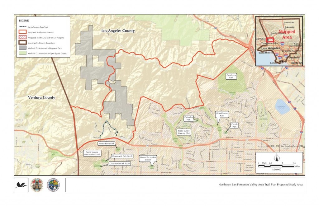
LA County NW San Fernando Trail Master Plan Study Area

LA County NW San Fernando Trail Master Plan Study Area

After a slate of introductions, Sapphos Environmental president Marie Campbell gave an overview of the process. From her outline and the numerous audience questions that ensued, it seemed like this meeting and call for public input might have been somewhat premature. Several members of the audience asked about specific subdivisions that have already been approved and which include trail easements, trail easements that are on record, newly approved equestrian parks and facilities, and other data, none of which were available.

Sapphos and the County have been in contact with State Parks, Mountains Recreation Conservation Authority, City of Los Angeles, Rim of the Valley Trail, and other adjacent public land agencies to coordinate with their trail plans. However, they could not supply data about existing or proposed trail alignments in those other jurisdictions to which many of the attendees would like to see trail connections. No trails in other jurisdictions appeared on the maps.

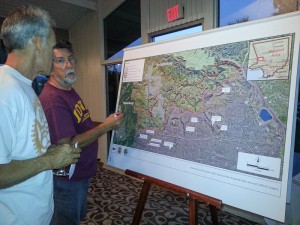
The room was set up with six easels with larger scale aerial photos of the study area, two each for hikers, cyclists and equestrians. We were asked to mark in one color trails that we are currently using, and in another color, trails and/or connections that we would like to see in the future. The aerial photos that were supplied, while larger scale than the study area map above, did not have any existing fire roads or trails, nor did they have any geographic markers or place names on them. This lack of background data made it extremely difficult to identify routes that we currently use, and more difficult to say where we’d like to see new connections and trails.

Marking a trail wishlist

Marking a trail wishlist

One issue that was raised is the fact that these trails will be multi-use trails including bicycles per County policy, wherever feasible. The southern boundary of the study area is all City of Los Angeles, where a blanket policy prohibits bikes on all trails unless specifically authorized. It was explained that in such cases, signage will be important to advise cyclists that a trail on which they are currently riding may pass into the jurisdiction of the City of Los Angeles, at which point the bicyclist would have to turn around and return. We feel it important that the County sticks to their multi-use policy, even when trails connect to City trails where bikes are not allowed.

This is a great opportunity to plan for some vital connections and help fulfill the unmet and growing demand for recreational trails around the San Fernando Valley. There is so much open space (8363 acres in the study area) but it is pockmarked with private properties, utility easements, gas lines and other infrastructure. This makes passage through the Santa Susanna Mountains by trail users very difficult. Many existing trails are old ranch roads and are unnamed and unmarked. Many unofficial trails have been created by the community and used for decades. In fact, the only official County trail in the study area is the Indian Springs/Indian falls trail, which lies partially within a subdivision, connecting to Johnson Motorway and Devil’s Canyon.

We’d of course like to see a way to ride from Mission Peak over to Weldon and Towsley, connections to the proposed Rim of the Valley trail, an east-west running trail from Mission Peak and O’Melveny park to Oat Mountain, Fossil Hill, Rocky Peak fire road and Las Llajas Canyon. These would lie partially outside the study area, and for that reason, we also suggested that the study area be expanded in its northwest section.

While the County does not have an easy way to submit data electronically, we encourage those familiar with the area to contact Steve Messer with GPS tracks of trails that are currently in common use, as well as trail connections that would be desired (GPS, Google Earth, hand-drawn, or however you can submit them). The County is accepting suggestions through Park Planner Lorrie Bradley (lbradley@parks.lacounty.gov). While no formal deadline for comments and suggestions was given, we were told they would accept comments by email for “the next few weeks.”


LA County Trail Plan Public Hearing for NW San Fernando Valley, Aug 30

Thursday, August 9th, 2012

Sapphos Environmental, Inc. is sending this e-mail on behalf of the County of Los Angeles (County) Department of Parks and Recreation to inform community members of the proposed Northwest San Fernando Valley Area Trail Plan including Rim of the Valley (proposed project). The intent of the County is to develop a trail plan for trails to guide future trail development to meet needs in the Northwest San Fernando Valley Area. Currently, the study area consists broadly of the unincorporated territory of the County bounded by the Ventura County line on the west, the Santa Susana Mountains (Johnson Motorway Trail, Rim of the Valley Trail, Oat Mountain Motorway Trail, and Weldon Canyon Trail) to the north, Interstate 5 to the east, and Roscoe Boulevard to the south, with provisions for connections to other nearby existing and planned recreational resources. The overall work effort would include a trail plan and associated California Environmental Quality Act documentation. The County is currently in the early development stages of the proposed project.

The County will hold a public outreach meeting to engage trail users and the surrounding communities and solicit ideas for the trail plan. The public outreach meeting is scheduled for:

Northwest San Fernando Valley Area Trail Plan including Rim of the Valley Public Outreach Meeting
Thursday, August 30, 2012
6:00 pm
Granada Room
Knollwood Country Club
12024 Balboa Blvd.
Granada Hills, CA 91344  
Please reply to this e-mail to indicate whether you are interested in receiving further updates on the proposed project and related meetings, or if you prefer to be removed from the contact list. If you are interested, please state in the e-mail whether you would be available for the scheduled public outreach meeting on Thursday August 30, 2012 at 6:00 p.m., and provide the following information:·        Name
·        Affiliation (trail group, etc.)
·        Area of interest (hiking, biking, equestrian, etc.)
·        Current e-mail address (if applicable)
·        E-mail addresses of other potentially interested parties you may know

Thank you for your time. Should you have any additional questions, please contact Ms. Lorrie Bradley at LBradley@parks.lacounty.gov or (213) 738-2812.

Sincerely,

SAPPHOS ENVIRONMENTAL, INC.

Leanna Guillermo

www.sapphosenvironmental.com