Archive for the ‘Environment’ Category

Pedaling through a Pandemic

Monday, March 23rd, 2020
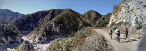
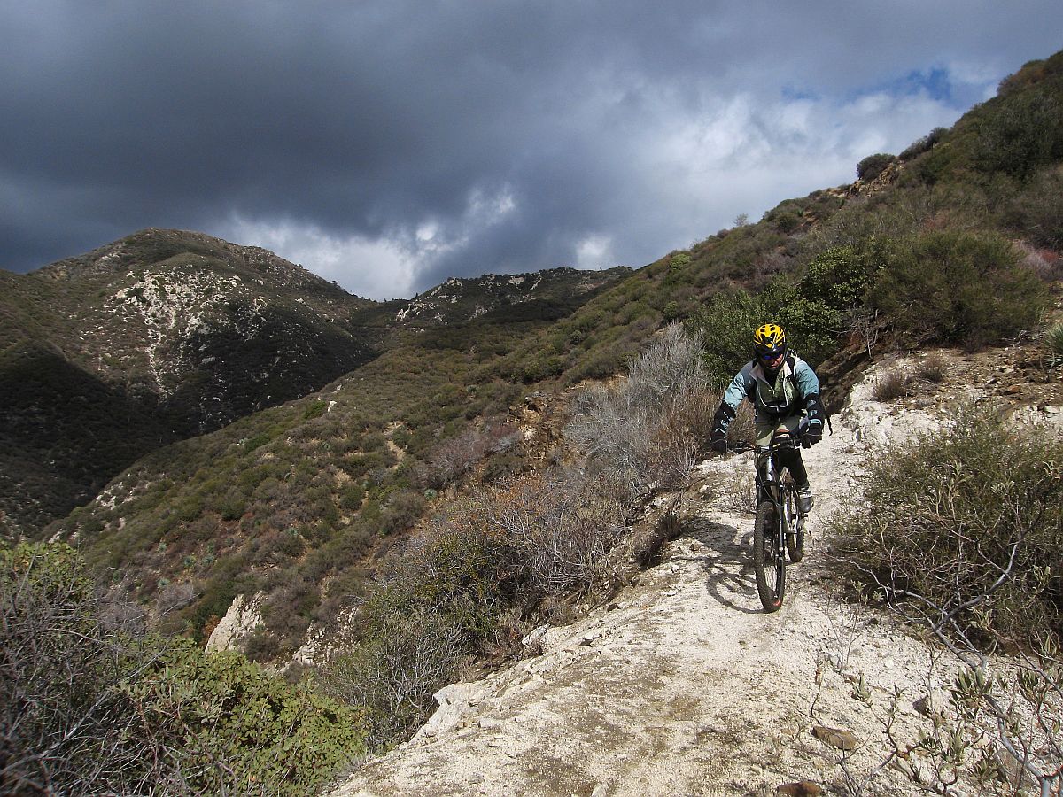
Cheney trail, one mile from the trailhead

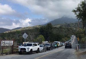
Illegal overflow parking 1.1 miles from the Sunset Ridge trailhead yesterday.

These are unprecedented times. We’ve all been constantly bombarded with reminders to avoid social contacts, maintain social distancing, and shelter at home. Those orders came with the caveat that it’s OK to get outside and get exercise, as long as that can be done while maintaining appropriate social distances.

This past weekend was the first under the “Safer at Home” orders currently in effect for Los Angeles city and County.  I feel very much at home on a trail, as do most of you. The instructions to shelter at home and only leave for exercise or to provide or access essential services, sounded to me like an invitation and a perfect reason to hit a local trail. It sounded like an invitation to the entire community.

This led to some serious crowding on our local trails this past weekend.  It is impossible to maintain appropriate social distancing, which includes physically separating individuals by at least six feet, on a two-way trail less than four feet in width. Trails are social, and many groups were seen heading out together onto trails. Many trailhead and park parking lots were closed, but this didn’t stop people from parking outside established parking lots, often illegally, and accessing the trails anyway.

Since it seems the public are unable or unwilling to recreate in a way that maintains social distancing, we recommend avoiding all singletrack trails. In fact, as of Saturday, March 28, all trails in Los Angeles County are closed, with the exception of trails on federal land in the Angeles National Forest which remain open. The following official closures are now in effect (subject to change):

  • All organized club rides, races and events have been canceled.
  • Santa Monica Mountains Conservancy/MRCA have closed all their parks and trails to the public.
  • LA County has closed all County trails and parks to the public, including the Pinecrest gate access to the Mt. Wilson Toll Road.
  • La Canada Flintridge have closed all their trails, including Cherry Canyon.
  • City of Monrovia has closed the Hillside Wilderness Preserve and all trails.
  • State Parks have closed all park and trailhead parking lots and facilities such as bathrooms and visitor centers at Malibu Creek State Park, Topanga State Park, Will Rogers State Park, and Baldwin Hills Scenic Overlook
  • The National Park Service has closed all park and trailhead parking lots and facilities such as bathrooms and visitor centers in the Santa Monica Mountains National Recreation Area. Soltice Canyon in Malibu is closed to all entry. NPS Trails will be closed from 2pm Fridays to 6am Mondays until further notice.
  • The Forest Service has closed all campgrounds, visitor centers and developed recreation sites, throughout Region 5 (California).  Additionally, the Angeles National Forest has closed most of the front country trails and trailheads.
  • LA County DPW have closed Big Dalton Canyon Road, Glendora Mountain Road (north of Big Dalton Rd to East Fork Rd) and Glendora Ridge Road (Glendora Mountain Rd to Mt. Baldy Rd). These roads will remain closed until the emergency order is lifted.
  • City of Glendale has closed all park, trails and fire roads including the Catalina Verdugo trail and trails in Deukmejian Wilderness Park and the Verdugo Mountains.
  • The City of Los Angeles has closed all parks, trails, skate parks, and public amenities, including Griffith Park and all beaches.
  • The City of Palos Verdes has closed all parks, trails, and open spaces.
  • Conejo Open Space Conservation Authority has closed all parks, trails and open spaces in their jurisdiction.
  • The City of Pasadena has closed the Rose Bowl Loop
  • The Forest Service has closed many trails, campgrounds, trailheads and recreation facilities as listed on their forest order.
  • SoCalGas Company has closed Sullivan Canyon, which is private property owned by the gas company.

It isn’t just mountain biking trails that are affected. The City of Santa Monica and County of Los Angeles have closed all beach parking lots. Portions of the Marvin Braude Bike Path around Venice and Santa Monica have been closed. The Ballona Creek bikeway, and LA River Bikeway and other County bike paths have been closed. The Pacific Crest Trail Association has alerted all through-hikers to cancel their 2020 plans.

While we understand everyone’s need to get out and exercise, enjoy our cleaner air and reduced road traffic, your health and the health of everyone in our community takes priority.  If trails continue to be crowded, we can expect more trail and park closures, over and above the closures already in effect.  We strongly advise adhering to official guidance from State and County public health departments, and/or the land managers themselves, though it can be difficult to decipher:

Centers for Disease Control and Prevention (CDC) https://tinyurl.com/tllxvcc

California Department of Public Health (CDPH) https://tinyurl.com/uw57yjx

Ventura County Health Care Agency http://www.vchca.org/agency-divisions/public-health

Los Angeles County Public Health http://www.publichealth.lacounty.gov/media/Coronavirus

While it’s now recommended just to stay at home or ride the streets near your home, if you choose to ride any of the few trails still open, here are some general guidelines:

  • Stay home if you’re sick. Period. It goes without saying, but we’re going to say it anyway – if you’re sick, or you’ve been in contact with somebody who is, you need to stay home.
  • Only ride open trails from open trailheads.  Agencies are monitoring the crowds on trails, and some trails (including all Santa Monica Mountains Conservancy trails) are now closed to all users. If we can’t maintain social distancing on trails, expect more closures. Check with the agencies if you’re not sure.
  • Maintain your distance. AT ALL TIMES maintain the safe, responsible social distance we’ve all come to know – keep 2-3 bike lengths between riders, on the trail and off the trail.  Don’t fist bump, etc., rather stick to air-fives and sharing content online. Allow ample passing room for other trail users. Ride only with your housemates/family, or those with whom you already have close physical contact. 
  • Find a lesser-used used trailhead. People are heading out in record numbers.  If you’re fortunate enough to know of more remote, lesser-used trailheads, please plan your ride so that you start there. Refrain from driving to trailheads wherever possible.
  • Ride to your ride.  If you are able to ride to a trailhead, do so.  Keep the cars off the road, out of the gas stations, and away from congested areas.  Balance this with avoiding crowded trailheads.
  • Slow it down.  Now is not the time to push your riding skills.  The last thing you or the rest of the community wants right now is for a rider to wreck and end up in a hospital, adding more strain on our EMS system and taking up valuable resources.  Plus, you’ll also be able to enjoy the benefits of being outdoors for a longer period of time if you slow your roll.
  • Take care of business before heading out.  Many public restrooms are closed – make every effort to make sure nature doesn’t call while out on the trail.
  • No snot rockets.  We get it, and usually we accept it – but if you need to blow your nose, use a hanky.  If you do need to sneeze, do it into your elbow.
  • No sharing.  Now is not the time to share gear, food, drinks, or tools.  Sorry. If you have a mechanical issue, sanitize tools and gear before sharing and again before taking it back.
  • Protect yourself.  Bring a small “to go” packet of hand wipes, disinfectant spray, and maybe even some soap to use with your own water.  Hopefully you won’t need this, but just in case you do it’s better to have it than not.

With all this in mind, think before you ride, keep it local, and don’t put yourself or others at risk. All of this will pass, and we’ll be planning group rides and trailwork events again soon.


Edit: Updated 3/23/2020 at 3:00 pm to reflect additional road closures.
Updated 3/23/2020 at 8:00 pm to reflect Cherry Canyon closures.
Updated 3/25/2020 to reflect City of Glendale closures
Updated 3/27/2020 to reflect City of Los Angeles and Palos Verdes closures
Updated 3/28/2020 to reflect COSCA closures
Updated 4/3/2020 to reflect Forest Service and Big Dalton closures
Updated 4/14/2020 to reflect Sullivan Canyon closures


Speak up for funding Public Lands

Friday, March 6th, 2020
We need your help by asking your Senators to fund public lands today.

Apparently the Senate is trying to figure out how to pass two important bills to fund public lands. The outdoor community has been working on them for years, and we have an unusual opportunity to get them passed right now.
These bills – dedicated funding for the Land and Water Conservation Fund (LWCF) and the Restore our Parks Act (ROPA) – will provide funding for parks and public lands and address the deferred maintenance backlog for National Parks. As written, there’s nothing in it for the Forest Service who seem even more chronically underfunded than the other agencies, and we’ve reflected that in our comments.
We need your help to get these bills passed and to make sure that National Forests and BLM lands are also included to receive funding along with National Parks.
The Outdoor Alliance have made it easy to send a message to your Senators right here. The outdoor community has been a powerful force in making public lands funding a priority to Congress, and we need your help to get across the finish line this week.

San Gabriels Protection bill Passes House

Saturday, February 22nd, 2020

Last week four bills affecting California passed the House. H.R.3820, the “San Gabriel Mountains Foothills and Rivers Protection Act”, and H.R.1708, the “Rim of the Valley Corridor Preservation Act,” were rolled into a land protection bill with four other bills including H.R. 2250. the Northwest California Wilderness, Recreation, and Working Forests Act, and the H.R.2199 Central Coast Heritage Protection Act–both of which have earned the support of local mountain biking organizations. Local mountain bike clubs and IMBA have been key players in the development of these bills. The combined bill, H.R. 2546, Protecting America’s Wilderness Act, passed the House on February 12, with 6 house republicans voting in favor.

San Gabriel Mountains, Foothills and Rivers Protection Act

San Gabriel Mountains Foothills and Rivers Protection Act

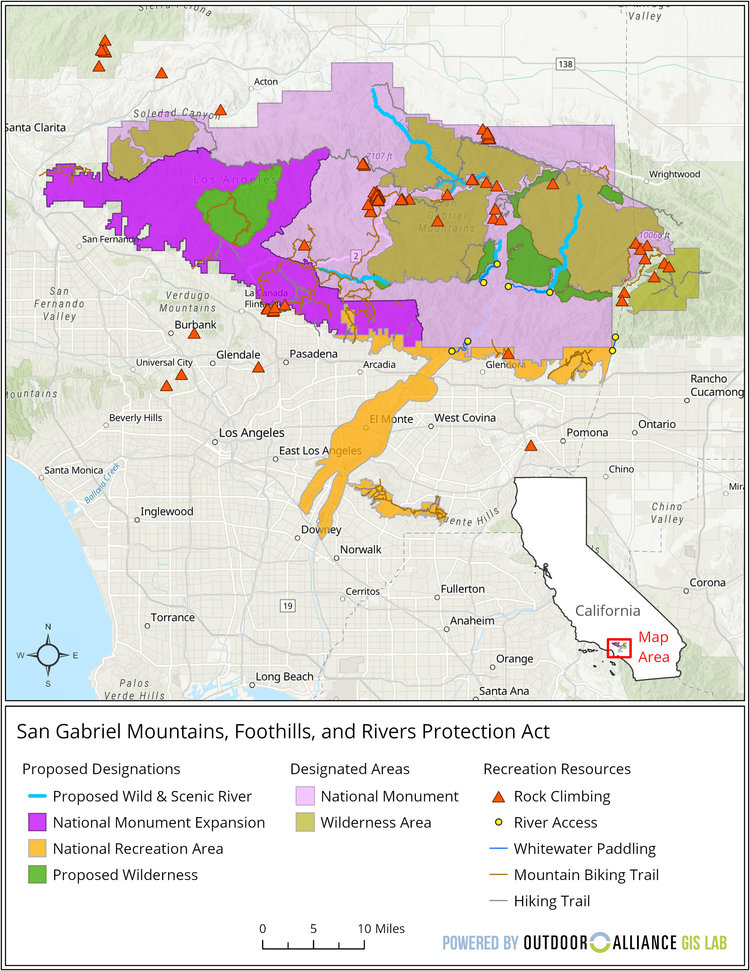
San Gabriel Mountains Foothills and Rivers Protection Act Reference Map

Wilderness Expansion

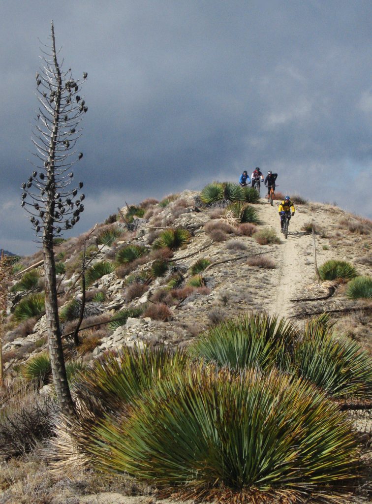
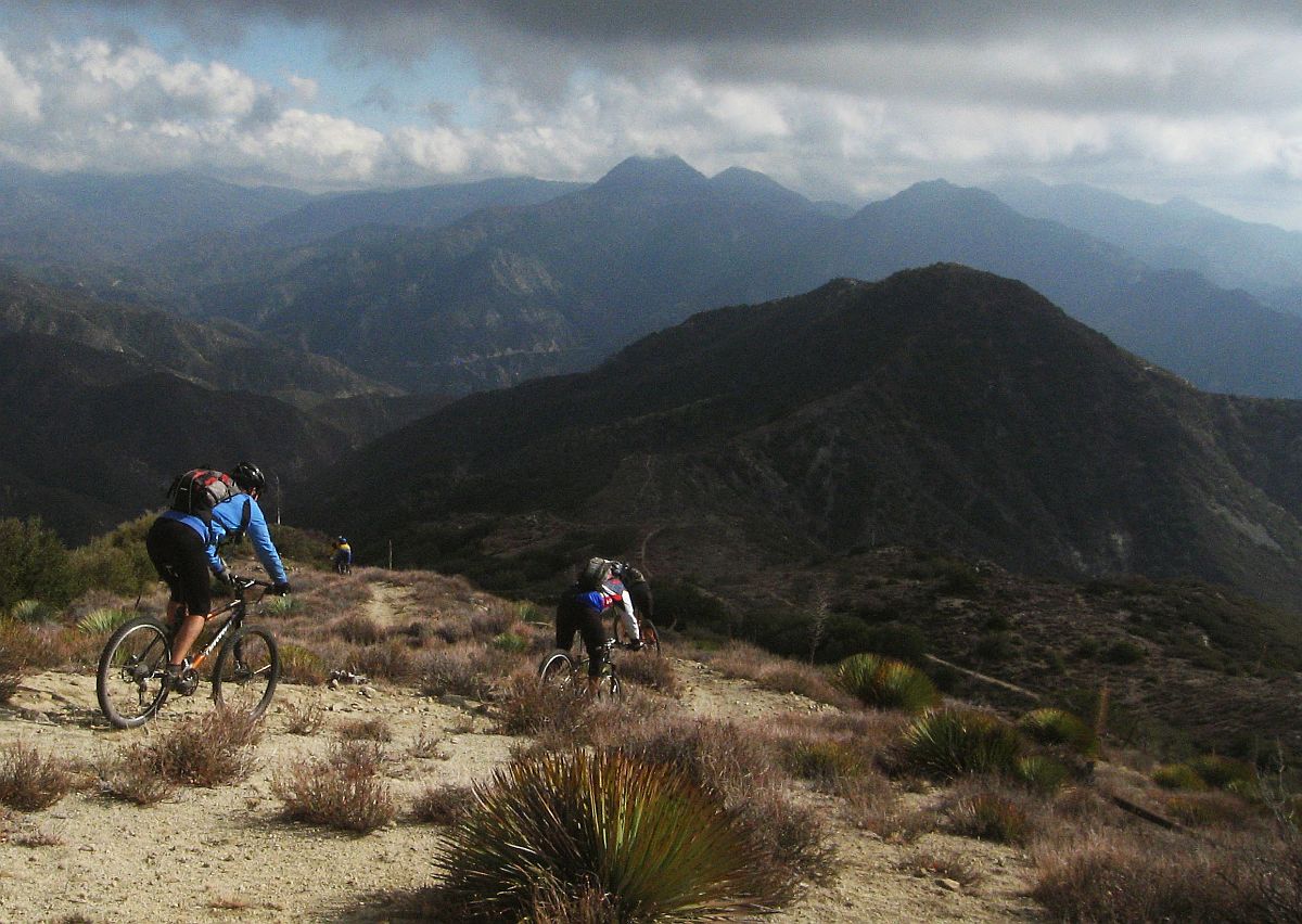
Mountain Bikers descend from Condor Peak

Protest Riders descend from Condor Peak, December 2007

H.R.3820, introduced by Judy Chu (CA-27), expands the boundaries of existing federally-designated wilderness areas within the Angeles National Forest. The bill also creates two new Wilderness areas, the Yerba Buena Wilderness and Condor Peak Wilderness.

Condor peak has long been a target for wilderness protection by environmental groups. It is also one of the last long-distance, high-elevation singletrack trails providing access to a mountain summit that remains open to bikes. It was included in a bill by Barbara Boxer, as a new wilderness area. Jim Hasenauer, then working with IMBA, led a protest ride on the trail showing that it was a high-value trail to mountain bikers on December 1, 2007. It was withdrawn from the Omnibus Public Land Management Act of 2009, but has never been forgotten by environmentalists.

CORBA worked locally with The Wilderness Society, Sierra Club and CalWild on the language and boundaries of the current bill for more than two years. Concurrently, IMBA worked at the national level and in Washington DC, to ensure that the proposed Wilderness areas would have no impact to existing trails open to mountain bikes.

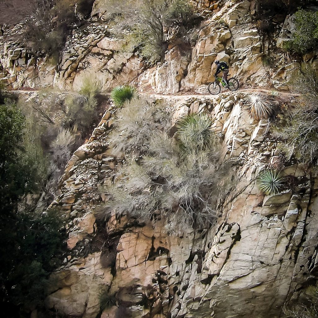
Condor Peak trail is a steep, exposed and challenging backcountry trail.

For mountain bikers, Condor Peak trail was not up for negotiation. While we support protecting the character of the area, we wanted to ensure not only that bicycles could continue to access it, but also that mechanized maintenance (using chainsaws or other powered tools) would continue to be allowed. We’ve seen many trails that have been closed to bikes by Wilderness designations slowly deteriorate as volunteer groups cannot keep up with the existing trail maintenance backlog, and the Angeles National Forest has no trail crew of its own.

The solution we reached was to propose two Wilderness Areas on each side of the trail. The resulting legislation passed last week in the House creates the Yerba Buena and Condor Peak Wilderness areas, separated by a 100′ buffer through which the Condor Peak trail passes. Trail Canyon trail, the only other trail within the proposed Wilderness boundary, is cherry-stemmed out of the Wilderness allowing bicycle access to Trail Canyon falls and the nearby campground. A portion of the upper Trail Canyon trail, which has not been passable by bicycle in decades, will fall within the new wilderness boundary.

CORBA chose not to oppose this latest bill as it had no impact to mountain bike access. However, we could not support it fully, as it does nothing to enhance our mission of improving and increasing trail access for mountain bikes. We remain neutral on the bill, but if it passes, we will remain fully engaged in its implementation to further keep the interests of mountain bikers represented. 

There are two amendments being sought by CORBA and IMBA. Due to what appears to be a mapping error, three switchbacks along the Mt. Waterman trail dip a few dozen feet into the Wilderness area.  Though the Forest Service manages it as a non-wilderness trail, an amendment to the bill, by inserting “fifty feet south of the Mt. Waterman Trail” into the legal description of the wilderness area boundary, would correct that. 

Proposed Boundary Adjustment

Proposed Boundary Adjustment

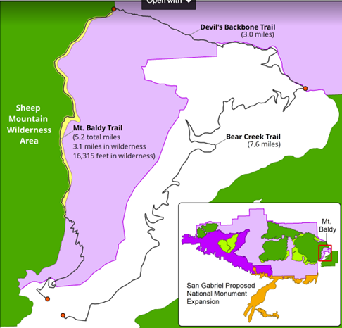
The other amendment we are seeking is more challenging. The eastern Boundary of the Sheep Mountain wilderness passes directly over the summit of Mt San Antonio (AKA Mt. Baldy).  It is the only one of three peaks in Southern California over 10,000′ and above treeline to which bicycles have access (via the Devil’s Backbone trail). Wilderness advocates wanted to expand the Wilderness boundary eastward, entirely enveloping the Bear Creek trail in Wilderness.  The trail follows the Wilderness boundary, lying just inside the boundary by 25 yards. The trail would completes an incredibly challenging, high-elevation, backcountry loop. We are seeking an amendment to move the boundary 75′ west of the trail, removing it from wilderness, and opening the loop to bicycles. The boundary remains unchanged in the current legislation. 

These two amendments would remove approximately 75 acres of existing wilderness in a bill that adds over 31,000 acres of new Wilderness. These will be difficult asks for some, but we feel the ride loop this boundary adjustment would create a truly unique experience that is attainable nowhere else.

National Monument Expansion

The bill also expands the boundary of the San Gabriel Mountains National Monument, which was declared in October 2014. The boundary expansion makes sense geographically, as one of the biggest challenges in developing the current Monument management plan (as a Forest Management Plan Amendment) was the allocation of district-specific resources.

The Forest Service felt growing pains as they transitioned from three districts to one district and a National Monument (which is managed as a district). The Monument designation left out the most historically significant and most visited section of the Angeles National Forest, which includes the front country trails south and west of Mt. Wilson, and Mt. Lukens, and areas south of Big Tujunga. There was confusion among Forest Service staff when a vehicle, for example, was assigned to the district, but was stationed physically much closer to the Monument. It has taken years, but those challenges have been largely sorted out.

This time around, the bill requires the development of a management plan within three years (the plan amendment for the SGMNM took almost four years to complete). The current Monument designation had no impact to trail access for mountain bikes, and has brought in some additional funding and additional attention to our local mountains. In fact, IMBA and CORBA worked closely with the White House in 2014 to ensure that mountain biking was specifically mentioned in the monument proclamation ensuring its future acceptance. As a result, visitorship has steadily increased since the 2014 designation.

San Gabriel National Recreation Area

The third section of Chu’s bill will create a new National Park Service unit in the San Gabriel Valley. The San Gabriel National Recreation Area would become a new unit of the National Park service. It would comprise land along the foothills of the San Gabriel Mountains and corridors along the San Gabriel, Rio Hondo, and other rivers and open spaces in the San Gabriel Valley.

The proposed NRA would not change any land ownership, nor restrict any current land owner from managing their land (and their trails) as they are already doing. It allows willing landowners or land managers within the NRA boundary to partner with the NPS to improve recreation, habitat connectivity, water quality, wildlife corridors and public access. It doesn’t change any existing trails, and has the potential to bring additional federal resources to local projects.

With all these aspects of the bill, our biggest concern is that the agencies managing lands the bills protect are not adequately funded at a level necessary to do their job effectively. Creating additional financial obligations by the Forest Service and National Park Service, when current budgets are falling short, will bring its own set of challenges.

H.R.3820 has a companion bill in the Senate, S.1109, introduced by Senator Kamala Harris. We will continue to work towards those amendments in the Senate version of the bill, which will face a tougher challenge under the current administration. If the bills fail this year, we expect them to be reintroduced in future sessions of congress.

A fact sheet from Judy Chu’s office can be found at https://chu.house.gov

Rim of the Valley Corridor Protection Act

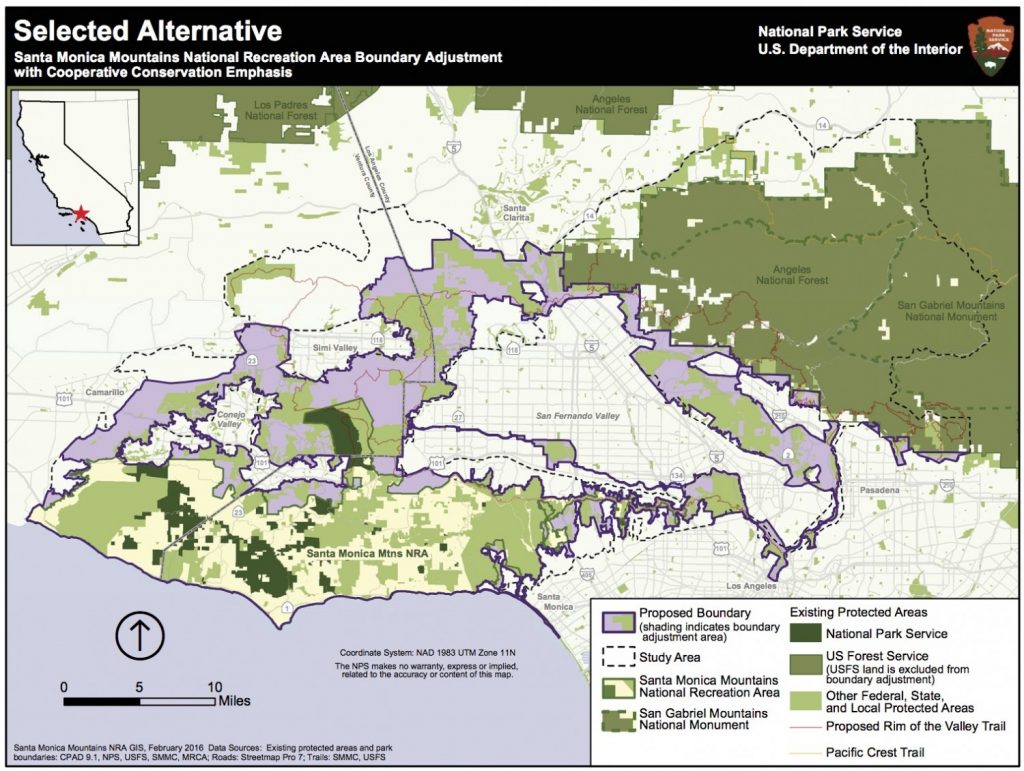
H.R.1708 was introduced by Congressman Adam Schiff, after several years where similar legislation failed to make it out of committee. The Rim of the Valley Corridor Preservation Act will expand the boundary of the Santa Monica Mountains National recreation area. The expanded boundary will include the mountains surrounding the Santa Clarita, San Fernando, Simi, La Crescenta and Conejo valleys. These include the Santa Susana Mountains, the Simi Hills, the Verdugo Mountains, and other adjacent lands and river corridors as shown below.

Rim of the Valley Corridor Map

The act does not change the current management of any land or trails within the expanded boundary. What it will do is allow willing landowners or land managers to partner with the NPS on projects that may enhance recreational access, improve habitat and wildlife connectivity, or provide capital improvements. It does not take land away from any existing landowners, nor does it force existing land managers to partner with the National Park service in any way. It has no downsides for mountain biking, and has the potential to improve trail access.

CORBA’s original mission statement and our operational boundary was defined as “the Rim of the Valley Corridor.” This bill is therefore very much at the heart of CORBA’s mission.

The bill was the outcome of a six-year feasibility study, authorized by an act of Congress in 2008. The study began in 2010, with CORBA engaged throughout the six-year process, attending public meetings, providing expert testimony and public comments, and encouraging public discourse and engagement in the process.

The study sought to determine if the area possess nationally significant natural or cultural resources; whether it is it a suitable and unique addition to the National Park System; whether it is feasible to add it to the Park System; and does it require direct NPS management, instead of stewardship from other groups or a public-private combination? The answer to the first three questions was Yes. Since the study concluded in 2016, legislation has been introduced twice without success. Last week the bill passed the House. In December, the Senate Committee on Energy and Natural Resources passed the Rim of the Valley Corridor Preservation Act, moving it one step closer to the Senate floor.

We are fortunate in Southern California to have one of the most mountain bike friendly NPS units in the country, the Santa Monica Mountains NRA. Currently all National Park service managed singletrack trails in the Santa Monica Mountains are open to bicycles. In fact, the only trails closed to us are closed by the Boney Mountain State Wilderness, and California State Parks. We expect the NPS to continue supporting a multi-use trail policy in the expanded NRA. In fact, all of the land managers within the expanded boundary, with the exception of the City of Los Angeles, are multi-use friendly.

Lands within the Angeles National Forest are specifically excluded from the expanded NRA. The Forest Service and the National Park Service already have an arrangement in which they are able to share resources for the benefit of our public lands under the Service First authority, which was made permanent in 2012.

For these reasons we are supportive of the expanded boundary of the Santa Monica Mountains NRA in the current legislation. However, to our knowledge there is no additional budget allocated to the expanded NRA, nor to the new San Gabriel NRA in Chu’s bill. For these reasons we have been reluctant to throw our full support behind the bills as they can be considered unfunded (or underfunded) mandates. If these bills pass, we will advocate for increased funding, and will remain engaged with land managers in the development of their management plans, and to identify opportunities for creating or improving multi-use trails and mountain bike access.

The Rim of the Valley trail was originally envisioned by Marge Feinberg in the 1960s as a trail that encircles the San Fernando Valley, connecting communities with their local mountains. The trail itself is being piecemealed together as opportunities present themselves. The vision of a trail led to a broader vision to protect the mountains surrounding our valleys, and ultimately to H.R.1708. It has been a forty-year effort to protect the mountains that define our valleys.

A fact sheet on the bill can be found at https://schiff.house.gov

Happy New Decade! A 20-Teens Retrospective

Wednesday, January 1st, 2020

CORBA has a lot to be proud of this last ten years. It feels like the twenty-teens was the decade in which mountain biking really came of age. The sport has grown and we’ve seen tremendous changes and challenges. Mountain bikers are no longer a newcomer to the trails, but we’ve still got a long way to go.

There’s no denying the explosive growth of mountain biking last decade. We’ve all seen more people on trails, and more of them on bikes than ever before. I’ve met more riders with less than five years experience than in any five-year period before the last. Conversely, we’ve seen relatively few new trails constructed in that time. The trail supply is not keeping up with the demand here in Southern California. The agencies and volunteers can’t keep up with maintenance of the supply we already have. That’s one thing that hasn’t changed in ten years, and has gotten worse with agency budget cuts and increasingly severe weather. It’s why we ask you to come out and give a morning back to the trails once or twice a year. You’ll appreciate them so much more after a morning of trailwork.

Let’s take a long look back at what has changed and been accomplished last decade.

(more…)

July 2019 Trail Fire Closures Update for the Santa Monica Mountains

Saturday, March 2nd, 2019

This article has been updated since it was originally posted on January 4th:

– January 12: The Mountains Recreation and Conservation Authority (MRCA) opened most of their open space areas

– March 2: The Backbone Trail between Kanan Road west to Yerba Buena Road has been opened.

– March 25: All COSCA trails in Thousand Oaks except the Hill Canyon Bridge are now open.

– April 30: The Backbone Trail fromYerba Buena Road west to the Mishe Mokwa trailhead is open

– July 18: The remaining sections of the Backbone Trail are now open, so the entire trail is open. (Note that not all of it is open to mountain biking, as always.)

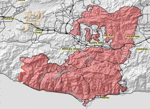
South of the 101 Freeway, the Woolsey Fire completely decimated most of the open space between Las Virgenes/Malibu Canyon Road on the east and Point Mugu State Park (Sycamore Canyon) on the west. North of the 101, most of the open space south of Simi Valley and between Valley Circle on the east and Erbes Road to the west was destroyed.

With the recent rains, the regeneration process has begun and new growth can be seen on the burned hillsides.

Nevertheless, many of the trails are still closed until they are assessed for damage, and repaired as necessary. In addition, heavy rains my result in mudslides that may damage sections of the trail that survived the fire.

The good news is that many of the trails are now open to use. The bad news is that during the Federal Government partial shutdown, the National Park Service is not able to work on their trails, prolonging the time that they will be closed.

The following list is not exhaustive – there are many smaller trails not listed that may be open or closed. If you see that a trail is marked as closed or cordoned off, please stay off it.

Areas that are open

Areas that are still closed

For your own safety and to protect the plants and creatures that live in the open space, please stay off closed trails completely, and where the trails are open to use, please stay on the trails! Also, watch for new hazards on the trails such as large ruts, debris slides, washouts and fallen trees.

CORBA Supports Wildlife Crossing – Meeting October 12

Saturday, September 16th, 2017


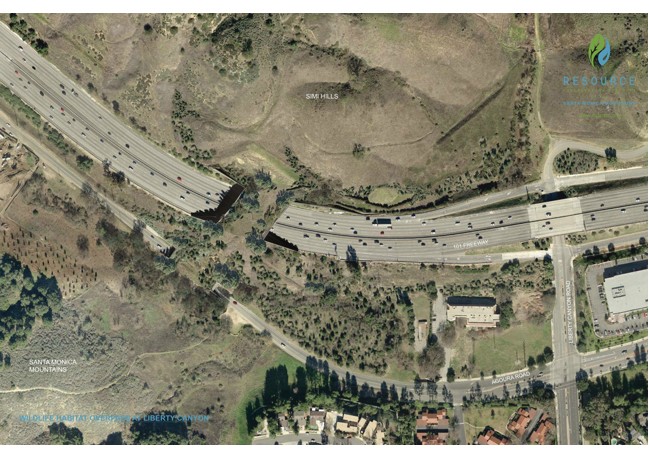
Caltrans is moving forward with the Liberty Canyon Wildlife Crossing across the 101 Freeway, west of Liberty Canyon.  The have released three draft alternatives, for public comment, and will be discussing them at a public meeting on October 12.

Public Meeting

October 12, 2017 – Public Hearing

When: October 12, 2017 6:00pm-8:00pm

Where:

King Gillette Ranch Auditorium
26800 Mulholland Hwy
Calabasas, CA 91302

Public Comments

The public comment period will be open from
September 11, 2017 to October 26, 2017.
You’re welcome to submit written comments by
October 26, 2017 to liberty.canyon@dot.ca.gov or to the address below:
Ronald Kosinski
Deputy Director, Division of Environmental Planning
California Department of Transportation
District 7, Division of Environmental Planning
100 S. Main Street, MS-16A
Los Angeles, CA 90012


This is a project that CORBA has fully supported. The wildlife crossing will improve the viability of our wildlife populations, especially our renowned mountain lions,.

Alternative 1 crosses the 101 freeway with a 165′ long bridge. Alternative 2 provides an extension that continues over Agoura Road.  Altternative 2 is further broken down into two ‘Build” alternatives: Option 1, a 48′ wide bridge and Option 2, a 54′ wide bridge.  Though more expensive, we have to support the option that gives wildlife the greatest chance of successfully crossing, Alternative 2, Option 2.

We’re especially excited that all the alternatives include a 5’ wide multi-use trail, linking open spaces and trail networks north and south of the freeway. This would allow one to ride or hike from the Santa Monica Mountains to the Simi Hills.

The Santa Monica Mountains Trail Master Plan is still under development, and we expect to see this crossing included in the TMP, with multi-use trail options linking the two trail networks. There has been no update on the status of that plan.

We urge all mountain bikers to email your support to  liberty.canyon@dot.ca.gov. The Deparment of Transport has all the information at http://www.dot.ca.gov/d7/projects/libertycanyon/. 

Here is CORBA’s letter of support. Feel free to copy all or part and customize for your own comments.


October 1, 2017

Ronald Kosinski
Deputy Director, Division of Environmental Planning
California Department of Transportation
District 7, Division of Environmental Planning
100 S. Main Street, MS-16A
Los Angeles, CA 90012

Re: Support for Proposed LIberty Ccanyon Wildlife Crossing

Dear Mr. Kosinski,

On hehalf of the Concered Off=Road Bicyclists Association (CORBA), I am pleased to offer our full support for the proposed Liberty Canyon Wildlife Crossing. CORBA is an all-volunteer membership based 501c3, and a Chapter of the International Mountain Bicyclists Association.

Specifcially, We support Alternative 2, providing the safest passage for wildlife and trail users over both the 101 Freeway and Agoura Road. Further, we support Design Option 2 providing a 54′ wide bridge. We feel this option provides the greatest potential for successful wildlife crossings, and the most room for trail users, wildlife and vegetation.

We are especially pleased to see a 5′ wide multi-use natural-surface trail included. We fully support linking trail networks north and south of the freeway, from the Santa Monica Mountains to the Simi Hills. We also urge that the trails approaching the bridge and the trail over the proposed bridge be designed with ample sightlines and a few wider passing zones to minimize conflicts between trail users or wildlife.

The new trail connectivity this project enables will provide additional recreational opportunities for hikers, equestrians and mountain bikers alike, in addition to its many crucial benefits for wildlife.

Thank you for the opportunity to provide these comments.

Sincerely,

HR3039, the San Gabriel Mountains Forever Act

Wednesday, June 28th, 2017

Condor Peak Trail before the Station Fire

Condor Peak Trail (2007)

On June 23, 2017, Congresswoman Judy Chu (CA-27) introduced a new bill to expand wilderness areas in the Angeles National Forest, and protect several rivers as wild and scenic rivers. Spearheaded by the San Gabriel Mountains Forever group, the bill is the result of many years of efforts to protect our local mountains.

A previous success of the San Gabriel Mountains Forever group was the establishment of the San Gabriel Mountains National Monument. CORBA President Steve Messer has been representing mountain bikers on the San Gabriel Mountains Community Collaborative, working alongside representatives of the Sierra Club, The Wilderness Society, and other environmental and social justice organizations.

For the past eighteen months we’ve been working together to ensure that mountain biking gets due consideration in these proposals. CORBA has opposed previous wilderness efforts that hurt bicyclists’ access to trails. With support from IMBA and MWBA, we worked out boundary adjustments that expand the Sheep Mountain and San Gabriel wilderness areas, but do not impact any trails that are currently open to bicycles.

The bill also establishes two new units of the Wilderness Preservation System, the Condor Peak Wilderness and the Yerba Buena Wilderness. These two wilderness areas protect the majestic Condor Peak, while leaving the Condor Peak trail outside the wilderness areas with a wide buffer.  While Condor Peak is not a popular trail for cyclists, it offers an increasingly-unique wilderness-type backcountry experience for those seeking to challenge themselves in nature. The trail can continue to be maintained using mechanized tools.

The western boundary of the proposed Yerba Buena Wilderness is the Yerba Buena Ridge trail, which could provide an epic backcountry loop ride with Condor Peak trail. Both trails, however, are in need of maintenance and are on our radar for future restoration work.

Condor Peak Trail

The following areas will be designated as wilderness in HR 3039:

Condor Peak Wilderness: Located in the Lower and Upper Big Tujunga Watersheds this designation preserves 8,417 acres of public lands. The unit rises abruptly from 1,800 feet on its southern flanks to over 6,000 feet at its northern boundary near Mt. Gleason. The Condor Peak Trail will be outside the Western boundary of this unit. Yerba Buena Wilderness: Preserves one of the most spectacular undeveloped landscapes in the San Gabriel Mountains (6,774 acres). The Condor Peak trail is just outside the eastern boundary of this unit. The western boundary is 300′ from the Yerba Buena Ridge trail, leaving both open to bicycles. The Trail Canyon Trail is cherry-stemmed (excluded from wilderness) up to the campground and waterfall. San Gabriel Wilderness Additions: This adds 2,027 acres to the existing San Gabriel Wilderness encompassing areas with dramatically rising slopes and a variety of flora and fauna. Sheep Mountain Wilderness Additions: Adds 13,851 acres to the established Sheep Mountain Wilderness. The Sheep Mountain Wilderness Additions are contiguous with the existing wilderness and add important landscapes to the wilderness area’s northwest and southwest/southern flanks.The bill also protects the 25.3 miles of the East, West and North Forks of the San Gabriel River, and 20.2 miles of Little Rock Creek as Wild and Scenic Rivers.

We truly appreciate being able to be proactive, working with the Sierra Club, The Wilderness Society, CalWild, and the San Gabriel Mountains Forever group. We also benefited greatly from IMBA’s support at the national level, and our partnership with the Mount Wilson Bicycling Association locally.

While this wilderness bill does not hurt mountain bikers’ access to trails, it does nothing to expand or directly improve existing opportunities. It does however, protect the remote backcountry experiences provided by the Condor Peak trail, the Yerba Buena Ridge trail, and the lower Trail Canyon Trail, ensuring these trails through this pristine landscape will be preserved, ready to be experienced by foot, hoof or bicycle.

Support the San Gabriel Mountains National Monument

Thursday, June 8th, 2017

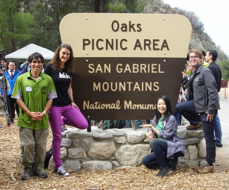
CORBA, IMBA, REI, and NFF at the Oaks Unveiling

CORBA has submitted a letter supporting the preservation of the San Gabriel Mountains National Monument. President Trump’s executive order 13792 called for a revision of the many National Monuments that were presidentially-designated under the Antiquities Act from the last two decades. Department of Interior Secretary Zinke has been charged with overseeing the review of these National Monuments for a number of specific items:

In making the requisite determinations, the Secretary is directed to consider, and is seeking public comment on:

(i) The requirements and original objectives of the Act, including the Act’s requirement that reservations of land not exceed “the smallest area compatible with the proper care and management of the objects to be protected”;

(ii) whether designated lands are appropriately classified under the Act as “historic landmarks, historic and prehistoric structures, [or] other objects of historic or scientific interest”;

(iii) the effects of a designation on the available uses of designated Federal lands, including consideration of the multiple-use policy of section 102(a)(7) of the Federal Land Policy and Management Act (43 U.S.C. 1701(a)(7)), as well as the effects on the available uses of Federal lands beyond the monument boundaries;

(iv) the effects of a designation on the use and enjoyment of non-Federal lands within or beyond monument boundaries;

(v) concerns of State, tribal, and local governments affected by a designation, including the economic development and fiscal condition of affected States, tribes, and localities;

(vi) the availability of Federal resources to properly manage designated areas; and

(vii) such other factors as the Secretary deems appropriate. 82 FR 20429-20430 (May 1, 2017).

As a participating member of the San Gabriel Mountains Community Collaborative, CORBA agrees with the findings expressed in the Collaborative’s letter to Secretary Zinke. While there are both supporters and one-time opponents of the Monument on the Collaborative, the Collaborative’s letter specifically addressed each of the seven points of consideration listed above without expressing support or opposition to the monument itself. The findings are that the Monument meets or exceeds the criteria established above. The Collaborative’s letter can be found HERE

CORBA has submitted a letter of support as well, and we urge our members and constituents to submit your own comments at https://www.regulations.gov/document?D=DOI-2017-0002-0001.

CORBA’s letter can be found HERE.


Report on the San Gabriel Watershed and Mountains Special Resources Study

Thursday, September 3rd, 2009

September 3, 2009
by Steve Messer

Last night Hans Keifer, Steve Messer and Jim Hasenauer attended the public comment meeting put on by the National Park Service in Santa Clarita. The following is a summary of the presentation and our thoughts, concerns and feedback on the study.

History:

This study was mandated by Congress through a bill introduced by Hilda Solis back in about 2002 and passed in 2003. The study began in 2005, but this is the first much of the public has heard of the process, including me and other CORBA and IMBA volunteers. The study area includes much of the San Gabriel mountains, as well as the San Gabriel Watershed. The watershed includes the San Gabriel River drainage area within the national forest, as well as cities along the river and its watershed such as El Monte, Hacienda Heights, La Habra, Brea, Walnut, West Covina, Baldwin Park, Monrovia, La Verne,  and the Puente-Chino Hills area. See more on the study and the process.

Study Area:

The goal of the first stage of the study was to determine:

1. the “Significance” in biological, historical and recreational terms, of the study area.

2. the “Suitability” of the area for inclusion in the National Park system. That’s to say that it fills a gap in the National Park system that can’t be filled by anything else… ie. its uniqueness.

3. The “Feasibility” of bringing it into the National Park system in some manner.


So far the study has found that there is Significance worthy of national park protection. The mountains, the biodiversity, the unique geological character, architecture and history all make it significant.

There is “Suitability” in that there is nothing else quite like it already within the National Park System.

It was deemed to be infeasible to make any of the study area a National Park. There are too many land owners and land managers, too many private holdings even within the National Forest, and in many respects, would be re-inventing the wheel to start from scratch with what the Forest service has already accomplished in managing the forest.

However, it would be feasible for the National Parks service to come in and participate in the management and development of the area, in collaboration with the Forest Service and other land managers in the study area.

Of particular concern to us, as mountain bikers, is the continued access to the trails to which we have access, the possibility of new trails being built, and to avoid any further wilderness designations.

The final goal of the study is to present to congress a report on the Significance, Suitability and Feasibility of the area, and make a final recommendation as to the most effective and efficient way for the NPS to be involved in the management of the San Gabriel Mountains and San Gabriel River watershed.

What is not covered at this stage of the study is what happens after the study is complete.

Once the final recommendation is made, it would then be up to congress to decide what to do with the recommendation. Of particular note is that Hilda Solis is now Labor Secretary, and is no longer involved in the committee that would be receiving the results of the study she helped start. The recommendation may linger on a shelf and never be implemented, or it may get picked up, brought to committee, a further recommendation made to the full house, and then may or may not pass.

This introduces some concerns. Alternative A and Alternative C both have the largest federal presence, and both would require an act of Congress to implement. Whenever an act of congress is proposed, it will be debated and most likely amended. Amendments may introduce language to weaken our position as mountain bikers, to introduce more wilderness legislation, or to to pander to certain special interest groups with large lobbying powers. It opens the door for a whole range of uncertainties in the implementation of the plan.

But that scenario would be a long way off. The study is still (four years along) at a very preliminary stage. They expect to have the draft proposal ready in a year, another round of public meetings and comments, and present their findings to congress in 2011.

Several times during the presentation and the Q&A group sessions, it was expressed that the NPS would continue to allow the Forest Service to manage the forest, and other land managers would continue to manage their own jurisdictions. From our point of view as mountain bikers, this seems good policy, since the Forest Service has just spent five years or so developing the Forest Management Plan <http://www.fs.fed.us/r5/angeles/projects/ForestPlan.shtml> in which the most productive use of the forest was deemed to be Recreation. It sounded like the Forest Service would be able to continue to implement that plan, which is not at odds with the concept of a “National Recreation Area.”

Jim, Hans, and myself split up and each joined a different discussion group. Nowhere was there any strong or vocal anti-mountain bike sentiment, and in Jim’s group four of the fifteen people were mountain bikers. My group were all hikers from Santa Clarita who wanted more trails and access from the northern slopes of the San Gabriels, which are greatly under-utilized in comparison to the more populated southern slopes. There was no equestrian presence, but a few in my group said that the equestrians were supportive and would be doing a letter writing campaign. Given the past positions of the Equestrian Trails, Inc. (ETI), their campaign will likely be very anti-mountain bike.

But this meeting wasn’t really about what people wanted more or less of (trails, signage, interpretive centers, etc) though that is what came up most in the group discussions. It was about how the forest and watershed would be managed, and the alternate proposals for how that partnership would function. Management includes the ability to meet the needs and provide the resources that the public want, something that just isn’t presently happening given the current financial situation of the FS. 85% of their budget presently goes to fire management (well spent at the moment) leaving little for improvements.

To summarize the three alternative plans:


Alternative A
, the forest would get the largest involvement by the NPS, the largest land area that would be covered (most of the Lower Angeles National Forest) and management would come mostly from the National Forest Service with assistance, input, and funding from the NPS. This seems to us, as the better option, with less agencies involved, more land area, and more funding. It incorporates most of the Southern Angeles National Forest, and little outside the forest.

Alternative B would have the NPS creating a Master Plan for the whole area, San Gabriel mountains, rivers, all of the cities and land managers along the river and into the Chino hills. After that master plan is developed, the NPS would have little involvement, and it would be up to each individual jurisdiction to implement that master plan as a the San Gabriels Parks and Open Space Network. It includes the southern Slopes and the San Gabriel mountains and the river corridors.

Alternative C would have the NPS taking a leadership role and overseeing a partnership between the FS and the many local land managers. The area would include only the San Gabriel watershed and river corridor. This would exclude most of the current southern Angeles National forest.

There was no mention of new wilderness areas, as this is strictly a study for inclusion in a National recreation area, or Recreational Open Space area, not a wilderness study. Not much was addressed among the group discussions about the lower watershed, including the various cities and the Chino-Puente hills area, though the meetings in El Monte and Diamond bar would have had more involvement in those areas.

There is a comment period on the current presentation through October 30th. At the above web site, click on “Newsletter 4” then click on the “Comment on Document” link on the left side of the screen.

They need to hear from as many mountain bikers as possible, to ensure that we are represented as a large and growing user group of the forest. To make comments, here’s my list of my answers and talking points:

NPS Public Comment Topic Questions:

1. Is there one alternative concept or idea presented that you think is most valuable in terms of improving recreational opportunities and protecting significant resources? Tell us why you think this idea is valuable.

The inclusion of the largest land area, Alternative A, would give the most coverage and likely bring the most resources in to manage the national forest.   A combination of Alternatives A & C would provide the most coverage of important natural resources, including both mountain and river protections and opportunities for interpretation.  A combination of A & C would create a strong federal management partnership between the USFS and NPS and a strong recreational identity for the San Gabriel Mountains and watershed.


2. What suggestion do you have for strengthening or improving on the alternative concepts? Do you have an entirely different vision of how the area should be managed? If so, please describe your vision.

However, the inclusion of the lower watershed portions of Alternatives B and C, which incorporates much of the green belts along the rivers and the Chino-Puente hills, would present the most recreational opportunities to the largest number people. Perhaps some hybrid of these proposals in which the NPS and USFS manage the San Gabriel Mountains portion, and together oversee the partnership outlined in Alternative C as an open space network.

3. What concerns do you have about the current alternatives?

Recreation. The most productive use of the forest should continue to be recreation, as outlined in the current Forest Plan, and recreational access should be increased through a more streamlined process for getting new recreational projects approved. Recreational projects should be given administrative and considerational priority over commercial and other proposals, since the most productive and valuable use of the forest has been deemed recreational. We would hope that the NPS could bring in additional staff to more rapidly complete studies required by the NEPA process. These goals would seem to be in line with a National “Recreation” area.

Mountain bike access. There is a strong need for an area for mountain bike specific trails for this fast growing user group, both to take pressure off existing multi-use trails and minimize disparate user group conflicts. However, this should not be at the expense of continued access to the existing trail network, which are currently enjoyed by many thousands of mountain bikers annually with few conflicts. A mountain-bike specific area or trail network would serve a subset of the mountain bike community whose major preference is technical downhill riding, and whose need has been demonstrated by the continued construction of illegal trails that meet that need within the region. This would remain under Forest Service management within the proposal, and no NPS policy should preclude the fulfilling of this recognized need.

Protection. Wilderness designations should be actively discouraged from any recommendation, legislation or amendments to legislation, as such designations do not meet the requirements for the best recreational use or protection of wild areas. Other protections are available that allow better management and access to wild areas without compromising biological protection. Other political and user groups are seeing this study and proposal as a way to slip in more wilderness designations. This is contrary to the recreational nature of the forest and not in the best interest of the public as a whole.

Management.  The Forest Service should be allowed to continue to implement its Forest Master Plan, albeit with additional resources and funding provided by the NPS within their shared goals and objectives. They have already invested years of study into the area, and have developed a master plan that at present provides the best guideline for the management and further development of the forest.

4. What are your thoughts or comments on the study findings (significance, suitability or feasibility)?

There is no doubt among any who have hiked, mountain biked, soared (hang gliders), ridden horses, off-highway vehicles, rock climbed, or done any geological, biological  or archaeological study, that the area is significant, unique, and worthy of including in the NPS system.

The biggest concern then becomes the addition of an additional layer of bureaucracy when trying to make improvements in access, recreational opportunities or facilities. Based on information in the presentation, those concerns appear to be minimized in the present proposals. The political manipulation of legislation that may be introduced as a result of the study favoring one user group over another, or one type of biological protection over another, then becomes the major future consideration, and that is largely beyond the scope of the present study.

Summary and Future:

There is nothing presently in the study that would threaten mountain bike access to the Naitonal Forest. In fact, all indications are that the increased funding and NPS administrative assistance, as Alternatives A and C would provide, would be beneficial to all forest user groups. Perhaps some hybrid of the alternatives would be best. The NPS will hopefully determine that from the comments and meetings.

At present, we should keep monitoring the web site <http://www.nps.gov/pwro/sangabriel> for changes and updates. The newsletters (Currently number 4) outline the progress of the study and explain each of the currently proposed alternatives in detail, including the vision, concept, management structure and funding.

Post your comments to the NPS web site as mentioned previously, and feel free to use what has been provided above or to elaborate or put your own thoughts into words.

The next round of public meetings will take place once the draft proposal is ready (Q4 2010), and we’ll have the opportunity to make our voices heard again then.

Poop Predicament Has Los Angeles Horse Owners Raising a Stink

Friday, April 25th, 2008

April 25, 2008 (Bloomberg) — The poop hit the fan when the last manure mulcher in Los Angeles closed shop.


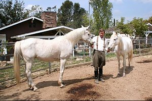
Fritz Bronner, a local horse owner and activist, feeds two of his five Arabian geldings in the corral behind his house in the Lake View Terrace neighborhood of Los Angeles on April 8, 2008. Los Angeles is home to some 1,500 legally registered horses, but the actual count is more like 10,000, according to Los Angeles City Councilwoman Wendy Greuel. Photographer: Nadja Brandt/Bloomberg News

The price of poop disposal is breaking the budgets of Los Angeles horse owners, as stable owners pass along the expense of taking horse droppings to landfills.

“The cost to get rid of this stuff has just skyrocketed,” said Royan Herman, 65, who runs the Peacock Hill and J-Bar Ranch stables in the San Fernando Valley with her husband, Mark. “A lot of young families aren’t able to afford a horse anymore.”

Los Angeles, the city of Hollywood stars, is also home to about 10,000 horses, said City Councilwoman Wendy Greuel. Some estimates of the horse population run as high as 20,000 within city limits and 45,000 in all of Los Angeles County, which has 9.9 million residents.

The waste produced by horses living in a big city wasn’t a problem for decades, as plant nurseries and compost yards accepted manure and turned it into fertilizer. When zoning officials allowed developers to build homes close to those sites, new residents complained of the stench and nurseries began turning away the dung. The owner of the last compost yard, Dickran Sarkisian, said he closed in October because he wasn’t able to renew the lease.

Depositing manure at a landfill costs as much as $47 a ton, five times what the mulchers charged, said Mark Herman of Peacock Hill and J-Bar. Stable owners can’t afford to stay in business unless they pass that expense to boarders, he said.

“In the last four to five years, the cost for individual horse owners has doubled,” said Herman, 85. He said the 120 horses at his stables produce as much as 5 tons (4.5 metric tons) of manure a day.

Equine Surrender

Some Angelenos said the rising stable fees are forcing them to give up their beloved horses.

“The prices for boarding a horse are crazy,” said Rachel Rosenberg, 24, an aspiring actress who keeps her mustang, Indie, at Ravensview Ranch. “If I don’t get enough hours together at work, I won’t be able to afford him.”
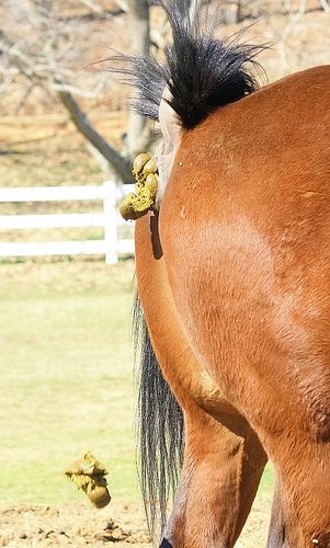
Jack Quigley, a retired oil field production technician, already had to sell his mare, Fancy.

“I loved her to death,” said Quigley, 67. “But I couldn’t afford to keep her.”

Barbara Underwood, 65, who owns Ravensview, a 27-horse stable near Burbank, said she lost eight boarders when she raised prices. She charges $300 a month for a small corral and $400 for a box stall, following the $15 increase in December. She expects to boost rates again soon, by $20.

At Peacock Hill and J-Bar, Royan Herman said she may have to raise fees by $100 from the current $300 to $450 a month.

Riding Territory

Los Angeles offers plenty of space and varied terrain for riding. The county encompasses 4,000 square miles (10,000 square kilometers), including a 70-mile (110-kilometer) Pacific Ocean coastline, mountains, forest and desert.

Some horse-friendly enclaves cater to riders. In Lake View Terrace, a dry cleaner has a hitching post, and street-crossing buttons at some intersections are at a height where they can be reached from horseback.

“It’s this incredible feeling of being in a different world,” said Fritz Bronner, 49, riding Faz, one of his five Arabian geldings, on one of Lake View Terrace’s bridal paths. “All along my street, there are horses and chickens and dogs. It’s a little country feel on a half acre.”

Much of the Los Angeles horse population is off the books. Only about 1,500 are registered, which is required by law, according to city officials.

Registration Drives

That doesn’t help the equine community’s cause, said Greuel, the councilwoman. She’s pushing for a Horse Advisory Task Force to get more owners to comply, so they’ll have a bigger voice in municipal affairs.

Some residents including formed “poop councils” and staged registration drives to educate owners and encourage them to sign up their animals for $14 a year.

“I’ve never even heard of registering your horse,” said Sari Sarlund, 41, who boards her Frido at the Los Angeles Equestrian Center.

Horses generate an estimated $900 million in ancillary revenues a year, Bronner said, sustaining riding teachers, veterinarians, blacksmiths, and feed and tack stores. Bronner, an actor, runs a non-profit service that provides Arabian horses for military re-enactments, parades, films and television.

“It’s an underground economy,” said Bronner, who serves on the Foothill Trails Neighborhood Council. “We never get credit for it. It’s never properly accounted for.”

Poop could add even more cash to city coffers. Councilman Richard Alarcon started a pilot program to recycle some of the manure into compost.

“We are looking at every option available to us, including the generation of electricity,” Greuel said.

Bronner said he’s worried that the poop-disposal crisis and lack of political clout may spell an end to the intangible benefits of sharing Los Angeles with horses.

“The clip-clop on the streets is soothing,” Bronner said. “Horses just slow everything down a bit. Traffic slows down, you slow down.”

To contact the reporter on this story: Nadja Brandt in Los Angeles at nbrandt@bloomberg.net