Archive for the ‘Advocacy’ Category

Rim of the Valley Corridor Preliminary Findings – Public Hearings in November

Thursday, October 25th, 2012

The Special Resource Study for the Rim of the Valley Corridor has been released. While we have not yet had a chance to look at the proposed alternatives, we will do so in the coming weeks and after the first round of meetings. We reported on the ROTV corridor study’s release of Scoping comments in 2011.  The alternatives presented in Newsletter #3 should address and consider these comments.

The four alternatives presented are:

  • Alternative A: No Action (A continuation of current management)
  • Alternative B: Cooperative Conservation Partnership
  • Alternative C: Connecting Urban Parks – Santa Monica Mountain National Recreation Area Boundary Adjustment
  • Alternative D: Connecting Natural Habitat – SMMNRA Boundary Adjustment

While all these alternatives have their advantages and disadvantages, there is an overlapping study for the San Gabriel Watershed and Mountains Special Resource Study. It’s unclear from these preliminary documents how these two studies overlap, and how much of the effort in each is a duplication.

It is within CORBA’s mission to help protect and preserve our open spaces and public lands, in addition to providing access to those public lands through natural-surface, shared use trails. None of the alternatives presented in this newsletter outline any specific actions with regards to the Rim of the Valley Trail, but rather, provide an outline for the role the National Park Service might play in its future development and management.

We’ll look over these alternatives and publish our comments, and strongly encourage others to also comment by the January 7 deadline.

Below the break is the meeting schedule and offical notice for the study, which can be downloaded here.

——————————————————————————————————————

Preliminary Findings & Alternative Concepts Newsletter Available for

Rim of the Valley Corridor Special Resource Study

Dear Friends,

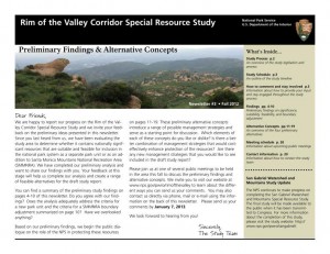
We are happy to report our progress on the Rim of the Valley Corridor Special Resource Study, and we invite your feedback on the preliminary ideas which are presented in our recently published Newsletter #3. The newsletter includes preliminary study findings that address whether resources of the study area are nationally significant, and whether they are suitable and feasible for inclusion in the national park system as a new park unit or as an addition to Santa Monica Mountains National Recreation Area (SMMNRA). Based on these preliminary findings, four preliminary alternative concepts are also presented in the newsletter for your consideration. Please send us your comments by January 7, 2013. 

The four preliminary alternative concepts presented in the newsletter illustrate different ways of providing protection and public enjoyment of resources that have been identified as potentiallynationally significant.  They include different levels and types of involvement by the National Park Service (NPS). Most importantly, these preliminary alternative concepts serve as a starting point for discussion and public input.

Please tell us what you think about the alternative concepts. Do you like one particular concept more than the others? Do you like various elements of each of the concepts? Do you have an entirely different vision of how the area should be managed? Your comments will help us refine the concepts and will ultimately lead to a recommendation to Congress.

We have scheduled seven public meetings extending through the month of November, concluding with a final meeting in early December. During these meetings, we will update you on our progress on the Rim of the Valley Corridor Special Resource Study and listen to your thoughts and ideas. Dates, times and locations of these meetings are listed below.  The NPS will also host a virtual public meeting online. Information on the virtual public meeting will be posted on the study website.

We look forward to hearing from you!


Wednesday, November 7, 7 – 9 p.m.
Conejo Recreation and Parks District, Community Room
403 W. Hillcrest Dr., Thousand Oaks,CA 91360

Thursday, November 8, 7 – 9 p.m.
George A. Caravalho Santa Clarita Sports Complex, Activities Center Building
20880 Centre Point Parkway
Santa Clarita, CA 91350

Tuesday, November 13, 6:30 – 8:30 p.m.***
Pacific Community Center
501 S. Pacific Ave.
Glendale, CA 91204

Thursday, November 15, 7 – 9 p.m.
Mason Recreation Center
10500 Mason Ave.
Chatsworth, CA 91311

Tuesday, November 27, 6:30 – 8:30 p.m.
Encino Community Center Women’s Club
4935 Balboa Blvd.
Encino, CA 91316

Thursday, November 29, 7 – 9 p.m.***
Moorpark Community Center
799 Moorpark Ave.
Moorpark, CA 93021

Saturday, December 1, 10 a.m. – noon
Eaton Canyon Nature Center
1750 North Altadena Dr.
Pasadena, CA 91107

Hastain Trail Victory

Thursday, October 25th, 2012

Back in March 2011 we reported on a developer’s attempts to cut off the Hastain trail, which has been in public use for more than forty years. A group of local advocates and trail lovers led by Ellen Scott, through the Save Franklin Canyon group, fought the developer’s attempts to close public access to the trail. They garnered petition signatures and did a great job of alerting the trail using public about what was at stake.

The Mountains Recreation Conservation Authority joined the plaintiffs in the suite, and brought in additional legal resources.

There were enough legacy hikers–people who could testify and verify that they had been using the trail since before 1972–to legally establish grounds for a prescriptive easement.  Judge Palazuelos, who presided over the case,  personally toured the trail at the request of the plaintiffs.

On Tuesday, October 16, 2012, the Court made a tentative ruling in favor of the plaintiffs. The defendant, Coldwater Development LLC, have been ordered to remove all equipment and fences from the trail. A public easement has been permanently established.

We thank this dedicated group of concerned trail users, that included many local hikers and some cyclists, for their diligent efforts to keep this trail open to the public.

Ride And Mingle (RAM) Nov 17 Building Momentum

Saturday, October 6th, 2012

In celebration of CORBA’s 25th Anniversary, on November 17 we will Ride up to The Hub in Topanga State Park and Mingle for a photo opportunity to show land managers and the trail user community that mountain bikers can and do coexist on the trails. We are hoping for 250 (or more) riders. Save the date and spread the word!

We’ll meet at 10am and around 10:30 we’ll take the group shot. We’ll then hand out cash prizes, with the top cash amount being $1,000. We’ll also be having a 50/50 drawing, so bring $20 in cash and put it into the pot, with the lucky winner getting half of whatever is collected and the other half going to CORBA.

How do you get to The Hub? There are several trail head locations you can start from. Reseda Blvd., Trippet Ranch, Sullivan Canyon, Mulholland Drive (dirt) from the east (Encino) or west (Woodland Hills), Will Rogers State Historic Park, Westridge Fireroad, and San Vicente Mountain Park (Nike Site), to name a few.

Check this map with all the trails and trailheads. The Hub is marked with a blue dot and the letter “z.”

Or, download this map. The Hub and the major trailheads are circled. Print it and bring it with you so you don’t get lost!

Though no RSVP is required, you can let us know you’re planning to Ride and Mingle on CORBA’s Meetup group.

Palos Verdes to open 15 additional trails to bicycles

Wednesday, October 3rd, 2012

After a long and drawn-out process, the Rancho Palos Verdes City Council on Tuesday voted to approve most of a staff recommendation to open additional trails in the Palos Verdes Nature Preserve to bicycles.  With leadership and guidance from CORBA’s Palos Verdes contingent (CORBA PV), including Troy Braswell, the newly approved trail plan opens the following to bikes:

Source: Palos Verdes Patch:

Filiorum Reserve (Previously Undesignated):

  • 6 trails encompassing 3.1 miles designated multiuse (pedestrian, equestrian, bicycle).
  • 2 trails encompassing 0.5 miles designated pedestrian and equestrian only.

Abalone Cove Reserve

  • Via de Campo Trail: Changed from pedestrian only to pedestrian/bicycle.
  • Chapel View Trail: Changed from pedestrian/equestrian to multiuse.
  • Beach School Trail: Changed from pedestrian to pedestrian/bicycle.
  • Harden Trail: Trail closed completely due to erosion.
  • Portuguese Point Loop Trail: Changed from pedestrian only to pedestrian/bicycle.

Three Sisters Reserve

  • Trail plan changed to include multiuse connector trail between the Three Sisters and Filiorum Reserve.

Portuguese Bend Reserve

  • Burma Road Overlook: New multiuse trail added to lead to an overlook.
  • Pine Grove Trail: Trail to be closed due to a fire that burned the pine grove.
  • Landslide Scarp Trail: Will remain pedestrian/equestrian only.
  • Ishibashi Farm Trail: Eastern branch will remain pedestrian/equestrian only.

Ocean Trails Reserve

  • Sagebrush Walk Trail: Changed from pedestrian only to pedestrian/bicycle.

Some additional stipulations were made, including a few “walk your bike” zones on some “dangerous” sections of trail.  Two trails which had been recommended by City Staff to open to bikes were overturned by City Council, including the Landslide Scarp trail and the eastern Ishibashi Farm trail, due to safety concerns.

Throughout the process there were many setbacks, numerous delays, and much heated debate from both sides of the argument. CORBA and local advocates have been unwavering and diligent in their participation and resolve in the process, and it is thanks to them that we have this new trail plan. There were fears that the trail plan, years in the making, would be tossed out and the process begun anew with a committee. Thankfully, the years of work put in to this trail plan were kept.

There were some disappointments, however. Eucalyptus and Jack’s Brim trails in Filiorium Preserve were not considered, perhaps due to the Council’s unfamiliarity with them. Landslide in Portuguese Bend Preserve was also not considered, due to safety and sight-line issues. However, despite these losses, the net result is very positive for the mountain biking community.

Since this process began, CORBA PV and local advocates have developed good relationships with City Council members and City staff. Recommendations were made to form a public trails committee, implement a bike patrol program, and to encourage the use of bike bells. CORBA PV expects to be working with them as the plan is implemented, and to sort out remaining issues, such as enforcement.

City staff were directed to develop a plan for enforcement within 90 days. The onus now falls on local mountain bikers to be good ambassadors for the sport and stewards of the trails, through their behavior while riding, by exercising good courtesy and respect for other trail users, and by riding on open trails only.

We thank the CORBA PV team for their continued efforts, and to the Palos Verdes City Council for working with cyclists on this process.

County to Open Canyon Trail to Bicycles

Wednesday, October 3rd, 2012
Canyon Trail

Canyon Trail

Thanks to the efforts of local mountain biking advocates from the Santa Clarita Valley, the County today announced that the Canyon trail will be opened to bicycles.  The report identified trail improvements and modifications needed to ensure that bicycles can be added to the existing users safely, and these modifications will take place over the next five months. The County is seeking authorization to apply for habitat restoration grants to install bridges along the Canyon trail.

The canyon trail is an easy trail, suitable for beginners, kids and family mountain bikers. It is also part of the longer and much-loved Los Pinetos loop. While the department is going to uphold the recommendation to open bikes, the decision could be challenged by other user groups. However, the State’s “Change in Use” trail assessment, which the County used to assess the trail, is designed from the ground up to be objective and defensible. Still, we need to thank the County and the people involved in the process, and keep an open dialog with them going forward.

We extend our congratulations and sincerest thanks to The Santa Clarita Valley Trail Users group who were able to harness, contain and focus the community’s initial reaction to the trail being closed to bikes almost two years ago.  Throughout the process they stuck to the “high road” as CORBA always recommends. Our collective patience and diligence through the process has paid off.  The trail is expected to open in spring 2013.

The Heritage trail in Vasquez Rocks is a different story. The County has identified many problems with innumerable “volunteer” trails in the area and a need for significant restoration, repair and trail improvements. The recommendation to keep the Heritage trail closed to bikes was upheld. In the future, when this park is re-assessed and new trails are considered, we will make sure to have a voice at the table.

From the LA County Parks web site:

TRAIL ASSESSMENT RECOMMENDATIONS UPHELD FOR HERITAGE AND CANYON TRAILS

Following two community meetings and the review of all comments, the County of Los Angeles Department of Parks and Recreation announced today that it will uphold the Trail Assessment recommendations for the Placerita Canyon Trail and Vasquez Rocks Heritage Trail. The recommendation is to not allow mountain bikes on the Heritage Trail at Vasquez Rocks Natural Area in Agua Dulce and to allow mountain bikes on the CanyonTrail at Placerita Canyon Natural Area in Newhall.

The recommendation to not allow mountain bikes on the Heritage Trail is based on the presence of significant cultural resources which could be negatively impacted by additional trail use; a lack of trails or connections to other trails outside the natural area where mountain biking is allowed; existing trail conditions which have been significantly compromised by many user created trails and the significant revegetation necessary to clarify the trail alignment.

The recommendation to allow mountain bikes on the Canyon Trail is contingent on the addition of pinch points, signage, erosion control measures and other trail maintenance items.

Trail maintenance for both trails will start within the next few weeks and following the completion of maintenance on the Canyon Trail, which is estimated to be completed in March 2013, mountain bikes will be allowed on the trail. The Department will address the safety concerns as identified in the Trail Assessment Report to ensure that the Placerita Canyon Trail is a safe trail for all users.

“We greatly appreciate the feedback we received from the community during and after the two community meetings,” said Russ Guiney, Director of the County of Los Angeles Department of Parks and Recreation. “We received 784 comments and took each comment into consideration. Trail use is a passionate issue for hikers, equestrians and mountain bikers. We are hopeful that working together the user groups will enjoy the recreational benefit of the trails while allowing trail and resource sustainability for years to come.”

The Trail Assessment process was completed by an independent consultant, The Planning Center|DC&E, who has extensive trail operations and sustainability experience. The consultant conducted two community meetings and solicited comments from the public as a part of the assessment process and made the Trail Assessment recommendations. The process used by the consultant and the Department is similar to one developed by California State Parks, but was modified to reflect the County’s Trails Manual guidelines and classifications. The purpose of the assessment process was to evaluate the condition of the trail and the trail’s sustainability as it pertains to existing and/or proposed use(s).

Quarterly Agency Meeting Report Sept. 2012

Friday, September 28th, 2012

CORBA conducts quarterly meetings with representatives from California Department of Parks and Recreation Angeles District and National Park Service Santa Monica Mountains National Recreation Area. It is a chance for us to voice concerns and report on upcoming and past trail work, events, and CORBA programs.

Of particular note are a couple of topics that have been posted on our blog recently. The first is enforcement of dangerous behavior by bicyclists (excessive speed, disregard for other users’ safety). The second, which was brought up in a reply to one of our blogs, is the concept of alternate day use on trails that are currently closed to bicyclists.

Enforcement: This is not a new issue. Citations have and will continue to be issued if and when rangers see cyclists riding in a manner that might endanger the resource, themselves, or other users. This can be, but is not limited to, going too fast. However, the issue that has brought more attention to this behavior is the increased use of the website Strava to create a “time trial” format. Even though groups are not going out on the trails and racing, the very nature of being able to “compete” against others by trying to post the fastest time on the Strava site creates a virtual group, and a situation that could lead to riders going fast at the expense of their and other users’ safety. It was noted that speed is also situational, and that as long as people are being safe there isn’t necessarily an issue with speed.

Alternate Days: The State and NPS representatives at the meeting agreed that alternate days are a viable alternative to trails that are currently closed to bicycles, and recognized that they were aware of similar programs that were being used successfully in other parts of the country. It was pointed out however, that there is currently a Change In Use process in place that allows for changing a trail that does not allow bicycles to one of designated as open to bicycles. The Yearling/Lookout Trails is currently undergoing this Change In Use process (see below for the status of this process). The comment was made that any change to the designation of a trail would have to go through the formal Change In Use process, so it makes sense to try to change a trail’s designation to shared use all the time, not on alternate days. One note: the suggestion of alternate trails came primarily in response to trails that are closed in the State Wilderness of Point Mugu State Park. State Wilderness basically follows the Federal Wilderness Act of 1964 which, among other things, bans “mechanized transport” which includes bicycles. To change the Wilderness Act would require a lengthy and costly political and legal battle which CORBA is not prepared to wage.

Yearling/Lookout Update: This trail, which is on the northwest edge of Malibu Creek State Park with, is slated for an Environmental Impact Report (EIR) because it will need to be rerouted before any change in use can occur. The Topanga General Plan/Malibu Lagoon EIR is taking precedent over other EIRs, so the Yearling/Lookout EIR’s status is on hold at this point. Click here to see our original blog article regarding the Change In Use for Yearling/Lookout trails.

TRAIL MANAGEMENT PLAN UPDATE

The long awaited NPS Trail Management Plan (TMP) is likely going to move forward soon. A consultant has been identified and public meetings and other efforts should begin shortly, with a projected completion date of early 2014. Once completed, the TMP will allow agencies within the the Santa Monica Mountains National Recreation Area to formally address many pressing issues, among them shared use on many trails that are currently restricted to hiking and equestrian use only.


More Work Taking Place in Sullivan Canyon Starting Early October

Saturday, September 22nd, 2012

From the Southern California Gas Company Public Affairs Manager

Southern California Gas Company Sullivan Canyon Pipeline Protection Project 

SoCal Gas plans to perform maintenance and repair work to the portion of Sullivan Canyon, which has been owned and maintained by SoCal Gas since 1960, in accordance with State and Federal pipeline safety regulations and a 5-year Maintenance Plan.  We are currently in the second year of that plan.

Heavy rains during 2010 and 2011 caused severe earth erosion and washout damage to the pipeline maintenance access road within the canyon.  As a result, buried SoCal Gas transmission pipelines have been exposed in some areas.  It is important that we repair this damage in order to maintain safety and so that we may continue to provide Southern California residents with a safe and reliable supply of natural gas.

For your consideration, the following impacts are to be expected in your neighborhood.  Please note that these are only approximations and are subject to change.  We will do our best to keep you apprised of any changes.

  • Duration of work (tentatively) – October 6, 2012, temporary restricted public access to certain areas of the canyon, which will remain in effect until work is completed.  At minimum, work is estimated to be completed by January 2013.  Staff will safely guide the public around restricted areas of the canyon.
  • Hours of Operation – 7am-7pm weekdays and 8am -6pm Saturdays.  No work will be performed Sundays;
  • Reduction of public curb parking at entrance to canyon;
  • Intermittent loud noise in the immediate work areas;
  • Increased dust in the immediate work areas;
  • Increased traffic from work crews and equipment; and
  • Signage indicating access restrictions.

Location and Logistics

  • 4.5 mile stretch of land that comprises Sullivan Canyon between Queensferry Rd. and Mulholland Dr. (Farmer’s Fire Rd.) at both ends of the canyon;
  • Equipment and material will be delivered via Queensferry Rd.;
  • Mulholland Drive will be the primary delivery/export route to avoid hindering traffic in the neighborhood near Queensferry Rd.; and
  • On-site construction management who will manage work crews to ensure that work is performed neatly and that a limited footprint is left in the canyon.

Purpose and Project Scope

  • Restoration of access road including grading and fill for safe pedestrian and vehicular use; the road will remain essentially an earthen road. and
  • Repair of cover to two high – pressure transmission pipelines.

Environmental Impacts

In order to re-establish the road and repair the pipelines while minimizing environmental impacts to the canyon, SoCal Gas has commissioned and will be working closely with professional environmental consultants during project planning and implementation.  To date, a survey has been conducted by the project biologist and an arborist recommended by the City of Los Angeles.  The survey identified and the City concurred upon the removal of two hazardous oak trees within the project alignment.  A hazard tree removal permit will be issued for this work and these trees will be mitigated at a 5:1 ratio (10 new trees will be planted as replacements) per the California Department of Fish and Game.  No additional oak trees or other native trees will be removed.

Oversight Agencies and Additional Advisory Assistance

  • United States Army Corps of Engineers
  • Los Angeles Region California Regional Water Quality Control Board
  • California Department of Fish and Game
  • Los Angeles Fire Department (fire prevention plan)
  • Sage Institute (environmental advisement)

Updates regarding additional closures and/or canyon restrictions, or changes to the project plan will be distributed periodically throughout the duration of the project.  Closures or restrictions will also be posted on the gate at Queensferry Road and at the entrance to the property off of Mulholland in advance, to the extent feasible.

We apologize for the inconvenience caused by this necessary work to ensure pipeline safety and maintenance of a reliable natural gas supply to the Los Angeles basin area.  SoCal Gas appreciates your understanding of the need for this maintenance work and temporary disruption of canyon access.

Please know that safety is our first priority.  We appreciate customers and members of the community keeping us informed on conditions surrounding our facilities.  Likewise, we believe it is important to communicate with you when we know our work will impact our neighbors. Again, there are two high-pressure transmission pipelines located in the canyon and we will continue to periodically perform maintenance work to them as-needed to ensure safety.  We will provide notification when projects are scheduled and we will do our best to work with neighbors and the public to minimize impacts to customers and stakeholders.  It is our goal to keep disruptions to a minimum and we regret temporary inconveniences.

Thank you for your understanding while we perform this necessary maintenance and repair work.  Should you have any questions, please call Krista Phipps at (323) 578-2650 or email kphipps@semprautilities.com.

Mapping the Rattling Creek Epic

Thursday, September 20th, 2012

IMBA’S MAPPING SPECIALIST VISITS PENNSYLVANIA

IMBA Mapping Specialist Leslie Kehmeier has been busier than a one-armed paper-hanger laying the groundwork for IMBA’s mapping program. Launching this type of venture is no small task, but one that will provide valuable resources for IMBA’s grassroots network in the years to come.

In addition to a vast amount of planning and research, Kehmeier has spent time in the field mapping selected trail systems in different regions. During those efforts, she’s had the opportunity to work with local chapters and advocates collecting information, refining techniques and developing the process for acquiring data on the ground.

“Our volunteer network will be a key aspect in building a comprehensive trails database. The knowledge they
can provide about their local trail systems is invaluable and we look forward to working with them as the mapping program continues to grow,” says Kehmeier.

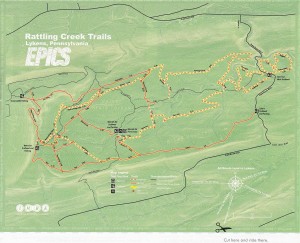
In March, Kehmeier traveled to Lykens, Pennsylvania, home of the Rattling Creek Trails that were designated as an IMBA Epic in 2011. Until recently, this exceptionally well-designed and built trail system has remained largely unknown. Alongside local rider Mike Kuhn and Mid-Atlantic Region Director Frank Maguire, Kehmeier collected GPS data for the entire trail system and facilities, resulting in the map on these pages.

In upcoming weeks and months, IMBA will release a small sampling of additional Epics maps. But there’s much more to come with IMBA’s mapping program.

For advocacy work, maps provide an effective way to communicate with local land managers and decision makers. Maps can showcase the need to develop trail maintenance plans, inform public comment for protecting trails and help plan routes for future riding opportunities. In the near future, IMBA’s network of chapters, members and supporters will have access to a robust set of GIS and mapping tools to help them create great maps in their own areas and trail systems. Kehmeier will conduct trainings and help our grassroots network create customized maps that suit their local needs.

In Lykens, as with many communities, trail systems have proven to be a powerful economic driver. The new Rattling Creek Trails map will be used for more than just a navigational guide. The local city council is leading the charge to develop more trail opportunities in the area, including a rail trail. The map will become a useful tool in future fundraising campaigns and grant cycles and will illustrate the potential for trail opportunities and connections in the area. A picture is worth a thousand words, but a map could be worth thousands of dollars.

MAPMAKING IN THE FIELD

Mapping a trail system on a mountain bike is a challenge, but if you do it right the results will be worthwhile. Keep in mind the more comprehensive the acquisition effort, the more potential it has to generate different maps. This data I collected for this Rattling Creek map can be spun into other versions that highlight needs like trail maintenance or funding requests.
Once in the field, try to be patient — you won’t set any ride-time records while gathering trail data. Be ready for the process to require multiple days, frequent stops and constant backtracking. Be sure to focus on the components of the trail system and its supporting facilities, like trailheads and parking lots. Remember to capture points for notable bike-specific features like rock gardens, switchbacks and ladder bridges. I like to jot down lots of notes in the field that I can refer back to when I’m drafting a map on my computer screen.

It’s usually possible to acquire existing map data that covers vegetation, waterways and road systems, so those things shouldn’t be the focus of your field mapping efforts. Consider rounding out your documentation by capturing photos, videos and other materials that you might use to create a memorable, multi-media map for online presentations. When you assemble all the elements you’ll have a map that truly tells a story.

— Leslie Kehmeier, IMBA mapping specialist

The Rattling Creek Epic offers flowy trails punctuated with rock gardens, creating classic East Coast riding that rewards bike handling as much as fitness. Trails don’t get more sustainable than the Rocks Ridge section — a 3/4-mile boulder field that’s featured on the IMBA website under the heading “Toughen Your Trail With Rocks.” Unforgiving, yes. But it’s rideable if you’ve got the chops. More info at imba.com/epics.

Copied from IMBA Trail News, Summer 2012

CORBA 25th Anniversary Gala: Still a few openings to attend

Wednesday, September 19th, 2012


Free Beer…Door Prizes…Great Cause, Sign up today for CORBA’s 25th anniversary gala to be held on Satuday evening, September 29th!

Note: Even though we are past the deadline, there are still a few openings for procrastinators. Registration will be open until we have 90 participants, so there are a few (very few) spots left.

CORBA would like to welcome newest event sponsor New Belgium Brewing Company, long time CORBA supporters who will be providing beer to event attendees.

Please sign up as soon as possible…there is limited seating and registration will close next Tuesday (September 25th), with no onsite registration available. The event will include a catered dinner (vegetarian option available) including beer, wine and other beverages for the $25 registration fee. The program will include a few brief speeches, a video presentation and awards.

All registered participants will be entered to win one of several great door prizes, including a Specialized Carve 29” bike, a Niner EMD 9 Frame and more. Extra tickets will be available onsite for $10 each.

This is a great opportunity to mingle with CORBA founders, current CORBA leadership, land managers, Mountain Bike Hall of Fame members and others who share a passion for riding on dirt. Come celebrate the first 25 years of advocacy volunteerism and accomplishments as we launch the next 25 years of CORBA.

Support the Trails, Support the Parklands…Support CORBA, and register online now!

Big Bear Group and USFS Partner for project

Monday, September 17th, 2012

The trails around Big Bear Lake, CA, enjoy a rich mountain biking heritage. Big Bear has played host to several World Championships and has the potential to become an outstanding riding destination for cyclists of all styles and abilities. Over the past few years, the Big Bear Valley Trails Foundation (BBVTF) has grown into a well-known and well-respected group of multi-use, non-motorized trail advocates, with the goal of developing a vibrant trail network in partnership with the San Bernardino National Forest (SBNF).

The current focus of the BBVTF’s work is the Skyline Trail, a planned, 15- to 20-mile network of singletrack to be located on a ridge just to the south of the ski resort. The trail will be designed inside a firebreak and will have options to ride short loops or the entire trail. “The Skyline project stands to become a premiere mountain bike trail network in southern California and within the Western states,” says Patrick Kell, IMBA Southwest Region Director.

Recently, the BBVTF held a showing of the documentary Pedal Driven to a packed audience. The group presented its work and committed $40,000 in cash and in-kind volunteer time to the project. The USFS committed $80,000 to the project. “Our partnership with the trails foundation is the example of how land stewardship is going to happen in the future,” says District Ranger Scott Tangenberg. “It’s the peoples’ forest; they are here to take care of it. I want to facilitate that and encourage their help.”

The work on the Skyline Trail has fostered a positive relationship between the BBVTF and the SBNF that has led to the consideration of the South Shore trail network, including a desire to maximize connectivity of the existing system so it best meets the needs of a variety of trail users. IMBA Trail Solutions will likely be contracted this summer to begin the planning process of the Skyline Trail. Kell hopes to see construction begin as early as late summer.

Copied from IMBA Trail News, Summer 2012