

Our last ride at Malibu Creek State Park was a success, with two new riders joining us!
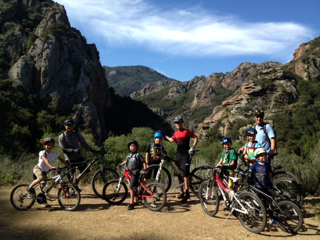
May’s ride will take place at Sycamore Canyon. Please meet us in the day parking lot at Point Mugu at 9 a.m.
|
|
|
|
|
|
|
|
|
Our last ride at Malibu Creek State Park was a success, with two new riders joining us!
May’s ride will take place at Sycamore Canyon. Please meet us in the day parking lot at Point Mugu at 9 a.m.
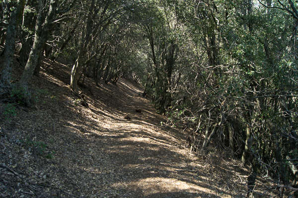
During the annual Santa Monica Mountains Trail Days in Pt Mugu State Park, CORBA volunteers with the help of a few others repaired drains and cleared brush along the entire 1.8 miles of the Wood Canyon Vista Trail, a segment of the Backbone Trail.
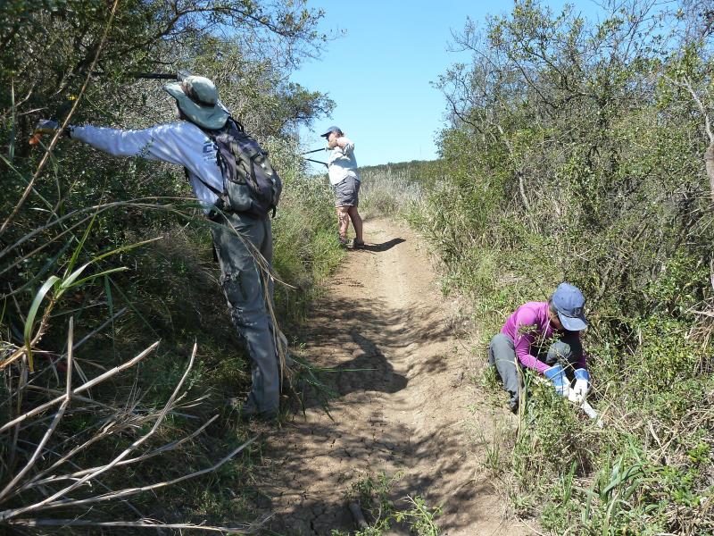
Clearing brush on the Wood Canyon Vista Trail. Links to the photo galleries are at the bottom of this article.
The SMM Trail Days is a weekend-long event organized by the Santa Monica Mountains Trails Council that has taken place at the end of April for 32 years running. As well as helping with trailwork on Saturday and Sunday morning, volunteers are able to camp over Friday and Saturday night at the Danielson Multiuse Area, enjoy a barbecue dinner on Saturday, and win great prizes on both Saturday and Sunday in appreciation for their work.
On Saturday morning, 17 CORBA Volunteers and a few others were shuttled from the registration area to the bottom of the Wood Canyon Vista Trail. We split into four groups, headed by CORBA trail crew leaders Steve Messer and Steve Clark, and Trails Council crew leaders John Kross and Greg Sweel, and started up the trail. Two of the groups focused on cleaning sediment out from existing drainage dips and cutting new drainages where needed, while the other two groups wielded loppers or a hedge trimmer to cut back overgrowing brush. In addition, we had the support of two employees of California State Parks who used a gas hedge trimmer to cut back a major overgrown section halfway up the trail. This section included lots of poison oak, so we are extremely grateful for their help!
Overall we fixed up about 1.3 miles of trail from the bottom.
While we were working on this section of the Backbone Trail, other groups were working on Coyote Trail, and in the Boney Mountain Wilderness Area, Blue Canyon Trail, Old Boney Trail and Chamberlain Trail.
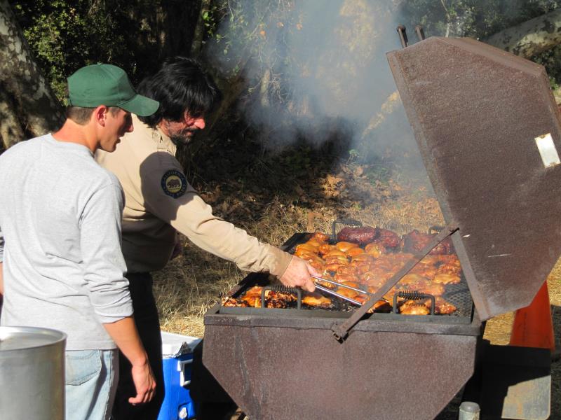
Preparing dinner on Saturday night.
On Sunday, a smaller group of 6 CORBA volunteers plus 3-4 others were shuttled to the top of the Wood Canyon Vista Trail so we could work down to where we had left off the day before. We split into a group with loppers led by CORBA trail crew leader Steve Clark to cut back brush, and a group with treadwork tools to clean out drainages, led by Trails Council crew leader Howard Cohen. We completed the upper section of the trail in about an hour and a half, then hiked to the bottom to catch a ride back to the registration area. On the way down we were able to take in the magnificent view of Sycamore Canyon and Boney Mountain, something we don’t have as much time to appreciate when we’re riding our bikes.
Other groups were working on the Upper Sycamore Trail and “Toe Stubber” Trail (part of Old Boney Trail) in the Wilderness Area on Sunday.
I’m very pleased with the work CORBA volunteers accomplished over the weekend! I never expected we’d get the whole trail completed. I’m also grateful for the help of a few other volunteers, and especially the State Park staff who took care of the poison oak. Without them, we wouldn’t have completed the trail.
A special thanks goes out to the Trails Council for the outstanding job they do in organizing this event, with the extras like free camping, bagel breakfasts, Saturday night BBQ dinner, and great prizes for everyone. And the rangers and other employees of the State and National Parks had a huge part in making this event such a success. All this effort ensured that the volunteers came away not only with a sense of accomplishment for helping to keep the trails in good shape, but also with great memories of the whole weekend!
Here are links to photo galleries of the weekend:
Officials from Los Angeles county and Santa Monica Mountains National Recreation Area (SMMNRA) are advising visitors that ticks from Paramount Ranch in Agoura Hills recently tested positive for Lyme disease. Three separate pools of western black-legged ticks (Ixodes pacificus) found along the Coyote Trail were found to be positive.
“This is a good reminder for visitors to stick to the trail and avoid the vegetated areas where ticks like to hang out,” said Evan Jones, SMMNRA chief ranger. “Though Lyme disease can be very serious, simply following a few basic steps can greatly minimize exposure.”
Jones also advises the public to check clothing and exposed skin before heading home, making sure to brush off any small creatures. Wearing light-colored clothing with long sleeves and long pants is also recommended.
Lyme disease is an infectious disease that can start as a mild flu-like illness and develop into severe chronic health problems over time. If identified in the early stages, it can be successfully treated with antibiotics, but the potential for long-term complications increases if the disease progresses untreated.
Paramount Ranch was one of three Santa Monica Mountains park sites that came back positive for Lyme disease in tests conducted by Los Angeles County West Vector and Vector-Borne Disease Control District. The other two locations were Tapia Park and Malibu Creek State Park, both located within a short distance of one another.
Robert Saviskas, executive director of the L.A. county agency responsible for conducting the tests, said this was the first year his agency tested for Lyme disease at Paramount Ranch, among approximately 12 sites tested within the Santa Monica Mountains. The first tick known to carry Lyme disease was found in the mountains in 1998.
“We’re finding that about 1 or 2 percent of western black-legged ticks in the area carry the Lyme disease bacteria, so it’s important for us to identify where the problem is occurring,” said Saviskas. “This particular tick is most active from late November through May.”
More information is available at www.lawestvector.org or by calling 310-915-7370.
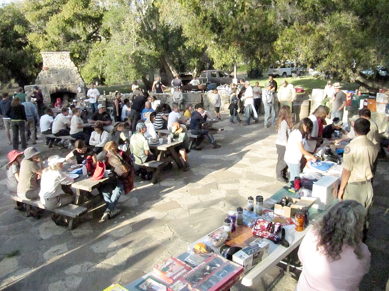
It was another perfect day to be riding in Malibu Creek State Park to participate in the free monthly basic skills clinic. This month we had 26 riders and I’m sure eveyone had a great time with the clear and warm weather! You can see the photos in the April Skills Clinic Photo Gallery.
The April edition of CORBA’s monthly newsletter, the eTerraTimes, was published today, March 4. If you don’t get it by email, you can view it online.
As always, the eTerraTimes has all the latest news for mountain bikers in the Santa Monica Mountains and surrounding areas.
THOUSAND OAKS, Calif. – The National Park Service (NPS) is advising visitors that trails at Cheeseboro and Palo Comado Canyons will be intermittently closed during April and May due to the demolition and removal of surplus water conveyance infrastructure.
Several days of trail closures are expected, though limited to weekdays between 8:00 a.m. and 5:00 p.m. Visitors can find up-to-date information on trailhead signs, by calling 818-889-8996 or by visiting www.nps.gov/samo.
The Cheeseboro Reservoir, capable of holding four million gallons of water, can be seen in the distance. Along with a pump station at Palo Comado Canyon, the reservoir will be demolished and removed during April and May. Courtesy of National Park Service
Triunfo Sanitation District (TSD) will be removing the Palo Comado Pump Station and the Cheeseboro Reservoir. These facilities, owned by TSD, were built in 1959 at the behest of comedian Bob Hope, who had hoped to build thousands of homes in the surrounding area as part of a master-planned community. TSD is decommissioning the facilities as part of an agreement with the NPS and other agencies.
Large trucks will be hauling salvaged materials along both the Palo Comado and Cheeseboro Canyon trails to recycling centers. For their safety, visitors are asked to refrain from using these trails when posted as closed.
Entrance to trails from Cheeseboro Canyon, Doubletree and Smoketree trailheads will be periodically closed. The China Flat trailhead and trailheads for Upper Las Virgenes Canyon Open Space Preserve will remain open.
The NPS and TSD appreciate the public’s cooperation with this effort. Additional information is available by calling 818-889-8996.
 Once a year we have an opportunity to work on the trails and then BBQ and camp at Danielson Ranch in Pt Mugu State Park. It is opened annually for the Santa Monica Trail Days! This is a unique opportunity to work on the trails that we enjoy so much in Sycamore Canyon, and the Saturday workday is followed by a BBQ and prizes, with free camping available on Friday and/or Saturday night. This is hands down the best day to get in some trail maintenance work! Camping is optional; you may leave with the escort after the BBQ. There will be trailwork projects on both Saturday and Sunday. Sign up for one or both! Pre-registration is requested by April 17th so we’ll know how many people to prepare for.
Schedule at a glance
Friday night April 19 – arrive for overnight camping (optional). Bagels and hot beverages supplied Saturday morning for campers.
Saturday April 20 – Trailwork, barbecue dinner, prize give-away. Bring your own lunch. Optional overnight camping. Bagels and hot beverages supplied Sunday morning for campers.
Sunday April 21 – Trailwork, prize give-away. Bring your own lunch.
You can volunteer to help out on Saturday, Sunday, or both.
BRING: LUNCHES, BEVERAGES, SNACKS AND WATER. Tools and instruction on using them are provided.
WEAR: Gloves, hat, long pants, protective clothing, and work boots or sturdy shoes.
REGISTRATION: Advance registration is required for the activities shown below, and appreciated by April 17th!
Saturday Registration: http://www.meetup.com/CORBAmtb/events/106405302/
Sunday Registration: http://www.meetup.com/CORBAmtb/events/106408382/
TRAILWORK: Saturday and/or Sunday. Help out with one or both! There are also opportunities to help out in the camp instead of trailwork.
CAMPING: Free camping Friday and/or Saturday nights for volunteers at the Danielson Multi-use Area located under the sycamores and oaks in the heart of Point Mugu State Park. Bring your own gear.
DINNER: Sat. Night Barbecue Free FOR VOLUNTEERS. Bring appetizers and beverages.
PRIZES: Thank-you prize give-aways will be held Saturday after dinner and Sunday after trailwork.
VEHICLE ACCESS: You will be able to caravan into and out of the park by vehicle only at these few designated times:
ARRIVE: Friday – 5 pm and 7 pm Saturday – 8 am and 4:30 pm Sunday – 8:30 am
DEPART: Saturday – 4 pm and after campfire Sunday – 8 am and 2:30 pm
Full details and camping/dining details are also provided on the registration pages.
The CORBA Kids Club returned to Sullivan Canyon for our monthly ride. Four dads, one mom, and 6 kids participated. You can view photos from the ride here.
On Saturday April 6 the CORBA Kids ride Malibu Creek State Park. Meet in the lower parking lot at 9 a.m. Email corbakids@corbamtb.com for more information.
On Wednesday night, March 27th, GGR and SOCAL Endurance Ladies Team were treated to a video chat with the Queen of Pain herself, Rebecca Rusch! For details, please go to the blog here: http://www.girlzgoneriding.com/2013/03/27/the-queen-of-pain-herself-miss-rebecca-rusch-treats-ggr-socal-endurance-ladies-team-to-very-special-video-chat/
April 7th: GGR presents Wenches with Wrenches Workshop! This workshop is FULL! Event is closed! To be held at Pasadena Cyclery. We will simulate typical breakdowns on the trail and fix them ourselves.
April 27th: GGR OPEN RIDE! Sycamore Canyon, Newbury Park. All levels welcome and beginners encouraged to join! Sign up is required. Please sign up on the Face Book page for details here: https://www.facebook.com/events/584789154864505/?ref=3
October 20th: SAVE THE DATE! This is the main, annual GGR event at Malibu Creek State Park! Back by VERY popular demand is the beginner skills clinic! The GGR event is a FREE event! We will also be having a CORBA/IMBA membership drive, raffles, silent auctions, 4 levels of XC rides, and of course the famous swap meet! Cycle World Chatsworth: http://cycleworldbikes.com/, will be back for their 3rd GGR event for ride support and offer light bike repairs before and after the rides.
GGR now has a calendar page so you can keep up with all the events going on! http://www.girlzgoneriding.com/calendar/
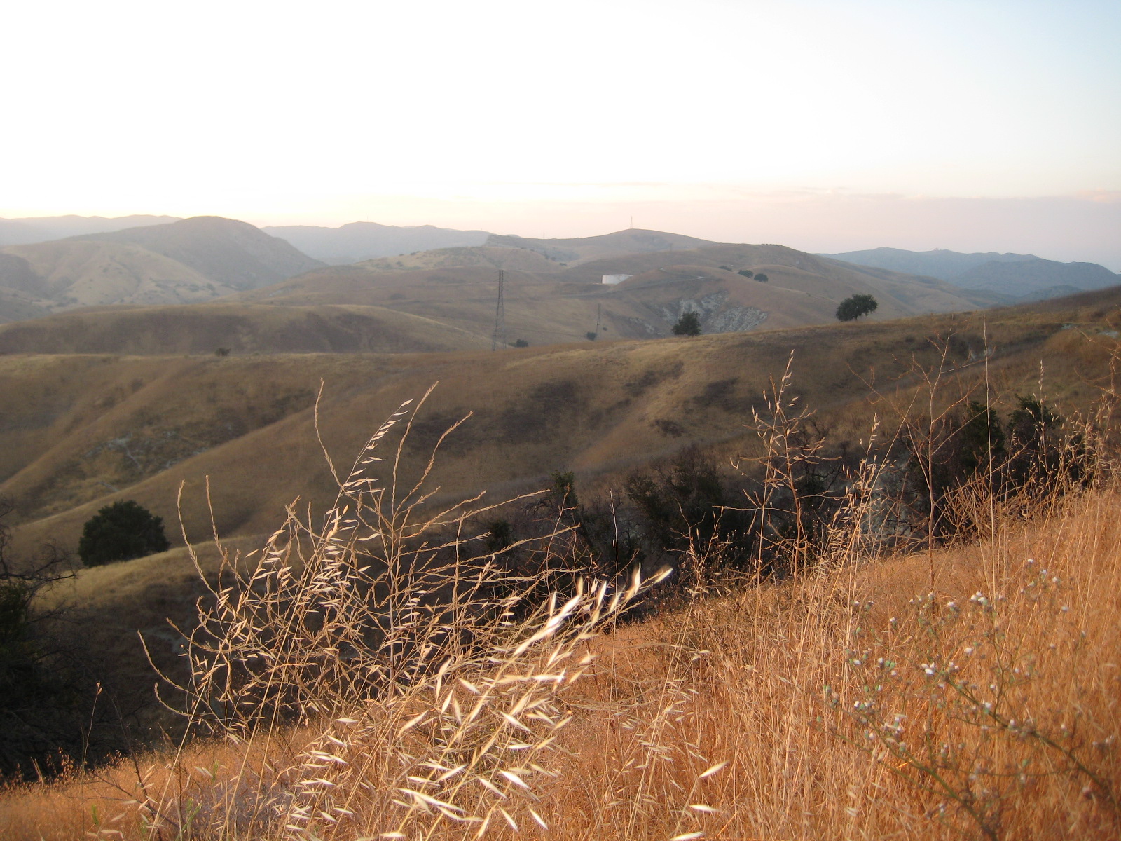
Burnt Peak Canyon Trail
Today, March 25, 2013, in a stakeholder meeting with the Forest Service and Wilderness advocates, we learned that our initial assessments of the National Forest Land Management Plan Amendments were based on an inaccurate interpretation of the draft proposal. Neither the maps supplied nor their descriptions show that the Forest Service had taken our comments into consideration.
In Alternative 2, the FS cherry-stemmed out the three official Forest Service trails in the area–Burnt Peak trail, Fish Canyon trail, and Gillette Mine trail–as per our initial requests. By “cherry-stemmed” we mean that they have drawn the wilderness boundary so that the trails retain a Backcountry Non-Motorized designation, allowing bicycles, while the surrounding area would become Recommended Wilderness. In this case the “cherry stems” are comprised of a 25-foot buffer either side of the historic trail alignment, as it is recorded in the Forest Service database.
While we greatly appreciate the Forest Service’s willingness to accommodate bicycles, there are a number of problems with this approach. First and foremost is the fact that sections of the official system trails are in disrepair and some sections have disappeared. Most of the trails in this area have been neglected for years, and for a portion of their length, have been reclaimed by nature. We have been led to believe that in some sections the only way to travel the “trail” is a wet-feet hike down the middle of the streambed. If true, this presents a problem for the future, as a 25’ buffer is not realistically wide enough to reconstruct these trails in a sustainable way, out of the streambed, or away from precipitous canyon walls. Having a trail corridor cherry-stemmed out of the wilderness will do us no good if we are unable to rebuild the trail because of the sensitive nature of the riparian habitat through which it passes, or trail engineering limitations.
We also learned that the Forest Service does not have a current Trail Master Plan or Travel Management Plan that clearly identifies official and unofficial trails and assesses their condition. Such a plan would ideally make recommendations for rerouting existing trails to more sustainable alignments, and also provide guidance on where new trails should be constructed or existing unofficial trails be made official, to accommodate growing future demands for recreational access, connectivity and diversity of experience.
At this point we must remain fully opposed to Alternative 3, which designates the Fish Canyon/Salt Creek, Tule and Red Mountain areas as recommended wilderness with no allowance for multi-use trails now or in the future. Alternative 3 would forever remove most recreational opportunities, including cycling, from tens of thousands of acres of land near the Santa Clarita and Antelope Valley areas, leaving precious little land for future generations of mountain bikers and others who value both conservation and outdoor recreation.
Alternative 2 is the Forest Service preferred alternative. While far better for us than Alternative 3, because of the problems with the current trails and cherry-stems based on those apparently non-existent trails, we are reluctant to support Alternative 2 in its current form. We do, however, agree that the area as a whole is worthy of protection from development, infrastructure, road building, and extractive use. Such protections are already provided by a Backcountry Non-Motorized designation, and existing critical habitat designations. In fact, in Appendix 2 of the current draft, the Fish Canyon IRA Evaluation states “….a change in land status may not substantially increase protection.” Similar statements are made for each of the areas under consideration for recommended wilderness.
We believe that it is premature and irresponsible to designate a recommended wilderness for this area without a full assessment of the existing trails and future trail needs by Forest Service staff and/or trained professional trailbuilders. We urge the Forest Service to complete a trail master plan and/or travel management plan that includes full assessments of existing system and non-system trails, proposed re-routes of existing trails to more sustainable alignments, and the identification of desired new trail alignments that provide missing connectivity and a more diverse range of trail experiences. We could subsequently support the stronger protections of a special conservation area or recommended wilderness that cherry stems out the trail corridors identified in such a plan.
Further, we continue to have concerns about the Golden Eagle trail. While not an official Forest Service trail, it is the most popular singletrack trail for cyclists in the area. The trail appears to cross the proposed wilderness boundary, but only for very short distances. We and the wilderness advocates both agree that the proposed wilderness boundary should be adjusted to exclude this popular trail. But without data gathered by the Forest Service in a trail master plan, the exact location of an adjusted boundary would be an educated guess at best. Again, this is an issue that would be addressed by a travel management and/or trail master plan.
We must therefore express our support for Alternative 1, the no-change alternative, unless the aforementioned concerns are addressed within Alternative 2. Something that everyone recognizes is that the populations of Santa Clarita and Antelope Valleys are growing. The mountain biking community is also growing rapidly. The most popular trails for SCV cyclists are in Tapia Canyon, private land that will one day be developed. We need to consider and allow for future demand for trails and balance that need with protecting remaining open space from development. Only Alternative 1 allows for future growth, while providing protection for this special area.
We have no additional comments on proposed changes in other areas of the Angeles National Forest, and defer to local advocacy groups for proposed changes in the Los Padres, San Bernardino and Cleveland National Forests.
After the public meetings, we’ll be putting together our official comments for the Angeles National Forest, and will encourage everyone to send their own comments to the Forest Service.
Copyright 1987-2020 CORBA. All Rights Reserved.
Privacy Policy

