

We had another unusually large class of 24 on a cool, cloudy day in Malibu Creek State Park this month at the Basic Skills Clinic. The clinic is always held the first Saturday of the month. You can see the photos in our March photo gallery.
Archive for the ‘Santa Monica Mountains’ Category
March Skills Clinic photos posted March 6
Sunday, March 6th, 2016Volunteers restore the Backbone Trail near Yerba Buena
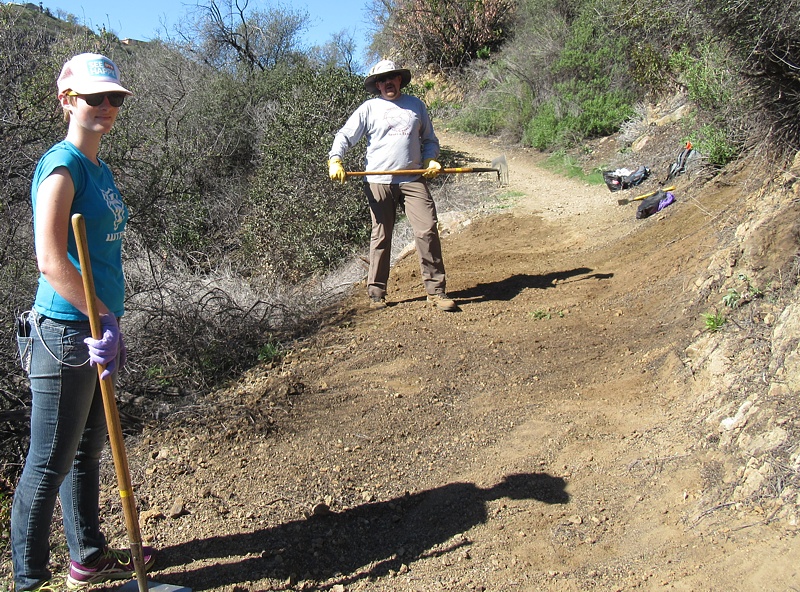
Monday, February 29th, 2016Ten CORBA and 17 other volunteers helped to restore 3/4 miles of the Backbone Trail (Yerba Buena segment) this past Saturday February 27.
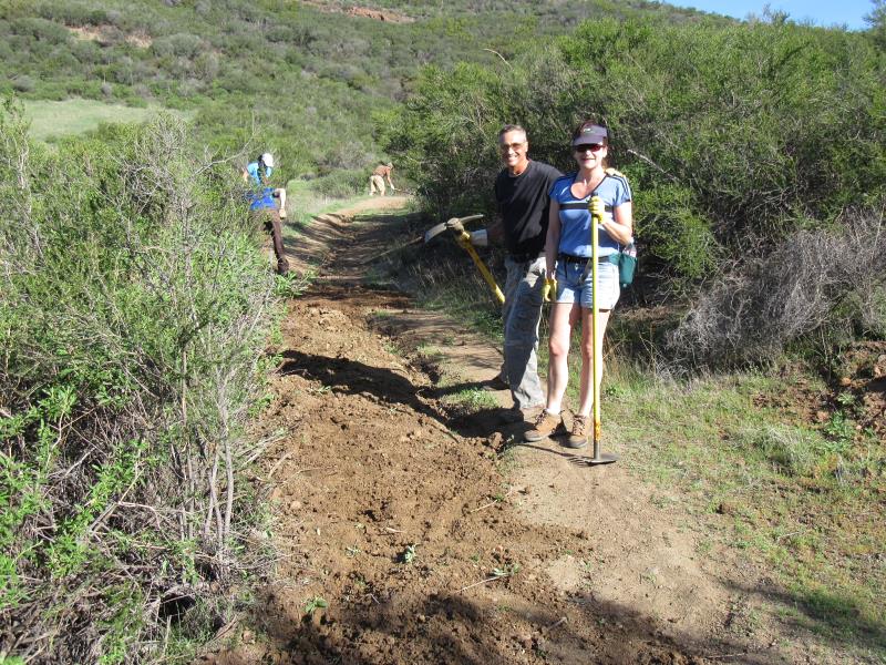
The outside berm of the trail is pulled back to fill in the rut, and to give it a slight slope so water will run off it, rather than down it. This is called ‘outsloping’ the trail.
This trail was built about 12 years ago and has had very little, if any maintenance work done on it since. Overall it has held up very well, which shows how well it was designed and constructed, but the lack of rainfall over the past several years has certainly contributed to its longevity.
Nevertheless, most of the original drainages were completely filled with silt and had become ineffective, allowing water to run down the middle of the trail, developing and enlarging ruts. As such, most of our work was spent fixing ruts, and repairing drainages or building new ones, to keep ruts from re-forming or enlarging. One long-time volunteer used a gas-powered hedge trimmer to cut back the brush that was starting to impinge on the trail while two people followed along behind to dispose of the cuttings.
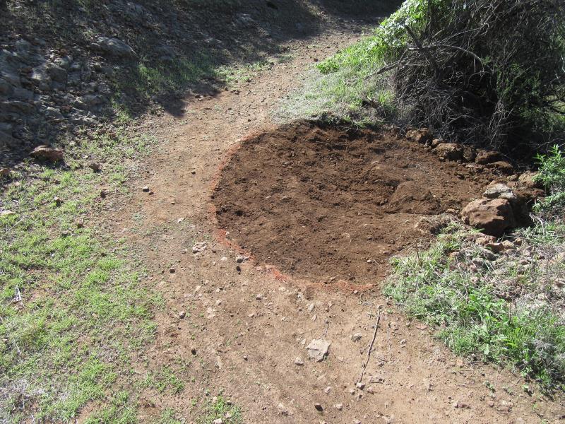
A finished drainage nick.
This CORBA crew embarked on a task that was new to us by completely rebuilding a section of the trail about 100′ long. The berm on the outside of the trail that keeps the water on it was chopped up. The dirt was then dragged back over the trail, filling in the center rut and used to re-establish the normal outslope that allows water to flow straight across and off the outside edge of the trail, rather then down the middle to make a rut. This took about three hours. For the rest of the day we joined in the other volunteers in clearing and building drainages.
We packed up about 2 pm, a littler earlier than usual, then some CORBA volunteers drove into Thousand Oaks for thank-you lunch on CORBA at the Stonefire Grill.
Thanks to all the CORBA and other volunteers who came out to help restore this trail! There are many more photos in our Feb 27th photo gallery for you to view.
Rim of the Valley Final Study Recommendations Released
Tuesday, February 16th, 2016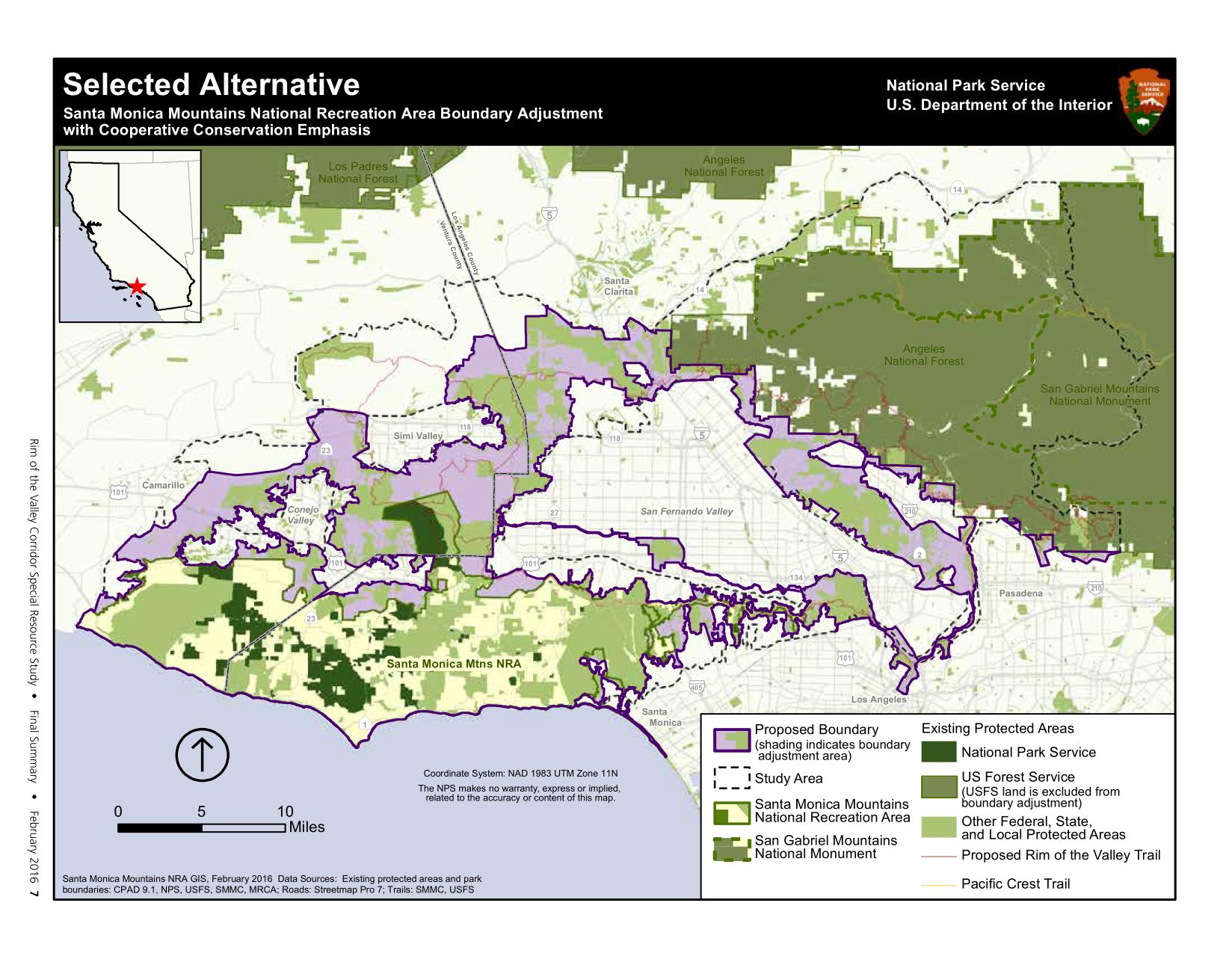
Final Study Recommendations
The National Park Service today released the Final Study Recommendations for the Rim of the Valley Corridor Special Resources Study. CORBA has been involved in the Rim of the Valley process since congress authorized the study in 2008, and even before that when the concept was only for a Rim of the Valley trail. We are pleased to see the final recommendation includes most of what we–and many other groups and individuals–suggested in our comments. The recommendation is a hybrid of Alternatives C and D of the draft released last June.
The Secretary of the Interior transmitted the final study to Congress on February 16, 2016. The final study recommends a 170,000-acre addition to Santa Monica Mountains National Recreation Area.The selected alternative would add portions of the Los Angeles River and Arroyo Seco corridors, the Verdugo Mountains-San Rafael Hills, the San Gabriel Mountains foothills, the Simi Hills, the Santa Susana Mountains, and the Conejo Mountain area to the national recreation area. Within the expanded area are: habitat types that contribute to the high biodiversity of the Santa Monica Mountains; functioning wildlife corridors; highly scenic landscapes; historic and archeological sites; geologic and paleontological resources; thousands of acres of open space and recreation areas; and miles of trails, all of which provide exceptional public enjoyment opportunities. Expanding Santa Monica Mountains National Recreation Area would provide new recreational opportunities for one of the most densely populated areas in the United States.
No lands currently managed by the Forest Service (Angeles National Forest and Los Padres National Forest) are included in the proposed boundary expansion of the SMMNRA. However, the National Park Service could partner with the Forest Service on projects, as needed, and as permitted under their current “service first authority.” Existing land managers would continue to manage their lands, but the inclusion of those lands within the expanded boundary of the SMMNRA would allow the NPS to work with them to acquire land from willing sellers, or invest in capitol improvements for recreation or habitat improvements.
The study at this point is just a recommendation from the Secretary of the Interior to Congress. It will be up to congress to take those recommendations and act on them. Or they may not. It many be many years, if ever, before the boundaries of the SMMNRA are adjusted as recommended in the Study.
The final study report, errata from the draft study and an analysis of public comments submitted can be found at http://www.nps.gov/pwro/rimofthevalley/
February Skills Clinic photos posted Feb 9th
Tuesday, February 9th, 2016We had an unusually large class of 25 on a warm day in the dead of winter in Malibu Creek State Park this month at the Basic Skills Clinic. The clinic is always held the first Saturday of the month. You can see the photos in our February photo gallery.
Trail Days 2016: We Need Your Help to Restore Sycamore Canyon Trails!
Monday, February 8th, 2016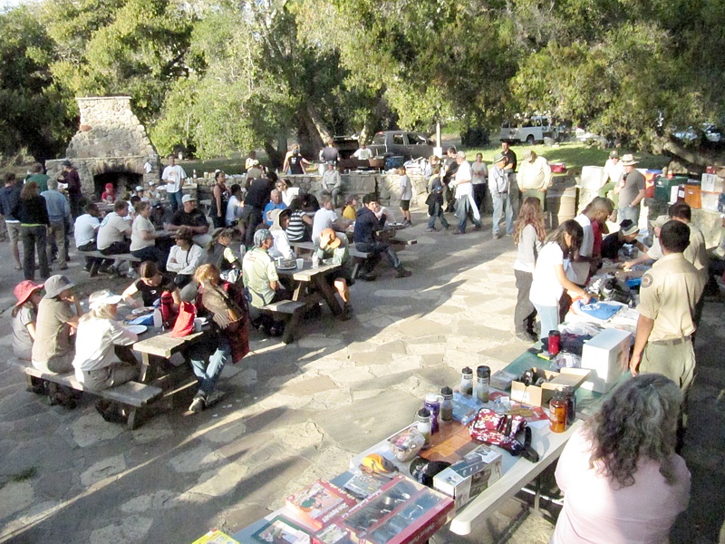 Once a year we have an opportunity to work on the trails and then BBQ and camp at Danielson Ranch in Pt Mugu State Park. It is opened annually for the Santa Monica Mountains Trail Days! This is a unique opportunity to work on the trails that we enjoy so much in Sycamore Canyon, and the Saturday workday is followed by a BBQ and prizes, with free camping available on Friday and/or Saturday night. This is hands down the best day to get in some trail maintenance work! Camping is optional; you may leave with the escort after the BBQ. There will be trailwork projects on both Saturday and Sunday. Sign up for one or both! Pre-registration is requested by April 18th so we’ll know how many people to prepare for.
Schedule at a glance
Friday night April 22 – arrive for overnight camping (optional). Bagels and hot beverages supplied Saturday morning for campers.
Saturday April 23 – Trailwork, barbecue dinner, prize give-away. Bring your own lunch. Optional overnight camping. Bagels and hot beverages supplied Sunday morning for campers.
Sunday April 24 – Trailwork, prize give-away. Bring your own lunch.
You can volunteer to help out on Saturday, Sunday, or both.
BRING: LUNCHES, BEVERAGES, SNACKS AND WATER. Tools and instruction on using them are provided.
WEAR: Gloves, hat, long pants, protective clothing, and work boots or sturdy shoes.
REGISTRATION: Advance registration is required for the activities shown below, and appreciated by April 18th!
Saturday Registration: http://www.meetup.com/CORBAmtb/events/228713049/
Sunday Registration: http://www.meetup.com/CORBAmtb/events/228713118/
TRAILWORK: Saturday and/or Sunday. Help out with one or both! There are also opportunities to help out in the camp instead of trailwork.
CAMPING: Free camping Friday and/or Saturday nights for volunteers at the Danielson Multi-use Area located under the sycamores and oaks in the heart of Point Mugu State Park. Bring your own gear.
DINNER: Sat. Night Barbecue Free FOR VOLUNTEERS. Bring appetizers and beverages.
PRIZES: Thank-you prize give-aways will be held Saturday after dinner and Sunday after trailwork.
VEHICLE ACCESS: You will be able to caravan into and out of the park by vehicle only at these few designated times:
ARRIVE: Friday – 5 pm and 7 pm. Saturday – 7:30 am and 4:30 pm Sunday – 7:30 am
DEPART: Saturday – 4 pm and about 9 pm. Sunday – 8 am and 2:30 pm
Full details and camping/dining details are also provided on the registration pages.
Students Restore the Trancas Canyon Section of the Backbone Trail
Sunday, February 7th, 2016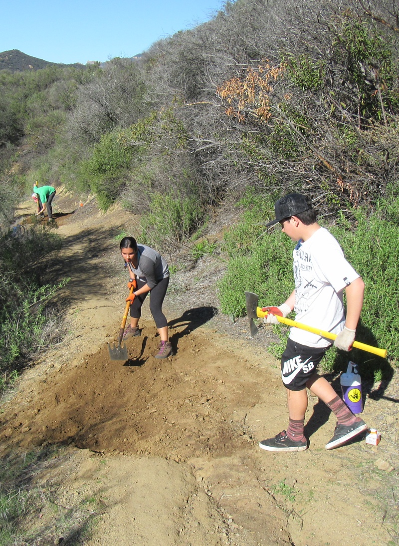 Twenty-five high school mountain bike team members and fourteen USC students, along with a few parents, coaches and CORBA and SMMTC trail crew leaders, came out this past Saturday to address the ruts on the Trancas Canyon section of the Backbone Trail.
We installed or fixed about 50 drainage nicks and otherwise repaired water damage over about a mile of the trail.
But two days before, with about 40 student volunteers ready and eager to help, we were afraid that we weren’t going to be able to do restoration work on Saturday! We had planned to work on the Backbone Trail about a mile east of Kanan Road, but we learned on Thursday morning that there was going to be a major trail running event that would see 300 runners passing through our work area. This would not only interfere with our ability to get needed work done (we stop working and step aside when trail users come through the work area), but was a safety concern for the runners. After a large flurry of emails and consulting with some park agencies, we decided to move the event to Trancas Canyon.
As usual, the students threw their youthful exuberance into the tasks and quickly dug out the drainage nicks. They finished about two hours before we expected, so some moved further along the trail and installed a few more nicks, while others worked on widening and resloping.
Many thanks to the students from Simi Valley, Calabasas and El Camino Real High Schools, and from the USC Outdoors Club!
More photos of the event can be seen in our trailwork photo gallery.
Rondell Oasis Ride – Hike – Horse Protest Gathering
Friday, January 15th, 2016Next weekend we’d like to help stop the 4-Story hotel that is going to forever block views and access to the National Historic DeAnza Trail if it is built. We need to get a good turnout of ALL trail users so please help me by spreading the word and getting these flyers distributed to your friends, riding buddies, the greater mountain biking community and anyone who cares about the views of the Santa Monica Mountains.
(CORBA is hosting an intermediate ride from Bark Park to this event. Learn more about it and sign up on this Meetup event page.)
This trail is located right off the 101 at Las Virgenes and next to the Mobil Station, the trail connects to the New Millennium and is only one of two access points to the New Millennium trail. The designated National Historic DeAnza trail runs from south of Arizona in Mexico to San Francisco and celebrates the discoveries by Juan Bautista DeAnza. It is one of only 16 trails in the nation that went before congress and the White House (according to the MND report).
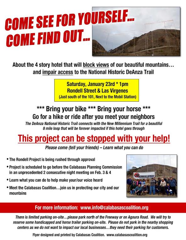
De Anza/New Millenium Rally.
The developer is being encouraged by the city to build a 4-Story hotel that will require that he put in substantial flood control measures, including a wall that will block access to the trail. Originally, they designed steps up and over the wall…and have since proposed an ADA ramp. One of the developer’s claims is that he is improving the trail for the community by putting in parking (4 shared spots with commuters and hotel guests), a doggie poo station and a trash can to justify the variance to the city’s height restrictions and building in the Las Virgenes Scenic Corridor. There will be no vehicle access to the trail anymore from the west side of Calabasas…only from Calabasas Road further east.
We want to make sure that all trail users are there (most impacted will be the equestrians)…because all will have impaired access to the trail. The developer has no plans for horse trailer parking and in fact has limited parking for other trail users unless the city “gifts” him the currently public Rondell street easement, that is currently used by trail users of all types, daily by commuters as a park and ride and now as a construction staging area for local infrastructure projects.
Please come…and spread the word to others too…at 1pm on January 23rd. We need a big group of trail users and the community to make sure that our voices are heard. We’re asking that mountain bikers ride in…, and park their cars either on Agoura Road or north of the freeway on Las Virgenes, since it is easier for us to ride in to the site. Or make a day of it and ride New Millennium Loop before or after, parking along Lost Hills Road and starting at the Bark Park.
We also want to be respectful of local businesses who are already victimized by transient parking and need their lots for their customers. It will only get worse for local businesses if the two hotels go and housing development goes in with inadequate parking. That is why we are asking people to park legally on the street and hike/ride in.
(CORBA is hosting an intermediate ride from Bark Park to this event. Learn more about it and sign up on this Meetup event page.)
Thank you for helping us spread the word…this development is not a done deal. We need all the support we can get.
A hiker approaches the De Anza trailhead, which will be hidden behind a hotel
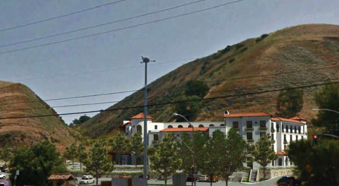
An artist’s rendering of the proposed hotel.
January 2016 Skills Clinic and Beginners’ Ride Photos Posted December 3
Sunday, January 3rd, 2016Malibu Creek State Park was busy with visitors on the second day of 2016. The morning started off overcast and chilly for 15 riders at the Basic Skills Clinic. The clinic is always held the first Saturday of the month. You can see the photos in our January photo gallery. This month, the clinic was followed by a Beginners’ Ride, sponsored by Cynergy Cycles and led by CORBA and GGR Director Wendy Engelberg. Photos of the ride can be seen at the end of the skills clinic photo gallery.
El Nino Watch: Trail Damage and Riding after it Rains
Tuesday, December 29th, 2015We are having a severe El Nino event this winter; as a result the weather forecast is for many heavy rainstorms in the early months of 2016. That will help our drought situation, but will have seriously bad impacts on our trails. As well as muddy conditions that interfere with their use, described below, the rains could be severe enough to erode some trails into huge ruts, and even wash them away in some cases. There may be more mudslides in Pt Mugu State Park (Sycamore Canyon) like we had last year. Furthermore, the rain will spur the chaparral to overgrow the trails, a condition we haven’t had to deal with much over the past couple of years because of the drought. The combination of waterlogged soil and high winds could blow trees over. We’re expecting to have special trailwork days to repair these damaged trails and hope many mountain bikers will want to help us get them back into shape!
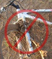
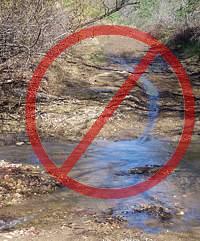 Most trails in our local riding area don’t respond well to rain. They have a high content of clay that turns into sticky, slippery muck that binds to everything it touches. It builds up on the tires, like a snowball rolling downhill, until it jams on the frame and the wheels won’t budge. Some models of clipless pedals won’t let go when full of this mud, resulting in the bike and the attached rider lying sideways in a puddle, or worse.
Most wet trails don’t respond well to use until they’ve had time to dry out. Hikers and horses make holes and ridges in the trail that become as hard as concrete when the trail dries. These holes and ridges are good for twisting ankles.
 As a rule of thumb, if your foot, tire or hoof makes an impression more than about 1/8 inch deep in the dirt, the trail is still too soft to use. Give it another day or two to dry out before using it!
On wet trails, bikes make grooves along the trail. The next time it rains, the water runs down these grooves and turns them into little ruts, then large ruts that destroy the trail.
The mud is particularly hard to remove. It sticks to the bike and shoes, no matter the efforts to remove it, rubbing off on the bike rack, car carpet and gas/brake pedals, making them slippery. Once home, it takes the careful use of a garden hose to remove the mud but not force water into the sensitive parts of the bike.
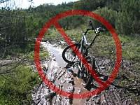 For these reasons, riders are well advised to stay off the trails after a rain until they have dried. How long to stay off? That depends on a number of factors including the particular trail, how much rain it received, how much sun it gets after the rain (is it in the shade or face south?), how warm and windy the weather is, and so on. After an isolated light rain you can probably ride the next day. After a heavy rain, you should wait several days. This is something where common sense and experience will help. Remember, tracks deeper than 1/8″ mean the trail is still too soft to use!
All is not lost when the trails are soaking! There are a few trails that hold up well when wet because they have more sand and rock that doesn’t hold the water. Here are a few you should know about:
–Space Mountain (Los Robles Trail West) to the picnic table is almost always rideable, even right after a big storm. However, it can be pretty mucky from the picnic table to Potrero Road.
–Rosewood Trail is pretty good, but not quite as resilient as Space Mountain.
–Zuma Ridge Motorway from Encinal (the bottom in Malibu is muddy)
–Dirt Mulholland around Topanga State Park.
-Brown Mountain Fireroad
-Most San Gabriel Mountains trails made up of decomposed granite
-Beaudry Fireroad
-Hostetter Fireroad
-Mt. Lukens
December 2015 Skills Clinic Photos Posted December 5
Saturday, December 5th, 2015It was practically deserted in Malibu Creek State Park this month on a sunny but cool morning for the five riders at the Basic Skills Clinic. The clinic is always held the first Saturday of the month. You can see the photos in our December photo gallery.

