Archive for the ‘Regions’ Category

Pt. Mugu State Park Backcountry Trail Closure Update

Thursday, May 9th, 2013

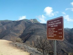
SycCynSign_Theune_SMALLFrom the office of the California State Parks Angeles District Superintendent:

All trails and fire roads are currently closed.  This is a hard closure that will remain in effect until May 23rd.  This closure is necessary as crews identify and extinguish hot spots and to assess trail hazards.  After that we are planning to temporarily restrict use sunrise to sunset. 

And below is a press release from the National Park Service with some VERY IMPORTANT information regarding the current closures and traveling in burn areas once they are open:

THOUSAND OAKS, Calif. — In the wake of approximately 14,000 acres of burned park land, officials from the National Park Service and California State Parks have a few suggestions for how community members can help nature recover. Numerous concerned visitors eager to protect and restore the affected land have contacted both agencies offering their assistance.

“We’re touched by the outpouring of support from the community and their desire to help,” said David Szymanski, superintendent of Santa Monica Mountains National Recreation Area. “We’ll need everyone’s help to ensure the recovery goes as smoothly as possible.”

Though fire is a natural part of all ecosystems, too many fires can harm native plant communities, reduce wildlife habitat and even increase future fire risk. Historically, the Santa Monica Mountains experienced fires only once every 75 to 100 years. When Southern California landscapes burn too often, dry and fire-prone invasive weeds and grasses become established and increase future fire risk.

The fire burned more than 1,000 acres of National Park Service land and more than 12,000 acres of California State Parks land (the remainder of public park land acreage is owned by an assortment of park agencies).

The ecosystem is especially fragile in the aftermath of fire, so park officials encourage the public to take the following steps to help nature make a healthy recovery:

1. Respect the closures. We’re working as hard as possible to assess conditions within the burn area, but the fire is still active and our own staff must be escorted by fire officials. We can’t open the park (or specific trails) until it’s safe for visitors and the cultural and natural resources we protect. We appreciate your patience!

2. Stay on the trail. When our parks re-open, staying on designated trails (not unofficial paths created by fire crews) and minding posted closure signs is critical to protecting the wildlife and plant communities that survived the flames. Foot and bike traffic tramples sensitive soil, vegetation, burrows and nests.

3. Sign up to volunteer. Fire is part of nature, but that doesn’t mean we shouldn’t give nature a hand along the way. We’re still assessing the damage, but you can sign up now for future opportunities to do habitat restoration and trail improvement.

Santa Monica Mountains National Recreation Area (SMMNRA) is the largest urban national park in the country, encompassing more than 150,000 acres of mountains and coastline in Ventura and Los Angeles counties.  It comprises a seamless network of local, state, and federal parks interwoven with private lands and communities. For more information, visit www.nps.gov/samo.

California State Parks is composed of 279 units on nearly 1.5 million acres of land. State Parks is responsible for nearly one-third of the coastline of California, with more than 3,000 miles of hiking, biking and equestrian trails. State Parks receives more than 65 million visitors yearly, making it the single largest visitor destination in the state and second only to the National Park system for the nation. For more information, visit www.parks.ca.gov.

Contact: Kate Kuykendall, 805-370-2343
Contact: Craig Sap, 310-699-1732

Glendale’s Newest Trail’s are Complete

Monday, May 6th, 2013
Glendale's new Catalina Verdugo Trail

Glendale’s new Catalina Verdugo Trail

When the City of Glendale updated its Trail Master Plan for the City’s open spaces in 2007 and 2008, CORBA volunteers worked closely with City staff to map out existing trails and to identify where new trails would make the most sense. The first two of those new trails have  just been completed.

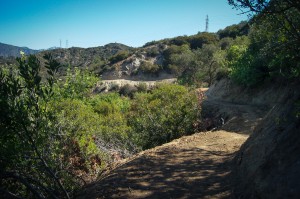
The Catalina Verdugo Trail loops around the Glendale Sports Complex at the end of  The northern trailhead is next to the Maintenance yard facility. The Southern end of the trail is behind the soccer fields, and comprises a series of switchbacks. Glendale has many difficult and steep trails like those at Brand and Deukmejian Parks, so City officials wanted this to be an easy trail for all levels of trail users to enjoy. The trail is open to hikers and mountain bikes only. The trail joins an existing fire road, from which there is access to Ridge Motorway, a lightly used fire road in the San Rafael hills.  From there it is possible to ride or hike all the way to the trail system at Cherry Canyon.

As with all newly constructed or recently re-built trails, it currently looks quite wide and raw. Over the coming months as the trail beds in it will naturally narrow down and brush will grow in along the trail.  It will be a beautiful, meandering trail through the Chaparral.  There is some steep slopeside exposure in a few sections, but overall it is a non-technical trail suitable for fit beginners and more experienced riders alike. Watch for poison oak along the trail, mostly on the north-facing slopes.

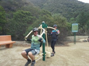
Mountain Do Trail exercise station photo by Robin McGuire

Mountain Do Trail exercise station

The second trail, and also a part of the Sports Complex trails,  is called the Mountain Do Trail. This is a wheelchair accessible, natural surface path, complete with a range of outdoor exercise stations, benches and tables. The Mountain Do Trail wraps around the soccer fields at the Southern end of the Sports Complex. Within the next month, signs and  interpetive panels with information on Flora, Fauna and local history will be added to both trails, making them a great educational resource as well. The Sports Complex is open from 7:00 a.m. to 10:00 pm and the gates are locked, so access to the trail is restricted outside those times.

The City is planning a formal opening ceremony on June 1st, National Trails Day, but the trails are now ready for use. These trails were expertly designed and constructed by Bellfree Contractors, in accordance with the City of Glendale Trails Master plan. For more information, a map and more photos visit BellFree Contractors’ web site.

Springs Fire Closure Update 5/6/13

Monday, May 6th, 2013

As of 5/5/13, this is the status of State Parks open space and other public facilities effected by closures due to the “Springs Fire”.

-Leo Carrillo SP was reopened Saturday at 3 pm

-Point Mugu-Thornhill Broome campground will reopen later this week

-Sycamore Cove and Mugu Beach day use areas have reopened

-Point Mugu back country will remain closed until further notice

-Point Mugu-Sycamore Campground is planned to reopen before Memorial Day

-Point Mugu-La Jolla Group Camp and Day Use to reopen by May 15th

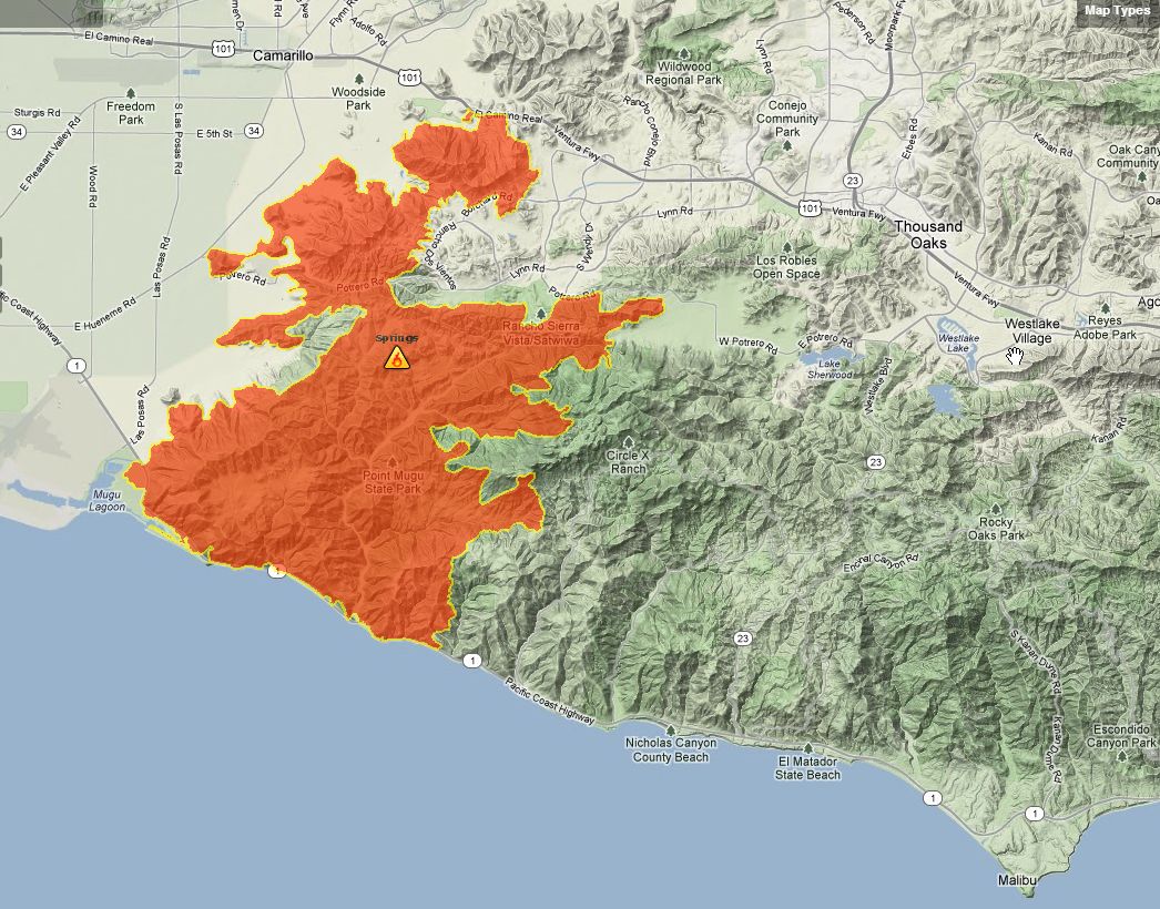
The burn area perimeter (unofficial):


2013 Springs Fire Perimeter


Skills Class 5/4/13 CANCELLED

Friday, May 3rd, 2013

As of 5 pm on Friday May 3, Malibu Creek State Park was closed due to high fire danger, and it was unclear as to whether it would be open on Saturday. In addition, air quality was poor due to smoke moving south into the area from the fires burning in the Santa Monica Mountains to the north. Therefor we have cancelled the 5/4/13 Introduction to Mountain Biking Skills Class. Hope to see you next month, June 1!


Comments on Proposed Wilderness Needed by May 13

Friday, May 3rd, 2013

From Santa Clarita Valley Trail Users:

Dear Friends,

As some of you know, the Forest Service, in response to a court order, has proposed three alternatives for the future management of roughly 40,000 acres of land to the northeast of Castaic Lake.  This area is referred to as Salt Creek and Fish Canyon.  In two of the three alternatives, large amounts of land would be designated as a “Recommended Wilderness” which would then prohibit any “mechanized” use including bicycles.

The three alternatives are summarized as follows:

Alternative 1:  No change.  The existing designation of Back County, Non-Motorized would remain.  Alternative 1, of course, is our preferred alternative.

Alternative 2:  The entire Salt Creek/Fish Canyon area would be designated as a Recommended Wilderness.  However, a number of existing trails including the  Gillette Mine Trail, the Fish Canyon Trail, and the Burnt Peak Trail would be “cherry stemmed” from the Recommended Wilderness and would remain accessible to bicycles.  If this Alternative 2 is selected, we would request some additional cherry stems and other changes.

Alternative 3:  This alternative would designate the entire Salt Creek/Fish Canyon area as a Recommended Wilderness WITHOUT any cherry stems for existing trails.  In addition, the new Recommended Wilderness would extend to the east side of Lake Hughes Road to include the Tule and Red Mountain areas just to the north of Tapia Canyon.  We oppose Alternative 3 entirely.

Here’s a link to maps of the three alternatives:

http://a123.g.akamai.net/7/123/11558/abc123/forestservic.download.akamai.com/11558/www/nepa/76364_FSPLT2_370978.pdf

We are asking all of you to write an email or letter to the Forest Service with the following comments.

1.  Identify yourself as a LOCAL resident of the Santa Clarita area who is concerned about a shortage of mountain bike trails in our area.

2.  Express a strong preference for Alternative 1 and request a study to be done for additional trails in this and other areas in the Santa Clarita vicinity.

3.  Request that if Alternative 2 is pursued, that it be amended as follows:

a.  A cherry stem should be provided for Cienega Canyon, a decommissioned fire road used by the Crank n Stein group and other cyclists.

b.  A cherry stem should be provided for Forest Route 7N13.1 from Forest Route 7N32 on the south all the way up to Sawmill Motor Way on the north.

c.  The area be designated as a “Special Conservation Area” rather than a Recommended Wilderness.

d.  The cherry stems should be wider than the proposed 25’ to provide for trail maintenance and accurate mapping.

e.  A provision should be made to move or adjust cherry stems in case of a need to re-route a trail on account of erosion or other similar issues.

4.  Request that the Forest Service ensure that the Golden Eagle Trail is entirely excluded from any Recommended Wilderness.

5.  Specifically ask the USFS if trail user counts were conducted on the existing and historical trails to determine the type and volume of traffic the trails currently support.  These sort of substantive comments can be used as the basis for an effective appeal.

6.  Finally mention that we cyclists value and want to protect wild lands.  We enjoy the solitude that can be found away from people and civilization within such back-country areas and don’t want to lose access to such lands in our own backyard.

Please email your comments to socal_nf_lmp_amendment@fs.fed.us or mail them to:

Cleveland National Forest

10845 Rancho Bernardo Road, Suite 200

San Diego, CA 92127-2107

ATTN: LMP Amendment

Your full name and address is required in order for your comments to be considered.

The Forest Service is accepting comments only until May 13, 2013.

SCV Trail Users

Safe and Equal Access for All Trail Users

SCVTrailUsers@gmail.com

Shameless Plug Alert

Wednesday, May 1st, 2013

By Mark Langton

Mark Langton

As the coordinator and instructor for the monthly CORBA Introduction to Mountain Biking Skills Class at Malibu Creek State Park, I look forward to the first Saturday each month to help yet another group of eager mountain bikers become safer and more proficient. I also provide private lessons (mountainbikeskills.com) and have gotten quite a few new clients over the last couple of months, which is pretty typical for this time of year, what with the weather getting nice and a crop of races just around the corner.

What continues to amaze me is how many people think they don’t need  coaching. As I say all the time, even the best athletes in the world have coaches. I see people in the CORBA classes who have been riding for quite some time who have developed bad habits that are quite debilitating. And they almost always can be easily corrected with a few minor adjustments. But the adjustments aren’t always intuitive or obvious, and that’s where a coach comes in. If there were a better way to improve one’s technique instead of using interpersonal coaching, I think they would have come up with it by now!

So hopefully I’ll see you one of these months at the FREE CORBA skills class. No reservations needed. Come back as many times as you like, it’s always free!

Space Mountain Trailwork Scheduled for May 11

Monday, April 29th, 2013

Join CORBA and the Santa Monica Mountains Trails Council as we fix up CORBA’s adopted trail, Space Mountain (Los Robles Trail West) in Thousand Oaks. We’ll be doing treadwork, clearing silt out of the drainages. This is a favorite mountain biking trail, especially in the winter when other trails are muddy. Our work on Saturday will help keep the water off the trail and open to riding next winter!. After the trailwork is finished, CORBA will have prizes for some (or all) lucky volunteers, and treat you to lunch afterwards.

SpaceMtnNo experience is necessary to help out with trailwork. Tools and instructions on how to use them safely and effectively will be provided. Children must be over 7-years old to attend, and children under 14 must be constantly and directly supervised by their parent or guardian who brought them. And you don’t need to be a mountain biker to help out – Everybody is welcome! For more information on trailwork in general, visit our trail crew web page.

Be sure to wear protective clothing (sturdy shoes, long pants and sleeves, hat, golves) and bring snacks, sunscreen and water. CORBA will provide the tools and training.

We request that you pre-register online so that we’ll know how many tools to provide. Remember, by registering here, CORBA will treat you to lunch afterwards, and enter you in the drawing for mountain biking prizes! We have some great 2.25″ CST tires, for both 26ers and 29ers.

CORBA’s thank-you lunch will be after trailwork ends at 2:00 pm, so bring some snacks to tide you over.

Meeting location and details are on the online registration page.

Originally this trailwork had been planned for Guadalasca Trail in Pt Mugu State Park, but we relocated because the Springs Fire has closed that park.

GirlzGoneRiding May 2013 Update

Monday, April 29th, 2013

WendyKimGGR NEWS!

Bells Bells Bells Bells! In accordance with CORBA & IMBA, GGR will start to incorporate using BELLS on their bikes. Bells and communication on the trails with the hikers and equestrians is key to keeping all users of the trails aware that bikers are coming.

GGR is now soliciting sponsors for their main event Oct 20th at Malibu Creek State Park. This is also a CORBA membership drive and fund raiser. Please email wendy@girlzgoneriding.com for details on becoming a sponsor. It’s EASY!

Please check out the GGR Calender!
http://www.girlzgoneriding.com/calendar/

Rides and special events are posted on the FB page here: https://www.facebook.com/groups/350083721682365/

Wood Canyon Vista Trail maintenance completed during Trail Days

Wednesday, April 24th, 2013

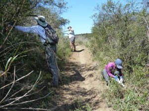
During the annual Santa Monica Mountains Trail Days in Pt Mugu State Park, CORBA volunteers with the help of a few others repaired drains and cleared brush along the entire 1.8 miles of the Wood Canyon Vista Trail, a segment of the Backbone Trail.

Clearing brush on the Wood Canyon Vista Trail. Links to the photo galleries are at the bottom of this article.

Clearing brush on the Wood Canyon Vista Trail. Links to the photo galleries are at the bottom of this article.

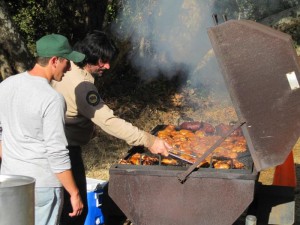
The SMM Trail Days is a weekend-long event organized by the Santa Monica Mountains Trails Council that has taken place at the end of April for 32 years running. As well as helping with trailwork on Saturday and Sunday morning, volunteers are able to camp over Friday and Saturday night at the Danielson Multiuse Area, enjoy a barbecue dinner on Saturday, and win great prizes on both Saturday and Sunday in appreciation for their work.

On Saturday morning, 17 CORBA Volunteers and a few others were shuttled from the registration area to the bottom of the Wood Canyon Vista Trail. We split into four groups, headed by CORBA trail crew leaders Steve Messer and Steve Clark, and Trails Council crew leaders John Kross and Greg Sweel, and started up the trail. Two of the groups focused on cleaning sediment out from existing drainage dips and cutting new drainages where needed, while the other two groups wielded loppers or a hedge trimmer to cut back overgrowing brush. In addition, we had the support of two employees of California State Parks who used a gas hedge trimmer to cut back a major overgrown section halfway up the trail. This section included lots of poison oak, so we are extremely grateful for their help!

Overall we fixed up about 1.3 miles of trail from the bottom.

While we were working on this section of the Backbone Trail, other groups were working on Coyote Trail, and in the Boney Mountain Wilderness Area, Blue Canyon Trail, Old Boney Trail and Chamberlain Trail.

Preparing dinner on Saturday night.

Preparing dinner on Saturday night.

On Sunday, a smaller group of 6 CORBA volunteers plus 3-4 others were shuttled to the top of the Wood Canyon Vista Trail so we could work down to where we had left off the day before. We split into a group with loppers led by CORBA trail crew leader Steve Clark to cut back brush, and a group with treadwork tools to clean out drainages, led by Trails Council crew leader Howard Cohen. We completed the upper section of the trail in about an hour and a half, then hiked to the bottom to catch a ride back to the registration area. On the way down we were able to take in the magnificent view of Sycamore Canyon and Boney Mountain, something we don’t have as much time to appreciate when we’re riding our bikes.

Other groups were working on the Upper Sycamore Trail and “Toe Stubber” Trail (part of Old Boney Trail) in the Wilderness Area on Sunday.

I’m very pleased with the work CORBA volunteers accomplished over the weekend! I never expected we’d get the whole trail completed. I’m also grateful for the help of a few other volunteers, and especially the State Park staff who took care of the poison oak. Without them, we wouldn’t have completed the trail.

A special thanks goes out to the Trails Council for the outstanding job they do in organizing this event, with the extras like free camping, bagel breakfasts, Saturday night BBQ dinner, and great prizes for everyone. And the rangers and other employees of the State and National Parks had a huge part in making this event such a success. All this effort ensured that the volunteers came away not only with a sense of accomplishment for helping to keep the trails in good shape, but also with great memories of the whole weekend!

Here are links to photo galleries of the weekend:

Lyme Disease Detected in Ticks at Paramount Ranch

Friday, April 12th, 2013

Officials from Los Angeles county and Santa Monica Mountains National Recreation Area (SMMNRA) are advising visitors that ticks from Paramount Ranch in Agoura Hills recently tested positive for Lyme disease. Three separate pools of western black-legged ticks (Ixodes pacificus) found along the Coyote Trail were found to be positive.

“This is a good reminder for visitors to stick to the trail and avoid the vegetated areas where ticks like to hang out,” said Evan Jones, SMMNRA chief ranger. “Though Lyme disease can be very serious, simply following a few basic steps can greatly minimize exposure.”

Jones also advises the public to check clothing and exposed skin before heading home, making sure to brush off any small creatures. Wearing light-colored clothing with long sleeves and long pants is also recommended.

Lyme disease is an infectious disease that can start as a mild flu-like illness and develop into severe chronic health problems over time. If identified in the early stages, it can be successfully treated with antibiotics, but the potential for long-term complications increases if the disease progresses untreated.

Paramount Ranch was one of three Santa Monica Mountains park sites that came back positive for Lyme disease in tests conducted by Los Angeles County West Vector and Vector-Borne Disease Control District. The other two locations were Tapia Park and Malibu Creek State Park, both located within a short distance of one another.

Robert Saviskas, executive director of the L.A. county agency responsible for conducting the tests, said this was the first year his agency tested for Lyme disease at Paramount Ranch, among approximately 12 sites tested within the Santa Monica Mountains. The first tick known to carry Lyme disease was found in the mountains in 1998.

“We’re finding that about 1 or 2 percent of western black-legged ticks in the area carry the Lyme disease bacteria, so it’s important for us to identify where the problem is occurring,” said Saviskas. “This particular tick is most active from late November through May.”

More information is available at www.lawestvector.org or by calling 310-915-7370.