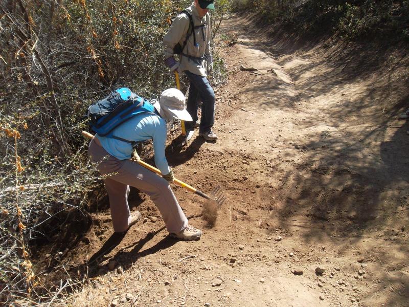
By Steve Clark, Trail Crew Coordinator
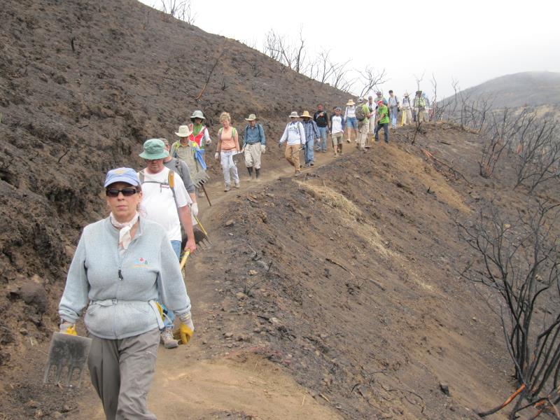
Twice in the past week at the request of the State Parks trails maintenance department, a group of about 8 volunteers from the Santa Monica Mountains Trails Council headed into Point Mugu State Park to begin cleanup and repair of the trails after the Springs Fire swept through just over a week earlier. This work was undertaken before the park is open to the general public to help assess the situation, clear and repair trails to make them safe for park visitors, and to limit damage to the fragile web of wildlife that survived the fire. The initial focus will be to protect park resources and make them safe for visitors. When that is complete, we’ll concentrate on repairing the drainage so rainwater that runs down the denuded hillsides doesn’t wash the trails away this winter.
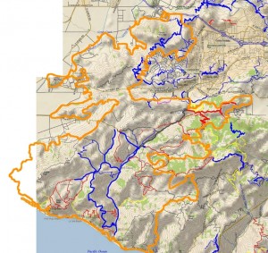
Outline of the Springs Fire burn area (orange), overlaid on a trail and topo map.
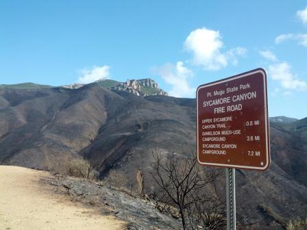
The park is currently scheduled to reopen on Friday, May 24, with some trails still closed for further repair. The park will be only open during daylight hours until further notice. When the park does open, please protect the wildlife that did survive the fire by not going off the trails.This is a report of what we saw and got accomplished during those two trailwork days.
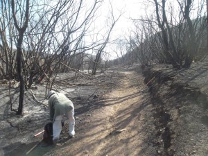
The first day (8:30 am to 2:00 pm) was spend entirely on Upper Sycamore Trail. We parked at the bottom of the blacktop hill in the large dirt area on the east side of the road, where the outhouse used to be. In it’s place is a piece of a metal frame and a stain of melted plastic in the dirt. Across the road is the remains of an old oak tree that had burned through the base and then toppled over. The tops of the railings on the bridge have been cut off and the surface planks are chared around the edges. The superstructure is steel so it is still strong enough to support fire trucks, but we drove our pickups across one at a time even so.
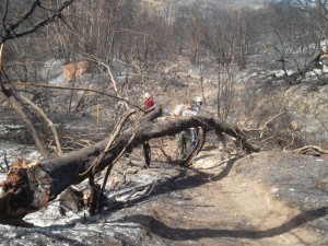
One of many trees fallen over the Upper Sycamore Canyon Trail
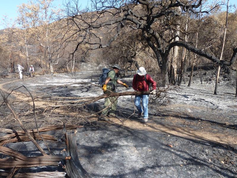
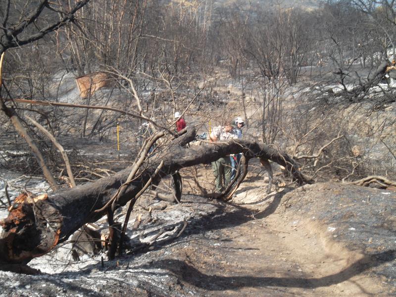
It was eerie on the trail itself. The fire seems to have burned about 10 feet up from the ground so the leaves are stripped off of the chaparral, but taller oaks and sycamores still have leaves in various states of scorched to dead. Being able to see through the leafless chaparral, we discover that there’s a lot of junk lying on the ground near the trail, including a metal windmill that must have fallen over years ago.The tread of the trail was in good shape. The leaves from the overhead trees that normally carpet it were all gone so we were walking on bare dirt. Unfortunately many of the oaks near the bottom of the trail had burned through the trunk and fallen over. Four or five of them blocked the trail and we spent considerable time cutting them up with a chainsaw and hand saws into pieces small enough for us to drag off the trail.
One of the many ‘ash ghosts’
There were a lot of ‘ash ghosts’ on the ground: markings left when whole trees or large limbs had fallen and been completely consumed, leaving a pattern of ash where branches used to be.Fortunately not all the oaks fell to the ground, but too many of them did.
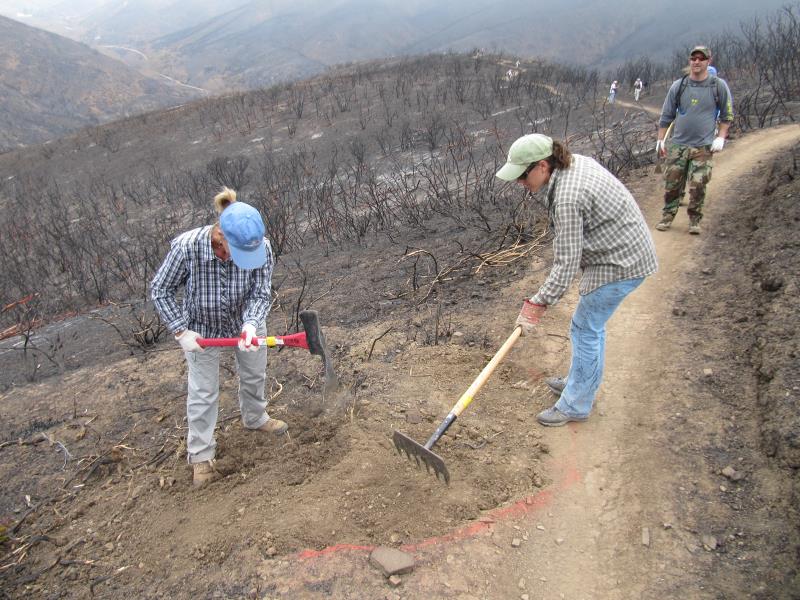
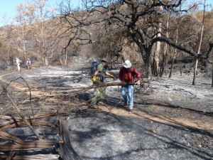
The oaks were not the only trees that fell across the trail. Dozens of large chaparral bushes, about 8 feet tall, had collapsed across the trail. Many were burned completely through at the base so we just picked them up and tossed them off the trail, but others were still attached to their roots, so we needed to cut them through with hand saws before we could unblock the trail.
We had to clear a lot of chaparral that had fallen across the trail
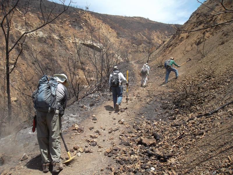
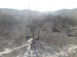
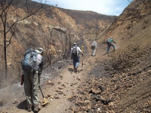
The amount of fire damage varied a lot from place to place. In some places the grass and most of the chaparral was almost completely gone. Some places weren’t burned at all, but most were singed to some degree. We could see on the hillsides patches where the fire had burned, surrounded by chaparral, and patches of chaparral surrounded by burn. We even saw a few shoots of brand new growth in some heavily burned areas.All of the collapsed oaks blocking the trail were near its lower end. Further up the trail were a few sections with minor rockfalls that we cleared. We also cleaned out three drains in a heavily rutted segment. The top section was relatively unaffected and we were relieved to see the giant oaks at the top of the trail, where it meets Danielson Road, were singed but not seriously damaged.
 On the second trailwork day, we covered Hidden Pond Trail between the bottom of the blacktop hill and Ranch Center Rd, Sin Nombre and about 2/3 of Blue Canyon Trail. We were able to cover much more ground because there were no fallen oak trees to clear and the two large fallen sycamore boughs shattered into pieces that were small enough to remove without using a chainsaw.
The surrounding land was much the same as Upper Sycamore Trail, except there were large meadows here and they were completely burned. It’s amazing to see how many gopher holes there are — it seems like there are several in each square foot!
 On both days we saw animals that had survied. We saw lots of ants, some beetles, a few lizards, one snake, a tree squirrel and even a large bobcat resting in the shade of some sycamore trees. Some areas had lots of funnel spider webs even thought the grass was completely burned, but other areas had none. We saw and heard birds, including a couple of small flocks of screeching parrots.
We also came across a group of about a half-dozen mountain bikers on Hidden Pond Trail. They said they heard the trails were open; they claimed they phoned a park agency and were told the trails were open. However, we know they snuck in bacause the main entry points were blocked off and manned by rangers to keep people out. As an open space enthusiast, I was angered more by the fact that they were in the park when it was closed to the public for their safety and to protect the surviving wildlife than by the fact that they were on a trail that is never open to mountain biking. As a mountain biker, I was angered by the fact that these boneheads were putting into jeapardy the goodwill and standing that CORBA has worked hard to establish for the mountain biking community with the various land managers in the Santa Monica Mountains. These were the only unauthorized people we saw in the park over our two workdays there.
Normally I would provide lots of pictures to go along with an article like this one but we have been asked by State Parks not to publish any photos of trailwork or fire damage until after the parks have reopened to the public. They don’t want anyone to see the photos of people working on the trails and assume that the trails are open to everyone.
As a final note, let me remind you, for the sake of the remaining wildlife, to stay on the trails when the park reopens, and I thank you for your cooperation in helping the open space to grow back to it’s former self!
If you would like to help repair the trails, a volunteer workday has been scheduled for Saturday June 8th. For more information and to sign up to help, please visit CORBA’s June 8th trailwork registration page.
Update Friday May 24, 2013. Point Mugu State Park is now completely open, but there is still some debris on some trails, including fallen trees. Use caution on these trails until they are completely cleared of all debris!
View the photo gallery of trailwork on Upper Sycamore Canyon Trail.
View the photo gallery of trailwork on Hidden Pond, Sin Nombre and Blue Canyon Trails.