Archive for the ‘Trail Access’ Category

CORBA’s State Parks Change in Use PEIR Comments

Tuesday, December 4th, 2012

CORBA has submitted comments on California State Parks Change In Use Programmatic Environmental Impact Report. Our comments are included below.

Currently, the Yearling trail has been approved for a change in use, pending the implementation of “Project Specific Requirements” which include a re-route and other trail modifications, for which the State does not presently have the resources to complete. Recently Bill’s Trail in Marin was also approved for multi-use, after more than a five-year process. Our comments reflect our desire to see the process streamlined and sped up.

While this is a step forward for gaining access to trails for bicycles in California State Parks, we see the process as overly burdensome and resource intensive. Given the State’s track record of meeting its stated goals and completing tasks, we have to question whether this additional process will slow down or speed up the process of opening trails to bicycles. However, the PEIR does in fact include some important documentation and acknowledgements of the legitimacy and appropriateness of allowing bicycles on trails, though it risks homogenizing State Parks trails to a “standard” that we feel will reduce the diversity of trail experiences for bicyclists. We’ll be reporting on the Change in Use process as the final version is released.

(more…)

Sullivan Canyon Winter 2012 Maintenance Completed

Monday, December 3rd, 2012

We have learned that the pipeline maintenance that forced the closure of Sullivan Canyon to the public is now completed. This means that you may access the canyon, but please remember that the trail is used by all types of users. Your courtesy and slowed speed around others is appreciated.

We also learned that the concrete “mats” that have been laid over the pipes have been covered with aggregate material so that the potential hazards of riding (bicycles and horses) and walking on them is reduced. The suggestion to cover the mats was made by Brentwood Hills Homeowners Association members Eric Edmunds (runner) and Mike Leslie (mountain biker).

RAM Take Two December 15

Monday, November 26th, 2012

Let’s try this again! We got rained out on November 17, so the Ride And Mingle will take place on December 15, same time (10am), same place (Topanga State Park, The Hub Junction). Come join us and your knobby-wearin’ brothers and sisters to celebrate CORBA’s 25 years of mountain bike and open space trails advocacy. We need as many people there as possible for a group shot to show the trail user community that mountain bikers can and do coexist on the trails. There will be cash prize opportunity drawings.  Click here for details!

Study Considering Shared Use of the PCT Begins in Spring 2013

Monday, November 19th, 2012

By Jim Hasenauer

You may have heard that there are a number of people working to re-open non-Wilderness sections of the Pacific Crest Trail (PCT) to bicycles.  When the PCT was closed to bikes in 1988, that regulation was supposed to have been reviewed annually.  It has never been reviewed.  We brought this to the attention of the National Forest Service (who are the lead agency for managing the PCT) , and they have agreed to review the regulation.  That process has not started yet.  We expect it to happen in the Spring.  At that time we will need high levels of participation from the mountain bike community.

Meanwhile, we’ve created a website www.sharingthepct.org and a facebook page “sharing the pct”.  Both are chock full of information about the initiative.  Unfortunately, some folks who oppose this idea have become quite strident and aggressive on the pct-l listserv and other venues.  We are trying to keep this initiative high-road with an emphasis on civility and fact-based decision making.  Don’t get into word wars with opponents.  Their insults (and threats of booby traps) and violence hurt them more than help them in the public process.

We think re-opening the PCT is good public policy.  It will help the trail and all of its trail users.

Right now, we are looking for organizations to sign on to our initiative and for specific information on different sections of the PCT itself and its suitability for multiple use.  Check out the website.  Your input is welcome.

Sullivan Canyon Closed to Public Until End of December

Wednesday, October 31st, 2012

The Southern California Gas Company recently released information regarding the closing of Sullivan Canyon to the public (see below for the press release).

A comment was made on our blog alleging that the area had been closed due to an incident involving a mountain biker  being seriously injured. According to Public Affairs Manager Krista Phipps, the area was not closed as a direct result of the incident, but in response to several factors. “I was told by the Project Manager that [the incident which caused injury to the mountain biker] did not occur at the construction site.  However, it was serious and required the person to be airlifted out of the canyon.  Overall, there have been a series of close calls in and around the construction site and we just do not want to risk injury to the public or our employees,” said Phipps.

Please note that Sullivan Canyon is NOT public property. It is owned and operated by the Southern California Gas Company which maintains it as open to the public unless work to the gas line is necessary. The Gas Co. can rescind permission to access Sullivan Canyon at any time. In this case, many users will be effected, not just mountain bikers. This surely will come down to a blame game with mountain bikers bearing the brunt of criticism, and to a large degree rightly so. All we can ask is that you ride safely for the conditions, and remember that your actions represent the entire mountain bike community.

————————————

October 29, 2012

RE: Sullivan Canyon Closure – Southern California Gas Company Pipeline Protection Project

Dear Neighbor:

In follow up to the notice of September 17, 2012 regarding the Sullivan Canyon Maintenance Project, this correspondence is to inform you that in spite of our efforts to complete the project without impeding public access, we have determined that in order to maintain public safety, Sullivan Canyon will be closed to the public during the hours of 6am to 6pm Monday thru Saturday, effective immediately. This schedule will be maintained throughout the duration of the project to ensure safe operation of two high-pressure transmission pipelines located in the canyon. The project is expected to be completed by December 31, 2012. Please note that this completion date is an approximation and may change due to the needs of the project.

Additional closures and/or further restrictions will be posted on the gate at Queensferry Road and at the entrance to the property off of Mulholland Drive in advance, to the extent feasible. We apologize for the inconvenience caused by this necessary work to ensure pipeline safety and maintenance of a reliable natural gas supply to the Los Angeles basin area. SoCal Gas appreciates your understanding of the need for this maintenance work and temporary disruption of canyon access. It is our goal to keep disruptions to a minimum and we regret temporary inconveniences.

Safety is our first priority. We appreciate customers and members of the community keeping us informed on conditions surrounding our facilities. Please feel free to share this notice with your networks which have an interest in the canyon.

Thank you for your understanding while we perform this necessary maintenance and repair work. Should you have any questions, please call me at (323) 371-0011 or email me at kphipps@semprautilities.com.

Ride Safely: Your Access to Trails Depends On It

Tuesday, October 30th, 2012

The below press release was issued today by the National Park Service (NPS) in conjunction with CORBA.

CORBA has learned that NPS administrators were ready and willing to temporarily close trails in reaction to the issues of increased complaints and collisions listed in the press release. However, due to the trust and reputation that has been fostered and maintained through CORBA’s advocacy efforts with NPS, trail closures were not implemented at this time. Let’s show that we are a responsible user group by slowing down and showing courtesy to our fellow trail users. It’s simple: Slow down, solve the problem.

———————————————–

FOR IMMEDIATE RELEASE
CONTACT: Kate Kuykendall (NPS), 805-370-2343 or Mark Langton (CORBA), 805-558-1606

National Park Service Teams with Mountain Bikers to Promote Safe Riding
New technology may play role in increased complaints and collisions

THOUSAND OAKS, Calif. – In response to increased complaints and collisions on local trails, the National Park Service (NPS) has teamed with the Concerned Off-Road Bicyclist Association (CORBA) to promote safe and courteous riding in the Santa Monica Mountains.

“We’re thrilled that there is great demand for the public to enjoy the beauty and public health benefits of our extensive trail system,” said Melanie Turner, law enforcement ranger and mountain bike unit coordinator with Santa Monica Mountains National Recreation Area (SMMNRA). “For the benefit and safety of all users, we ask people to follow proper trail etiquette and observe the 15 mph speed limit.”

Rangers report an uptick in visitor complaints regarding cyclists who are riding too fast or in restricted areas. Particularly on busy weekends, the effects can be dangerous. In the past year, accidents at Cheeseboro/Palo Comado Canyon resulted in several helicopter extractions, though the problem is not limited to that site.

Turner, who is an avid mountain biker herself, wonders if a new website that allows riders to publicly post their times on specific trails has led to an increase in violations. Strava (www.strava.com) shows speeds of up to 35 mph, with average speeds of 25 mph, on some trails within the recreation area. Made aware of the problem, Strava is working with Turner to prohibit users from posting times on certain trails, along with a message about trail regulations.

As part of its mission to promote safe riding, CORBA is working closely with SMMNRA, a unit of the National Park Service, to inform its members about these concerns and remind them about responsible riding tips.

“If you just slow down around other users (including other cyclists), you create a win-win for everyone,” said Mark Langton, president of CORBA. “Speed is subjective; what one person might think is slow might still be too fast. Even at 10 mph you can startle someone and disrupt their enjoyment of our open space. If you slow down, you literally solve the problem most people have with bicycles on the trail – that they go too fast and scare other users.”

Turner attended a recent CORBA meeting and is visiting local bike shops to let the community know that rangers will be stepping up patrols and issuing citations. Both organizations hope the efforts will result in a safe and enjoyable trail experience for all users.

About Santa Monica Mountains National Recreation Area:
Santa Monica Mountains National Recreation Area (SMMNRA) is the largest urban national park in the country, encompassing more than 150,000 acres of mountains and coastline in Ventura and Los Angeles counties. A unit of the National Park Service, it comprises a seamless network of local, state, and federal parks interwoven with private lands and communities. As one of only five Mediterranean ecosystems in the world, SMMNRA preserves the rich biological diversity of more than 450 animal species and 26 distinct plant communities. For more information, visit www.nps.gov/samo.

About Concerned Off-Road Bicyclists Association:
Concerned Off-Road Bicyclists Association was founded in 1987 to serve the mountain bicycling community of Los Angeles and surrounding areas including southern Ventura County. CORBA is a 501(c)(3) non-profit organization committed to gaining and maintaining public trail access for mountain cyclists and the public at-large. CORBA encourages and promotes the safe and environmentally responsible use of unpaved roads and trails for bicycling and to educate the public about all aspects of off-road cycling and trails. www.corbamtb.com.

###

Rim of the Valley Corridor Preliminary Findings – Public Hearings in November

Thursday, October 25th, 2012

The Special Resource Study for the Rim of the Valley Corridor has been released. While we have not yet had a chance to look at the proposed alternatives, we will do so in the coming weeks and after the first round of meetings. We reported on the ROTV corridor study’s release of Scoping comments in 2011.  The alternatives presented in Newsletter #3 should address and consider these comments.

The four alternatives presented are:

  • Alternative A: No Action (A continuation of current management)
  • Alternative B: Cooperative Conservation Partnership
  • Alternative C: Connecting Urban Parks – Santa Monica Mountain National Recreation Area Boundary Adjustment
  • Alternative D: Connecting Natural Habitat – SMMNRA Boundary Adjustment

While all these alternatives have their advantages and disadvantages, there is an overlapping study for the San Gabriel Watershed and Mountains Special Resource Study. It’s unclear from these preliminary documents how these two studies overlap, and how much of the effort in each is a duplication.

It is within CORBA’s mission to help protect and preserve our open spaces and public lands, in addition to providing access to those public lands through natural-surface, shared use trails. None of the alternatives presented in this newsletter outline any specific actions with regards to the Rim of the Valley Trail, but rather, provide an outline for the role the National Park Service might play in its future development and management.

We’ll look over these alternatives and publish our comments, and strongly encourage others to also comment by the January 7 deadline.

Below the break is the meeting schedule and offical notice for the study, which can be downloaded here.

——————————————————————————————————————

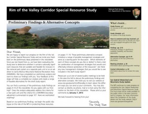
Preliminary Findings & Alternative Concepts Newsletter Available for

Rim of the Valley Corridor Special Resource Study

Dear Friends,

We are happy to report our progress on the Rim of the Valley Corridor Special Resource Study, and we invite your feedback on the preliminary ideas which are presented in our recently published Newsletter #3. The newsletter includes preliminary study findings that address whether resources of the study area are nationally significant, and whether they are suitable and feasible for inclusion in the national park system as a new park unit or as an addition to Santa Monica Mountains National Recreation Area (SMMNRA). Based on these preliminary findings, four preliminary alternative concepts are also presented in the newsletter for your consideration. Please send us your comments by January 7, 2013. 

The four preliminary alternative concepts presented in the newsletter illustrate different ways of providing protection and public enjoyment of resources that have been identified as potentiallynationally significant.  They include different levels and types of involvement by the National Park Service (NPS). Most importantly, these preliminary alternative concepts serve as a starting point for discussion and public input.

Please tell us what you think about the alternative concepts. Do you like one particular concept more than the others? Do you like various elements of each of the concepts? Do you have an entirely different vision of how the area should be managed? Your comments will help us refine the concepts and will ultimately lead to a recommendation to Congress.

We have scheduled seven public meetings extending through the month of November, concluding with a final meeting in early December. During these meetings, we will update you on our progress on the Rim of the Valley Corridor Special Resource Study and listen to your thoughts and ideas. Dates, times and locations of these meetings are listed below.  The NPS will also host a virtual public meeting online. Information on the virtual public meeting will be posted on the study website.

We look forward to hearing from you!


Wednesday, November 7, 7 – 9 p.m.
Conejo Recreation and Parks District, Community Room
403 W. Hillcrest Dr., Thousand Oaks,CA 91360

Thursday, November 8, 7 – 9 p.m.
George A. Caravalho Santa Clarita Sports Complex, Activities Center Building
20880 Centre Point Parkway
Santa Clarita, CA 91350

Tuesday, November 13, 6:30 – 8:30 p.m.***
Pacific Community Center
501 S. Pacific Ave.
Glendale, CA 91204

Thursday, November 15, 7 – 9 p.m.
Mason Recreation Center
10500 Mason Ave.
Chatsworth, CA 91311

Tuesday, November 27, 6:30 – 8:30 p.m.
Encino Community Center Women’s Club
4935 Balboa Blvd.
Encino, CA 91316

Thursday, November 29, 7 – 9 p.m.***
Moorpark Community Center
799 Moorpark Ave.
Moorpark, CA 93021

Saturday, December 1, 10 a.m. – noon
Eaton Canyon Nature Center
1750 North Altadena Dr.
Pasadena, CA 91107

Hastain Trail Victory

Thursday, October 25th, 2012

Back in March 2011 we reported on a developer’s attempts to cut off the Hastain trail, which has been in public use for more than forty years. A group of local advocates and trail lovers led by Ellen Scott, through the Save Franklin Canyon group, fought the developer’s attempts to close public access to the trail. They garnered petition signatures and did a great job of alerting the trail using public about what was at stake.

The Mountains Recreation Conservation Authority joined the plaintiffs in the suite, and brought in additional legal resources.

There were enough legacy hikers–people who could testify and verify that they had been using the trail since before 1972–to legally establish grounds for a prescriptive easement.  Judge Palazuelos, who presided over the case,  personally toured the trail at the request of the plaintiffs.

On Tuesday, October 16, 2012, the Court made a tentative ruling in favor of the plaintiffs. The defendant, Coldwater Development LLC, have been ordered to remove all equipment and fences from the trail. A public easement has been permanently established.

We thank this dedicated group of concerned trail users, that included many local hikers and some cyclists, for their diligent efforts to keep this trail open to the public.

Palos Verdes to open 15 additional trails to bicycles

Wednesday, October 3rd, 2012

After a long and drawn-out process, the Rancho Palos Verdes City Council on Tuesday voted to approve most of a staff recommendation to open additional trails in the Palos Verdes Nature Preserve to bicycles.  With leadership and guidance from CORBA’s Palos Verdes contingent (CORBA PV), including Troy Braswell, the newly approved trail plan opens the following to bikes:

Source: Palos Verdes Patch:

Filiorum Reserve (Previously Undesignated):

  • 6 trails encompassing 3.1 miles designated multiuse (pedestrian, equestrian, bicycle).
  • 2 trails encompassing 0.5 miles designated pedestrian and equestrian only.

Abalone Cove Reserve

  • Via de Campo Trail: Changed from pedestrian only to pedestrian/bicycle.
  • Chapel View Trail: Changed from pedestrian/equestrian to multiuse.
  • Beach School Trail: Changed from pedestrian to pedestrian/bicycle.
  • Harden Trail: Trail closed completely due to erosion.
  • Portuguese Point Loop Trail: Changed from pedestrian only to pedestrian/bicycle.

Three Sisters Reserve

  • Trail plan changed to include multiuse connector trail between the Three Sisters and Filiorum Reserve.

Portuguese Bend Reserve

  • Burma Road Overlook: New multiuse trail added to lead to an overlook.
  • Pine Grove Trail: Trail to be closed due to a fire that burned the pine grove.
  • Landslide Scarp Trail: Will remain pedestrian/equestrian only.
  • Ishibashi Farm Trail: Eastern branch will remain pedestrian/equestrian only.

Ocean Trails Reserve

  • Sagebrush Walk Trail: Changed from pedestrian only to pedestrian/bicycle.

Some additional stipulations were made, including a few “walk your bike” zones on some “dangerous” sections of trail.  Two trails which had been recommended by City Staff to open to bikes were overturned by City Council, including the Landslide Scarp trail and the eastern Ishibashi Farm trail, due to safety concerns.

Throughout the process there were many setbacks, numerous delays, and much heated debate from both sides of the argument. CORBA and local advocates have been unwavering and diligent in their participation and resolve in the process, and it is thanks to them that we have this new trail plan. There were fears that the trail plan, years in the making, would be tossed out and the process begun anew with a committee. Thankfully, the years of work put in to this trail plan were kept.

There were some disappointments, however. Eucalyptus and Jack’s Brim trails in Filiorium Preserve were not considered, perhaps due to the Council’s unfamiliarity with them. Landslide in Portuguese Bend Preserve was also not considered, due to safety and sight-line issues. However, despite these losses, the net result is very positive for the mountain biking community.

Since this process began, CORBA PV and local advocates have developed good relationships with City Council members and City staff. Recommendations were made to form a public trails committee, implement a bike patrol program, and to encourage the use of bike bells. CORBA PV expects to be working with them as the plan is implemented, and to sort out remaining issues, such as enforcement.

City staff were directed to develop a plan for enforcement within 90 days. The onus now falls on local mountain bikers to be good ambassadors for the sport and stewards of the trails, through their behavior while riding, by exercising good courtesy and respect for other trail users, and by riding on open trails only.

We thank the CORBA PV team for their continued efforts, and to the Palos Verdes City Council for working with cyclists on this process.

County to Open Canyon Trail to Bicycles

Wednesday, October 3rd, 2012
Canyon Trail

Canyon Trail

Thanks to the efforts of local mountain biking advocates from the Santa Clarita Valley, the County today announced that the Canyon trail will be opened to bicycles.  The report identified trail improvements and modifications needed to ensure that bicycles can be added to the existing users safely, and these modifications will take place over the next five months. The County is seeking authorization to apply for habitat restoration grants to install bridges along the Canyon trail.

The canyon trail is an easy trail, suitable for beginners, kids and family mountain bikers. It is also part of the longer and much-loved Los Pinetos loop. While the department is going to uphold the recommendation to open bikes, the decision could be challenged by other user groups. However, the State’s “Change in Use” trail assessment, which the County used to assess the trail, is designed from the ground up to be objective and defensible. Still, we need to thank the County and the people involved in the process, and keep an open dialog with them going forward.

We extend our congratulations and sincerest thanks to The Santa Clarita Valley Trail Users group who were able to harness, contain and focus the community’s initial reaction to the trail being closed to bikes almost two years ago.  Throughout the process they stuck to the “high road” as CORBA always recommends. Our collective patience and diligence through the process has paid off.  The trail is expected to open in spring 2013.

The Heritage trail in Vasquez Rocks is a different story. The County has identified many problems with innumerable “volunteer” trails in the area and a need for significant restoration, repair and trail improvements. The recommendation to keep the Heritage trail closed to bikes was upheld. In the future, when this park is re-assessed and new trails are considered, we will make sure to have a voice at the table.

From the LA County Parks web site:

TRAIL ASSESSMENT RECOMMENDATIONS UPHELD FOR HERITAGE AND CANYON TRAILS

Following two community meetings and the review of all comments, the County of Los Angeles Department of Parks and Recreation announced today that it will uphold the Trail Assessment recommendations for the Placerita Canyon Trail and Vasquez Rocks Heritage Trail. The recommendation is to not allow mountain bikes on the Heritage Trail at Vasquez Rocks Natural Area in Agua Dulce and to allow mountain bikes on the CanyonTrail at Placerita Canyon Natural Area in Newhall.

The recommendation to not allow mountain bikes on the Heritage Trail is based on the presence of significant cultural resources which could be negatively impacted by additional trail use; a lack of trails or connections to other trails outside the natural area where mountain biking is allowed; existing trail conditions which have been significantly compromised by many user created trails and the significant revegetation necessary to clarify the trail alignment.

The recommendation to allow mountain bikes on the Canyon Trail is contingent on the addition of pinch points, signage, erosion control measures and other trail maintenance items.

Trail maintenance for both trails will start within the next few weeks and following the completion of maintenance on the Canyon Trail, which is estimated to be completed in March 2013, mountain bikes will be allowed on the trail. The Department will address the safety concerns as identified in the Trail Assessment Report to ensure that the Placerita Canyon Trail is a safe trail for all users.

“We greatly appreciate the feedback we received from the community during and after the two community meetings,” said Russ Guiney, Director of the County of Los Angeles Department of Parks and Recreation. “We received 784 comments and took each comment into consideration. Trail use is a passionate issue for hikers, equestrians and mountain bikers. We are hopeful that working together the user groups will enjoy the recreational benefit of the trails while allowing trail and resource sustainability for years to come.”

The Trail Assessment process was completed by an independent consultant, The Planning Center|DC&E, who has extensive trail operations and sustainability experience. The consultant conducted two community meetings and solicited comments from the public as a part of the assessment process and made the Trail Assessment recommendations. The process used by the consultant and the Department is similar to one developed by California State Parks, but was modified to reflect the County’s Trails Manual guidelines and classifications. The purpose of the assessment process was to evaluate the condition of the trail and the trail’s sustainability as it pertains to existing and/or proposed use(s).