Archive for the ‘Trail Access’ Category

CORBA’s Comments on State Parks’ Rulemaking Process

Thursday, August 15th, 2013

California State ParksLast year, a disconcerting fact came to light. The California Public Resources Code, under which State Parks operate, contained a rule that essentially allowed bicycles on State Parks trails unless specifically closed to them. It also contained a rule that trails were closed to equestrians unless specifically opened to them.

State Parks’ practice and policy for these past 25 years has been the exact opposite.

While considerable progress has been made by State Parks in acknowledging the legitimacy of bicycle use in State Parks at the policy level, in practice little has changed. CORBA has fought long and hard to gain more equitable access to trails in State Parks, and in fact, virtually all of the singletrack trails in the Santa Monica Mountains that are open to bicycles, are open either directly or indirectly, because of CORBA’s efforts.

Yet there is a rule currently on the books that, if followed, would have helped give us access to trails two decades ago.

State Parks held two private focus group meetings in October 2012, at which both CORBA and IMBA were represented, along with equestrians, hikers, and environmentalists. Those focus groups almost unanimously called for more inclusive rules that allowed both equestrians and cyclists access to trails unless specifically closed to them, despite the policy and practice in place.

Also discussed were rules regarding “minimum tool use” with the goal of only allowing use of only the minimum tools required to complete a task, in State Preserves (natural and cultural).

Fast forward nine months, and the proposed draft rules were released and public meetings were scheduled. One of the public meetings was scheduled AFTER the public comment period closed. The draft rules were the exact opposite of the consensus of the focus group meetings in which we participated.

We understand that due to the seriously flawed nature of this public rulemaking process, and the confusion resulting from these poorly drafted rules, that there will be another chance to comment on them. Details of the current drafts are available at http://www.parks.ca.gov/?page_id=27460

While this was not an issue that required a show of numbers by the public, even the limited public process involving stakeholder groups such as CORBA and IMBA was flawed. Our comments follow, and we’ll keep you informed when there are any further developments in the process.


————————————————————-


August 15, 2013
Alexandra Stehl, Statewide Trails Program Manager
California Department of Parks and Recreation
PO Box, 942896
Sacramento, CA 94296
Alexandra.Stehl@parks.ca.gov

Re: State Parks Proposed Rule Making Comments

Dear Ms. Stehl,

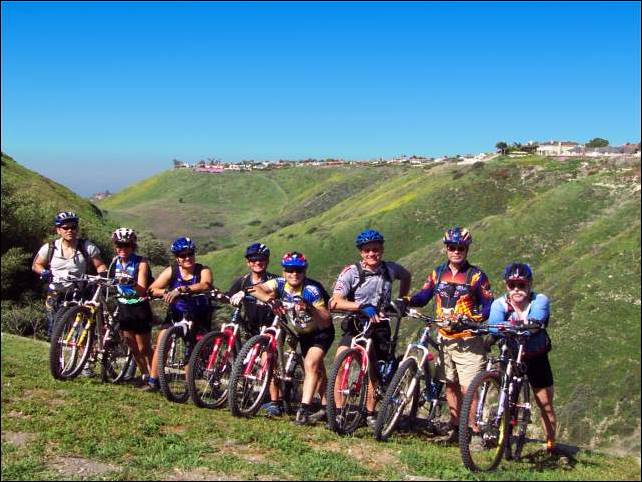
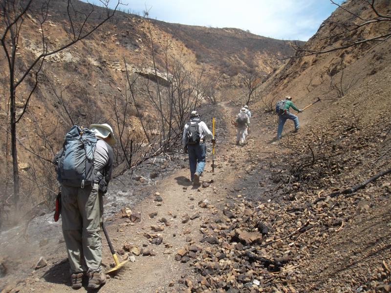
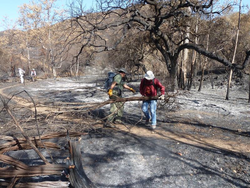
I am submitting these comments on behalf of the Concerned Off-Road Bicyclists Association (CORBA), a chapter of the International Mountain Bicycling Association (IMBA). We are a 501(c)(3) non-profit representing off-road cyclists in the Los Angeles and Ventura County region. We have been working closely with State Parks on trail-related issues since our founding in 1987. Our volunteer trail crews have contributed many thousands of hours of labor to trail maintenance efforts in State Parks. We serve as a bridge between land managers and the mountain biking community, educating and encouraging trail users on proper trail etiquette and responsible trail use, while at the same time advocating for protection of public lands and equitable access to the trails by which the public enjoys those resources for all trail users.

Having participated in the initial invitation-only focus group meetings conducted by Charlie Willard, we were initially dismayed to learn that State Parks policy of trails being “closed to bicycles unless specifically opened“ had been implemented in direct contradiction to the language of Title 14, division 3 of the Natural Resources Code. The policy of equestrians being permitted on trails unless specifically closed to them was also in direct contradiction to the code. We welcomed the opportunity to be a part of the process of rectifying this situation. The outcome of those focus group meetings appeared to be overwhelmingly in support of language that welcomes and includes equestrians, hikers and cyclists as trail users on State Parks trails. The proposed draft rules fail to meet that goal shared by the focus groups in both Southern California and Northern California, and appears to have completely ignored our input.

We therefore fully support and agree with the position taken by IMBA. We encourage State Parks to adopt the language submitted by IMBA for Title 14, Division 3 of the Natural Resources Code as follows:

§ 4360 – Trail Use

State park trails are open to non-motorized users including hikers, bicyclists, and equestrians unless otherwise designated. Trail use designations are established based upon user needs, visitor safety and environmental sustainability. This includes access to trails in Reserves and Preserves, as defined in PRC Sections 5019.65, 5019.71 and 5019.74, where particular emphasis will be placed upon importance of public access to the area, or desirability of providing important connections to other trails, provided impacts to special resources for which the area was established will be less than significant.

We put forward this language to replace existing provisions in the Natural Resources Code (§4359 and §4360).  It will also include the provisions of proposed §4360.1, which we, and IMBA, urge be eliminated.

IMBA’s and others’ comments also include a background of State Parks policy and the policy’s contradiction to the existing code. CORBA has been at the forefront of these issues and we have played an ongoing part in that history and background. Despite more than two decades of gradual State Park policy changes to be more inclusive of cyclists, the rate of actual progress towards increasing trail access and opportunities for cyclists has been painstakingly slow and frustrating. This is an opportunity for State Parks to follow through on their stated goals of providing increased access for bicycles. The language proposed by State Parks would be a step backwards in this process.

There are many reasons for adoption of the above language, or even to retain the existing language of §4360, and change §4359 to include similar language to that for bicycles in §4360, allowing equestrian access to trails unless specifically closed to them. As a group we advocate for shared-use trails, and feel that the message sent by the proposed exclusionary and negative language sends the wrong message to State Park unit superintendents and managers, and sets the wrong example for other land management agencies who may be influenced by State Park rules and policy.

It also sends the wrong message to the public. The proposed language has the potential to further and compound perceived user conflict by giving one user group a sense of “superiority” over other user groups; it legitimizes and reinforces this perceived conflict, and discourages the sharing of multi-use trails. As outlined in the State Parks Trail Change In Use PEIR, Appendix A, even perceived conflict is rare, and actual incidents are rarer still. The language we are proposing will help promote a sense of community, sharing of trails, and is in line with State Parks’ stated goals of providing more trail opportunities to off-road cyclists.

Management practices exist to close specific trails to particular user groups where legitimate, objectively-determined concerns or environmental impacts are demonstrated. Therefore, adopting this more welcoming language will not have any immediate impact on existing trails, and where impacts are demonstrated, the means to close them is already in place. This should place no additional burden on State Parks, above that of the now-adopted Change-In-Use process. Further, a more uniform shared-use policy will be easier to manage and police than the current status quo.

Our proposed language is also in keeping with current research on trail and resource impacts by different “muscle-powered” user groups. It treats each user group equally, just as overall impacts to resources and trails by each of the major muscle-powered user groups have been demonstrated to be similar. It is now well-understood that the greatest impacts to trail and resource sustainability are the result of poor trail design, rather than any particular user group. The proposed language appears to ignore this fact.

With regards to the proposed changes to the “Minimal Tool Use” sections of Division 3 of Title 14, we are deeply troubled by the proposed lumping together of Preserves and State Wilderness. These are two distinct land-use designations (actually three if you include ‘cultural’; and ‘natural’ preserves) that require distinct, but at times overlapping, approaches to management. The term “mechanical transport” as it applies to State Wilderness is NOT applicable to Preserves as proposed. The unintended consequences could be daunting, with significant impacts to cyclists and the mobility-impaired as user groups. While the concept and goal of “minimum tool use” is appropriate for both natural preserves and state wilderness, the proposed language can too easily be misinterpreted. We have been informed that State Parks does not wish to summarily exclude cyclists from Preserves, yet the proposed language does just that. We urge State Parks to either retain the existing sections §4351 and §4351.1, or to prepare language that avoids misinterpretation and unintended consequences.

Given the haphazardly drafted proposed rules, and numerous problems with the process–including scheduling public meetings AFTER the public comment period closes–we can only surmise that the draft rules were preordained prior to any public process and were put together with complete disregard to public input. The public and private meetings seem to have been held only to placate the public, not to seek actual input. We therefore urge State Parks to continue the public process appropriately and professionally, and allow for another round of public comments on the revisions that come out of this comment period.

Thank you for consideration of our comments. If you have any questions, feel free to contact us.

I’d Like to Thank…

Tuesday, July 30th, 2013

By Mark Langton

When I learned that CORBA would be inducted into the Mountain Bike Hall of Fame, my first reaction was, “where do we begin to start thanking people?” If you go back to the inception of CORBA, it all started with a 1987 Santa Monica Mountains Conservancy (SMMC) meeting where one of the agenda items was to consider adopting California State Parks’ policy of single track trails being closed to bicycles. So I guess you could say that CORBA owes a debt of gratitude to the SMMC for considering closing trails to bikes.

There were quite a few mountain bikers at that SMMC meeting, myself included. We sat patiently while the committee members discussed the pros and cons of allowing this “new” recreation on their public trails. They decided to adopt the State Parks policy, but they would continue dialogue with “the bike group” to see if bicycles could be integrated into the trail system. The cyclists in the audience looked around and silently acknowledged that “I guess we’re the bike group.” A legal pad was passed around and the list of people collected at that meeting became the impetus for CORBA. (Since then SMMC has adopted an inclusive policy toward mountain bikes.)

Twenty-six years later, we are still having to address issues of whether or not bicycles can coexist on public open space trails, mostly on State Parks’ trails. It’s like when snowboarding became popular at ski resorts. There was a lot of animosity leveled at snowboarders by skiers. A partial solution was to create separate areas where snowboarders could do their thing and skiers knew to stay away from those areas. But with public open space trails, we don’t necessarily have that luxury. If we want to share the trails, we have to behave accordingly and expect that there may be hikers, equestrians, and other (less experienced) cyclists on those trails.

The sport of mountain biking is evolving much like the sport of skiing has evolved to include snowboard riders. Separate areas are being developed to accommodate “gravity” mountain biking, and CORBA is working with land managers in our region to develop mountain bike parks that allow for more aggressive riding, including jumps, drops, and technical features. We will be announcing some very exciting news within the next few months regarding these new areas!

If you want something to last, you have to be willing to commit to the long haul. I’m not sure if that’s what the founders of CORBA set out to do, but thanks to them and everyone who got involved from then until now, we have a lasting legacy and solid foundation that will serve the next generation of mountain bikers in the greater Los Angeles and Eastern Ventura Counties.

And when we accept the award on behalf of CORBA for being inducted into the Mountain Bike Hall of Fame, you can be sure that everyone on that stage will be feeling the pride of all of those who have supported CORBA over the last 26 years.


CORBA To Be Inducted Into Mountain Bike Hall of Fame

Saturday, July 27th, 2013

mbhof-logoThanks to all who voted for CORBA to be inducted into the Mountain Bike Hall of Fame! The ceremony will take place September 18, 2013 at Mandalay Bay in Las Vegas as part of the Interbike trade show.

In the 26 years CORBA has been advocating for shared use open space trails, we have literally hundreds of people to thank for our successes and achievements. Normally a Hall of Fame induction indicates a retirement. But CORBA is still going strong and continues to represent the interests of those who want to ride their bikes in the dirt!

Palos Verdes Volunteer Trail Patrol Needs Mountain Bikers

Thursday, June 6th, 2013

bike_group_delcerro2Rancho Palos Verdes will soon create a Volunteer Trail Patrol program. CORBA PV has recommended the formation of a trail patrol for many years. It will be similar to volunteer patrols from other open space agencies including the Santa Monica Mountains based Mountain Bike Unit. The MBU was founded by CORBA in 1988 and now works under the National Park Service, the California State Parks, and the Santa Monica Mountains MRCA (Mountains Recreation & Conservation Authority).

Volunteer Trail Patrol members will assist the MRCA rangers by regularly patrolling the Palos Verdes Nature Preserve on foot, by horse or by bicycle. The goal is to educate and assist trail users, report safety hazards, maintenance needs, and regulation infractions. Volunteer Trail Patrol members will not be able to issue citations or make arrests.

It is important to have members from all three user groups on the patrol. Peer to peer communication is the most effective way to education trail users and minimize user conflicts concerns. For years CORBA PV has called on the city to collect factual on-trail information instead of relying on anecdotal comments at public meetings. Your participation will help collect accurate information and lead to impartial decisions by the city council.

The program is yet to be finalized but volunteers will undergo training and commit to four hours per month. Those who are interested can contact Barb Ailor at info@PVPLC.org. For more information go to mtbpv.org/

Pt. Mugu State Park Backcountry Trails to Reopen Friday 5/24/13

Tuesday, May 21st, 2013

SycCynSign_Theune_SMALLFrom Craig Sap, Superintendent of Angeles District, California State Parks:

To allow for a complete and successful post-fire recovery there will be a District Superintendent’s Order requiring that visitors to the back country stay on the authorized system trails and fire roads.    Our hope is to gain compliance through signage and messaging and not have to resort to citations, ejections or closures of areas while the fire damaged backcountry recovers.

Although a park with this much damage would probably necessitate a longer period of closure to allow for restoration and recovery I believe this incredible recreational resource can be reopened if used in a responsible manner.

Current Status for Point Mugu State Park:

Sycamore Campground– Reopening May 24th

Back Country area- Reopening May 24th (with some trails closed for additional repairs)

Mugu Beach-Open

Chumash Trail Head Parking– Reopening May 24th

Thornhill Broome Campground-Open

Sycamore Cove Day-Use-Open

La Jolla Group Camp– Reopening May 24th

La Jolla Day-Use– Reopening May 24th

Springs Fire Trail Repair Progress

Tuesday, May 21st, 2013

By Steve Clark, Trail Crew Coordinator

Twice in the past week at the request of the State Parks trails maintenance department, a group of about 8 volunteers from the Santa Monica Mountains Trails Council headed into Point Mugu State Park to begin cleanup and repair of the trails after the Springs Fire swept through just over a week earlier. This work was undertaken before the park is open to the general public to help assess the situation, clear and repair trails to make them safe for park visitors, and to limit damage to the fragile web of wildlife that survived the fire. The initial focus will be to protect park resources and make them safe for visitors. When that is complete, we’ll concentrate on repairing the drainage so rainwater that runs down the denuded hillsides doesn’t wash the trails away this winter.

Outline of the Springs Fire burn area (orange), overlaid on a trail and topo map.

Outline of the Springs Fire burn area (orange), overlaid on a trail and topo map.

The park is currently scheduled to reopen on Friday, May 24, with some trails still closed for further repair. The park will be only open during daylight hours until further notice. When the park does open, please protect the wildlife that did survive the fire by not going off the trails.This is a report of what we saw and got accomplished during those two trailwork days.

The first day (8:30 am to 2:00 pm) was spend entirely on Upper Sycamore Trail. We parked at the bottom of the blacktop hill in the large dirt area on the east side of the road, where the outhouse used to be. In it’s place is a piece of a metal frame and a stain of melted plastic in the dirt. Across the road is the remains of an old oak tree that had burned through the base and then toppled over. The tops of the railings on the bridge have been cut off and the surface planks are chared around the edges. The superstructure is steel so it is still strong enough to support fire trucks, but we drove our pickups across one at a time even so.

One of many trees fallen over the Upper Sycamore Canyon Trail

One of many trees fallen over the Upper Sycamore Canyon Trail

It was eerie on the trail itself. The fire seems to have burned about 10 feet up from the ground so the leaves are stripped off of the chaparral, but taller oaks and sycamores still have leaves in various states of scorched to dead. Being able to see through the leafless chaparral, we discover that there’s a lot of junk lying on the ground near the trail, including a metal windmill that must have fallen over years ago.The tread of the trail was in good shape. The leaves from the overhead trees that normally carpet it were all gone so we were walking on bare dirt. Unfortunately many of the oaks near the bottom of the trail had burned through the trunk and fallen over. Four or five of them blocked the trail and we spent considerable time cutting them up with a chainsaw and hand saws into pieces small enough for us to drag off the trail.

One of the many 'ash ghosts'

One of the many ‘ash ghosts’

There were a lot of ‘ash ghosts’ on the ground: markings left when whole trees or large limbs had fallen and been completely consumed, leaving a pattern of ash where branches used to be.Fortunately not all the oaks fell to the ground, but too many of them did.

The oaks were not the only trees that fell across the trail. Dozens of large chaparral bushes, about 8 feet tall, had collapsed across the trail. Many were burned completely through at the base so we just picked them up and tossed them off the trail, but others were still attached to their roots, so we needed to cut them through with hand saws before we could unblock the trail.

We had to clear a lot of chaparral that had fallen across the trail

We had to clear a lot of chaparral that had fallen across the trail

The amount of fire damage varied a lot from place to place. In some places the grass and most of the chaparral was almost completely gone. Some places weren’t burned at all, but most were singed to some degree. We could see on the hillsides patches where the fire had burned, surrounded by chaparral, and patches of chaparral surrounded by burn. We even saw a few shoots of brand new growth in some heavily burned areas.All of the collapsed oaks blocking the trail were near its lower end. Further up the trail were a few sections with minor rockfalls that we cleared. We also cleaned out three drains in a heavily rutted segment. The top section was relatively unaffected and we were relieved to see the giant oaks at the top of the trail, where it meets Danielson Road, were singed but not seriously damaged.

More rockfall to clearOn the second trailwork day, we covered Hidden Pond Trail between the bottom of the blacktop hill and Ranch Center Rd, Sin Nombre and about 2/3 of Blue Canyon Trail. We were able to cover much more ground because there were no fallen oak trees to clear and the two large fallen sycamore boughs shattered into pieces that were small enough to remove without using a chainsaw.

The surrounding land was much the same as Upper Sycamore Trail, except there were large meadows here and they were completely burned. It’s amazing to see how many gopher holes there are — it seems like there are several in each square foot!

P1220118On both days we saw animals that had survied. We saw lots of ants, some beetles, a few lizards, one snake, a tree squirrel and even a large bobcat resting in the shade of some sycamore trees. Some areas had lots of funnel spider webs even thought the grass was completely burned, but other areas had none. We saw and heard birds, including a couple of small flocks of screeching parrots.

We also came across a group of about a half-dozen mountain bikers on Hidden Pond Trail. They said they heard the trails were open; they claimed they phoned a park agency and were told the trails were open. However, we know they snuck in bacause the main entry points were blocked off and manned by rangers to keep people out. As an open space enthusiast, I was angered more by the fact that they were in the park when it was closed to the public for their safety and to protect the surviving wildlife than by the fact that they were on a trail that is never open to mountain biking. As a mountain biker, I was angered by the fact that these boneheads were putting into jeapardy the goodwill and standing that CORBA has worked hard to establish for the mountain biking community with the various land managers in the Santa Monica Mountains. These were the only unauthorized people we saw in the park over our two workdays there.

Normally I would provide lots of pictures to go along with an article like this one but we have been asked by State Parks not to publish any photos of trailwork or fire damage until after the parks have reopened to the public. They don’t want anyone to see the photos of people working on the trails and assume that the trails are open to everyone.

As a final note, let me remind you, for the sake of the remaining wildlife, to stay on the trails when the park reopens, and I thank you for your cooperation in helping the open space to grow back to it’s former self!

If you would like to help repair the trails, a volunteer workday has been scheduled for Saturday June 8th. For more information and to sign up to help, please visit CORBA’s June 8th trailwork registration page.

Update Friday May 24, 2013. Point Mugu State Park is now completely open, but there is still some debris on some trails, including fallen trees. Use caution on these trails until they are completely cleared of all debris!

View the photo gallery of trailwork on Upper Sycamore Canyon Trail.
View the photo gallery of trailwork on Hidden Pond, Sin Nombre and Blue Canyon Trails.

NPS To Re-Open Additional Trails Tuesday 5-14-13

Monday, May 13th, 2013

THOUSAND OAKS, Calif. – Now that the 24,000-acre Springs Fire is officially controlled, the National Park Service will re-open trails on the western side of the Santa Monica Mountains Tuesday morning, with restrictions.

“We know the public is anxious to return to their neighborhood national park,” said David Szymanski, superintendent of Santa Monica Mountains National Recreation Area. “We’re working as hard as we can to balance that enthusiasm with visitor safety and protection of our resources.”

Rancho Sierra Vista in Newbury Park will partially re-open, but some trails will remain off-limits and the park will close from sunset to sunrise. Due to ongoing safety concerns and trail damage, visitors won’t be able to travel into Sycamore Canyon, but will be able to reach the overlook at the boundary with Point Mugu State Park.

The Sandstone Peak and Mishe Mokwa trailheads will also re-open, as will the Backbone Trail east of the Point Mugu State Park boundary. California State Parks land sustained severe fire damage and all backcountry trails in the area remain closed. (Per an earlier press release, backcountry trails in Pt. Mugu State Park are closed until May 23.) 

Visitors are encouraged to help nature recover from the fire by respecting trail closures and staying on the trail in areas that are open. Foot and bike traffic tramples sensitive soil, vegetation, burrows and nests.

Park officials estimate 70% of Rancho Sierra Vista’s 1170 acres burned during the fire, though the Satwiwa Native American Indian Culture Center and all other structures were protected.

More information is available at 805-370-2301.

Pt. Mugu State Park Backcountry Trail Closure Update

Thursday, May 9th, 2013

SycCynSign_Theune_SMALLFrom the office of the California State Parks Angeles District Superintendent:

All trails and fire roads are currently closed.  This is a hard closure that will remain in effect until May 23rd.  This closure is necessary as crews identify and extinguish hot spots and to assess trail hazards.  After that we are planning to temporarily restrict use sunrise to sunset. 

And below is a press release from the National Park Service with some VERY IMPORTANT information regarding the current closures and traveling in burn areas once they are open:

THOUSAND OAKS, Calif. — In the wake of approximately 14,000 acres of burned park land, officials from the National Park Service and California State Parks have a few suggestions for how community members can help nature recover. Numerous concerned visitors eager to protect and restore the affected land have contacted both agencies offering their assistance.

“We’re touched by the outpouring of support from the community and their desire to help,” said David Szymanski, superintendent of Santa Monica Mountains National Recreation Area. “We’ll need everyone’s help to ensure the recovery goes as smoothly as possible.”

Though fire is a natural part of all ecosystems, too many fires can harm native plant communities, reduce wildlife habitat and even increase future fire risk. Historically, the Santa Monica Mountains experienced fires only once every 75 to 100 years. When Southern California landscapes burn too often, dry and fire-prone invasive weeds and grasses become established and increase future fire risk.

The fire burned more than 1,000 acres of National Park Service land and more than 12,000 acres of California State Parks land (the remainder of public park land acreage is owned by an assortment of park agencies).

The ecosystem is especially fragile in the aftermath of fire, so park officials encourage the public to take the following steps to help nature make a healthy recovery:

1. Respect the closures. We’re working as hard as possible to assess conditions within the burn area, but the fire is still active and our own staff must be escorted by fire officials. We can’t open the park (or specific trails) until it’s safe for visitors and the cultural and natural resources we protect. We appreciate your patience!

2. Stay on the trail. When our parks re-open, staying on designated trails (not unofficial paths created by fire crews) and minding posted closure signs is critical to protecting the wildlife and plant communities that survived the flames. Foot and bike traffic tramples sensitive soil, vegetation, burrows and nests.

3. Sign up to volunteer. Fire is part of nature, but that doesn’t mean we shouldn’t give nature a hand along the way. We’re still assessing the damage, but you can sign up now for future opportunities to do habitat restoration and trail improvement.

Santa Monica Mountains National Recreation Area (SMMNRA) is the largest urban national park in the country, encompassing more than 150,000 acres of mountains and coastline in Ventura and Los Angeles counties.  It comprises a seamless network of local, state, and federal parks interwoven with private lands and communities. For more information, visit www.nps.gov/samo.

California State Parks is composed of 279 units on nearly 1.5 million acres of land. State Parks is responsible for nearly one-third of the coastline of California, with more than 3,000 miles of hiking, biking and equestrian trails. State Parks receives more than 65 million visitors yearly, making it the single largest visitor destination in the state and second only to the National Park system for the nation. For more information, visit www.parks.ca.gov.

Contact: Kate Kuykendall, 805-370-2343
Contact: Craig Sap, 310-699-1732

Glendale’s Newest Trail’s are Complete

Monday, May 6th, 2013
Glendale's new Catalina Verdugo Trail

Glendale’s new Catalina Verdugo Trail

When the City of Glendale updated its Trail Master Plan for the City’s open spaces in 2007 and 2008, CORBA volunteers worked closely with City staff to map out existing trails and to identify where new trails would make the most sense. The first two of those new trails have  just been completed.

The Catalina Verdugo Trail loops around the Glendale Sports Complex at the end of  The northern trailhead is next to the Maintenance yard facility. The Southern end of the trail is behind the soccer fields, and comprises a series of switchbacks. Glendale has many difficult and steep trails like those at Brand and Deukmejian Parks, so City officials wanted this to be an easy trail for all levels of trail users to enjoy. The trail is open to hikers and mountain bikes only. The trail joins an existing fire road, from which there is access to Ridge Motorway, a lightly used fire road in the San Rafael hills.  From there it is possible to ride or hike all the way to the trail system at Cherry Canyon.

As with all newly constructed or recently re-built trails, it currently looks quite wide and raw. Over the coming months as the trail beds in it will naturally narrow down and brush will grow in along the trail.  It will be a beautiful, meandering trail through the Chaparral.  There is some steep slopeside exposure in a few sections, but overall it is a non-technical trail suitable for fit beginners and more experienced riders alike. Watch for poison oak along the trail, mostly on the north-facing slopes.

Mountain Do Trail exercise station photo by Robin McGuire

Mountain Do Trail exercise station

The second trail, and also a part of the Sports Complex trails,  is called the Mountain Do Trail. This is a wheelchair accessible, natural surface path, complete with a range of outdoor exercise stations, benches and tables. The Mountain Do Trail wraps around the soccer fields at the Southern end of the Sports Complex. Within the next month, signs and  interpetive panels with information on Flora, Fauna and local history will be added to both trails, making them a great educational resource as well. The Sports Complex is open from 7:00 a.m. to 10:00 pm and the gates are locked, so access to the trail is restricted outside those times.

The City is planning a formal opening ceremony on June 1st, National Trails Day, but the trails are now ready for use. These trails were expertly designed and constructed by Bellfree Contractors, in accordance with the City of Glendale Trails Master plan. For more information, a map and more photos visit BellFree Contractors’ web site.

Comments on Proposed Wilderness Needed by May 13

Friday, May 3rd, 2013

From Santa Clarita Valley Trail Users:

Dear Friends,

As some of you know, the Forest Service, in response to a court order, has proposed three alternatives for the future management of roughly 40,000 acres of land to the northeast of Castaic Lake.  This area is referred to as Salt Creek and Fish Canyon.  In two of the three alternatives, large amounts of land would be designated as a “Recommended Wilderness” which would then prohibit any “mechanized” use including bicycles.

The three alternatives are summarized as follows:

Alternative 1:  No change.  The existing designation of Back County, Non-Motorized would remain.  Alternative 1, of course, is our preferred alternative.

Alternative 2:  The entire Salt Creek/Fish Canyon area would be designated as a Recommended Wilderness.  However, a number of existing trails including the  Gillette Mine Trail, the Fish Canyon Trail, and the Burnt Peak Trail would be “cherry stemmed” from the Recommended Wilderness and would remain accessible to bicycles.  If this Alternative 2 is selected, we would request some additional cherry stems and other changes.

Alternative 3:  This alternative would designate the entire Salt Creek/Fish Canyon area as a Recommended Wilderness WITHOUT any cherry stems for existing trails.  In addition, the new Recommended Wilderness would extend to the east side of Lake Hughes Road to include the Tule and Red Mountain areas just to the north of Tapia Canyon.  We oppose Alternative 3 entirely.

Here’s a link to maps of the three alternatives:

http://a123.g.akamai.net/7/123/11558/abc123/forestservic.download.akamai.com/11558/www/nepa/76364_FSPLT2_370978.pdf

We are asking all of you to write an email or letter to the Forest Service with the following comments.

1.  Identify yourself as a LOCAL resident of the Santa Clarita area who is concerned about a shortage of mountain bike trails in our area.

2.  Express a strong preference for Alternative 1 and request a study to be done for additional trails in this and other areas in the Santa Clarita vicinity.

3.  Request that if Alternative 2 is pursued, that it be amended as follows:

a.  A cherry stem should be provided for Cienega Canyon, a decommissioned fire road used by the Crank n Stein group and other cyclists.

b.  A cherry stem should be provided for Forest Route 7N13.1 from Forest Route 7N32 on the south all the way up to Sawmill Motor Way on the north.

c.  The area be designated as a “Special Conservation Area” rather than a Recommended Wilderness.

d.  The cherry stems should be wider than the proposed 25’ to provide for trail maintenance and accurate mapping.

e.  A provision should be made to move or adjust cherry stems in case of a need to re-route a trail on account of erosion or other similar issues.

4.  Request that the Forest Service ensure that the Golden Eagle Trail is entirely excluded from any Recommended Wilderness.

5.  Specifically ask the USFS if trail user counts were conducted on the existing and historical trails to determine the type and volume of traffic the trails currently support.  These sort of substantive comments can be used as the basis for an effective appeal.

6.  Finally mention that we cyclists value and want to protect wild lands.  We enjoy the solitude that can be found away from people and civilization within such back-country areas and don’t want to lose access to such lands in our own backyard.

Please email your comments to socal_nf_lmp_amendment@fs.fed.us or mail them to:

Cleveland National Forest

10845 Rancho Bernardo Road, Suite 200

San Diego, CA 92127-2107

ATTN: LMP Amendment

Your full name and address is required in order for your comments to be considered.

The Forest Service is accepting comments only until May 13, 2013.

SCV Trail Users

Safe and Equal Access for All Trail Users

SCVTrailUsers@gmail.com