Archive for the ‘Advocacy’ Category

Strava String Update 9/8/12

Saturday, September 8th, 2012

By Mark Langton

Thanks for all your replies and questions to the original blog “It’s Not Strava’s Fault Mountain Bikers Are Ignorant.” Before I answer some of the questions posed, I wanted to update you on some important information I got while at a meeting last Wednesday. Specifically, National Park Service (NPS) Ranger Melanie Turner stated that bicyclists using trails unsafely will be cited, and no warnings will be issued. Citations include mandatory court appearances and up to several hundred dollars in fines. She did not specify which areas of NPS property within the Santa Monica Mountains National Recreation Area (SMMNRA) would be getting increased ranger presence, although Cheeseboro Canyon was mentioned during the conversation. Rangers from California Department of Parks and Recreation (State Parks) and Mountains Recreation and Conservation Authority (MRCA) were also at the meeting, and while they were less specific as to their enforcement tactics, they said that they would be vigilant in making sure trails are safe for all users. If you are wondering about the references to the three different agencies, it is because within the SMMNRA there are three primary open space administrative agencies, NPS, State Parks, and MRCA. NPS and MRCA currently have the most inclusive trail use policy (shared use in most cases), with State Parks being more restrictive, with many trails still closed to bicycles, despite those trails being exactly the same as ones that are open to bicycles.

The replies to the original post are a wonderful microcosm of CORBA’s efforts over the 25+ years we have been striving for shared use trails in the SMMNRA. Below in italics are statements and/or questions that are most relevant to this discussion, after which I will try to answer or clarify:

Can you please tell me if the idea of alternate trail days (those for hikers / equestrians and those for mtn bikers) has ever been brought up at a previous meeting? If so I would like to know why this policy has not been adopted by the NPS.

Yes, this idea has been posed before, with ensuing heated discussion. While used in other parts of the country to varying degrees of success, we (CORBA and the agencies) felt that it would likely be too difficult to enforce and would still create rule-breakers and a bad image for whoever did not adhere to the posted use restrictions. However, I would be in favor of revisiting the topic and will bring it up at our next meeting with the agencies.

I am just wondering why some trails (a lot of them in Sycamore) are off limits for mountain bikes.

As mentioned in a reply to the original post, many of the trails in Pt. Mugu State Park (Sycamore Canyon) to the east of the main canyon are in state Wilderness and are therefore off-limits to to bicycles (which are considered “mechanized transport”). State Parks unfortunately maintains a restrictive use policy on many of their trails that are not in Wilderness, which CORBA feels is biased and unfair. In response to this situation, State Parks has created a system to identify a trail as viable for shared use (hiking, cycling, equestrian), but it is extremely time-consuming and labor-intensive (read costly).

I have been hiking on some of these trails and during the week you will never see a single person on them other than the occasional mountain biker and me.

This is one of CORBA’s biggest examples of why trail closures don’t work. When it comes to trail closures, you can’t close a trail seven days a week when it really only gets used on two of them, mainly the weekends/holidays.

Never once in my life have I seen a trail that said no hikers or horses.

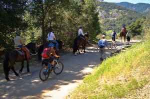
There aren’t many, but there are a few trails in the SMMNRA that are closed to horses. As long as horses are allowed on trails, then it is everyone’s responsibility to yield for the safety of everyone on the trail. The unfortunate thing about this situation is that a very small percentage of the user community (equestrians, approximately 5 percent) is being given almost complete access to the trails, while a much larger user group (cyclists, approximately 35 percent) is being restricted.

Why would the park ever close a perfectly good trail? Just to further congest our trail system? Trying to create more conflict?

I’m sure it’s not the intent, but it’s what’s happening.

There could easily be a trail that parallels the main road through Sycamore for bikes only to get them off the road where 90% of the hikers are and the same goes for Cheeseboro.

CORBA has made this suggestion several times over the years. The answer we usually get is that the agencies’ primary mandate is open space protection and preservation. Building parallel trails to accomodate single use recreation is not a suitable use of their resources. This is not to say it couldn’t be revisited. One thing to note here is that just because a trail is marked “bikes only”, it doesn’t mean hikers wouldn’t use it also. But I am in favor of this idea (it’s just probably not going to happen).


RPV Trail Plan Saved (Probably), Final Vote 10/2/12

Friday, September 7th, 2012

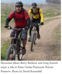
The article below is from the Easy Reader newspaper (Hermosa Beach). It details the struggles Rancho Palos Verdes mountain bikers (represented by CORBA Palos Verdes) have been having with access to local trails, dating back to 2008 (and even before that). The news is good, but it still remains to be seen until the next RPV City Council meeting on October 2. People in favor of bicycle access to Rancho Palos Verdes trails are encouraged to attend. For more information go to www.mtbpv.org/

RPV TO AMEND TRAILS USE PLAN

Mountain bikers could see more access to trails at the Palos Verdes Nature Preserve and Abalone Cove Shoreline Park and Ecological Preserve if, as expected, the Rancho Palos Verdes City Council decides the matter Oct. 4. (Info incorrect, actual date is Oct. 2–CORBA)

The proposal drew lots of public input last May when it first came before the council after a series of public workshops earlier in the year that drew around 40 people each. Several speakers opposed the additional access for bikers, causing the council to reconsider the issue until after the summer.

The original trails use plan for most of the 1,400-acre nature preserve went into effect in 2009 after a nearly two-year process led by a committee of citizens and public officials. Now the non-profit Palos Verdes Peninsula Nature Conservancy, which oversees the property, wants to designate trails on a remaining 190-acre portion known as Filiorum.

The opportunity also opened the door to revise the existing trails plan on the rest of the preserve, said Danielle LeFer, conservation director. In all, mountain bikers will potentially regain access to two trails in the Portuguese Bend area and four trails in the Abalone Cove area.

“I know mountain bikers would like to see more trails open to bikes,” said LeFer. “We incorporated all the comments we received and responded to those. Based on all of those, and discussions with rangers and city staff, we came up with some recommended changes.”

When the issue comes back to the council next month, little will have changed from what was presented in May, said Ara Mihranian, deputy director of community development for RPV.

“There are other groups out there that have their own agendas who are asking the council to make changes, but that’s not what’s being recommended by staff,” Mihranian said.

Long-time mountain biker Troy Braswell said he’s concerned the council could reverse a lot of the hard work accomplished in 2009. But council member Susan Brooks said that’s not the case.

The council postponed its decision so it could become more familiar with the preserve, Brooks said.

“The community had been working on this, but I think a lot of us were not aware of just how intensely they have been,” Brooks said. “Now that I’ve come to see just how much work has been done in the ensuing years, it really gives me a new respect for the process that has already taken place and we need to respect that.”

Brooks said RPV bears the burden of managing all the parks on the peninsula with no additional funding aside from city coffers.

“We have over 40,000 residents and we’re the largest city on the hill, but we bear the responsibility for all the parks and all the recreational facilities,” Brooks said. “Is RPV supposed to be the playground for all of the LA basin?”

By designating the trails, conservationists hope to limit impacts to the natural terrain as well as conflicts with different users. Since June 18, a ranger hotline received 55 calls, mostly about off-leash dogs said Katie Howe, parks and recreation administrative assistant.

“It’s helping to keep us aware of what’s going on in the preserve,” Howe said.

So far no calls have come in with conflicts regarding horses or mountain bikers, Howe said.

Gordon Leon, who formerly chaired the city’s equestrian committee, said the trails plan has worked pretty well.

“The trails are integral to the semi rural nature of Rancho Palos Verdes,” Leon said. “We have enviably one of the best trail networks certainly in the South Bay and to a greater extent Los Angeles. I think we’ve come to a reasonably amicable solution.” ER

NPS Announces Expanded Opportunities for Mountain Biking

Thursday, September 6th, 2012

The National Park Service recently announced changes designed to expand opportunities for mountain biking in parks nationwide. “Bikes are a great way to exercise, get healthy and experience the great outdoors,” said NPS Director Jonathan B. Jarvis. “This new rule gives park superintendents greater flexibility to determine where bikes can be allowed in a park and additional authority to shut areas where cycling is jeopardizing visitors or park resources.”

IMBA and the NPS have held a formal partnership agreement since 2005. The new rule is another step forward in that relationship, providing park staff with a more streamlined administrative process and localized decision making about where the best opportunities for mountain biking exist.

“IMBA’s policy is to work with parks that express an interest in developing opportunities for mountain biking,” says Mike Van Abel, the group’s executive director. “We are not interested in trying to insert mountain biking into all national parks or putting bikes on every NPS trail. But we know from experience that well-designed,sustainable trails can be successfully shared by different types of users.”

There are already more than 40 NPS properties that allow mountain biking on dirt roads and trails. Research from the Outdoor Industry Association shows that bicycling is one of the most popular forms of recreation — especially among young people. “At a time when park visitation is declining, and America’s youth is becoming more sedentary, it’s good to see the NPS taking this positive step,” said Van Abel.

Some groups have questioned whether mountain biking is compatible with the NPS’ conservation values, but current research shows that the impacts of mountain biking are similar to those caused by hiking. Studies indicate that when it comes to trails, the major issue is not the type of user but the way the trail is designed and built.

Copied from IMBA Trail News, Summer 2012

Federal Trails Funding Secured for Two Years

Tuesday, September 4th, 2012

The Recreational Trails Program (RTP), the federal funding program that supports natural surface trails, has been reauthorized for two years in a bill that the U.S. Congress approved this July. An $85 million program, RTP strongly benefits mountain bikers and funds the development and maintenance of thousands of trail miles.

“We are very grateful to our grassroots advocates whose relentless calls and letters elevated the importance of RTP. This has been an extremely long reauthorization process — time and time again, mountain bikers rallied to save RTP,” says Jenn Dice, IMBA Government Affairs Director. “We also would like to thank U.S. Sen. Klobuchar and U.S. Rep. Petri for their commitment to the program and seeing it through this difficult process.”

RTP has funded iconic mountain bike trail projects across the country, including two IMBA Epics: FATS in North Carolina and Brown County State Park in Indiana. RTP funds were also used in the construction of the just-opened Rockburn Skills Park in Maryland and the Highbridge Bike Park in New York City. IMBA chapters and clubs have become experts in securing RTP grants for trail construction and maintenance.

In a new development, governors and state-level department of transportation offices have the opportunity to opt out of the entire program and return funds collected on behalf of RTP back to other uses (such as roads). For example, a state like Colorado could lose more than $2 million that would have otherwise gone to singletrack, trailheads and other expenditures that benefit mountain bikers. IMBA urges its members to contact their Governors about the importance of RTP funding for trails. Governors must decide by mid-September, so do not delay.

Groups interested in taking advantage of RTP funding to further trail projects should visit imba. com/resources to learn more.

Copied from IMBA Trail News, Summer 2012

25th Anniversary Party Update September 3, 2012

Monday, September 3rd, 2012

Thanks to all of you who have registered for CORBA’s 25th Anniversary Celebration. As we get closer to the date, we are extremely excited at the prospect of seeing so many great folks who have helped make CORBA the successful advocacy organization it has become.

We have one major concern: Seating is limited, and early registration has been so good that it looks like our space is going to fill up early, so please register as soon as possible to secure your spot at this historic event. For more information, click here.

It’s not Strava’s Fault Mountain Bikers are Ignorant

Monday, September 3rd, 2012

By Mark Langton

It has come to our attention that it is possible that small group of mountain bikers is using the web site Strava to have “competitions” in various locations around the Santa Monica Mountains National Recreation area.

Strava allows you to track and upload your outings onto their web site via a GPS tracking device. The data ncludes the time it took you to traverse a particular route. It seems that some mountain bikers are using this feature to create a “time trail” competition and posting their times to see who is fastest. Obviously, trying to go as fast as possible on our shared use trails is not acceptable as it can endanger other users, including but not limited to mountain bikers. In response to this situation, we have learned that National Park Service rangers will be intensifying their presence at locations known to be experiencing this time trial scenario, Cheeseboro Canyon Park in Agoura Hills being one of them.

Currently it is the policy of the Santa Monica Mountains National Recreation Area’s managing agencies that events that displace or affect the safety of other trail users on public open space trails are prohibited. If you want to race, go to a sanctioned race (usacycling.org). If you want to go fast, go to a location that is set up for high speed mountain biking, such as Mammoth Mountain (mammothmountain.com).

County Seeks Public Input on Trails in NW San Fernando Valley

Friday, August 31st, 2012

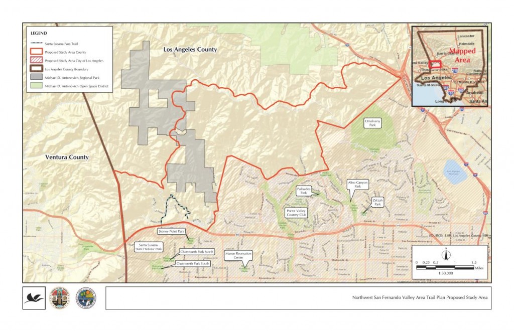
Thursday evening, August 30, Los Angeles County held their first public input meeting for the Northwest San Fernando Trail Master Plan in Granada Hills. About 40 people were in attendance, including at least 7 from the mountain biking community. This was an information gathering session for the County, being conducted by Sapphos Environmental, the lead consultants for the project. Sapphos also helped develop the County’s Trail Manual and have collaborated with them on many other projects.

LA County NW San Fernando Trail Master Plan Study Area

LA County NW San Fernando Trail Master Plan Study Area

After a slate of introductions, Sapphos Environmental president Marie Campbell gave an overview of the process. From her outline and the numerous audience questions that ensued, it seemed like this meeting and call for public input might have been somewhat premature. Several members of the audience asked about specific subdivisions that have already been approved and which include trail easements, trail easements that are on record, newly approved equestrian parks and facilities, and other data, none of which were available.

Sapphos and the County have been in contact with State Parks, Mountains Recreation Conservation Authority, City of Los Angeles, Rim of the Valley Trail, and other adjacent public land agencies to coordinate with their trail plans. However, they could not supply data about existing or proposed trail alignments in those other jurisdictions to which many of the attendees would like to see trail connections. No trails in other jurisdictions appeared on the maps.

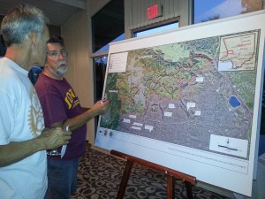
The room was set up with six easels with larger scale aerial photos of the study area, two each for hikers, cyclists and equestrians. We were asked to mark in one color trails that we are currently using, and in another color, trails and/or connections that we would like to see in the future. The aerial photos that were supplied, while larger scale than the study area map above, did not have any existing fire roads or trails, nor did they have any geographic markers or place names on them. This lack of background data made it extremely difficult to identify routes that we currently use, and more difficult to say where we’d like to see new connections and trails.

Marking a trail wishlist

Marking a trail wishlist

One issue that was raised is the fact that these trails will be multi-use trails including bicycles per County policy, wherever feasible. The southern boundary of the study area is all City of Los Angeles, where a blanket policy prohibits bikes on all trails unless specifically authorized. It was explained that in such cases, signage will be important to advise cyclists that a trail on which they are currently riding may pass into the jurisdiction of the City of Los Angeles, at which point the bicyclist would have to turn around and return. We feel it important that the County sticks to their multi-use policy, even when trails connect to City trails where bikes are not allowed.

This is a great opportunity to plan for some vital connections and help fulfill the unmet and growing demand for recreational trails around the San Fernando Valley. There is so much open space (8363 acres in the study area) but it is pockmarked with private properties, utility easements, gas lines and other infrastructure. This makes passage through the Santa Susanna Mountains by trail users very difficult. Many existing trails are old ranch roads and are unnamed and unmarked. Many unofficial trails have been created by the community and used for decades. In fact, the only official County trail in the study area is the Indian Springs/Indian falls trail, which lies partially within a subdivision, connecting to Johnson Motorway and Devil’s Canyon.

We’d of course like to see a way to ride from Mission Peak over to Weldon and Towsley, connections to the proposed Rim of the Valley trail, an east-west running trail from Mission Peak and O’Melveny park to Oat Mountain, Fossil Hill, Rocky Peak fire road and Las Llajas Canyon. These would lie partially outside the study area, and for that reason, we also suggested that the study area be expanded in its northwest section.

While the County does not have an easy way to submit data electronically, we encourage those familiar with the area to contact Steve Messer with GPS tracks of trails that are currently in common use, as well as trail connections that would be desired (GPS, Google Earth, hand-drawn, or however you can submit them). The County is accepting suggestions through Park Planner Lorrie Bradley (lbradley@parks.lacounty.gov). While no formal deadline for comments and suggestions was given, we were told they would accept comments by email for “the next few weeks.”


Donation Stations Installed at Trailheads September 2012

Wednesday, August 29th, 2012

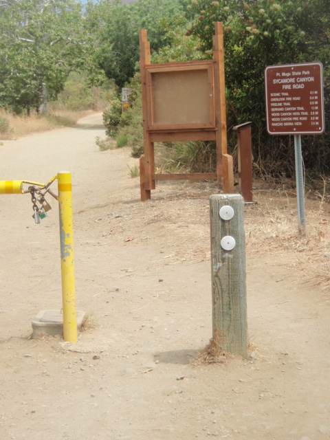
Donation boxes and info kiosks have been installed at the PCH entrances to Sycamore and  and La Jolla Canyons, and at Chumash trail head. We have been informed that any and all donations collected at these stations will go directly to trail maintenance and resource projects in the state park where the money was collected. The kiosks will allow volunteer partners (such as CORBA) to post information about upcoming events and other general information.

Newly installed donation station and info kiosk at Sycamore Canyon entrance to Point Mugu State Park.

LA County Trail Plan Public Hearing for NW San Fernando Valley, Aug 30

Thursday, August 9th, 2012

Sapphos Environmental, Inc. is sending this e-mail on behalf of the County of Los Angeles (County) Department of Parks and Recreation to inform community members of the proposed Northwest San Fernando Valley Area Trail Plan including Rim of the Valley (proposed project). The intent of the County is to develop a trail plan for trails to guide future trail development to meet needs in the Northwest San Fernando Valley Area. Currently, the study area consists broadly of the unincorporated territory of the County bounded by the Ventura County line on the west, the Santa Susana Mountains (Johnson Motorway Trail, Rim of the Valley Trail, Oat Mountain Motorway Trail, and Weldon Canyon Trail) to the north, Interstate 5 to the east, and Roscoe Boulevard to the south, with provisions for connections to other nearby existing and planned recreational resources. The overall work effort would include a trail plan and associated California Environmental Quality Act documentation. The County is currently in the early development stages of the proposed project.

The County will hold a public outreach meeting to engage trail users and the surrounding communities and solicit ideas for the trail plan. The public outreach meeting is scheduled for:

Northwest San Fernando Valley Area Trail Plan including Rim of the Valley Public Outreach Meeting
Thursday, August 30, 2012
6:00 pm
Granada Room
Knollwood Country Club
12024 Balboa Blvd.
Granada Hills, CA 91344  
Please reply to this e-mail to indicate whether you are interested in receiving further updates on the proposed project and related meetings, or if you prefer to be removed from the contact list. If you are interested, please state in the e-mail whether you would be available for the scheduled public outreach meeting on Thursday August 30, 2012 at 6:00 p.m., and provide the following information:·        Name
·        Affiliation (trail group, etc.)
·        Area of interest (hiking, biking, equestrian, etc.)
·        Current e-mail address (if applicable)
·        E-mail addresses of other potentially interested parties you may know

Thank you for your time. Should you have any additional questions, please contact Ms. Lorrie Bradley at LBradley@parks.lacounty.gov or (213) 738-2812.

Sincerely,

SAPPHOS ENVIRONMENTAL, INC.

Leanna Guillermo

www.sapphosenvironmental.com

Chicken or Egg?

Tuesday, July 31st, 2012

By Mark Langton

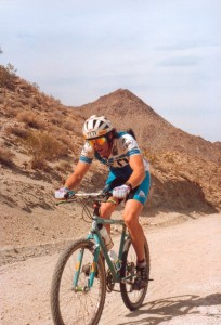
Mark Langton at the Cindy Whitehead Desert Challenge, circa 1988

There’s a saying that goes something like, “as soon as there’s two of anything, there’s going to be a competition.”

Competition, in the form of racing, has probably been around since pre-historic times. When it comes to bicycles, racing has been part and parcel of the activity since the very beginning, and in the early 1900’s track racing was the most popular sport in the United States, drawing bigger crowds than baseball.

But like most things, there’s a time and a place for racing. As a motorcycle RiderCoach for the Motorcycle Safety Foundation, I am constantly reminded of the statistics of sport bike riders who are killed or severely inured because they race each other on the roads of our local mountains. I am also constantly reminded that people like to go fast on their mountain bikes on our local trails, to the detriment of others and even to themselves. I have nothing against people who race. The problem I too often see is with people who think that because they are training for a race, they can ride the local shared use trails at race pace. Our trails in the Santa Monica Mountains are used by a wide variety of people, including new mountain bikers who have no idea what “on your left” means.

Again, I have nothing against people who race, or go fast for that matter. But when around other users, there is no excuse for not slowing down to others’ speed, uphill or down. If you want to go fast, make sure you can see far enough ahead so that your speed will not impact other trail users.

If you want to go fast but are not into racing, there are several places you can go where speed is allowed, such as Mammoth Mountain Bike Park (mammothmountain.com).

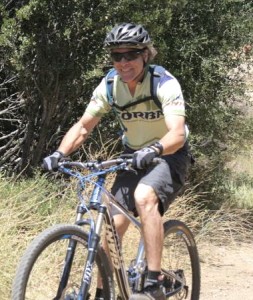
Mark Langton, Malibu Creek State Park, circa 2012

As I’ve said before, simply slowing down for other users (slowing to their speed) virtually eliminates the problem that people have with mountain bikers; being scared by getting passed at a high rate of speed. Slowing down improves things for mountain bikers, both from an image and safety standpoint. And it makes for a much more pleasant experience for everyone. Remember, your actions speak for the entire mountain bike community.