Archive for the ‘Advocacy’ Category

Glendale Park Planning Meeting – Sep 26

Friday, September 18th, 2015

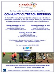
2015 Glendale Parks MeetingThe City of Glendale is growing. The increase in development of the downtown area has provided the City some funds for parks, and they are asking the public how that money should be spent.

We have some ideas, and you might too. The City wants to hear from us on Saturday, September 26, 10 a.m. – noon at the Maple Park Community Center, 820 E. Maple Street, Glendale, 91205. A third meeting will take place at the Pacific Park Community Center on Saturday, October 3, 10 a.m. – noon.

In 2008, CORBA successfully lobbied the City of Glendale to include a Bicycle Skills Park and Bike-Only downhill trail in their Trail Master Plan. In 2012, CORBA and the Los Angeles County Bicycle Coalition advocated for a bicycle skills park in their Safe and Healthy Streets Plan (within Chapter 3, Encouragement, and Chapter 2, Education components of that plan).

We started a Glendale Bike Park petition in 2011 that gathered over 500 signatures online and several hundred more on paper. That online petition is still live and available to be signed at: http://www.ipetitions.com/petition/glendale_bike_skills_park/. This pre-dates our current Los Angeles Bike Park Collective Petition which has over 1800 signatures calling for bike parks in the greater Los Angeles area.

in 2011 CORBA’s then Vice President Steve Messer and former high school mountain biking Coach Mauricio Barba testified before the Glendale Parks Commission to propose a new bike park. Not long after, the great recession forced the City to cut back and put many programs on hold, including our Bike Park proposal.

Earlier, in 2007 CORBA gave significant input to the City of Glendale Trail Master Plan. We proposed, and the City adopted plans for a number of new trails. Since the opening of the highly successful Catalina Verdugo trail, we believe the City is ready for a beginner-friendly multi-use singletrack trail connection from Brand Library to Las Flores Motorway and South Beaudry Motorway. Such a trail would connect these popular fire road routes and make much more interesting loop ride or hikes possible, at more beginner-friendly grades than existing fire roads.

The funds available to the City of Glendale are primarily allocated for the downtown and south Glendale areas, but there is an opportunity for some of those funds be allocated to projects that have a city-wide benefit. Come on out and ask Glendale for the Bike Skills Park, and new trails that will benefit the entire community, and/or a smaller Community Pump Track for South Glendale, or perhaps even the proposed Space 134 project, where you can currently vote for a “Bike Station.”

Castaic Area Trail Master Plan Public Meetings

Tuesday, August 18th, 2015

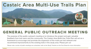
Castaic Trail PlanWith proposed developments at Tapia Canyon and our pending proposal for a bike park at Castaic Lake State Recreation Area, there are some changes coming to trails and bike access in the Castaic Area. We’ve long known that the trails of Tapia Canyon, in particular, would be at risk once the developers move forward with their construction plans. We’ve had several meetings with the developers who seem willing to work with us to preserve some trails in the area.

In response to the public’s need for future planning, 5th District Supervisor Michael Antonovich has authorized the development of the Castaic Area Multi-Use Trail Plan.  The County will survey existing trails, proposed developments, desired trail connections, and gauge future trail needs to support a growing population. This will be a similar process to the Santa Susana Mountains Trail Master Plan, a process in which we participated from April 2012 until it’s completion last year.

The first general public meeting is scheduled for Thursday, August 20th at 6:30 p.m., at the Los Angeles County Castaic Public Library, 27971 Sloan Canyon Road, Val Verde, CA 91384.  This meeting will be followed by three user-group specific meetings for mountain bikers, equestrians, and hikers. Currently the mountain bikers’ meeting conflicts with Interbike, so we have asked if that can be rescheduled.

Last year CORBA submitted a comprehensive Bike Park proposal for the Grasshopper Canyon area of Castaic Lake State Recreation Area which we would like to see included in this planning process.

If you’re able to, come to this meeting and express your support for our bike park proposal, for preserving existing multi-use trails, and for creating new trail opportunities, such as the conceptual “Castaic Loop Trail.”

Read the County’s Fact Sheet for more details: Castaic Area Multi-Use Trails Plan Factsheet


Castaic Area Trail Master Plan General Meeting

When: Thursday, August 20th at 6:30 p.m.,

Where: Los Angeles County Castaic Public Library, 27971 Sloan Canyon Road, Val Verde, CA 91384

—————————————————————————————-

Castaic Area Trail Master Plan Mountain Bikers Meeting

When: Thursday, September 17th at 6:30 p.m.,

Where: Los Angeles County Castaic Public Library, 27971 Sloan Canyon Road, Val Verde, CA 91384

San Gabriel Mountains National Monument Management Plan Comments

Tuesday, August 11th, 2015

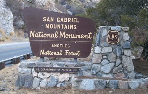
need to changeToday, August 11, 2015, CORBA and the Mount Wilson Bicycling Association (MWBA), submitted joint comments to the U.S. Forest Service on the San Gabriel Mountains National Monument Plan and Land Management Plan Amendment’s “Need to Change” Analysis.  Our comments are linked below.

As members of the San Gabriel Mountains National Monument Community Collaborative, we have also signed the consensus comments submitted by the Collaborative group, which we helped develop.

These are an important milestone in the development of a management plan for our new National Monument. The Presidential Proclamation directed the Forest Service to develop a management plan within three years. Most management plans take longer than that to develop, but the Forest Service’s approach to amend the current plan should allow them to complete the plan within the alotted time frame. We were pleased that the Forest Service extended the current comment period to allow for more thoughtful comments.

We were in general agreement with most of the findings of the “Need to Change” analysis, which stated specifically that the existing Forest Plan guidance on Recreation Management did not need to change. However, the Proclamation calls for the development of a Transportation Plan, which could impact recreational trail management. Accordingly, we commented on the need to develop a transportation plan for the entire Forest, both to improve recreational opportunities and to protect the resources of the Forest.

It is now up to the Forest Service to take into consideration all of the comments submitted, and their own analysis to develop a draft Environmental Assessment and Monument Management Plan. We expect that draft to be available for public review in spring, 2016.

Until that time, we’ll continue to work with the Forest Service on project-level issues including trail maintenance and restoration, in accordance with our existing partnership and volunteer agreements.

Comment PDF:  2015-08-11 – CORBA and MWBA SGMNM Need to Change Comments

Puente Hills Landfill Park Master Plan Announced

Tuesday, July 28th, 2015

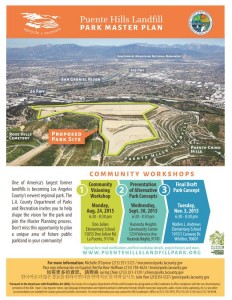
PHLP_WkshpFlyer1_print_300dpi_01The decommissioned Puente Hills Landfill is preparing to become the newest addition to the Los Angeles County regional park system. The area has outlived it’s usefulness as a landfill, and is presently a blank canvas waiting for a public park to be developed. The proposed park is close to Chino Hillls, Turnbull Canyon and the Emerald Necklace, all areas popular for outdoor recreation, including cycling and mountain biking.

There are a there meetings scheduled:

Community Visioning Workshop, Monday, August 24, 2015, 6:30 – 8:30 and the Don Julian Elementary School, 13855 Don Julian Road, La Puente, 91746

Presentation of Alternative Park Concepts, Wednesday, September 30, 2015, 6:30 – 8:30, Hacienda Heights Community Center, 1234 Valencia Ave, Hacienda Heights, 91745

Final Draft Park Concept, Tuesday, November 3, 2015, 6:30 – 8:30, Wallen L. Andrews Elementary School, 1010 S Caraway Drive, Whittier, 90601. 

We invite mountain bikers and CORBA members to attend one or more of these meetings. The more the County hears demands for Bike Park facilities in the Los Angeles, the more likely we will be to get one. Whatever park ideas people have can to be presented and discussed at the initial meetings or by contacting moconnor@parks.lacounty.gov.

More information can be found at www.PuenteHillsLandfillPark.org.

President declares three new National Monuments

Saturday, July 11th, 2015
Three new national monuments

Three new national monuments

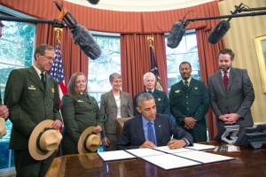
Yesterday, July 10, 2015, President Obama used his powers under the Antiquities act to declare three new National Monuments.  There were another three declared in February 2015, and a further monument in December. That’s seven new National Monuments since we were given the San Gabriel Mountains National Monument on October 10, 2014.

Clearly, this President has been on a roll when it comes to land protections. All of these new National Monuments will face the similar challenges of developing management plans that protect the resources of the monuments, but also allows for recreation and enjoyment of those resources. Each has their unique characteristics and each proclamation is written specifically for each monument.

Of the most recently-declared monuments, one has no real biking opportunities. The Waco Mammoth National Monument was owned and operated as an archaeological dig site by the City of Waco, Texas. Under the new monument, the city of Waco will transfer the 108 acre site to the Federal Government, via the National Park Service, who will now coordinate with the City and with Baylor University to continue archaeological research and protect the site.

The other two, Berryessa Snow National Monument in northern California, and the Basin Range National Monument in Nevada, both include trails and mountain biking opportunities on a mix of Forest Service and BLM lands. In both proclamations, recreation opportunities are considered. The Berryessa Snow proclamation reads “…motorized and mechanized vehicle use in the monument shall be allowed only on roads and trails designated for such use, consistent with the care and management of the objects identified above.”

In the Basin Range, more than 700,000 acres of Nevada desert and mountain terrain, there are many trails. The proclamation similarly states that “…motorized vehicle use shall be permitted only on roads existing as of the date of the proclamation. Non-motorized mechanized vehicle use shall be permitted only on roads and trails designated for their use, consistent with the care and management of the objects identified above. The Secretary shall prepare a transportation plan that designates the roads and trails where motorized or non-motorized mechanized vehicle use will be permitted.”

In both of the above examples, just as in our own San Gabriel Mountains National Monument, mountain bikes will be permitted only on roads and trails authorized for their use. One difference between the two, however, is that the Basin Range proclamation also explicitly prohibits the development of new motorized vehicle routes. No such restriction is placed on non-motorized trails used for mountain bikes or “mechanized” travel, but the development of a transportation plan is where the details will be hammered out.

Similarly, our San Gabriel Mountains National Monument allows existing uses on existing trails, but also calls for the development of a transportation plan that will include trails, roads, and their respective use designations. Mountain bikers in all these areas should be thankful for the elevated protections these special places have now been given, but should also remain engaged as active trail advocates, trail stewards, and partners in the development of the management plans and transportation plans that will govern our future access to and enjoyment of these special landscapes and the trails by which we experience them.


TO Acorn Publishes Article on Trail Conflict, Etiquette

Thursday, July 2nd, 2015

An evenhanded account of the issues surrounding conflict and etiquette on the trails was published on the front page of the July 25th issue of the Thousand Oaks Acorn.

The article starts with an account by an equestrian in Ahmanson Ranch who felt threatened by mountain bikers who sped by and shouted expletives when asked to slow down. The equestrian also has been charged by unleashed dogs on other outings.

Mark Langton, CORBA board member and past president, is quoted extensively on the need for mountain bikers to show speed restraint when passing other people on the trail.

Another cyclists is critical of people who take poorly trained horses on trails where they can expect to encounter mountain bikers.

An equestrian from Agoura Hills says the vast majority of mountain bikers show appropriate courtesy. “This is pretty much a nonissue with all but a tiny handful of jerks on bicycles and nervous equestrians who are afraid of their horses and probably should not be on the trails in the first place.”

Finally, there are some quotes from representatives of the Santa Monica Mountains National Recreation Area, including Superintendent David Szymanski.

You can read the full article here.

President’s Message: It’s complicated

Thursday, July 2nd, 2015
San Gabriel Mountains National Monument Community Collaborative

San Gabriel Mountains National Monument Community Collaborative

There’s always a lot going on here in Southern California. We have recently submitted comments on the Rim of the Valley study. We’re expecting the Santa Monica Mountains NRA Interagency Trail Management Plan early next year. A new National Monument management plan development process just began, though CORBA has been involved in the Community Collaborative Group since last November. We’ve successfully alerted L.A. County of the need for another trail master plan, to be announced soon. We have pending Bike Park proposals, and a recently-opened Bike Park in Fillmore. We have a growing high school and middle school racing contingent. We have a new Forest Supervisor. There are wilderness proposals, missing links in trails, fire-damaged trails still in need of restoration, access issues on Etz Meloy (Backbone Trail). There’s no shortage of issues, threats to our public lands, our trails and access to them.

It’s complicated.

And it takes time to figure things out and try to get things right.  These studies and plans seem to disappear from the radar, only to re-emerge six months to a decade later. Advocacy is a marathon, not a sprint, and CORBA is still at it after 28 years. Government is slow to move but no matter how frustratingly slow it sometimes seems, there is progress being made.

CORBA is busily engaged in all of these processes on your behalf, in partnership with IMBA, to help make sure there is progress. We continue to work to make sure the landscapes we ride and the trails we love are protected, improved, and remain open to our community.

We need each and every one of you to be engaged as well. After all, we’re all ambassadors of the sport when we’re on multi-use trails. This means ride an appropriate speed for your sightline (slow down!) and be courteous. Be safe. Follow trail etiquette best practices. Be an example for others. Leave no trace. Support CORBA. Sign a petition. There are lots of ways to have a positive impact.

Riding trails to explore our public lands is a passion we all share, and want to continue to enjoy. Enjoy your summer and keep on riding!


Rim of the Valley Corridor Study

Tuesday, June 30th, 2015

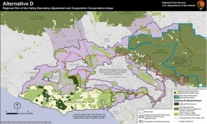
ROTValternativeDCORBA has been involved in the Rim of the Valley Corridor since our inception. In fact, we’re so ingrained in the process that the Rim of the Valley Corridor is mentioned in our mission statement as our primary territory of concern. We were excited to see the draft study released, and have submitted comments on the plan.

The study sought to answer the following:

1. Does the area possess nationally significant natural or cultural resources?
2. Is it a suitable and unique addition to the National Park System?
3. Can it be feasibly added to the Park System?
4. Does it require direct NPS management, instead of stewardship from other groups or a public-private combination?

The answer to all of the above questions was a “yes.” The National Park Service presented four alternatives based on the study findings. The first NEPA-required “no action” alternatives serves as a baseline against which we can compare the alternatives. Alternative B allows the NPS to offer “technical assistance” to existing land managers within the study area, but falls short of allowing the NPS to make any direct capitol investments.

Alternatives C and D expand the authorized boundary of the Santa Monica Mountains National Recreation Area. What the boundary expansions really mean is that the National Park Service will be authorized to offer technical assistance to existing land managers for any project that enhances recreation, or restores habitat and connectivity. Under Alternative C or D, the NPS is also authorized to spend money on capitol projects within the expanded boundaries.

We believe that the largest operational boundary proposed under Alternative D would have the greatest long-term benefit for recreation, bio-connectivity, wildlife and the communities adjacent to the study area. It also includes the wildlife corridors linking the two areas of the Angeles National Forest separated by Highway 14, as well as between the Santa Susana Mountains and Los Padres National Forests.

The boundary expansion does not come without concern. The NPS, like most public land agencies, is currently under-funded. We would hope that any boundary expansion would come with an increase in funding sufficient to at least maintain the current level of service across the expanded NRA.

During the course of the public meetings we heard a lot of misinformation and a misunderstanding of what the boundary expansions mean. The Federal government will not be taking anyone’s property against their will. Existing land ownership rights and management authority is respected and maintained.

One thing that would change is the permitting of landfills. In our comments, we asked for the existing landfills to be excluded from the proposed NRA expansion to eliminate the need for additional permitting. We also feel that the recently completed San Gabriel Watershed and Special Resource Study which proposed a San Gabriel Unit of the NRA, must be considered and its findings also addressed by any congressional action to the effect of either.

The Rim of the Valley trail system is also important to us. It’s a proposed multi-use trail network that will encircle the San Fernando Valley, and perhaps Simi and Conejo Valleys. We feel the National Park Service will be in a good position to help facilitate its completion under Alternatives C or D.

It will probably be another year before we see a final recommendation from the study. From there it will be up to Congress to decide what to do with the recommendations.

2015-06-24 – Rim of the Valley Draft Study Comments from CORBA

San Gabriel Mountain NM – Public Meetings June 22-27.

Friday, June 5th, 2015

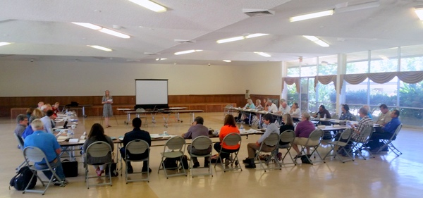
stelprd3829626At our last San Gabriel Mountains National Monument (SGMNM) Community Collaborative (the Collaborative) meeting, we learned the dates of the first round of public scoping meetings for the new Monument Management Plan.

President Obama gave the Forest Service three years to develop a management plan for the monument. The first step in that process is reviewing the current Angeles National Forest Management Plan, and the Presidential proclamation declaring the moment. They need to determine what needs to change in the current management plan to bring it into compliance with the proclamation and the new Monument.

The Forest Service will continue to manage the same land that was the Angeles National Forest as the SGMNM. This means they don’t need to write a new plan for the Monument. Instead They will be developing an amendment to the current management plan.

At this series of public meetings the Forest Service will present a “need to change” document: what they have so far determined needs to change in the current plan. They will be seeking public input on what they have found, and looking for public comments. Comments could be supportive, suggestive of improvements or object to the findings.

Comments will be taken at the meetings. The deadline for comments will end 45 days after this “need for change” document is released, which is expected mid-June). We understand the document is not long, expected between 10 and 20 pages long. The meetings will be four hours long, with stations explaining each aspect of the proposed changes. People can arrive at any time during the four hour window to review the materials. They will also be made available online at http://www.fs.fed.us/nepa/nepa_project_exp.php?project=46964.

While we don’t expect any surprises that will affect trail access for mountain bikers or other user groups. We may see changes in management structure, projects, funding and staffing levels, community involvement and access, and other things that we must consider. Until the document is released to the public we won’t know exactly what it contains.

Watch for CORBA’s reports and alerts, CORBA’s comments, and suggested comments for our members, will be posted after the first meeting. Please attend if you’re able, or visit the Forest Service planning web site at: http://www.fs.fed.us/nepa/nepa_project_exp.php?project=46964 to keep updated.

Meeting Schedule – Save the Dates

June 22, 4-8 p.m. – Pacific Community Center, 501 S. Pacific Ave, Glendale California

June 23, 4-8 p.m. – Palmdale Legacy Commons Senior Center, 930 East Ave Q9, Palmdale, California

June 24, 4-8 p.m. – Glendora Public Library, 140 S. Glendora Ave, Glendlora, California

June 25, 3-8 p.m. – Pico House, 424 N. Main Street Los Angeles, California

June 26 4-8 p.m. – Big Pines Lodge, 24537 Big Pines Highway, Wrightwood, California

Rim of the Valley Corridor Study Released

Tuesday, April 14th, 2015
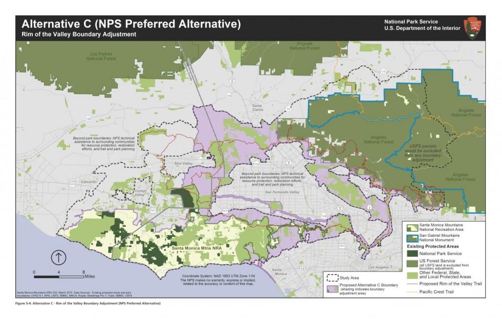
The NPS Preferred Alternative

The National Park Service (NPS) today released the findings of the Rim of the Valley (ROTV) study, including a draft Environmental Impact Report and Proposed Alternatives. The study has been underway since 2010. CORBA has commented on previous phases of the study and has also encouraged our members and the mountain biking community to do so.

The NPS has developed five alternatives for the public to comment upon. Their preferred alternative expands the boundary of the Santa Monica Mountains National Recreation Area (SMMNRA) to include much of the study area, which would allow the NPS to provide technical assistance to other land managers within the NRA.  Other alternatives include a “no action” alternative, meaning that nothing will change, a Conservation Partnership alternative, and a boundary expansion plus conservation partnership alternative.  A fifth alternative, which would have only provided planning assistance for a Rim of the Valley trail, was rejected as it didn’t meet the objectives of the study.

None of the proposed alternatives would affect or include any Angeles National Forest or San Gabriel Mountains National Monument, which would remain under the management of the Forest Service. All alternatives (except the “no action” alternative) include the conceptual Rim of the Valley Trail, as originally envisioned by Marge Feinberg in her 1976 Masters thesis.

CORBA will be analyzing the study’s findings and will report back. Comments must be submitted before June 30, 2015.  An executive summary can be found here. The comprehensive set of related documents and maps, and a comment submission form can be found on the NPS Park Planning web site, while a more user-friendly overview of the process can be found at http://www.nps.gov/pwro/rimofthevalley/index.htm

The NPS is hosting six public meetings between April 21, 2015 and June 2, 2015 to discuss the findings and alternatives presented in the draft study report. We invite and encourage all CORBA members and supporters to attend one of the public meetings. For those unable to attend, we’ll post a full report after the first meeting.

Online/Virtual Public Meeting:

Tuesday, April 21, 2015 12:30 p.m.(PDT)/ 3:30 p.m.(EDT) (WebEx Connect Time)

Please check-in early as there could be some software downloads that you may need to install to participate. The meeting presentation will start promptly at 1:00 pm PDT/4:00 pm EDT.

Click here for instructions on how to participate in the online meeting.

Local Public Meetings Schedule:

Monday, May 4, 2015, 7–9 pm
La Crescenta Public Library, Community Room
2809 Foothill Blvd.
La Crescenta, CA 91214

Tuesday, May 5, 2015, 7–9 pm
William S. Hart Regional Park, Hart Hall
24151 Newhall Avenue
Newhall, CA 91321

Wednesday, May 6,2015, 7–9 pm
Conejo Recreation and Parks District
Community Room
403 West Hillcrest Dr.
Thousand Oaks, CA 91360

Thursday, May 21, 2015, 7–9 pm
Mason Recreation Center
10500 Mason Ave.
Chatsworth, CA 91311

Tuesday, June 2, 2015, 3-5 pm*
El Pueblo de Los Angeles
Hellman-Quon Building
130 Paseo de la Plaza
Los Angeles CA 90012