

On October 17, 2016, the Forest Service revised the Sand Fire Closure order. The order was drawn up while the fire was still burning. It included many areas that did not burn. Now that the fire has been fully contained for several weeks The Forest Service has reduced the closure area, reopening many areas and trails that were not burned, but were in the initial closure.
Newly re-opened trails include:
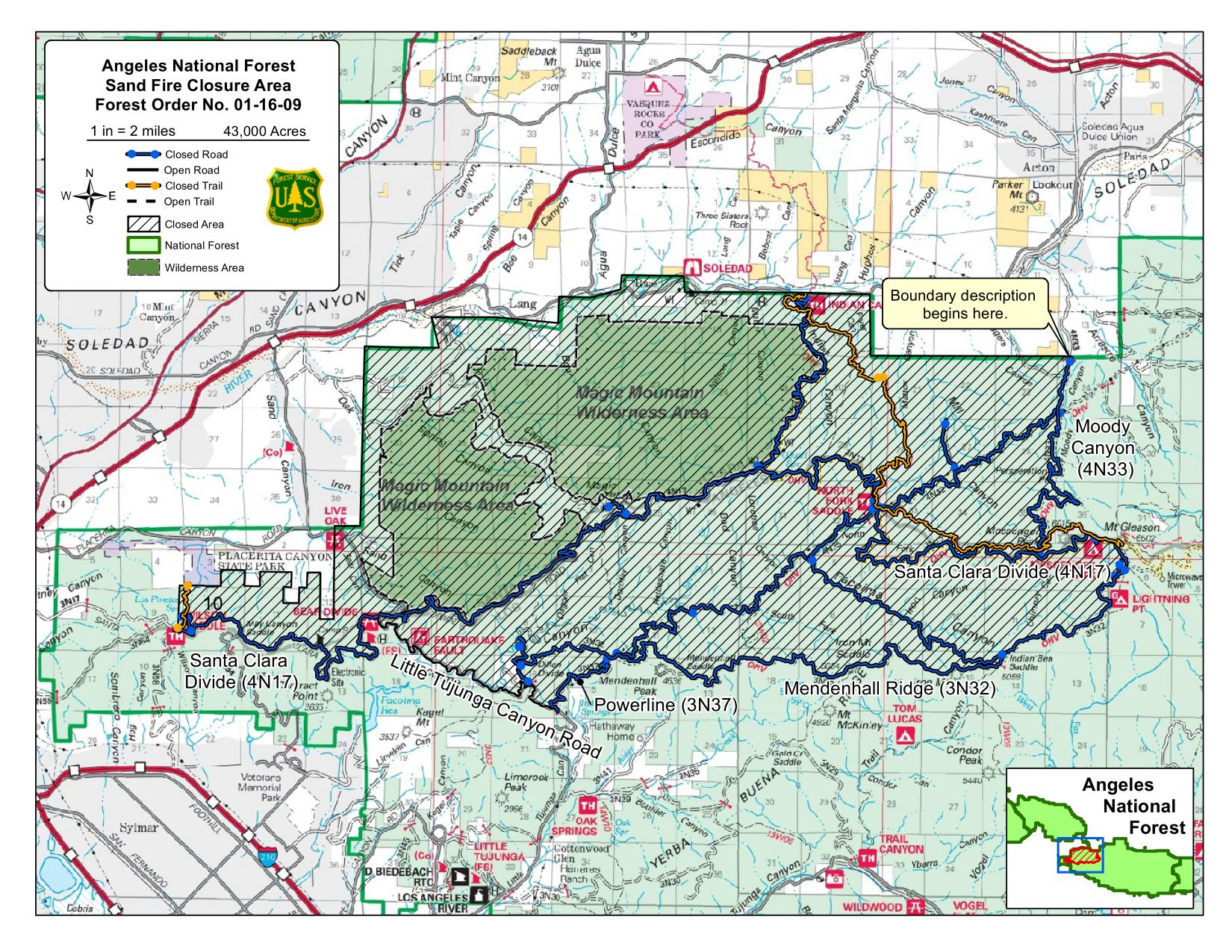
- the Santa Clara Truck Trail (AKA the Beast) (4N17), from Newhall Road to the top of Wilson Canyon,
- Wilson Canyon (3N56)
- May Canyon (3N54)
- Viper
- Oak Springs Trail (14W10)
- all trails south of Mendenhall Ridge, including Condor Peak and Trail Canyon,
- all trails east of Moody Canyon, Lightning Point and Mt. Gleason.
Closed trails include (but are not limited to):
- Los Pinetos Trail,
- Santa Clara Truck Trail (4N17) from Wilson Saddle to Mt. Gleason,
- Mendenhall Ridge (3N32),
- Powerline (AKA Burma Road) (3N37),
- Pacoima Canyon Trail,
- Moody Canyon (4N33),
- Indian Canyon (4N37),
- Pacific Crest Trail from Mt. Gleason to Indian Canyon,
- Dagger Flat Trail.
Little Tujunga Canyon road remains closed from Santa Clara Truck Trail (Bear Divide) to 1.5 miles north of Gold Creek Road.
The closure is needed for public safety and resource protection. The burnt areas could be subject to flash flooding, debris flows, and landslides during the coming winter rains, posing a danger to public safety. Burned areas are also much more sensitive, and can easily be damaged by going off trail.
For more information on how fires impact trails, see the interview with CORBA’s Steve Messer in Trails After the Wildfire, Mountain Bike Action.
Tags: Closure order, sand fire

