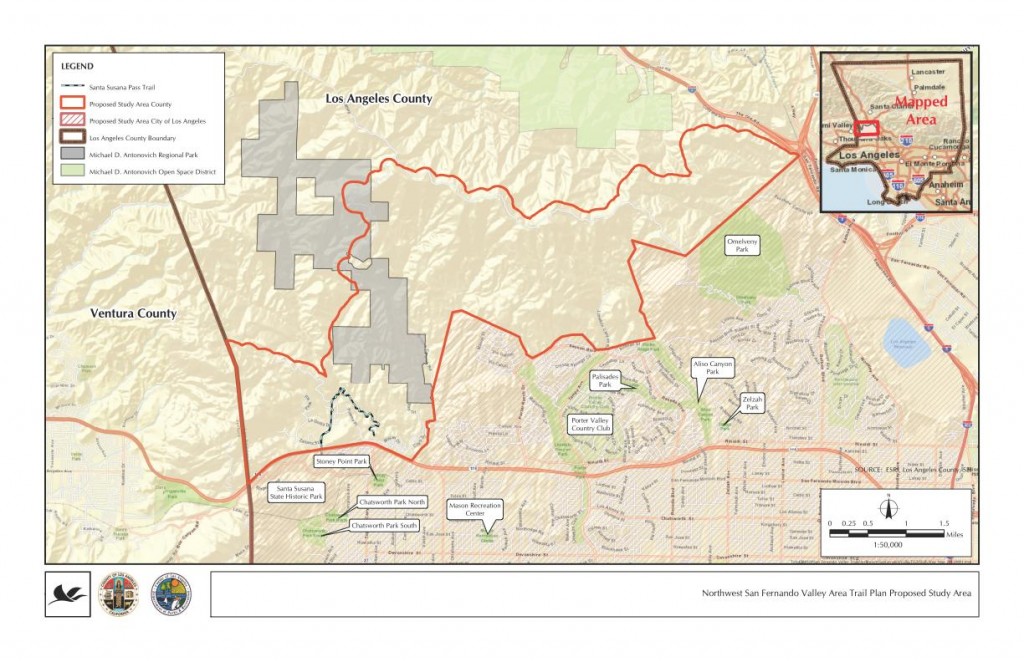
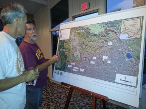
Thursday evening, August 30, Los Angeles County held their first public input meeting for the Northwest San Fernando Trail Master Plan in Granada Hills. About 40 people were in attendance, including at least 7 from the mountain biking community. This was an information gathering session for the County, being conducted by Sapphos Environmental, the lead consultants for the project. Sapphos also helped develop the County’s Trail Manual and have collaborated with them on many other projects.
After a slate of introductions, Sapphos Environmental president Marie Campbell gave an overview of the process. From her outline and the numerous audience questions that ensued, it seemed like this meeting and call for public input might have been somewhat premature. Several members of the audience asked about specific subdivisions that have already been approved and which include trail easements, trail easements that are on record, newly approved equestrian parks and facilities, and other data, none of which were available.
Sapphos and the County have been in contact with State Parks, Mountains Recreation Conservation Authority, City of Los Angeles, Rim of the Valley Trail, and other adjacent public land agencies to coordinate with their trail plans. However, they could not supply data about existing or proposed trail alignments in those other jurisdictions to which many of the attendees would like to see trail connections. No trails in other jurisdictions appeared on the maps.
The room was set up with six easels with larger scale aerial photos of the study area, two each for hikers, cyclists and equestrians. We were asked to mark in one color trails that we are currently using, and in another color, trails and/or connections that we would like to see in the future. The aerial photos that were supplied, while larger scale than the study area map above, did not have any existing fire roads or trails, nor did they have any geographic markers or place names on them. This lack of background data made it extremely difficult to identify routes that we currently use, and more difficult to say where we’d like to see new connections and trails.
One issue that was raised is the fact that these trails will be multi-use trails including bicycles per County policy, wherever feasible. The southern boundary of the study area is all City of Los Angeles, where a blanket policy prohibits bikes on all trails unless specifically authorized. It was explained that in such cases, signage will be important to advise cyclists that a trail on which they are currently riding may pass into the jurisdiction of the City of Los Angeles, at which point the bicyclist would have to turn around and return. We feel it important that the County sticks to their multi-use policy, even when trails connect to City trails where bikes are not allowed.
This is a great opportunity to plan for some vital connections and help fulfill the unmet and growing demand for recreational trails around the San Fernando Valley. There is so much open space (8363 acres in the study area) but it is pockmarked with private properties, utility easements, gas lines and other infrastructure. This makes passage through the Santa Susanna Mountains by trail users very difficult. Many existing trails are old ranch roads and are unnamed and unmarked. Many unofficial trails have been created by the community and used for decades. In fact, the only official County trail in the study area is the Indian Springs/Indian falls trail, which lies partially within a subdivision, connecting to Johnson Motorway and Devil’s Canyon.
We’d of course like to see a way to ride from Mission Peak over to Weldon and Towsley, connections to the proposed Rim of the Valley trail, an east-west running trail from Mission Peak and O’Melveny park to Oat Mountain, Fossil Hill, Rocky Peak fire road and Las Llajas Canyon. These would lie partially outside the study area, and for that reason, we also suggested that the study area be expanded in its northwest section.


If you have any feedback or comments/questions, feel free to post them here or on our facebook page at https://www.facebook.com/CORBAMTB/posts/149872525153631?notif_t=like