CORBA Home Page
The voice of off-road bicyclists


Archive for the ‘Santa Clarita Valley’ Category

Bike Thefts On The Rise–Again

Friday, July 3rd, 2015

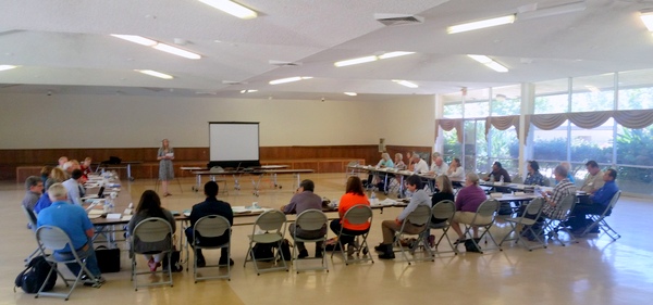
Evidently there has been a rash of bicycle thefts that have hit several CORBA members within the last month. While it is not known if the perpetrators are part of an organized ring, LAPD officer John “Rusty” Redican thinks it sounds a lot like a gang that was operating out of South Los Angels a few years ago. Click here for the link to MTBR to view his post and see photos of the thieves that were arrested a few years back. Below is the text of his post:

Hello All, My name is John (Rusty) Redican, I’m a fellow cyclist and LAPDOfficer. This reminder is not an official LAPD news blast, but me as a fellow cyclist and community member arming you with a little information to keep you and your property safe. Due to another salient event, where a fellow cyclist had his bicycles stolen out of his garage.

I need to advise you all about a ring of high end bicycle thieves that we (LAPDWest LA Division) arrested a couple years back, who may or may not be at it again. That arrest was only made possible due to cooperation between the cycling community and the police. First off, be very cautious on what you post on social media, i.e. Facebook, Instagram, Strava and similar forms of tracking and communication we all use for our shared love of cycling.

A few years back, this ring of bike thieves, based out of south Los Angeles, were responsible for millions of dollars of bicycle thefts, from San Diego County to Ventura County. They would follow cyclists home from group rides, scour FaceBook and other social media for intel on cyclists and their homes, so they could conduct surveillance on you and break into your garage or storage areas to steal your bicycles. They would do this during the day mostly when no one was home, but also at night while you slept. At times they would cause damage to the garage, but most times they were very surreptitious about it and the only evidence left, was the absence of your property. The majority of the bikes they targeted were well worth (as you all know) the chance for them to get caught by the home owner. At the time, they used a very clean and newer model silver, 4 door Audi sedan with bike racks on it. The suspects in the cases I’m referring too were all male hispanics in their mid to lat 20’s – early thirties, between 5’6” and 5’9”, 175 lbs to 220 lbs, not climbers. Again, I’m not saying this is definitely them, but the MO used in the theft of bikes from one of our fellow cyclists in Torrence, last week is very similar.

So be advised and be cautious of what you put on social media, NEVER have the starting point to your ride be your residence, and be cautious on who you share your photos and information with. Also, you don’t have to be paranoid, but be aware of your surroundings and if you notice a vehicle following you, or the same vehicle in 3 different locations, that may be a clue, and take not of the lic plate number, or any other distinguishing characteristics of the vehicle and occupant(s). Criminals are not dumb, and have evolved with the technology, so a little operational security will help you keep your property that you love, and work hard to obtain. If you see anything suspicious please be a good witness, don’t physically get involved, as you never know what these criminals are armed with, but immediately call your local police department.

Anyway, I put this info out not to alarm, but to inform, for-warned is for-armed. Please share with your cycling teams and groups, or any cycling friends who may benefit from this information.

These are the suspects from 2012. This photo is from CBS Los Angeles. They were apparently seen today in Corona at Corona High checking out the mountain bike teams bikes and asking questions… They are now driving a black newer model Honda Accord….FYI…


President’s Message: It’s complicated

Thursday, July 2nd, 2015
San Gabriel Mountains National Monument Community Collaborative

San Gabriel Mountains National Monument Community Collaborative

There’s always a lot going on here in Southern California. We have recently submitted comments on the Rim of the Valley study. We’re expecting the Santa Monica Mountains NRA Interagency Trail Management Plan early next year. A new National Monument management plan development process just began, though CORBA has been involved in the Community Collaborative Group since last November. We’ve successfully alerted L.A. County of the need for another trail master plan, to be announced soon. We have pending Bike Park proposals, and a recently-opened Bike Park in Fillmore. We have a growing high school and middle school racing contingent. We have a new Forest Supervisor. There are wilderness proposals, missing links in trails, fire-damaged trails still in need of restoration, access issues on Etz Meloy (Backbone Trail). There’s no shortage of issues, threats to our public lands, our trails and access to them.

It’s complicated.

And it takes time to figure things out and try to get things right.  These studies and plans seem to disappear from the radar, only to re-emerge six months to a decade later. Advocacy is a marathon, not a sprint, and CORBA is still at it after 28 years. Government is slow to move but no matter how frustratingly slow it sometimes seems, there is progress being made.

CORBA is busily engaged in all of these processes on your behalf, in partnership with IMBA, to help make sure there is progress. We continue to work to make sure the landscapes we ride and the trails we love are protected, improved, and remain open to our community.

We need each and every one of you to be engaged as well. After all, we’re all ambassadors of the sport when we’re on multi-use trails. This means ride an appropriate speed for your sightline (slow down!) and be courteous. Be safe. Follow trail etiquette best practices. Be an example for others. Leave no trace. Support CORBA. Sign a petition. There are lots of ways to have a positive impact.

Riding trails to explore our public lands is a passion we all share, and want to continue to enjoy. Enjoy your summer and keep on riding!


Rim of the Valley Corridor Study

Tuesday, June 30th, 2015

ROTValternativeDCORBA has been involved in the Rim of the Valley Corridor since our inception. In fact, we’re so ingrained in the process that the Rim of the Valley Corridor is mentioned in our mission statement as our primary territory of concern. We were excited to see the draft study released, and have submitted comments on the plan.

The study sought to answer the following:

1. Does the area possess nationally significant natural or cultural resources?
2. Is it a suitable and unique addition to the National Park System?
3. Can it be feasibly added to the Park System?
4. Does it require direct NPS management, instead of stewardship from other groups or a public-private combination?

The answer to all of the above questions was a “yes.” The National Park Service presented four alternatives based on the study findings. The first NEPA-required “no action” alternatives serves as a baseline against which we can compare the alternatives. Alternative B allows the NPS to offer “technical assistance” to existing land managers within the study area, but falls short of allowing the NPS to make any direct capitol investments.

Alternatives C and D expand the authorized boundary of the Santa Monica Mountains National Recreation Area. What the boundary expansions really mean is that the National Park Service will be authorized to offer technical assistance to existing land managers for any project that enhances recreation, or restores habitat and connectivity. Under Alternative C or D, the NPS is also authorized to spend money on capitol projects within the expanded boundaries.

We believe that the largest operational boundary proposed under Alternative D would have the greatest long-term benefit for recreation, bio-connectivity, wildlife and the communities adjacent to the study area. It also includes the wildlife corridors linking the two areas of the Angeles National Forest separated by Highway 14, as well as between the Santa Susana Mountains and Los Padres National Forests.

The boundary expansion does not come without concern. The NPS, like most public land agencies, is currently under-funded. We would hope that any boundary expansion would come with an increase in funding sufficient to at least maintain the current level of service across the expanded NRA.

During the course of the public meetings we heard a lot of misinformation and a misunderstanding of what the boundary expansions mean. The Federal government will not be taking anyone’s property against their will. Existing land ownership rights and management authority is respected and maintained.

One thing that would change is the permitting of landfills. In our comments, we asked for the existing landfills to be excluded from the proposed NRA expansion to eliminate the need for additional permitting. We also feel that the recently completed San Gabriel Watershed and Special Resource Study which proposed a San Gabriel Unit of the NRA, must be considered and its findings also addressed by any congressional action to the effect of either.

The Rim of the Valley trail system is also important to us. It’s a proposed multi-use trail network that will encircle the San Fernando Valley, and perhaps Simi and Conejo Valleys. We feel the National Park Service will be in a good position to help facilitate its completion under Alternatives C or D.

It will probably be another year before we see a final recommendation from the study. From there it will be up to Congress to decide what to do with the recommendations.

2015-06-24 – Rim of the Valley Draft Study Comments from CORBA

Action Alert! Protect Mountain Bike Access

Saturday, August 16th, 2014

From our Friends to the north, Santa Clarita Valley Trail Users:

Dear Friends,

Congressman “Buck” McKeon is holding a Town Hall meeting to discuss a proposal to designate approximately 40,000 acres just north of Castaic Lake as a federally protected Wilderness area.  This proposed Wilderness area could potentially include the Fish Canyon, Salt Creek, Elderberry Canyon, Tule and Red Mountain areas on the northeast side of Castaic Lake.  All of these areas are very close to Tapia Canyon where the majority of mountain biking occurs in Santa Clarita AND which will likely be lost to development in the not too distant future.

Even though many of us would support the protection and preservation of our public lands, it is important to note that the Wilderness designation severely limits recreation on such lands.  Specifically, cycling or mountain biking is prohibited in Wilderness areas because they are “mechanized”.  Access is only allowed on foot or horseback.

Already, the federal government has set aside very large Wilderness areas near Santa Clarita including the Magic Mountain Wilderness (just south of the 14 Freeway near Canyon Country), the Sespe Wilderness (just north of Fillmore and Santa Paula), and the San Rafael Wilderness (just east of Ventura and Santa Barbara).  This is why you can’t ride a mountain bike in the mountains above Fillmore and why there are so few mountain bike trails in the Ventura/Santa Barbara area.  We think these three Wilderness areas near Santa Clarita are more than enough.

For this reason, we encourage you to attend next week’s Town Hall meeting to let Congressman McKeon know that you object to the Wilderness designation of these additional areas near Castaic Lake because it would permanently prohibit mountain biking.  The current designation of Backcountry – Non-motorized or something else more protective (such as a Special Conservation Area) would be preferred so long as mountain biking continues to be allowed.

Here are the details of the Town Hall meeting:

Date:  Tuesday, August 19

Time:  10:30AM

Where: Santa Clarita City Hall, Century Room

Address:  23920 Valencia Boulevard, Santa Clarita, CA  91355

Thank you for your continued support.

SCV Trail Users

Safe and Equal Access for All Trail Users

SCVTrailUsers@gmail.com

What CORBA Does

Wednesday, October 30th, 2013

By Mark Langton

Bikes, horses, hikers and runners

Bikes, horses, hikers and runners. We all love trails.

Recently a bicycle club-team representative  contacted CORBA wanting to see what more they could do to get more of the trails that are currently closed to bicycles opened up to shared use. A couple of comments from the correspondence were that they thought that showing up in larger numbers to public meetings would help, and that they thought the main reason that trails were closed were because of an influential public anti-bicycle lobby.

I wrote back to the person who contacted me, and in doing so came up with what I think is a good overview of what CORBA has been doing for the past 26 years, and continues to do on behalf of all public backcountry trail users (see below). Yes, CORBA is a mountain bike organization, but we are more than that, and here’s why: We believe that shared use works better because it disperses use, rather than concentrating it. When you disperse use, you reduce congestion, and when you reduce congestion, you reduce confrontation. Moreover, it has been shown that where shared use trails exist, it works. Maybe not perfectly, but certainly better than where there are restrictions to bicycles, because shared use also fosters cooperation. Bicycles do mix when operated considerately and with the safety and serenity of other trail users in mind. And that’s the crux of the issue: If bicyclists would simply slow down around others, including other bicyclists, they would be solving the problem of both dangerous speed, and the “startle factor,” or the disruption of another’s peaceful enjoyment of the backcountry.

Here’s what I wrote to that bicycle club team member:

This year CORBA celebrated its 26th anniversary. In that time we have made many strides to opening trails to shared use (hiking, equestrian, bicycle) in the Santa Monica Mountains National Recreation Area, Angeles National Forest, Los Angeles County, and Eastern Ventura County. We have participated in hundreds of public meetings with land managers over the years. Land managers recognize and continue to adapt to the growing bicycle population and changing demographic profile of the trail user community. They are certainly aware of the needs and desires of the mountain biking community through CORBA’s efforts, which include quarterly meetings with principal agency managers (National Park Service, State Parks, Mountains Recreation and Conservation Authority). We are also in constant communication with these agencies and/or when the need arises to address a specific issue. CORBA also works closely with the Mountain Bike Unit which aids the rangers and community with safety and education. CORBA also schedules and organizes regular trail maintenance work days s in conjunction with the Santa Monica Mountains Trails Council and Conejo Open Space Conservation Agency. CORBA is also heavily involved with the Angeles National Forest with trail maintenance and volunteer patrol participation. Due to CORBA’s efforts, most of the singletrack trails built in the last 25 years are shared use (not to mention a lot of the singletrack that already existed not getting shut down).

 As you can see, there is more to getting involved than just showing up at meetings in large numbers. The issue of bikes not being allowed on trails is more than just politically active opponents to bicycles; it is mired in an outdated management policy of restriction that is predicated to a large degree on ignorance and a status quo mentality. Within the last few years there has been a systemic change for adopting shared use as the overriding management strategy. It is a slow moving process but we do see a very strong indication that within the next few years we will see many more trails opening to shared use on a statewide basis than currently exists. This change comes from consistent efforts not only by CORBA, but mountain bike advocates all over the state, with assistance from the International Mountain Bicycle Association (of which CORBA was a founding club in 1988).

 The one concern that is always at the forefront of managers’ minds is safety. It is agreed by everyone that bicycles are an acceptable form of public open space trail recreation. However, it is when riders go too fast around other users as to make it an unsafe or even just an unpleasant experience that gets mountain bikers a bad reputation, and gets the managers to thinking about restricting bicycles. If everyone would just slow down when passing others, and slow down into corners so they don’t scare others on the other side, we would pretty much solve the problem. I am not saying you shouldn’t go fast, I’m just saying do it when conditions are safe. 

Show Us Your Smile

Tuesday, August 27th, 2013

smileSometimes a picture is worth a thousand words. We have created this message tag with the help of BikeTags (biketag.wordpress.com) so that we can spread the message of goodwill, peace, and harmony throughout the world. Or maybe just the message “don’t worry, be happy.” The idea is to show other trail users that we belong, we care, and we can coexist. Similar to the SoCal High School Cycling League’s “spirit of howdy”, it’s a way to remember to slow down and smell the sage brush.

We’ll be making the CORBA Smile Tags available to anyone who wants one, just send an email request to info@corbamtb.com. We’ll be giving away prizes for the best photos of the tags on your bikes while on the trail. Photos will be judged on originality, creativity, and overall quality. (Details to follow in the coming weeks). The grand prize will be a Niner full suspension frameset, donated by Niner.

OK, so maybe putting the Smile Tag on your bike* won’t save the world. But a lot of times a little smile can go a long way.

*The Smile Tag is a high quality plastic laminated product and comes with all hardware necessary to mount on a handlebar or under the seat. If mounting to the handlebar, a hole may need to be punched at the bottom of the tag to help secure the tag to a brake or derailleur cable (see photo).


I’d Like to Thank…

Tuesday, July 30th, 2013

By Mark Langton

When I learned that CORBA would be inducted into the Mountain Bike Hall of Fame, my first reaction was, “where do we begin to start thanking people?” If you go back to the inception of CORBA, it all started with a 1987 Santa Monica Mountains Conservancy (SMMC) meeting where one of the agenda items was to consider adopting California State Parks’ policy of single track trails being closed to bicycles. So I guess you could say that CORBA owes a debt of gratitude to the SMMC for considering closing trails to bikes.

There were quite a few mountain bikers at that SMMC meeting, myself included. We sat patiently while the committee members discussed the pros and cons of allowing this “new” recreation on their public trails. They decided to adopt the State Parks policy, but they would continue dialogue with “the bike group” to see if bicycles could be integrated into the trail system. The cyclists in the audience looked around and silently acknowledged that “I guess we’re the bike group.” A legal pad was passed around and the list of people collected at that meeting became the impetus for CORBA. (Since then SMMC has adopted an inclusive policy toward mountain bikes.)

Twenty-six years later, we are still having to address issues of whether or not bicycles can coexist on public open space trails, mostly on State Parks’ trails. It’s like when snowboarding became popular at ski resorts. There was a lot of animosity leveled at snowboarders by skiers. A partial solution was to create separate areas where snowboarders could do their thing and skiers knew to stay away from those areas. But with public open space trails, we don’t necessarily have that luxury. If we want to share the trails, we have to behave accordingly and expect that there may be hikers, equestrians, and other (less experienced) cyclists on those trails.

The sport of mountain biking is evolving much like the sport of skiing has evolved to include snowboard riders. Separate areas are being developed to accommodate “gravity” mountain biking, and CORBA is working with land managers in our region to develop mountain bike parks that allow for more aggressive riding, including jumps, drops, and technical features. We will be announcing some very exciting news within the next few months regarding these new areas!

If you want something to last, you have to be willing to commit to the long haul. I’m not sure if that’s what the founders of CORBA set out to do, but thanks to them and everyone who got involved from then until now, we have a lasting legacy and solid foundation that will serve the next generation of mountain bikers in the greater Los Angeles and Eastern Ventura Counties.

And when we accept the award on behalf of CORBA for being inducted into the Mountain Bike Hall of Fame, you can be sure that everyone on that stage will be feeling the pride of all of those who have supported CORBA over the last 26 years.


Comments on Proposed Wilderness Needed by May 13

Friday, May 3rd, 2013

From Santa Clarita Valley Trail Users:

Dear Friends,

As some of you know, the Forest Service, in response to a court order, has proposed three alternatives for the future management of roughly 40,000 acres of land to the northeast of Castaic Lake.  This area is referred to as Salt Creek and Fish Canyon.  In two of the three alternatives, large amounts of land would be designated as a “Recommended Wilderness” which would then prohibit any “mechanized” use including bicycles.

The three alternatives are summarized as follows:

Alternative 1:  No change.  The existing designation of Back County, Non-Motorized would remain.  Alternative 1, of course, is our preferred alternative.

Alternative 2:  The entire Salt Creek/Fish Canyon area would be designated as a Recommended Wilderness.  However, a number of existing trails including the  Gillette Mine Trail, the Fish Canyon Trail, and the Burnt Peak Trail would be “cherry stemmed” from the Recommended Wilderness and would remain accessible to bicycles.  If this Alternative 2 is selected, we would request some additional cherry stems and other changes.

Alternative 3:  This alternative would designate the entire Salt Creek/Fish Canyon area as a Recommended Wilderness WITHOUT any cherry stems for existing trails.  In addition, the new Recommended Wilderness would extend to the east side of Lake Hughes Road to include the Tule and Red Mountain areas just to the north of Tapia Canyon.  We oppose Alternative 3 entirely.

Here’s a link to maps of the three alternatives:

http://a123.g.akamai.net/7/123/11558/abc123/forestservic.download.akamai.com/11558/www/nepa/76364_FSPLT2_370978.pdf

We are asking all of you to write an email or letter to the Forest Service with the following comments.

1.  Identify yourself as a LOCAL resident of the Santa Clarita area who is concerned about a shortage of mountain bike trails in our area.

2.  Express a strong preference for Alternative 1 and request a study to be done for additional trails in this and other areas in the Santa Clarita vicinity.

3.  Request that if Alternative 2 is pursued, that it be amended as follows:

a.  A cherry stem should be provided for Cienega Canyon, a decommissioned fire road used by the Crank n Stein group and other cyclists.

b.  A cherry stem should be provided for Forest Route 7N13.1 from Forest Route 7N32 on the south all the way up to Sawmill Motor Way on the north.

c.  The area be designated as a “Special Conservation Area” rather than a Recommended Wilderness.

d.  The cherry stems should be wider than the proposed 25’ to provide for trail maintenance and accurate mapping.

e.  A provision should be made to move or adjust cherry stems in case of a need to re-route a trail on account of erosion or other similar issues.

4.  Request that the Forest Service ensure that the Golden Eagle Trail is entirely excluded from any Recommended Wilderness.

5.  Specifically ask the USFS if trail user counts were conducted on the existing and historical trails to determine the type and volume of traffic the trails currently support.  These sort of substantive comments can be used as the basis for an effective appeal.

6.  Finally mention that we cyclists value and want to protect wild lands.  We enjoy the solitude that can be found away from people and civilization within such back-country areas and don’t want to lose access to such lands in our own backyard.

Please email your comments to socal_nf_lmp_amendment@fs.fed.us or mail them to:

Cleveland National Forest

10845 Rancho Bernardo Road, Suite 200

San Diego, CA 92127-2107

ATTN: LMP Amendment

Your full name and address is required in order for your comments to be considered.

The Forest Service is accepting comments only until May 13, 2013.

SCV Trail Users

Safe and Equal Access for All Trail Users

SCVTrailUsers@gmail.com

Angeles National Forest Wilderness Proposal Update

Monday, March 25th, 2013
Burnt Peak Canyon Trail - one of the good sections

Burnt Peak Canyon Trail

Today, March 25, 2013, in a stakeholder meeting with the Forest Service and Wilderness advocates, we learned that our initial assessments of the National Forest Land Management Plan Amendments were based on an inaccurate interpretation of the draft proposal. Neither the maps supplied nor their descriptions show that the Forest Service had taken our comments into consideration.

In Alternative 2, the FS cherry-stemmed out the three official Forest Service trails in the area–Burnt Peak trail, Fish Canyon trail, and Gillette Mine trail–as per our initial requests. By “cherry-stemmed” we mean that they have drawn the wilderness boundary so that the trails retain a Backcountry Non-Motorized designation, allowing bicycles, while the surrounding area would become Recommended Wilderness. In this case the “cherry stems” are comprised of a 25-foot buffer either side of the historic trail alignment, as it is recorded in the Forest Service database.

While we greatly appreciate the Forest Service’s willingness to accommodate bicycles, there are a number of problems with this approach. First and foremost is the fact that sections of the official system trails are in disrepair and some sections have disappeared. Most of the trails in this area have been neglected for years, and for a portion of their length, have been reclaimed by nature. We have been led to believe that in some sections the only way to travel the “trail” is a wet-feet hike down the middle of the streambed. If true, this presents a problem for the future, as a 25’ buffer is not realistically wide enough to reconstruct these trails in a sustainable way, out of the streambed, or away from precipitous canyon walls. Having a trail corridor cherry-stemmed out of the wilderness will do us no good if we are unable to rebuild the trail because of the sensitive nature of the riparian habitat through which it passes, or trail engineering limitations.

We also learned that the Forest Service does not have a current Trail Master Plan or Travel Management Plan that clearly identifies official and unofficial trails and assesses their condition. Such a plan would ideally make recommendations for rerouting existing trails to more sustainable alignments, and also provide guidance on where new trails should be constructed or existing unofficial trails be made official, to accommodate growing future demands for recreational access, connectivity and diversity of experience.

At this point we must remain fully opposed to Alternative 3, which designates the Fish Canyon/Salt Creek, Tule and Red Mountain areas as recommended wilderness with no allowance for multi-use trails now or in the future. Alternative 3 would forever remove most recreational opportunities, including cycling, from tens of thousands of acres of land near the Santa Clarita and Antelope Valley areas, leaving precious little land for future generations of mountain bikers and others who value both conservation and outdoor recreation.

Alternative 2 is the Forest Service preferred alternative. While far better for us than Alternative 3, because of the problems with the current trails and cherry-stems based on those apparently non-existent trails, we are reluctant to support Alternative 2 in its current form. We do, however, agree that the area as a whole is worthy of protection from development, infrastructure, road building, and extractive use. Such protections are already provided by a Backcountry Non-Motorized designation, and existing critical habitat designations. In fact, in Appendix 2 of the current draft, the Fish Canyon IRA Evaluation states “….a change in land status may not substantially increase protection.” Similar statements are made for each of the areas under consideration for recommended wilderness.

We believe that it is premature and irresponsible to designate a recommended wilderness for this area without a full assessment of the existing trails and future trail needs by Forest Service staff and/or trained professional trailbuilders. We urge the Forest Service to complete a trail master plan and/or travel management plan that includes full assessments of existing system and non-system trails, proposed re-routes of existing trails to more sustainable alignments, and the identification of desired new trail alignments that provide missing connectivity and a more diverse range of trail experiences. We could subsequently support the stronger protections of a special conservation area or recommended wilderness that cherry stems out the trail corridors identified in such a plan.

Further, we continue to have concerns about the Golden Eagle trail. While not an official Forest Service trail, it is the most popular singletrack trail for cyclists in the area. The trail appears to cross the proposed wilderness boundary, but only for very short distances. We and the wilderness advocates both agree that the proposed wilderness boundary should be adjusted to exclude this popular trail. But without data gathered by the Forest Service in a trail master plan, the exact location of an adjusted boundary would be an educated guess at best. Again, this is an issue that would be addressed by a travel management and/or trail master plan.

We must therefore express our support for Alternative 1, the no-change alternative, unless the aforementioned concerns are addressed within Alternative 2. Something that everyone recognizes is that the populations of Santa Clarita and Antelope Valleys are growing. The mountain biking community is also growing rapidly. The most popular trails for SCV cyclists are in Tapia Canyon, private land that will one day be developed. We need to consider and allow for future demand for trails and balance that need with protecting remaining open space from development. Only Alternative 1 allows for future growth, while providing protection for this special area.

We have no additional comments on proposed changes in other areas of the Angeles National Forest, and defer to local advocacy groups for proposed changes in the Los Padres, San Bernardino and Cleveland National Forests.

After the public meetings, we’ll be putting together our official comments for the Angeles National Forest, and will encourage everyone to send their own comments to the Forest Service.

Wilderness Proposal Public Hearings – Be there to help save access to trails Apr 9, 10

Friday, March 22nd, 2013

Fellow cyclists, the four Southern California National Forests Land Management Plan Amendment is currently in its public comment period. The amendment makes changes to Land Management plans in the Los Padres, Angeles, San Bernadino and Cleveland National Forests. Within that proposal are two alternatives that will forever impact bicycle access to public lands in the Angeles National Forest.

Maps of the proposals are available here.

Fish Canyon Salt Creek Wilderness - Alternative 2

Alternative 2 Map – Click for a larger version

Alternative 1, the “no-action” alternative, is the only alternative we can presently support.

Alternative 2 retains a backcountry non-motorized status for Red Mountain and Tule districts, but it appears that the trails in the Fish Canyon/Salt creek areas may be forever closed. These trails have appeared in guidebooks dating back to the 90’s, and we have ride reports from much more recent times. We asked for these trails to be left out of any wilderness proposals.  There are many other trails, official and unofficial, in the area, and we’re seeking documentation of those trails. If you have knowledge of these potentially affected trails, let us know. We could support Alternative 2 if the trails in question are cherry-stemmed out of the wilderness proposal.

In Alternative 3, the Fish Canyon/Salt Creek proposed wilderness on which we commented last year has now been expanded to include the Red Mountain and Tule districts of the Angeles National Forest. These two areas lie to the east and south of the Fish Canyon/Salt Creek area. These two areas were not included as potential wilderness in the original scoping documents, and we therefore made no comment on them, other than to offer our general support for their designation for non-motorized backcountry use.  Now, in Alternative 3, these two areas and the many trails that traverse them are included as wilderness. Local riders have been riding these trails for more than 30 years, right up to the present. We cannot allow Alternative 3 to be adopted.

We too would like to see these areas protected, and feel that backcountry non-motorized designation gives the area adequate protection, but the environmental lobby is pushing for federal wilderness. We have proposed a compromise, a federally designated Special Conservation Area, which prohibits extractive use, development and road-building and can be custom tailored to allow for non-motorized recreational use, while affording stronger protection for and monitoring of the environment. This would require special legislation.

After the public meetings in March, we will be compiling and submitting our comments on the proposals. We encourage everyone to submit comments on the proposals, along with supporting documentation (GPS tracks, photos) of bicycle use of the trails. The comment period will close on May 16, 2013.

The Forest Service will be hosting multiple open house meetings during the comment period. The content and format of each meeting will be the same. Meetings will begin with an open house where Forest Service staff will be available to answer questions about the Draft SEIS. A brief presentation will begin 30 minutes after the meeting opens, followed by an opportunity to ask questions. Maps of the alternatives will be available for viewing. The meeting times and locations are:

  • March 26, 2013, 4:00 PM to 7:00 PM, Angeles National Forest Headquarters, 701 North Santa Anita Avenue, Arcadia, CA 91006 
  • March 26, 2013, 4:00 PM to 7:00 PM, Alpine Community Center, 1830 Alpine Blvd, Alpine, CA 91901 (Hosted by the Cleveland National Forest)
  • March 27, 2013, 4:00 PM to 7:00 PM, Palomar Ranger District Office, 1634 Black Canyon Road, Ramona, CA 92065
  • March 28, 2013, 4:00 PM to 7:00 PM, Santa Clara Mojave Rivers Ranger District Office, 33708 Crown Valley Road, Acton, CA 93510 
  • March 28, 2013, 5:00 PM to 7:30 PM, San Bernardino National Forest Headquarters, 602 S. Tippecanoe Ave., San Bernardino, CA 92408
  • April 9, 2013, 4:00 PM to 7:00 PM, Mt. Pinos Ranger District office, 34580 Lockwood Valley Road, Frazier Park, CA 93225
  • April 10, 2013, 4:00 PM to 7:00 PM, Southern California Edison, 103 David Love Place, Goleta, CA 93117 (Hosted by Los Padres National Forest)

For Further Information Contact Bob Hawkins, Project Manager atsocal_nf_lmp_amendment@fs.fed.us, or visit the
project website at http://www.fs.fed.us/nepa/fs-usda-pop.php?project=35130.


Update 3/25/2013:  We have learned more about the draft proposals and reported here.


 Home

About

Membership

Info

Galleries

  Visit CORBA on Twitter!   Visit CORBA on Facebook!

 Site-Map

Activities

Blog & News

Calendar

Buy Stuff


Copyright 1987-2020 CORBA. All Rights Reserved. Privacy Policy