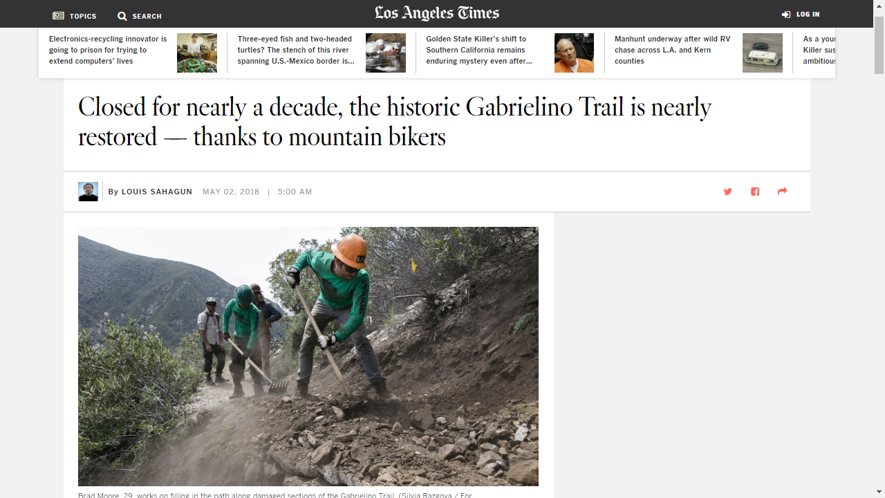
At the last volunteer work day on the Gabrielino Trail, we were delighted to have Louis Sahagun, reporter for the LA Times and a photographer join us. They were there to cover the restoration efforts undertaken by CORBA and MWBA on the Angeles National Forest.
Quoted in the story are Erik Hillard and Matt Baffert of the Mount Wilson Bicycling Association, and Steve Messer of CORBA. The article covers efforts by mountain bikers to open the Gabrielino Trail from Redbox to JPL, but doesn’t mention the continuing efforts by the Boy Scouts, the Sierra Club, and the Angeles Crest 100 volunteers who have worked on the trail east of Redbox.
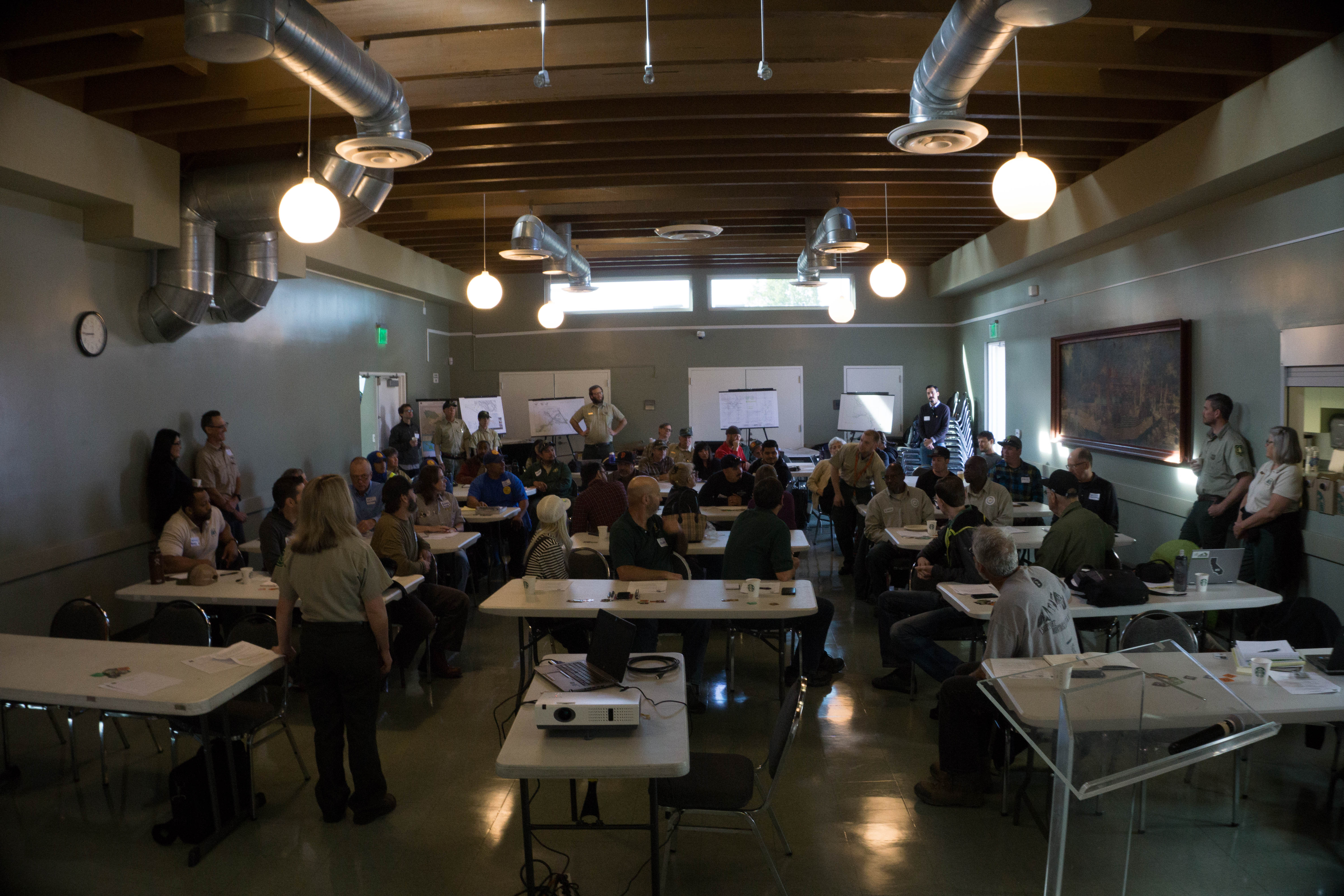
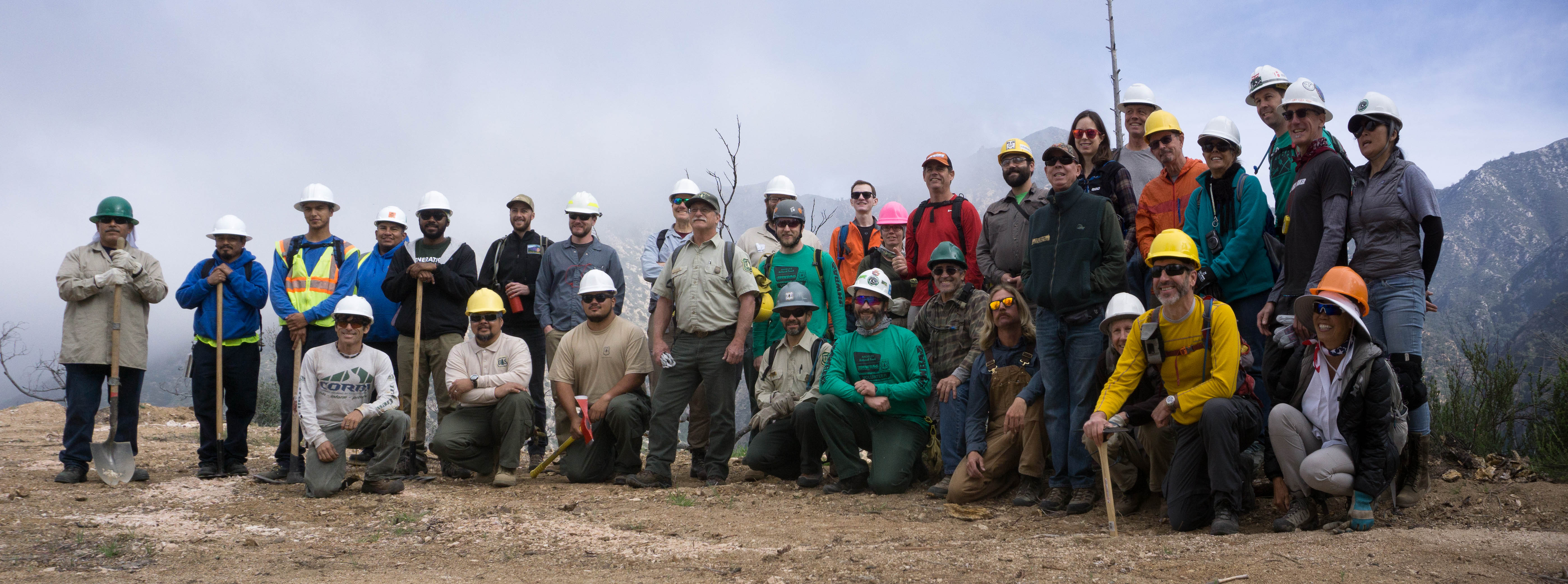
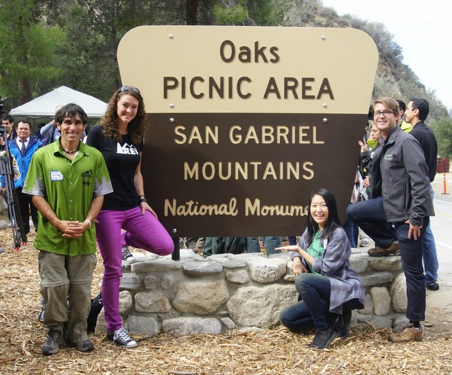
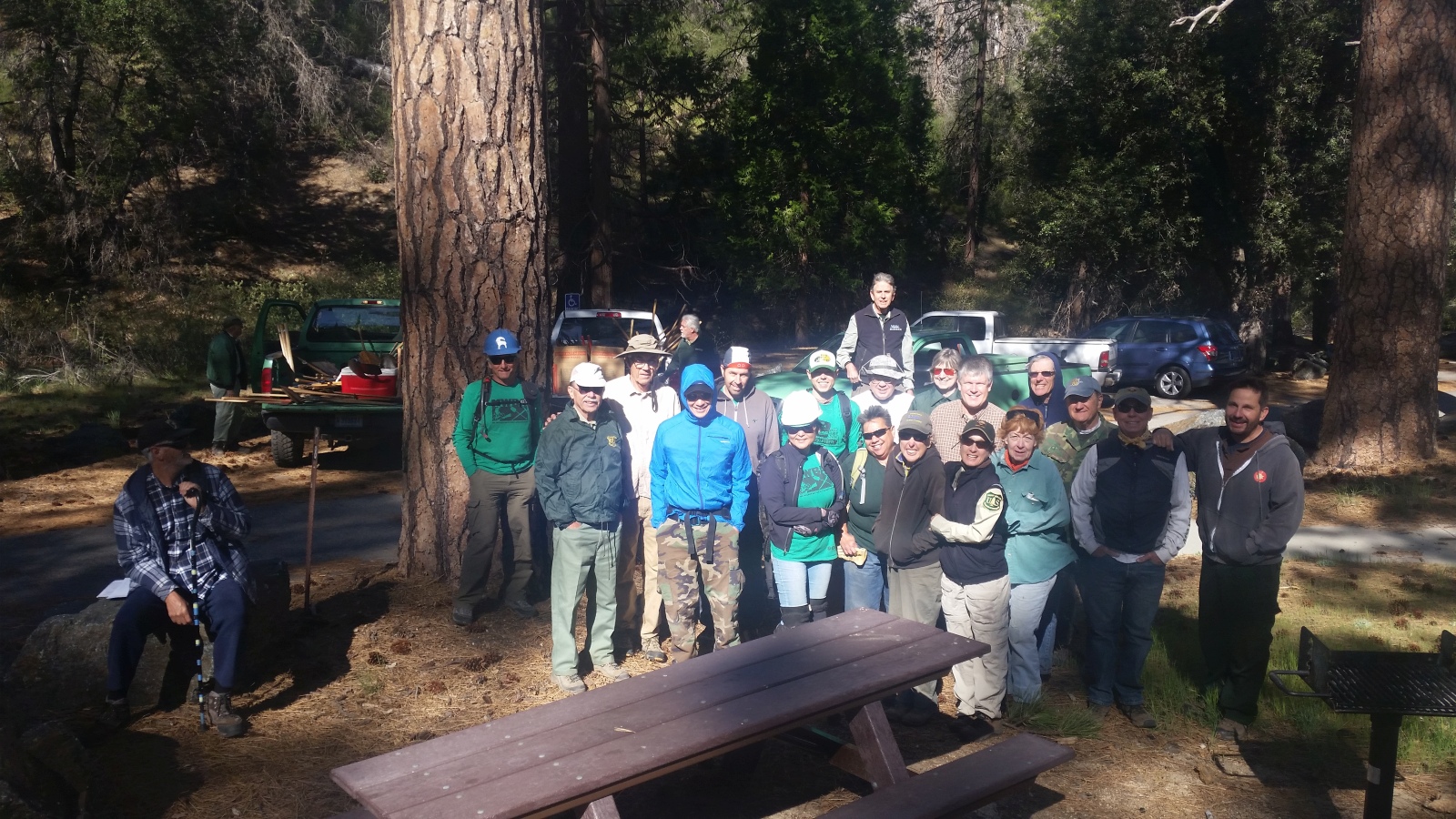
This past weekend we had an amazing four days at the 2018 Angeles National Forest Trail Stewardship Summit. In the days prior to the summit, we showed some of our trails, our previous trailwork, and our current Gabrielino trail restoration project to Regional forest service staff, and trail construction experts.
The Angeles National Forest was selected as one of fifteen priority sites for trail maintenance under the National Forest Trail Stewardship Act of 2016. As a priority site, the goal is to double the number of trail miles maintained on the Angeles.
We held a series of discussions with Forest Service Region 5 about our trail system and Station Fire recovery efforts. CORBA has received $35,000 in grants from REI and Southern California Edison, for the Gabrielino Trail restoration. CORBA and MWBA’s awesome volunteers have contributed over 2500 hours of volunteer labor at a value of over $56,000.
Some great news has come out of the summit. Using the above contributions as a match, the regional office of the Forest Service has allocated $100,000 to restore and improve the Gabrielino National Recreation Trail. We’re in the process of writing up a formal cost-share partnership agreement with the Forest Service to manage that investment into our local trails.
At the summit, partners, volunteers and Forest Service staff brainstormed on how to remove bottlenecks to getting things done. We discussed how to make it easier for volunteers to do the necessary paperwork by moving to an online system, minimizing shuffling paper and lengthy email chains. We talked about how to get better information on trails and their conditions for the public, as well as how to better coordinate efforts between volunteer groups. Good things are in the works and potential solutions to both of these shortfalls are being explored right now.
CORBA President Steve Messer spoke about the San Gabriel Mountains Community Collaborative (video here), and on how volunteers and NGO’s like CORBA and MWBA, and the partnerships we have with the Forest Service are a vital component of sustainability of our trails (video here). Other presentations from LA County, Equestrian trail patroller, Jim Lesh, IMBA Trail Solutions, MWBA, and regional Forest Service Trails Coordinator Garrett Villanueva helped guide the breakout sessions exploring how to achieve some of these goals.
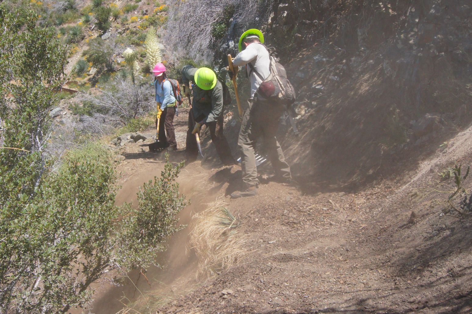
We then spent two days learning about and refining our trail maintenance skills on Sunset Ridge Trail, where volunteers and trail crew leaders learned updated techniques to managing water on trails, minimizing erosion, and decreasing future maintenance needs. We learned from some of the most knowledgeable trailbuilders from IMBA Trail Solutions and the Forest Service. Sunset Ridge trail received some treatments to help improve water control.
It was an extremely positive summit with lots of productive exchange and a path to move forward. We thank the Forest Service and their Regional staff, IMBA Trail Solutions, MWBA, the National Forest Foundation, and all the other volunteers and partners from around the region who participated.
The Forest Service, in partnership with CORBA, the Mount Wilson Bicycling Association, IMBA, and the National Forest Foundation will hold a three-day trail workshop.
The agenda is still being finalized, and official invitations and announcements will go out in the coming week, but you can save the dates of April 6, 7 and 8, April 2018. Details will be included with the Forest Service official announcement.
Friday, April 6, will be an all-day classroom session at the Altadena Community Center. This day will cover the assessment, management and planning of trails, and will be of most use to those advocating for trails, planning to build trails or land and trail managers.
Saturday April 7 will see a morning classroom session, followed by Saturday afternoon in the field, then a full day of hands-on on Sunday April 8.
There is no charge for the workshop and lunch will be provided. If you’d like to attend contact us and we’ll let you know when registration opens.
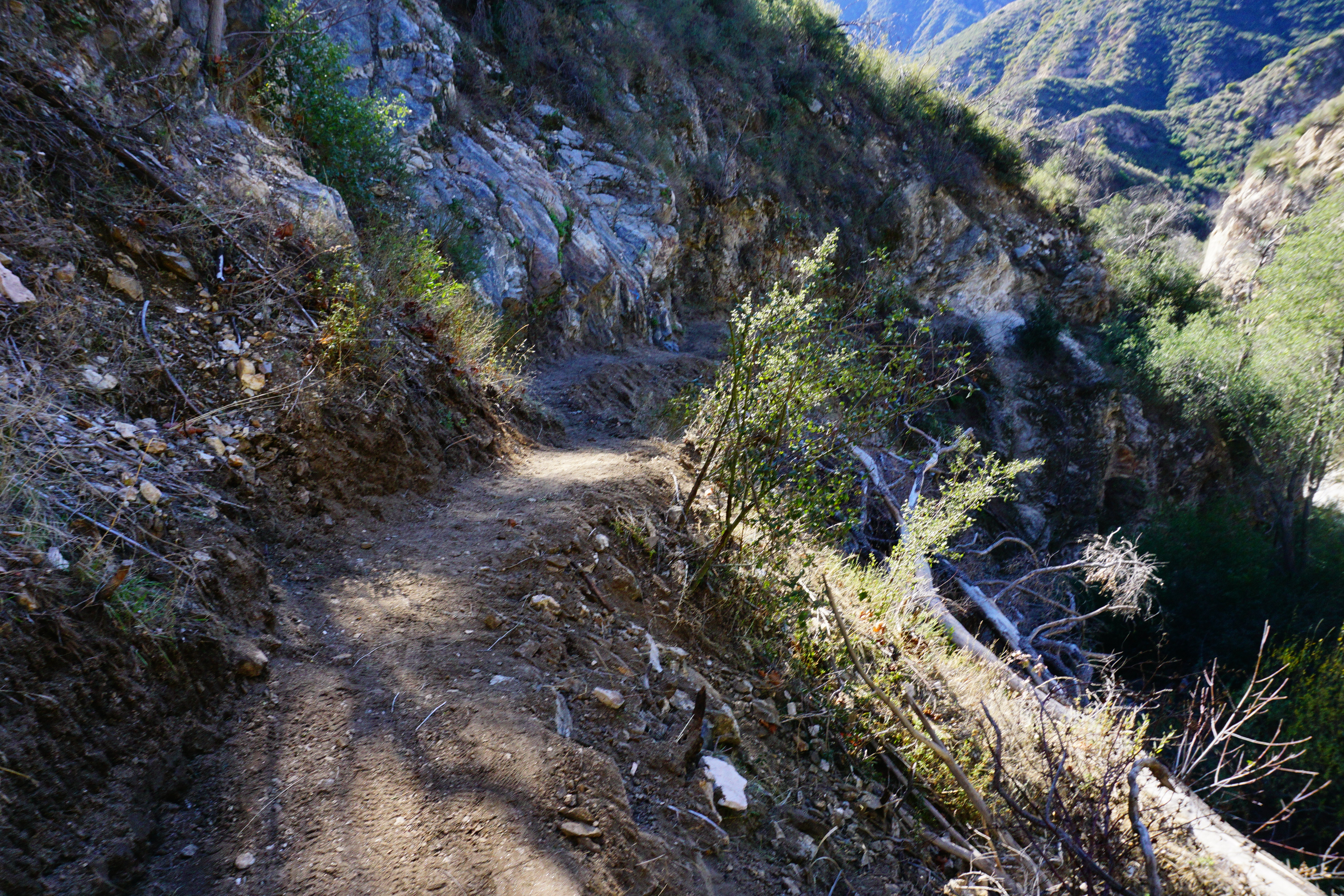
CORBA has been working behind the scenes on restoring the Gabrielino National Recreation Trail. The Gabrielino is the last trail still closed because of damage due to the Station Fire. It’s been an ongoing effort since 2011 to open up sections of the trail and then keep them clear of downed trees.
In early 2015 the Los Angeles Conservation Corps worked with Bellfree Contractors to rebuild the Gabrielino from Paul Little to Oakwilde Campground. CORBA helped fund that effort with a generous grant from REI. We subsequently concentrated on the Ken Burton trail, a project that rallied volunteers in an intensive 8-months of bi-monthly work days.
Searching for the trail in February 2016
Only the section from Oakwilde to the junction with Bear Canyon trail remains closed to public use. CORBA has been awarded grants from both REI and Edison International to help fund the restoration of this section. Those funds support volunteers, buy tools and materials and will pay for professional services to improve the sustainability of the trail and reduce future maintenance needs. We are grateful for their support.
The trail was littered with downed trees in 2016
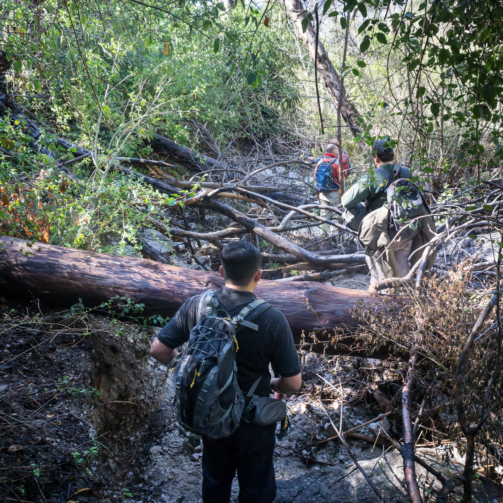
In early 2016 we did a hike-through inspection of the trail with Forest Service staff, Bellfree Contractors, Los Angeles Conservation Corps and Boy Scout volunteers. The arduous journey involved climbing over and under dozens and dozens of downed trees, searching for remnants of trail where it had been washed away, and dodging and ducking heavy brush. Sections of the trail were completely gone, the only route was to hike along the streambed, which was also covered in downed trees.
After more than a year of internal Forest Service review, the go-ahead was given to us by District Ranger Bob Blount last summer. Sadly, Ranger Bob passed away last week and won’t see this trail completed. He was especially excited for us to be working on this trail and bringing it back to its earlier glory. We hope to finish the project by summer in his honor.
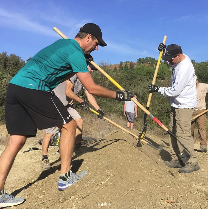
After months of extreme fire danger (meaning no chainsaw use), last fall CORBA and MWBA volunteer sawyers spent six solid days wielding chainsaws to cut through the deadfall along the trail.
With the corridor opened up, MWBA have devoted their monthly trailwork day to the project since December. In three work days the volunteer crews have worked on just over two miles of the trail.
There is so much enthusiasm for getting this trail restored and opened that there have been more volunteers that tools for the last two days. The volunteer effort has been astounding, with more than 40 volunteers signed up each day. Some sections that have been worked on are now in better shape than before the Station Fire. But there is still much to do.
So far, over 50 individual volunteers have devoted more than 1000 hours to the restoration effort.
A recently restored section
This is truly a team effort, with the Angeles Forest 50k Run trail crew having worked on another section of the Gabrielino near Switzers; the Sierra Club have been working on the section around Devore camp; and previous work was done by the Los Angeles Conservation Corps and the Boy Scouts on other sections.
Thanks to all the volunteers who have contributed to this restoration effort. Special thanks to our partners at the Mount Wilson Bicycling Association for organizing group work days and REI and Edison International for their financial support.
There is still more to do. The trail is not officially open to the public, but we hope to change that soon.. Watch for upcoming announcements for March and April volunteer work days from MWBA, or CORBA’s Meetup group.
This past weekend the holidays seemed to come into full swing, and there was a lot of giving. On Saturday morning, members of our Sapwi Bike park committee gave their time building the first trailside feature at Sapwi Bike Park. Contractors have cleared and graded the bike park area, and the final bike park plan from FlowRide Concepts is close to completion. Lots of people have given to our IMBA Dig In campaign now standing at $1900, in addition to the generous grant of $15,000 from REI. We need to raise close to $100,000 so there’s a long way to go. Keep the donations coming!
Also on Saturday, former CORBA Chair and current volunteer Mark Langton was conducting our monthly Free Basic Mountain Bike Skills Clinic. Mark has been teaching new mountain bikers the basics of bike handling, safety and etiquette for more than 20 years. Eight riders attended the last skills clinic of the year.
This year we have seen legislation introduced to further protect and enhance our local open spaces and public lands.
HR3039, the San Gabriel Mountains Forever Act. Judy Chu introduced this bill in June. The bill would establish two new units of Wilderness within the Angeles National Forest. CORBA worked for two years with wilderness advocates to ensure these newly-proposed designations would not impact trails used by mountain bikers. The bill establishes the Condor Peak Wilderness and Yerba Buena Wilderness units, separated by the Condor Peak Trail. Condor Peak trail and Trail Canyon trail to the waterfall and campground would remain open to bicycles under this new designation.
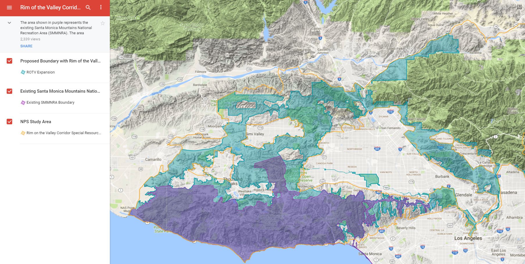
This bill by Adam Schiff/Diane Feinstein would expand the boundary of the Santa Monica Mountains National Recreation Area to include open spaces around the Conejo, Simi, San Fernando, La Crescenta and Verdugo valleys. It does not change any land ownership or management but allows the National Park Service to partner with current land managers to improve habitat, wildlife corridors, and recreational opportunities. It puts into action the findings of the Rim of the Valley Corridor Study. It does not impact bicycle access to trails and could improve recreational opportunities.
H.R. 2323: San Gabriel Mountains Foothills and Rivers Protection Act. This act introduced by Judy Chu would establish the San Gabriel National Recreation Area as a unit of the National Park System. The NRA would cover river corridors and open spaces from the Angeles National Forest border through the San Gabriel Valley. It does not create any new federally-managed public land. It would allow the National Park Service to partner with existing land managers to improve habitat, biodiversity, and recreational access. It would also expand the boundary of the San Gabriel Mountains National Monument to include areas of the Angeles Front Country that are currently outside the Monument.
While these bills have been introduced, it remains to be seen whether they will make it out of their respective committees.
CORBA’s mission includes the protection of the places we play. Nationally, as the current administration proposes major changes to environmental regulations, national monument boundaries (our San Gabriel Mountains National Monument is not expected to be a target of boundary reductions), forest management practices, permitted uses, we stand ready to speak up for our local public lands and the recreational opportunities they provide and we all cherish.
On June 23, 2017, Congresswoman Judy Chu (CA-27) introduced a new bill to expand wilderness areas in the Angeles National Forest, and protect several rivers as wild and scenic rivers. Spearheaded by the San Gabriel Mountains Forever group, the bill is the result of many years of efforts to protect our local mountains.
A previous success of the San Gabriel Mountains Forever group was the establishment of the San Gabriel Mountains National Monument. CORBA President Steve Messer has been representing mountain bikers on the San Gabriel Mountains Community Collaborative, working alongside representatives of the Sierra Club, The Wilderness Society, and other environmental and social justice organizations.
For the past eighteen months we’ve been working together to ensure that mountain biking gets due consideration in these proposals. CORBA has opposed previous wilderness efforts that hurt bicyclists’ access to trails. With support from IMBA and MWBA, we worked out boundary adjustments that expand the Sheep Mountain and San Gabriel wilderness areas, but do not impact any trails that are currently open to bicycles.
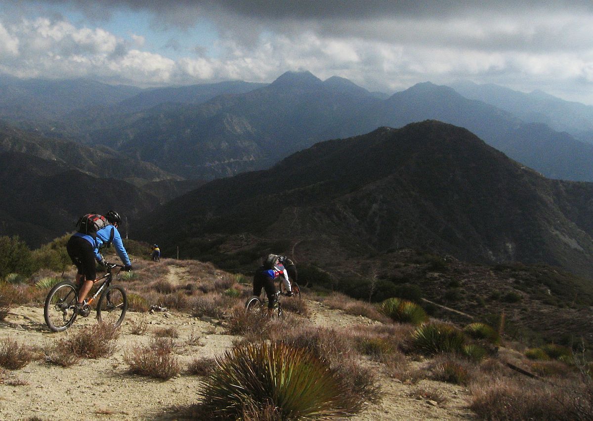
The bill also establishes two new units of the Wilderness Preservation System, the Condor Peak Wilderness and the Yerba Buena Wilderness. These two wilderness areas protect the majestic Condor Peak, while leaving the Condor Peak trail outside the wilderness areas with a wide buffer. While Condor Peak is not a popular trail for cyclists, it offers an increasingly-unique wilderness-type backcountry experience for those seeking to challenge themselves in nature. The trail can continue to be maintained using mechanized tools.
The western boundary of the proposed Yerba Buena Wilderness is the Yerba Buena Ridge trail, which could provide an epic backcountry loop ride with Condor Peak trail. Both trails, however, are in need of maintenance and are on our radar for future restoration work.
Condor Peak Trail
The following areas will be designated as wilderness in HR 3039:
Condor Peak Wilderness: Located in the Lower and Upper Big Tujunga Watersheds this designation preserves 8,417 acres of public lands. The unit rises abruptly from 1,800 feet on its southern flanks to over 6,000 feet at its northern boundary near Mt. Gleason. The Condor Peak Trail will be outside the Western boundary of this unit. Yerba Buena Wilderness: Preserves one of the most spectacular undeveloped landscapes in the San Gabriel Mountains (6,774 acres). The Condor Peak trail is just outside the eastern boundary of this unit. The western boundary is 300′ from the Yerba Buena Ridge trail, leaving both open to bicycles. The Trail Canyon Trail is cherry-stemmed (excluded from wilderness) up to the campground and waterfall. San Gabriel Wilderness Additions: This adds 2,027 acres to the existing San Gabriel Wilderness encompassing areas with dramatically rising slopes and a variety of flora and fauna. Sheep Mountain Wilderness Additions: Adds 13,851 acres to the established Sheep Mountain Wilderness. The Sheep Mountain Wilderness Additions are contiguous with the existing wilderness and add important landscapes to the wilderness area’s northwest and southwest/southern flanks.The bill also protects the 25.3 miles of the East, West and North Forks of the San Gabriel River, and 20.2 miles of Little Rock Creek as Wild and Scenic Rivers.
We truly appreciate being able to be proactive, working with the Sierra Club, The Wilderness Society, CalWild, and the San Gabriel Mountains Forever group. We also benefited greatly from IMBA’s support at the national level, and our partnership with the Mount Wilson Bicycling Association locally.
While this wilderness bill does not hurt mountain bikers’ access to trails, it does nothing to expand or directly improve existing opportunities. It does however, protect the remote backcountry experiences provided by the Condor Peak trail, the Yerba Buena Ridge trail, and the lower Trail Canyon Trail, ensuring these trails through this pristine landscape will be preserved, ready to be experienced by foot, hoof or bicycle.
CORBA has submitted a letter supporting the preservation of the San Gabriel Mountains National Monument. President Trump’s executive order 13792 called for a revision of the many National Monuments that were presidentially-designated under the Antiquities Act from the last two decades. Department of Interior Secretary Zinke has been charged with overseeing the review of these National Monuments for a number of specific items:
In making the requisite determinations, the Secretary is directed to consider, and is seeking public comment on:
(i) The requirements and original objectives of the Act, including the Act’s requirement that reservations of land not exceed “the smallest area compatible with the proper care and management of the objects to be protected”;
(ii) whether designated lands are appropriately classified under the Act as “historic landmarks, historic and prehistoric structures, [or] other objects of historic or scientific interest”;
(iii) the effects of a designation on the available uses of designated Federal lands, including consideration of the multiple-use policy of section 102(a)(7) of the Federal Land Policy and Management Act (43 U.S.C. 1701(a)(7)), as well as the effects on the available uses of Federal lands beyond the monument boundaries;
(iv) the effects of a designation on the use and enjoyment of non-Federal lands within or beyond monument boundaries;
(v) concerns of State, tribal, and local governments affected by a designation, including the economic development and fiscal condition of affected States, tribes, and localities;
(vi) the availability of Federal resources to properly manage designated areas; and
(vii) such other factors as the Secretary deems appropriate. 82 FR 20429-20430 (May 1, 2017).
As a participating member of the San Gabriel Mountains Community Collaborative, CORBA agrees with the findings expressed in the Collaborative’s letter to Secretary Zinke. While there are both supporters and one-time opponents of the Monument on the Collaborative, the Collaborative’s letter specifically addressed each of the seven points of consideration listed above without expressing support or opposition to the monument itself. The findings are that the Monument meets or exceeds the criteria established above. The Collaborative’s letter can be found HERE
Arcadia, Calif. – The Fire Danger Level on the Angeles National Forest is being raised from “Moderate” to “High,” effective June 6, 2008 as summer temperatures continue to dry out vegetation and the forest prepares for an increase in summer visitors. The “High” fire danger level is the third in a six-level, graduated fire danger rating system. A variety of factors determine the level, including the moisture in vegetation, weather conditions and firefighting equipment needs due to national fire activity. Despite the change, there are no new campfire restrictions: Open wood and charcoal fires will still be permitted in developed campgrounds and picnic areas only. Gas and propane powered stoves and grills are permitted in non-developed areas with a valid California Campfire Permit.
Spark arrestors (required year-round) should be checked to make sure they are in good working order on all off-road motorcycles, chain saws and other equipment with internal combustion engines. Travelers through the Forest should remain on designated roads and never park on dry brush or grass.
Visitors should also be reminded that some closures remain in effect. This includes areas affected by the Ranch Fire (west of I-5) and the Buckweed Fire (northwest of Hwy 14), including the popular Rowher Flat OHV area. In addition, approximately 1,000 acres in the vicinity of Cooper Canyon (north of the Angeles Crest Hwy) remain closed in order to protect critical habitat of the Mountain Yellow-Legged Frog, a federally endangered species. Williamson Rock, an area frequented by rock climbers, and a portion of the Pacific Crest Trail lie within the closed area. Hikers can take a detour around the area by departing the trail (northbound) at Eagles Roost and taking the highway to Cloudburst Summit, a distance of 4.5 miles.
Contact: Sherry Rollman or Stanton Florea at (626) 574-5208
“Know Before You Go” to the Angeles National Forest. Find out about local conditions at your destination prior to leaving by contacting the following offices:
Forest Supervisor’s Office – Arcadia, (M-F 8:00 am to 4:30 pm) (626) 574-1613
Los Angeles River Ranger District, (M-F 8:00 am to 4:30 pm) (818) 899-1900
San Gabriel River Ranger District, (M-F 8:00 am to 4:30 pm) (626) 335-1251
Santa Clara-Mojave Rivers Ranger District, (M-F 8:00 am to 4:30 pm) (661) 296-9710
After more than two years of dedicated volunteer work by CORBA and MWBA volunteer sawyers, we’re happy to announce that the Vetter Mountain Trail, near Charlton Flat in the San Gabriel Mountains National Monument, will be open to the public this weekend.
Our volunteer sawyer crew has been cutting downed trees off the trail, clearing brush, and working to reopen the heavily-damaged trail. It is in one of the most badly burned areas of the 2009 Station Fire, and thousands of trees killed in the fire have been falling since then.
Vetter Mountain Trail, May 2010
We surveyed the trail for the Forest Service in 2010, the year after the Station Fire. The area had barely begun recovering and would need several more years before work could begin. Vegetation had to grow back, hillsides stabilize, and standing dead trees would fall to the ground. Intense poodle dog settled in not long after, increasing the hazards.
October 2015 we began volunteer work, needing to first clear the trail corridor as best we could, and in many cases, locate the trail. CORBA and MWBA Chainsaw crews began the heavy work. Sawyers have cut well over 100 trees that fell across the trail, and dozens more on the roads to access the trail, in ten days of chainsaw work over the last year. We cut back brush that was choking off the trail, and reopened the corridor. Three times over the past year we cleared the entire trail of downed trees, only to return months later to start again.
Volunteer Sawyers begin work on Vetter in 2015
Earlier this year, hot shots fire crews were able to fell most of the largest standing hazard trees, reducing hazards along the trail corridor. The rate of trees falling is slowing down, especially since the big windstorms of this past winter. Numerous dead trees are still standing, and will continue to pose a hazard for some time, much like many other trails in the recovering areas. Be especially aware if you’re on the trails in a burn zone during high winds or bad weather, as dead trees are especially prone to falling in these conditions.
Volunteers on National Trails Day
Last Saturday, at our urging, the Forest Service scheduled the annual National Trails Day volunteer project on the Vetter Mountain trail. Volunteer Crews from Coca Cola, MWBA, CORBA, JPL Trail Builders, Angeles National Forest Fire Lookout Association, National Forest Foundation and many other groups and individuals proceeded to re-establish tread and cut back brush. Sawyer crews chainsawed a dozen or more trees from the trail. Sunday, CORBA volunteer sawyers returned to continue cutting the remaining downed trees from the trail.
Today, Thursday May 4, the CORBA team will return to put some final touches on the trail, remove the last remaining obstructions, and officially remove the “trail closed” signs in preparation for the trail’s opening this weekend.
The Vetter Mountain trail has been closed for 8 years. It is part of the classic and much-loved Chilao Figure 8, a popular mountain bike loop that includes the Charlton Connector Trail, Vetter Mountain Trail, Mount Hillyer Trail, connecting fire roads, and the Silver Mocassin trail. It has been missed, and will be enjoyed once again!
Once lush with majestic conifers, and known for a series of switchbacks, followed by a flowy descent along a drainage, the trail looks much less apocalyptic than it did on our first survey in 2010. The area is recovering, but it is still within the burn zone, and will look very different from it’s pre-fire state. We’re just happy to have it back!
The Vetter Mountain trail has been closed for 8 years. It was part of the classic and much-loved Chilao Figure 8, a route that includes the Charlton Connector Trail, Vetter Mountain Trail, Mount Hillyer Trail, connecting fire roads, and the Silver Mocassin trail. It has been missed, and will be enjoyed once again!


 At the last volunteer work day on the Gabrielino Trail, we were delighted to have Louis Sahagun, reporter for the LA Times and a photographer join us. They were there to cover the restoration efforts undertaken by CORBA and MWBA on the Angeles National Forest.